|
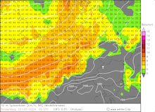
A small surface low brought a potent windstorm to the northern parts of Germany in the night from February 22, 2024, to February 23, 2024. Wind gusts peaked at 141 kph on top of the Brocken mountain in the Harz mountain range. In the Alps, a Genoa low brought intense fresh snow accumulations, reaching up to 70 cm within a 12 h period.
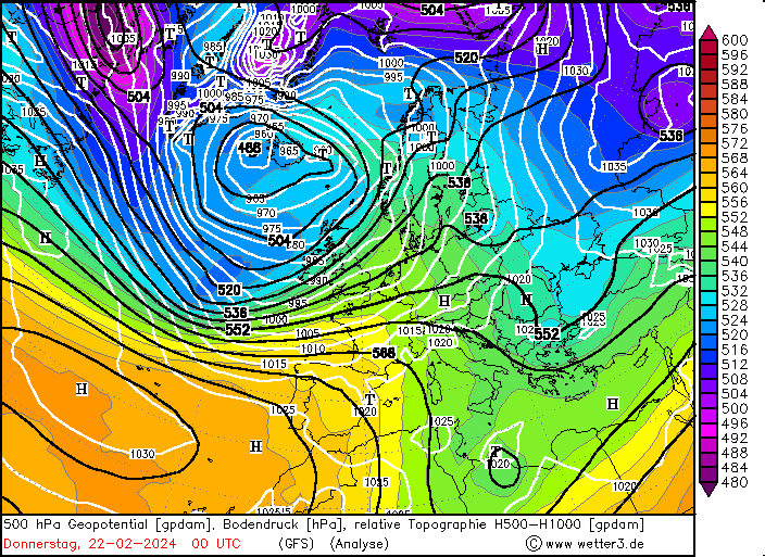
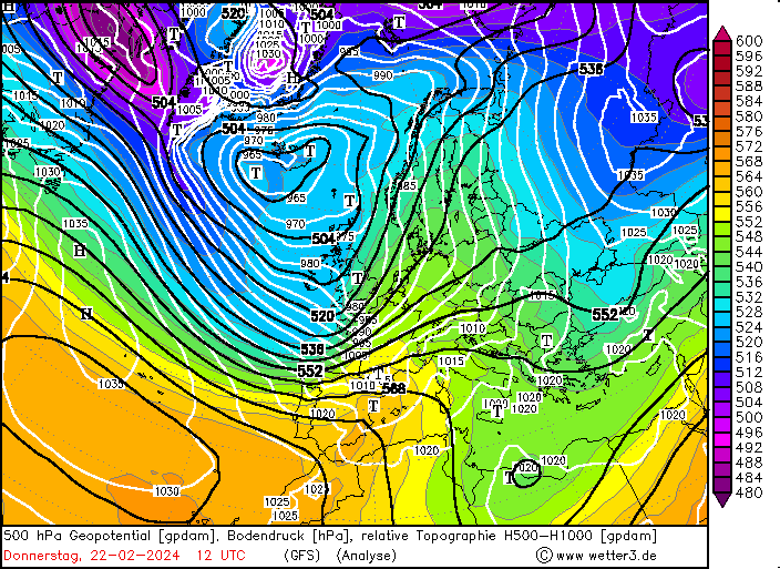
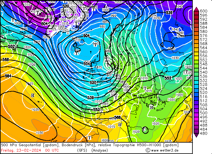
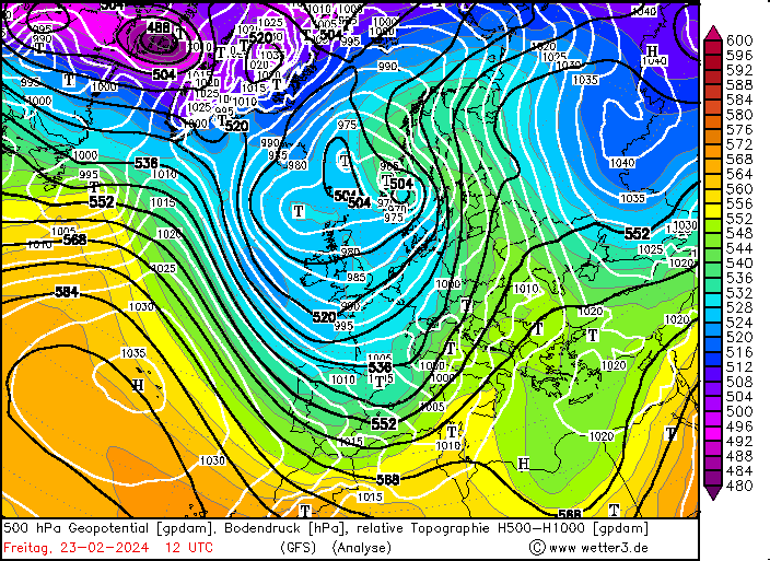
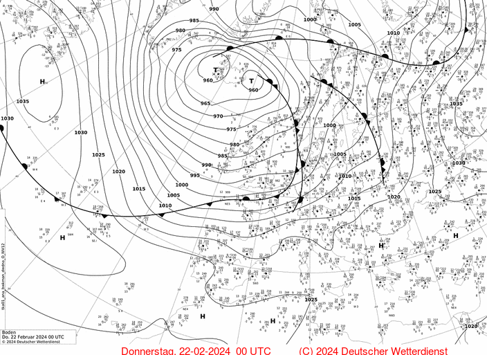
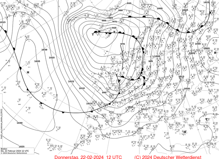
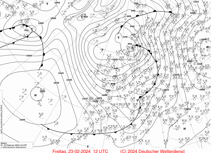
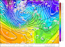
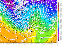
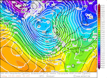
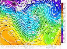
In the final decade of February 2024 which proved to be exceptionally warm in Central Europe, a strong steering low moved over the Northern Atlantic between the British Isles and Iceland. On February 22, 2024, a shallow surface low developed at the southern tip of said steering low off the coast of Ireland. Throughout the day, the low moved quickly eastwards across the English Channel over the North Sea. Within a 24 h period, the core pressure of the system dropped by 35 hPa, easily fulfilling the threshold for rapid cyclogenesis.
|
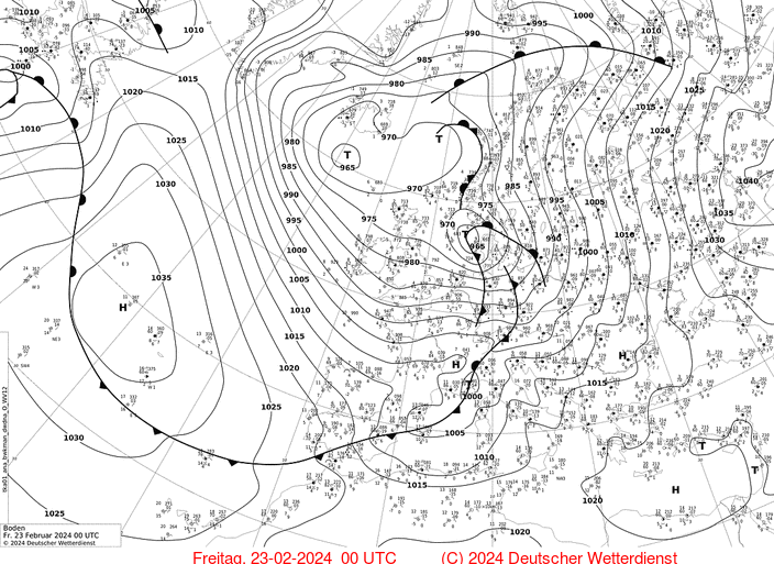
500 hPa Geopotential and sea surface pressure (upper row), and sea surface pressure with the analyzed fronts over Europe (lower row), 22.02.2024 00 UTC - 23.02.2024 12 UTC, source:
wetter3
|
 |
 |
 |
 |
 |
 |
 |
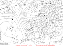 |
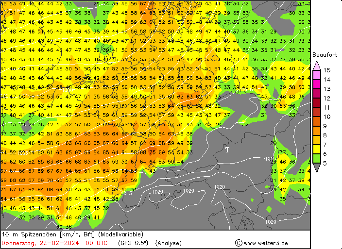
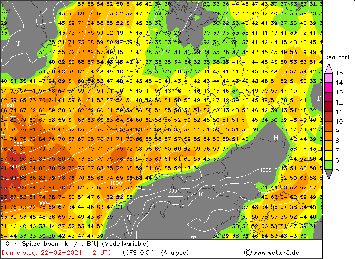
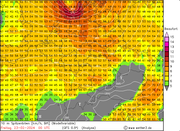
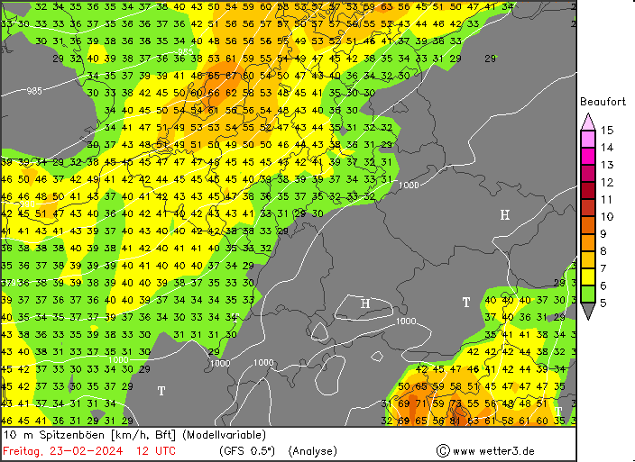
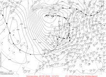
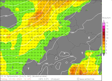
The rapidly deepening low vigorously exacerbated the pressure gradient across Central Europe. By the late evening of February 22, 2024, the storm field of winter storm Wencke started to affect the northern parts of Germany. The highest wind gust of the system with 141 kph was observed at the top of the Brocken mountain in the Harz mountain range. At exposed locations in the central part of Germany and the Northern German Lowlands wind gusts of over 100 kph were recorded. Along the German coast, the wind gusts locally reached hurricane strength.
|
Model analysis for the peak 10 m wind gusts over Central Europe, 22.02.2024 00 UTC - 23.02.2024 12 UTC, source:
wetter3
|
 |
 |
 |
 |
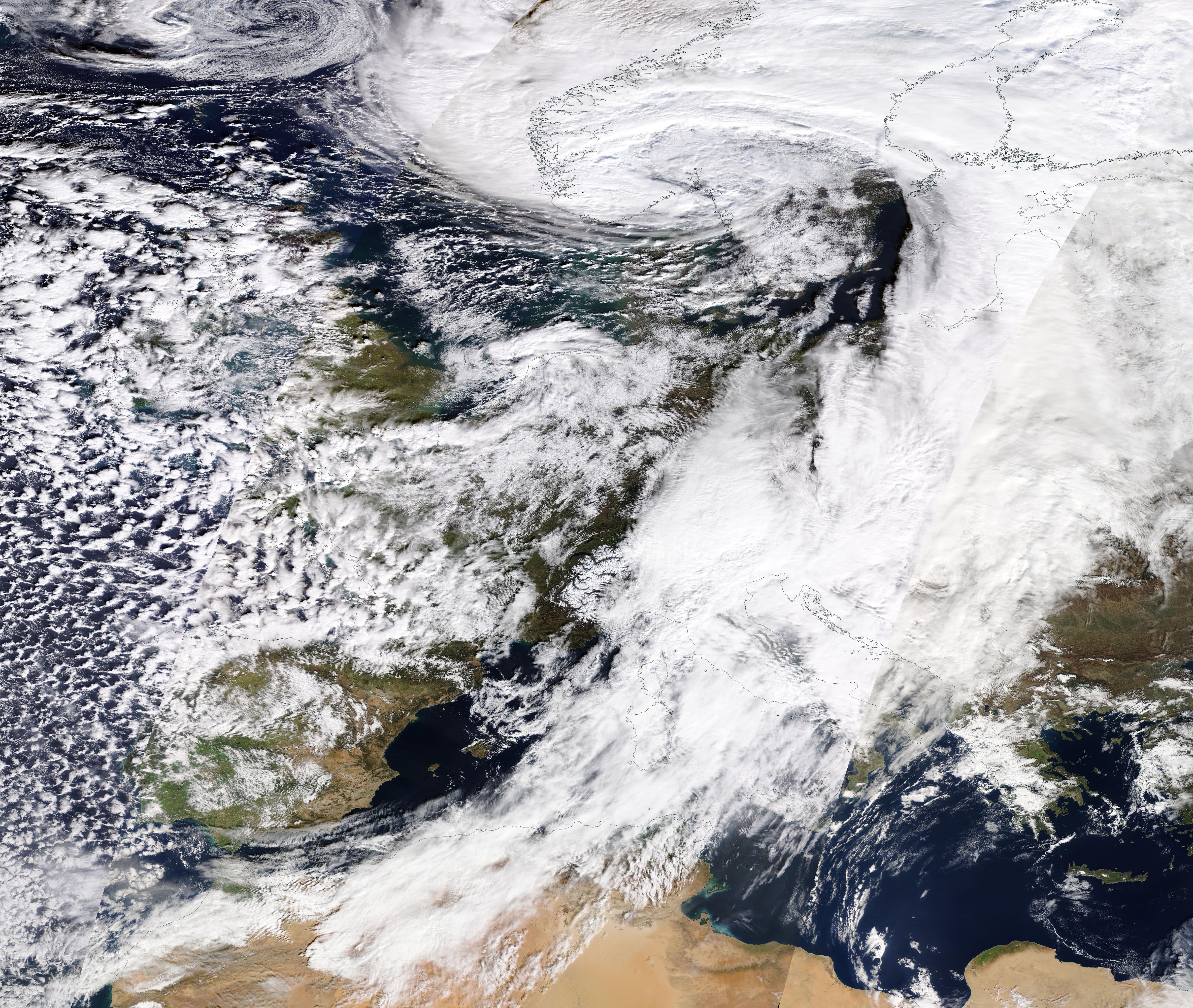
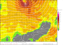
The adjacent trough of the steering low also led to the development of a potent Genoa low over the northern part of Italy. Ahead of the surface low, warm and moist air masses from the Mediterranean were advected northwards. Along southern facing flanks of the Alps, intense orographic precipitation was observed. Locally, precipitation totals exceeded the 150 mm mark within a 36 h period in the foothills of the Southern Alps in Italy. At higher elevations in the Southern Alps, the low brought intense snowfall with fresh snow accumulations of up to 70 cm within a few hours.
At the Brenner Pass between Italy and Austria fresh snow accumulation rates of up to 10 cm/h were observed. The multi-hour intense snowfall at higher elevations forced a closure of this important traffic link between Southern and Central Europe. Traffic could commence in the night from February 23, 2024, to February 24, 2024, limiting the potential economic impact of the closure of this important road link.
Text: KG
February 28, 2024
|