|
Between the low Wolfgang over Western Europe and the high-pressure ridge Wibke over Northern Europe, an exceptionally strong windstorm with unusually strong easterly winds developed. The easterlies led to the worst storm surge along the shoreline of the Baltic Sea in Germany and Denmark, recording the highest water levels for more than 100 years.
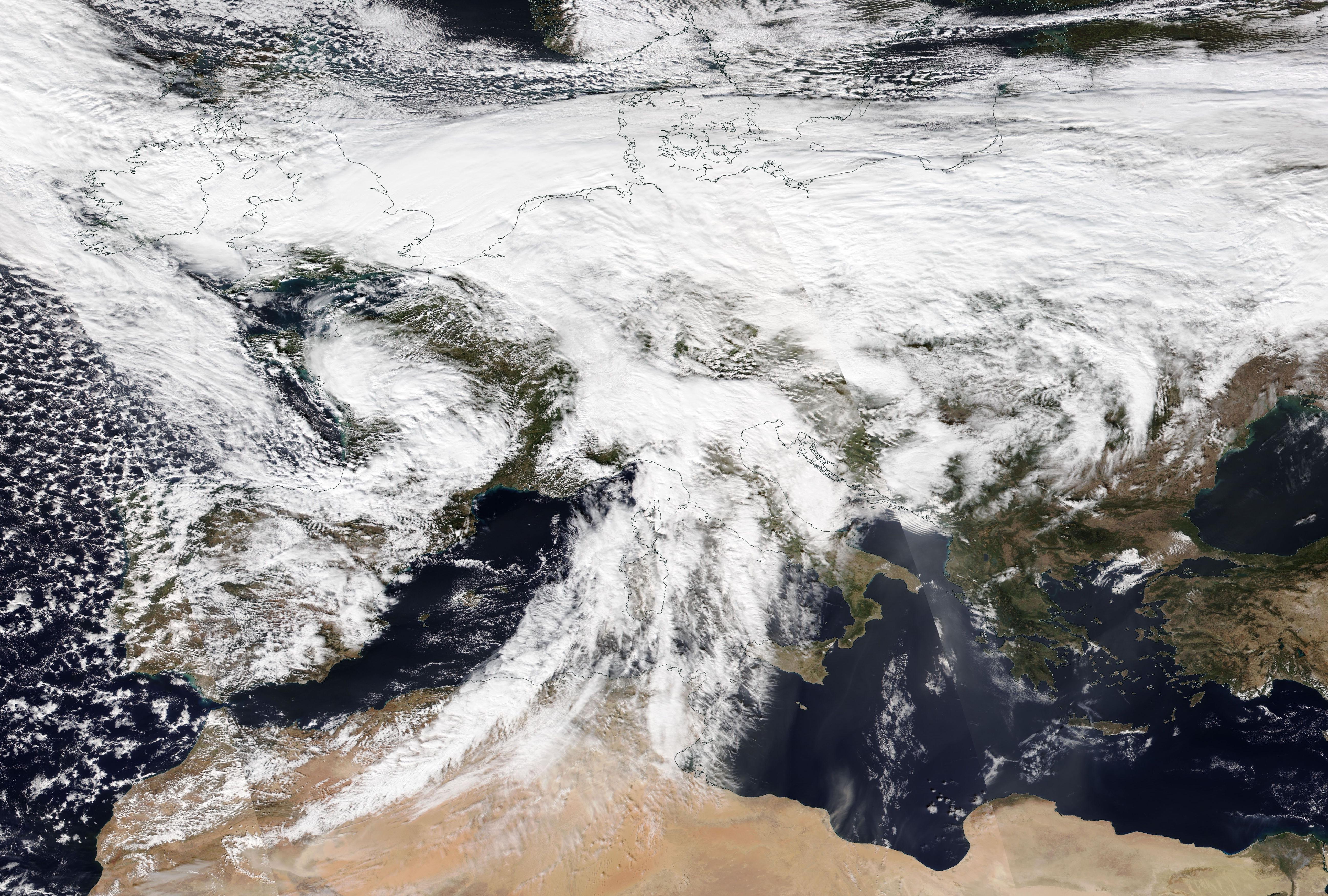
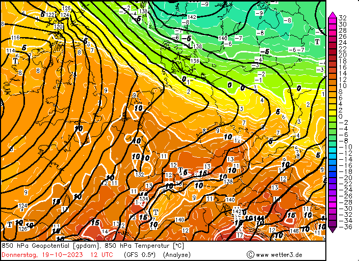
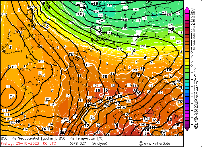
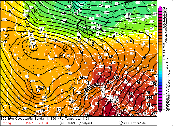
The first half of October 2023 was dominated by strong ridges across large parts of Europe, bringing exceptionally high temperatures for October. Germany observed the latest day with temperatures of more than 30 °C in recorded history on October 13, 2023. In the following days, a strong temperature boundary developed over Germany, with warmer air masses over the southwestern part of Germany and cooler air masses over the northeastern part of Germany.
|
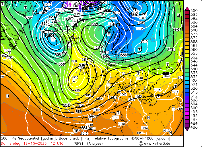
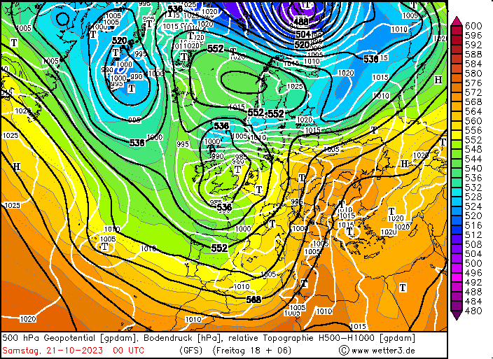
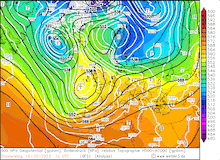
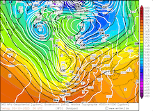
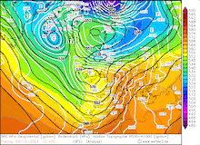
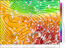
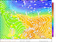
500 hPa Geopotential and sea surface pressure over Europe, 19.10.2023 12 UTC - 21.10.2023 00 UTC, source:
wetter3
|
 |
 |
 |
 |
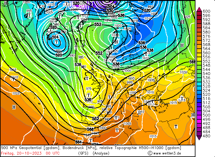
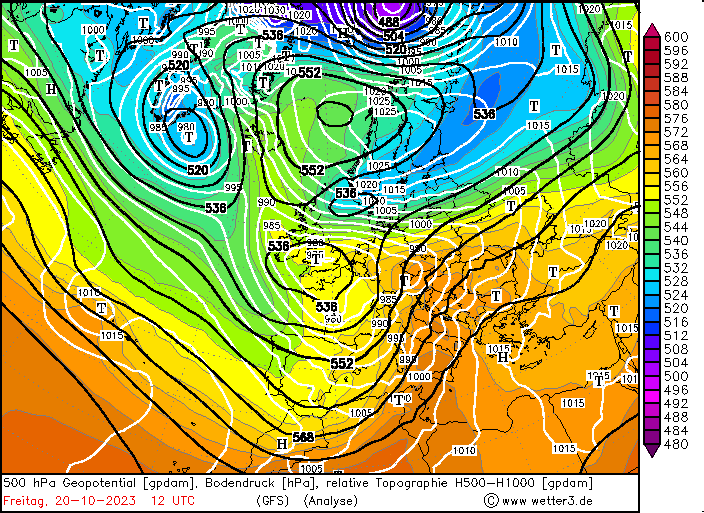
At the southeastern tip of a trough over Southern Greenland, a surface low developed in a broad low-pressure area west of the British Isles. By October 19, 2023, the surface low significantly deepened with the core pressure dropping below 970 hPa. In the following hours, the surface low moved southeastwards towards the Bretagne. On October 20, 2023, the pressure gradient on the northeastern flank of the surface low increased sharply. The pressure gradient was exacerbated by a cut-off ridge over the Norwegian Sea with an accompanied surface high-pressure system over Scandinavia.
|
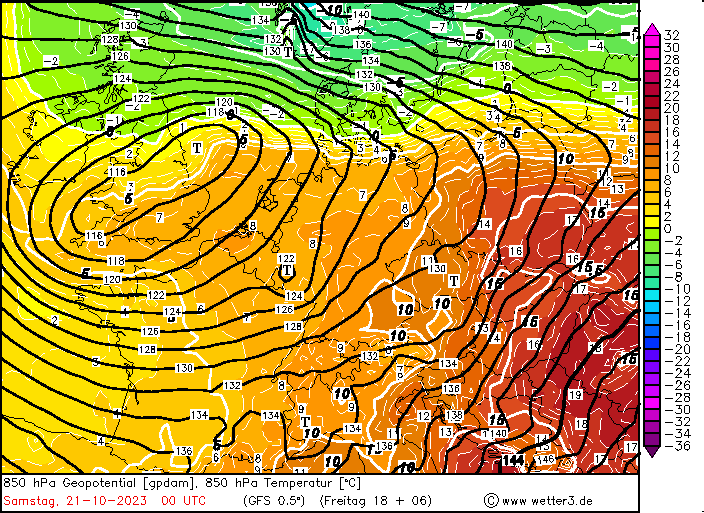
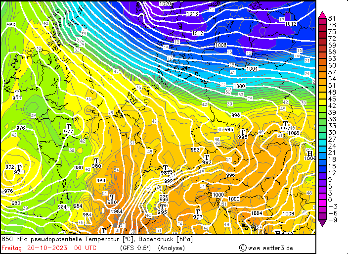
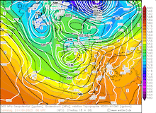
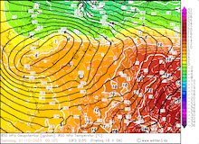
850 hPa Temperature and 850 geopotential over Central Europe (top) and 850 hPa pseudo-potential temperature and sea surface pressure (bottom), 19.10.2023 12 UTC - 21.10.2023 00 UTC, source:
wetter3
|
 |
 |
 |
 |
 |
 |
 |
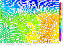 |
Over a distance of around 1000 km, the mean sea surface pressure increased from 978 hPa over the Netherlands to 1025 hPa over the central part of Scandinavia. Due to the rare synoptic situation of a low over western Europe and a high over Scandinavia, a strong easterly windstorm developed over the Baltic Sea. Since the surface low over only slowly northeastwards, a persistent easterly windstorm matured over the Baltic Sea. At the exposed weather station at Kap Arkona, wind gusts reached up to 133.3 kph and remained above the 120 kph-mark for 10 hours in the afternoon hours of October 20, 2023.
The strong winds over the Baltic Sea brought an unusual storm surge along the eastern shoreline of Northern Germany and Denmark. Normally, strong storm surges along the North and Baltic Sea are induced by strong westerlies or northwesterlies. The extremely strong easterly winds of low Wolfgang brought an exceptionally strong storm surge along the Baltic Sea. The city of Flensburg recorded the highest water levels for more than 100 years. At the town Förde recorded a water level of 2.27 m above normal. The last time water levels in the same order of magnitude were recorded at the station was back in 1904. Also, the city of Kiel was impacted by the storm surge. In Denmark, evacuation orders were placed along the Baltic Sea, as waters rose to extreme water levels. To prevent further damages, the power supply for coastal regions both in Northern Germany and Denmark was cut-off during the storm surge.
Contrary along the North Sea, the strong easterlies led to an exceptionally low low tide. Along the German shoreline water level fell more than 1.5 m below the average low tide, which only occurred 4 times in the last 25 years. Subsequentially, many ferry services had to pause operations as harbors fell dry along the German shoreline. Early estimates suggest that the damages along the German shoreline reached more than 100 Million €, with at least one reported fatality due to strong winds.
|
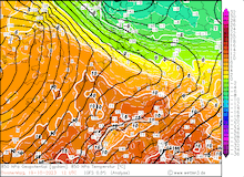
24 h precipitation over Germany, 20.10.2023, source:
DWD, Visualization: K. Gramlich
|
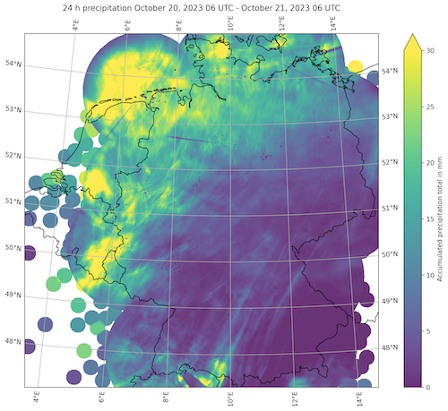 |
Over Germany, low Wolfgang exacerbated the temperature gradient within the state. In the northern part of Germany, temperatures failed to surpass the 10 °C-mark in the continuous precipitation. Here, widespread precipitation totals reached up to 30 mm. In some Alpine valleys, the strong southwesterly flow in the lower and middle atmosphere led to a strong Föhn event. In Reit im Winkl, temperatures reached up to 27.1 °C.
Text: KG
October 21, 2023
|