Severe Thunderstorms, Heat Central Europe
17 - 23 June 2023
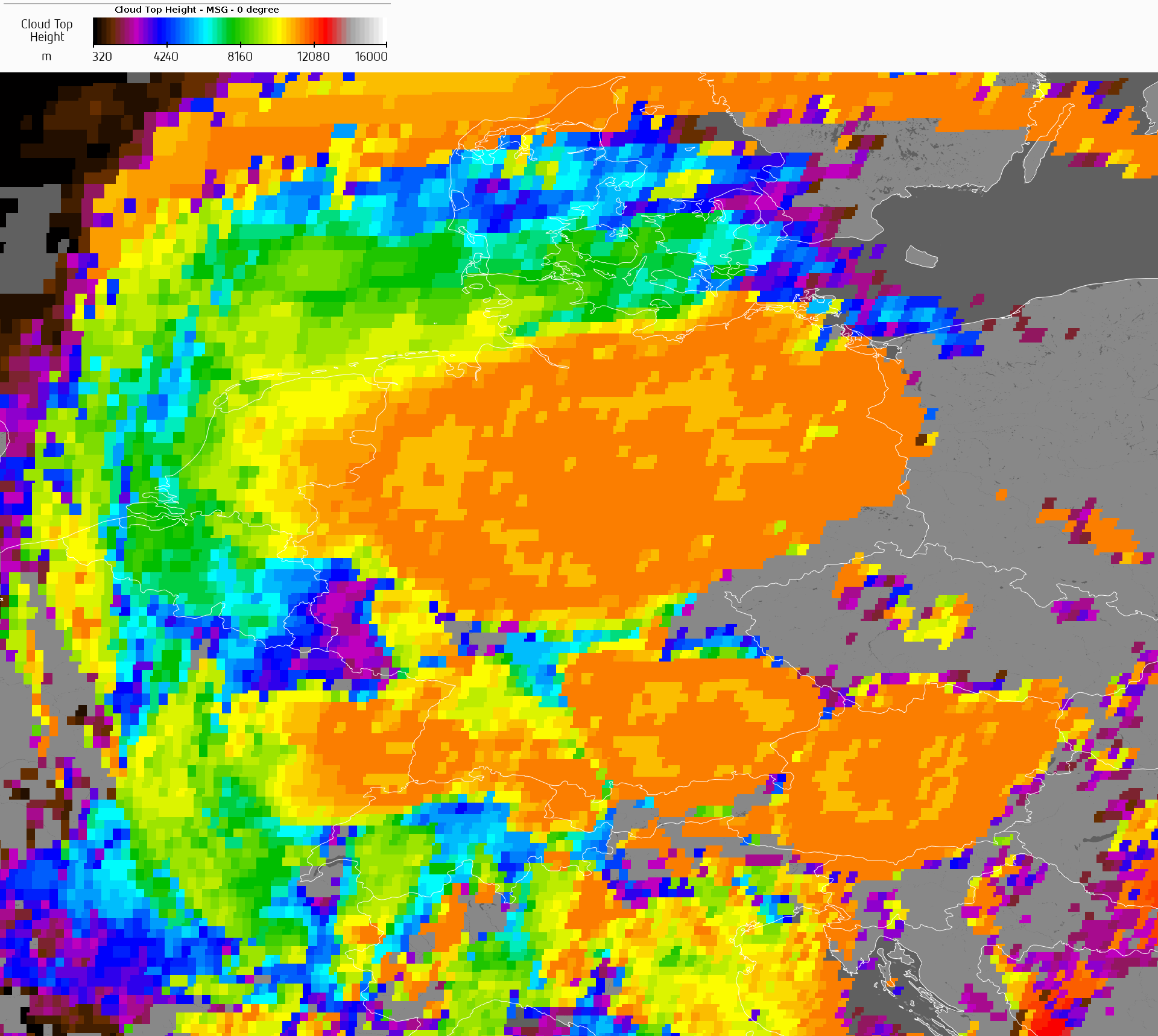
Cloud top heights above Central Europe with multiple mesoscale convective systems, 22.06.2023 17 UTC
Source: EUMETSAT
Consecutive small upper-level troughs over Western Europe induced severe convection across large parts of Germany. Ahead of the trough, through the enhanced advection of subtropical air masses from the Mediterranean, sweltering heat with temperatures of up to 35,7 °C in Reit im Winkl, BY was observed.
The first half of June 2023 was exceptionally dry in large parts of Central Europe with well above average temperatures, yet no severe heat had been observed with the maximum temperatures only slightly above the 30 °C-mark. By the beginning of the second half of the month, the weather pattern over Europe changed with a strong trough over the Eastern Atlantic and a ridge over Continental Europe. At the southern tip of the trough, repeatedly small secondary troughs developed, moving across Western Europe ahead of the main trough. The troughs induced locally severe convection and intensified the advection of moist and very warm air masses from the Mediterranean.
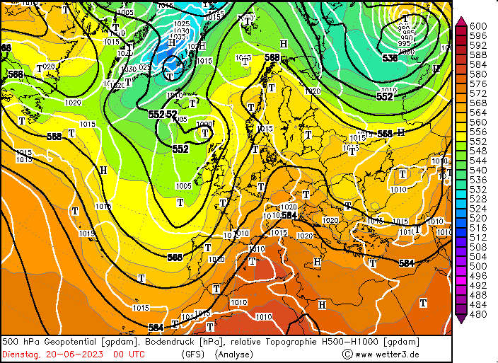
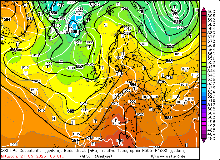
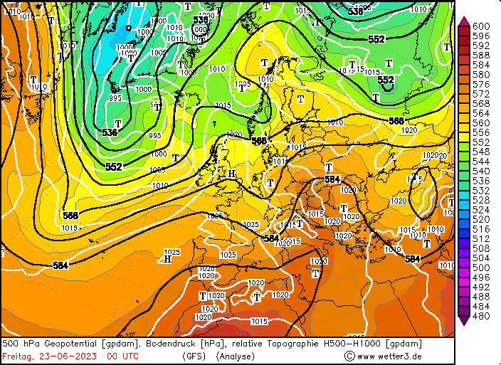
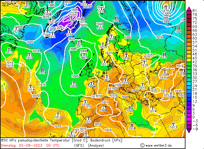
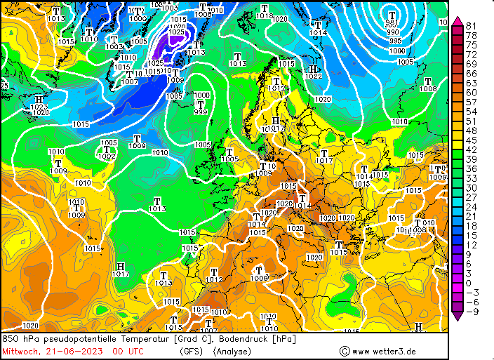
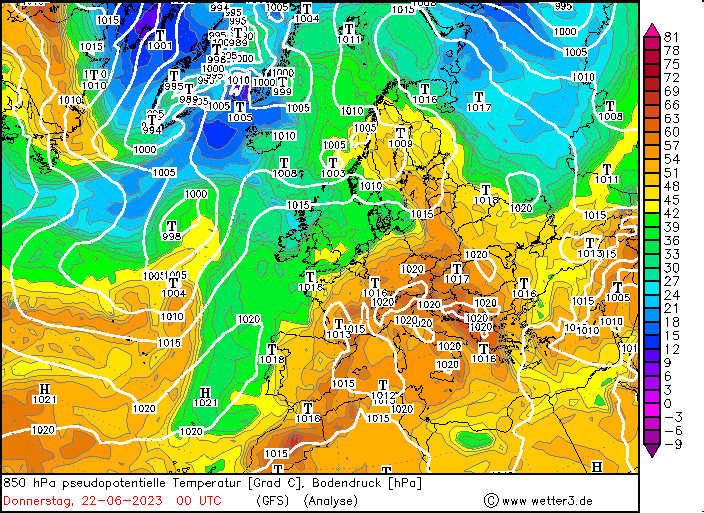
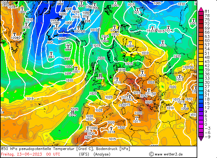
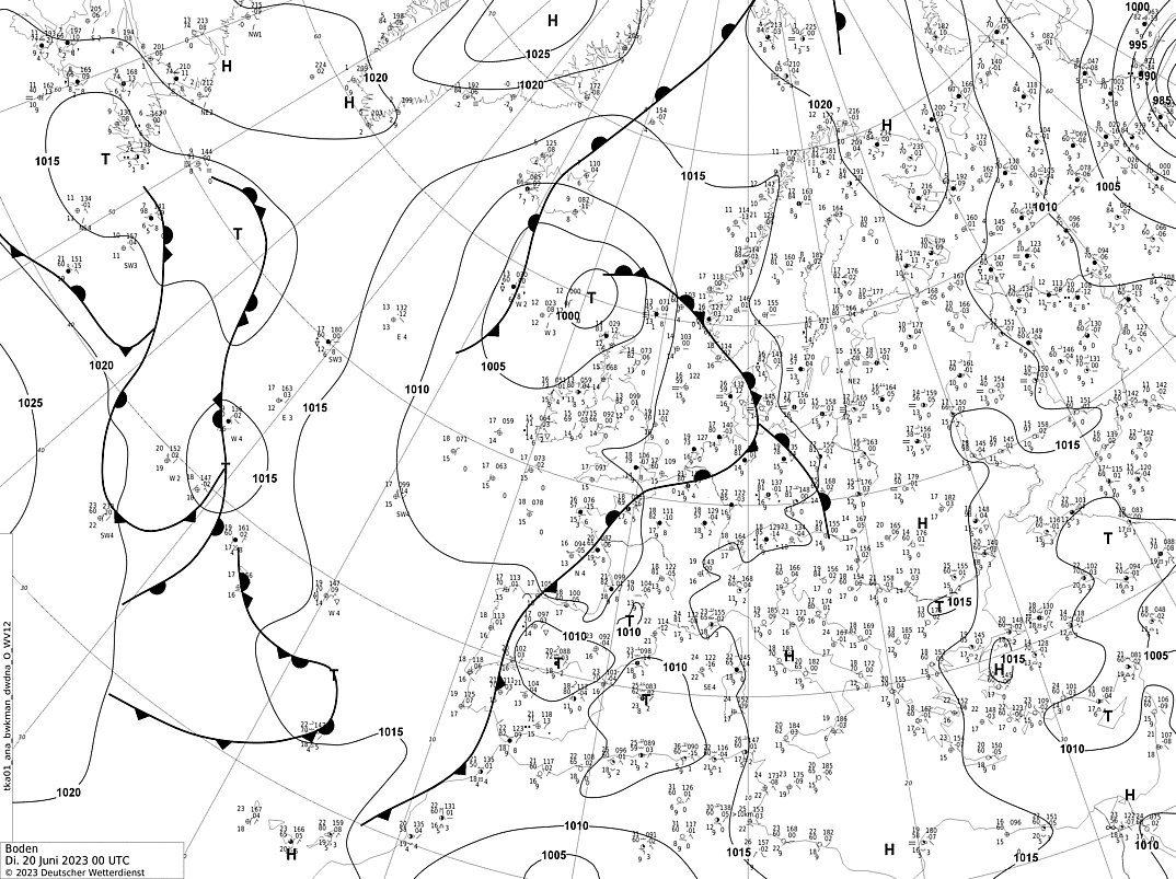
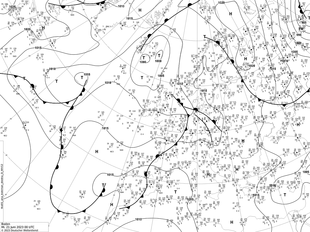
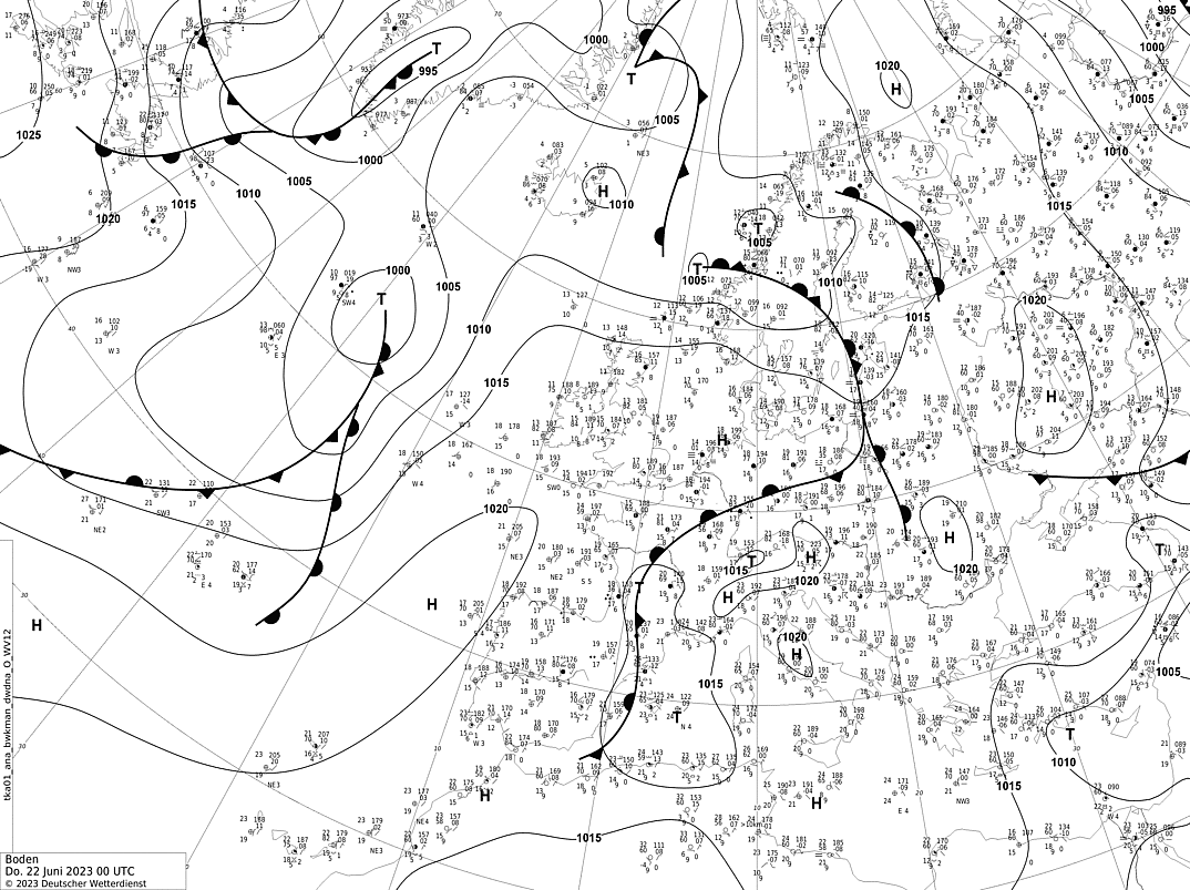
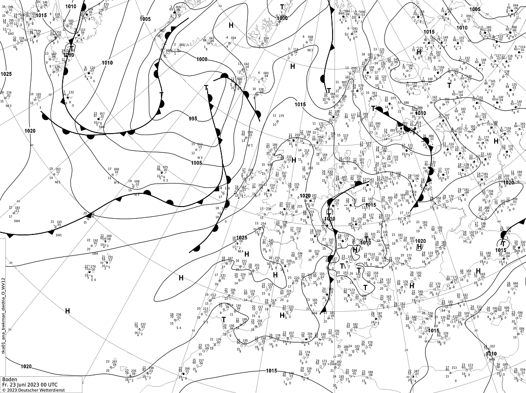
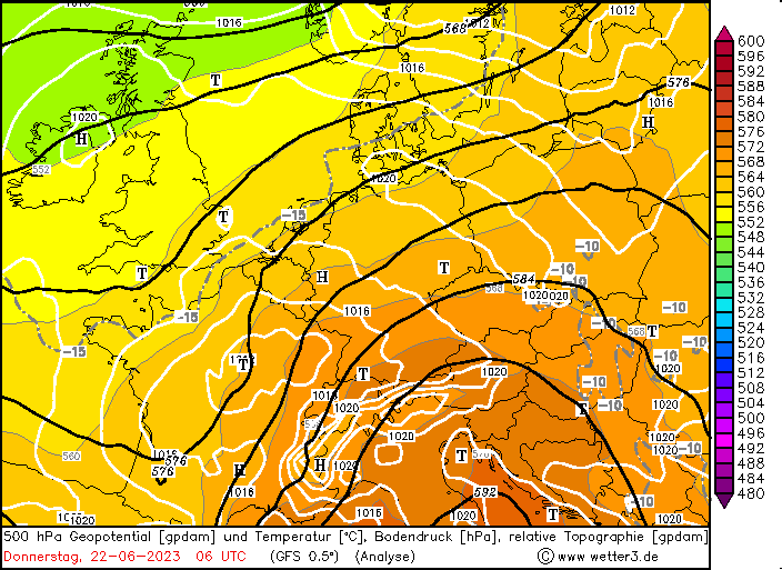
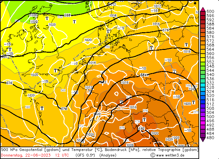
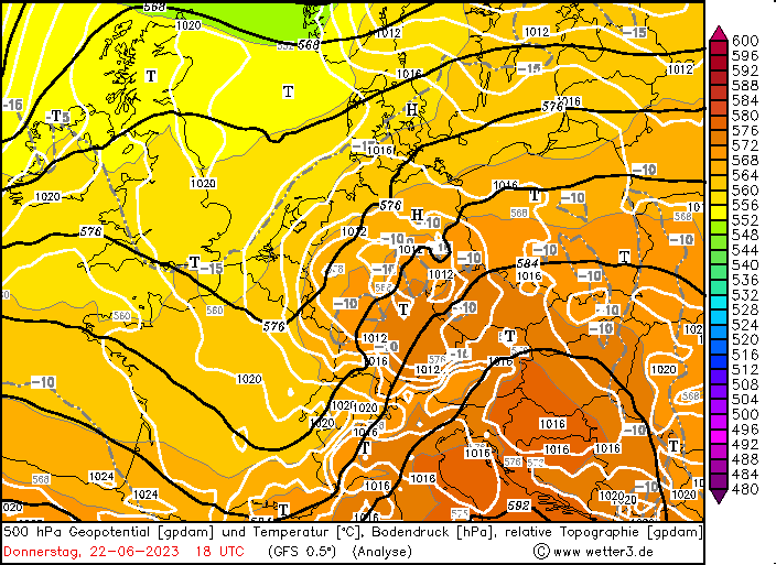
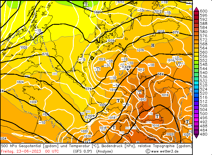
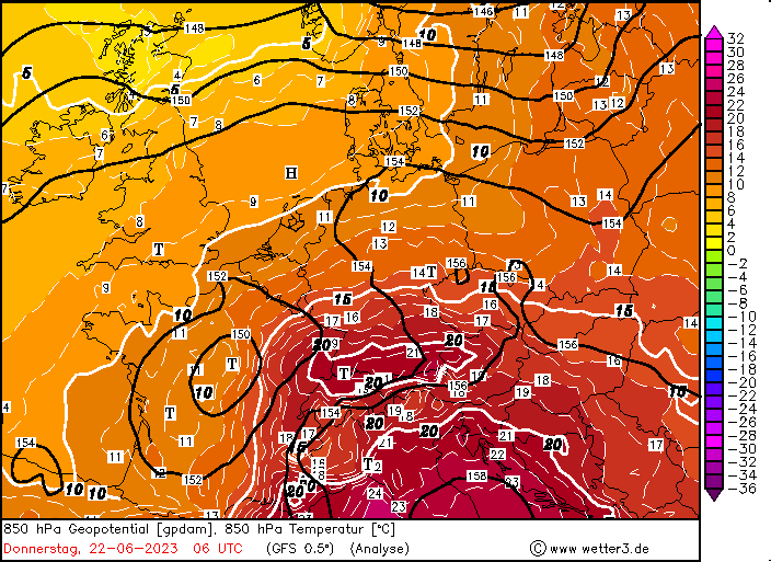
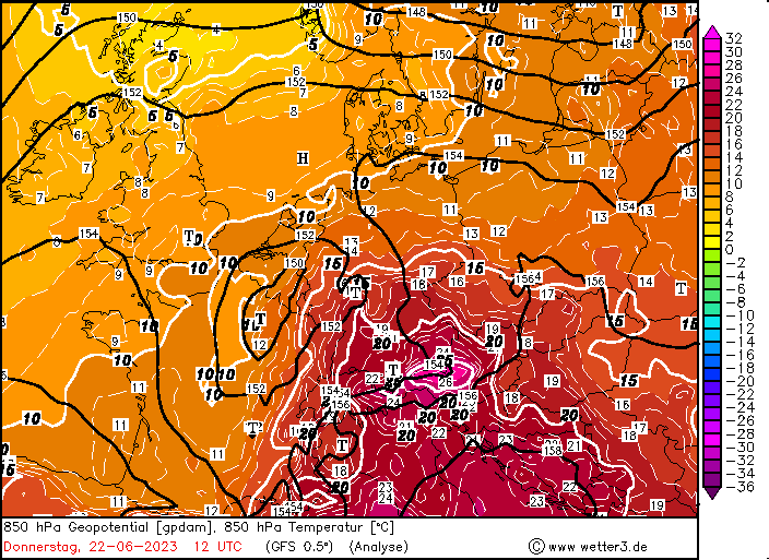
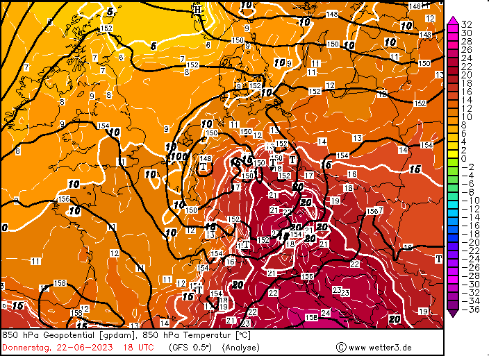
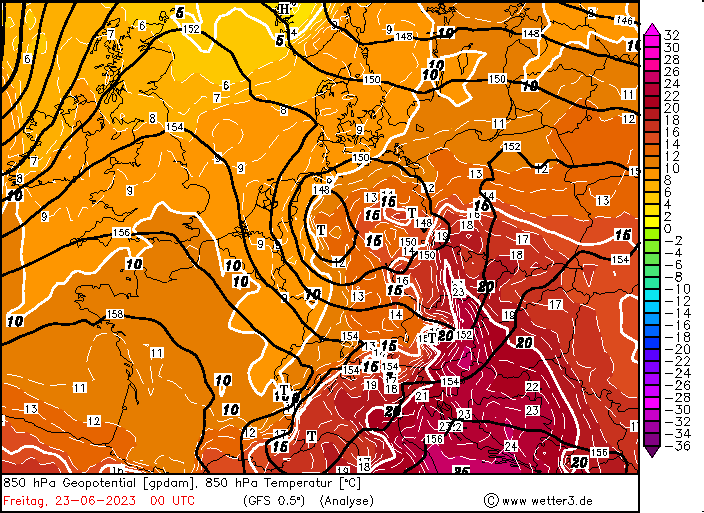
500 hPa Geopotential (top), 850 hPa pseudo-potential temperature (middle), and surface analysis (bottom) along with sea surface pressure over Europe 20.06.2023 00 UTC - 23.06.2023 00 UTC, source:
wetter3
On June 20, 2023, a distinct secondary trough developed over the Iberian Peninsula moving northeastwards across Western Europe. Nearing Central Europe, a complex synoptic situation developed, with a shallow surface low developing over Germany on June 22, 2023, with the core pressure reaching only slightly less than 1010 hPa. Nevertheless, this surface low further increased the advection of moist and very warm air masses into Germany, with the 850 hPa temperatures reaching 25 °C in the Alpine foothills. Due to the pressure difference across the Alps, a strong Föhn effect set in along the northern side of the Alps, leading to extreme heat in Föhn valley in the Alps. The temperatures reached 35,7 °C in Reit im Winkel, BY at an altitude of 685 m above sea level, which is only 0,4 K below the temperature record at the station and beating the previous June record by 1 K. At an non-DWD station at Lenggries in Bavaria temperatures of up to 38,4 °C were measured at a staggering 730 m above sea level. Besides the Alps, much of Southern Germany was experiencing sweltering heat from June 20 through June 22, 2023, with the heat stress being exacerbated by unusual high dewpoints with dewpoint temperatures close to the 20 °C-mark.
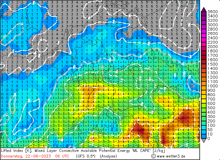
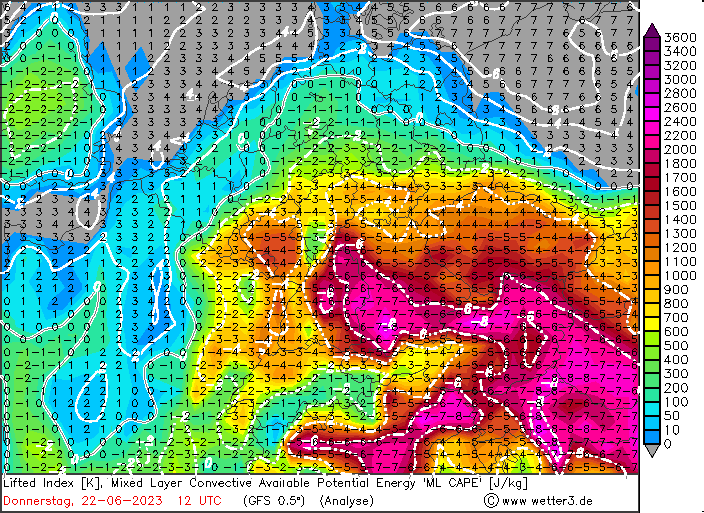
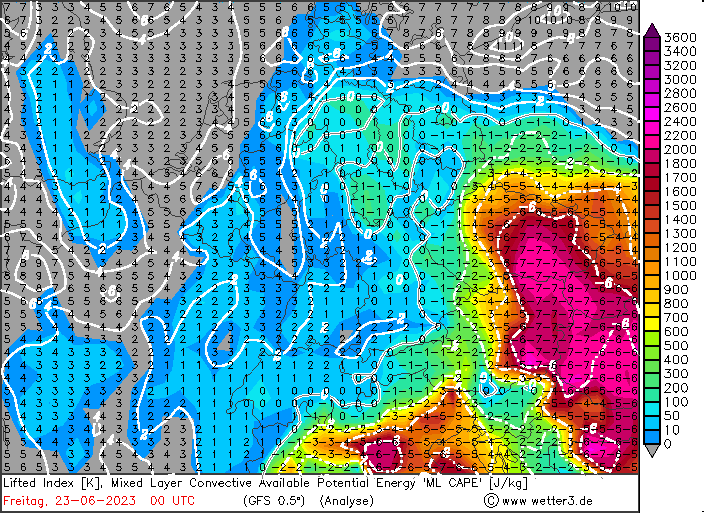
500 hPa Geopotential and sea surface pressure (top), 850 hPa temperature and sea surface pressure (middle), and LI-index and mixed layer CAPE (bottom) over Central Europe 22.06.2023 06 UTC - 23.06.2023 00 UTC, source:
wetter3
Already, on June 20 and June 21, 2023, the first upper-level trough led to severe convective activity across Germany, with some smaller squall lines forming and bringing heavy downpours and extreme convective downdrafts with wind gusts of up to 135 kph in the Swabian Jura. Though, convective activity was much more localized than on the June 22, 2023.
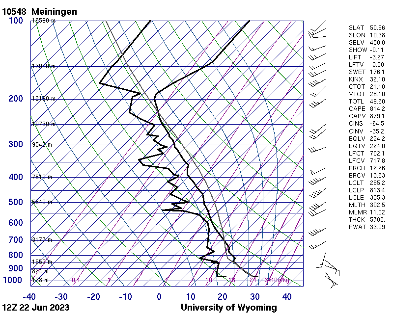
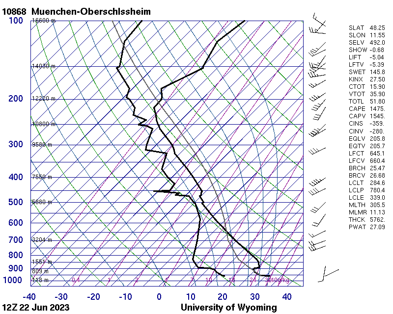
Atmospheric sounding from 22.06.2023 12 UTC Meiningen (left) and München (right), source:
University of Wyoming
By early morning of June 22, 2023, already some convective activity had formed over the western part of Germany and the neighboring Benelux states, as the complex synoptic situation across Germany developed. In the middle part of Germany, high CAPE values were superposed by a strong vertical wind shear as the trough neared, as the surface low induced weak south to southeasterlies compared to the mid-level southwesterlies ahead of the trough. In Southern Germany in combination with the strong solar insolation, extreme CAPE values > 3000 J/kg were observed, though they were capped by a strong capping inversion (CIN of -295 J/kg at 09 UTC at Hohenpeißenberg observatory). Though, the mid-level lifting provided by the trough would prove to be a sufficient external forcing to overcome the capping inversion in the latter half of the day and lead to the formation of severe thunderstorms also over Southern Germany. Close to the center of the upper-level trough, a third area high-impact weather developed, as the slow-moving trough provided a forcing for lifting, creating a rain band of continuous heavy precipitation, locally interspersed with strong thunderstorm bringing torrential downpours.
By 10 UTC within the remands of a convective system above the Eifel mountains, a strong thunderstorm developed, moving quickly northeastwards into North Rhine-Westphalia. Over the Sauerland Mountains, the cell increased its intensity and at around 12:45 UTC the typical cell-splitting of a developing super cell was observed. The left moving cell quickly dissolved into a broad convective heavy rain system, while the right moving super cell rapidly increased its strength. Moving on a westward trajectory across the northern part of Hesse, the massive supercell brought torrential downpours and massive hail. On its trajectory, the super cell hit the metropolitan area of Kassel close to peak intensity. Within the area, the super cell brought torrential downpours with precipitation rates of up to 40 mm/h, which led to flash flooding in the city. Concurrently, large hail was observed in the area, with hail stones reaching diameters of up to 5 cm causing damages to buildings and crops in the area.
Over the western part of Germany, the outflow of an ageing thunderstorm, triggered the development of multiple thunderstorms over the northern part of Rhineland-Palatine at around 12:30 UTC, which slowly merged into a strong cluster of strong convective cells bringing heavy precipitation across state with precipitation totals of more than 30 mm to the north of Koblenz. The cluster moved on a northeasterly trajectory into Hesse, affecting the same regions of Northern Hesse, which had been hit by the super cell about 2 h prior. Both systems continue to move on a more westerly trajectory into the eastern part of Germany, while developing a more squall-line-esque structure, slowly dissolving into a broad area heavy rain over Brandenburg in the nighttime hours. The area of heavy rain moved into Western Poland, with some stronger convective activity along the leading edge of the system.
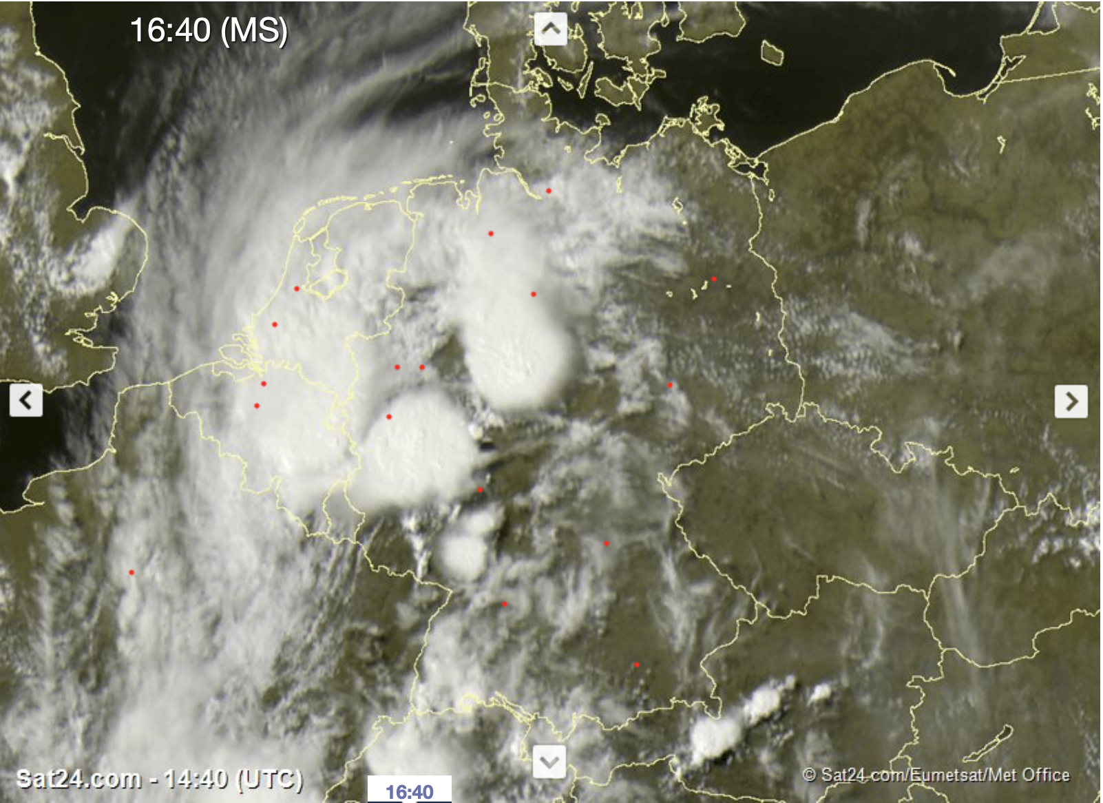
Visible satellite image with two mesoscale convective systems active over Germany, 22.06.2023 14:40 UTC, source:
Sat24
By 16 UTC, the nearing trough provided enough forcing for convection to be triggered over the northern part of the Alps. The cells found a very favorable environment for further development in the Alpine foothills and the Danube Valley with CAPE values of more than 2000 J/kg. Over Bavaria, the thunderstorms brought locally large hail stones as well as very strong convective downdrafts. While moving quickly northeastwards into the northern part of Bavaria, the shear increased, as here the surface low induced more southeasterly winds superposed by the mid-level southwesterlies induced by the upper-level trough. By 20 UTC, multiple supercells formed across the northern part of Bavaria bringing torrential downpours, with more than 120 mm of rain falling in a short period at Bad Berneck. In the nighttime hours, the supercells moved into Saxony, dissolving into a broad area heavy convective precipitation.
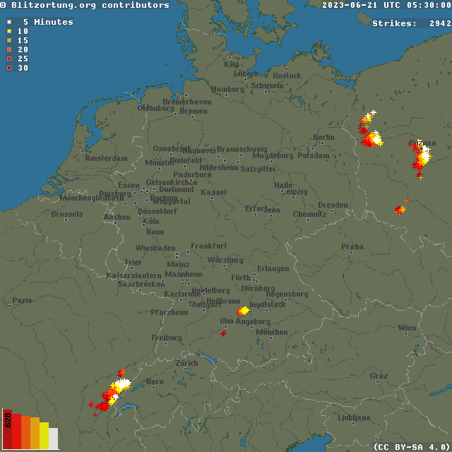
Lighting flashes over Central Europe, 21.06.2023 05 UTC - 23.06.2023 05 UTC, source:
Blitzortung
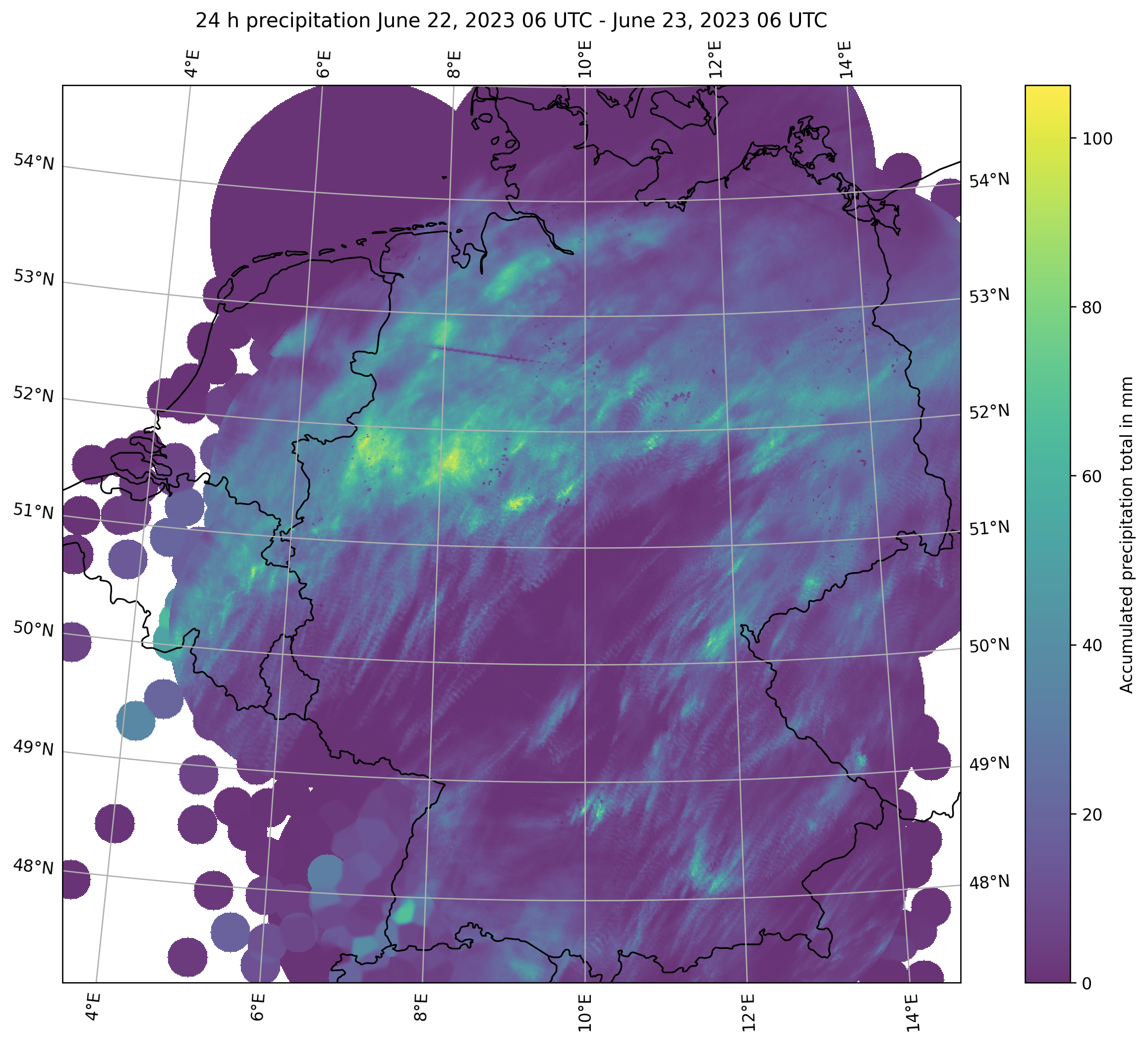
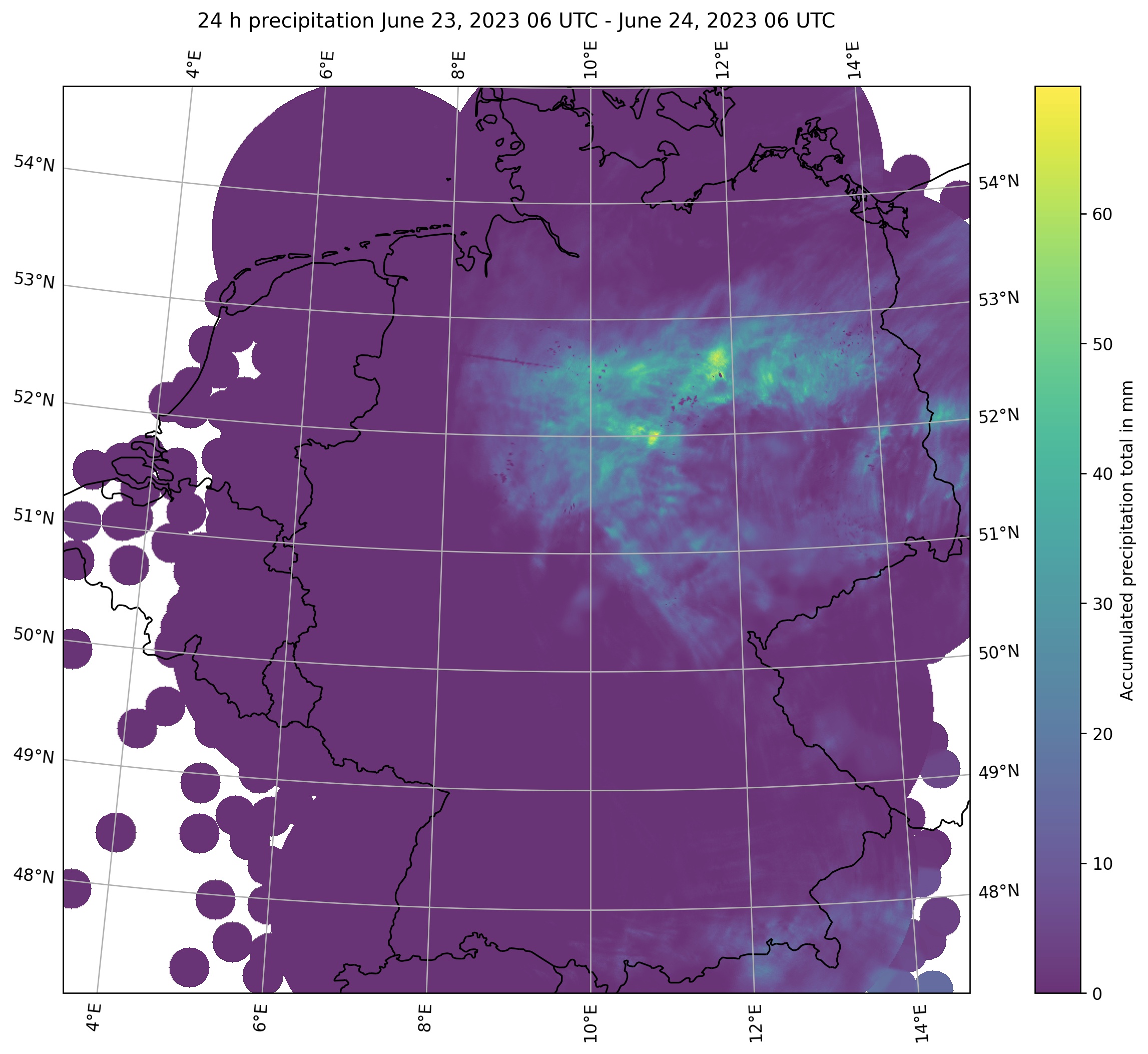
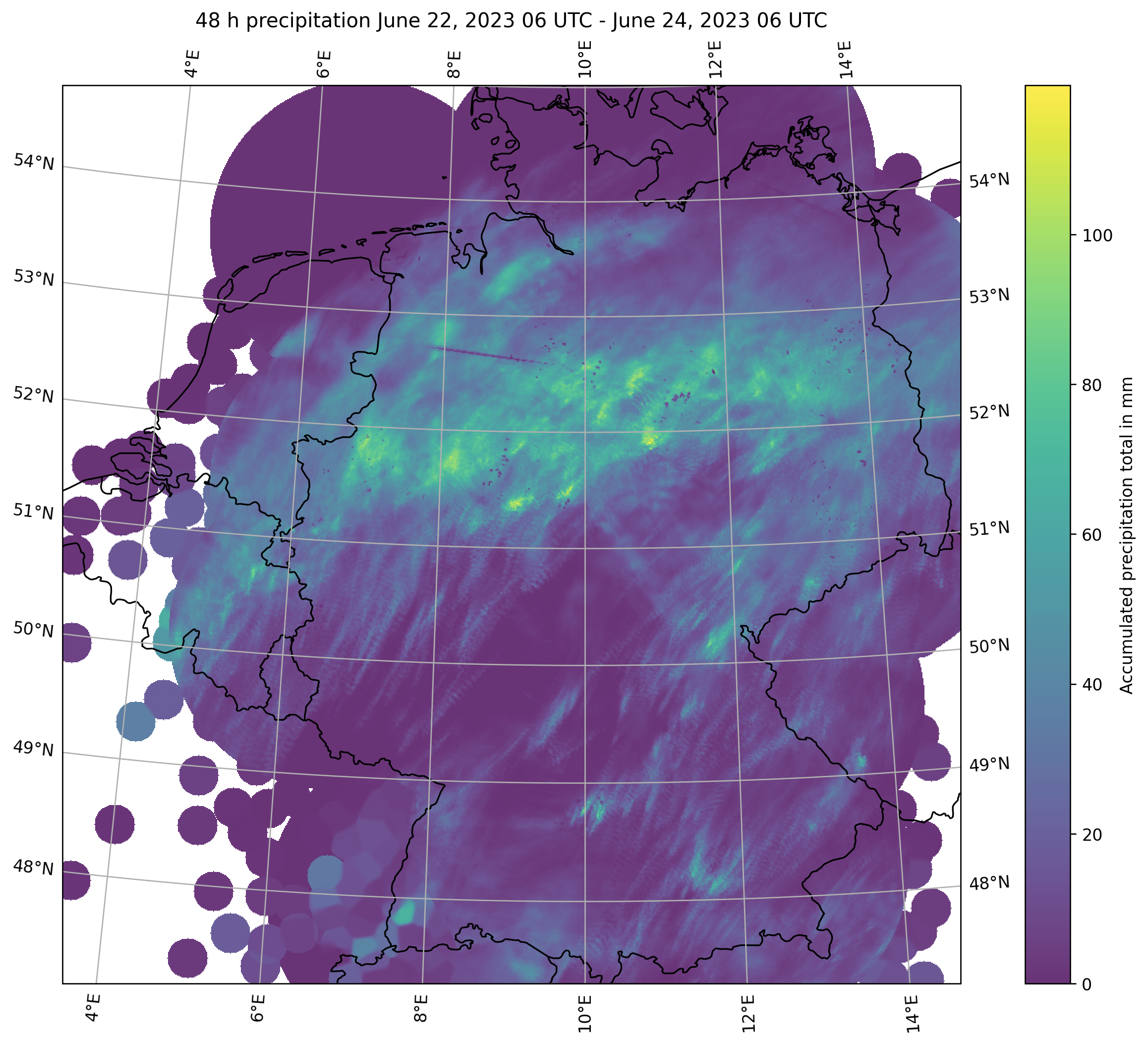
Beneath the upper-level trough, an area of heavy continuous precipitation formed over North Rhine-Westphalia due to the lifting induced by the trough above. Hourly precipitation rates reached more than 30 mm, as embedded thunderstorms increased the precipitation rates. With the movement of the trough, this precipitation area shifted slowly eastwards, yet on June 23, 2023, the precipitation rates increased again. Only by the end of the day, the precipitation subsided as the trough moved eastwards into Western Poland. Within a 24 h-period more than 75 mm of rain were observed in strip spanning from the northern part of North Rhine-Westphalia into the eastern part of Germany stretching into the Northern Lowlands, with a maximum of 102,4 mm at Bad Sassendorf-Beusingsen, NRW. Combined with the recent dry spell, the continuous heavy precipitation brought heavy run-off along many small rivers. In Dinslaken, the rising water level severely damaged a levee, leading to the sagging of a railroad bridge, bringing it on the verge of collapsing.
RADOLAN 24 h precipitation totals June 22, 2023 06 UTC - June 23, 2023 (left), 24 h precipitation totals June 22, 2023 06 UTC - June 23, 2023 (middle), 48 h precipitation totals June 22, 2023 06 UTC - June 23, 2023 (right), 22.06.2023 14:40 UTC, source:
DWD, Visualization: K. Gramlich
Overall, the impact of severe thunderstorms was slightly smaller than expected, no major reports of Tornado formation were reported across Central Germany, were models suggested that the potential for tornado formation was given. Especially, over Bavaria some models suggested more widespread convective activity with the potential for large hail stones. Nevertheless, the severe thunderstorms led to damages in many parts of Germany, with many reports flash flooding and localized, which is in a stark contrast to the dry and sunny weather in the first weeks of the summer 2023.