|
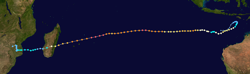
Very Intense Tropical Cyclone FREDDY reached 1-minute-sustained winds of up to 270 kph and a core pressure of 931 hPa. Landfall on Madagascar with winds up to 185 kph.
Very Intense Tropical Cyclone FREDDY was a tropical cyclone in the southern Indian Ocean that passed close to the islands of Mauritius as well as La Reunion and made landfall on
Madagascar on February 21. The cyclone developed from a tropical depression with very active convection over the western Pacific Warm Pool. On 06 February, the Joint Typhoon Warning
Center issued a Tropical Cyclone Formation Alert. On 07 February, the system reached a strength equivalent to Category 1 for the first time, and by 08 February, wind speeds were up
to 180 kph. On 09 February, however, the system weakened again and wind speeds dropped below 100 kph. At 00 UTC on 10 February, the system regained tropical cyclone status and maintained
it until landfall on Madagascar on 21 February.
|
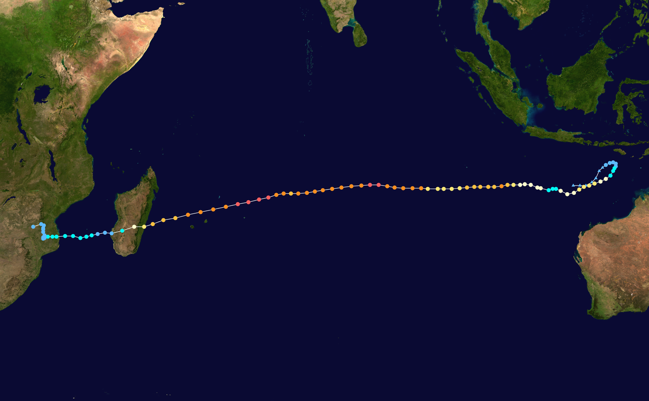
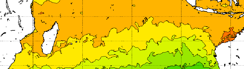
Trajectory of FREDDY and sea surface temperature within this area, source:
NASA and NOAA
|
 |
 |
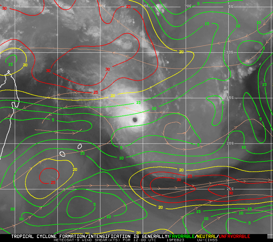
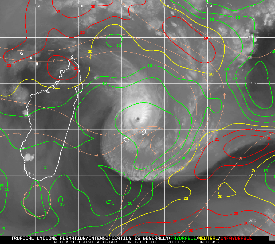
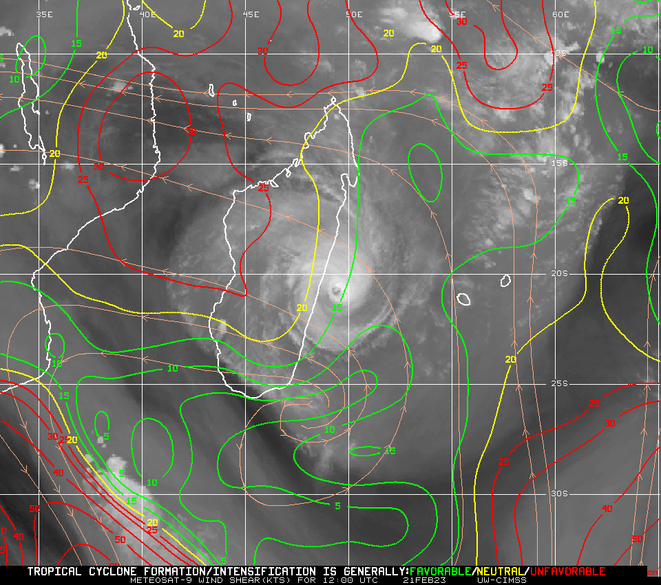
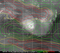
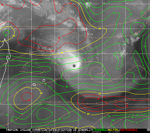
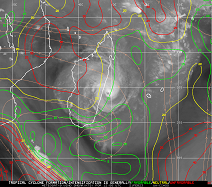
Such a long lifetime is uncommon for tropical cyclones. FREDDY, however, moved almost straight west, remaining within the range of ideal latitudes for tropical cyclone formation or maintenance.
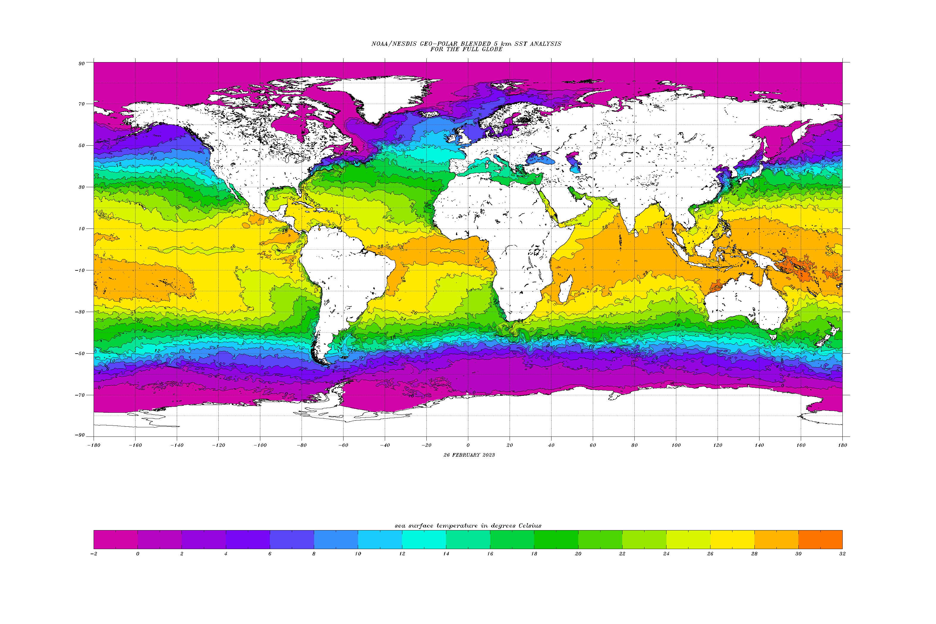
If FREDDY had moved toward the equator, the water surface temperature would still have been a little higher, but the system would have experienced a weaker Coriolis force here. Moving away from
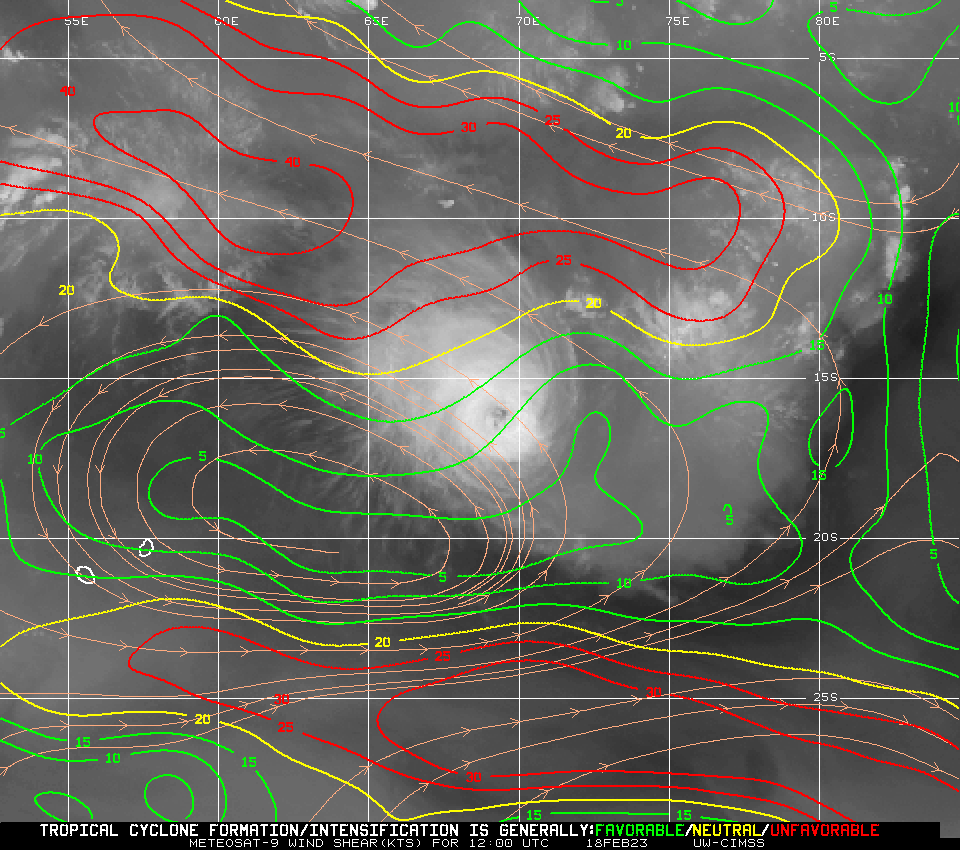
the equator, FREDDY would have passed over much cooler water masses. A particular focus here is also on the wind shear, which was very low during the entire journey through the southern Indian
Ocean. This can be seen well in the satellite images that even the high cirrus clouds at the outer end of the round storm are hardly fringed, but the system has a particularly high symmetry.
--
|
Deel layer shear for 18 to 21 Feb, 12 UTC source:
CIMSS
|
 |
 |
 |
 |
FREDDY reached its preliminary peak on February 14 with 10-minute sustained winds of 250 kph and 1-minute sustained winds of 270 kph. The storm would thus rank as a Category 5 storm on the
Saffir-Simpson scale for hurricanes. On February 20, the system passed north of the island of Mauritius and La Reunion at a distance of about 150 km. At this time, the system was barely
below its peak intensity and still exhibited 10-minute-sustained wind speeds of 225 kph. Because of the sufficient distance and ongoing safety precautions, the impact on the two islands
was minor. Despite the long distance, FREDDY's eye could be clearly detected in the rain radar on Mauritius. At the Le Port and Gillot-Aeroport stations on La Reunion, gusts of 104 and
106 kph, respectively, were recorded during the night of February 20-21.
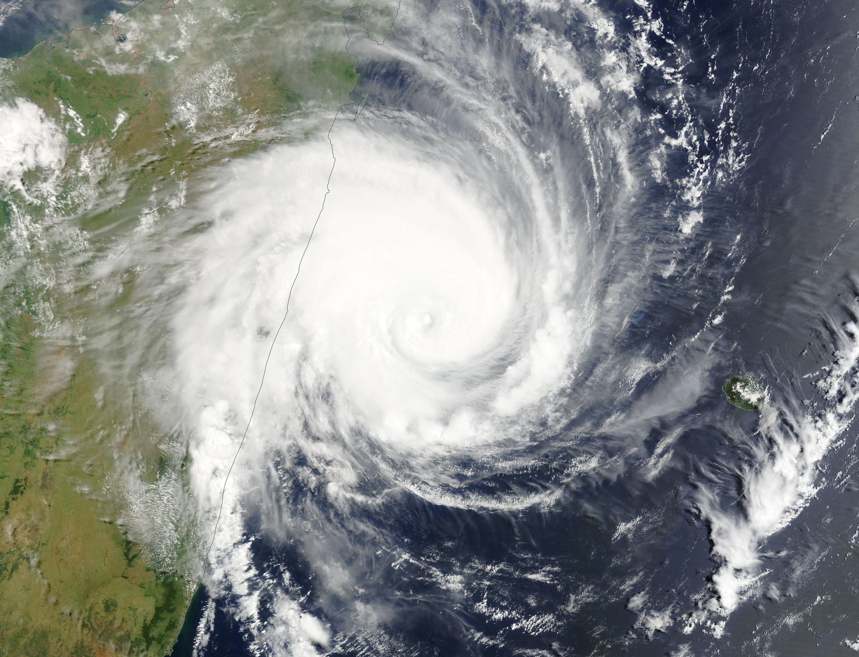
On the evening of 21 February, FREDDY hit the east coast of Madagascar with 10-minute sustained winds of 185 kph. Around the town of Manajary and the river of the same name, severe flooding
and high water due to storm surge occurred. Furthermore, there was heavy rainfall of up to 300 mm total precipitation. More than 1000 houses were destroyed by the storm, many of which were
still under reconstruction as a result of the February 2022 storm BATSIRAI. FREDDY quickly crossed Madagascar and made landfall again on the east coast of Mozambique on February 24. Even
though the winds here are already strongly weakened, there were widespread rainfall amounts of around 200 mm in the southern part of the country, in isolated cases even up to 500 mm.
Text: FS
February 28, 2023
|