|
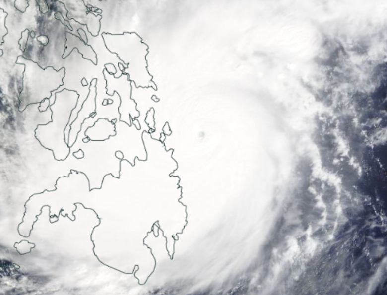
Typhoon Rai was the first landfalling super typhoon in the Western North Pacific in 2021.
Rai affected the southern Philippine islands with severe winds above 250 km/h, torrential rainfall, and a strong storm surge.
Rai formed on December 13 at 00 UTC, several hundred kilometers southeast of Paula in the central Western North Pacific close to the equator.
The disturbance indicated for the first time a cyclonic vortex due to the more northward location in contrast to the days before. A complex of diffuse
convection becomes more organized and results in a tropical storm with a low and mid-level vortex. This intensity change is mainly a result of the increasing latitude-dependent Coriolis force
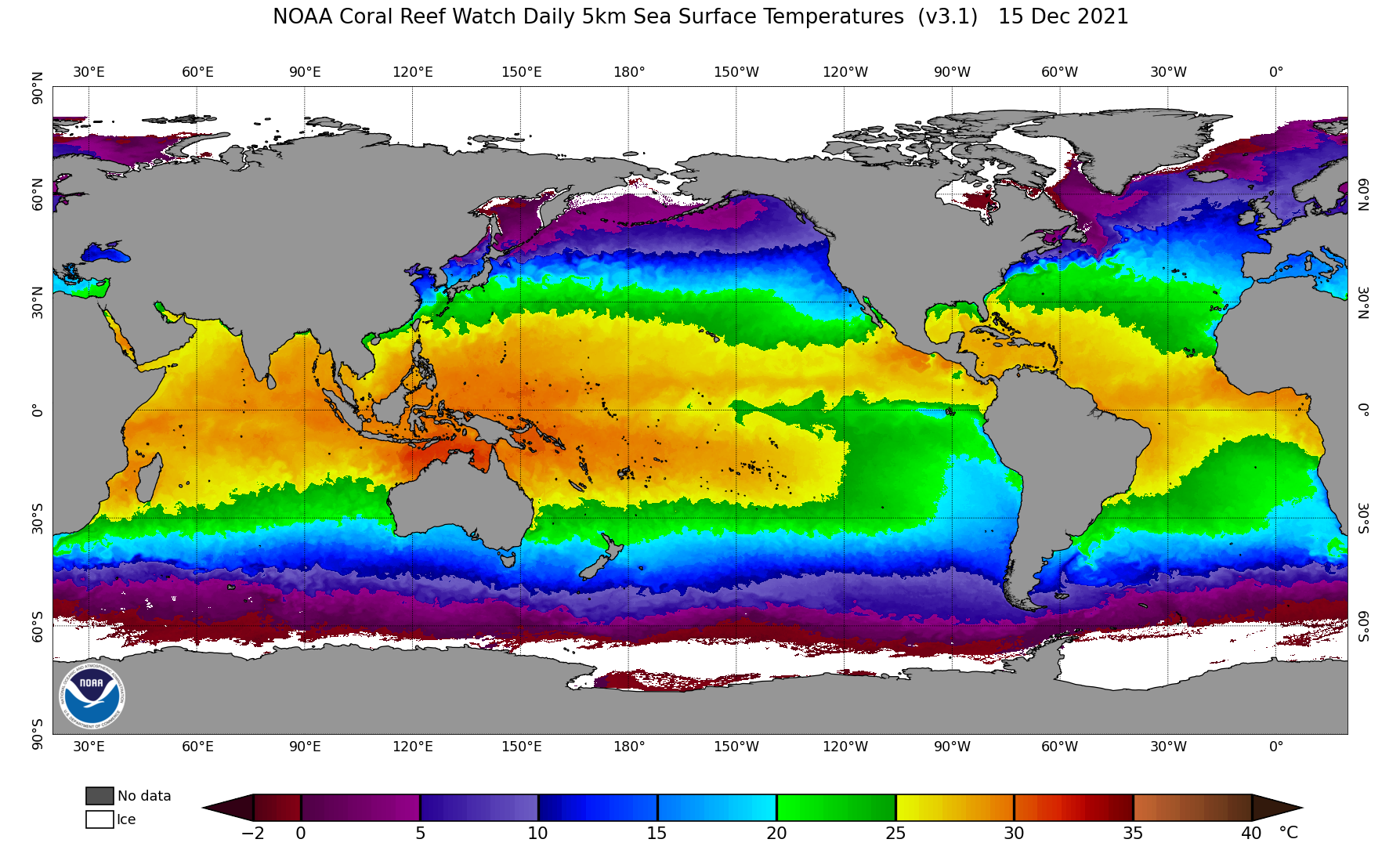
because the environmental conditions were still favorable for development. Sea surface temperature exceeds 28°C, and the environmental deep-layer vertical wind shear
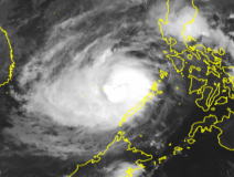
was relatively weak. On December 14, the cyclone moved northwest Palau towards the southern Philippines. However, the storm system showed only a weak intensification rate.
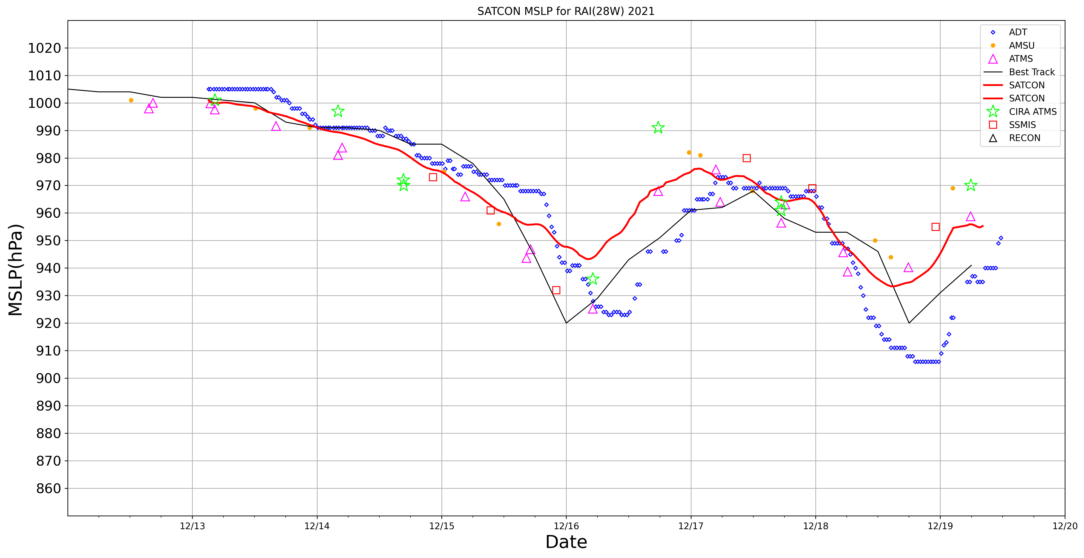
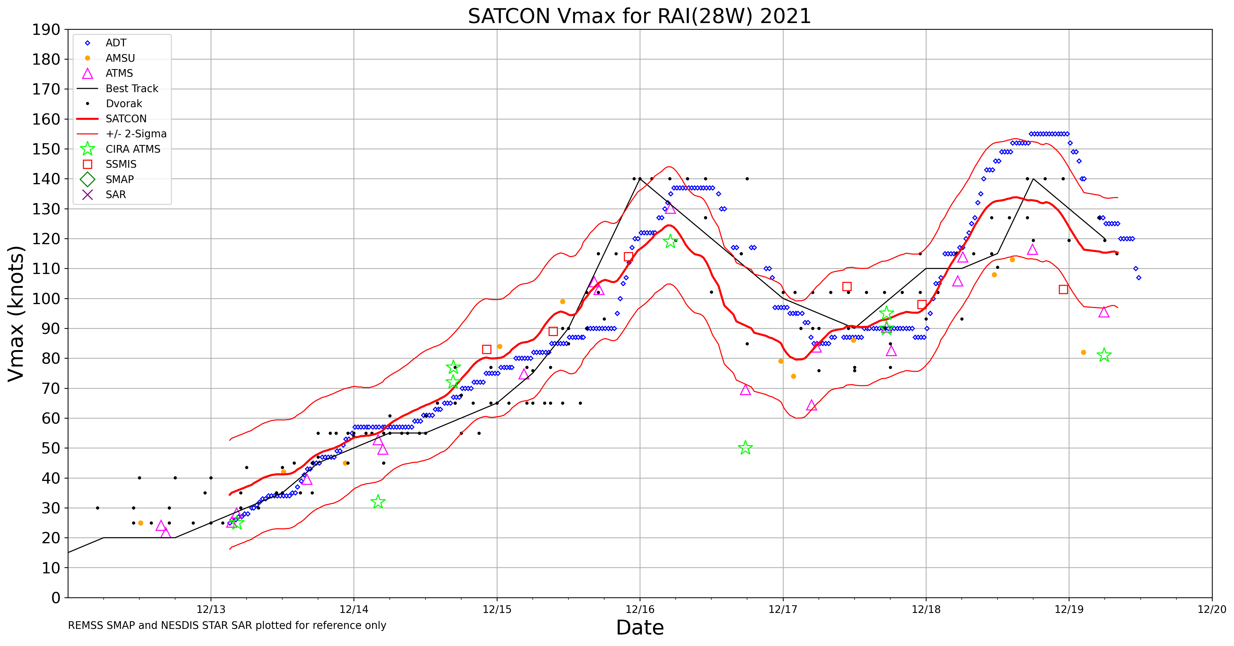
One day later, the storm intensified to a Taifun with wind speeds above 120 km/h and pressure under 985 hPa. The closed circulation system and the decreasing
vertical wind shear combined with an inflow of very moist air provided the initial conditions of an amazing rapid intensification rate afterward.
|
Sea surface temperature over the Western North Pacific, 15 December, source:
NOAA
|
 |
|
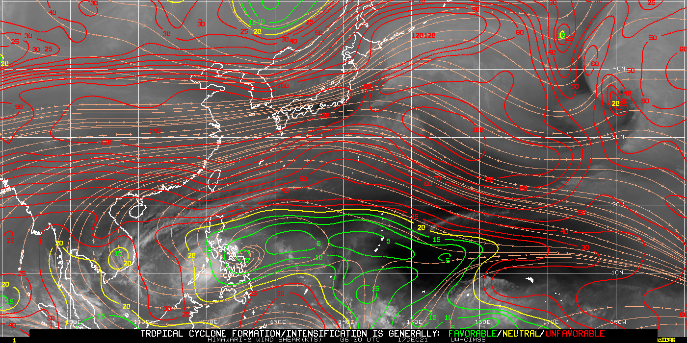
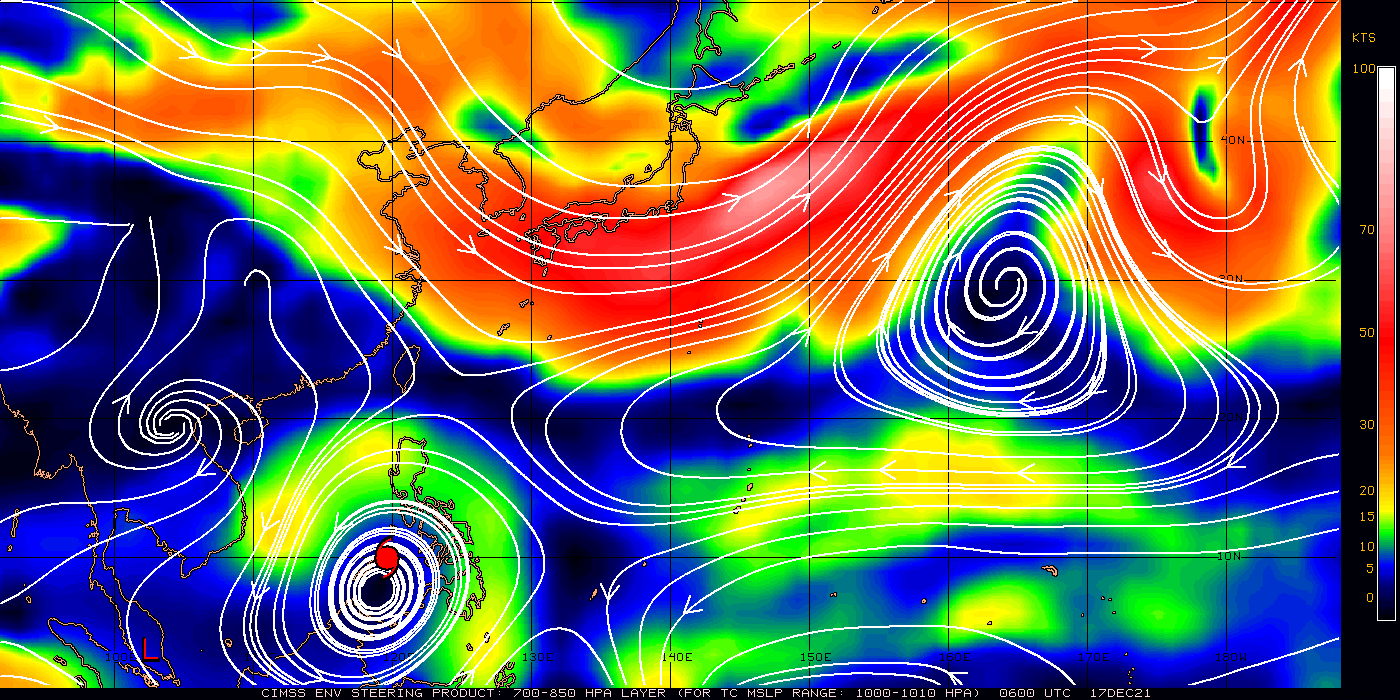
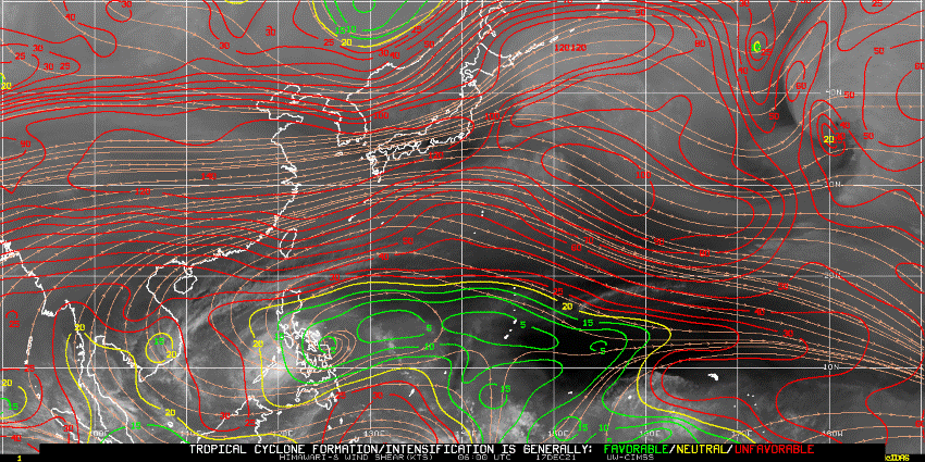
Environmental deep layer vertical wind shear over Western North Pacific, 17 December, 00 UTC, Data source:
CIMSS Tropical Cyclones
|
 |
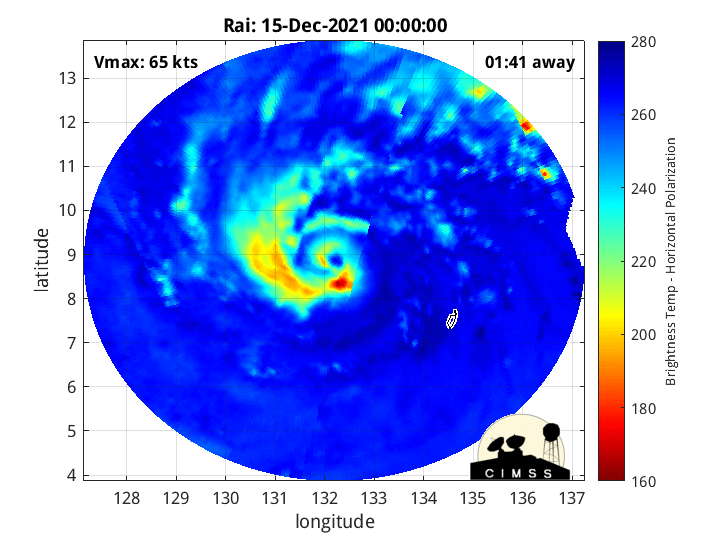
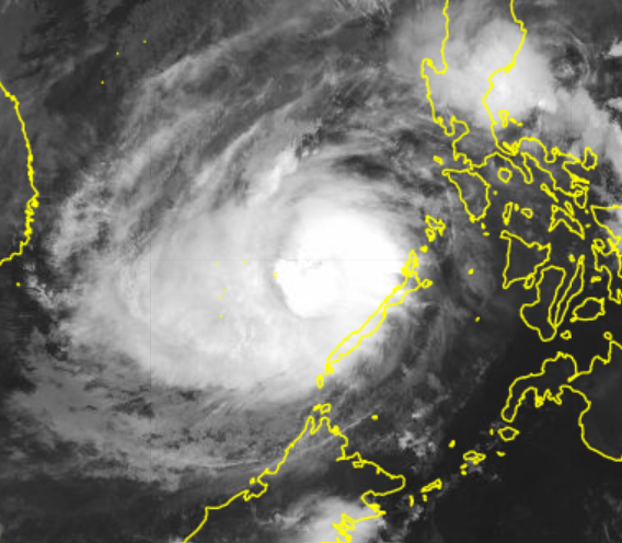
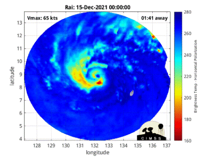
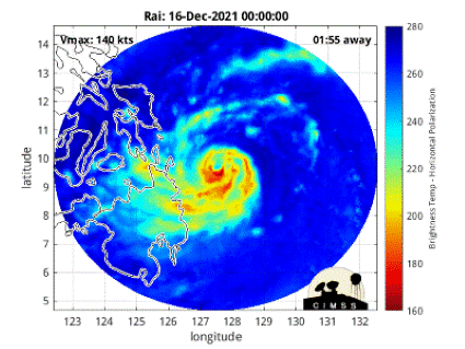
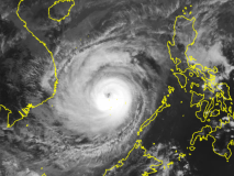
From December 15, 12 UTC to December 16, 00 UTC, a pressure fall of 57 hPa and a mean wind increase of 95 km/h from 165 km/h to 260 km/h were visible. Rai
became a Super Taifun in an extremely short period. Sea surface temperatures over 28°C lead to enthalpy fluxes from the surface and provide the moisture source
of the cyclone. The weak vertical wind shear enables a vertically stacked column of heat and significantly decreases the inflow of low entropy air from the midlevel.
Furthermore, an advection of moist air into the cyclone forces the convection-related latent heat release. Observations of brightness temperature indicate an enhanced convective activity to the south at the beginning of the period related to moisture advection into the storm. This convective area spread around the cyclone and
formed a clear eyewall with intense deep convective clouds. This process contributed to extreme latent heat releases. The latent heat release strengthened the secondary
circulation that led to the tropical cyclone's intensification. This positive feedback caused this intense rapid intensification rate.
|
Animation of brightness temperature during rapid intensification period (left) and landfall (right), source:
CIMSS Tropical Cyclones
|
 |
 |
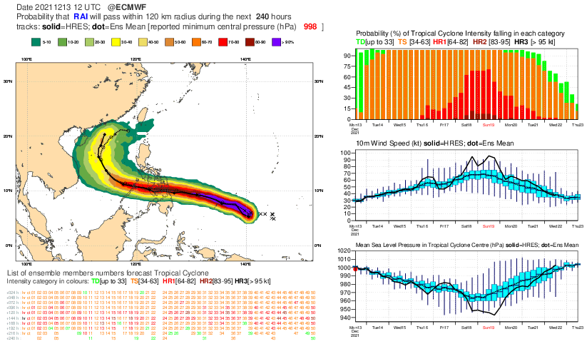
The model forecasts are not able to predict the rapid intensification rates. The Ensemble Prediction System of the ECMWF model simulated on December 13, 12 UTC for Rai
short before landfall at the Philippines a minimum pressure of 968 hPa for the high-resolution deterministic run. Additionally, the ensemble mean showed an even higher pressure
of 977 hPa. As a result, the ensemble forecast failed to predict the intensity of the Taifun accurately.
Why is this possible?
The processes behind that are not fully understood. A previous study showed for a case study in this area that the model cannot predict the intensity of
vertically integrated water vapor fluxes adequately. This variable provides moisture in a tropical cyclone center's lower and middle troposphere and enhances the storm's convective
activity. Other studies have shown that the forecasts are very sensitive to the environmental deep-layer vertical wind shear and moisture in the midlevel.
These parameters could also play a role in the wrong prediction.
Therefore, further research is crucial.
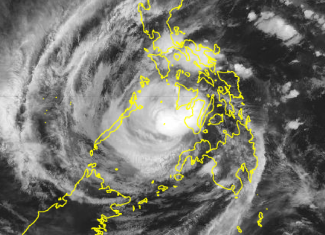
The intense winds over 200 km/h of Rai destroyed buildings and capped power lines. Torrential precipitation caused extensive floodings and landslides that led to
severe infrastructure damage. The impact of Rai caused power outages in large parts of the southern Philippines. Concerning the super typhoon, more than 100 deaths were identified.
This amount will rise because some parts are still cut off from the outside world, and several people are missed. After the southern Philippine islands' transition, Rai lost its symmetric structure and weakened to a Taifun of category 2. This intensity decrease is due
to the capped energy source and the frictional effects over land. The storm recovers over the South China Sea despite more unfavorable environmental conditions.
Deep layer environmental wind shear increased to moderate values between 10-15 m/s in the outer storm areas, and the sea surface temperatures decreased from 29°C to 27°C.
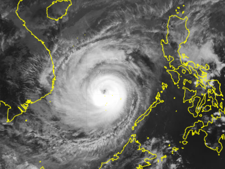
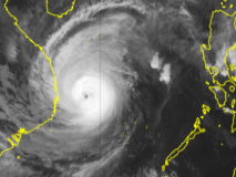
Nevertheless, Rai intensified again to a storm of the highest category. This regaining intensity is mainly related to a strong cold surge event in the South China Sea. The intense cold surge
is associated with a layer of dry and cold air that moves from the north around the cyclone and caused a thermodynamic imbalance between the sea surface an the air above. Simultaneously, the pressure differences between the area outside of the storm and the inner core rise. This imbalance contributes to enhanced water vapor fluxes in the central region
of the storm system. As a result, the convective activity is enhanced again. First in the western part of the eyewall and afterward in the whole inner circle.
Finally, the intensity increased, and Taifun Rai developed into a super typhoon of the highest category for the second time with maximum winds of 260 km/h.
|
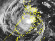
Satellite images of reintensification over the South China Sea, source:
JTWC
|
 |
 |
 |
 |
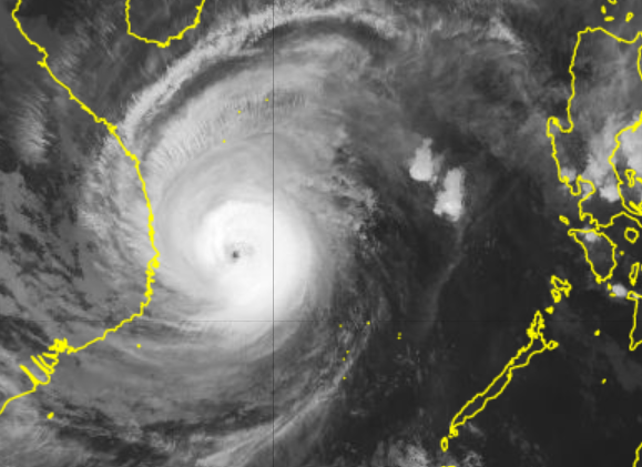
On December 19, the storm system indicated an anticyclonic turning to the north close to Vietnam. Increased vertical wind shear destroyed the healthy structure of the
cyclone, and sea surface temperatures under 26°C decreased the intensity of heat fluxes from the sea surface. Both led to a fast weakening of Rai.
Text: NB
December 19, 2021
|