Heat Wave / Thunderstorms Central Europe
17 - 20 June 2021
Squall Line in Kiel, 20 June, 06 UTC
Source: Laura Kranich
First extensive heat wave for Central Europe of the year. German-wide peak in Baruth and Belrin-Tempelhof with 36.6°C on 19 June. Advection of hot and humid air masses
with tropical origin caused heavy thunderstorms from Friday to Sunday. Heat wave ended with large MCS crossing Germany from Southwest to Northeast.
Spring and the beginning of summer were characterized by below-average temperatures. While at the weather station in Rheinstetten,
the months January and February and March were still 1.7 and 0.5 K too warm, a period of several months followed in which above-average
temperatures could hardly establish themselves. March was 0.7 K too cold, April was 3.1 K and May even 3.2 K colder than the long-term average.
A larger negative deviation was last seen in January 2017, which turned out to be 3.9 K too cold. However, June initiated a gradual trend
reversal in terms of daily maximum temperatures. While the station in Rheinstetten was able to break through the 20°C mark on on four occasions
in May, maximum temperatures below 20°C did only happen on twi occasions in June.
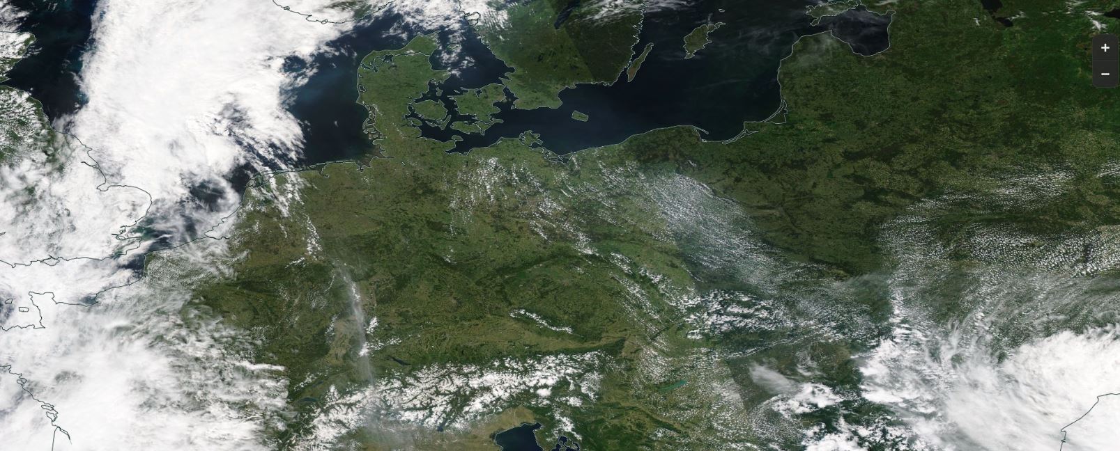
Satellite image (visible) from 17 June, source:
NASA Worldview
In the second decade of June, the first strong heat wave of the Central European summer prevailed. For the first time this
summer, a high-level ridge was able to position itself directly over Central Europe and block the passage of zonally incoming
low-pressure areas or meridional inflow of cold polar air. Mostly cloudless skies and the strongly positive - even almost
maximum - radiation balance at this time of year ensured surface near air layer to to heat up day after day.
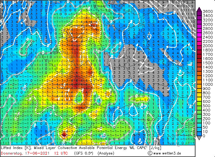
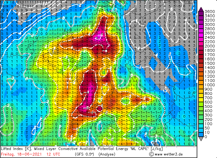
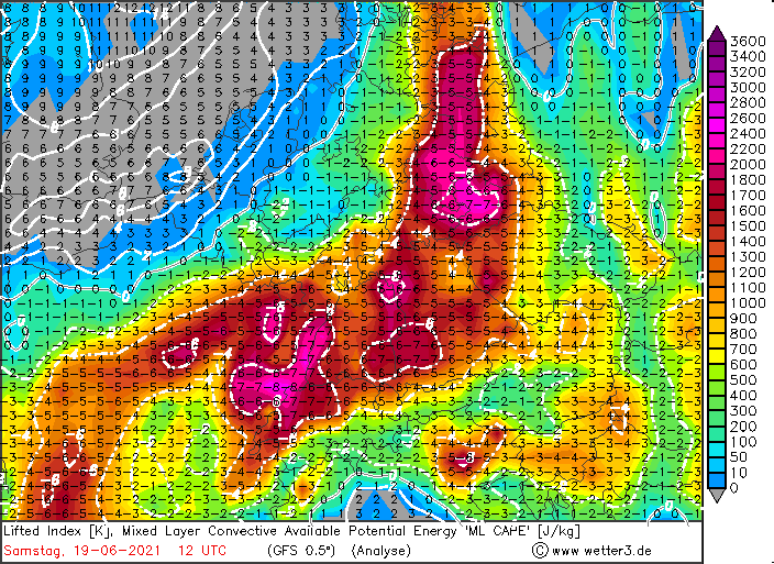
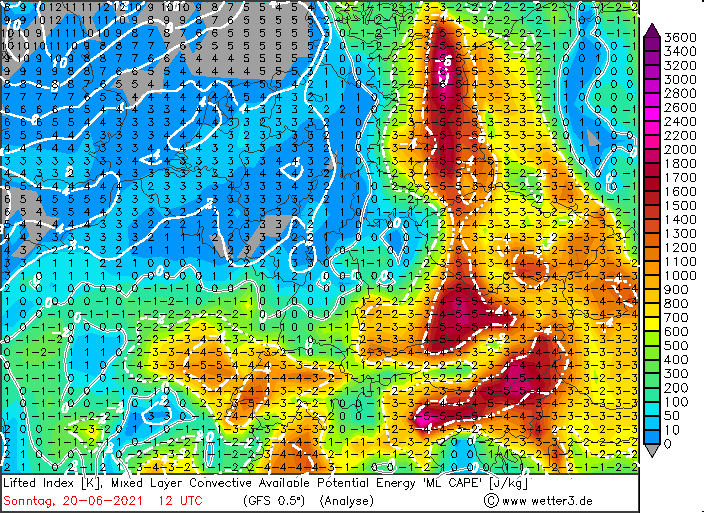
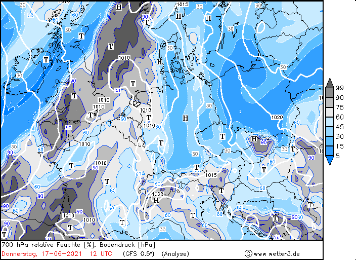
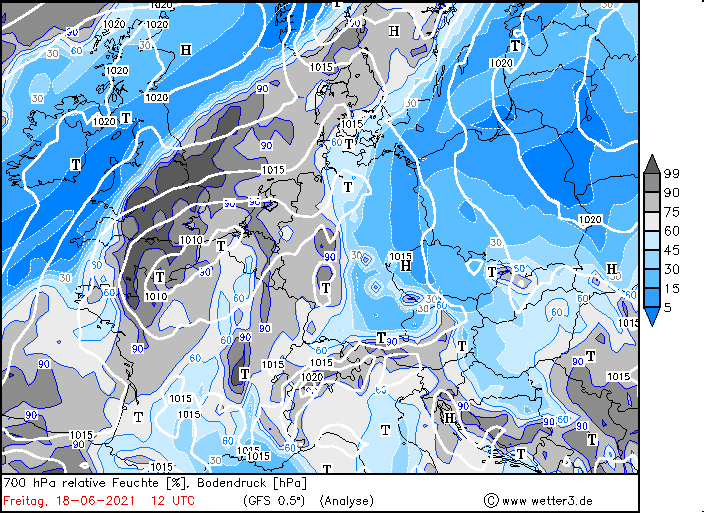
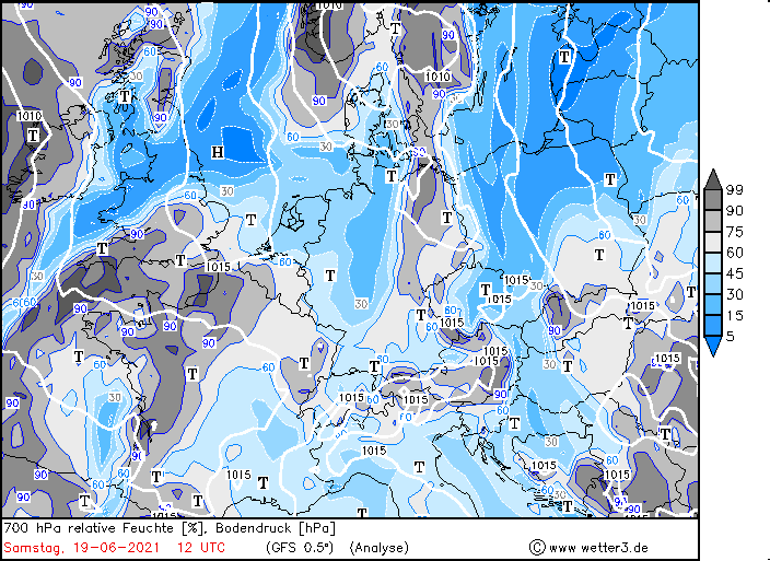
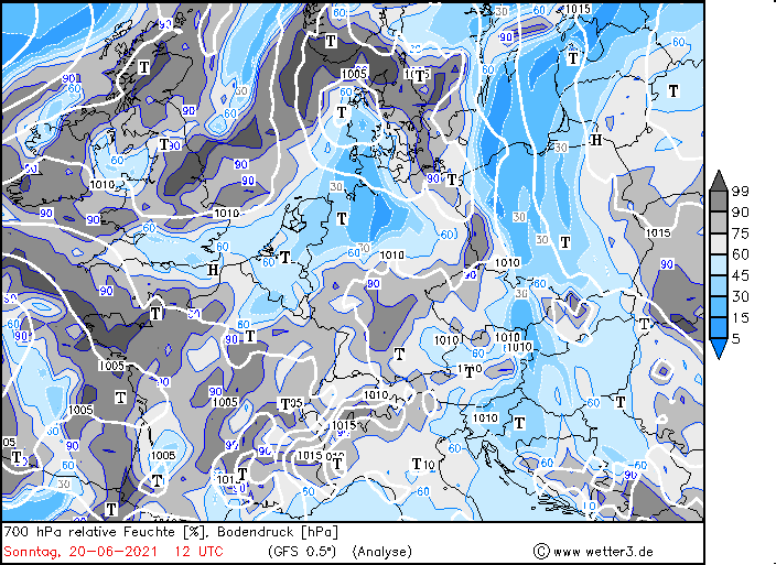
ML-CAPE and 700hPa relative humidity from 17 to 20 June, 12 UTC, source:
Wetter3
Beginning on Friday, June 18, the high altitude ridge slowly shifted eastward. A trough reaching far to the south
over the eastern Atlantic then directed warm, humid air from tropical latitudes to Central Europe. This caused 850
hPa temperatures to exceed 20°C, in some cases even reaching 25°C. Near the ground, the temperature climbed to more
than 35°C, with the stations in Baruth and Berlin-Tempelhof marking the German-wide peak of 36.6°C on June 19. In
the northeast of the country, the heat was able to persist the longest on this day, while in the south and west the
warming was already restrained by high reaching cirrus clouds.
Daily maximum temperatures from 17 and 18 June, minimal temperature in the night from 17 to 18 June. Data source: DWD
Due to the influx of warm and humid air, not only the heat load for human beings increased, but also the risk of thunderstorms.
On Saturday and Sunday, the ML-CAPE (Mixed Layer Convective Potential Available Energy) reached values around 2000 J/kg, locally
even up to 2500 J/kg. The first thunderstorms on Friday and Saturday were mostly individual cells, which showed quite photogenic
shapes like the pictures of Laura Kranich from northern Germany shown below.
Images from a supercell on 19 June, East Frisia, source:
Laura Kranich
Increasing vertical wind shear caused two strongly organized Mesoscale Convective Systems (MCS) to move across Germany from the
southwest on Sunday. Within a large area of weak to moderate precipitation, isolated strong thunderstorms were embedded, which
produced heavy rain and also hail with particle sizes of up to 5cm. Furthermore, gale-force winds also occurred in their vicinity.
Thus, a gust of 85 km/h was registered on the Feldberg, and 78 km/h in Rheinstetten. The following animation shows the 2m temperature
development from Sunday 12 UTC to Monday 03 UTC. It is clearly visible how the extensive precipitation area from the southwest abruptly
clears out the hot air masses.
Data Source: ICON-D2 (DWD), Visualization: Fabian Siegmann
The video below shows the effect of the thunderstorms, in form of hail. The video was recorded on Tuesday, 22 June, in northwestern Lucerne (Switzerland).