|
In mid-June, NADINE, an almost stationary low pressure system, caused thunderstorms and precipitation in Germany and Central Europe. The thunderstorm situation
in Germany lasted almost 1 week. Locally over 60 mm came together in 24 hours, in connection with thunderstorms even 20-40 mm in 1 hour.
Weather Situation
While temperatures at the beginning of June were still in the cool and moderately warm range, they rose sharply from 12 June onwards. The weather situation changed
over Europe. A so-called high over low weather situation arose. The normal pressure conditions turned around, so that a high pressure area was located over
Scandinavia and a low pressure area over southwest Europe. The air pressure over Germany will then be very weak, resulting in a weak wind situation.
|
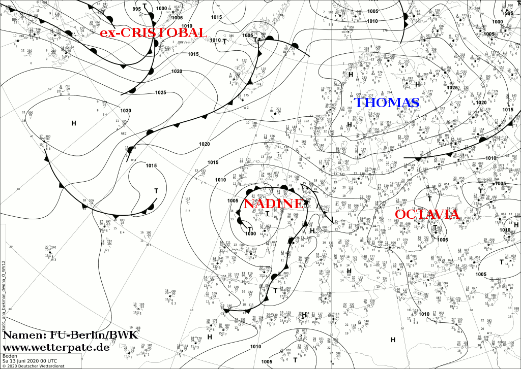
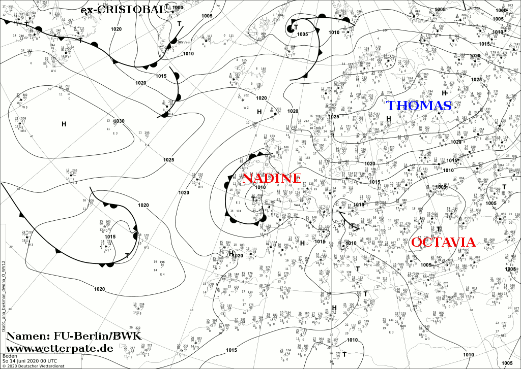
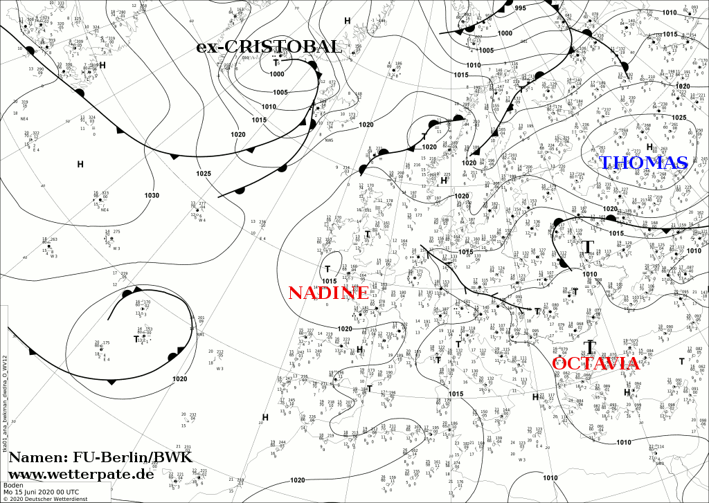
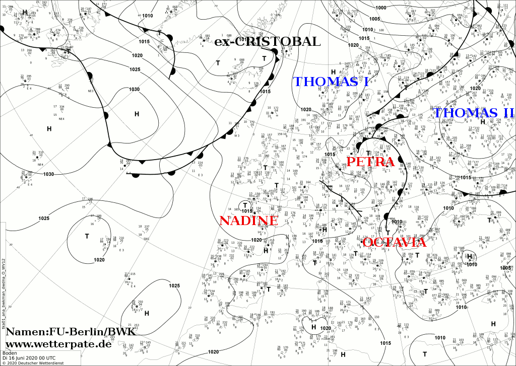
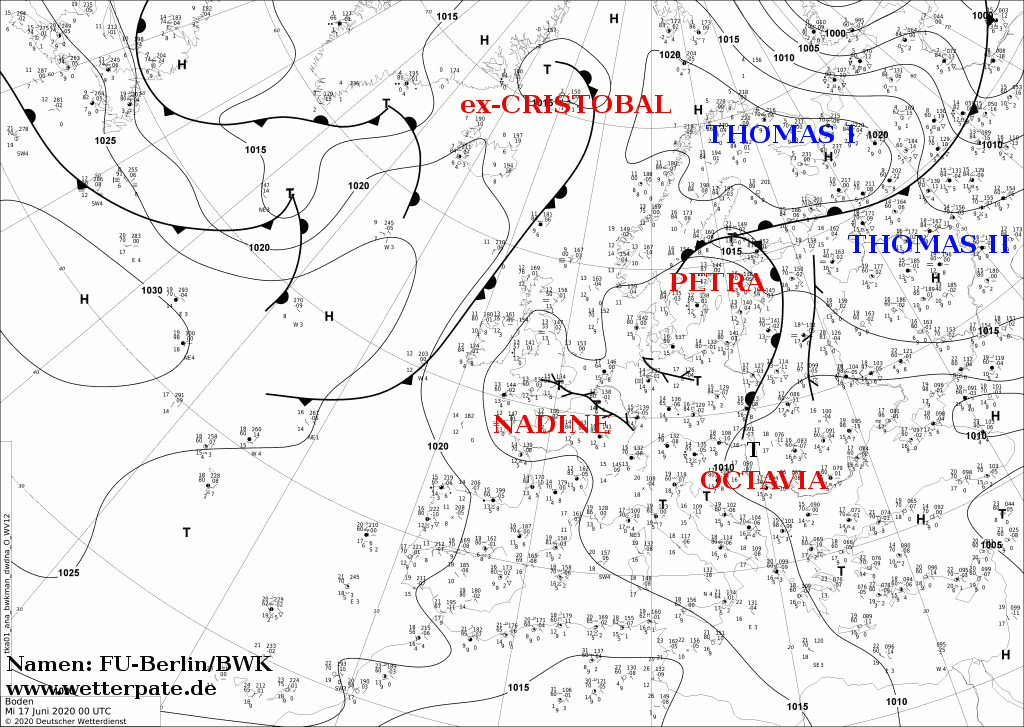
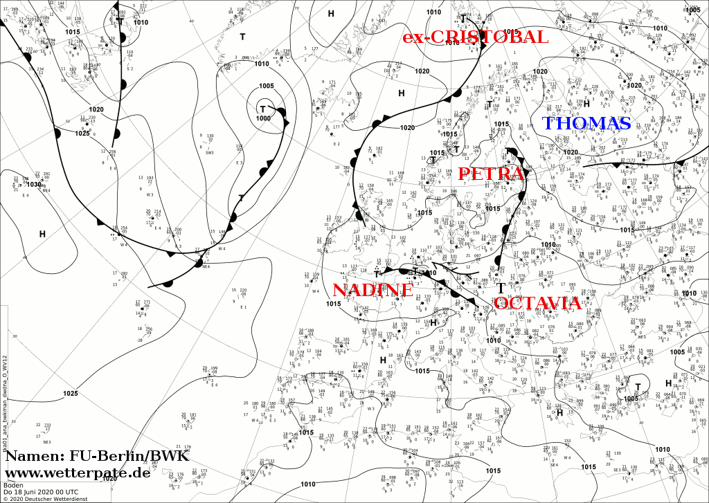
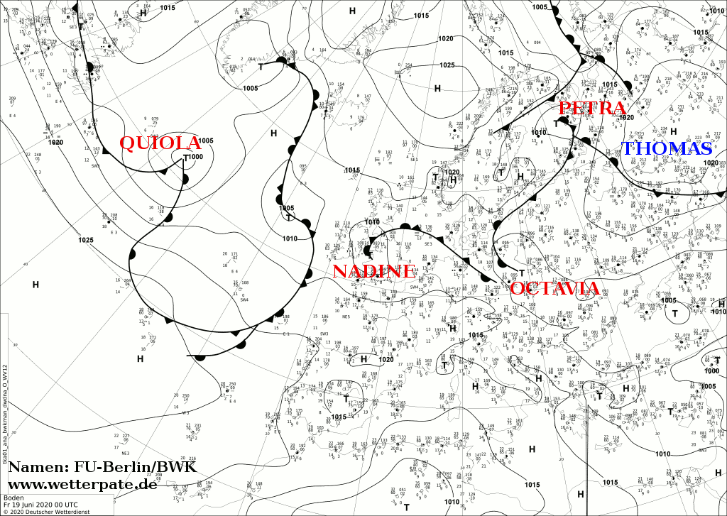
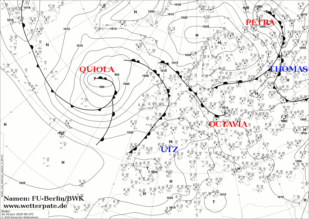
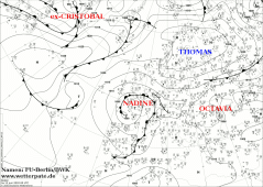
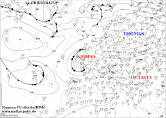
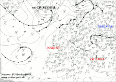
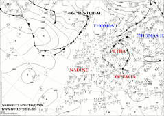
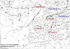
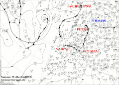
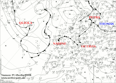
Sea level pressure and fronts, June 13-20, 2019:
FU Berlin
|
 |
 |
 |
 |
 |
 |
 |
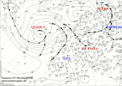 |
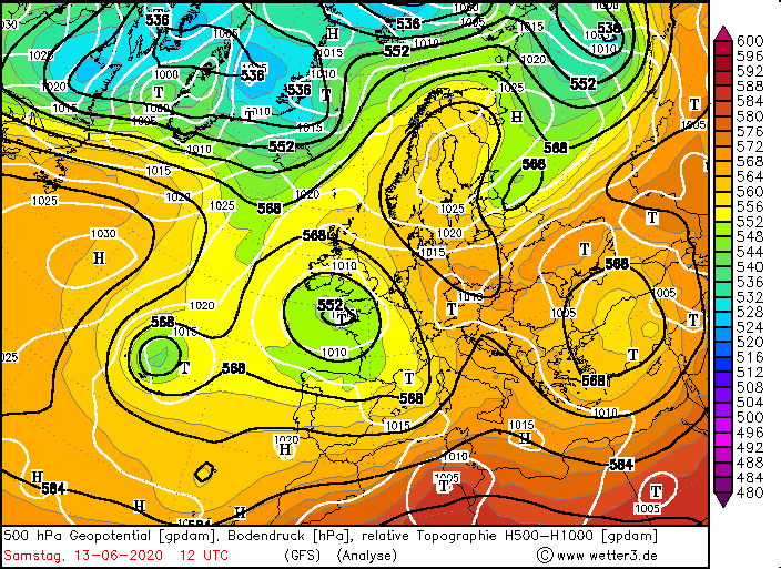
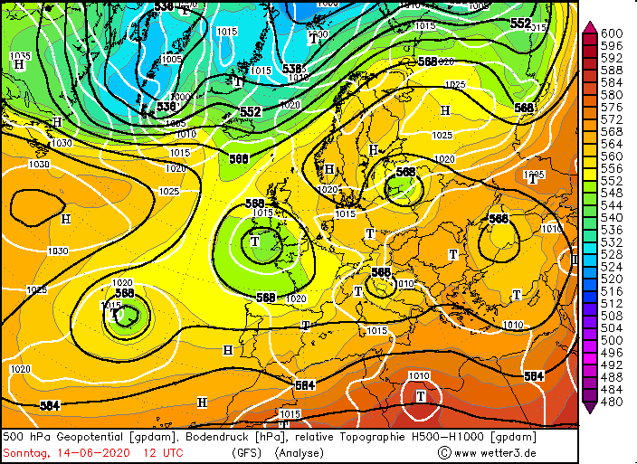
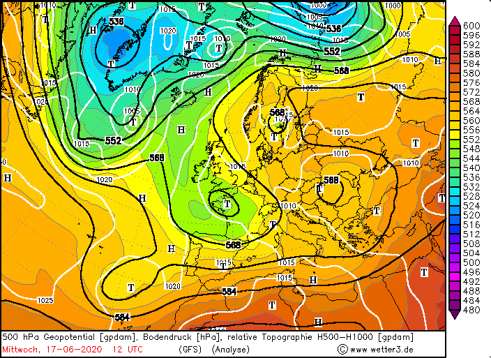
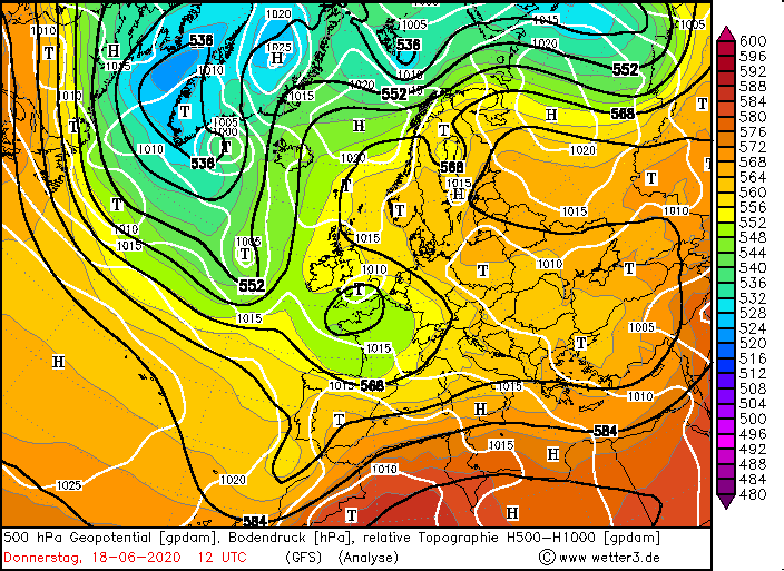
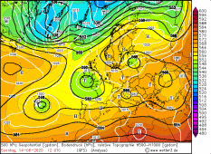
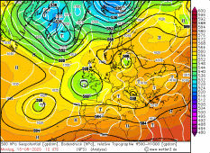
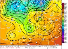
Such a high over low weather situation also occurred from 12 June onwards. Over southwest Europe/ Biskaya was the low pressure area NADINE, over Scandinavia the
high THOMAS. From the southwest, warm and humid air masses were advected, causing temperatures to rise to summery 25 degrees plus and a noticeable increase in
humidity.Sometimes the PPW rose to 40 mm, the CAPE values ranged between 500 and 800 J/Kg.
|
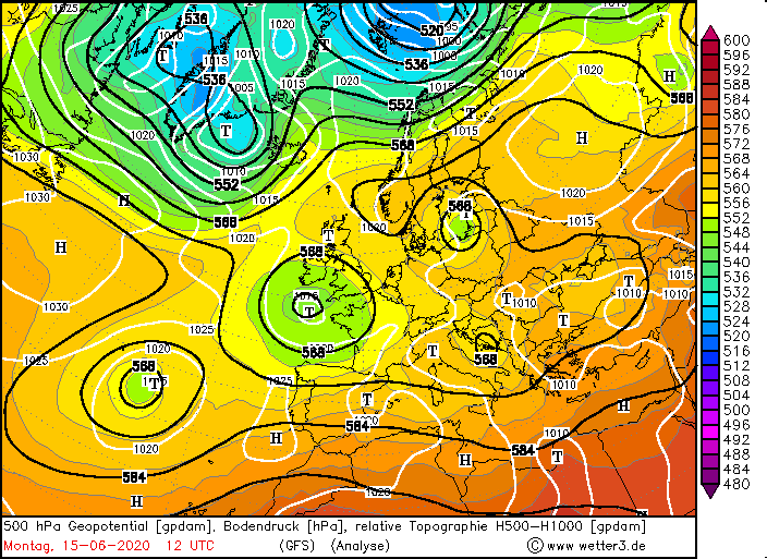
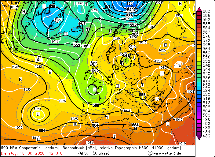
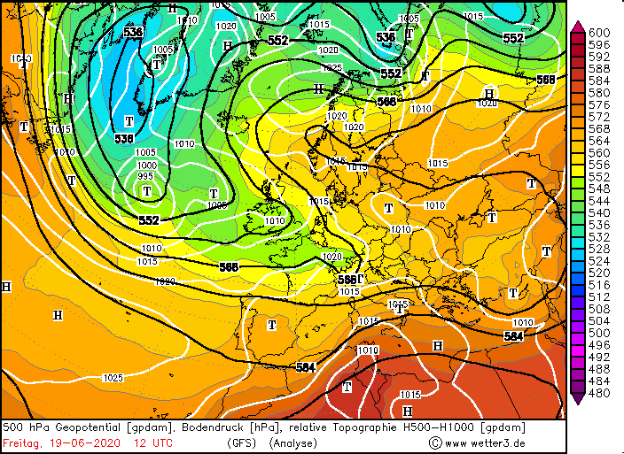
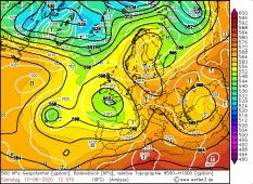
500 hPa geopotential, June 13-19, 2020
Wetter3
|
 |
 |
 |
 |
Severe weather Thunderstorms
From 13 June onwards, strong thunderstorms developed in this humid air over southwest Germany (especially Baden-Württemberg, Black Forest) as a result of a
convergence line/low pressure trough. In the early evening, a single cell developed relatively quickly northeast of Stuttgart, ejecting heavy rain and small-grained
hail. A little later a textbook cell splitting could be observed
(see radar images),so that a right and left mover developed.
Initially, the right cell remained the stronger cell and
pulsed. But also the left cell (which normally weakens rapidly and dies) remained and formed hail for a short time. Also in Switzerland the first thunderstorms
formed early on when the foehn collapsed. There a MCS formed, which moved from the southwest across the Alps and reached the southwest of Germany in the evening.
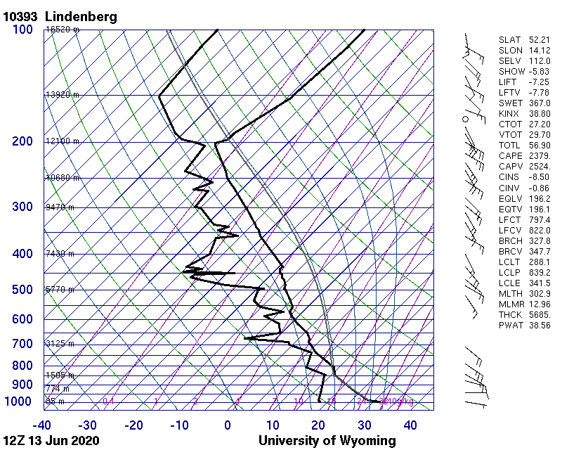
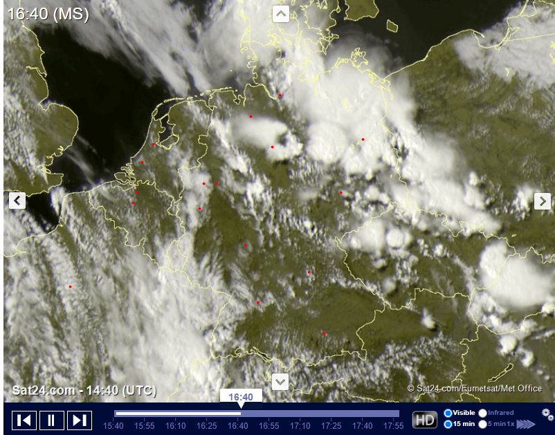
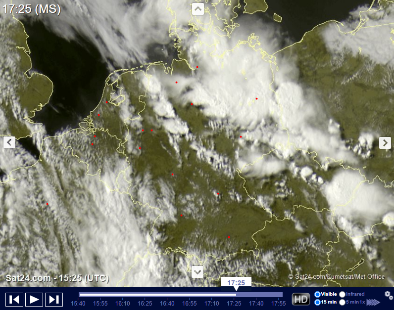
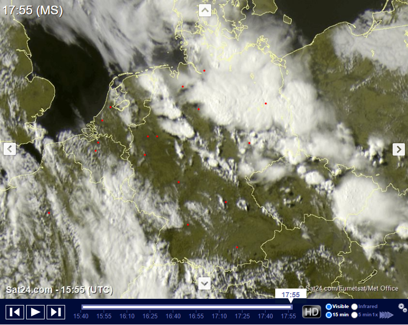
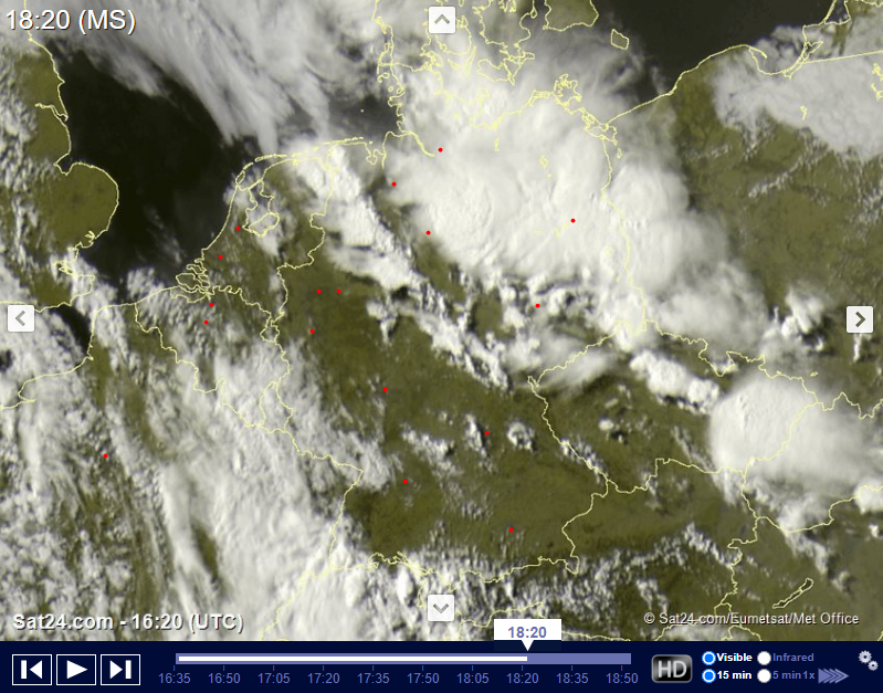
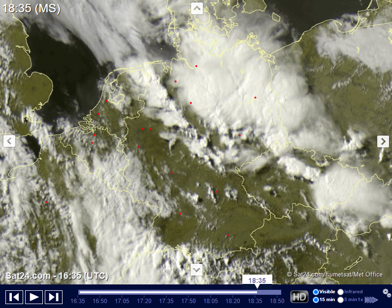
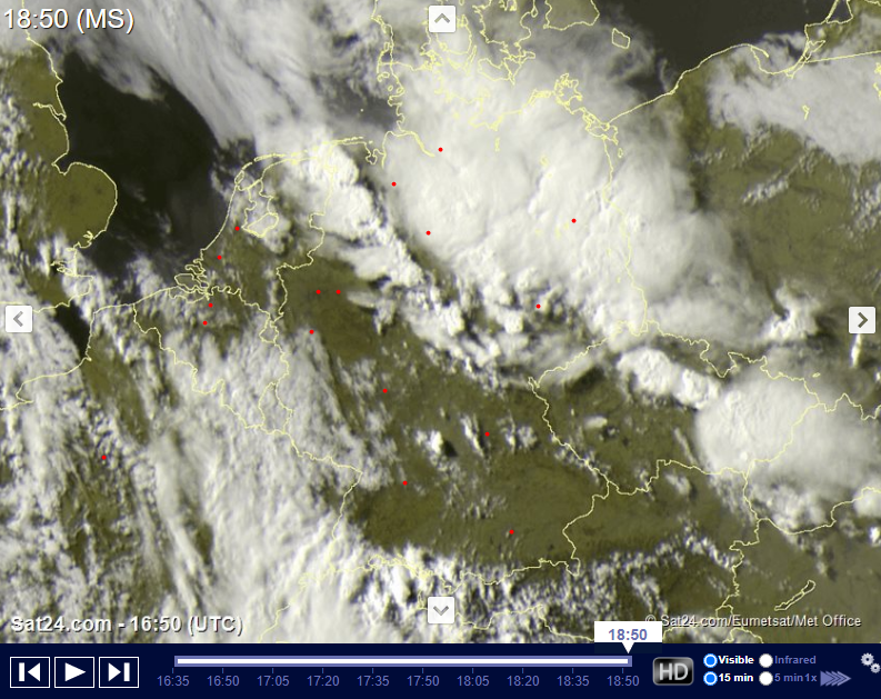
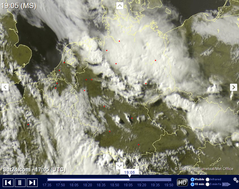
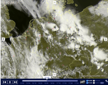
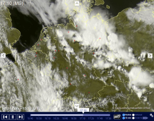
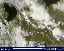
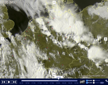
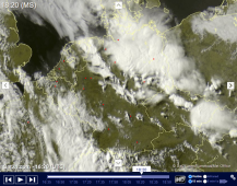
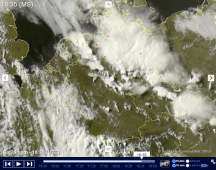
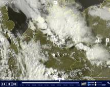
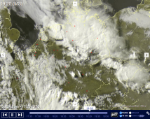
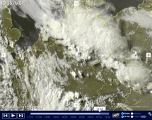
But the strongest thunderstorms formed in the northeast of Germany. Also here a MCS formed and CAPE values reached about 2500 J/Kg as seen in the soundings. At first,
single thunderstorm cells formed at noon, which then formed a complex in the course of the day (see satellite images). The MCS was active till the next morning.
This blocking weather situation lasted for almost a week. Again and again thunderstorms occurred in the warm and humid air and along the convergence line diagonally
over Germany. The storm potential was not necessarily hail and squalls, but much more the amount of rain. The PPW values continued to move around 30 mm, CAPE around
600 J/Kg. Since the thunderstorms could hardly move forward due to the weak pressure gradient, their water masses discharged to a locally very limited area.
Therefore, many places were flooded by the heavy precipitation.
On 17 June, the cold front of NADINE crossed the southwest of Germany and on 18 June the northern parts of the country. It was not until 19 June that the weather
situation calmed down and the thunderstorms subsided. In the following days, a strong ridge established itself with a corresponding ground level over Germany.
A heat wave is looming, which can bring local temperatures above 30 degrees.
|
Satellite images (visible), June 13:
Sat24
|
 |
 |
 |
 |
 |
 |
 |
 |
 |
 |
 |
 |
Daily Precipitaion Amounts
| Location |
24h precipitation in mm |
Date |
Ahaus
Göttingen
Borken in Westfalen
Gräfenberg-Kasberg
Ennigerloh-Ostenfelde
Herzberg
Brilon-Thülen
Fichtelberg/Oberfranken
Martinroda
Wsserkuppe
Alfeld
|
68.0
64.0
52.1
49.0
46.0
43.3
42.0
41.0
39.0
38.0
35.0
|
14.06.2020
14.06.2020
14.06.2020
14.06.2020
14.06.2020
14.06.2020
14.06.2020
14.06.2020
14.06.2020
14.06.2020
14.06.2020
|
|
| Location |
24h precipitation in mm |
Date |
Siegenburg
Aschau-Stein
Siegsdorf-Maria
Obere Firstalm/ Schliersee Ber
Marktschellenberg
Bad Endorf
Siegsdorf-Höll
Brannenburg-Degendorf
Rupholding-Seehaus
Bamberg
|
66.5
66.1
66.1
54.8
51.3
48.9
47.9
47.4
47.3
44.7
|
15.06.2020
15.06.2020
15.06.2020
15.06.2020
15.06.2020
15.06.2020
15.06.2020
15.06.2020
15.06.2020
15.06.2020
|
|
| Location |
24h precipitation in mm |
Date |
Seegebiet Mansfelder Land-Roe.
Brocken
Pirmasens
Emsbueren-Ahlde
Leutkirch-Herlazhofen
Neckargemünd
Waibstadt
Mannheim
|
45.7
44.4
37.2
36.9
47.3
40.3
36.3
35.7
|
16.06.2020
16.06.2020
16.06.2020
16.06.2020
17.06.2020
17.06.2020
17.06.2020
17.06.2020
|
|
| Location |
24h precipitation in mm |
Date |
Kaufbeuren-Oberbeuren
Langenlipsdorf
Sohland/Spree
Leutkirch-Herlazhofen
Bertsdorf-Hörnitz
Soltau
Faßberg
Carlsfeld
Langenwetzendorf-Göttendorf
Treuen
|
50.0
44.4
44.4
44.0
43.3
42.0
37.9
35.0
33.0
32.0
|
18.06.2020
18.06.2020
18.06.2020
18.06.2020
18.06.2020
18.06.2020
18.06.2020
18.06.2020
18.06.2020
18.06.2020
|
|
Data source: Ogimet.
Text: MG
June 23th, 2020
|