|
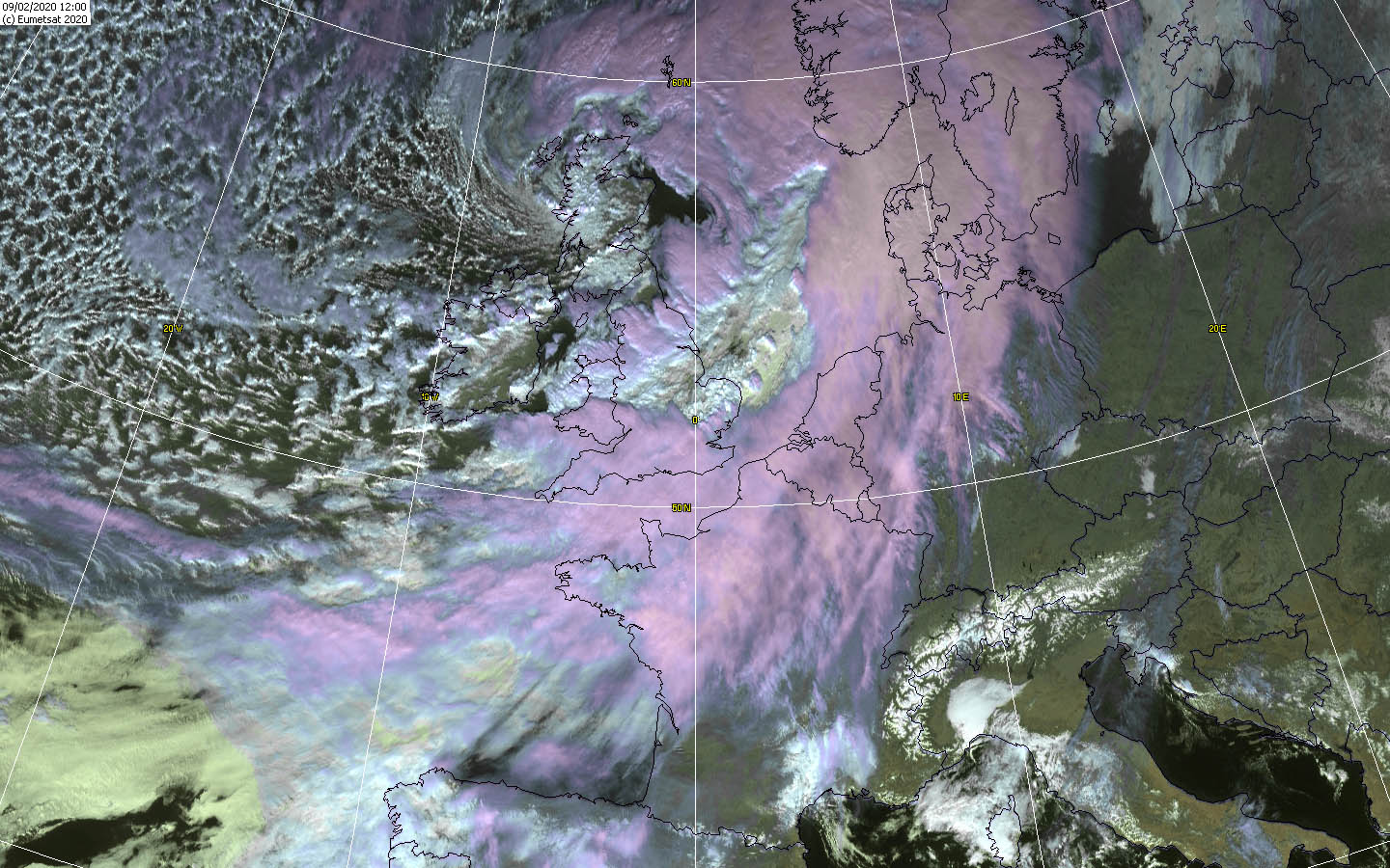
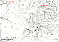
Windstorm SABINE passed over Central Europe and Great Britain on 9 and 10 February. The main storm hit Germany and Great Britain in particular.
In exposed locations, in Germany gusts of up to 177 km/h were registered in Great Britain 202 km/h, in the lowlands of Germany gusts of up to 120 km/h.
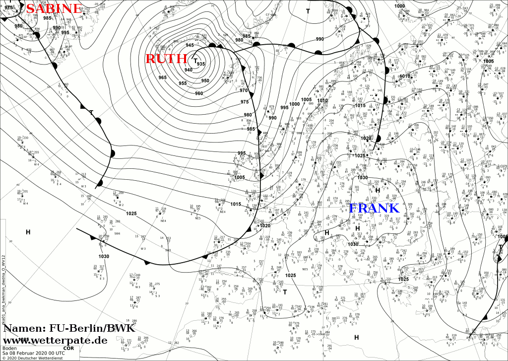
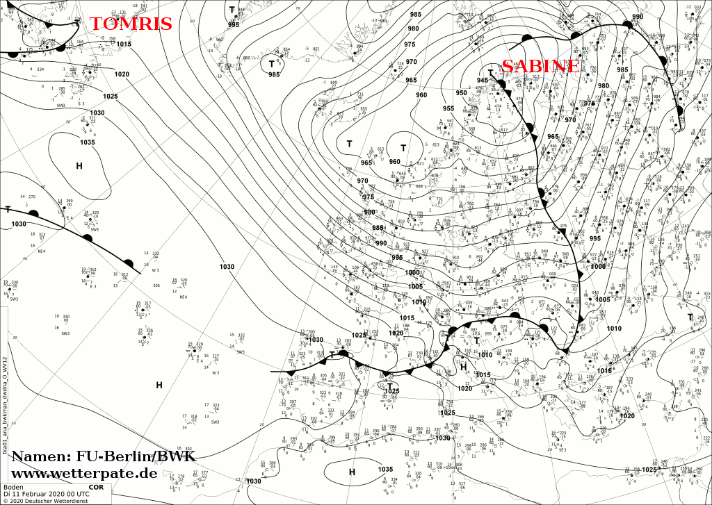
SABINE was a Norwegian storm low.
Before SABINE reached Europe, the previous days had been sunny and calm high-pressure weather. The calm before the storm.
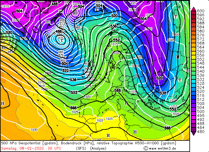
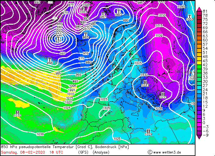
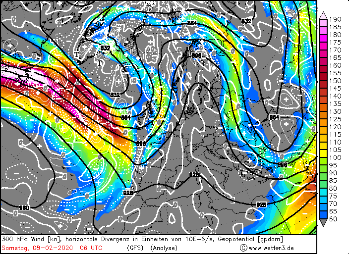
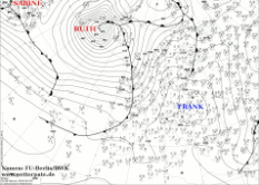
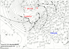
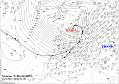
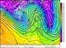
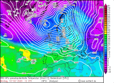
On February 8, SABINE was at the back of a trough above Newfoundland as a small marginal low. At that time, its core pressure was 975 hPa.
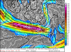
It was favourably located at the front of a jet stream with a strong jet stream. The jet stream extended almost zonally across the Atlantic to Europe
and provided top wind speeds of over 400 km/h. A British Airways commercial aircraft made the distance across the Atlantic in less than 5 hours of flight,
setting a new record.
|
Sea level pressure and fronts, February 08-11, 2020:
FU-Berlin
|
 |
 |
 |
 |
|
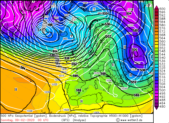
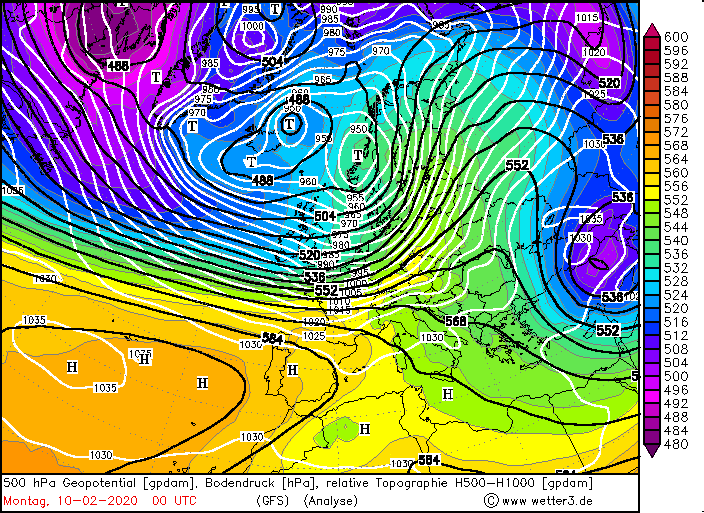
500 hPa Geopotential and Temperature, February 08-11, 2020:
Wetter3
|
 |
 |
 |
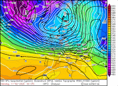 |
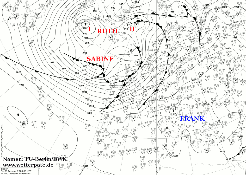
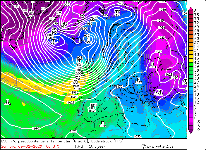
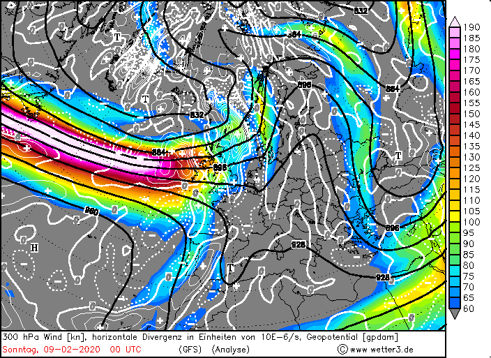
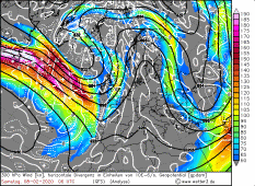
24 hours later, SABINE was on the Atlantic Ocean northwest of Ireland with a core pressure of 965 hPa. Due to its favourable position at
the front of the jet stream, it quickly propagated eastwards (fast runners) and intensified due to the positive divergence at the left jet exit.
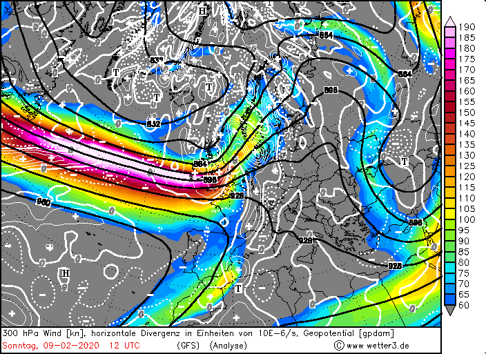
Its storm field first reached Ireland and Great Britain on 9 Feburary. Gusts up to 180 km/h were registered. The high wind speeds were mainly achieved by
the enormous pressure gradient / isobaric pressure (90 hPa per km). High air pressure over Italy and the Mediterranean Sea provided a large-scale area of
high horizontal pressure gradient. In addition to damaging winds, the UK suffered from severe precipitation that led to flooding. On 9 February, 130 mm came
together in 24 hours at Shap and 123 mm at Capel Curing. In several other regions and cities up to 100 mm came together.Due to the southwest wind and the
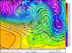
associated warm air advection, unusually mild temperatures above 15 degrees Celsius were
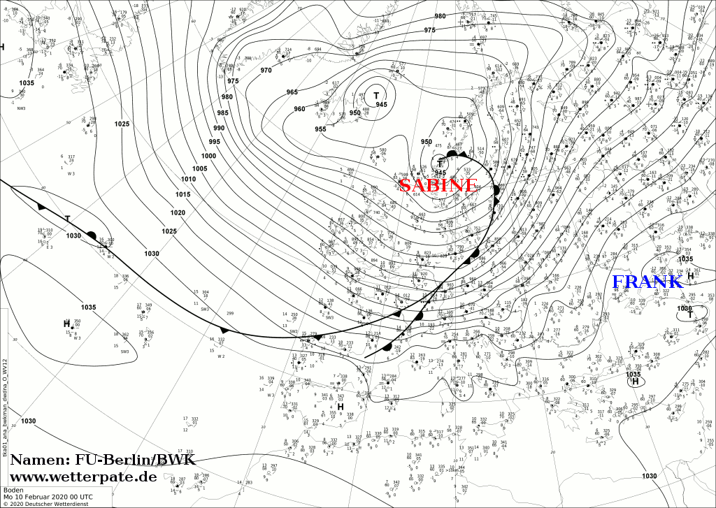
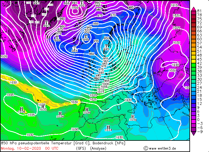
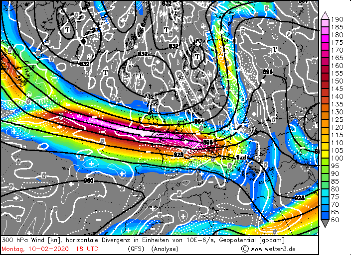
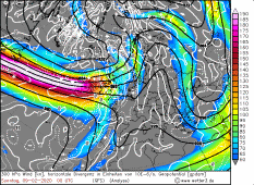
reached in Germany. In Germany, the wind increased noticeably at noon and in the afternoon. However, the main storm field reached
Germany in the night of 10 February. Its pressure dropped to 945 hPa and its centre moved across the European sea. Due to the cold front that crossed
the whole of Germany, the hurricane-like gusts lasted until the evening and were even intensified by the so-called guard rail effect on the Alps.
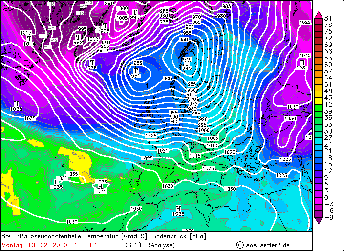
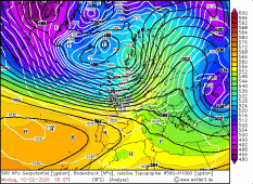
On Monday the jet stream was over Germany. On the cold front of SABINE, a wave developed, which intensified due to the jet stream and again brought stormy winds.
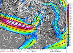
On Tuesday it remained stormy, primarily due to the strong isobaric pressure. The advection of cold maritime air at high altitudes caused the air to become
unstable and showers and thunderstorms occurred throughout the country, which pushed the high-altitude winds down to lower altitudes and also produced gusts
of around 100 km/h. The weather did not calm down again until Wednesday. However, a new storm low is already in the starting blocks.
|
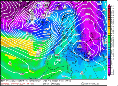
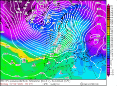
850 hPa equivalent pot. Temperature, February 08-10, 2020:
Wetter3
|
 |
 |
 |
 |
|
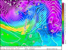
300 hPa wind and divergence, February 08-10, 2020:
Wetter3
|
 |
 |
 |
 |
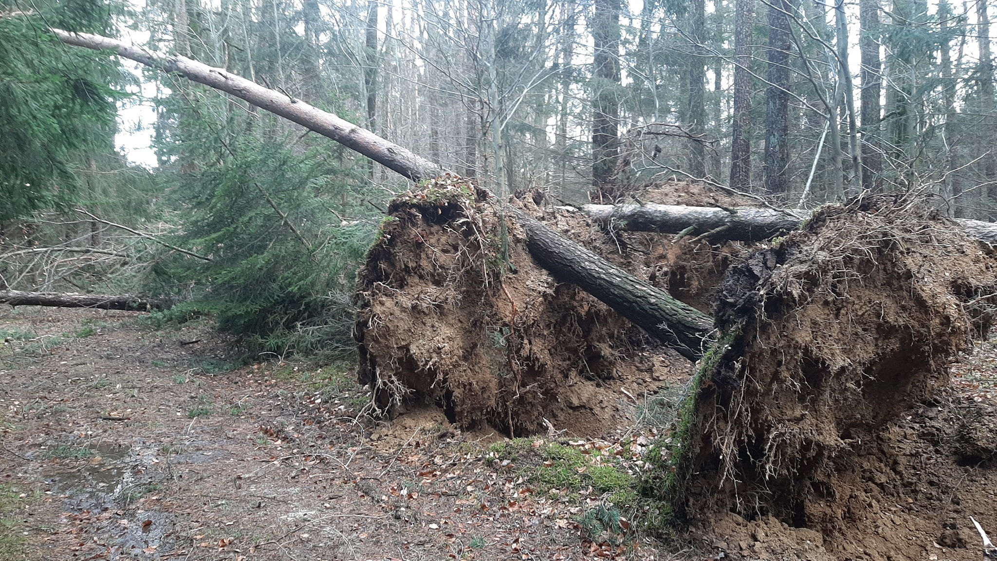
The high wind speeds damaged buildings, uprooted and overturned trees, broke off branches and also damaged buildings and vehicles. The wind also caused high waves
and thus storm surges. In combination with the high tides, flooding occurred. In some regions air traffic was interrupted. Delays and cancellations also occurred in local and long-distance traffic in other countries like
Great Britain and France. In the table below you can see wind gusts in Germany (left) and in Europe and Great Britain (right):
| Location |
Gusts in km/h |
Date |
Feldberg (Schwarzwald)
Brocken
Grosser Arber
Zugspitze
Fürstenzell
Fichtelberg
Weinbiet
Hohenpeissenberg
Wasserkuppe
Altenstadt
Kahler Asten
Mühldorf
Stötten
Werningrode
Leuchtturm Alte Weser
Leuchtturm Kiel
München Stadt
|
177
173
162
158
155
151
151
144
144
137
137
130
130
126
122
122
119
|
10.02.2020
10.02.2020
10.02.2020
10.02.2020
10.02.2020
10.02.2020
10.02.2020
10.02.2020
10.02.2020
10.02.2020
10.02.2020
10.02.2020
10.02.2020
10.02.2020
10.02.2020
10.02.2020
10.02.2020
|
|
| Location |
Gusts in km/h |
Date |
Cairngorn (GB)
Cairnwell (GB)
Aonach Mor (GB)
Glen Ogle (GB)
Bealach Na Ba No2 (GB)
Great Dun Fell (GB)
Aberdaron (GB)
Capel Curing (GB)
Lake Vyrnwy (GB)
Cap Corse (FR)
Cap Sagro (FR)
Ile Rousse (FR)
Barfleur Point (FR)
Mont Aigoual (FR)
Carteret (FR)
|
202
183
170
163
157
156
150
143
139
184
180
173
163
155
152
|
10.02.2020
10.02.2020
10.02.2020
10.02.2020
10.02.2020
10.02.2020
10.02.2020
10.02.2020
10.02.2020
10.02.2020
10.02.2020
10.02.2020
10.02.2020
10.02.2020
10.02.2020
|
|
Data source: Ogimet.
SABINE is often compared with storm KYRILL (2007). SABINE was a strong and dangerous storm, but not as extraordinary as
KYRILL or LOTHAR, which hit Europe. However, it is rare that the storm field of a storm low reaches all of Germany and brings
hurricane-like gusts down to the lowlands, which was the case with SABINE (KYRILL and LOTHAR is 150 km/h in the lowlands, 200 km/h in exposed locations).
In addition, many damages could be prevented, because warnings were given in time and schools and certain facilities were closed in most of the federal
states on Monday 10 February. The Deutsche Bahn advised already on Friday not to start travelling on Sunday and Monday. Air traffic as well as train
services were suspended throughout Germany and were only resumed in the evening or at noon on Tuesday. Nevertheless, people were
injured and a fireman was killed. Of course, damage was still caused by fallen trees and flooding due to the storm tides.
|
Storm damages, Güntersdorf/ Schweitenkirchen, Source:
Marius Block
|
 |
 |
SABINE was able to be predicted well by the simulation models despite its enormous displacement speed. Already on February 5, many models simulated the storm.
The predictions of the models hardly changed until the arrival of SABINE. The strength of the wind and the storm field were predicted very well and the models
were quite unanimous, which is unusual for such a storm as they still pose a challenge in terms of their accurate prediction.
Text: MG
February 12, 2020
|