|
Steered by the Iceland lows YADID and ZELIA, several fast-running low-pressure systems reached
Western and Central Europe, causing storm, mild temperatures and precipitation.
Already a few months ago, many weather models predicted an extremely mild winter for Central Europe.
Due to the negative radiation balance in mid-latitudes during winter, mild temperatures can only be
achieved by advection of air from warmth sources, which is usually the Atlantic Ocean for Central Europe.
This is often accomplished by extratropical low pressure systems moving eastwards in the south of the
polar front. This leads not only to advection of mild temperatures but also to energy transport in form
of latent heat.
|
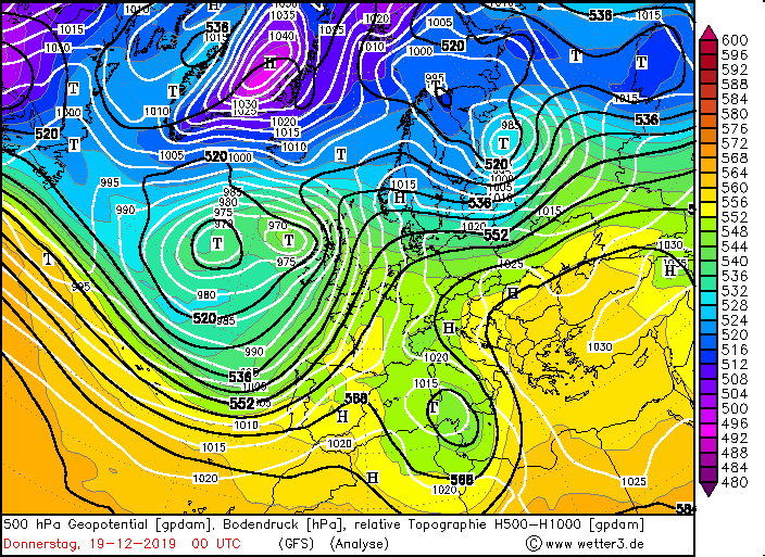
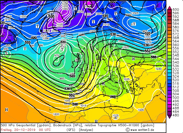
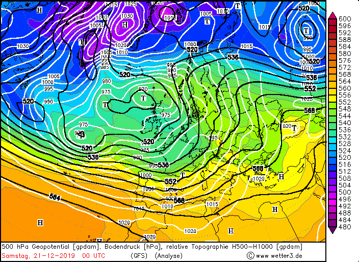
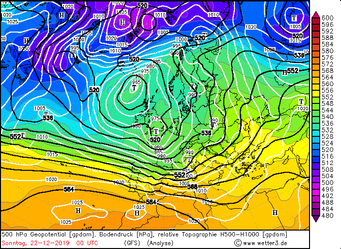
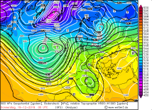
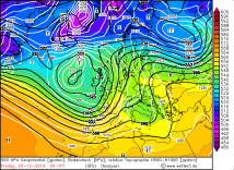
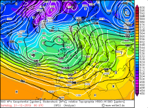
500 hPa Geopotential from Dec 19 until 22, 00 UTC,
Source: wetter3
|
 |
 |
 |
 |
|
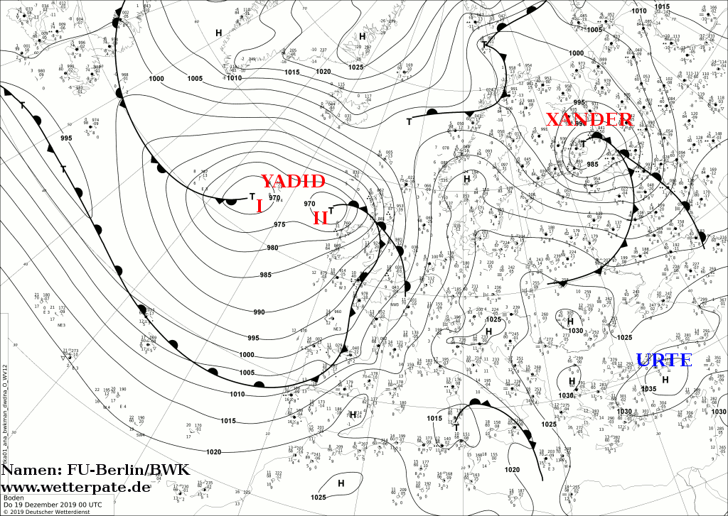
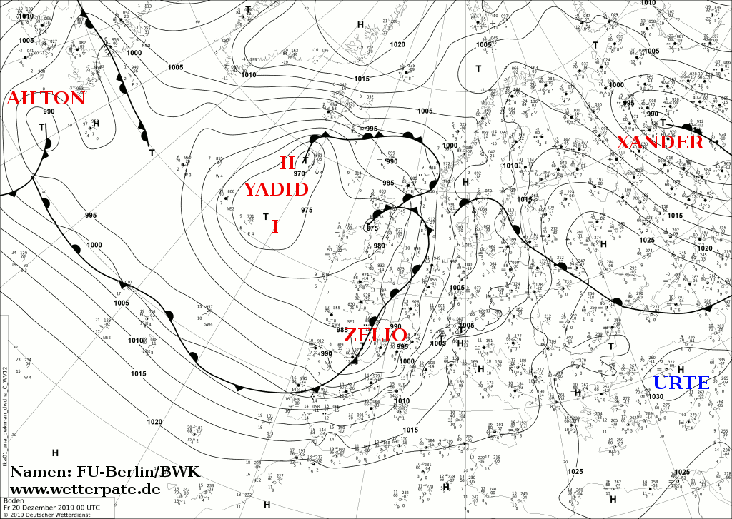
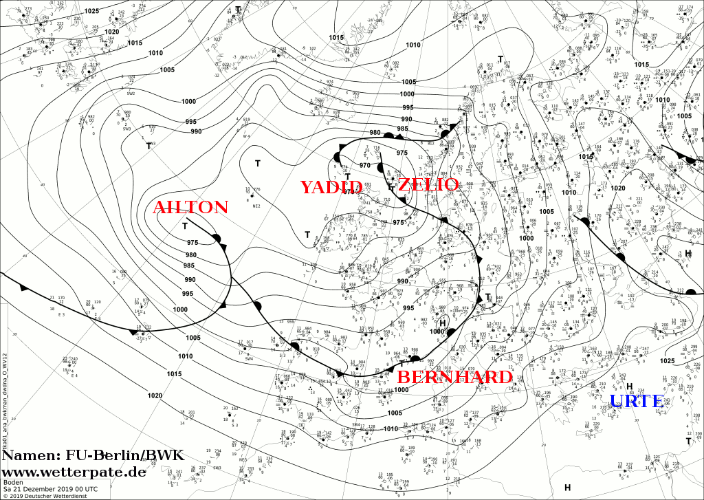
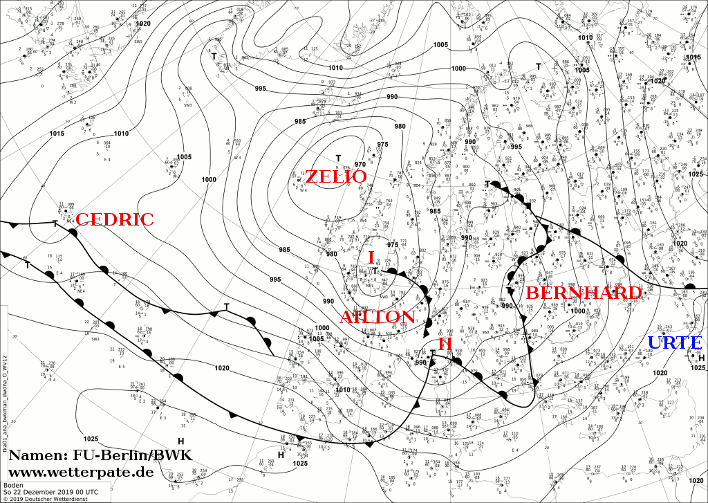
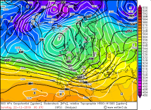
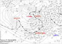
Sea level pressure from Dec 19 until 22, 00 UTC,
Source: FU Berlin
|
 |
 |
 |
 |
|
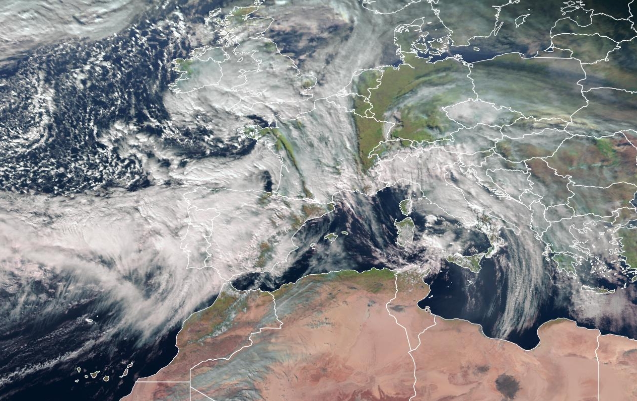
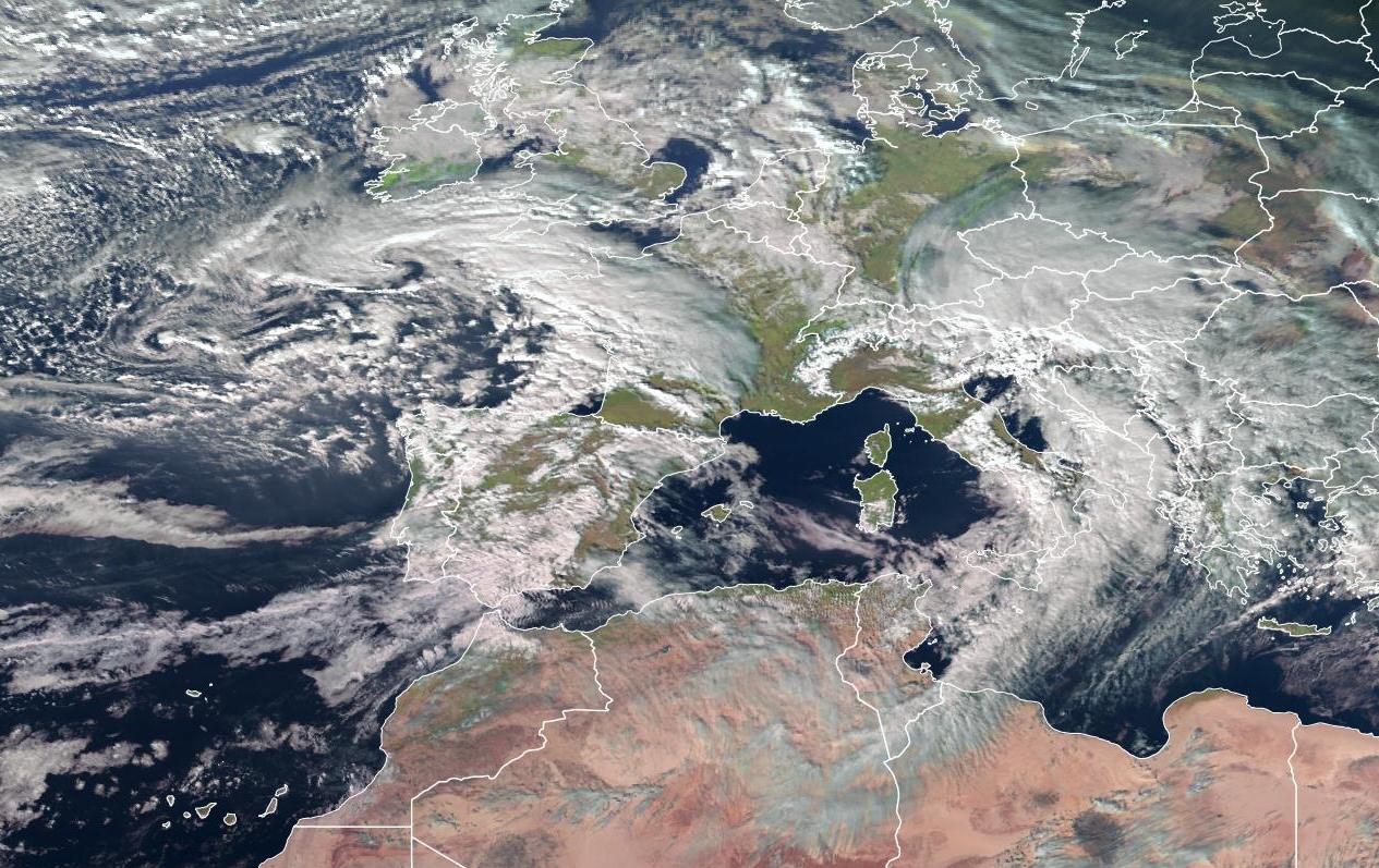
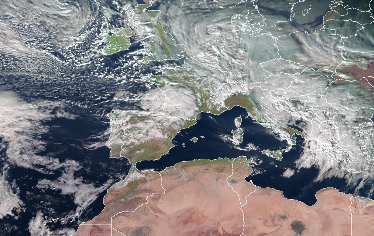
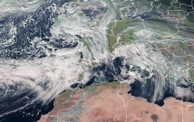
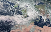
Satellite images (visible) from Dec 19 until 22, 12 UTC,
Source: EUMETVIEW
|
 |
 |
 |
 |
In the pre-Christmas period, a far southward reaching trough of cold polar air ensured that the polar
front and the polar jet above it extended far to the south over several degrees of longitude. Due to
the strong temperature gradient in the area of the air mass boundary between the polar air reaching far
south and the warm maritime subtropical air, strong baroclinicity is generated below the jet stream.
Particularly in the southern entrance area of the jet streak, a local maximum of the jet stream band,
upper level divergence leads to explosive pressure drops at sea level and thus prvoides rapid cyclogenesis.
|
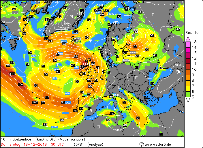
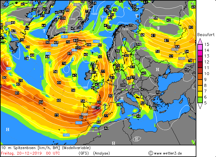
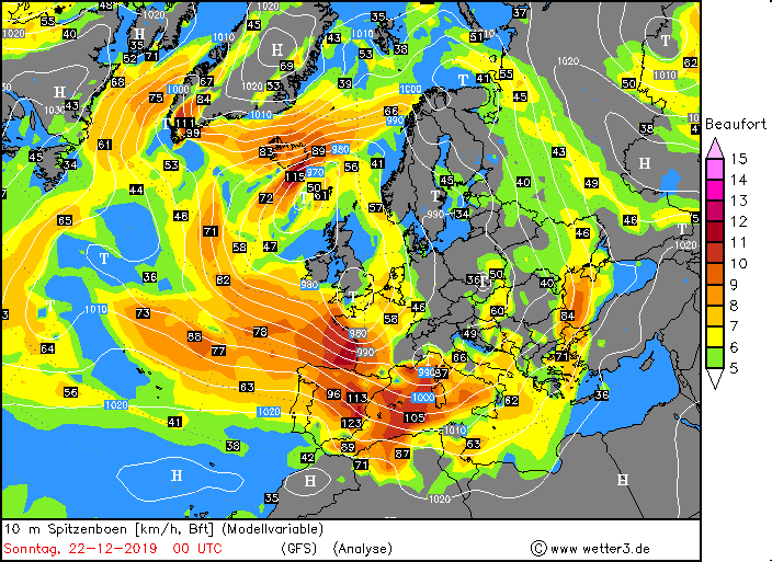
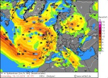
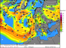
Wind gusts from 19 Dec until 22, 00 UTC,
Source: wetter3
|
 |
 |
 |
 |
This configuration ensured that within a short period of time several rapidly moving low-pressure systems
could travel across Western and Central Europe. Low pressure system YADID caused hurricane gusts in the
British Isles as early as 18 December and then moved over Iceland to take on the role of the steering central
depression. On 19 and 20 December, low-pressure system ZELIO moved along the Atlantic coast of northern
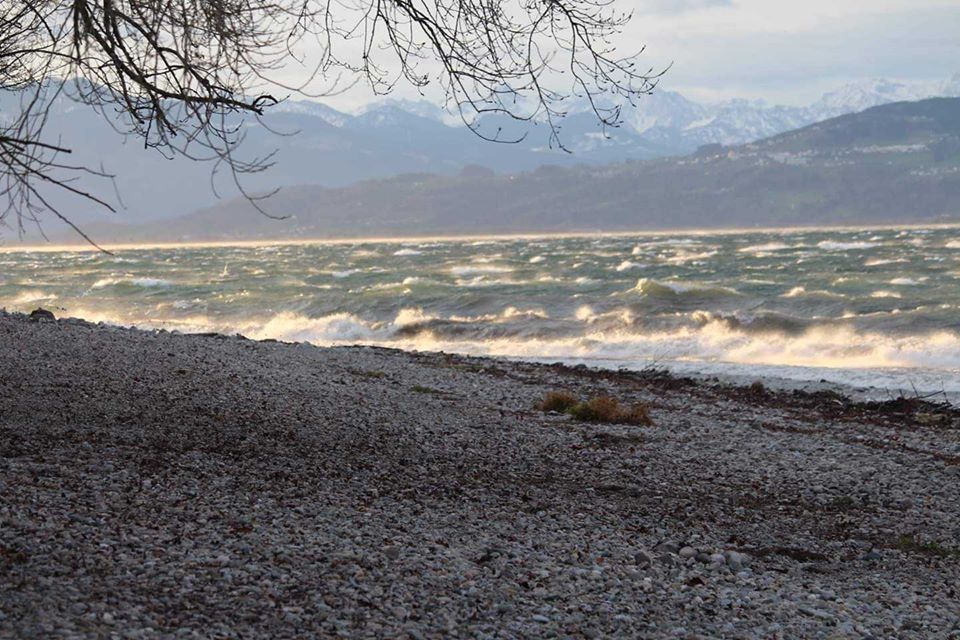
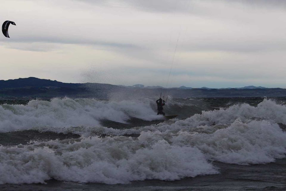
Spain and France. In addition to hurricane-like gusts on the Iberian Peninsula and in the coastal region
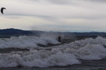
of France, there were also strong foehn winds over the Alps. This caused temperatures above 15°C and stormy
winds on the northern side of the Alps to the delight of many wind and kite surfers.
|
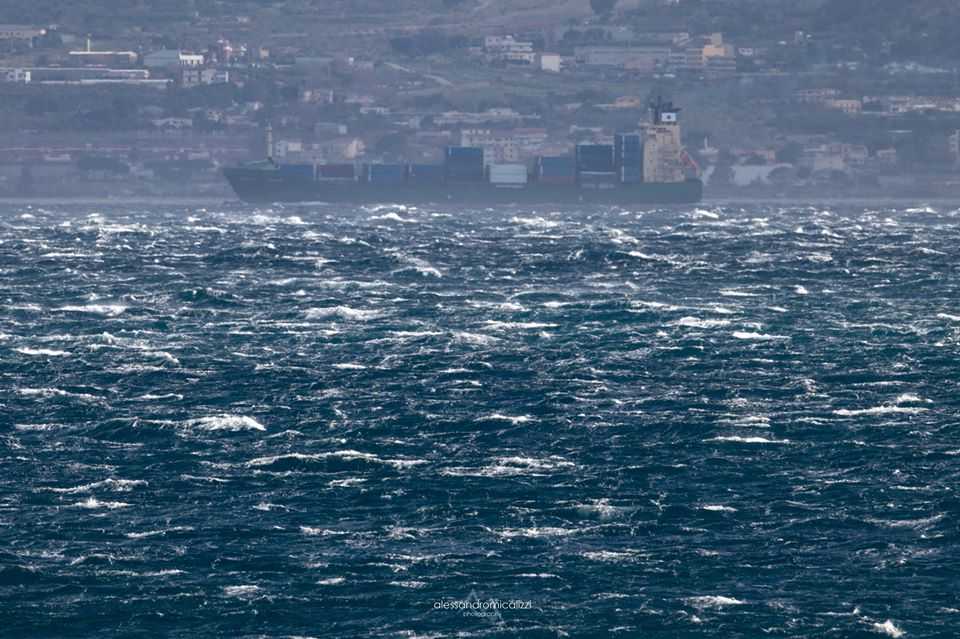
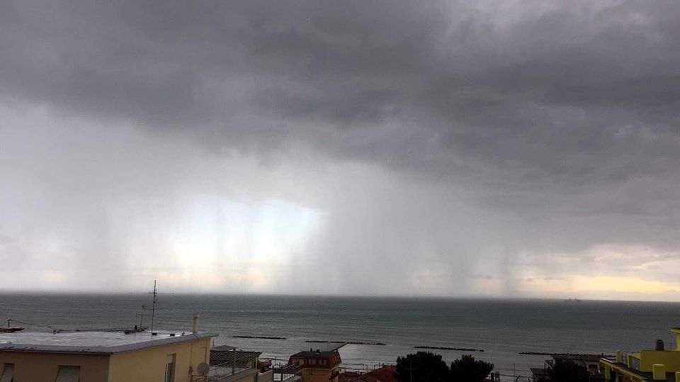
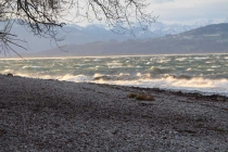
Foehn winds at Lake Constance 19 Dec, Strong winds in the Strait of Messina 22 Dec, Severe storms with heavy rainfall 22 Dec,
Source: Severe Weather Europe (Johannes Gerlinger, Alessandro Micalizzi, Christian Boni).
|
 |
 |
 |
 |
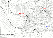
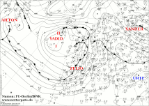
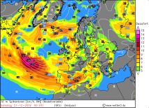
Low pressure area ZELIO then moved north and took over the role of the steering Icelandic depression. South
of it, low pressure system AILTON rushed towards the northern French Atlantic coast. In the evening of 21 December,
the depression split up. While AILTON I moved across the English Channel, AILTON II moved over the northwestern
Mediterranean. During this time, stormy winds with hurricane gusts occurred over the Madeira Islands and also on
Corsica and Sardinia.
|
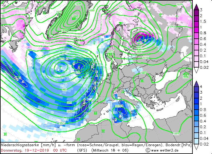
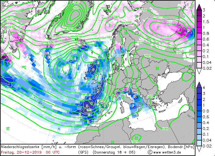
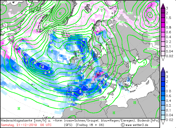
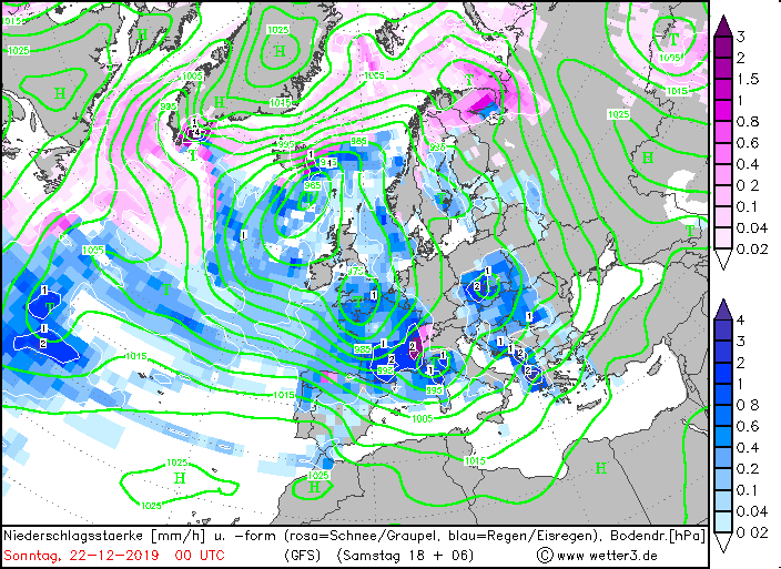
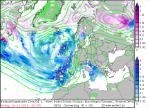
Precipitation intensity, Dec 19 until Dec 22,
Source: wetter3
|
 |
 |
 |
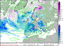 |
Due to strong positive temperature advection and vorticity advection increasing with height, strong convection and
thunderstorms occurred at the front of the low pressure area. Due to the high wind speeds, orographic precipitation
was observed especially on the upwind sides of the mountainous Mediterranean islands, Corsica and Sardinia.
| Location |
Wind gust in kph |
Date |
Pampilhosa da Serra, Fajao (PT)
Enciso (ES)
Velilla del Rio Carrion (ES)
Mogadouro (PT)
Sao Pedro de Moel (PT)
Soba, Alto Miera (ES)
Cerler-Cogulla (ES)
La Pinilla, estacion de esqui (ES)
Valdezcaray, estacion de esqui (ES)
Velilla del Rio Carrion, Camporredondo de Alba (ES)
Enciso (ES)
Brocken (DE)
Zugspitze (DE)
Madeira, Lombo da Terca (PT)
Valdezcaray, estacion de esqui (ES)
Estaca de Bares (ES)
Sierra de Alfabia, Bunyola (ES)
La Pinilla, estacion de esqui (ES)
Machichaco (ES)
Andorra (ES)
Panticosa-Petrosos (ES)
Cabo Vilan (ES)
Machichaco (ES)
Estaca de Bares (ES)
Valdezcaray, estacion de esqui (ES)
La Pinilla, estacion de esqui (ES)
Sierra de Alfabia, Bunyola (ES)
Feldberg (DE)
|
150.1
138.0
132.0
132.0
116.6
111.2
168.0
155.0
153.0
149.0
130.0
115.0
115.0
88.6
180.0
177.0
160.0
147.0
133.0
131.0
131.0
130.0
174.0
150.0
149.0
143.0
141.0
113.0
|
19.12.2019
19.12.2019
19.12.2019
19.12.2019
19.12.2019
19.12.2019
20.12.2019
20.12.2019
20.12.2019
20.12.2019
20.12.2019
20.12.2019
20.12.2019
20.12.2019
21.12.2019
21.12.2019
21.12.2019
21.12.2019
21.12.2019
21.12.2019
21.12.2019
21.12.2019
22.12.2019
22.12.2019
22.12.2019
22.12.2019
22.12.2019
22.12.2019
|
|
Data source:
Source: Ogimet,
IPMA,
DWD and
AEMET
Text: FS
December 25, 2019
|