|
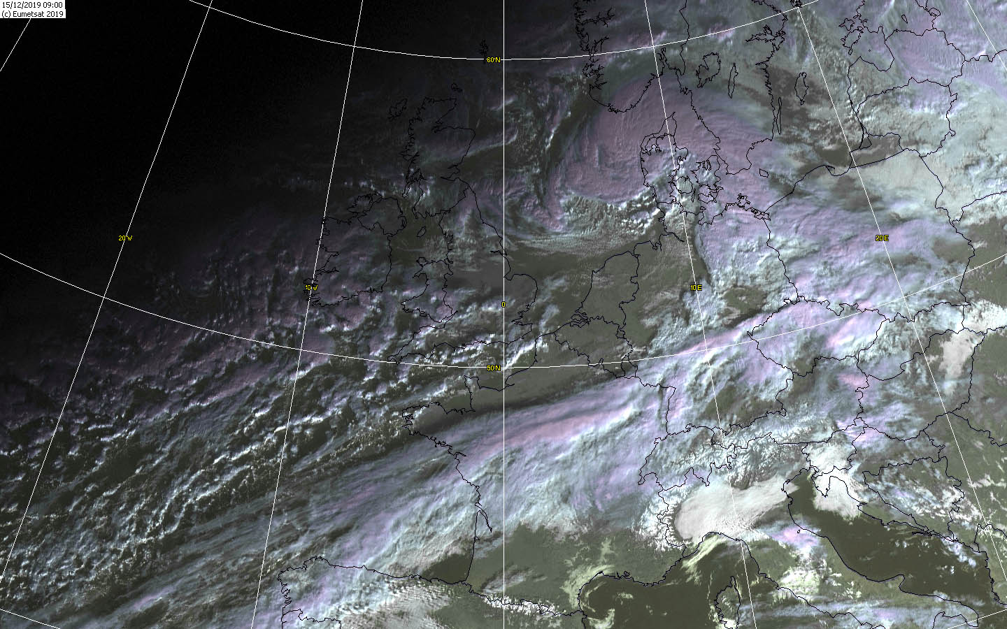
Europe was hit by several winter storms in mid-December. Gusts of more than 120 kph were measured. Storm surges, accumulated precipitation and persistent meltdowns
caused flooding in some places. In Portugal, 115.8 mm were accumulated in 24 hours and on 16 December and in France a gust of 173 kph was registered on December 13.
Weather situation and development
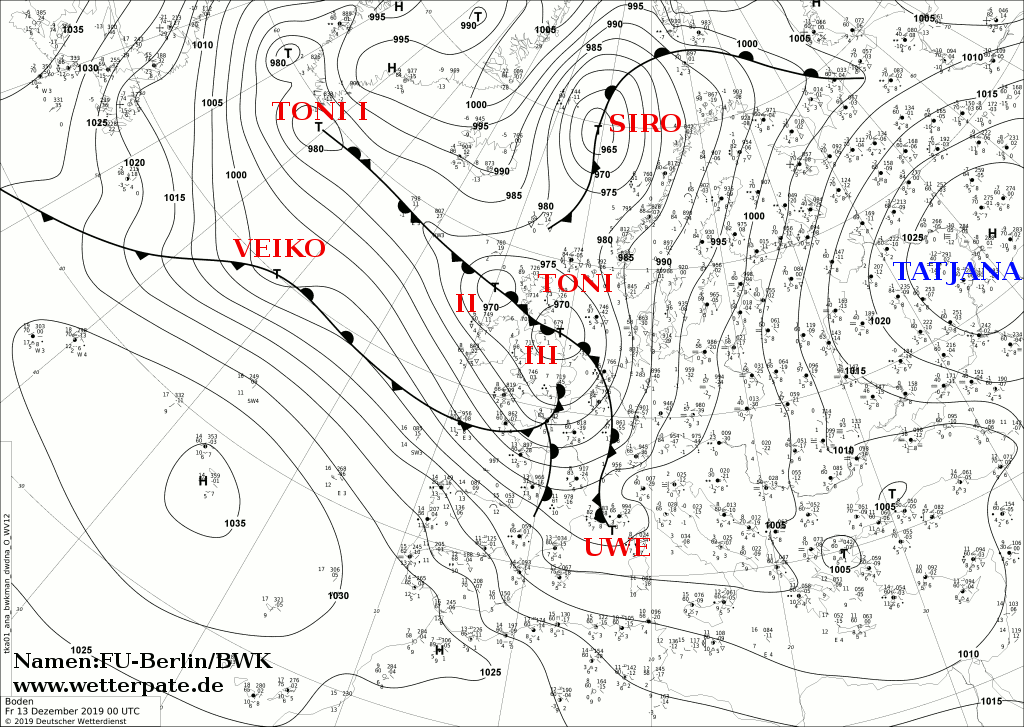
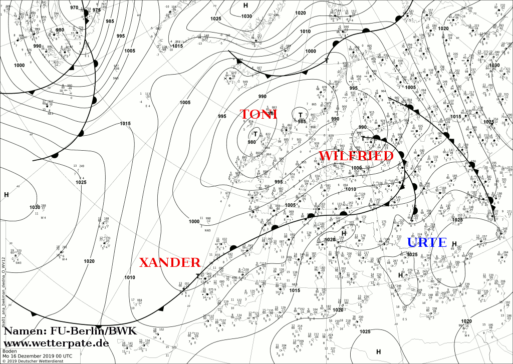
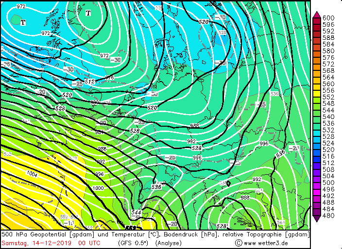
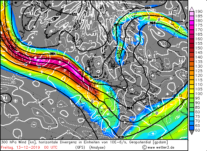
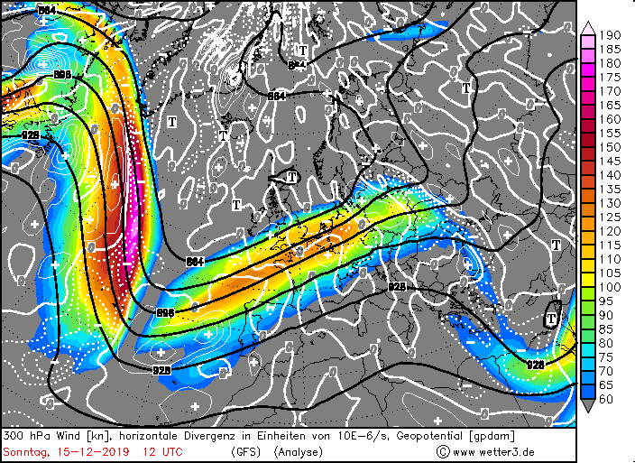
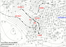
The storm series began with winterstorm TONI and its boundary lows TONI II and TONI III. TONI was formed near Newfoundland on the North Atlantic and also remained
there. Along its front system at the back of a trough, TONI II and TONI III developed on 12 December. Favoured by the location at the front of a large and powerful
jet stream, they quickly moved southeast and intensified rapidly. On the night of 13 December they reached Great Britain and Ireland. In addition, the Genoa Cyclone
UWE developed on TONI III front system. UWE moved via France towards the Mediterranean and then towards Italy and finally via the Balkans. In addition to gusts of up
to 128 kph, there were storm surges and floods caused by stagnant precipitation and thunderstorms. In Monte Scuro 49.0 mm fell in 24 hours. Also in the Balkan
countries gusts over 100 kph were measured and precipitation over 40 mm (see table below). TONI II and III took over the role of the controlling central low from
this time on.
|
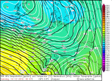
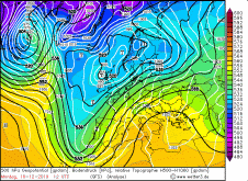
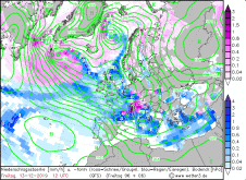
Sea level pressure and fronts, December 13-16, 2019:
FU-Berlin
|
 |
 |
 |
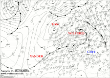 |
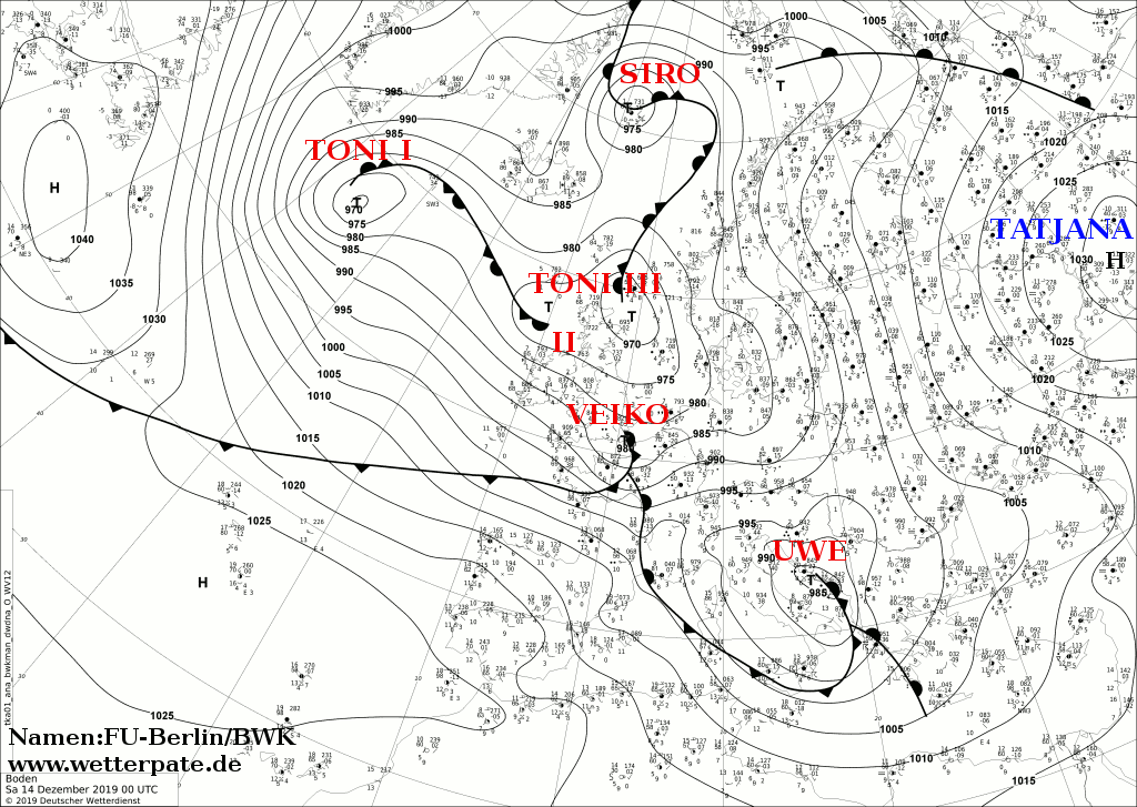
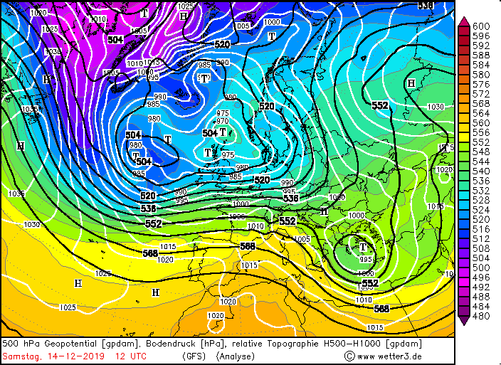
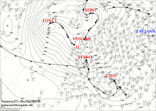
Directly after low TONI winterstorm VEIKO followed. VEIKO was a so-called fast runner. He was formed on the morning of December 13th on the western Atlantic and
already in the evening it reached the Bay of Biscay. Since it was stocked in a jet stream, its development was also favoured. Especially France, the Benelux
countries and Germany were affected by its storm field. The strongest gusts were registered in the southwest of France, as well as in the south of Germany in the
night to 14 December. VEIKO's centre crossed the English Channel and the North Sea, later the Baltic Sea. Its core pressure dropped to a minimum value of 980 hPa
and began to rise again on 14 December.
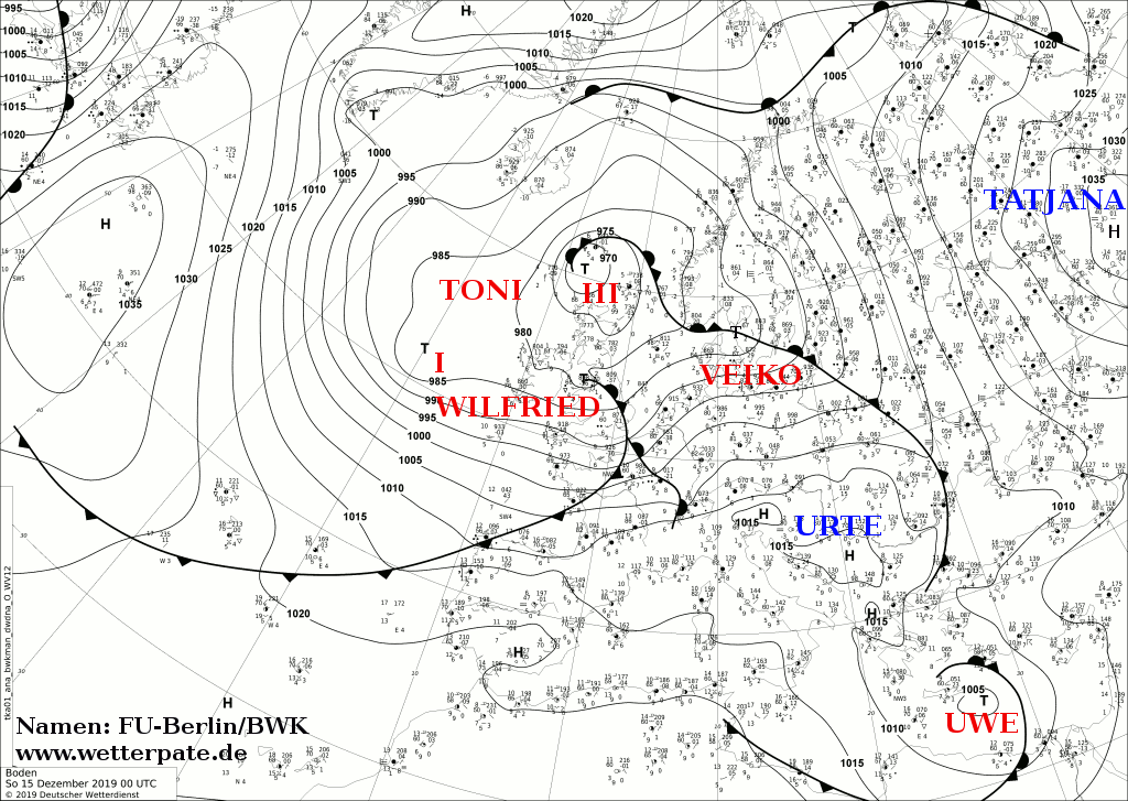
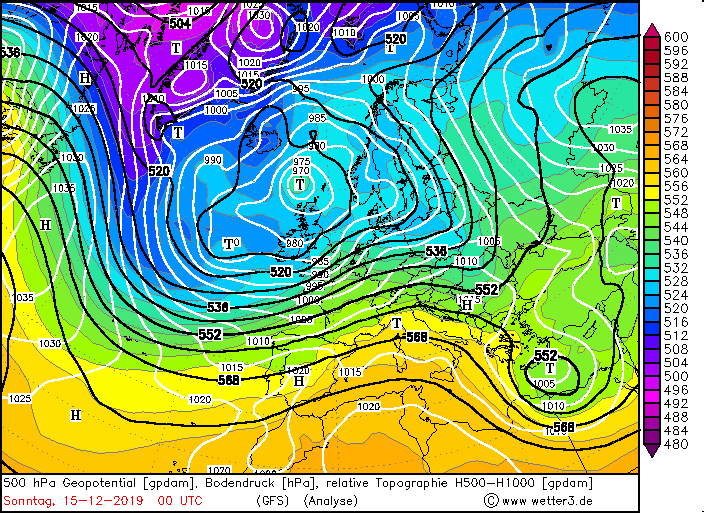
Meanwhile, another winter storm developed over the Atlantic. WILFRIED, the last low in the storm series, reached the Bay of Biscay at noon on 14 December.
Its track was similar to that of VEIKO. Also its storm field influenced France, Benelux and Germany and also at night and in the early morning hours.
For Central Europe the weather calmed down now.
However, the cutt off low XANDER developed on WILFRIED's cold front and caused severe weather in Portugal and Spain on 16 December. This resulted in storm surges,
thunderstorms followed by floods. XANDER is almost stanionary as its way east is blocked by high URTE. This increases the effects of severe precipitation.
|
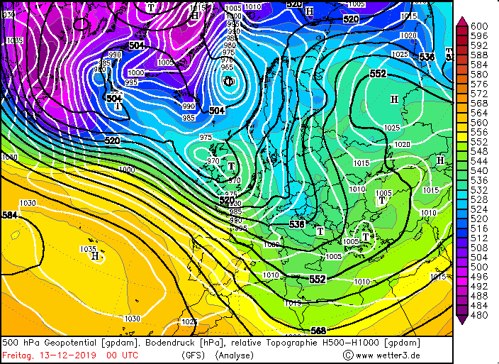
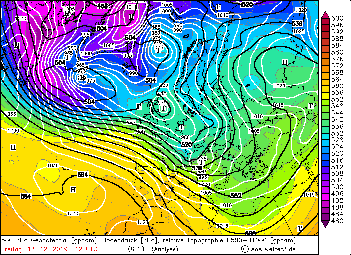
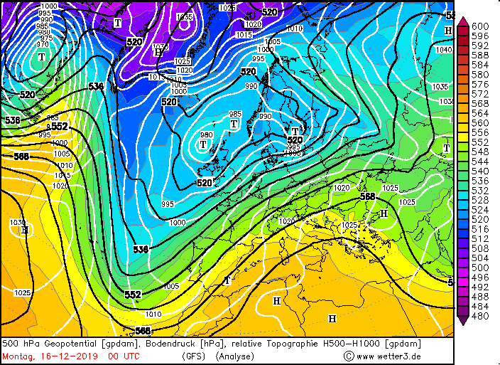
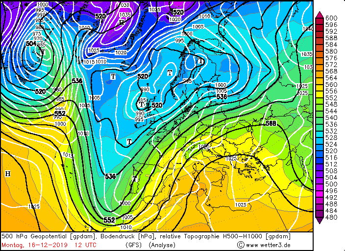
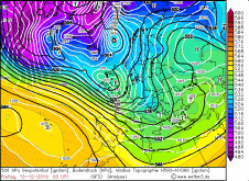
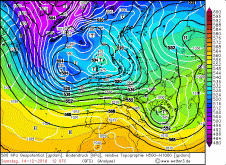
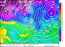
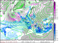
500 hPa Geopotential, December 13-16, Source:
Wetter3
|
 |
 |
 |
 |
|
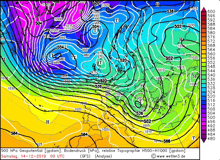
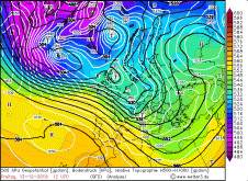
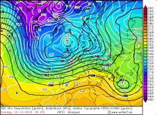
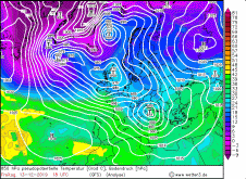
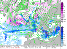
500 hPa Geopotential, December 13-16, Source:
Wetter3
|
 |
 |
 |
 |
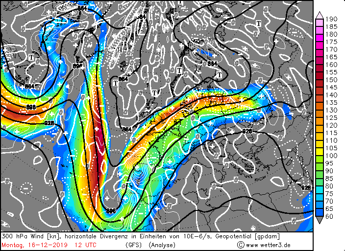
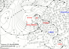
Between the trough over the Atlantic and the ridge over eastern and southeastern Europe, the air pressure gradient rose and also caused stormy weather in France on
17 December. A foehn storm was triggered in the Alps. The Alps are almost cloudless and on their northern side leewaves can be seen through linear clouds parallel
to the Alps. In addition, there was a strong warm air advection, which caused unusually mild temperatures of over 15 degrees in Germany, for example. The foehn
storm caused even higher temperatures of around 20 degrees in southern Germany. As a result, it was warmer there than in some places on the Mediterranean.
Also worth mentioning is winterstorm SIRO, which hit Iceland on 11 December and caused wind speeds of 256 kph. This corresponds to an upper category 4 hurricane.
|
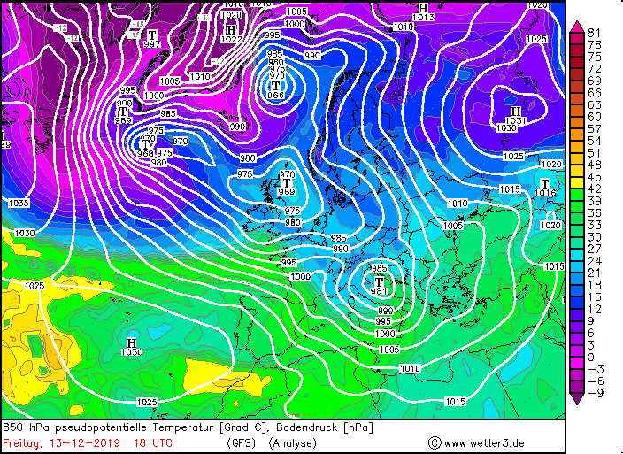
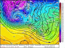
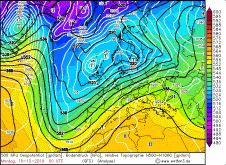
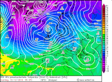
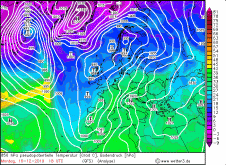
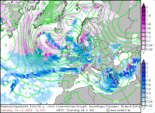
850 hPa pseudopot. Temperature, December 13-16, Source:
Wetter3
|
 |
 |
 |
 |
|
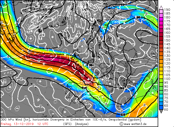
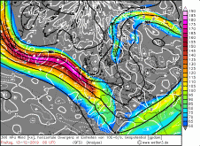
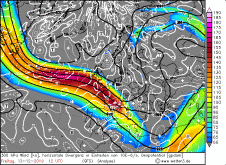
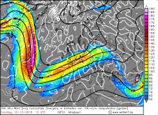
300 hPa wind and divergence, December 13-16, Source:
Wetter3
|
 |
 |
 |
 |
Observations and Damages
Due to the strong winds, trees were disrooted and branches were broken off in the affected countries. These damaged roads, cars and houses in many regions. Because
of flying parts, houses and cars were also damaged. Delays and cancellations occurred in public transport and traffic disruptions on the roads. Several people were
slightly to severely injured when trees crashed into their cars.
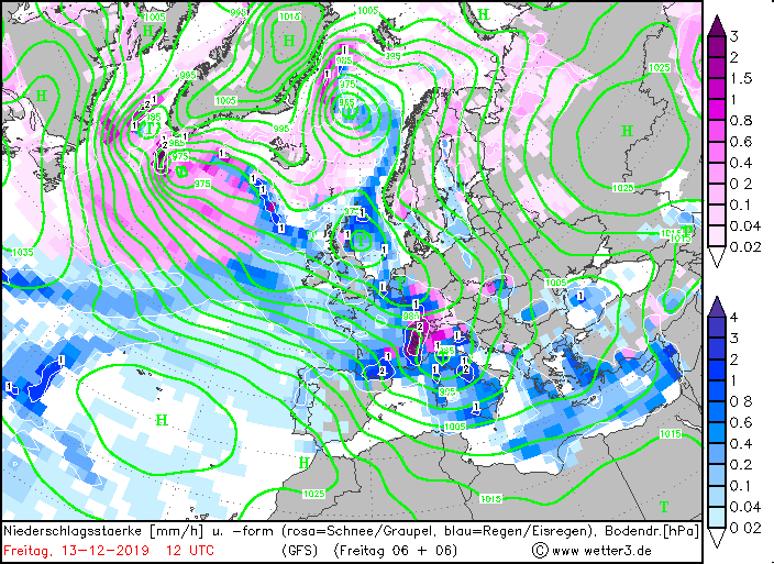
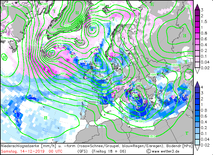
The strong winds caused storm surges on the coasts of France, Italy and Germany which caused flooding. On the eastern side of the Pyrenees and on the western
side of the Black Forest, there were stagnant precipitation, which also caused local flooding. These were exacerbated by persistent thawing caused by unusually
high temperatures in the double-digit range. This also increases the risk of avalanches.
In the south of France, precipitation and storm surges caused power outages. On 13 December, 220,000 households on the coast were without electricity.
The floods also claimed at least 4 lives. Some thunderstorms even had hail in tow. In Germany, for example, hailstones caused damage in Italy.
|
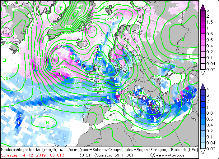
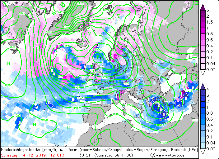
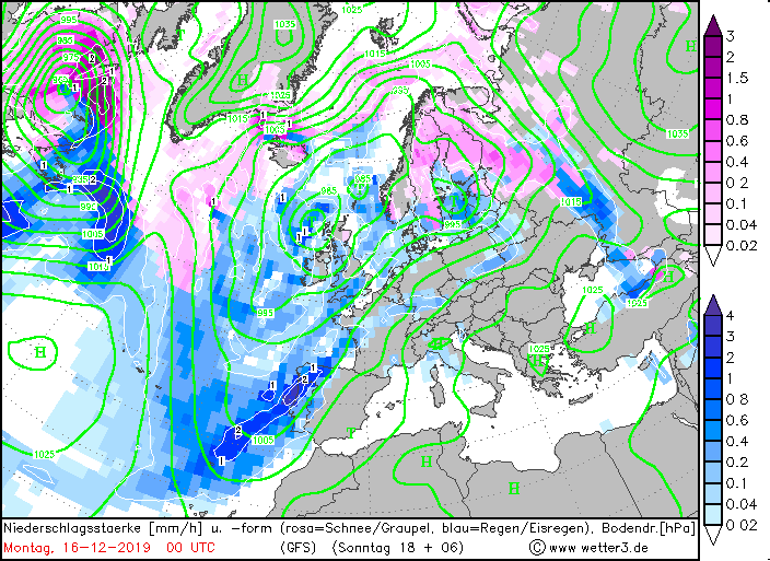
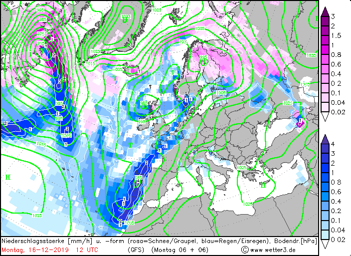
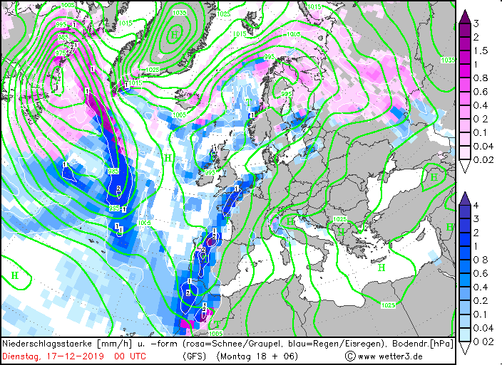
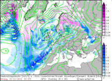
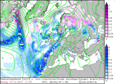
Precipitation, December 13-16, Source:
Wetter3
|
 |
 |
 |
 |
|
Precipitation, December 13-16, Source:
Wetter3
|
 |
 |
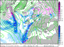 |
In the table below you can see 24 hours precipitation in Europe (left) and Gusts (right):
| Location |
Precipitation amount in mm |
Date |
Sarges (PT)
Pajares-Valgraude (ES)
Portalegre (PT)
Puerto De San Isidro (ES)
Penhas Douradas (PT)
Tarbes Ossun Lourdes (FR)
Castelo Branco (PT)
Viseu (PT)
Makarska (CR)
Dau (FR)
Asturias/ Aviles (ES)
Villardeciervos (ES)
Aktion Airport (GR)
|
115.8
114.0
112.6
103.0
95.6
89.0
84.1
82.6
69.0
66.0
64.0
61.6
60.0
|
16.12.2019
16.12.2019
16.12.2019
16.12.2019
16.12.2019
13.12.2019
16.12.2019
16.12.2019
14.12.2019
13.12.2019
16.12.2019
16.12.2019
14.12.2019
|
|
| Location |
Gusts in kph |
Date |
Cap Corse (FR)
Cap Sagro (FR)
La Parata (FR)
Ile Rousse (FR)
Mont Aigoual (FR)
Millau (FR)
Pertusato (FR)
Barfleur Point (FR)
Feldberg (DE)
Brocken (DE)
Leuchtturm Kiel (DE)
Bastia (FR)
Cap Bear (FR)
|
173
161
161
155
148
144
140
135
133
133
133
130
130
|
13.12.2019
13.12.2019
13.12.2019
13.12.2019
13.12.2019
13.12.2019
13.12.2019
13.12.2019
14.12.2019
14.12.2019
15.12.2019
13.12.2019
13.12.2019
|
|
Data source: Ogimet.
Text: MG
December 18, 2019
|