|
In mid and late October a cut off low over Spain and later the Mediterranean caused heavy rain and thunderstorms. Spain and France were particularly affected by
the torrential rainfall. There more than 70mm came together in 3 hours (Beziers-Vias 214,4mm/24h, San Vicente 117,4mm/24h). In addition it came to hurricane-like gusts
in the south of France (Toulon 131 kph).
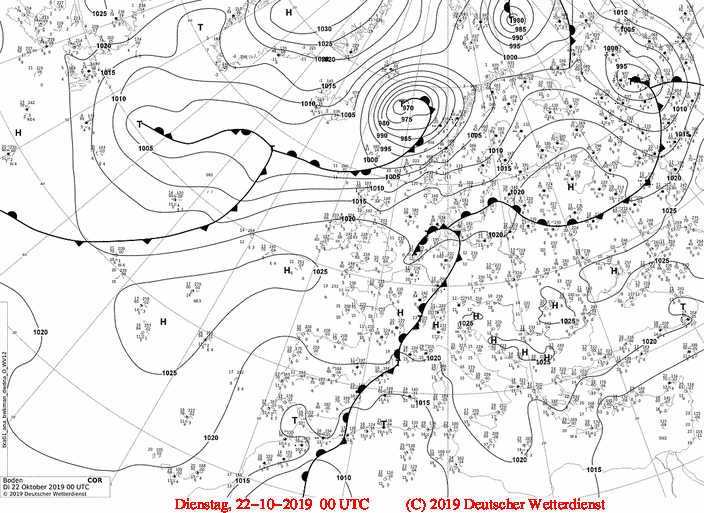
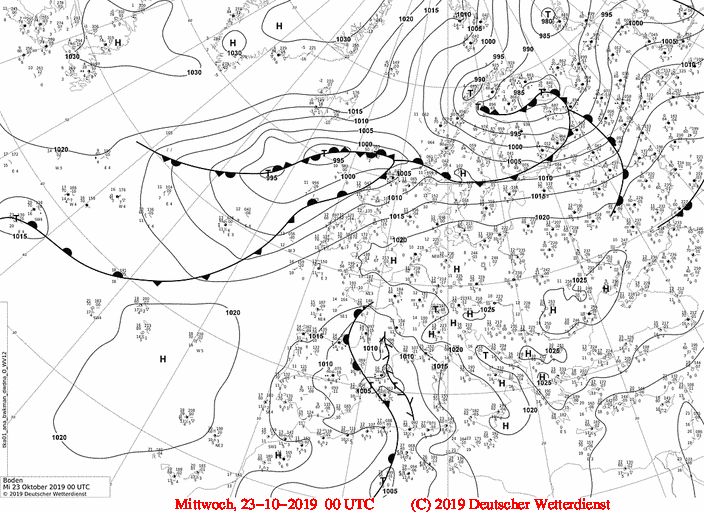
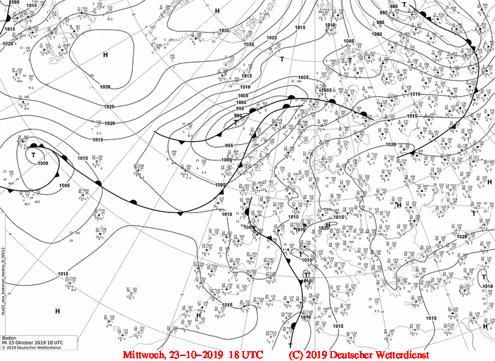
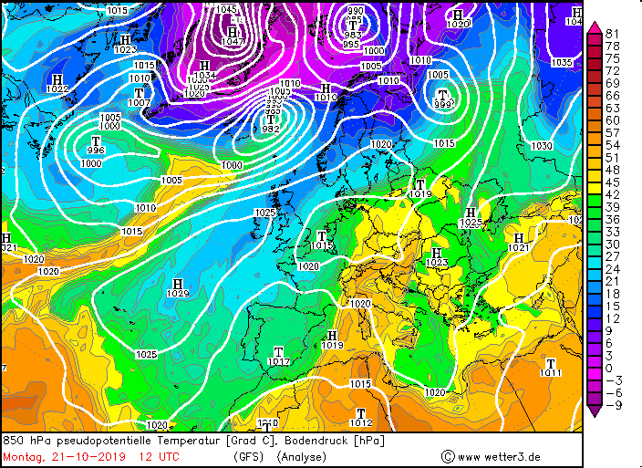
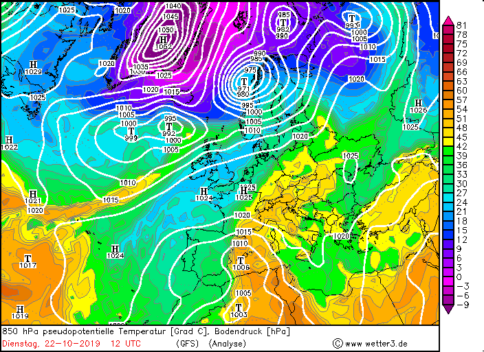
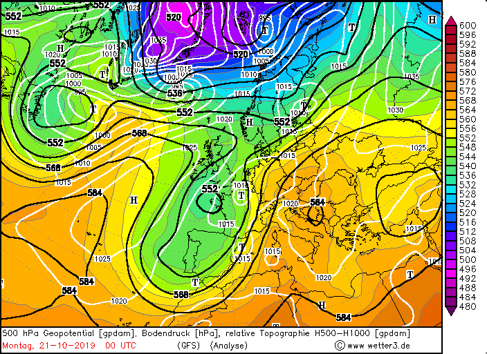
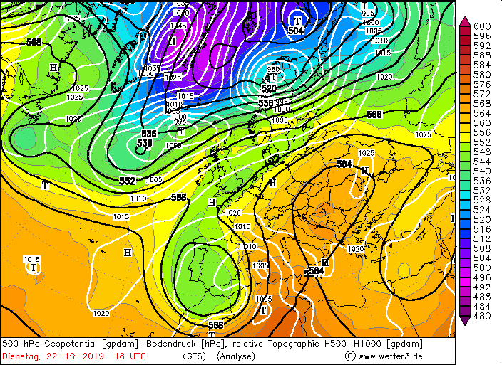
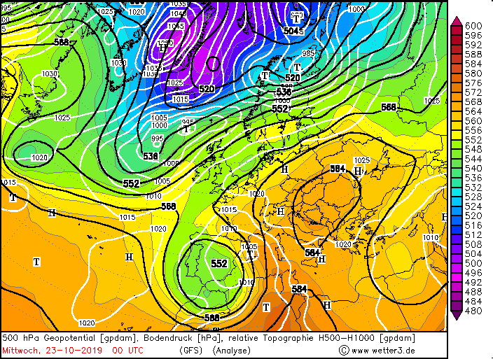
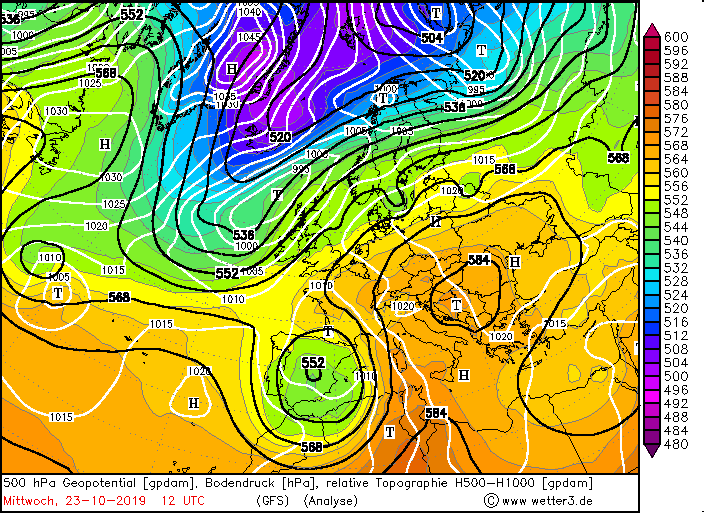
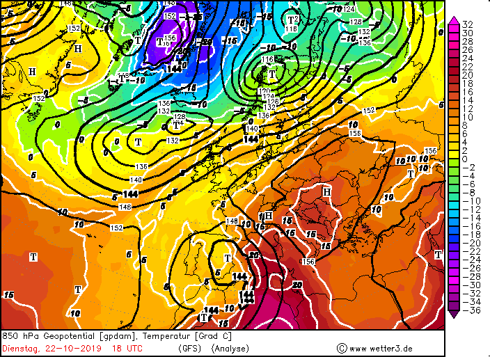
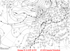
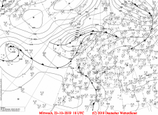
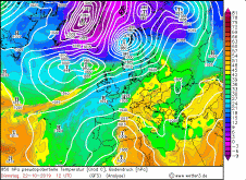
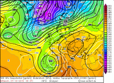
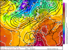
While a high pressure area stabilized over Central and Eastern Europe, there was an almost stationary trough over Spain and the Atlantic Ocean. A cut off low with a
high vertical extension formed at the top of this trough. Warm air from Africa was advected on the eastern flank of the low. Since the
temperatures of the Mediterranean Sea were still very high, about 23 degrees at this time, the air masses could absorb a lot of humidity. Also the Vorticity advection
increased, which led to strong thunderstorms.
|
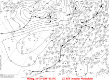
Sea level pressure and fronts, October 21-24, 2019:
Wetter3
|
 |
 |
 |
 |
|
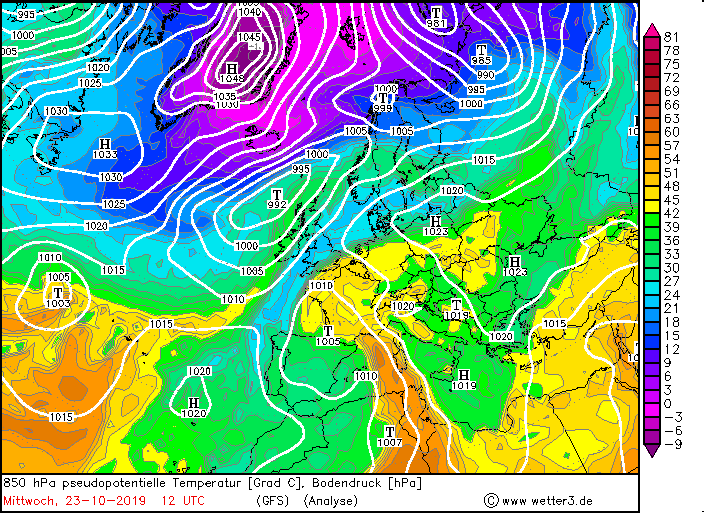
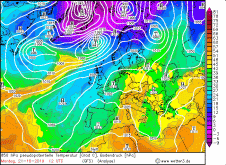
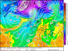
850 hPa pseudopot. temperature, October 21-24, 2019:
Wetter3
|
 |
 |
 |
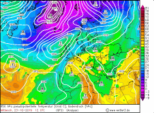 |
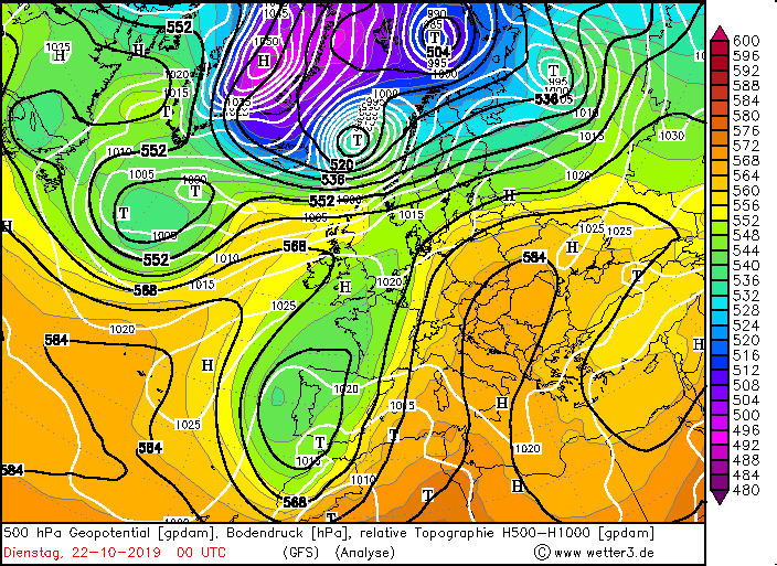
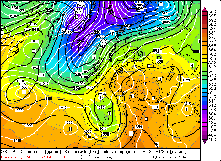
Due to the massive ridge over Central and Eastern Europe, the low was blocked in ist shift to the east as well as its fronts, which were partly recending.
The almost stationary front resulted in extreme rainfall, especially in northeastern Spain and southwestern France. In addition there were accumulated precipitation
at the mountains ranges such as the Pyrenees and the Massif Central. Rainfall also accumulated in northwestern Italy.
In addition to precipitation, hurricane-like winds occurred in France, especially in the Rhone Valley, due to the rising pressure gradient on 23 October.
|
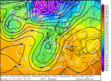
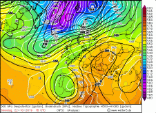
500 hPa Gopotential, October 21-24:
Wetter3
|
 |
 |
 |
 |
|
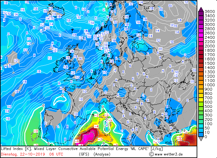
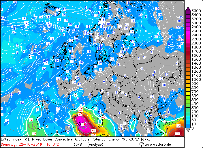
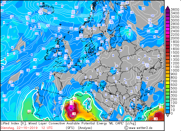
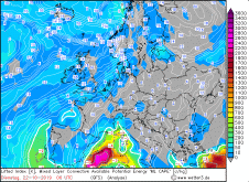
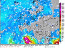
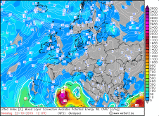
Mixed Layer Cape and 850 hPa temperature advection, several dates:
Wetter3
|
 |
 |
 |
 |
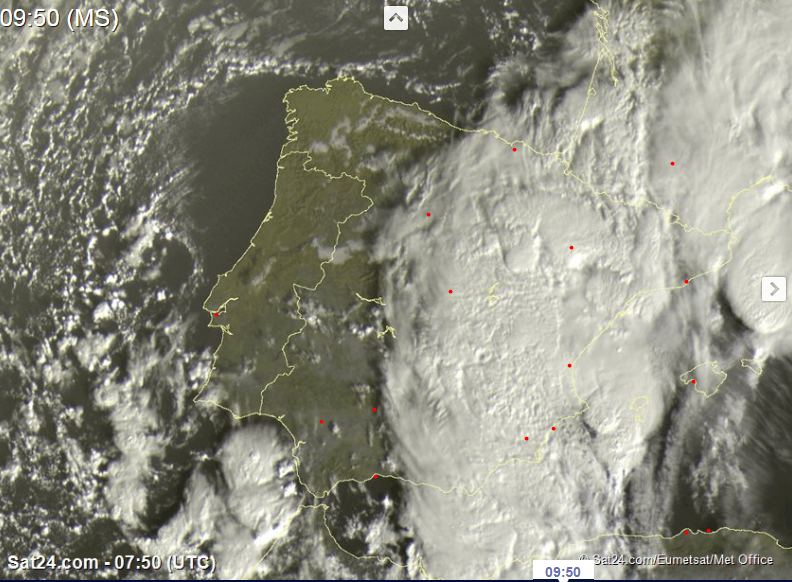
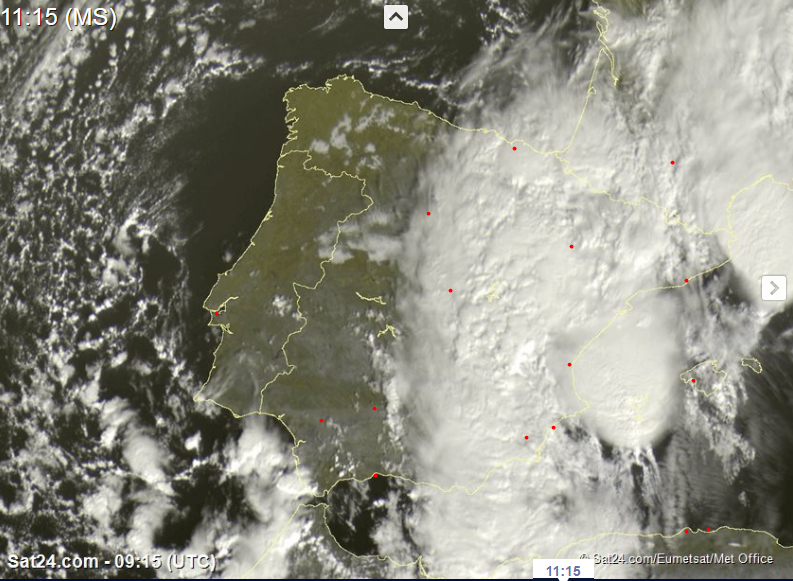
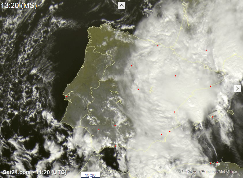
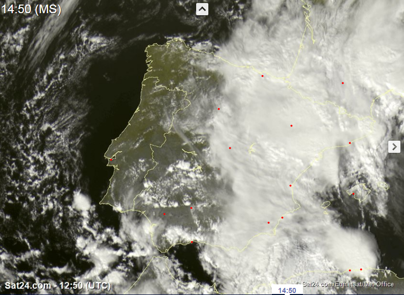
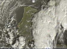
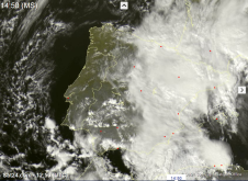
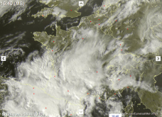
On Monday 21 October, the severe precipitation reached Spain and then France. Convective clouds were already seen on the visible satellite images in the morning.
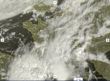
Also on the Balearic Islands there was strong precipitation due to the cut off low. These lasted until 23 October and then also reached the northwest of Italy.
Later, on October 25, heavy thunderstorms formed over the Mediterranean Sea near Sicily and caused heavy precipitation there as well
(Torino/ Bric Della Croce 60 mm and Torino Venaria 54 mm).
|
Satellite images, October 22:
Sat24
|
 |
 |
 |
 |
|
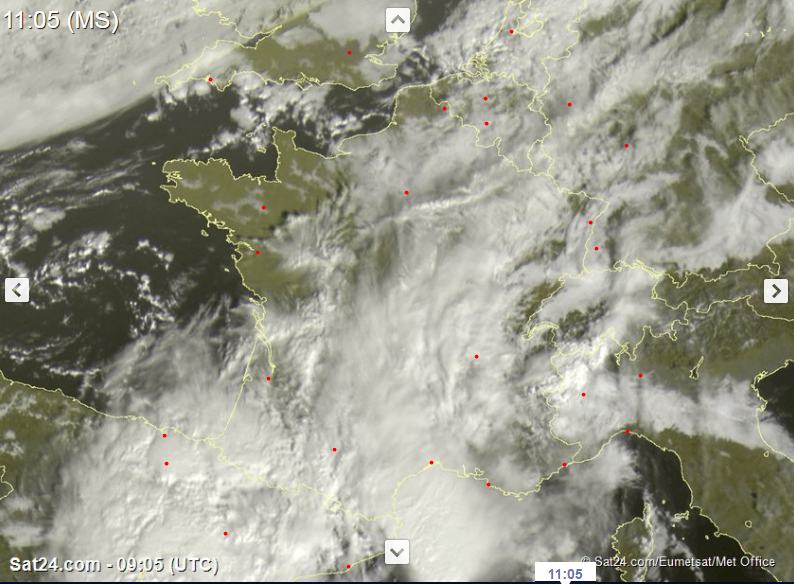
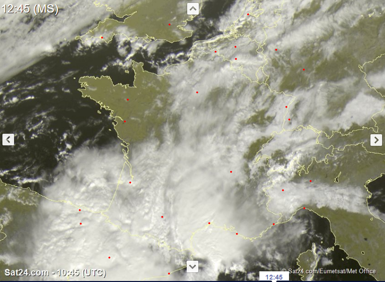
Satellite images, October 22:
Sat24
|
 |
 |
 |
At the beginning there was the possibility that the cut off low could develop into a mediacne due to the high water temperatures,
but this did not happen. The cut off low withdrew to the northwest of Africa on 25 October and rapidly weakened.
In the table below you can see 24 hours precipitation in France and Spain (left) and Gusts (right):
| Location |
Precipitation amount in mm |
Date |
Beziers-Vias (FR)
San Vicente (ES)
Sant Jaume (ES)
Mount Aigoual (FR)
Leucate (FR)
Vandellos (ES)
Cup Bear (FR)
Le Luc (FR)
Cap Sagro (ES)
Tortosa (ES)
Talar (ES)
|
214.4
117.4
113.0
110.0
108.2
106.0
104.2
99.8
95.0
77.6
76.2
|
23.10.2019
23.10.2019
22.10.2019
23.10.2019
22.10.2019
22.10.2019
23.10.2019
23.10.2019
24.10.2019
22.10.2019
22.10.2019
|
|
| Location |
Gusts in kph |
Date |
Toulon (FR)
Bec De'L Aigle (FR)
Cap Cepet (FR)
Mount Aigoual (FR)
Sete (FR)
La Garoupe (FR)
Cape Bear (FR)
Cup Conronne (FR)
Santander/ Parayas (ES)
Castro Urdiales (ES)
Talar (ES)
Palma De Mallorca (ES)
|
131
126
115
115
101
100
97
96
93
86
83
81
|
23.10.2019
23.10.2019
23.10.2019
23.10.2019
23.10.2019
23.10.2019
23.10.2019
23.10.2019
23.10.2019
23.10.2019
22.10.2019
22.10.2019
|
|
Data source: Ogimet.
Text: MG
October 30, 2019
|