|
June began in Germany with high temperatures around 30°C and severe thunderstorms. In Munich and Berlin a supercell formed on 10 and 12 June on each city
that had hail and downbursts in tow. Gusts up to 119 km / h and rainfall up to 70 mm were recorded.
After the first weekend in June, the temperatures in Germany rose to over 30°C and because of the southwest wind with its high humidity advection a
lot of thunderstorms formed in many parts of Germany with hurricanes-like gusts and heavy rainfall as well as bighail. After the weather calmed down on the
second weekend in June, the new week started turbulent thanks to thunderstorms and downbursts aigain. This was the case on 10 June in Munich and on 12 June in
Berlin.
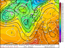
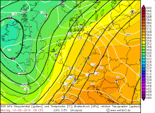
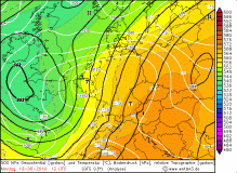
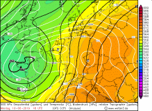
On June 10, Germany was still in the border area between a ridge over Eastern Europe and a trough over the Atlantic. At the front of the trough there was
still the cold front of a low. At this cold front formed again and again short-wave troughs, which favored the storms. It was the same on the 10th of June.
The southwest of Germany was in the range of a small high, whereas the rest was in the influence of the short wave. The isobars of shortwave slid along the
north side of the Alps in a wedge shape, forming a bottom low over the northwest and one over the southeast over Bavaria. In this area CAPE values increased to
over 2500 J / kg and also the wind shear increased. Ideal conditions for heavy thunderstorms like an MCS or supercells. That's exactly what happened.
|
500 hPa geopotential on June 14:
Wetter3
|
 |
 |
 |
 |
At about 14:00UTC a thunderstorm formed south of Kempten near Füssen which moved to the northeast and developed into a supercell.
It moved relatively slowly northeast between Weilheim in Upper Bavaria and Augsburg and reached Munich at around 16:00 UTC. It trained hail over 5 cm.
Also downbursts and some water came to the ground. In Carlsfeld it was 34 mm. At the airport of Munich a gust of 119 kph was registered, which corresponds to
a hurricane-like gusts or a category 1 hurricane.
On June 11 there was a similar weather situation in northeastern Germany. There, the CAPE values rise to just under 3000 J/kg
and there were also heavy thunderstorms.
On June 12 the situation barely changed. A bottom low had formed on the border to Poland and the CAPE values also reached values of about 2500 J/kg on
this day. Both in Germany and in the neighboring country there were heavy storms with hail, which had a diameter of sometimes more than 11 cm. The storm cell
formed at about 15:00UTC on a squall line that extended from the Baltic Sea to the southern border of Saxony. It moved from west to east and reached the city
state of Berlin at about 16:45 UTC. Remarkable here are the gusts and precipitation. In Berlin-Schoenefeld a gust was measured at 112 kph.
|
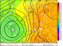
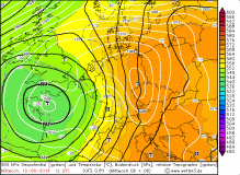
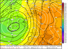
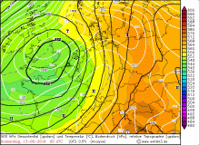
500 hPa geopotential on June 14:
Wetter3
|
 |
 |
 |
 |
The maximum rainfall was 70 mm in goods, in Berlin-Dahlem it was 60.7 mm. The rainfall amounts are listed in the following table (coming soon).
Spared on this 3 day was the southwest, as it was under the influence of an intermediate high.
Both in Munich and in Berlin the two storms caused devastating damage. The big hail damaged houses and solar panels. Cars were damaged,
windows were smashed. The fall gusts uprooted trees or they were overturned by the force. The train and rail traffic came to a standstill and on
the following days there were still delays in the operation.
Text: MG
June 14th, 2019
|


