|
Freitag, 23. Oktober 2018, 22:30 MEZ
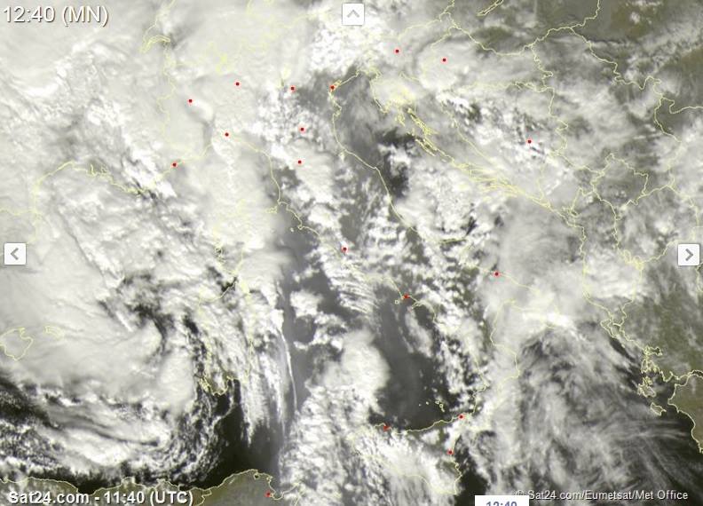
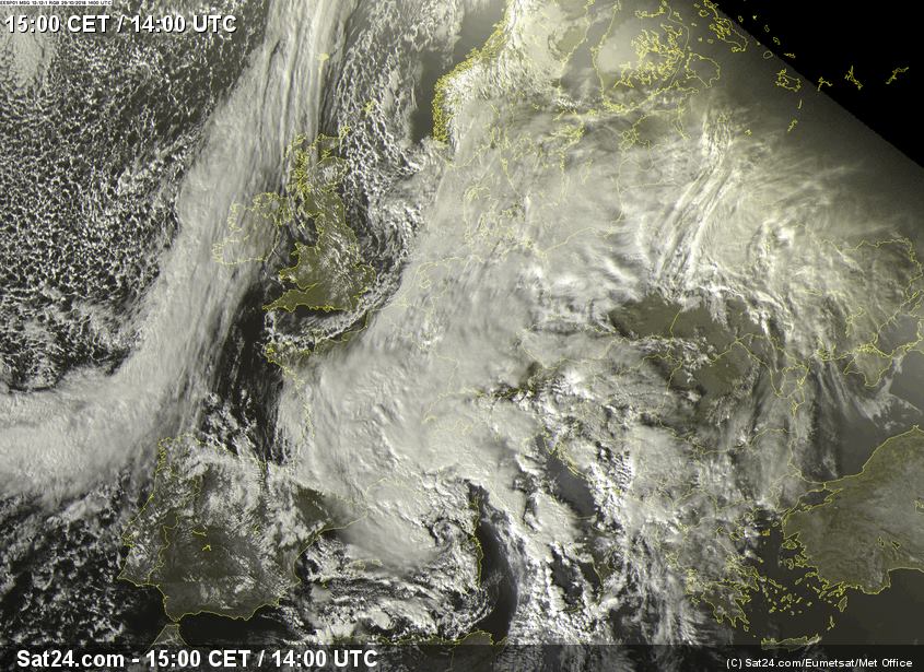
Artic Outbreak Stauniederschläge Europa 20.10.-30.10.2018 Saharastaub auf dem Mittelmeer am 29. Oktober 2018 Quelle: Sat24 |
|
|
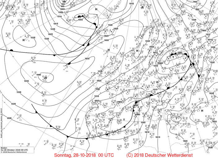
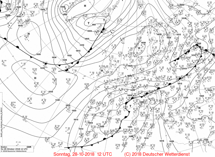
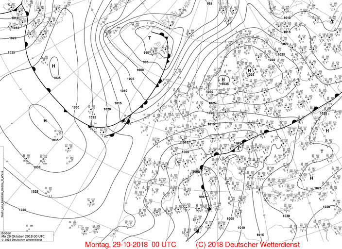
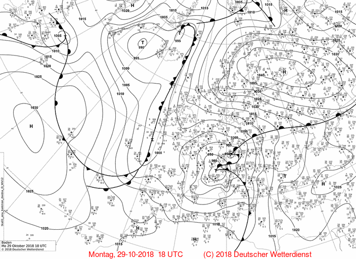
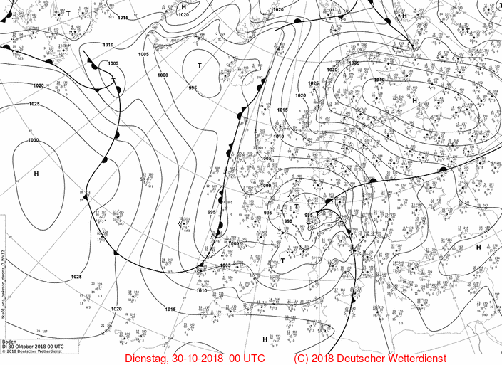
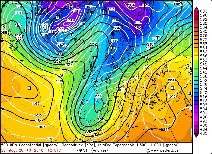
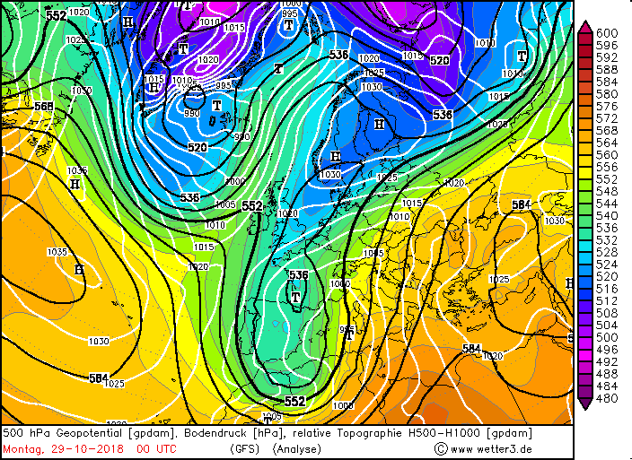
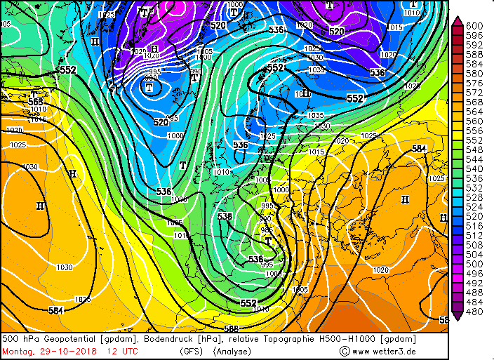
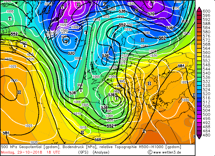
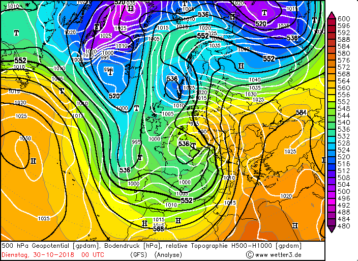
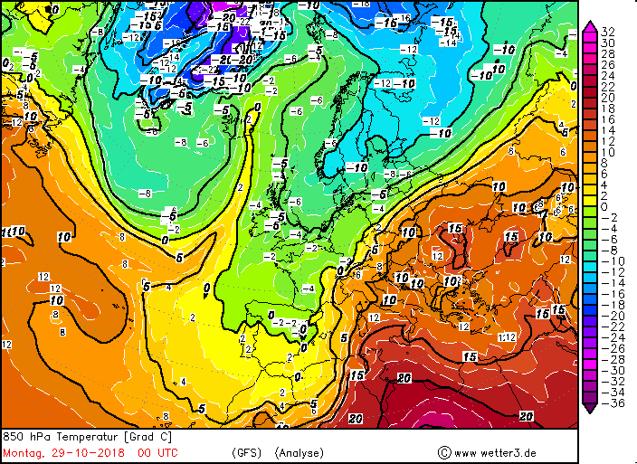
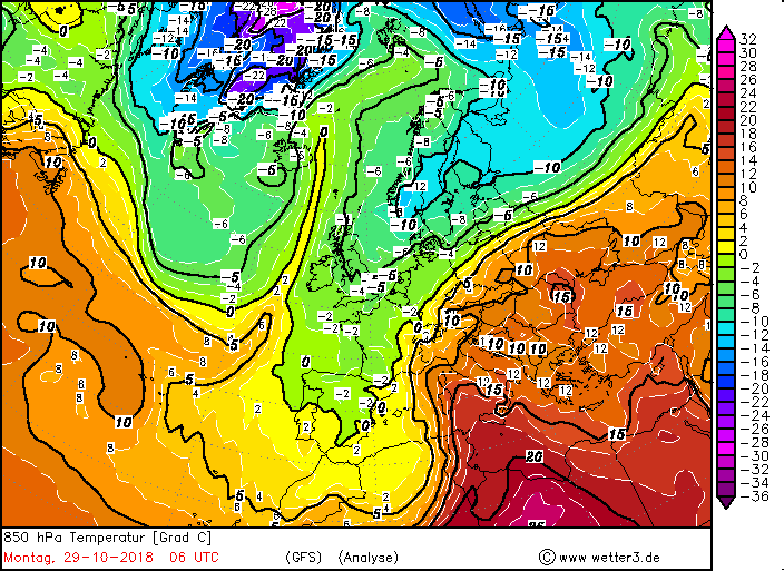
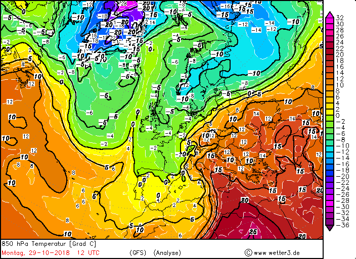
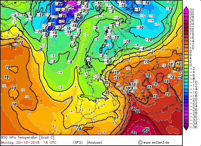
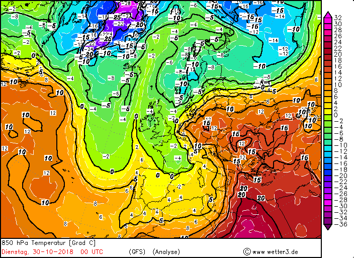
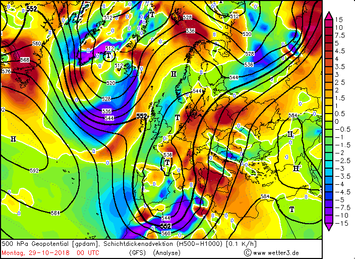
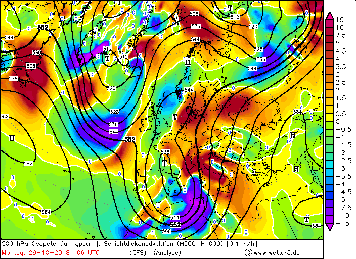
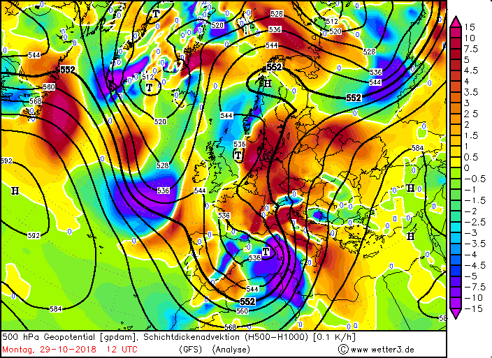
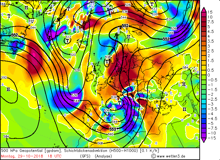
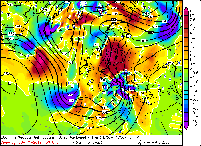
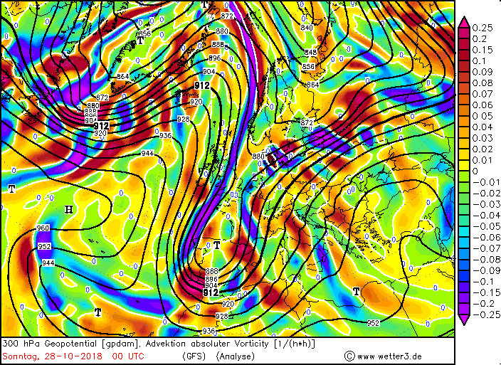
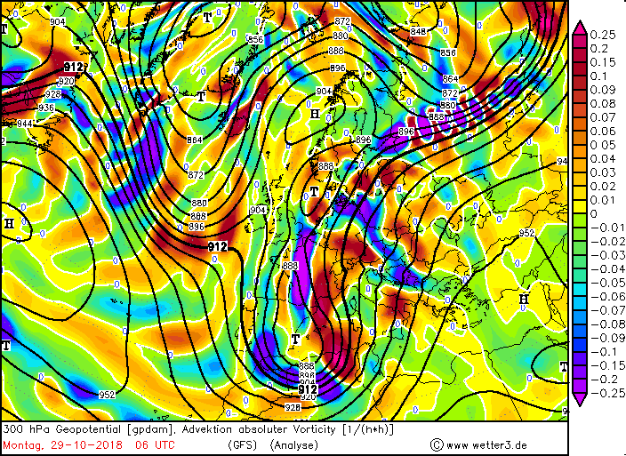
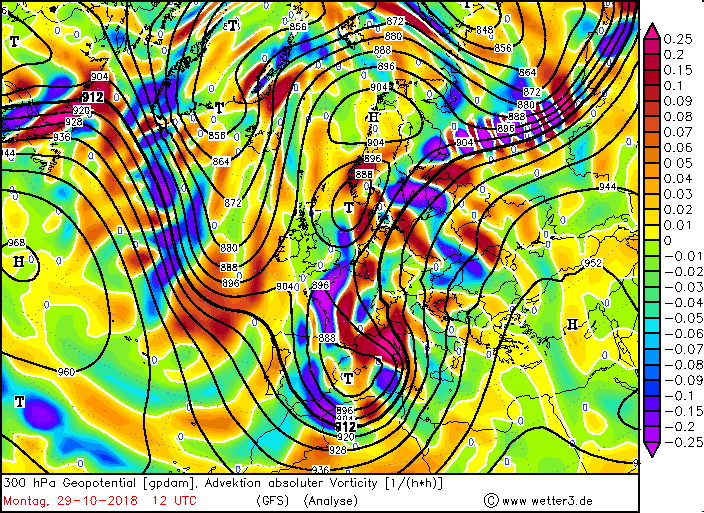
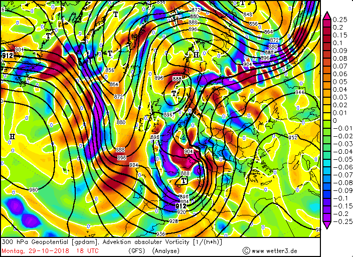
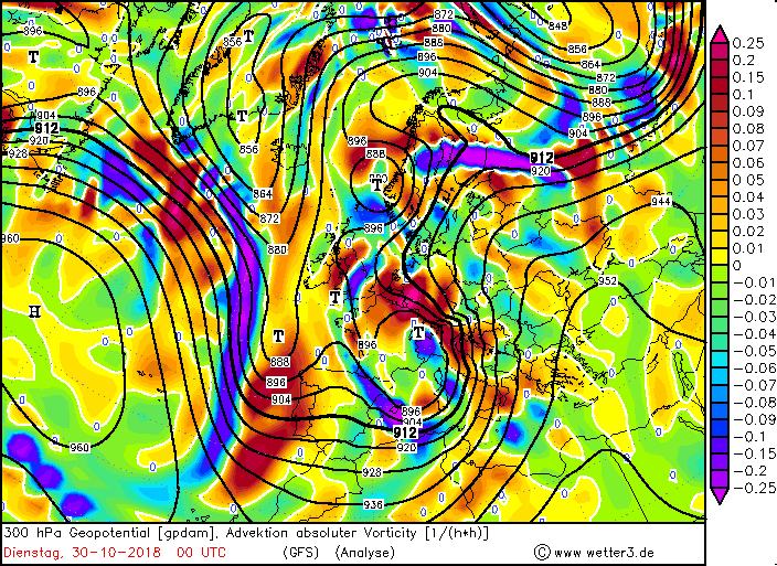
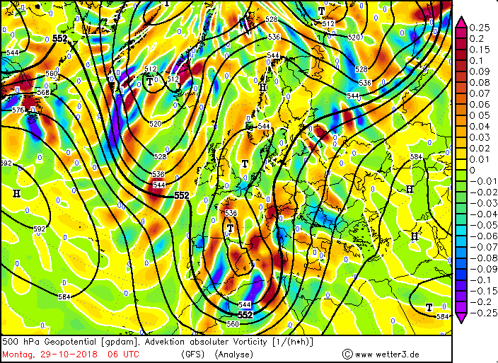
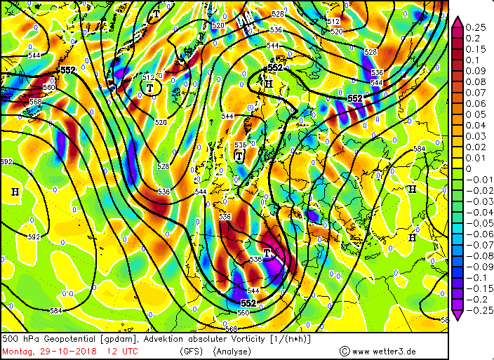
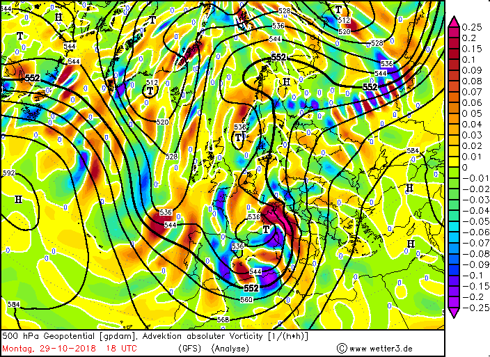
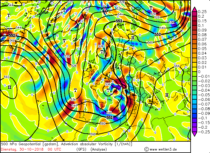
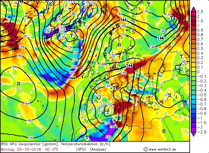
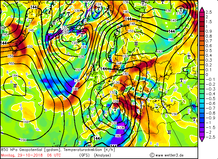
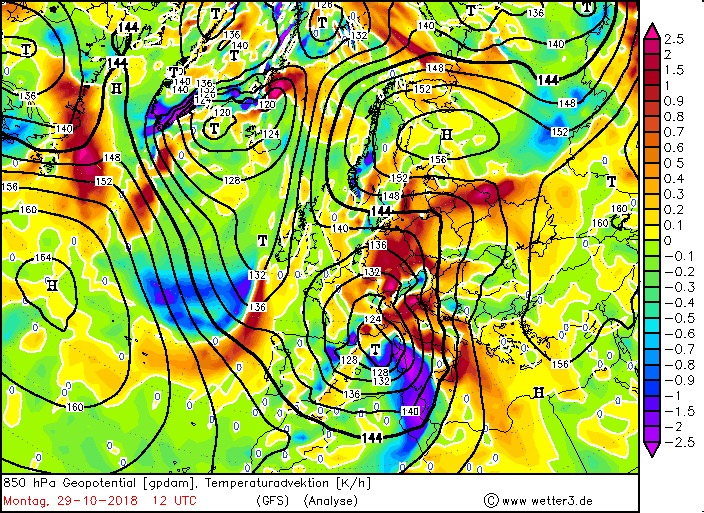
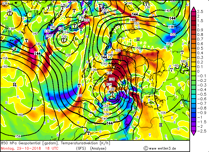
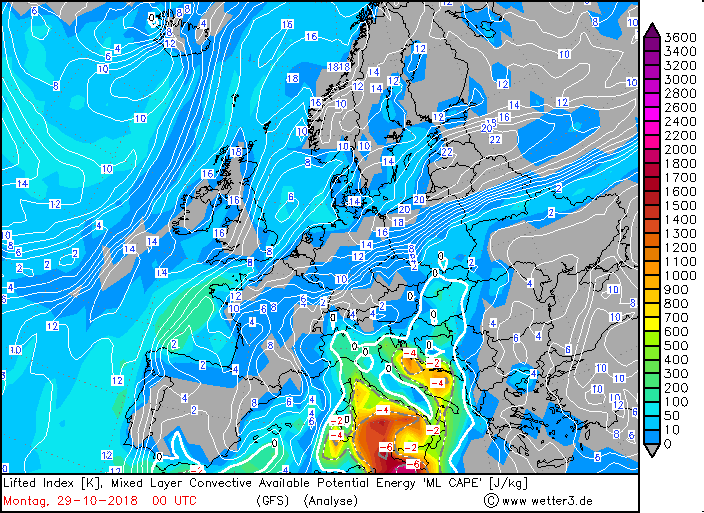
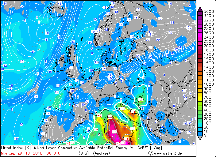
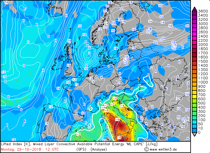
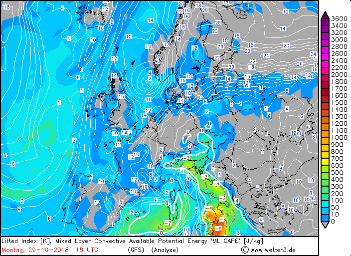
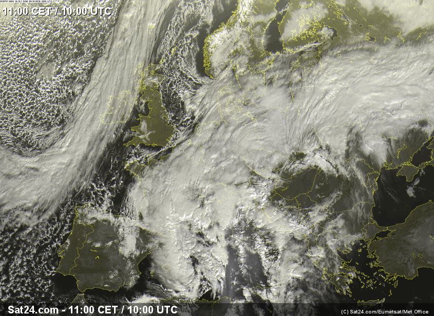
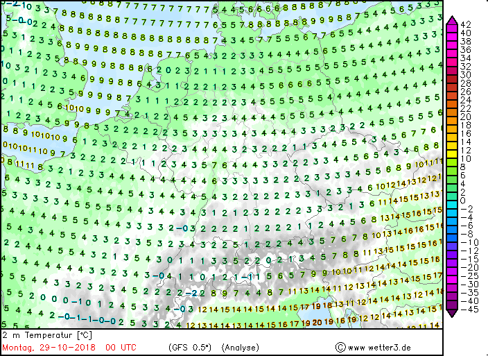
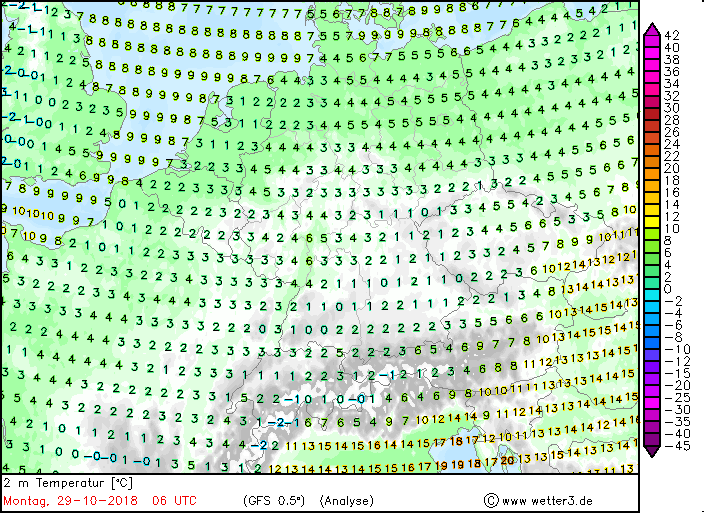
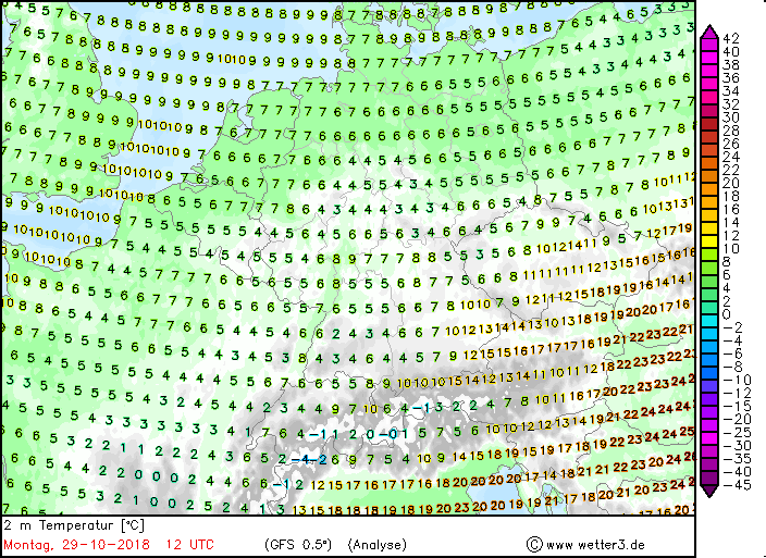
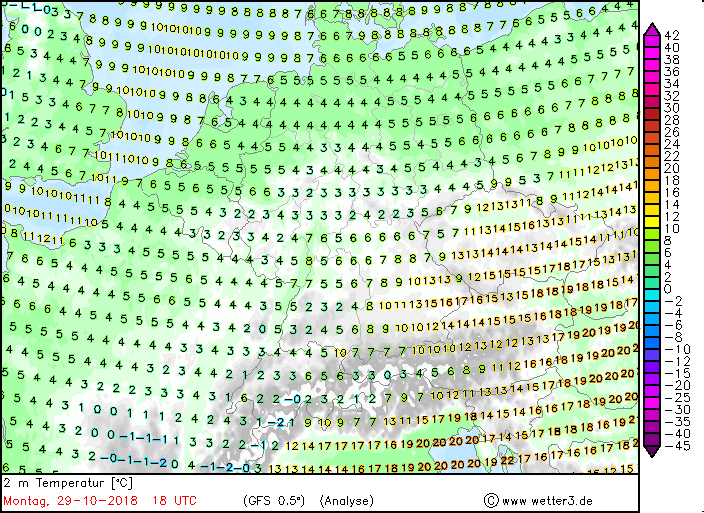
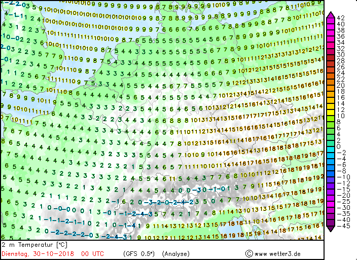
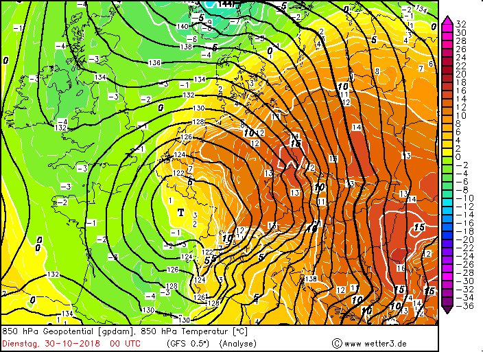
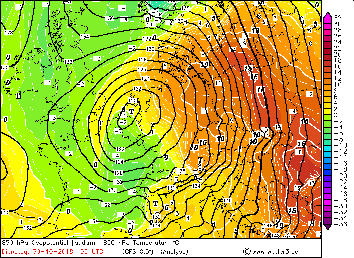
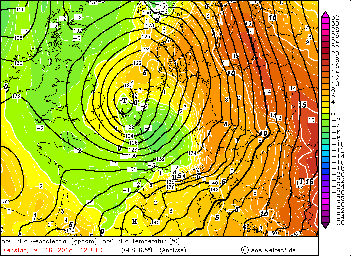
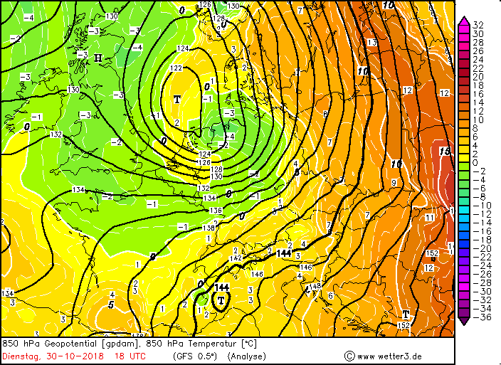
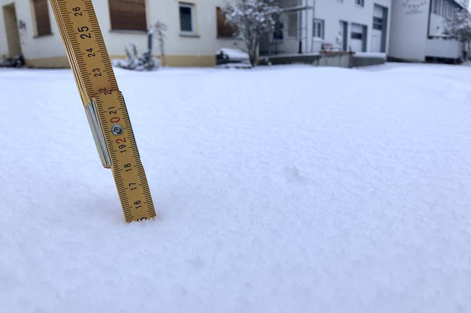
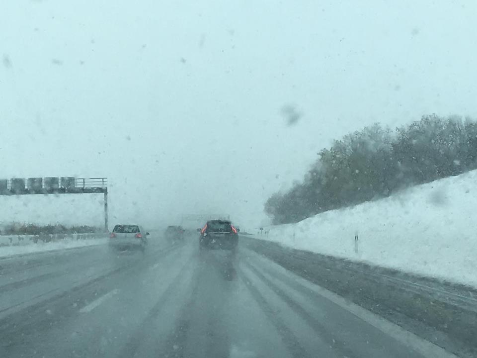
Precipitation accumulation in Mediterranean areas At the end of October, a cut off low or cold air drop once again caused heavy precipitation on the southern side of the Alps. This formed on Saturday October 20th at the through's top over Eastern Europe. At the same time, a ridge wedge pushed over Germany towards the northeast, increasing the dripping process. The cold air drop moved on the backside of the trough/ the front side of the wedge to the southwest initially along the Alps. This leads to severe precipitation and thunderstorms. On the south side of the low, moist and warm air was advected, which increased the CAPE values and thus increased the thunderstorm risk. In the course of the day of October 22nd, 2018, the cold-air drop moved further southwest over the central Italy and also brought precipitation there in form of showers and thunderstorms. Enormous amounts of hail are also present, such as in Rome. Towards evening and night it reached Sicily and is completely drained and adopted a southeastern course. On the evening of October 23rd, 2018 Sicily is no longer in the area of influence and the drop of cold air moved further to the southeast in the direction of the northeastern coast of Africa Only a few days later, on October 26th until October 28th 2018, a similar spectacle occurred. A so-called Artic Outbreak again generated a cut off low, which brought not only single-digit temperatures, but devastating rainfall to Mediterranean areas. There were also enormous amounts of fresh snow due to these precipitations. During the course of October 26th and 27 th a trough formed, which extended extremely far to the south. On October 28 th the trough top reached over Spain to Africa! As a result temperatures dropped to the single-digit range not only in Central Europe, but also in southwestern Europe. In the highlands of these areas, temperatures even dropped below zero. The front of this trough was a cold front that extended from the Alps over France to Spain and Portugal (later also over the northwest coast of Africa). Partly, however, that cold front was stationary or began to shift retrogradely. As a result, on October 28th southwest of the Alps and over the Mediterranean several low pressure areas were generated. One of them developed late in the evening of October 28th south of Mallorca. It was named VAIA. The center moved in the course of October 29 th west to Majorca over to the north towards the south of France. At the same time, an almost stationary front over southwestern Spain released enormous amounts of precipitation. Storm low VAIA, Scirocco and again accumulated precipitation Deep VAIA strengthened until Monday night very fast, due to the favorable location in a weak jet stream branch. It was in the range of positive divergence and front of the trough. VAIA finally developed into a storm low. In Germany, the stormy to hurricane-like gusts made themselves noticeable on late Monday evening and in the night of Tuesday, especially in the west and southwest. The strongest gusts were measured in Saarland and Rhineland-Palatinate. VAIA quickly moved in the course the next day north over the Benelux over the North Sea. The most popular feature of VAIA was the train track. It moved from south to north and not as usually from northwest / west to east. But not only the train track was untypical, but also the temperature distribution. From the southwest cold air was advected that comes from the trough. On the eastern side of the air, on the other hand, mild air from the Italy / Balkans region was sucked in and led around the deep. This benefited above all the east and southeast of Germany. There were partly measured two-digit temperatures around 11°C, whereas in the rest of the country only single-digit temperatures were measured. VAIA also revealed an inverse temperature gradient on Tuesday. It did not get colder in the evenings, but warmed up by the warm air. In addition to unusual temperature changes and storm gusts, VAIA also brought precipitation in the form of rain and snow at higher altitudes. The snow line fell below 500m during the night and locally brought e.g. on the Swabian Alp scarcely 20cm fresh snow (19cm Klippeneck). Due to the foehn effects on the edge of the Alps, however, mild temperatures were recorded in the following days, which is why the snow remained only for a short time. Storm gusts were registered also on Tuesday evening in the east of Germany by the strong pressure gradient between low VAIA and high YOGI. In the same period (October 26th to 30th) there were heavy precipitations on the south side of the Alps due to the strong south and southwest winds. Again, very warm and humid air was advected, so that the CAPE values increased and it partly came to heavy thunderstorms with hail. A look at the maps of the layer thickness advection and vorticity advection reveals the heavy rainfall. Central and north Italy were affected the most. Also in the Balkans accumulated precipitation emerged. It formed during October 29th a thunderstorm line over the Tyrrhenian Sea. Due to the strong warm air advection, summer temperatures above 20 ° C were reached again in Italy and Southeastern Europe. Due to the strong pressure gradient through low VAIA (when it was still on the Tyrrhenian Sea) Scirocco winds formed on the same day that swept over Italy and the Balkans and carried Saharan dust with it, which was very well visible on the satellite images. Over Africa, the Scirocco remained dry, but recharged moisture over the Mediterranean, which increased the stagnant rainfall. The trough retreated only in early November from southwest and central Europe back north. Central Europe was again dominated by high pressure and the urgently needed rainfall did not occur. In the Mediterranean regions, however, there were again heavy rainfall.
German Version Text: MG 23. November 2018 |
|||||||||||||||||||||||||||||||||||||||||||||||||||||||||||||