|
Sunday, March 15, 2026, 17:00 UTC
Issued: Sunday, March 15, 2026, 17:00 UTC
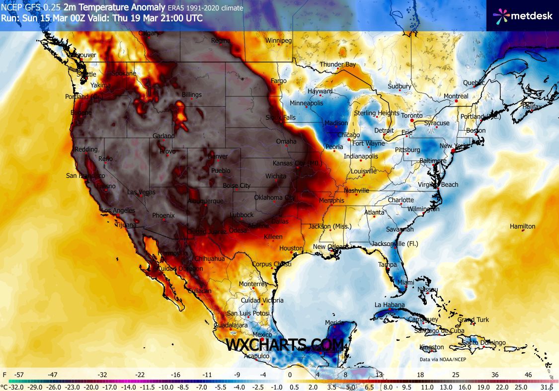
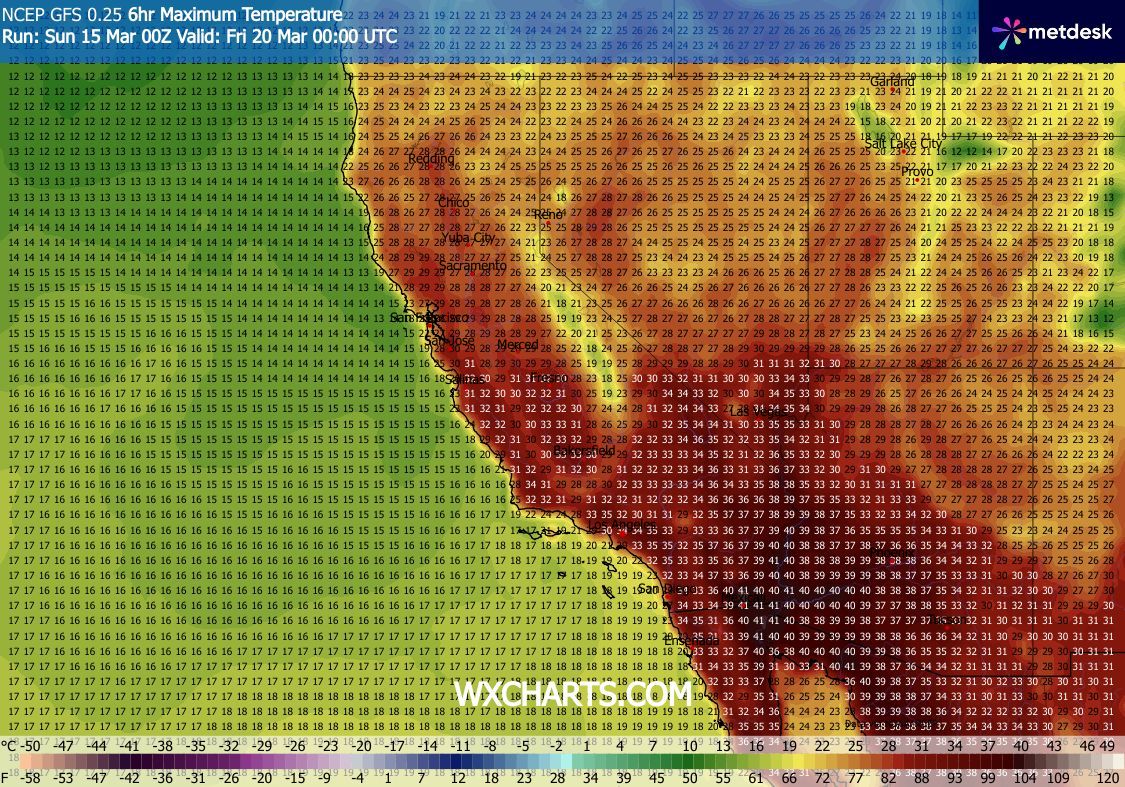
An unprecedented early-spring heat wave is forecast to impact the US West Coast in the coming week. Temperatures will be running way above average. Although it is mid-March, monthly temperature records for April may be broken in the Southern Deserts. Concurrently, a major snowstorm is expected to impact Minnesota and the Upper Peninsula of Michigan.
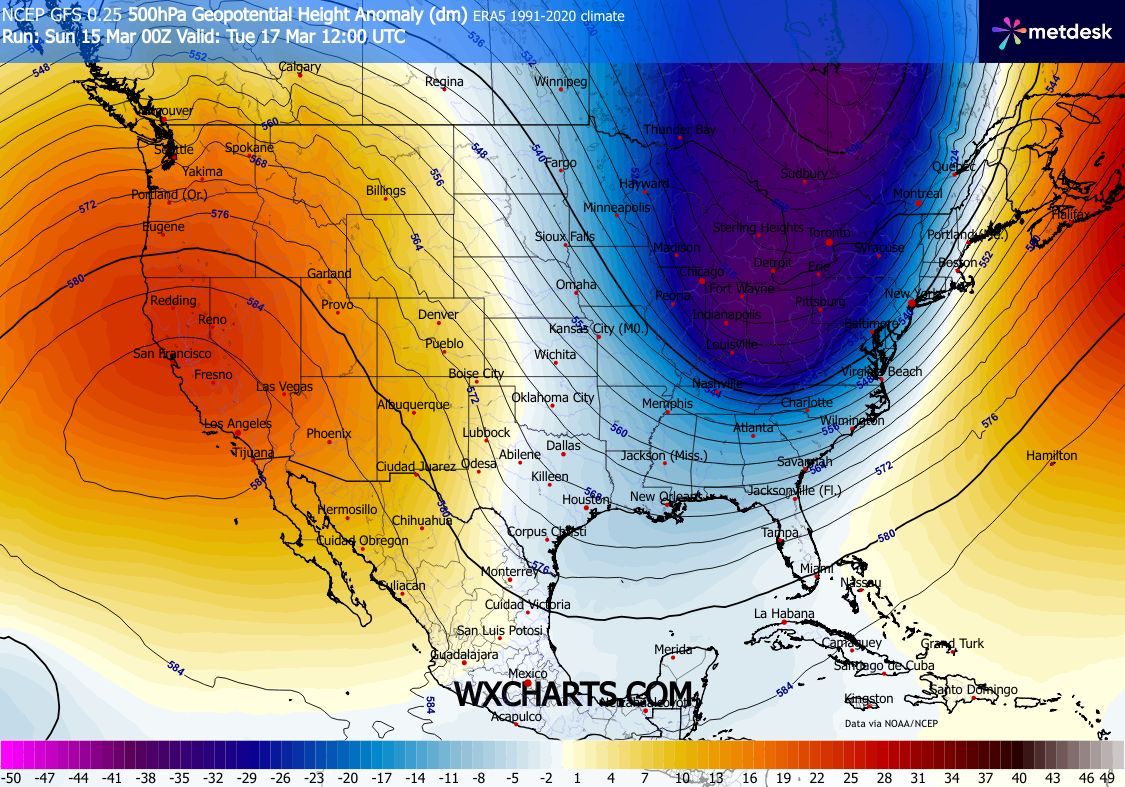
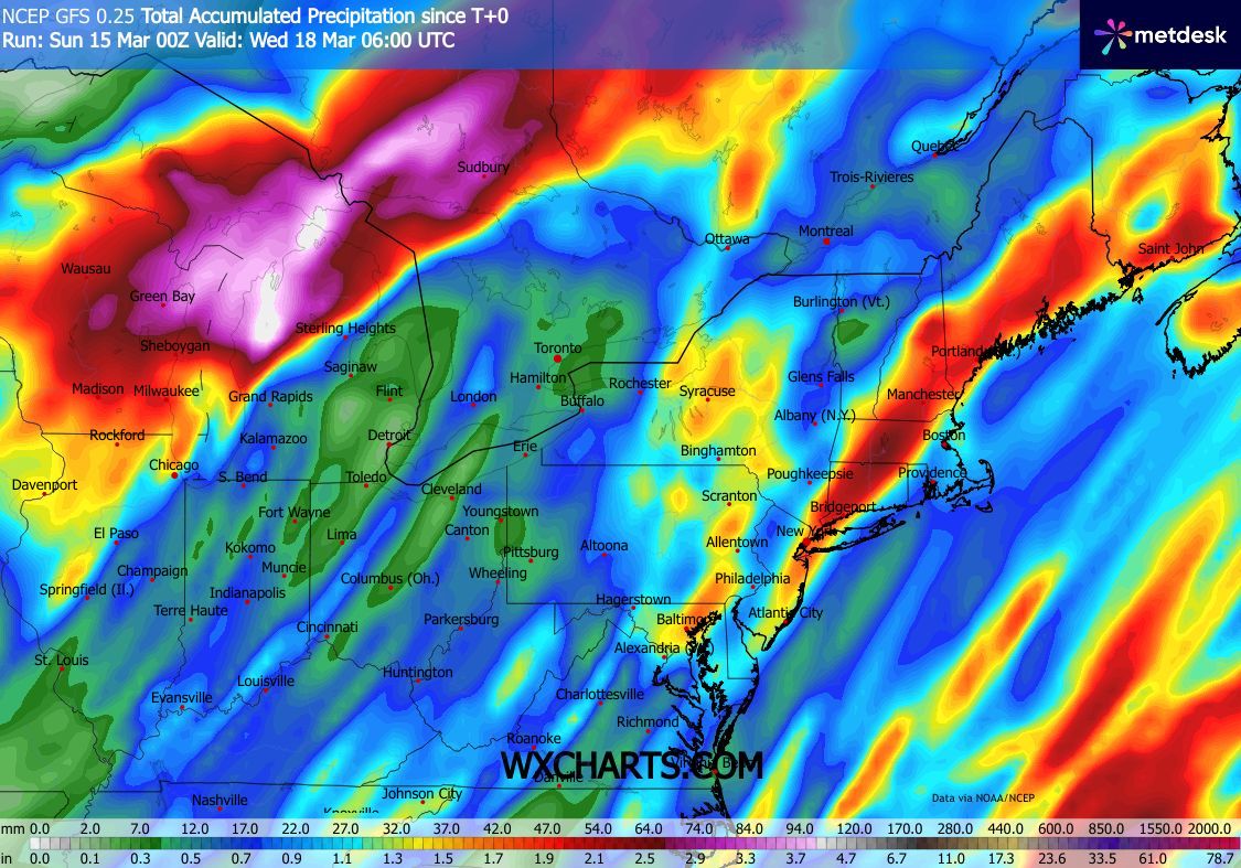
A highly distorted synoptic pattern has developed across the US. From west to east, there is an unusually strong trough located north of Hawaii, bringing torrential rains to the island chain. Over the Eastern Pacific, an enormous ridge has developed, which is slowly drifting eastwards in the coming days, impacting the US West Coast. Further east, a large trough has plunged southwards east of the Rocky Mountains. Ahead of this trough, moist air masses are advected far northwards into the Northern Great Plains and Great Lakes area. Here, the moist air masses meet a cold air mass residing across the area. At the boundary, heavy precipitation is expected. Due to the cold temperatures, most of the precipitation will fall as snow. Only in the southern parts of the air mass boundary are significant threats to icing present. Stretching from the Twin Cities into the Upper Peninsula in Michigan, widespread fresh snow accumulations of more than 30 cm are possible. Near Marquette, MI, fresh snow accumulations of more than 60 cm with the potential for snow totals of up to 100 cm in extreme cases. Together with high winds, blizzard conditions will persist until Tuesday, March 17, 2026.
Sunday, March 15, 2026, 17:00 UTC KG |