Sunday, January 11, 2026, 18:00 UTC
|
|
|
|
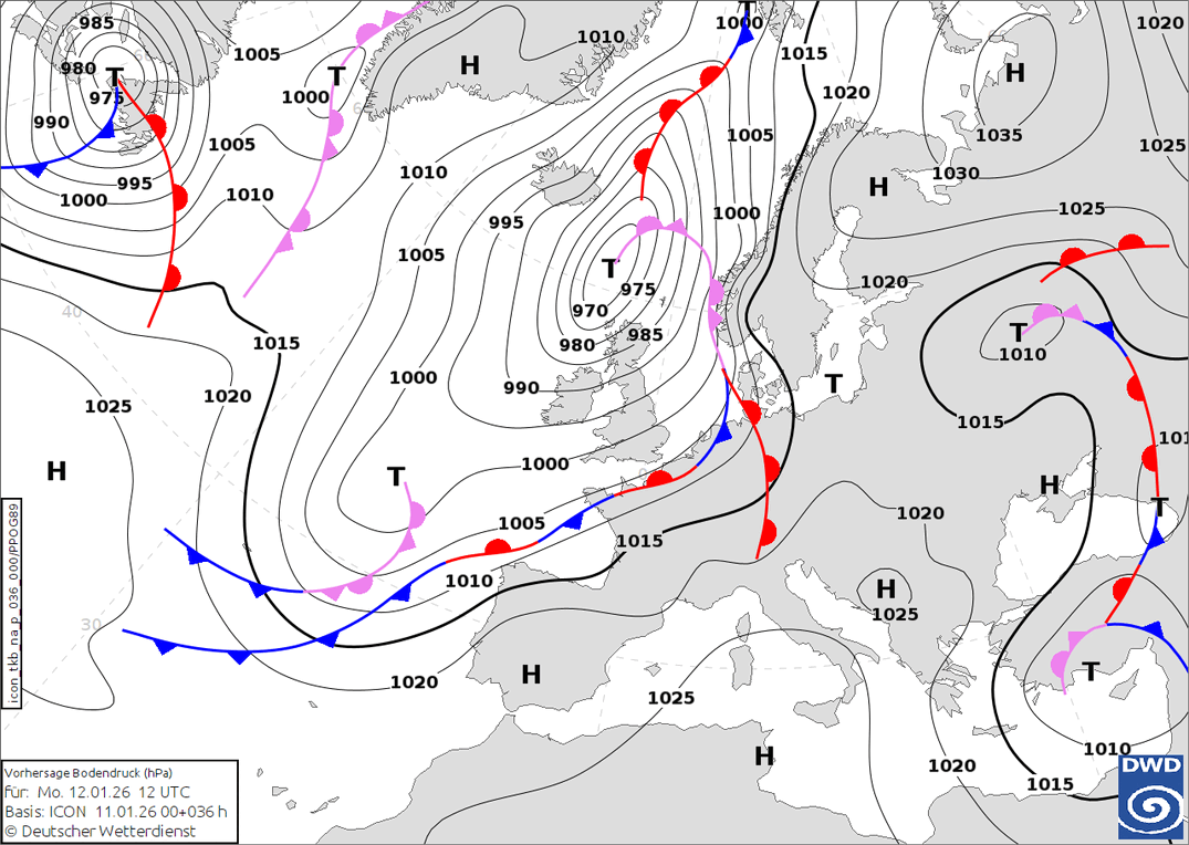
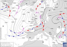
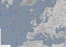
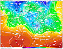
Predicted sea-level pressure and fronts
over Europe,
12.01 12 UTC
Source: wetter3
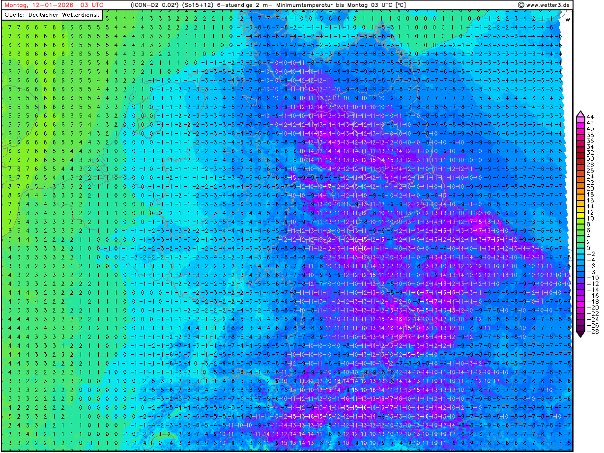
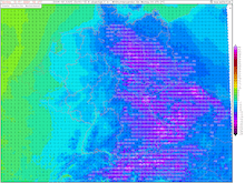
| 2 m minimum temperature over Central Europe,
12.01 03 UTC
Source: wetterzentrale
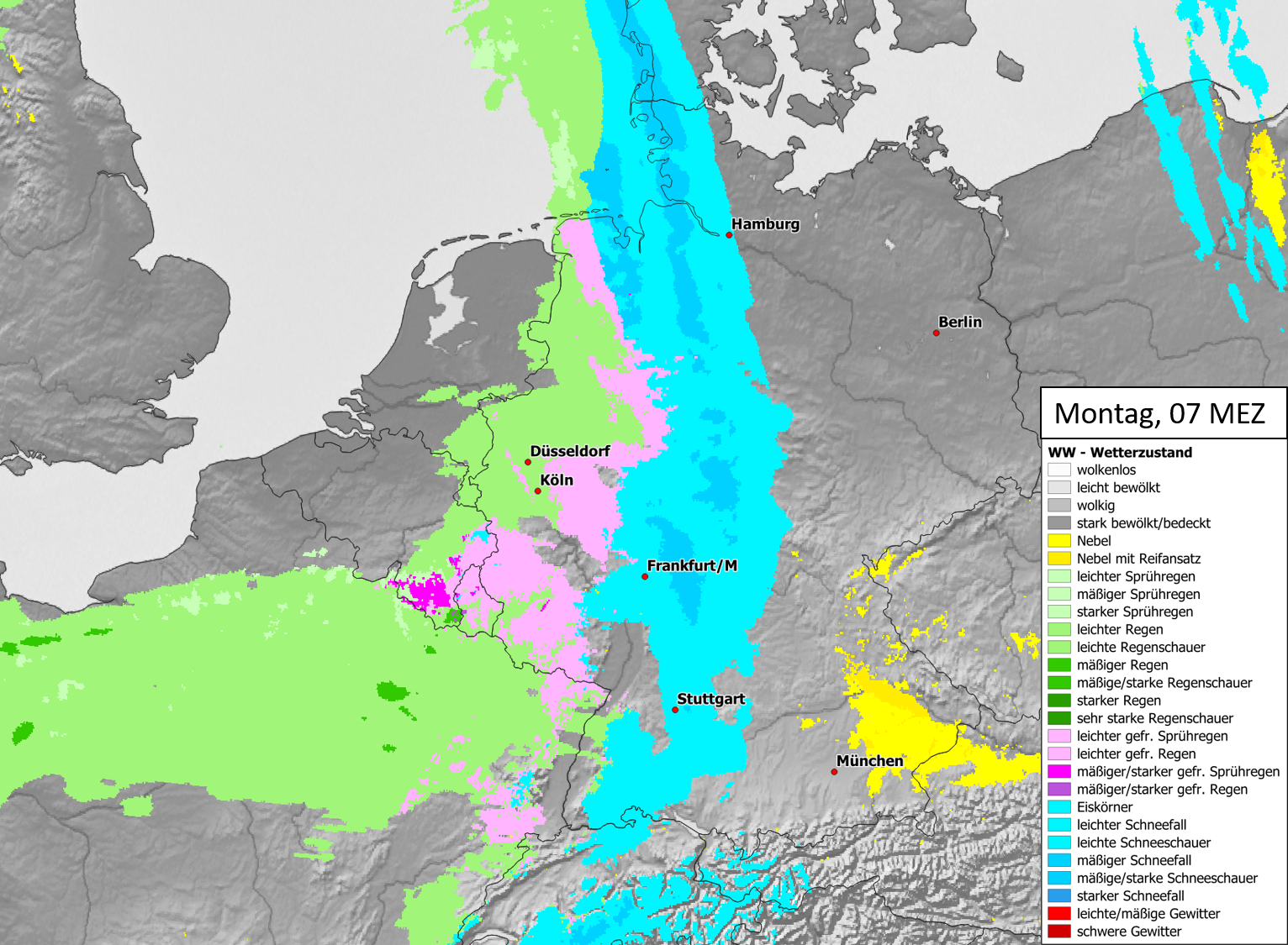
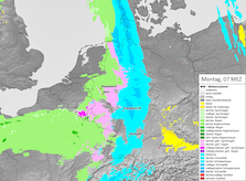
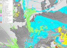
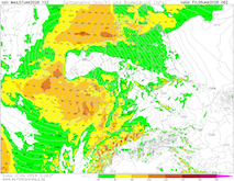
| Significant weather over Central Europe,
12.01 06 UTC
Source: DWD visualization: B. Mühr
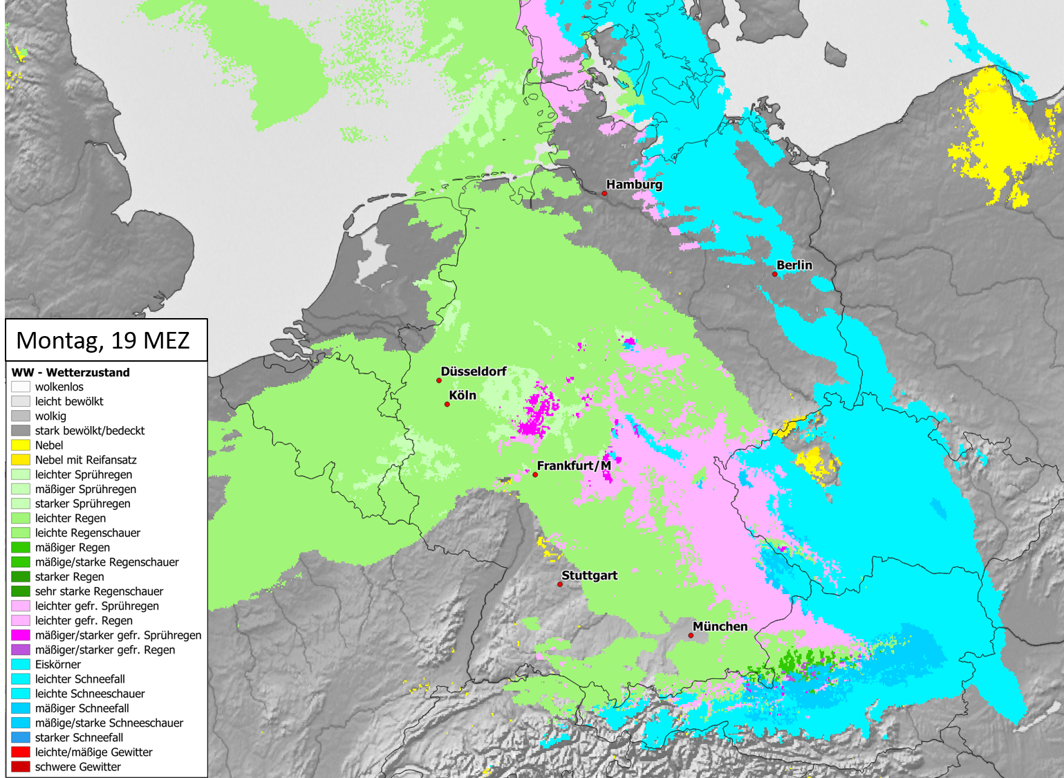
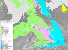
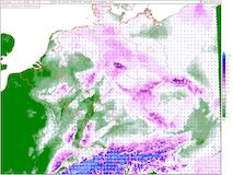
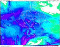
| Significant weather over Central Europe,
12.01 18 UTC
Source: DWD visualization: B. Mühr
|
Freezing rain
Central Europe
Issued: Sunday, January 11, 2026, 18:00 UTC
With an approaching warm front over Western Europe, the widespread potential for freezing rain is forecast across Germany on Monday, January 12, 2026. Ahead of the warm front, another frigid night is expected across Eastern Germany with low temperatures locally below -15 °C.
11.01.2026
Behind winter storm Elli, cold air masses have reached Central Europe. In the past night, low temperatures across the extensive snow fields in Northern Germany often dropped to below -10 °C. At Wittingen-Vorhop, the temperatures dropped to -18.9 °C. On the synoptic scale, an extensive low-pressure system is located over the Northern Atlantic. Belonging to said low-pressure system is a warm front, which is expected to reach Western Germany early on January 12, 2026. Initially, a few centimeters of fresh snow accumulation are possible. At higher elevations, fresh snow accumulations of more than 5 cm may occur. In the central and eastern parts of Germany the night to Monday will be once again frigid with widespread low temperatures below -10 °C. Locally, low temperatures of -15 °C are possible.
Quickly, the snow line will rise to elevations above 1500 m. Subsequently, the precipitation will turn to rain. However, the near-surface temperatures will have a short temporal lack and may remain below freezing for a limited time. Even if the near-surface temperatures swiftly rise above the freezing mark, the extensive period of below-average temperatures has led to deeply frozen soils. Thus, widespread freezing rain is possible. In Western Germany, the risk for freezing rain is the highest between 03 and 09 UTC. Over Central Germany, this time frame shifts to 09 to 15 UTC and over Eastern Germany, freezing rain risks persist from 15 UTC to 06 UTC on Tuesday, January 13, 2026. During the period of freezing rain, widespread travel disruptions must be expected.
In the following days, the temperatures over Germany will rise to near-normal to slightly-above-average temperatures. Subsequently, the extensive snow coverage over Germany will largely melt. In Northern Germany, there is a minor risk of flooding due to the combination of melting snow and frozen ground. Along small frozen rivers, marginal risks of ice jams may arise.
Friday, January 09, 2026, 12:00 UTC
|
|
|
|
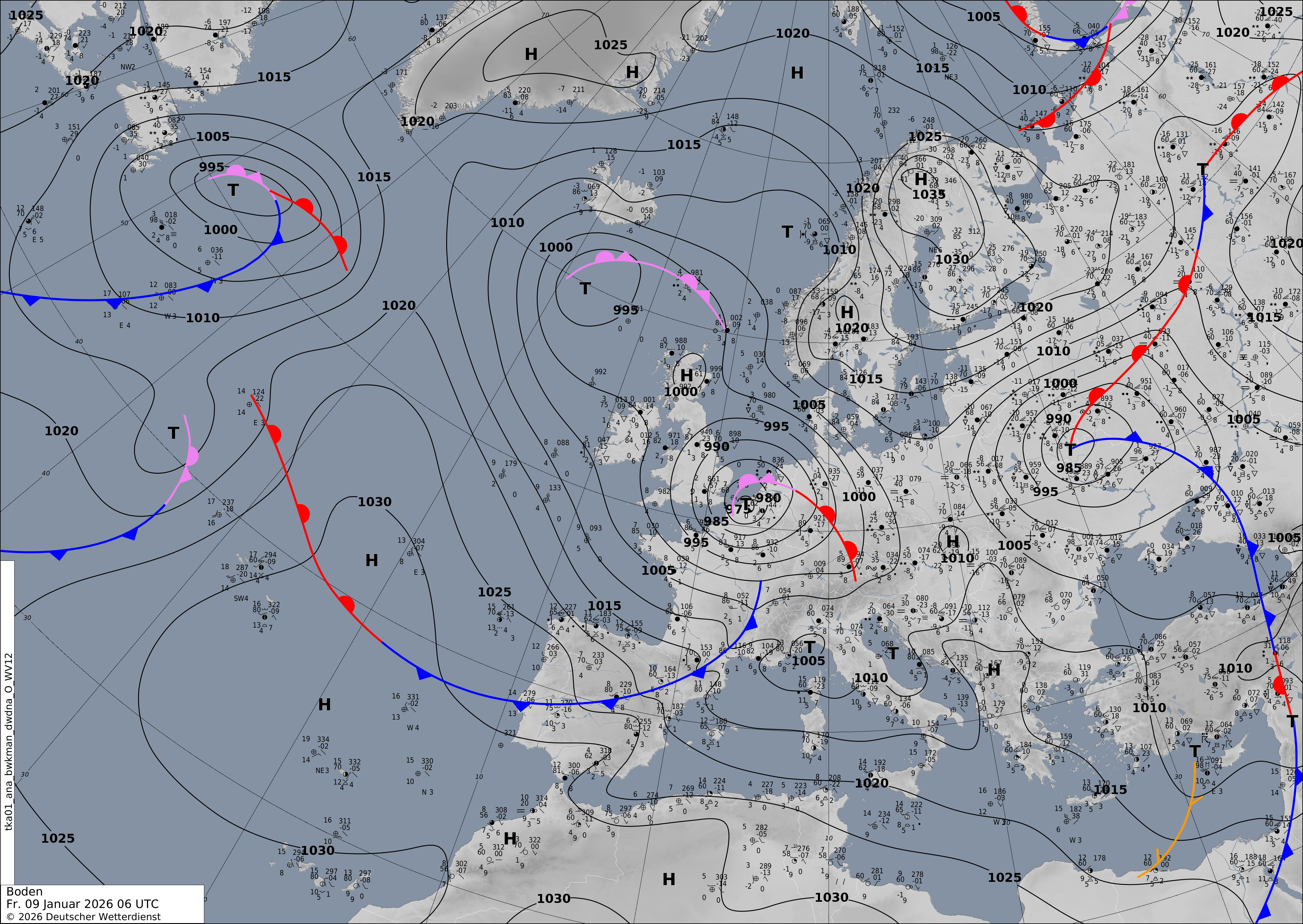
Sea-level pressure and analyzed fronts over Europe,
09.01 06 UTC
Source: DWD
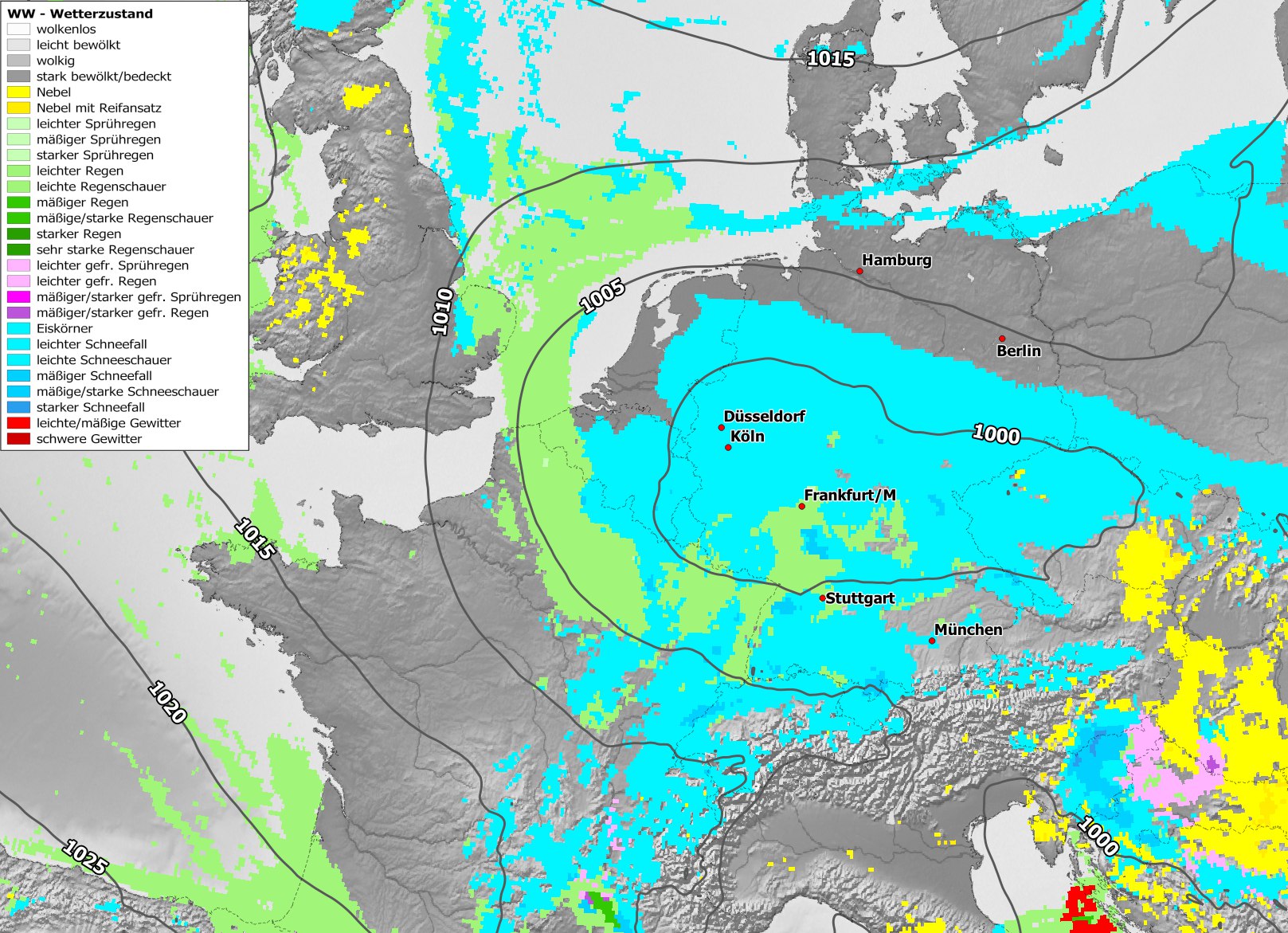
| Significant weather and sea-surface pressure
over Central Europe,
10.01 06 UTC
Source: DWD visualization: B. Mühr
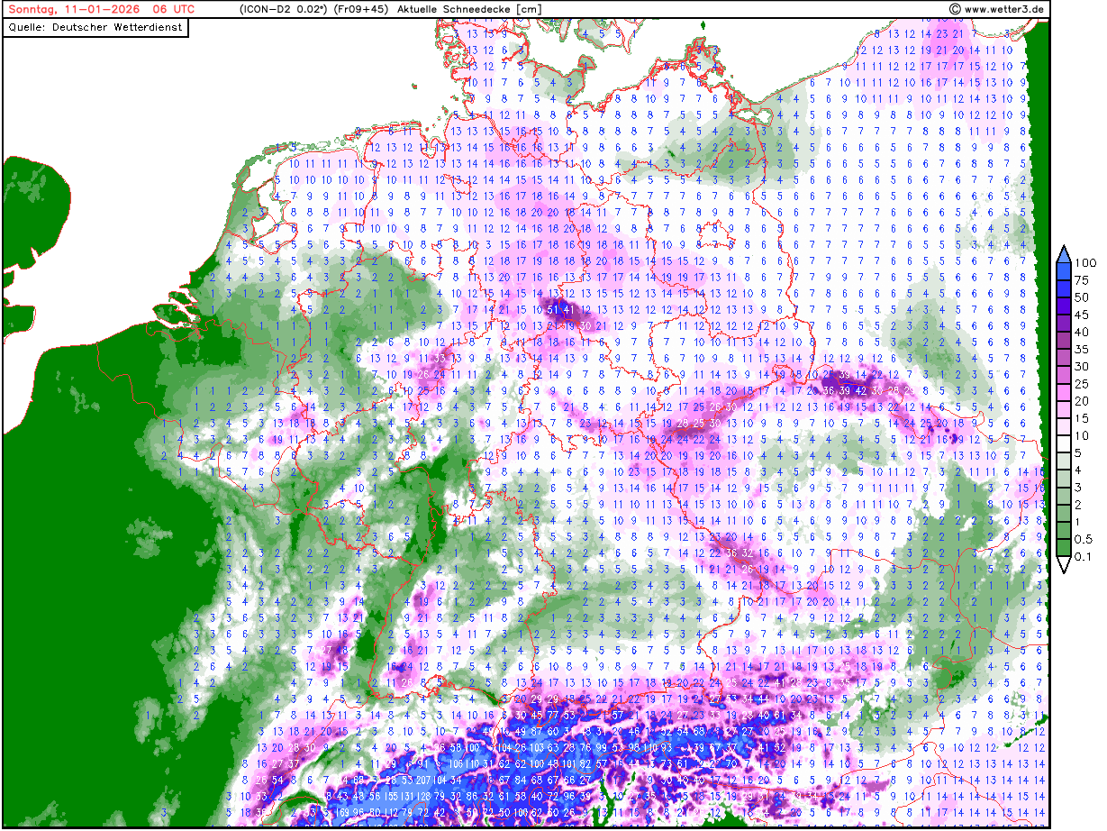
| Snow height over Germany,
11.01 06 UTC
Source: wetter3
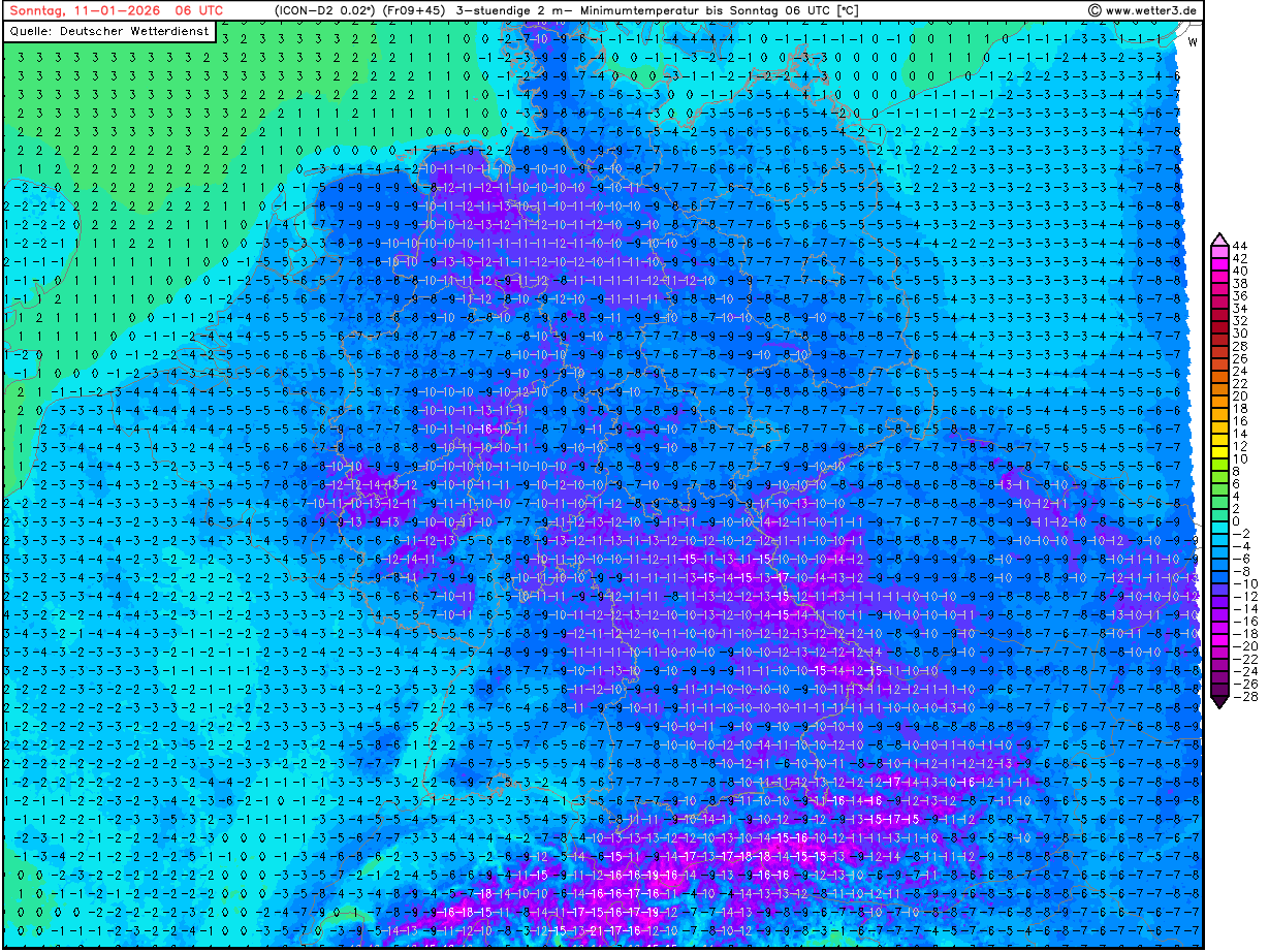
| 2 m minimum temperature over Germany,
11.01 06 UTC
Source: wetter3
|
Winter storm, heavy precipitation
Central Europe
Issued: Friday, January 09, 2026, 12:00 UTC
The powerful winter storm Elli is continuing to impact Central Europe. High winds and heavy snow are producing treacherous travelling conditions. Additional fresh snow accumulations of up to 10 cm are likely across Northern Germany. Intruding cold air masses will lead to significant fresh snow accumulations in Western Germany.
09.01.2026
Winter storm Elli has already had a significant impact on Northern France and the British Isles. Along the English Channel, extreme wind gusts were observed in Cornwall and Northern France. At Gatteville-le-Phare, a wind gust of 213 kph was observed in the night. Heavy snow is impacting Wales, the Midlands, and the Highlands. Currently, the center of Elli is located over the southern part of the Netherlands with a central pressure below 980 hPa. The warm front of Elli is stretching from Hamburg, Dresden, Prague, and Vienna. Along the warm front, heavy snow is expected to continue into the night. Fresh snow accumulations of 10 cm are likely. Strong easterly winds with gusts of more than 70 kph pose a significant threat for snow drifts. Treacherous travelling conditions will persist along the warm front of low Elli.
In the coming hours, a complex interaction of low Elli with a trough over Eastern Europe is anticipated. Subsequently, the forward motion of low Elli will stall over Western Germany, and the low will slowly drift southeastwards. Cold air masses can advance around the center of Elli. Subsequently, the snow line across Western Germany will drop. By early Saturday morning, January 10, 2026, the snow line will reach the lowest valleys in Western Germany. At elevations above 400 m, heavy snow is already starting to fall in the Eifel mountains. By Saturday evening, fresh snow accumulations of up to 20 cm in the Eifel, Westerwald, and Sauerland must be expected. In the Black Forest, persistent heavy snow showers give the potential for fresh snow accumulations of more than 50 cm by Sunday morning, January 11, 2026, at elevations above 800 m. With clear skies, frigid low temperatures below -10 °C are forecast over Central Germany on Sunday morning.
Wednesday, January 07, 2026, 17:00 UTC
|
|
|
|
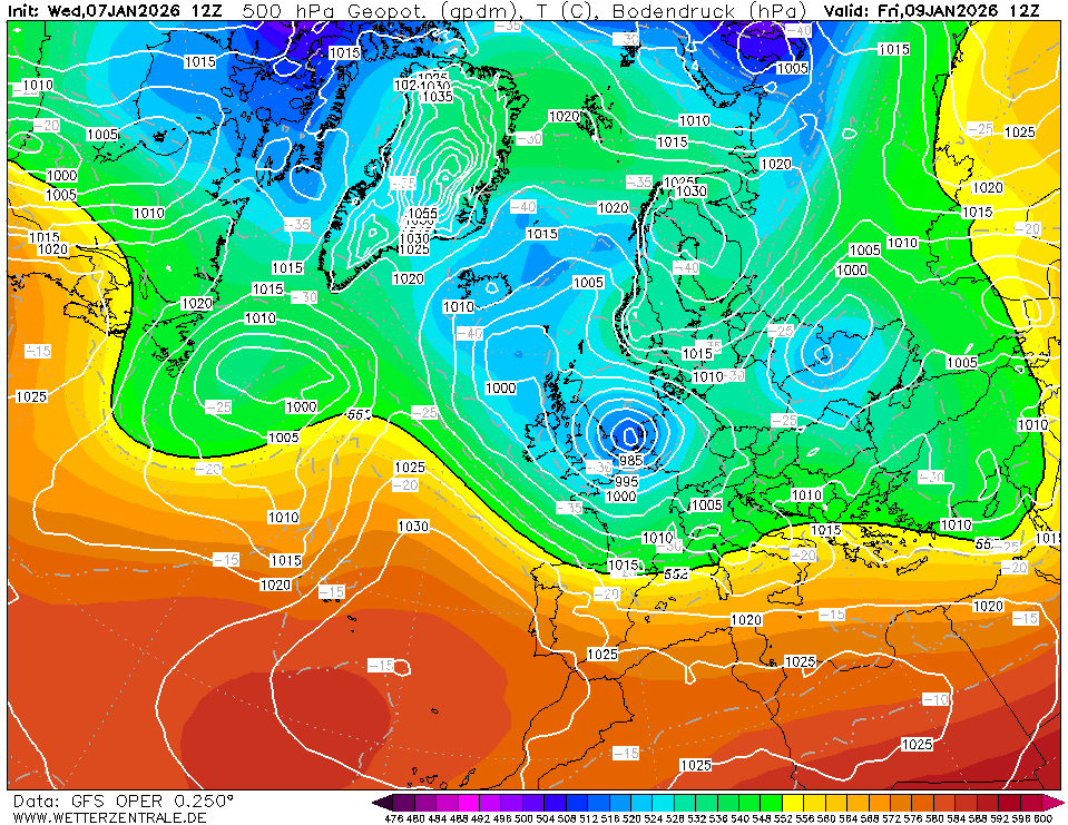
500 hPa geopotential and sea-surface pressure
over Europe,
07.01 12 UTC
Source: wetterzentrale
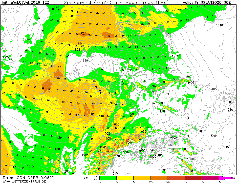
| 10 m wind gusts over Central Europe,
09.01 06 UTC
Source: wetterzentrale
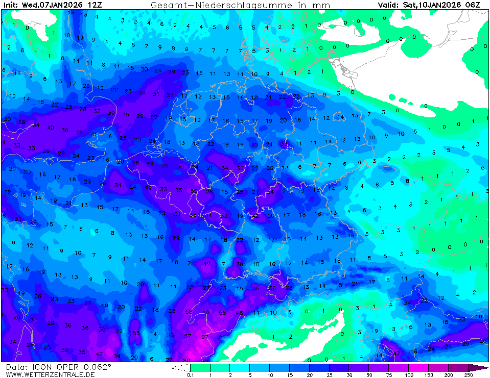
| Accumulated precipitation over Central Europe,
until 10.01 06 UTC
Source: wetterzentrale
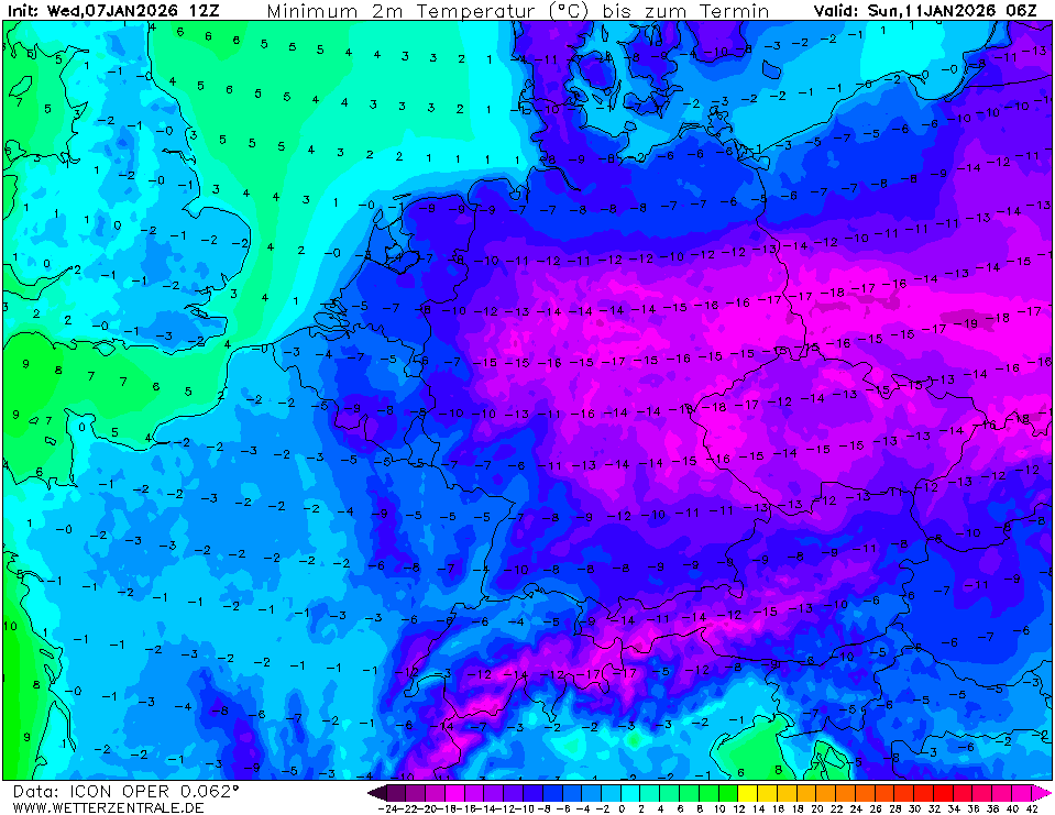
| 2 m minimum temperature over Central Europe,
11.01 06 UTC
Source: wetterzentrale
|
Winter storm, heavy precipitation
Central Europe
Issued: Wednesday, January 07, 2026, 17:00 UTC
A strong winter storm is expected to impact Central Europe on Friday, January 09, 2026, bringing high winds and heavy precipitation. Widespread wintry weather is forecast to cause major travel disruptions throughout Germany. Mixed precipitation is expected over Western Germany with wind gusts of up to 80 kph. Further northeast, heavy snow is predicted.
07.01.2026
The start of the weather year 2026 has been frigid in Central Europe. Strong negative temperature deviations dominate across the region. Over the North Atlantic, a surface low is forecast to develop and move eastwards towards Europe. Approaching the British Isles on Thursday, January 08, 2026, the warm front of said low-pressure system named Ellie is forecasted to reach Western Germany. With the warm front, milder air masses can advance eastwards across Central Europe. Initially, the precipitation will mostly fall as snow. With the advancing milder air masses, the precipitation over Western Germany will shift into rain in the night to Friday, January 09, 2026. Due to cold temperatures before the arrival of surface low Elli, freezing rain must be expected on frozen grounds.
In Southwestern Germany, temperatures may rise to 8 °C in the warm sector of low Elli early on Friday. On Friday, a complex interaction of low Elli with a trough over Eastern Europe is anticipated. As such, the forward motion of the surface low will stall, and the surface low will subsequently track slowly southeastwards. The attached warm front will also stall over Northern Germany. The further northeast, the likelier that all the precipitation related to low Ellie will accumulate as snow. Fresh snow accumulations of up to 10 cm are likely. High winds are expected to induce significant snow drifts due to prevalent snow cover.
The secondary phase of low Elli will feature rapidly decreasing temperatures over the central part of Germany. Here, the most dynamic weather of low Ellie is expected. Before noon on Friday, the snow line across the Eifel, Westerwald, and Sauerland mountains is forecasted to fall to 400 m. Heavy showers and high winds are expected to cause major travel disruptions. Until Saturday afternoon, January 10, 2026, fresh snow accumulations of more than 20 cm are possible. Wind gusts of more than 90 kph on Friday pose a significant risk for snow drifts. By Friday night, the snow line will drop to the valleys, and even at the lowest elevations, a snow cover may build. On Saturday evening, winds subside, and temperatures are predicted to drop rapidly. Low temperatures on Sunday morning, January 11, 2026, are very difficult to forecast but may likely reach below -10 °C. Temperatures below -15 °C cannot be excluded.
Sunday, January 11, 2026, 18:00 UTC
KG
Friday, January 09, 2026, 12:00 UTC
KG
Wednesday, January 07, 2026, 17:00 UTC
KG
|