Tuesday, October 21, 2025, 20:00 UTC
|
|

|
|
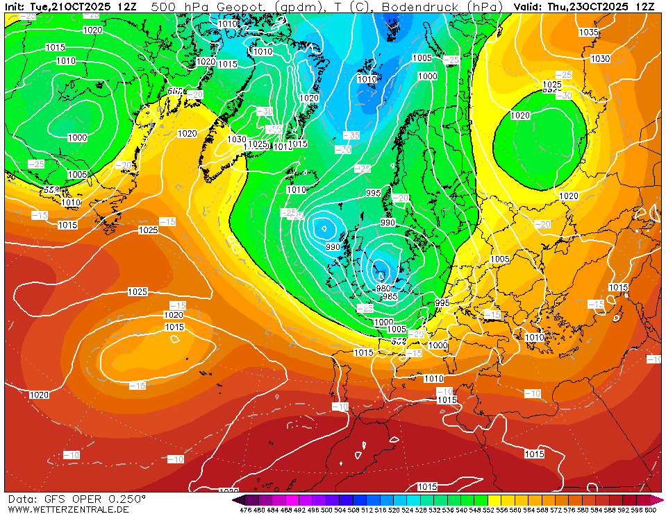
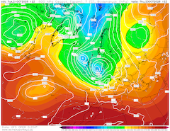
500 hPa geopotential and sea-surface pressure
over Europe,
23.10 12 UTC
Source: wetterzentrale
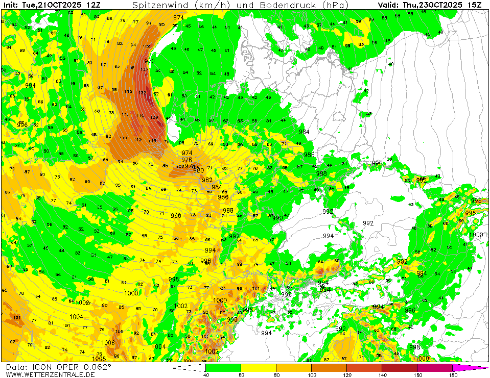
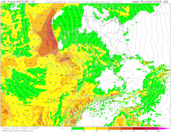
| 10 m wind gusts and sea-surface pressure
over Central Europe,
23.10 15 UTC
Source: wetterzentrale
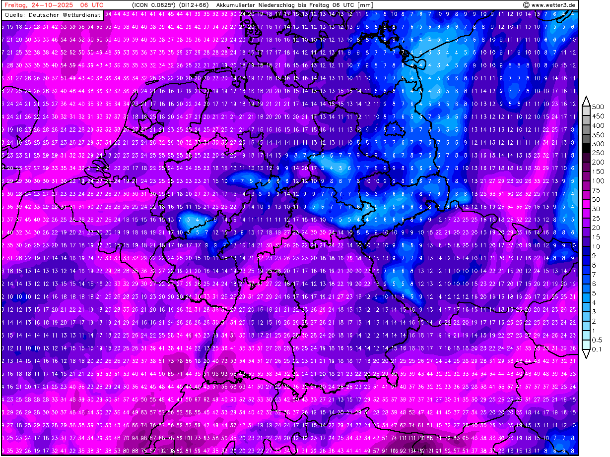
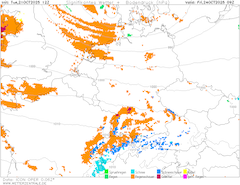
| Accumulated precipitation over Germany,
until 24.10 06 UTC
Source: wetter3
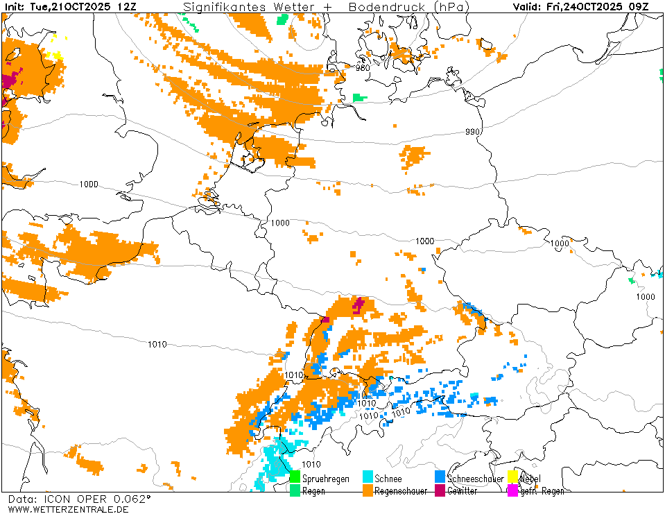
| Significant weather and sea-surface pressure
over Central Europe
24.10 09 UTC
Source: wetterzentrale
|
Wind storm
British Isles and Central Europe
Issued: Tuesday, October 21, 2025, 20:00 UTC
The first significant winter storm of the coming winter season 2025/26 is forecasted to impact the British Isles and Central Europe tomorrow, October 22, 2025, and Thursday, October 23, 2025. Widespread wind gusts of more than 80 kph are likely. Along the North Sea and exposed mountain ranges, gusts of more than 100 kph are expected.
21.10.2025
A strong central low has shifted over the North Sea in the past days. South of Iceland, a secondary low has developed and is quickly moving southeastwards along the outer boundary of the central low. Short-term forecasts indicate that the secondary low will move cyclonically around the central low. At the same time, the central low north of Scotland will also rotate cyclonically around Scotland. On Wednesday, October 22, 2025, the secondary low will reach the British Isles. In the afternoon and evening hours, the secondary low is expected to rapidly deepen. Until Thursday morning, October 23, 2025, the secondary low is anticipated to reach a central pressure below 975 hPa.
Behind the warm front of the secondary low, a widespread storm field will impact France and Germany. Gusts of more than 80 kph are likely. Current NWP output indicates that the secondary low likely develops into a Shapiro-Keyser cyclone. Characteristic of such cyclones is a displaced rather weak cold front. Indeed, it is expected that the cold front will reach Western Germany before midday. During the passage of the cold front, at times, heavy precipitation is likely. On the back side of the surface low, the warm jet of the low will wrap around the pressure center. In addition, a sharp pressure gradient will develop along the backside of the low. At the tip of the bent-back warm front, hurricane-force wind gusts are possible. Along the North Sea, wind gusts of more than 120 kph are possible. In the rare chance that a sting jet develops, inward locations of the Netherlands and Northern Germany may also experience wind gusts in excess of 120 kph.
The surface low will be accompanied by at times heavy precipitation. Along western-facing flanks of mountain ranges in Western Germany, precipitation totals of more than 50 mm are possible until Friday morning, October 24, 2025. Behind the low, cold air masses with 850 hPa temperatures below the freezing mark are anticipated to reach Germany. At elevations above 1000 m, the first snow is possible. In strong showers, snow flurries may reach as low as 800 m ASL.
Tuesday, October 21, 2025, 20:00 UTC
KG
|