Monday, September 08, 2025, 22:00 UTC
|
|
|
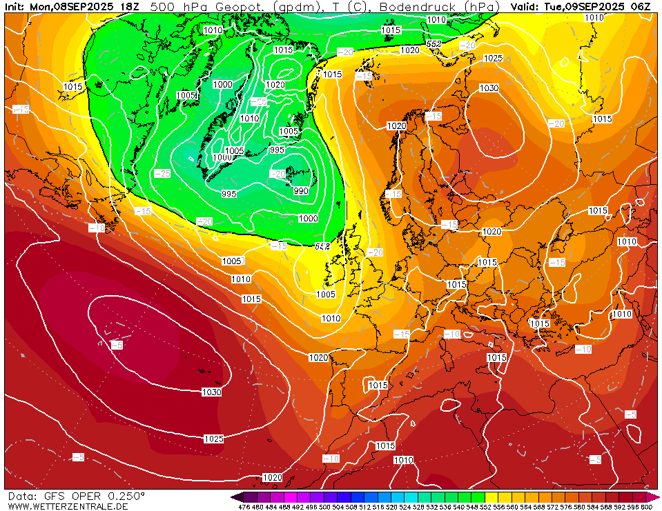
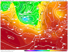
500 hPa geopotential and sea-surface pressure
over Europe,
09.09 06 UTC
Source: wetterzentrale
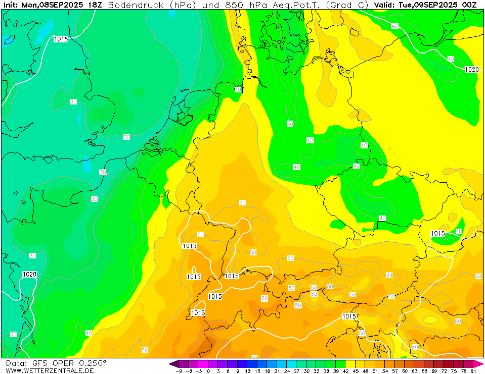
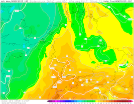
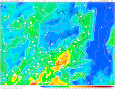
| 850 hPa pseudo-potential temperature
and sea-surface pressure over Central Europe,
09.09 00 UTC
Source: wetterzentrale
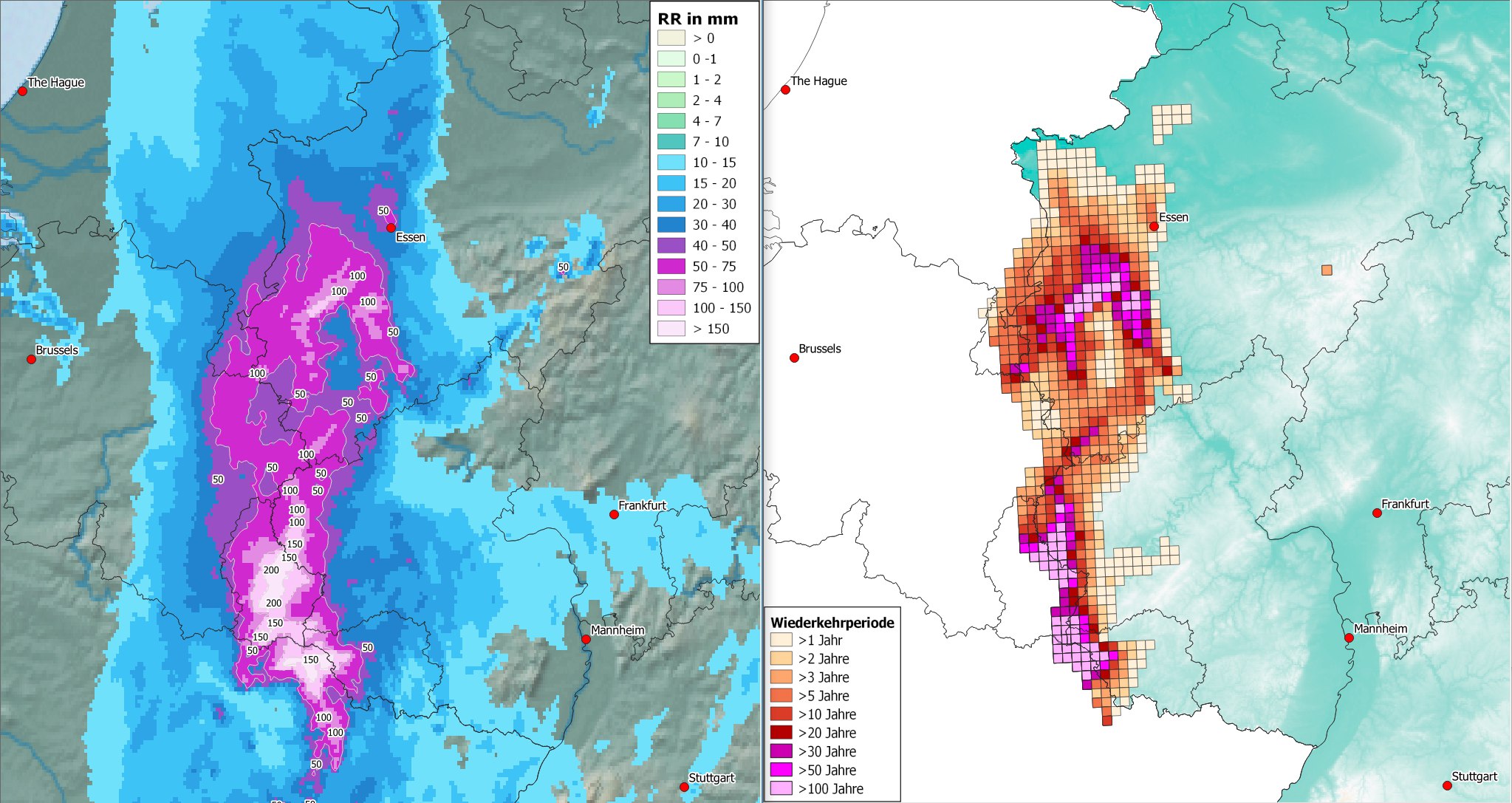
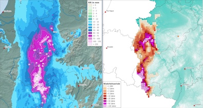
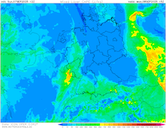
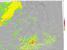
| 18 h precipitation totals (left) and occurrence frequency (right) over Central Europe
08.09 18 UTC
Source: DWD, visualization: B. Mühr
|
Heavy rains
Western Germany
Issued: Monday, September 08, 2025, 22:00 UTC
A frontal wave is forecasted to bring heavy to torrential rains to parts of Western Germany, adjacent Luxembourg, and the Ardennes Forest. In the night and on Tuesday, September 09, 2025, widespread precipitation totals of 30 to 70 mm are likely. Due to embedded thunderstorms, isolated precipitation hotspots of more than 100 mm/12 h can occur.
08.09.2025
Between a ridge across Eastern Europe and a trough over the British Isles, warm and very moist air masses are advected into Central Europe. In the coming hours, it is expected that a cold front related to the surface low over the British Isles will develop into a frontal wave. Along the frontal wave, mesoscale lift will produce heavy rains. Due to the overall slow propagation speed of the system, high precipitation totals are forecasted.
Within a 12 to 18 h period from now on, heavy rains will impact the Western border regions of Germany and its neighbors. At times, torrential rain, due to embedded thunderstorms, will lead to widespread precipitation totals of 30 to 70 mm. Isolated precipitation hotspots, mainly in Luxembourg, may reach more than 100 mm. Considering thunderstorms dumped already locally more than 50 mm of rain in the border area between Luxembourg, France, and Germany, precipitation maxima close to 150 mm cannot be excluded entirely. These torrential rains range locally up to an event with a 100-year occurrence frequency. At large, the occurrence frequency is around 10 to 20 years in the affected areas.
Due to dry soils and little precipitation in the past weeks over Western Germany, no severe river flooding is anticipated. Much in contrast to the catastrophic flooding in Western Germany in July 2021. Most minor rivers will crest between a 2 to 10-year flood. Depending on the exact precipitation totals, a 10-year flood can potentially occur.
Sunday, September 07, 2025, 16:00 UTC
|
|
|
|
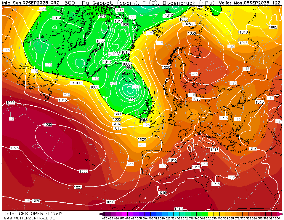
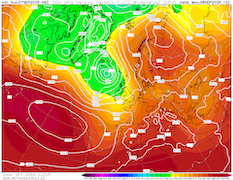
500 hPa geopotential and sea-surface pressure
over Europe,
08.09 12 UTC
Source: wetterzentrale
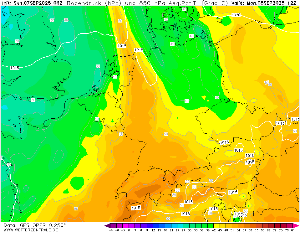
| 850 hPa pseudo-potential temperature
and sea-surface pressure over Central Europe,
08.09 12 UTC
Source: wetterzentrale
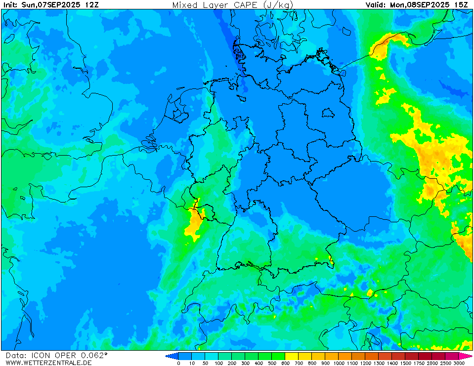
| Mixed-layer CAPE and Lifted Index
over Central Europe,
08.09 15 UTC
Source: wetterzentrale
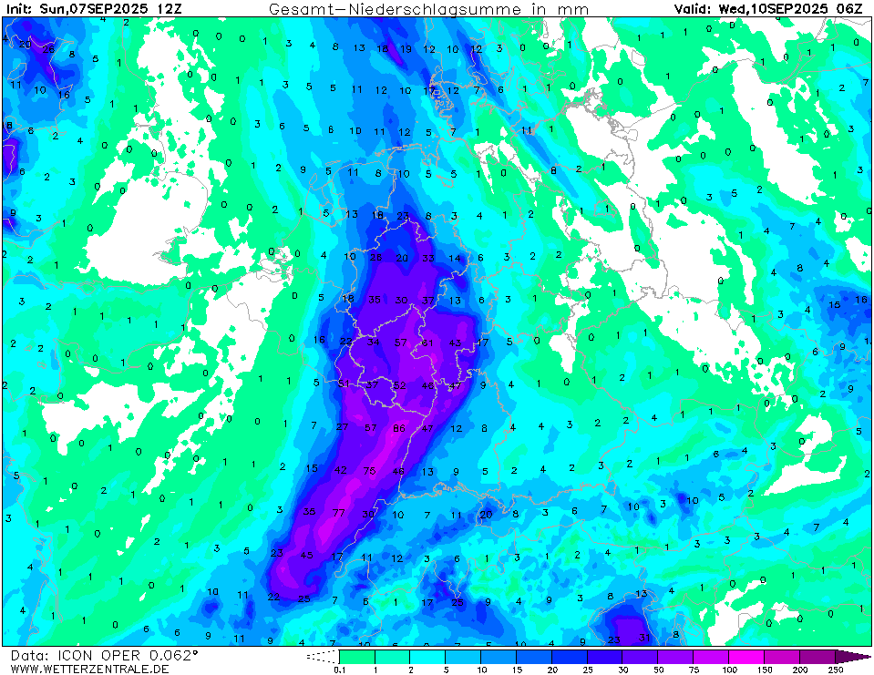
| Accumulated precipitation over Central Europe,
until 10.09 06 UTC
Source: wetterzentrale
|
Heavy rains
Western Germany
Issued: Sunday, September 07, 2025, 16:00 UTC
Along a frontal wave, heavy rains are forecasted to impact Western Germany on Monday, September 08, and Tuesday, September 09, 2025. Aided by embedded thunderstorms, precipitation totals of 30 to 50 mm must be expected. In isolated areas, 36 h precipitation totals of more than 75 mm cannot be excluded.
07.09.2025
The synoptic pattern across Europe is still dominated by a strong ridge over Eastern Europe and a large trough over the North Atlantic. Additionally, a minor cut-off low is located along the German-Polish border. Between these two major pressure systems, warm air masses are advected into Central Europe. The minor cut-off narrows the warm sector of the low-pressure system located north of the British Isles significantly. As the surface low moves eastwards across the British Isles, the warm sector is expected to narrow further on Monday.
Ahead of the approaching cold front, significant CAPE values are anticipated to build up. Over Western Germany, CAPE values will reach around 500 J/kg. In combination with the approaching cold front providing lift and narrowing the warm sector, the air mass in the warm sector is expected to grow unstable throughout Monday and into the night to Tuesday. Aided by high precipitable water values of more than 30 mm, heavy downpours are forecasted to develop on Monday.
In the night to Tuesday and on Tuesday itself, the cold front of the low-pressure system is expected to reach Western Germany. A frontal wave is forecasted to develop. The frontal wave can bring abundant precipitation to Western Germany. Widespread precipitation totals of 30 to 50 mm are possible. Due to the unstable air mass, embedded thunderstorms can form. These can lead to localized precipitation maxima of more than 75 mm. Due to the heavy rains, minor river flooding may develop along small rivers draining the hilly countryside of Western Germany.
It must be noted that due to the dynamic synoptic set-up, forecast uncertainty remains very high. Minor atmospheric changes may lead to significant changes in the forecast. Currently, the focal point of the precipitation event is forecasted in the state of Rhineland-Palatinate with a tendency towards the Eifel Mountains. Heavy rains can also occur in the adjacent regions of Luxembourg, the Ardennes Mountains, and Southern North Rhine-Westphalia.
Thursday, September 04, 2025, 09:00 UTC
|
|
|
|
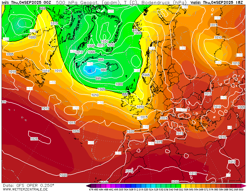
500 hPa geopotential and sea-surface pressure
over Europe,
04.09 18 UTC
Source: wetterzentrale
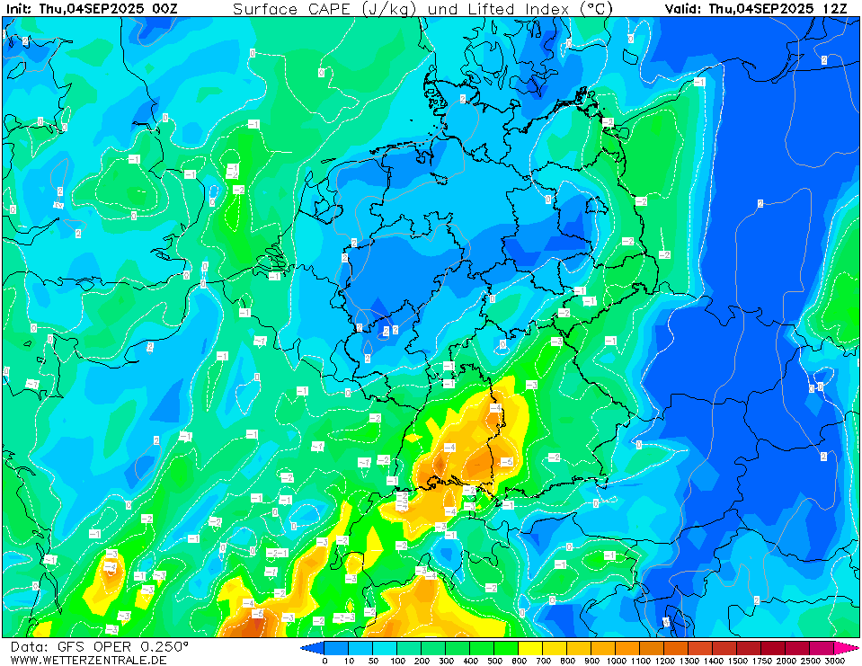
| Mixed-layer CAPE and Lifted Index
over Central Europe,
04.09 12 UTC
Source: wetterzentrale
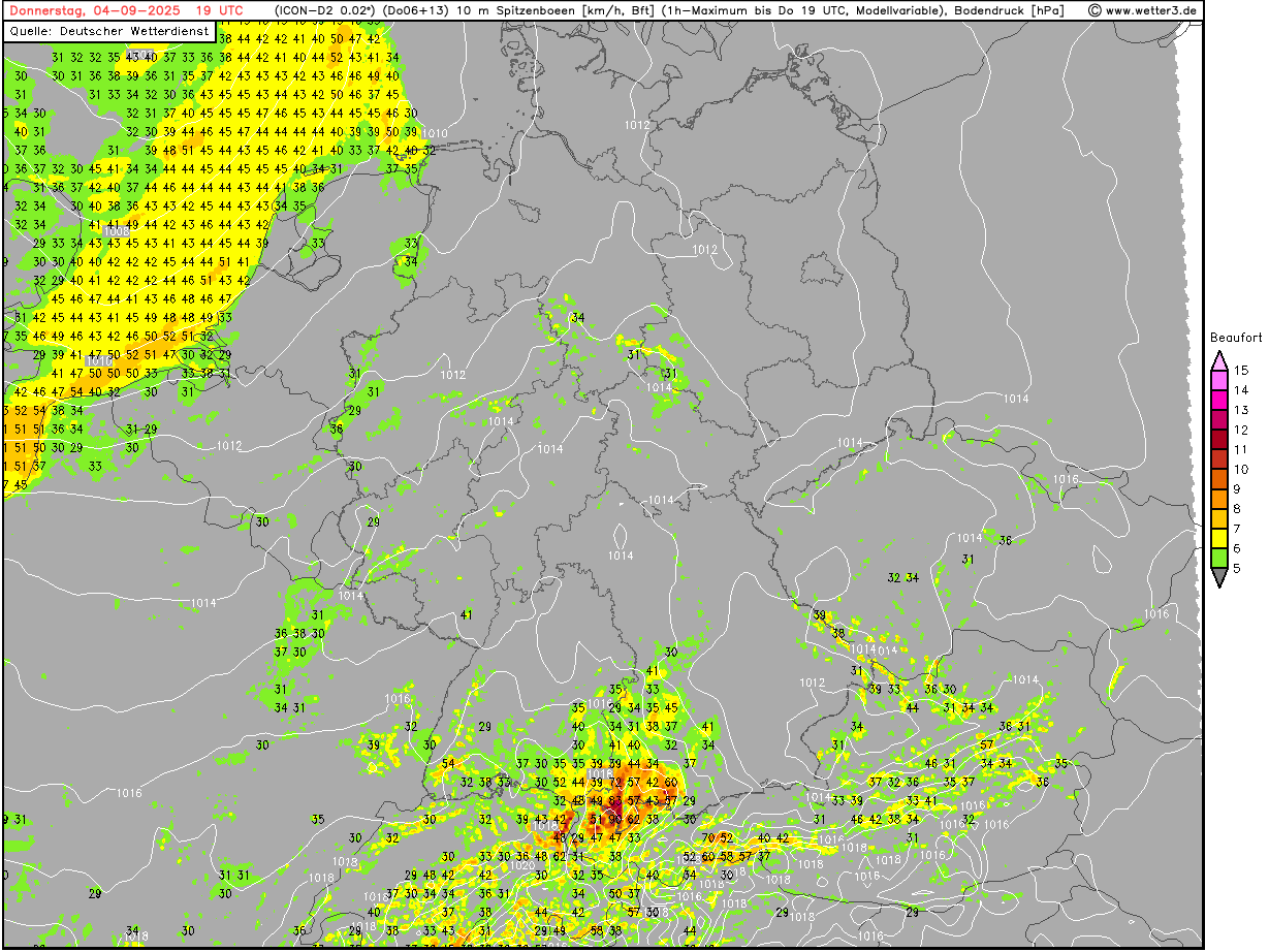
| 1 h peak 10 m wind gusts over Germany,
04.09 19 UTC
Source: wetter3
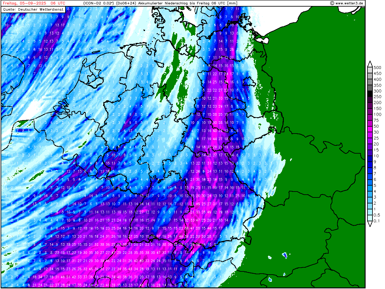
| Accumulated precipitation over Germany,
until 05.09 06 UTC
Source: wetter3
|
Severe thunderstorms
Southern Germany
Issued: Thursday, September 04, 2025, 09:00 UTC
A strong mesoscale convective system (MCS) is likely to develop over Southern Germany in the afternoon and evening hours of today, September 04, 2025. Strong convective downdrafts with wind gusts up to 100 kph and heavy downpours with 6 h precipitation totals of up to 50 mm must be expected.
04.09.2025
Central Europe is in the convergence zone between two major weather patterns battling for dominance over the European weather regime. Over Eastern Europe, a large ridge has expanded towards the Arctic. West of Europe, strong low-pressure systems reside over the Northern Atlantic. This general synoptic pattern leads to persistent southwesterly winds in Central Europe. With these, mild air masses reach Germany. While temperatures are running above average, the mild start to September is no comparison to the early-September heat wave of last year. Today, September 04, 2025, a trough is moving across the British Isles over to the North Sea. Ahead of the trough, warm air masses are reaching Southern Germany. 850 hPa temperatures will rise to more than 15 °C.
In this moist and warm air mass, the conditions for convective activity grow favorable as the day progresses. Along the Southern Black Forest and the Swabian Jura, mixed-layer CAPE values of more than 1000 J/kg will build up during the day. Convective activity is forecasted to be initialized along the Northern Alps and quickly shift northwards in the Southern Danube Plain. Here, the thunderstorms will likely find favorable conditions for intensification. By nightfall, a large MCS is predicted to form over Southern Bavaria. The MCS will move northeastwards during the first half of the night to Friday, September 05, 2025.
Along the leading edge of the MCS, strong convective downdrafts with wind gusts of up to 100 kph must be expected. Heavy downpours are likely. Hourly precipitation rates of up to 30 mm and 6 h precipitation of more than 50 mm may occur. An isolated threat of significant hail cannot be excluded.
Monday, September 08, 2025, 22:00 UTC
KG
Sunday, September 07, 2025, 16:00 UTC
KG
Thursday, September 04, 2025, 09:00 UTC
KG
|