Friday, August 15, 2025, 09:00 UTC
|
|

|
|
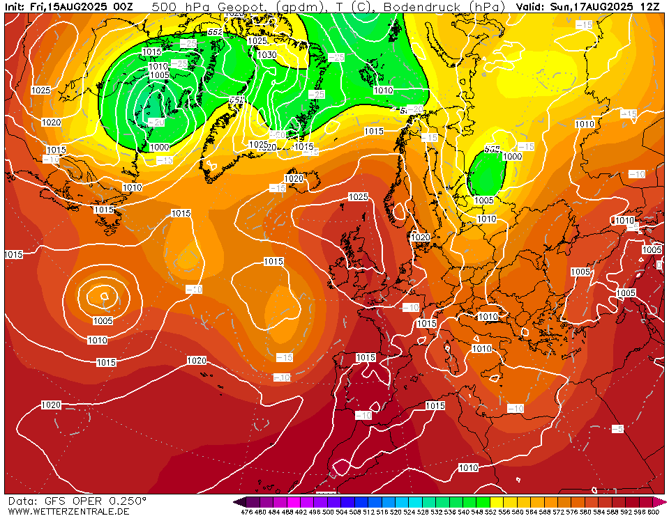
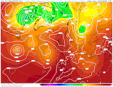
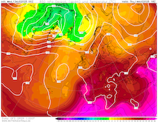
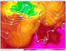
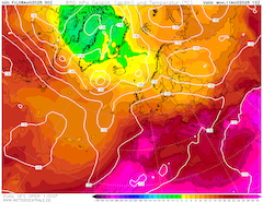
500 hPa geopotential and sea-surface pressure
over Europe,
17.08 12 UTC
Source: wetterzentrale
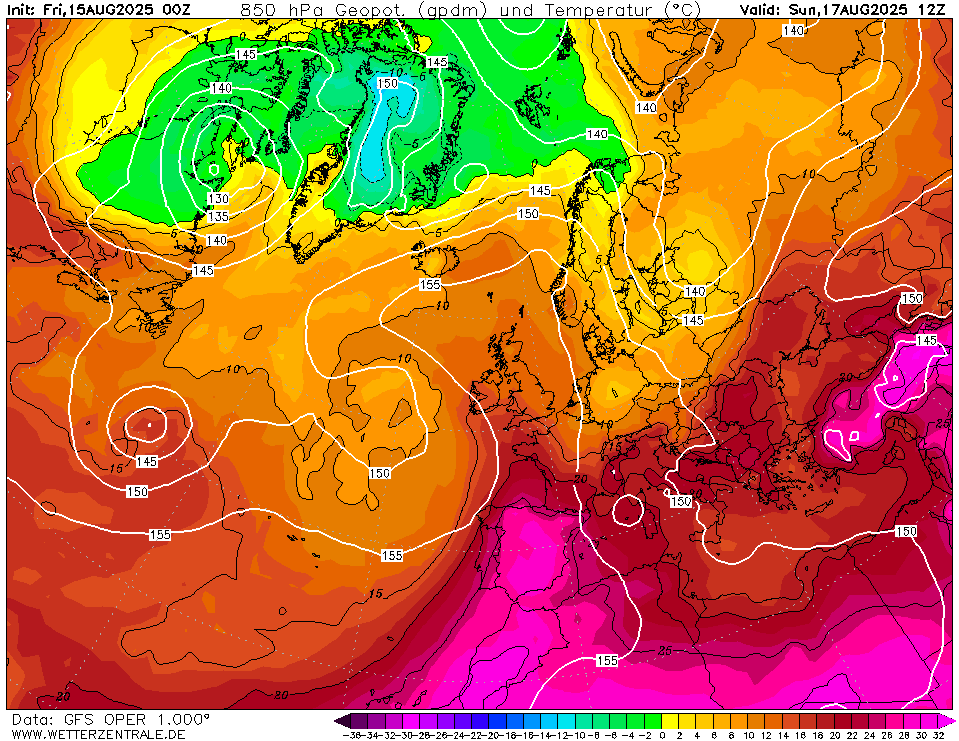
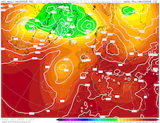
| 850 hPa temperature and geopotential
over Europe,
17.08 12 UTC
Source: wetterzentrale
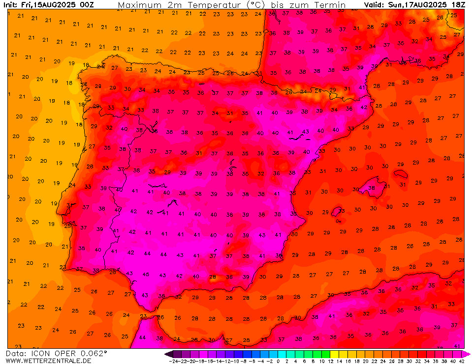
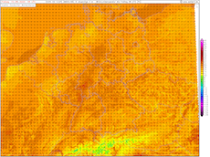
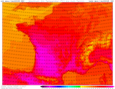
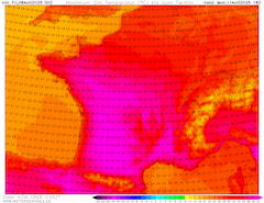
| 2 m maximum temperature over Spain,
17.08 18 UTC
Source: wetterzentrale
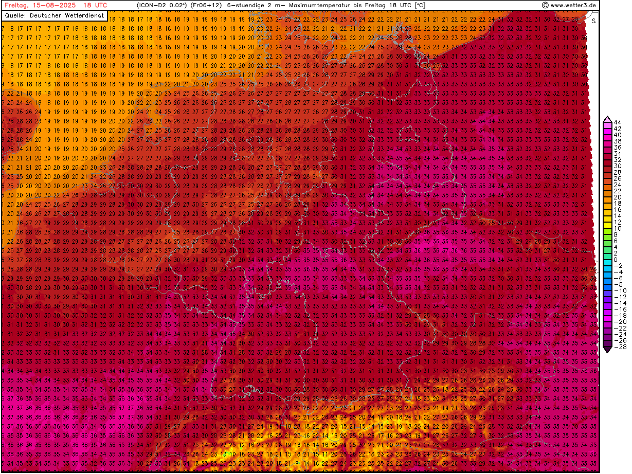
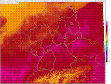
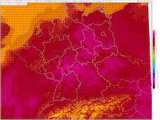
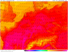
| 2 m maximum temperature over Germany,
15.08 18 UTC
Source: wetter3
|
Heat wave
Western and Central Europe
Issued: Friday, August 15, 2025, 09:00 UTC
A strenuous heat wave is continuing to impact Western and Central Europe. Temperatures are expected to rise to more than 40 °C across the Iberian Peninsula and Southern France from today, August 15, 2025, through to Sunday, August 17, 2025. Locally up to 44 °C are possible in Southern Spain. In Central Europe, temperatures can reach up to 35 °C today.
15.08.2025
Between a trough over the Eastern Atlantic and a cut-off low located over the Eastern Mediterranean, a large ridge has expanded across Europe. With this ridge, hot air masses have reached Europe. Over the weekend, a trough over Scandinavia will quickly plunge southwards across Eastern Europe. Concurrently, the ridge will expand far northwards across the British Isles. In this highly meridional flow pattern, much cooler air masses are expected to reach Central Europe. 850 hPa temperatures are expected to drop from 20 °C to below the 10 °C mark. Over Western Europe, the trough located over the Eastern Atlantic brings hot air masses from Northern Africa to the Iberian Peninsula. 850 hPa temperatures are expected to reach more than 25 °C. In the coming week, the ridge is forecasted to move retrogradely over the Eastern Atlantic. This allows cooler air masses to penetrate westwards.
From today to Sunday, severe heat is forecast to impact much of Western Europe. Across the Iberian Peninsula and Southern France, temperatures will climb to more than 40 °C. Localized temperature readings of up to 44 °C may occur in parts of Southern Spain. In Central Europe, the past night has been sweltering in many areas with temperatures remaining close or above the 20 °C mark. Today, temperatures are again likely to reach up to 35 °C in parts of Southern Germany. Maximum temperatures are likely to remain below the readings of the past two days.
This is related to an increasing convective activity over Southern Germany and the Alps. Localized thunderstorms can produce heavy downpours and hail. Additionally, severe convective downdrafts may occur. On Saturday, August 16, 2025, convective activity will be even more confined in the vicinity of the Alps. Due to the colder air masses reaching Central Europe, temperatures over the weekend are expected to drop sharply. From Saturday through to Monday, August 18, 2025, temperatures will remain below the 30 °C mark. There is a chance that next week on Tuesday, August 19, 2025, and Wednesday, August 20, 2025, temperatures may once again surpass the 30 °C mark in Southern Germany.
The medium-range forecast hints at much cooler conditions in Europe from August 20, 2025, onwards. Though there is significant forecast uncertainty related to Tropical Storm ERIN. Current forecast guidance suggests that the extratropical transition of Tropical Storm ERIN is expected to occur between August 20 and August 22, 2025. Significant downstream impacts on the weather pattern across Europe are possible.
Wednesday, August 13, 2025, 09:00 UTC
|
|
|
|
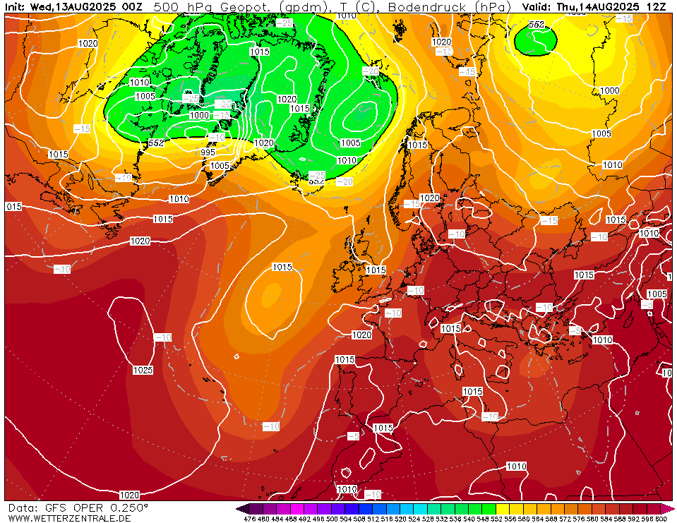
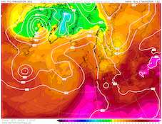
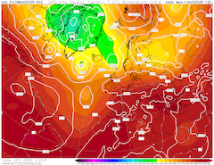
500 hPa geopotential and sea-surface pressure
over Europe,
14.08 12 UTC
Source: wetterzentrale
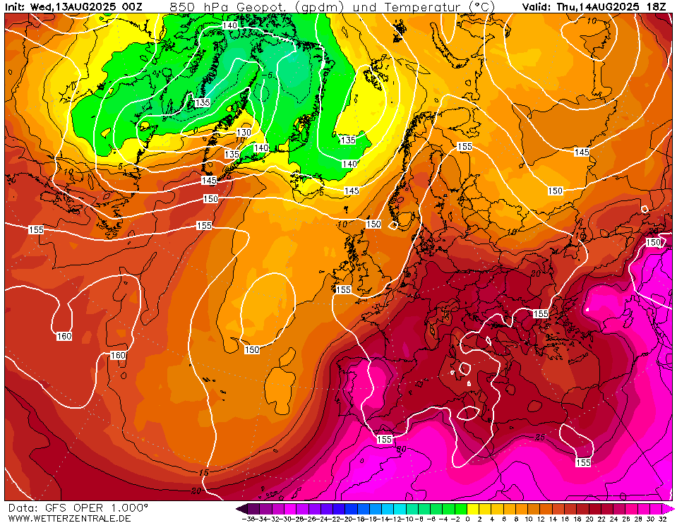
| 850 hPa temperature and geopotential
over Europe,
14.08 18 UTC
Source: wetterzentrale
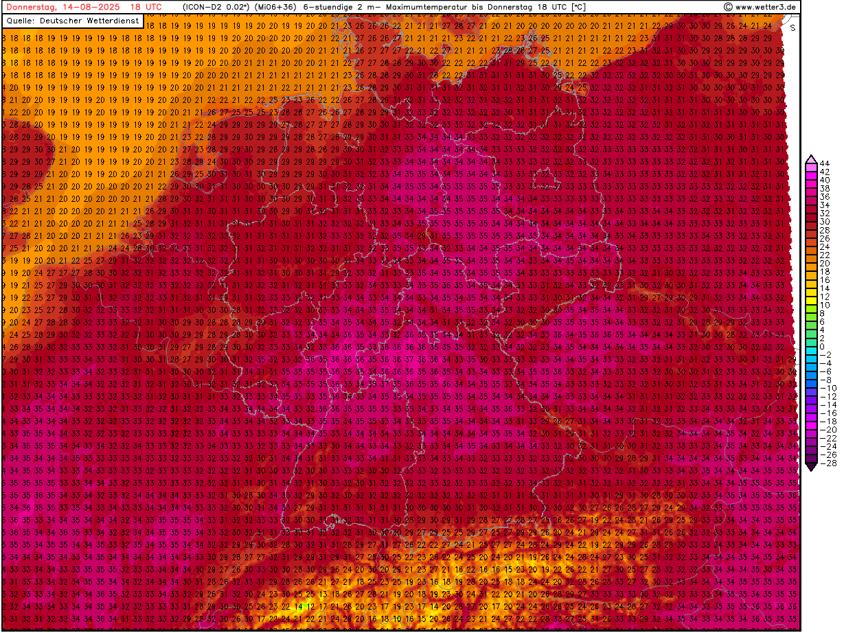
| 2 m maximum temperature over Germany,
14.08 18 UTC
Source: wetter3
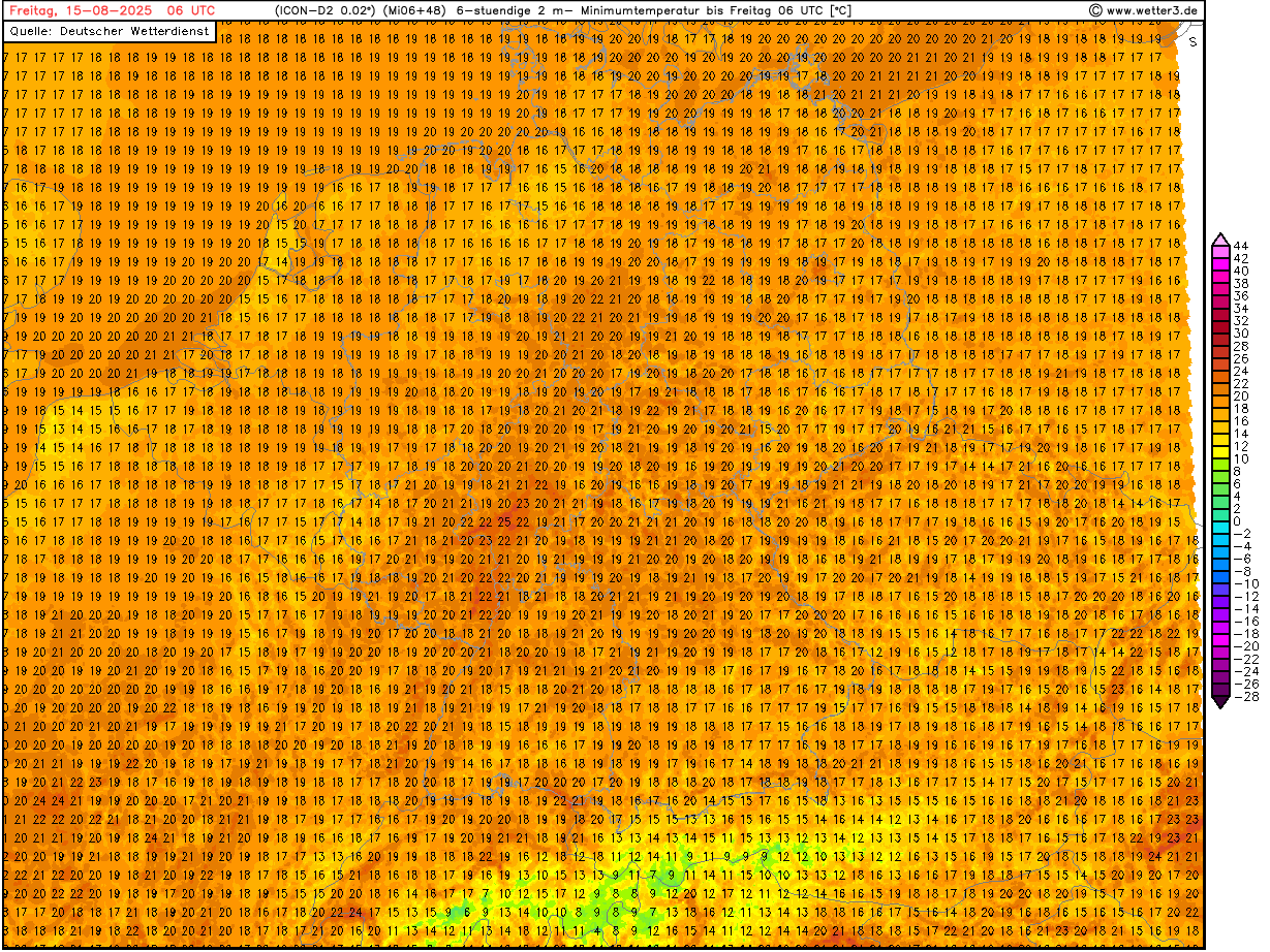
| 2 m minimum temperature over Germany,
15.08 06 UTC
Source: wetter3
|
Heat wave
Western and Central Europe
Issued: Wednesday, August 13, 2025, 09:00 UTC
A pronounced heat wave is impacting Western and Central Europe. Temperatures across Southern Europe will reach up to 43 °C in the coming days. From today, August 13, 2025, to Friday, August 15, 2025, the highest temperatures of the current heat wave are predicted to impact Central Europe. Temperatures are likely to rise to 37 °C along the Rhine River.
13.08.2025
A large ridge is responsible for the current heat wave impacting large parts of Europe. The ridge is located between two cut-off lows, located over the Eastern North Atlantic and the Central Mediterranean. With this synoptic set-up, hot air masses with 850 hPa temperatures of more than 20 °C can reach Central Europe. By Saturday, August 16, 2025, it is expected that the large-scale flow pattern will turn even more meridionally with a strong trough over Western Russia plunging southwards. As a result, the ridge over Western Europe will expand far northwards across the British Isles. This will likely lead to another swell of very warm air masses impacting Western Europe.
Yesterday, August 12, 2025, the peak of the current heat wave was observed in Western Europe. In Spain, temperatures reached 45.5 °C. In Southern France, the highest recorded temperature was 42.9 °C. The center of the heat wave will shift eastwards in the coming days. Today, temperatures in Central France can peak at 41 °C. Further east, temperatures in Central Europe will rise to more than 35 °C from today to Friday. Along the Rhine River, maximum temperatures of up to 37 °C are possible. It has to be noted that there is an unusually large forecast spread between the different high-resolution NWP models over Central Europe with regard to the maximum temperatures in the coming 48 h. Nevertheless, heat stress levels are far elevated. Additionally, high overnight low temperatures will further bolster heat stress levels. In many metropolitan areas of Western Germany, the nighttime low temperatures will likely not drop below 20 °C from today through to Friday. Isolated areas may experience overnight low temperatures as high as 24 °C in the night from Thursday to Friday due to an expected increase in cloud coverage.
On Thursday and Friday, a shallow trough will pass the western half of Germany. This trough may provide enough mid-level lift for convection to be initiated over Germany. Though isolated, the affected areas may experience torrential downpours. Over the weekend (August 16 and 17, 2025), temperatures over Central Europe are predicted to drop due to the trough over Western Russia. With this trough cooler air masses will likely reach most of Central Europe resulting in maximum temperatures remaining below the 30 °C mark in most areas. In Southern Europe, temperatures across the Iberian Peninsula may once again reach 43 °C. Early next week, temperatures in Central Europe are expected to rise again.
The medium-range forecast shows above-average temperatures in Europe to last until at least August 20, 2025. Past that date, there is substantial forecast uncertainty due to the expected extratropical transition of tropical storm ERIN in that time frame.
Monday, August 11, 2025, 11:00 UTC
|
|
|
|
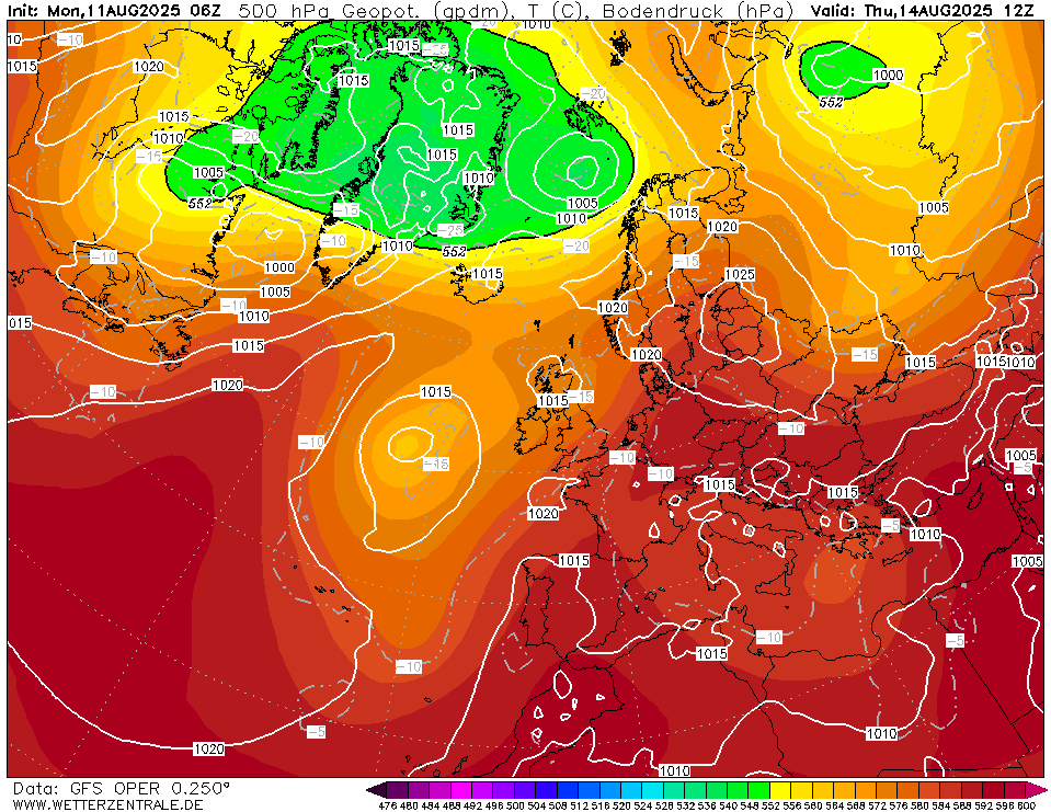
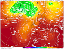
500 hPa geopotential and sea-surface pressure
over Europe,
14.08 12 UTC
Source: wetterzentrale
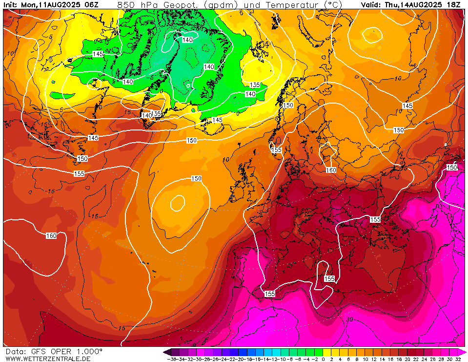
| 850 hPa temperature and geopotential
over Europe,
14.08 18 UTC
Source: wetterzentrale
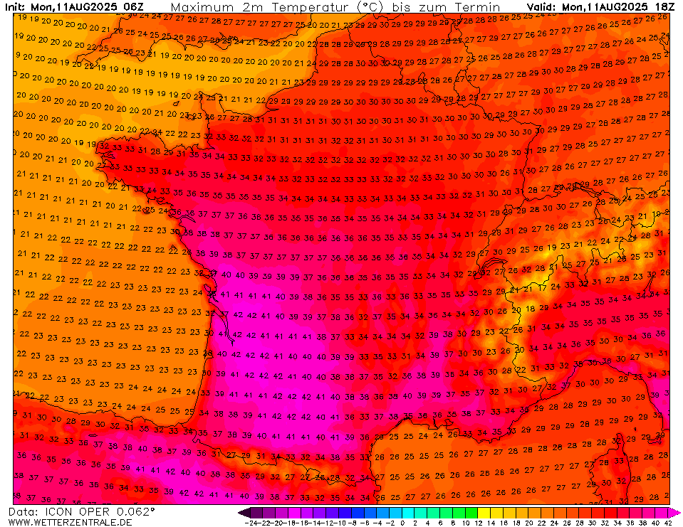
| 2 m maximum temperature over France,
11.08 18 UTC
Source: wetterzentrale
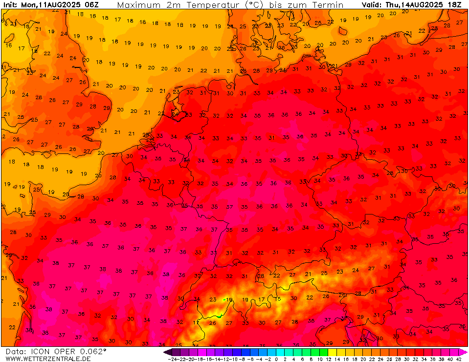
| 2 m maximum temperature over Central Europe,
14.08 18 UTC
Source: wetterzentrale
|
Heat wave
Western and Central Europe
Issued: Monday, August 11, 2025, 11:00 UTC
A powerful heat wave is continuing to impact large parts of Europe. Over the Iberian Peninsula and in Southern France, maximum temperatures are forecasted to reach up to 43 °C today, August 11, 2025, and Tuesday, August 12, 2025. Over Central Europe, temperatures are expected to climb above 35 °C from Wednesday, August 13, 2025, to Friday, August 15, 2025.
11.08.2025
A large ridge has expanded across Europe. With this ridge, hot air masses can advance across Europe. The advection of these air masses is exacerbated by an upper-level cut-off located over the Central Mediterranean. This synoptic set-up favors very warm air masses to reach much of Europe. 850 hPa temperatures of more than 25 °C are forecasted to spread across Western Europe. By Tuesday, a trough off the coast of the Iberian Peninsula allows these hot air masses to reach Central Europe. By the latter half of this week, a strong trough east of Scandinavia will plunge southwards across Western Russia. Likely, the ridge across Europe will expand northwards across Western Europe. This may result in cooler air masses reaching Central Europe by the weekend.
In Southern Europe, temperatures are forecasted to reach more than 40 °C for this week. Currently, the highest temperatures will likely be observed today and Tuesday. Across the Iberian Peninsula and Southern France, maximum temperatures of up to 43 °C are possible in favorable locations. By Wednesday, strenuous heat will also shift into Central Europe. Maximum temperatures of more than 35 °C are forecasted for Germany from Wednesday to Friday. Along the Rhine River, temperatures can reach 37 °C in this period. High overnight low temperatures in metropolitan areas will increase heat stress levels. By Saturday, August 16, 2025, the ensemble forecasts hint at cooler temperatures. Though the forecast past Thursday, August 14, 2025, remains highly uncertain.
In Southern Europe, maximum temperatures of up to or more than 40 °C are forecasted from today to next Friday, August 15, 2025. Especially across the Iberian Peninsula and in Southern France, temperatures may reach up to 43 °C. The highest temperatures will likely occur between Monday and Wednesday, August 13, 2025. In Central Europe, temperatures are expected to reach more than 30 °C in parts of Western Germany. Along the Upper Rhine, temperatures may reach 33 °C on Saturday, August 09, 2025. Sunday, August 10, 2025, and Monday, temperatures will likely remain slightly lower due to a weak cold front moving across Central Europe. From Tuesday to Thursday, August 14, 2025, more strenuous heat is expected across Central Europe. Once again, the highest temperatures are likely to occur along the Upper Rhine. Forecasted highs range around 35 °C in these areas. Additionally, high overnight low temperatures of around 20 °C in metropolitan areas will elevate heat stress levels further. By next Friday, ensemble forecasts trend to cooler temperatures in Central Europe.
There is an increasing likelihood that the present heat wave will extend past the coming weekend (August 16 to August 17, 2025). A key bottleneck for predictability in the medium-range forecast will be the development of Invest 97L, which will likely develop into a tropical cyclone later this week.
Friday, August 08, 2025, 07:00 UTC
|
|
|
|
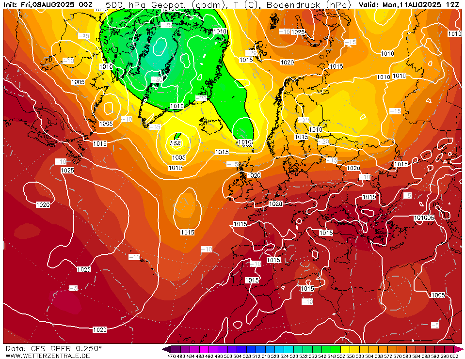
500 hPa geopotential and sea-surface pressure
over Europe,
11.08 12 UTC
Source: wetterzentrale
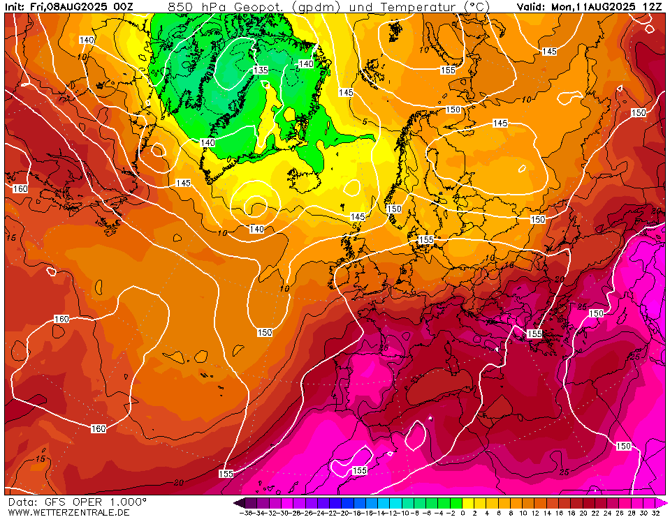
| 850 hPa temperature and geopotential
over Europe,
11.08 12 UTC
Source: wetterzentrale
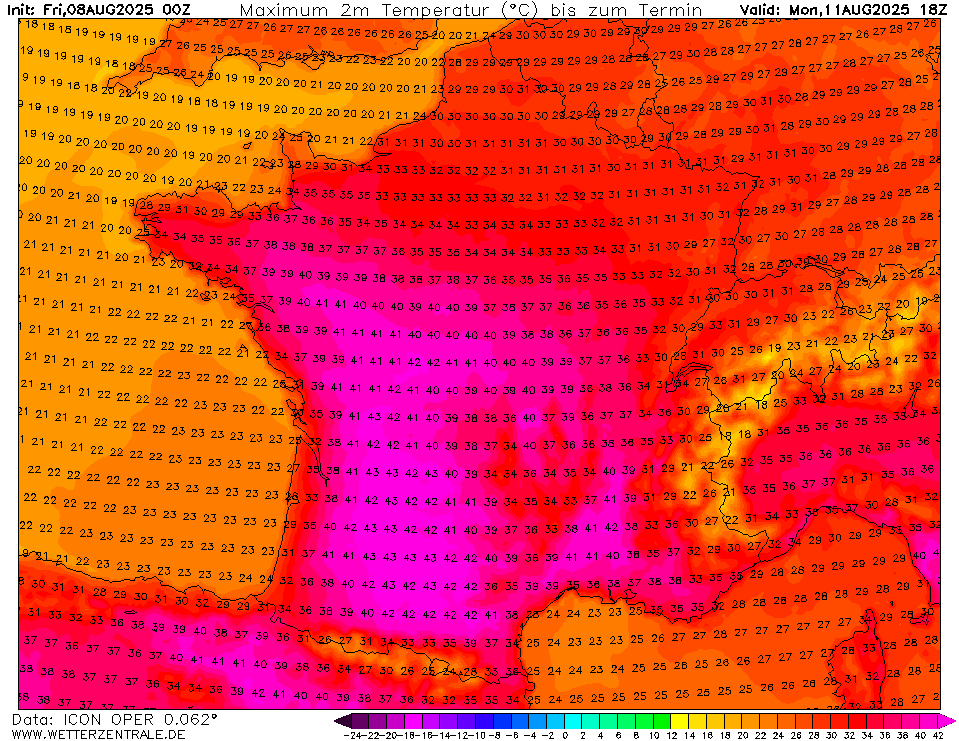
| 2 m maximum temperature over France,
11.08 18 UTC
Source: wetterzentrale
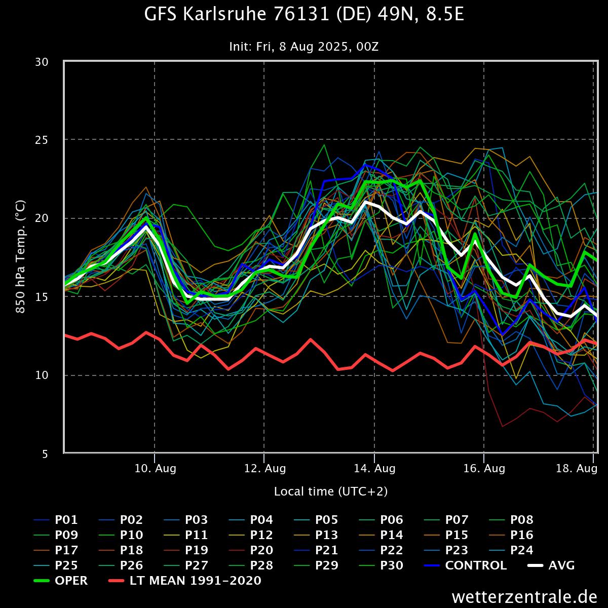
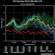
| 850 hPa temperature ensemble for
Karlsruhe, BW
until 18.08 00 UTC
Source: wetterzentrale
|
Heat wave
Western and Central Europe
Issued: Friday, August 08, 2025, 07:00 UTC
A prolonged heat wave is expected to affect large parts of Continental Europe for at least the next 7 days. Temperatures in Southern Europe are forecasted to reach more than 40 °C. In Central Europe, temperatures may reach up to 35 °C in the coming week.
08.08.2025
Albeit the powerful heat wave at the beginning of July, most of the month had been dominated by troughs over the British Isles or the North Sea. As a result, little to no heat has been recorded in Central Europe for the past weeks. A complete contrast to the regions in far-northern Europe, where the warm air masses circled the troughs over the North Sea. This led to a prolonged heat wave by subarctic standards. Over the past few days, the synoptic set-up over Europe has become more zonally aligned.
As the dominating trough over the North Sea has disappeared, a strong ridge is forecasted to extend from Northern Africa into Western and Central Europe. With this ridge, hot air masses will reach Western and Central Europe in the coming days. Starting today, August 08, 2025, 850 hPa temperature over the Iberian Peninsula and Southern France will reach more than 25 °C. By Monday, August 11, 2025, the advection of hot air masses will be exacerbated by a trough related to ex-tropical cyclone DEXTER over the Northern Atlantic. As a result, a second swell of very warm air masses will reach Western and Central Europe by Tuesday, August 12, 2025. Presently, it is expected that with this swell of subtropical air masses the 850 hPa temperatures in Central Europe will also reach more than 20 °C.
In Southern Europe, maximum temperatures of up to or more than 40 °C are forecasted from today to next Friday, August 15, 2025. Especially across the Iberian Peninsula and in Southern France, temperatures may reach up to 43 °C. The highest temperatures will likely occur between Monday and Wednesday, August 13, 2025. In Central Europe, temperatures are expected to reach more than 30 °C in parts of Western Germany. Along the Upper Rhine, temperatures may reach 33 °C on Saturday, August 09, 2025. Sunday, August 10, 2025, and Monday, temperatures will likely remain slightly lower due to a weak cold front moving across Central Europe. From Tuesday to Thursday, August 14, 2025, more strenuous heat is expected across Central Europe. Once again, the highest temperatures are likely to occur along the Upper Rhine. Forecasted highs range around 35 °C in these areas. Additionally, high overnight low temperatures of around 20 °C in metropolitan areas will elevate heat stress levels further. By next Friday, ensemble forecasts trend to cooler temperatures in Central Europe.
It has to be noted that due to the extratropical transition of ex-tropical cyclone DEXTER, forecast uncertainty across Europe is elevated. Additionally, an early northerly course and potential development of Invest 96L may induce increased forecast uncertainty in the medium range.
Friday, August 15, 2025, 09:00 UTC
KG
Wednesday, August 13, 2025, 09:00 UTC
KG
Monday, August 11, 2025, 11:00 UTC
KG
Friday, August 08, 2025, 07:00 UTC
KG
|