Friday, June 28, 2024, 08:30 UTC
|
|
|
|
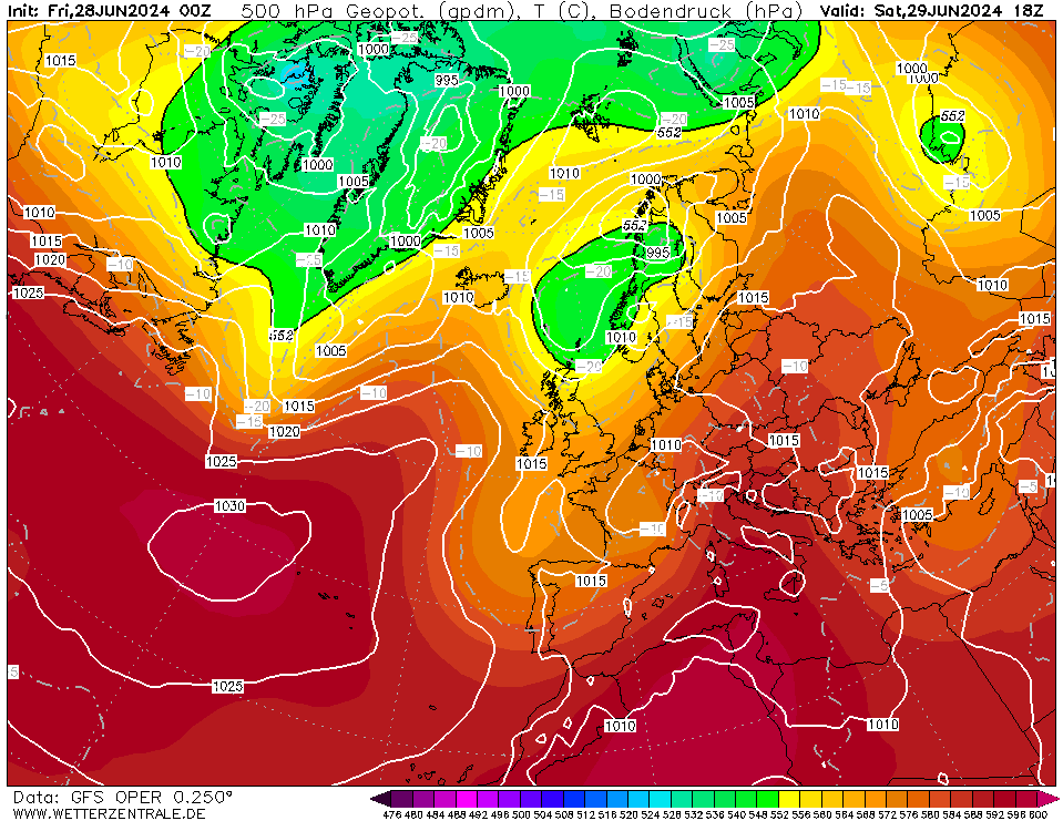
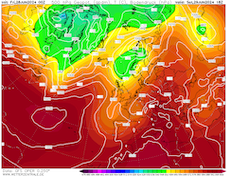
500 geopotential and mean sea-surface pressure
over Europe,
29.06 18 UTC
Source: wetterzentrale
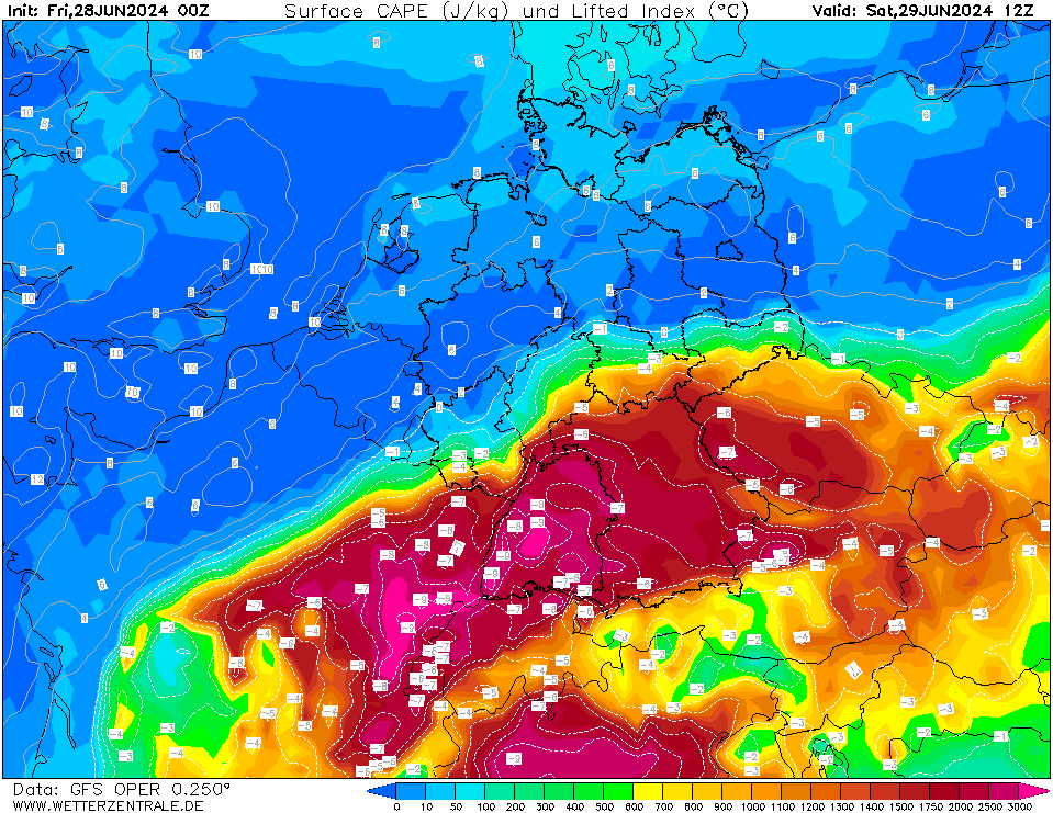
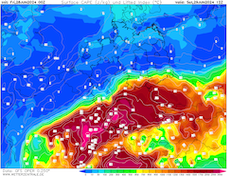
| Surface-layer CAPE and lifted index
over Central Europe,
29.06 12 UTC
Source: wetterzentrale
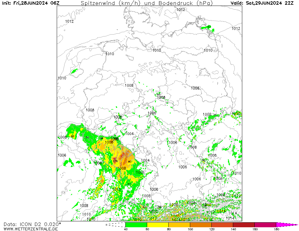
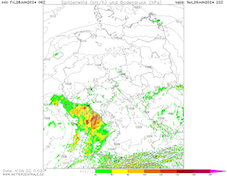
| 10 m peak wind gusts over Central Europe,
29.06 22 UTC
Source: wetterzentrale
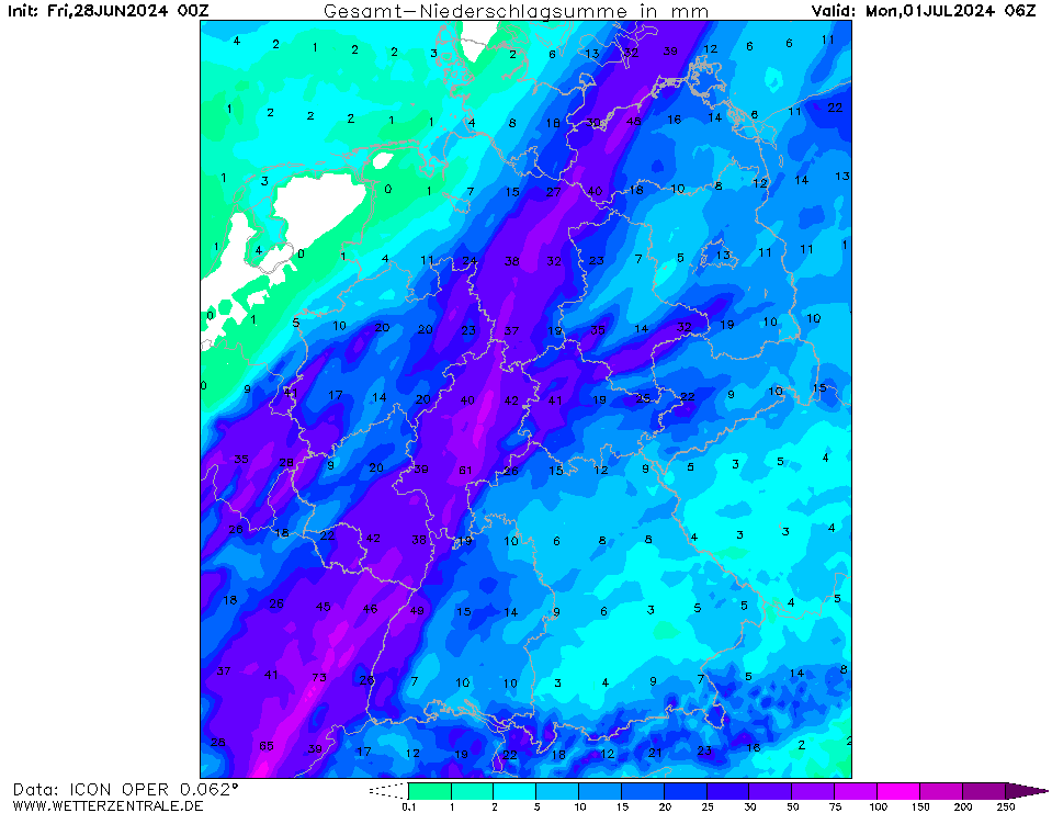
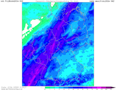
| Accumulated precipitation over Germany,
until 01.07 06 UTC
Source: wetterzentrale
|
Heat, severe thunderstorms
Central Europe
Issued: Friday, June 28, 2024, 08:30 UTC
A cut-off low over the Iberian Peninsula will move northeastwards across Europe and is likely to induce severe convective activity. Over the western half of Germany, severe thunderstorms are forecasted to bring heavy downpours, hail, and strong convective downdrafts on June 29, 2024.
28.06.2024
Today, June 28, 2024, a small cut-off low is located over the Iberian Peninsula. In the coming days, said cut-off will be moving northeastwards across Western and Central Europe and will be gradually reintegrated into the main westerly current. Ahead of the cut-off low, warm, and moist air masses will be advected into Central Europe. Over Southern Germany, the 850 hPa temperatures will reach more than 20 °C. Southeast of a line stretching from Frankfurt to Dresden, maximum temperatures will likely surpass the 30 °C-mark. Along the Upper Rhine, maximum temperatures can reach up to 35 °C. With dewpoints of more than 20 °C, excessive heat stress must be expected.
In the evening hours, a large-scale convective complex is forecasted to move from Eastern France into the western half of Germany. The very warm and moist air mass is likely to provide abundant CAPE with mixed-layer CAPE values of more than 2000 J/kg. Especially over Rhineland-Palatine and Hesse, the convective complex is forecasted to bring heavy downpours with hourly precipitation rates of up to 50 mm/h. Further, the risk of convective downdrafts will be most prominent during the evening hours with the potential for wind gusts of more than 120 kph. Large hail may also be an issue.
In the second half of the night, the cold front of the system will bring continuous precipitation to parts of Western Germany. Until Sunday afternoon, June 30, 2024, widespread precipitation totals of more than 40 mm are possible.
Especially in the case of a strong organization of the convective activity, a high-impact scenario is possible across Western Germany. The risk is further enhanced as the strongest convective activity will be present shortly after the game of the German national side at the Euro 2024, with likely many people being outdoors due to the hot temperatures during the day.
Friday, June 28, 2024, 08:30 UTC
KG
|