Friday, June 21, 2024, 10:00 UTC
|
|
|
|
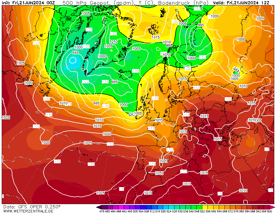
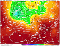
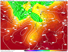
500 geopotential and mean sea-surface pressure
over Europe,
21.06 12 UTC
Source: wetterzentrale
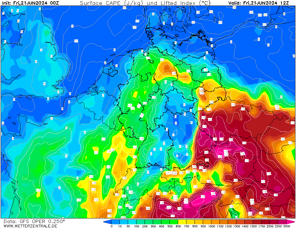
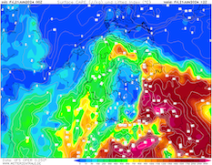
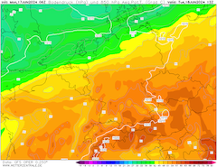
| Surface-layer CAPE and lifted index
over Central Europe,
21.06 12 UTC
Source: wetterzentrale
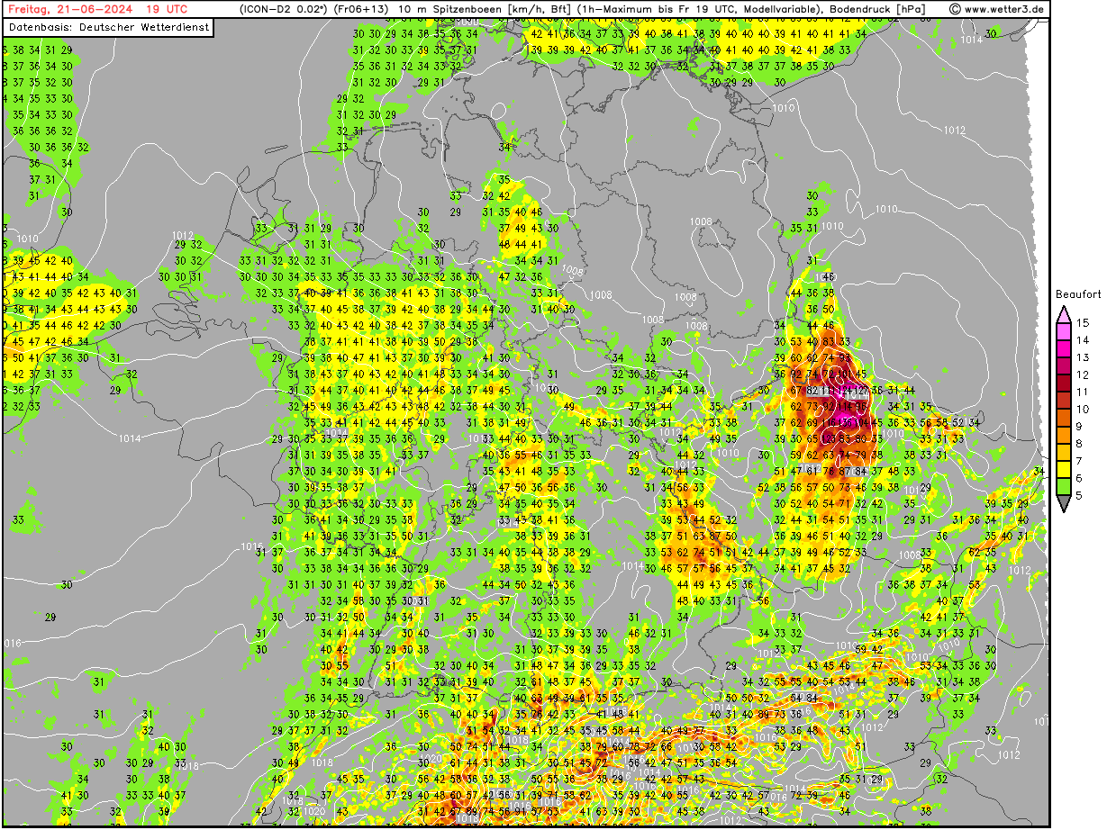
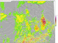
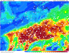
| 10 m peak wind gusts over Central Europe,
21.06 19 UTC
Source: wetter3
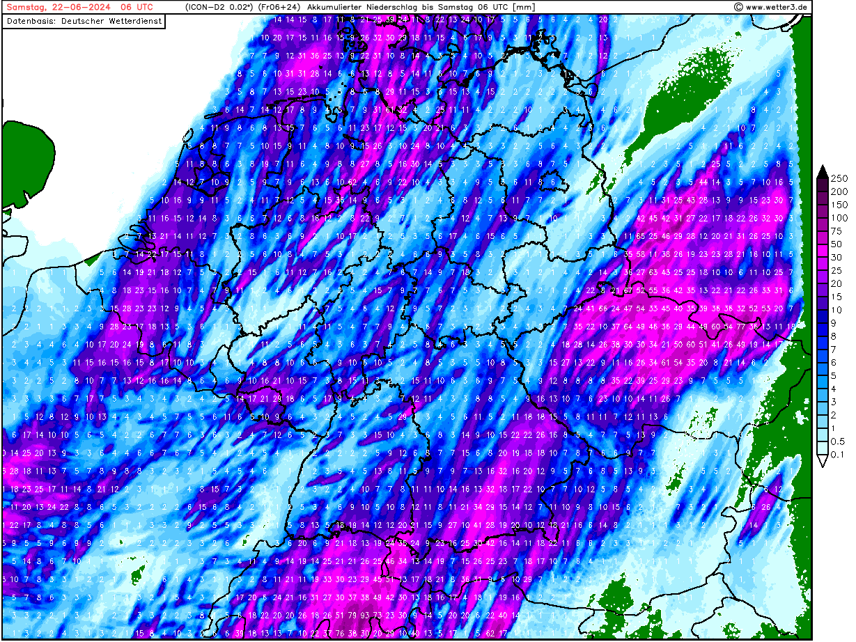
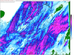
| Accumulated precipitation over Central Europe,
until 22.06 06 UTC
Source: wetter3
|
Heat, severe thunderstorms
Central Europe
Issued: Friday, June 21, 2024, 10:00 UTC
The threat of severe weather continues over Central Europe today, June 21, 2024. The highest potential for severe weather is forecasted in Saxony, and parts of Northern Czechia, and shifting into Western Poland by late evening. The thunderstorms are forecasted to bring severe downpours, large and damaging hail, and violent convective downdrafts.
21.06.2024
A trough over Western Europe is continuing to dominate the weather across large parts of Europe. Ahead of the trough, warm and moist air masses are advected into Central Europe. For the first time this summer widespread 30+ °C were recorded in Southern Germany in the past days. Over Eastern Germany, the daytime maximum temperatures are once again forecasted to be close to the 30 °C-mark.
The combination of strong daytime heating, high boundary layer humidity (dewpoints reaching more than 20 °C), and abundant mid-level shear provided by the approaching trough, creates an environment very favorable for severe convection to occur. Mixed-layer CAPE values will reach values of more than 200 J/kg over Czechia, with even higher values in Austria along the Danube Plain. Contrary here, the models forecast that no initiation occurs. If convective activity is initiated in this region, violent convective must be expected because of the large atmospheric energy reservoir.
Further north, where initiation is likely to occur by early evening over Western Czechia, the shear pattern favors line-like convective organization due to a strong velocity shear in the atmosphere. This does not exclude embedded supercell development in the evening hours. If a high degree of convective organization is observed, violent convective downdrafts with wind gusts above 120 kph must be expected. Further, the thunderstorms are forecasted to bring heavy downpours with hourly precipitation rates of more than 40 mm/h. Due to the large CAPE values, the potential for large and very large hail formation, mainly across Czechia is given. By late evening, the thunderstorms are forecasted to move into Western Poland, losing strength gradually throughout the night.
On Saturday, June 22, 2024, convective activity over Central Europe is forecasted to persist, though far less severe.
Monday, June 17, 2024, 15:30 UTC
|
|
|
|
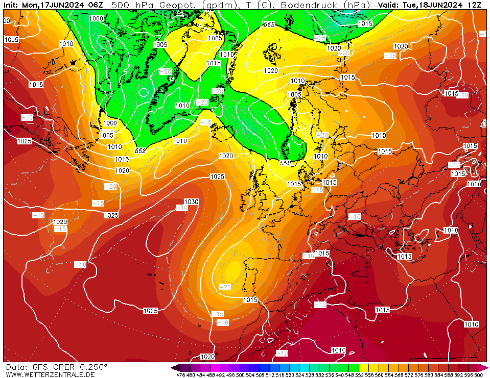
500 geopotential and mean sea-surface pressure
over Europe,
18.06 12 UTC
Source: wetterzentrale
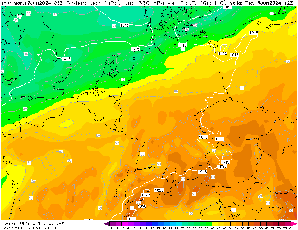
| 850 hPa pseudo-potential temperature and
mean sea-surface pressure
over Central Europe,
18.06 12 UTC
Source: wetterzentrale
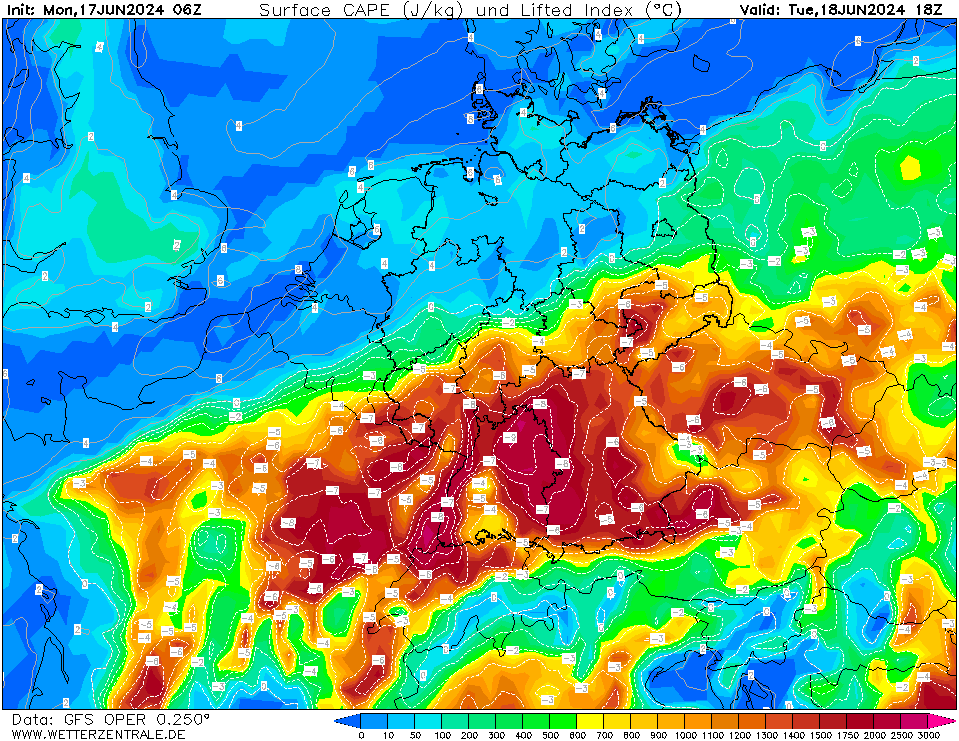
| Mixed-layer CAPE and lifted index
over Central Europe,
18.06 18 UTC
Source: wetterzentrale
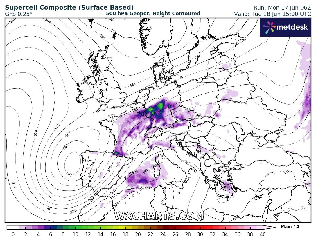
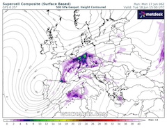
| Supercell composite parameter and
500 hPa geopotential over Europe,
18.06 15 UTC
Source: wxcharts
|
Heat, severe thunderstorms
Central Europe
Issued: Monday, June 17, 2024, 15:30 UTC
The first heatwave of the summer season of 2024 is expected to bring the first 30+ °C day to Germany. Tomorrow, June 18, 2024, the synoptic set-up over the central part of Germany is very favorable for severe convective activity. If realized, the potential for long-tracked supercells is given.
17.06.2024
After a below-average start to June 2024, a trough off the French Atlantic Coast is advecting very warm air masses into Central Europe. In the southern part of Germany, 850 hPa temperatures are forecasted to surpass the 20 °C-mark. Both Tuesday, June 18, 2024, and Thursday, June 20, 2024, the potential for the first 30 °C day in Southern Germany is given. Along the Upper Rhine, daytime maximum temperatures of up to 31 °C are possible.
Further north, the air mass boundary between the moist and warm air mass over Southern Germany and the cooler and drier air mass over Northern Germany provides an environment favorable for severe convective activity. The superposition of low-level south-westerlies and mid-level westerlies is expected to provide a sheared environment, which is very conducive to supercell development. The nearing trough over the North Sea will likely provide sufficient mid-level lifting to overcome the CIN barrier in the atmosphere for convective initiation by 12 UTC over Western Germany. With mixed-layer CAPE values above 1000 J/kg, an abundant energy reservoir for convective activity is forecasted to be present over the central part of Germany.
Especially over the western part of Germany, the forecast for the severity of the convective activity seems most uncertain. Lingering convective activity from Eastern France and uncertain initiation make the forecast of whether organized convection is likely to occur most difficult. Current NWP model output forecast a first supercell to form over the central part of Germany by 12 UTC, most likely in the northern part of Rhineland-Palatine and the southern part of North Rhine-Westphalia moving northeastwards from there. Later in the day, a second maximum of convective activity is forecasted further north in North Rhine-Westphalia moving into Northern Hesse.
The main risk from the convective activity is heavy downpours with hourly precipitation over 30 mm/h. To a lesser extent, violent convective downdrafts of more than 100 kph must be expected in case organized convection occurs. In more extreme scenarios very large hail is locally possible as well as a threat of tornadoes cannot be excluded.
Friday, June 21, 2024, 10:00 UTC
KG
Monday, June 17, 2024, 15:30 UTC
KG
|