Monday, May 06, 2024, 16:30 UTC
|
|
|
|
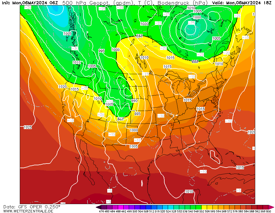
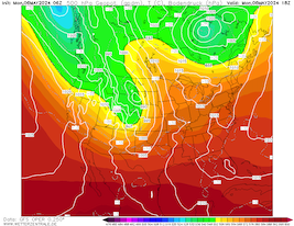
500 Geopotential and mean sea-surface pressure
over North America,
06.05 18 UTC
Source: wetterzentrale
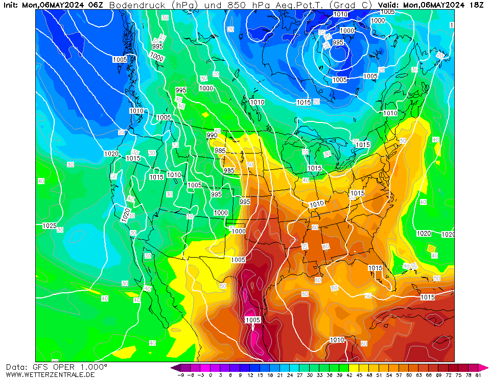
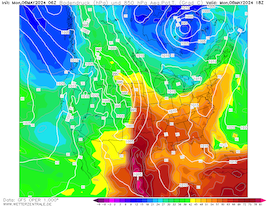
| 850 hPa pseudo-potential temperature and
mean sea-surface pressure
over North America,
06.05 18 UTC
Source: wetterzentrale
| SPC severe weather warning levels
over North America,
06.05 16:30 UTC
Source: SPC
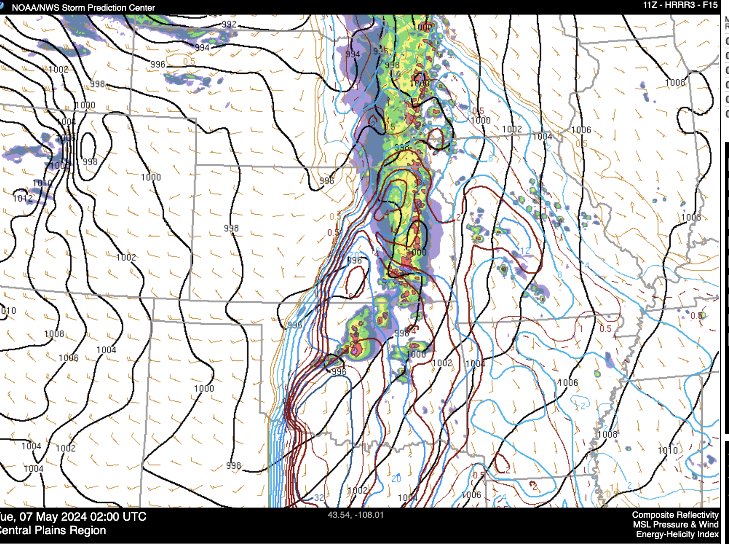
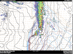
| Similuated radar image over Central Oklahoma with
the mean sea-surface pressure and
the significant tornado parameter,
07.05 02 UTC
Source: SPC
|
Severe thunderstorms
Central Plains, US
Issued: Monday, May 06, 2024, 16:30 UTC
Extremely favorable conditions for severe weather are present over much of the Central Plains ahead of a short-wave trough. Though few, but very severe, supercells are forecasted to develop across Oklahoma and Kansas. Further north, stretching as far north as the Dakotas, line-structured thunderstorm development is expected.
06.05.2024
Over the Rockies, a strong trough is presently moving eastwards. Ahead of the trough, very moist air masses from the Gulf of Mexico will be advected northwards into the Great Plains. Moving eastwards from Utah into the Plains, the cold front of the trough is expected to overtake the dry line in the afternoon hours. The dry line is a dewpoint front, between the dry desert air masses from the Desert Southwest and the moist air masses from the Gulf of Mexico. Typically, the dry line is located over West Texas and Western Oklahoma.
On the moist side of the dry line, which is forecasted to stretch north up into Western Kansas, convection is expected to be initiated. With the cold front of the trough overtaking the dry line through the afternoon. A deep shear is expected to develop over Central Oklahoma and Western Kansas. Combined with mixed-layer CAPE greater than 2000 J/kg, the formation of powerful long-tracked supercells is expected. Due to the strong shear and very favorable synoptic conditions, the significant tornado parameter is forecasted to sustain values larger than 5 for many hours over large parts of Central Oklahoma. This indicates the potential for strong tornadoes, potentially long-tracked. Further very large hail and damaging winds must be expected.
East of the Oklahoma City metropolitan area, the highest threat of tornadoes is in the nighttime hours. East of the Arkansas state border, the tornado threat is forecasted to be smaller. Further north, the convective activity is forecasted to be more line-structured, with an increasing threat of damaging winds, stretching into the Dakotas.
Monday, May 06, 2024, 16:30 UTC
KG
|