Thursday, February 29, 2024, 17:00 UTC
|
|
|
|
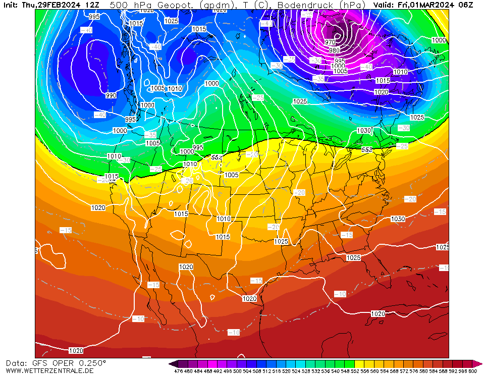
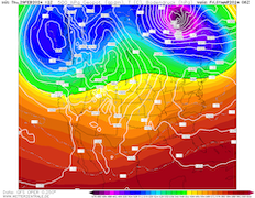
500 Geopotential and mean sea-surface pressure
over North America,
01.03 06 UTC
Source: wetterzentrale
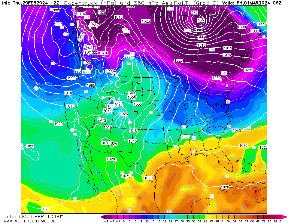
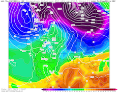
| 850 hPa pseudo-potential temperaturen and
mean sea-surface pressure over North America,
01.03 06 UTC
Source: wetterzentrale
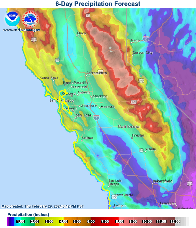
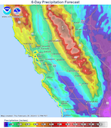
| 6-day accumulated precipitation over California,
until 06.03 12 UTC
Source: CNRFC
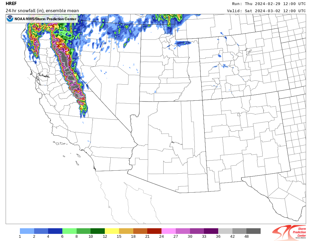
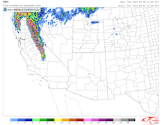
| 24 h snow rate over the Southwestern US,
02.03 12 UTC
Source: SPC
|
Extreme snowfall
California
Issued: Thursday, February 29, 2024, 17:00 UTC
A potent atmospheric river is expected to bring exceptional fresh snow accumulations to higher elevations of the Sierra Nevada and Coastal Mountain Ranges in California from February 29, 2024, to March 04, 2024. Along the Sierra Crest, fresh snow accumulations of more than 3 m/72 h are possible.
29.02.2024
After a calm start to the winter season 2023/24, the snowpack of the Sierra Nevada was way below average going into February 2024. A multitude of weak to moderate winter storms brought the snowpack close to the seasonal average by the end of February. By late February 2024, a surge of cold air masses onto the Pacific Ocean led to the formation of a large trough off the Californian coast.
Today, February 29, 2024, the precipitation band from the atmospheric river is making landfall in California currently. Above 1500 m altitude, continuous heavy snow is expected. Current model output suggests that heavy snowfall with snow rates of more than 5 cm/h can persist for an exceptionally long period of up to 72 h. By March 04, 2024, precipitation totals of more than 250 mm along western facing flanks of the Sierra Nevada and Coastal Mountain Ranges are possible, with the highest precipitation totals in the Northern Sierra Nevada. At elevations above 1500 m multiple meters of fresh snow accumulations must be expected. Along the Sierra Crest, fresh snow accumulations of up to 5 m cannot be excluded.
By Saturday, March 02, 2024, snow levels are expected to drop continuously as the storm system will advect unseasonably cold air masses into California. Above 1000 m, fresh snow accumulations of up to 30 cm are possible. By Sunday, March 03, 2024, snow levels can drop as low as 300 m. Valley frost in the Central Valley is possible during the weekend.
The extreme snowfall will be accompanied by hurricane-force wind gusts along the Sierra Crest, providing treacherous traveling conditions at higher elevations in California. The highest impacts are expected along the I-80 corridor, with fresh snow accumulations of up to 3 m/72 h along Donner Pass.
Thursday, February 29, 2024, 17:00 UTC
KG
|