|
Thursday, February 22, 2023, 16:00 UTC
Issued: Thursday, February 22, 2024, 16:00 UTC
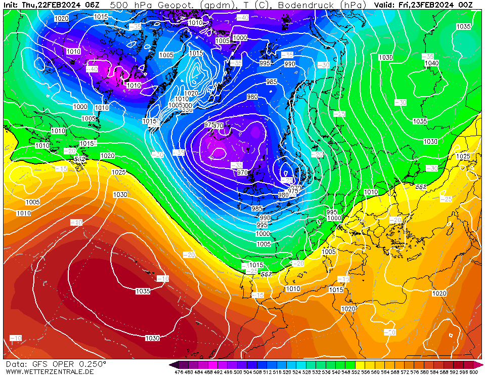
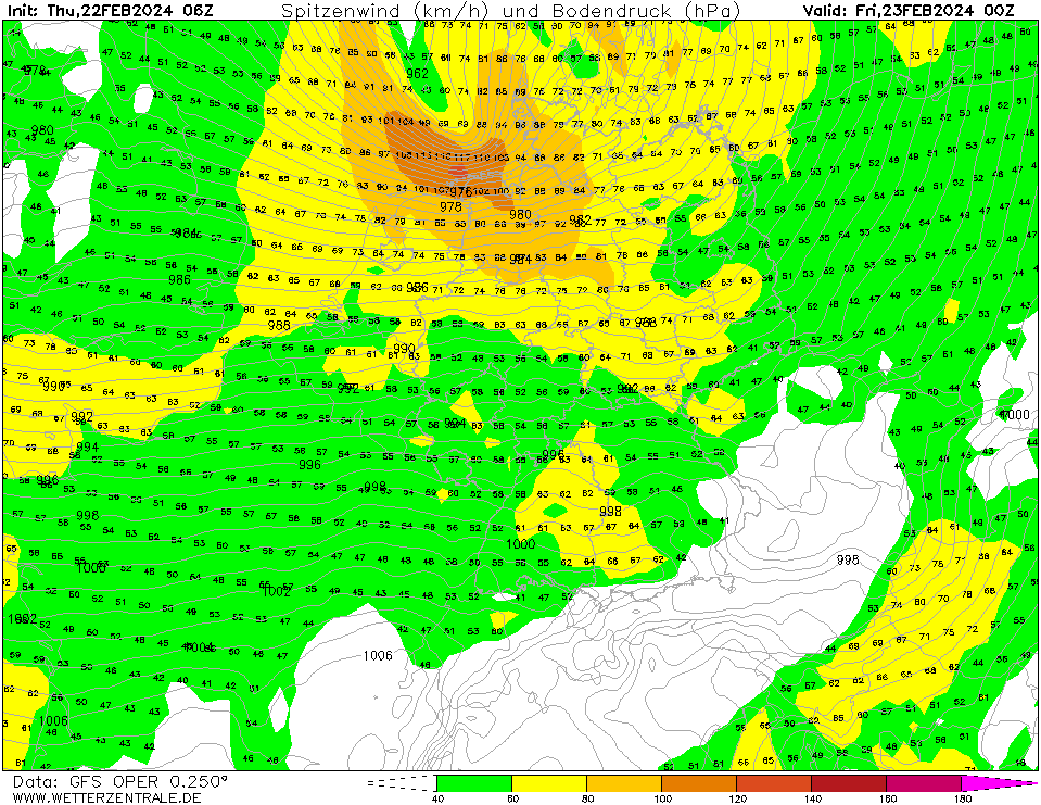
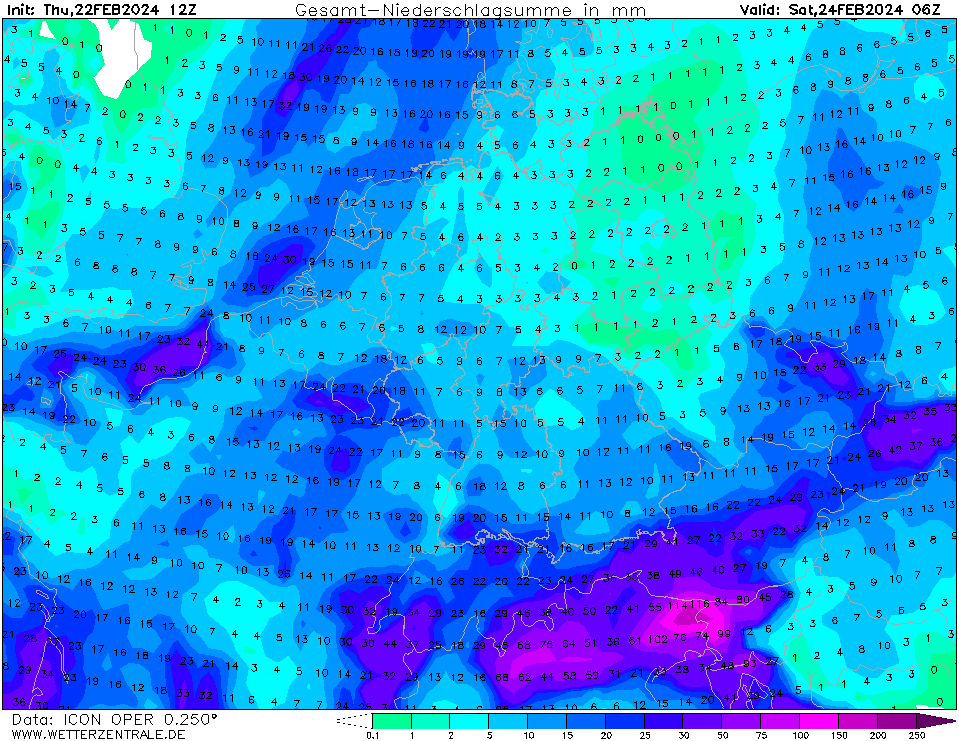
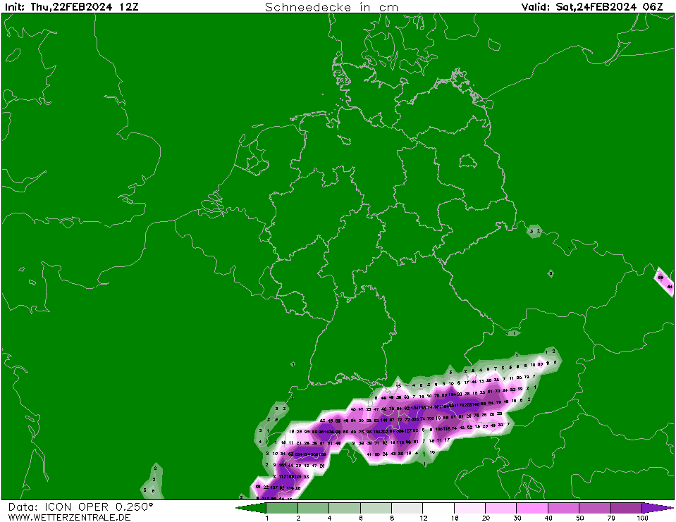
A quick-moving cyclone over the North Sea is expected to rapidly deepen and bring severe storms to the northern parts of Central Europe with wind gusts expected to reach more than 120 kph along the German coast. Along the Southern Alps, heavy precipitation is expected with abundant mountain snow with fresh snow accumulations of up to 50 cm/36 h.
At the southern flank of a broad low-pressure system over the Northern Atlantic, a small surface low developed. The rapidly deepening low is expected to move quickly eastwards across the British Isles over the North Sea. South of the low-pressure center, a quickly intensifying storm field is expected to develop. At the backside of the low-pressure, the highest wind gusts are expected due to an enhanced pressure gradient. Along the German coast, hurricane-force wind gusts of more than 130 kph are possible. Inland, wind gusts are forecasted to reach up to 110 kph. During the second half of the night, the winds are expected to calm quickly as the surface low moves over the Baltic Sea. Nevertheless, due to very moist soils widespread wind damage in forests is possible.
Thursday, February 22, 2024, 16:00 UTC KG |