Monday, 04 September 2023, 16:00 UTC
|
|
|
|
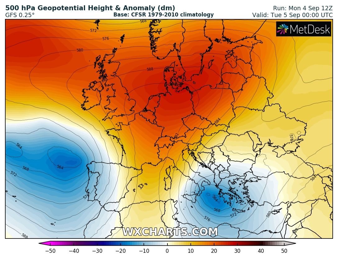
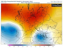
500 hPa Geopotential and geopotential anomaly
over Europe, 05.09 00 UTC
Source: wxcharts
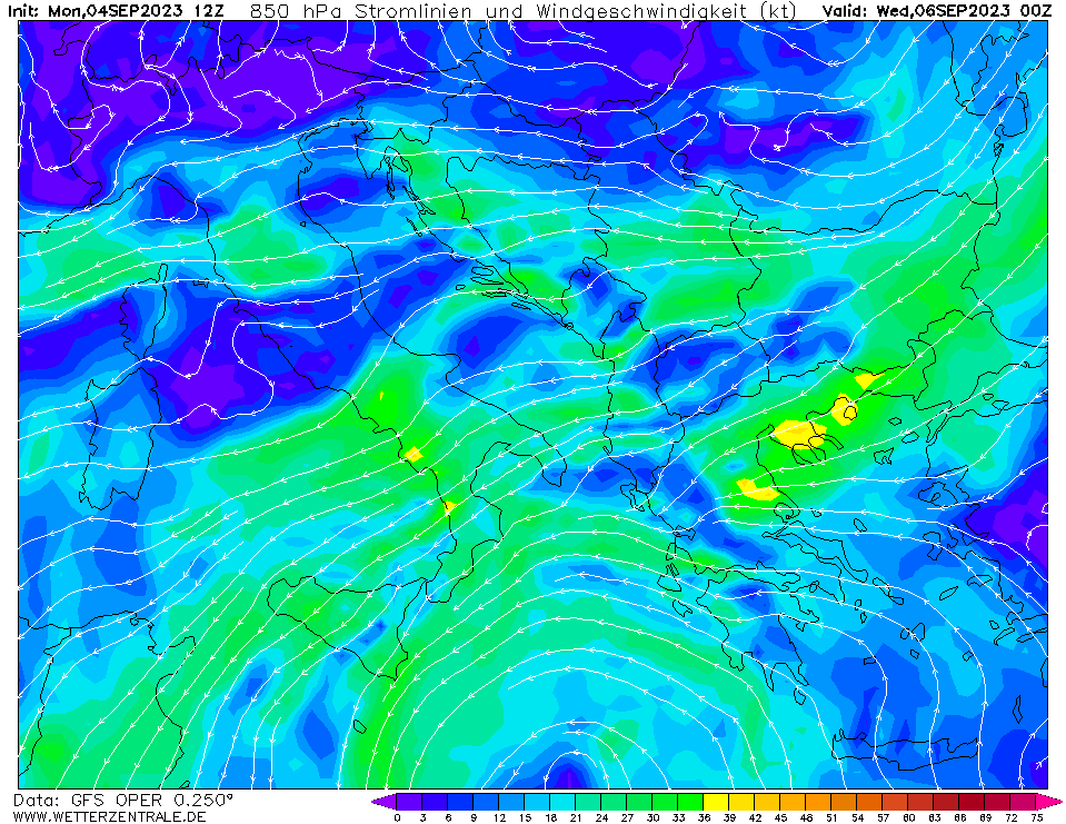
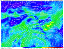
| 850 hPa streamlines and wind speed
over the Eastern Mediterranean,
06.09 00 UTC
Source: wetterzentrale
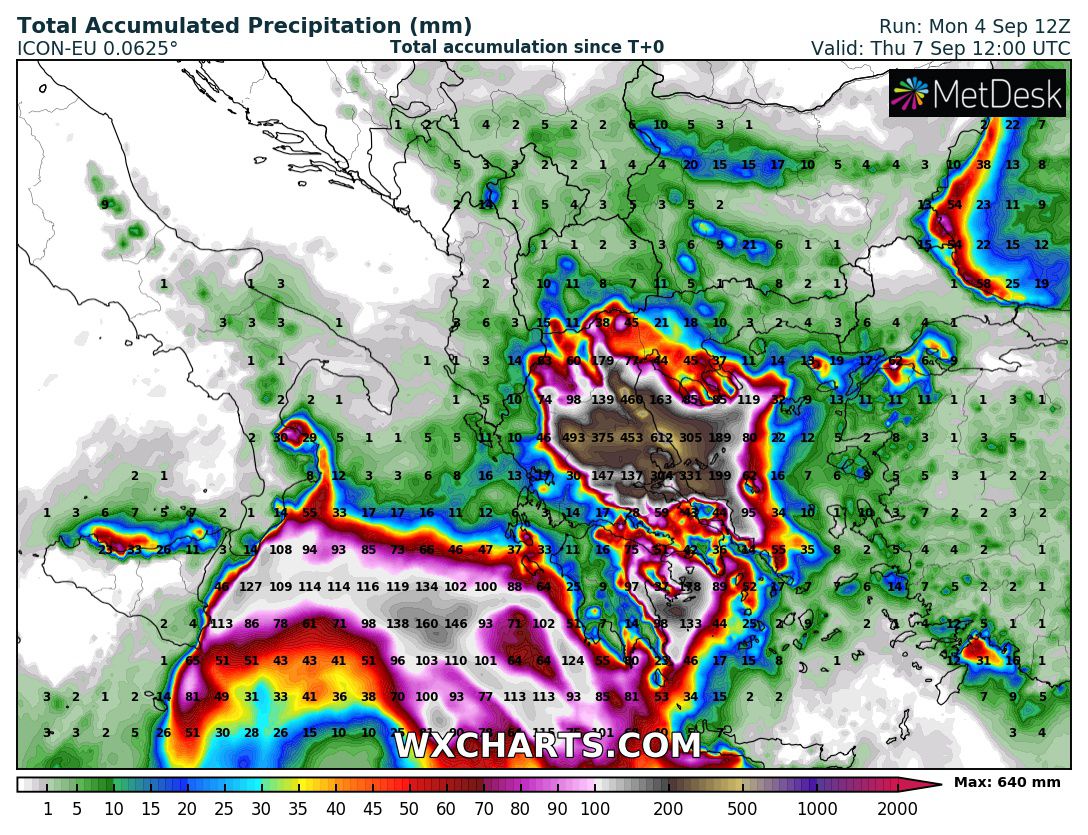
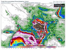
| Accumulated precipitation over Greece,
until 07.09 12 UTC
Source: wxcharts
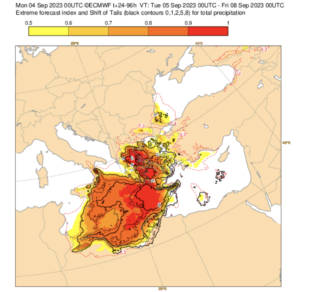
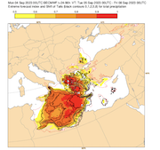
| EFI and Shift of Tails
for the 48 h accumulated precipitation
over Southeastern Europe,
05.09 - 07.09 00 UTC
Source: ECMWF
|
Heavy precipitation
Greece
Issued: Monday, 04 September 2023, 16:00 UTC
A cut-off over the Eastern Mediterranean will likely bring extreme precipitation to parts of Greece, within a 48 h-period precipitation totals of more than 500 mm are possible. As a result, abundant flash and river flooding must be expected as the dry season around the Mediterranean is just ending.
04.09.2023
A strong Omega Pattern is currently dominating the weather across Europe, with a strong ridge across Central Europe bringing well-above-average temperatures to Central Europe. Flanked is this ridge by two cut-offs over the Mediterranean. The upper-level cut-off over the Iberian Peninsula already brought abundant precipitation to parts of Spain on September 03, 2023. A second upper-level cut-off is currently moving over the Eastern Mediterranean.
The cut-off over the Mediterranean will bring abundant precipitation to Greece, as it will be inducing mid-level easterlies over the Aegean Sea, advecting continuously very moist airmasses into Greece. Within a 48 h-period on September 05, 2023, and September 06, 2023, extreme precipitation totals are excepted across parts of Greece, as continuous convective activity is expected to move onshore from the Aegean Sea. The heaviest precipitation will likely be confined in precipitation bands, moving inland nearly perpendicular to the shoreline.
At the moment, models suggest that the precipitation hotspot will likely be located in the Greek region of Thessaly. Here, the potential is given for precipitation totals of more than 500 mm/48 h, and local precipitation totals of more than 750 mm/48 h cannot be excluded. The EFI for the 48 h precipitation totals across Thessaly is larger than 0.99, with positive Shift of Tails values suggesting new records within the model climatology. With convective activity enhancing the rains across Greece hourly precipitation rates of more than 50 mm/h must be excepted. Likely, the city of Larisa will be affected by the heavy rains. As a result, widespread flash and river flooding must be expected, as the dry season across the Mediterranean is just now ending and soils across Greece will be very dry, limiting their ability to absorb the water. Flash Flood potential will be even more enhanced in the vicinity of recent burn scars.
Issued: September 04, 2023, 16:00 UTC
KG
|