Sunday, 06 August 2023, 18:00 UTC
|
|
|
|
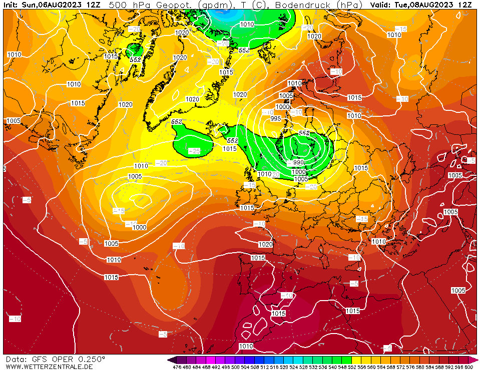
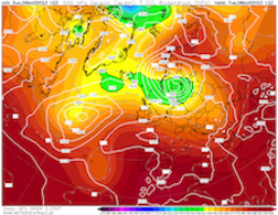
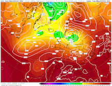
500 Geopotential and sea surface pressure over Europe,
08.08 12 UTC
Source: wetterzentrale
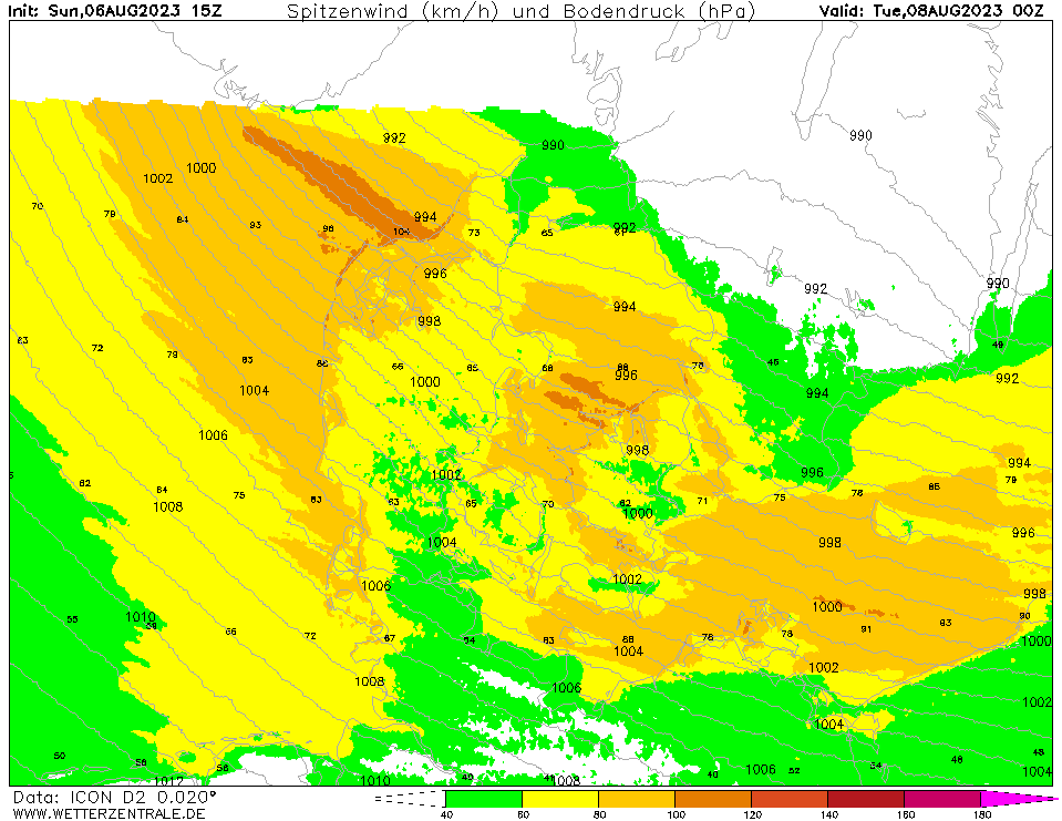
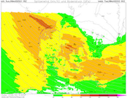
| 10 m wind gusts over Denmark,
08.08 00 UTC
Source: wetterzentrale
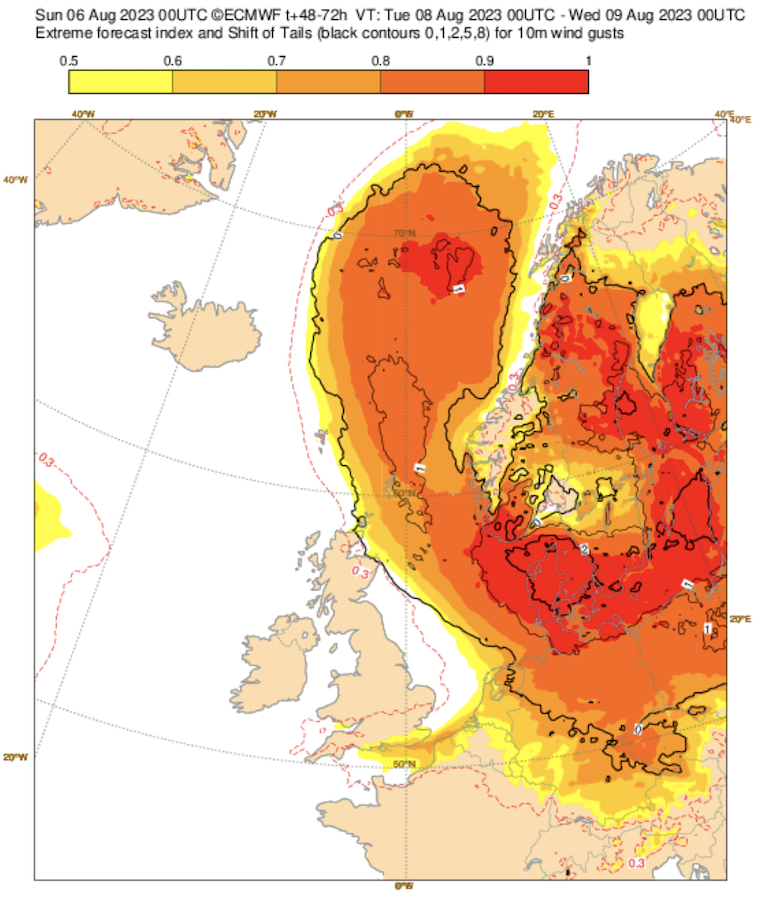
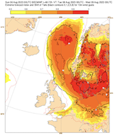
| EFI for 10 m wind gusts over
Northwestern Europe,
08.08
Source: ECMWF
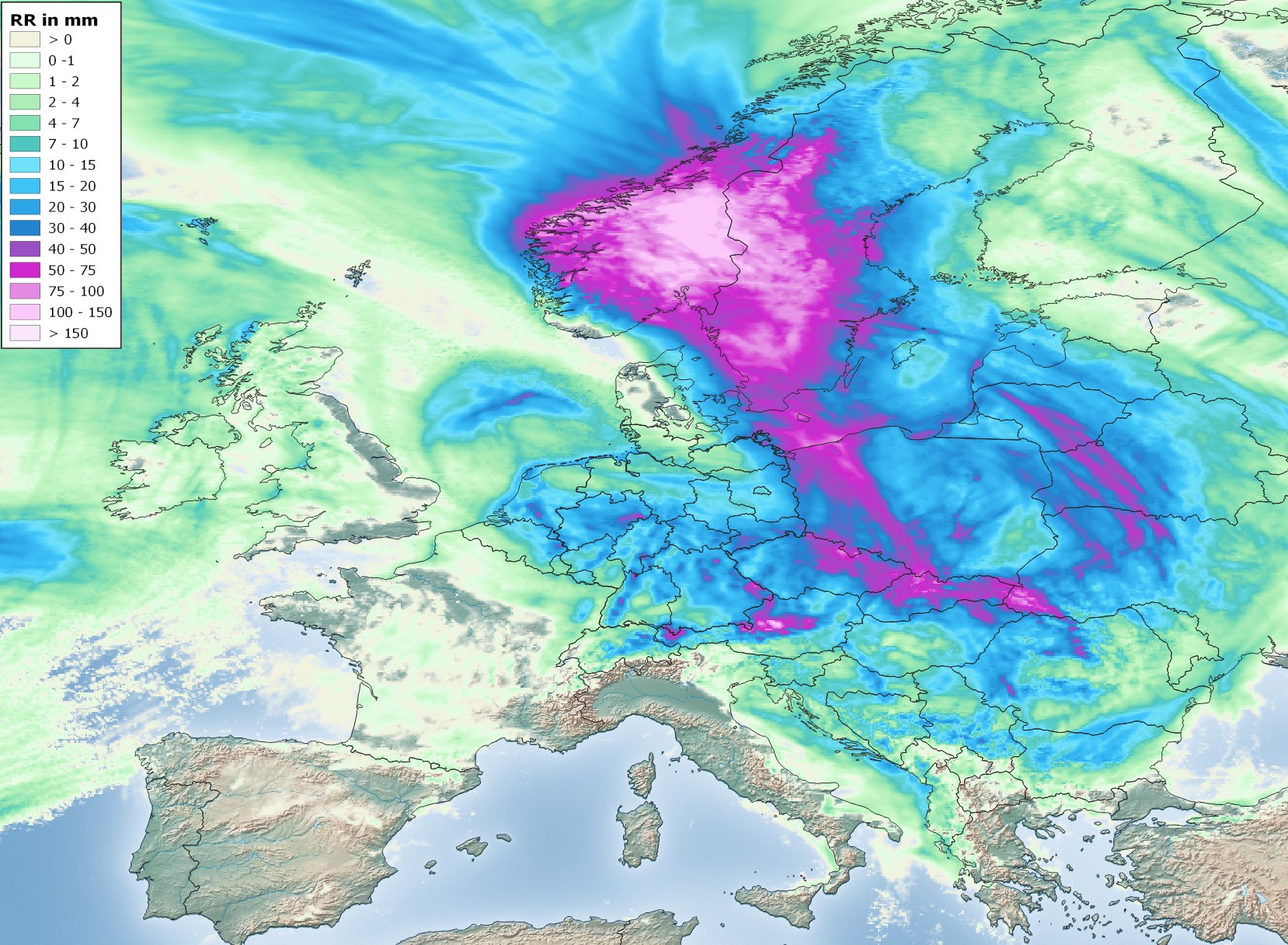
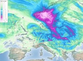
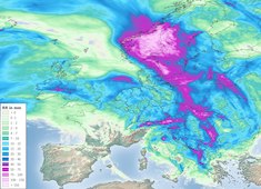
| Accumulated precipitation over Europe,
until 11.08 00 UTC
Source: DWD, Visulaization: B. Mühr
|
Heavy precipitation
Europe
Issued: Sunday, 06 Augsut 2023, 18:00 UTC
A strong trough over the Skagerrak is expected to develop in the coming days bringing abundant precipitation. The accompanied storm low is expected to rapidly deepen, inducing a unseasonably severe summer storm across Denmark with wind gusts of more than 100 kph in coastal regions.
06.08.2023
A complex trough structure over Scandinavia has already led to high precipitation totals over Austria and Slovenia, inducing strong river flooding in the upper reaches of the Drava and Sava basin, especially along minor rivers. Parts of Slovenia have experienced the worst river flooding in the last 30 years. Along the river Mur a levee broke, bringing severe flooding further down the river. With only minor precipitation totals in the forecast, river levels are expected to recede slowly in the coming days. Though, the flood wave along the Sava River is expected to move downstream through Croatia, leading to elevated flooding risks in the Croatian capital city of Zagreb.
On Monday, August 07, 2023, a surface low over the Skagerrak, connected to the upper-atmosphere trough, is expected to quickly deepen. With enhancing pressure gradients, an unseasonably strong summer storm is expected over Denmark, with wind gusts reaching up to 100 kph in exposed coastal regions and up to 120 kph over the open waters of the North Sea. The EFI at the northern tip of Denmark is expected to reach values greater than 0.99 on Tuesday, August 08, 2023. Along the German shoreline of the Baltic Sea, the potential for a strong storm surge is given, with strong northwesterly winds pushing the water onshore.
Ahead of the surface low, very warm air masses are expected to be advected into Scandinavia, bringing intense precipitation both to Western Poland and Southern Sweden and Norway, with 3-day precipitation totals reaching up to 100 mm.
Saturday, 05 August 2023, 16:00 UTC
|
|
|
|
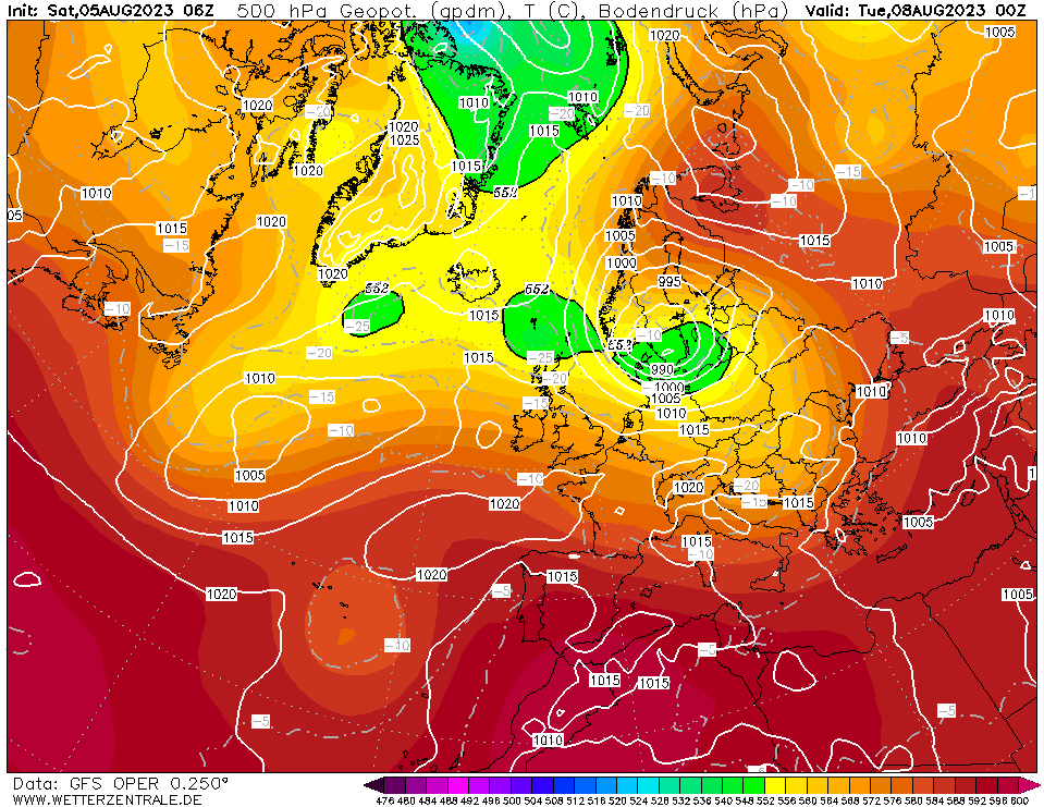
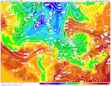
500 Geopotential and sea surface pressure over Europe,
08.08 00 UTC
Source: wetterzentrale
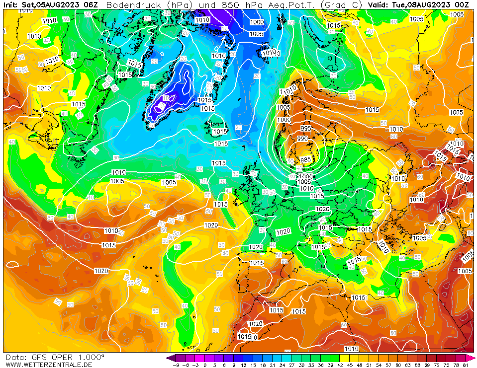
| 850 hPa Pseudo-potential temperature over Europe,
08.08 00 UTC
Source: wetterzentrale
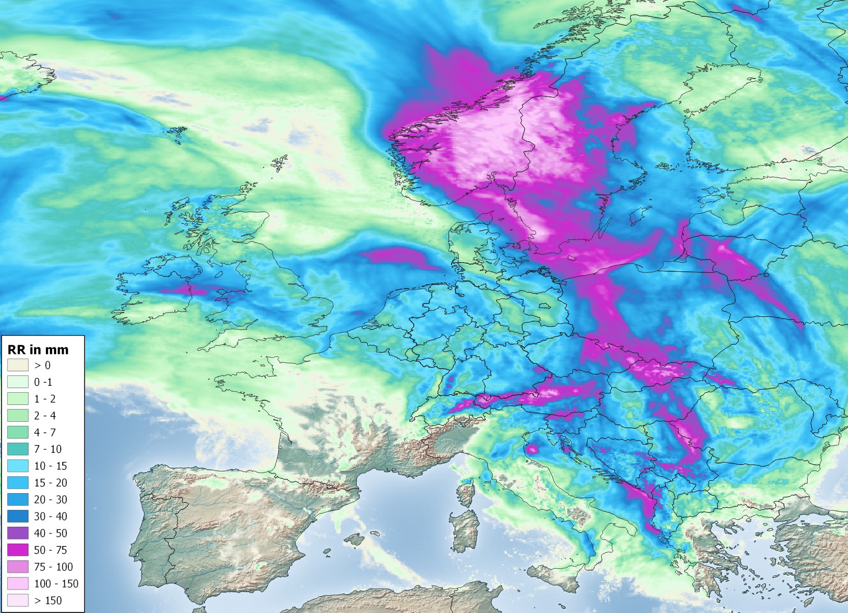
| Accumulated precipitation over Europe,
until 10.08 00 UTC
Source: DWD, Visulaization: B. Mühr
|
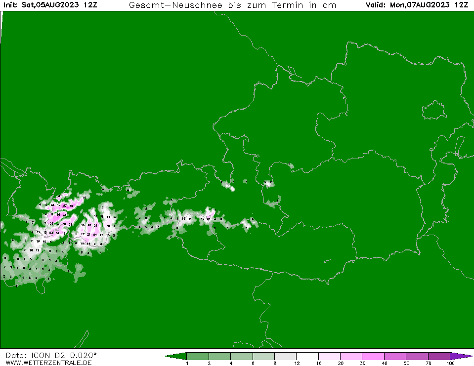
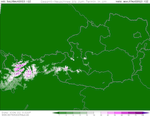
Fresh snow accumulation over Austria,
until 07.08 12 UTC
Source: wetterzentrale
|
Heavy precipitation
Europe
Issued: Saturday, 05 Augsut 2023, 16:00 UTC
A trough over Scandinavia will bring widespread heavy precipitation to Continental Europe, with a precipitation maximum in the southern part of Scandinavia. 5-day precipitation totals over Eastern Europe and Scandinavia are expected to reach more than 100 mm.
05.08.2023
Since Mid-July, a more active westerly weather regime is dominating the weather across Europe, with abundant precipitation in Central Europe. Over the Norwegian Sea, a trough has developed, dominating the weather across Continental Europe. At the tip of the trough, a secondary trough is developing over Germany. Ahead of the trough moist air masses are advected northwards, which already brought intense precipitation to Austria and Slovenia. As a result, widespread river flooding was observed in the Drava and Sava basin. Along some minor rivers along the Drava in the Austrian state of Carinthia, river levels have reached the level of a 30 annual flood or higher, especially in the region around Klagenfurt.
On Sunday, August 06, 2023, the trough is situated over Germany, with the air flow around the surface low advecting moist air masses from northeasterly direction against the Northern Alps in Bavaria. With the strong orographic lift, precipitation totals in the Bavarian Alps are expected to reach up to 100 mm. Due to the unseasonally cold air masses over Germany, snow must be expected above 2000 m altitude, locally snow accumulations of more than 30 cm are possible.
On Monday, August 07, 2023, and Tuesday, August 08, 2023, the secondary trough above Denmark is expected to rapidly strengthen accompanied by the surface low beneath the trough rapidly deepening. Hence, the advection of very warm air masses from the Mediterranean is strongly enhanced, bringing widespread precipitation to parts of Eastern Europe and the southern part of Scandinavia. The highest precipitation totals must be expected in Southern Sweden and Norway, as well as Western Poland. 5-day precipitation totals are expected to reach more than 100 mm. As a result, river flooding must be expected.
Issued: August 05, 2023, 16:00 UTC
KG
Issued: August 06, 2023, 18:00 UTC
KG
|