Tuesday, 11 July 2023, 07:00 UTC
|
|
|

|
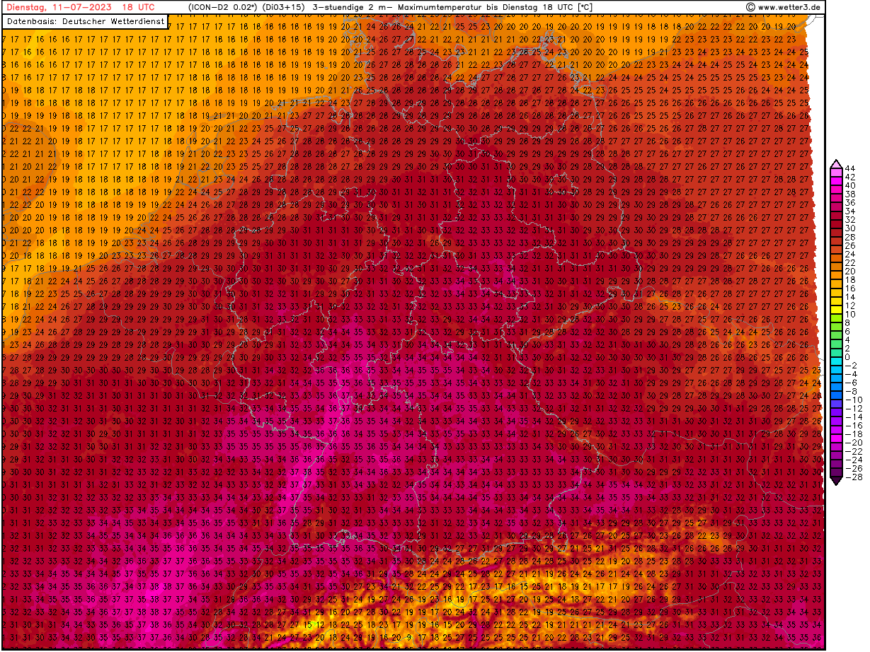
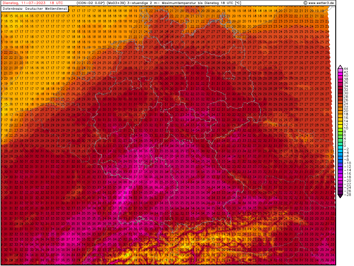
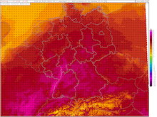
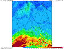
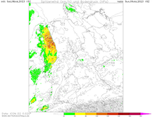
6 h maximum temperatures over Central Europe,
11.07 18 UTC
Source: wetter3
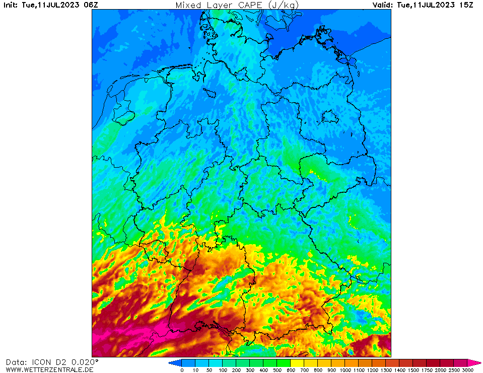
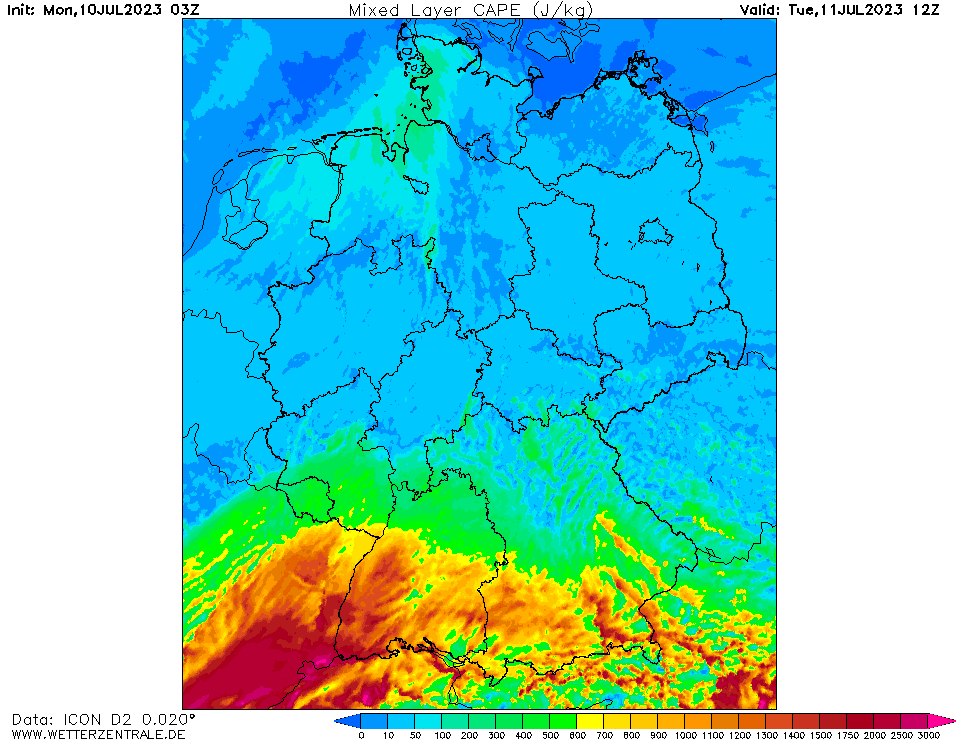
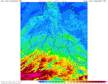
| Mixed-layer CAPE over Germany,
11.07 15 UTC
Source: wetterzentrale
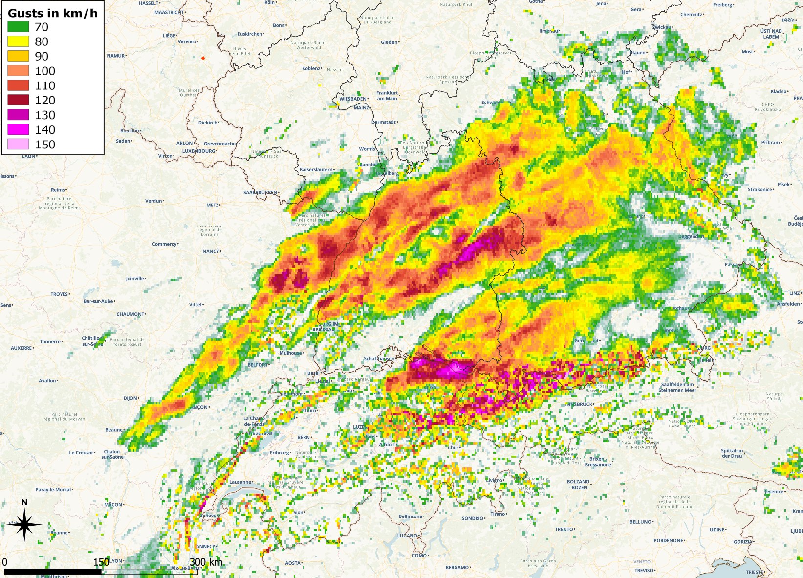
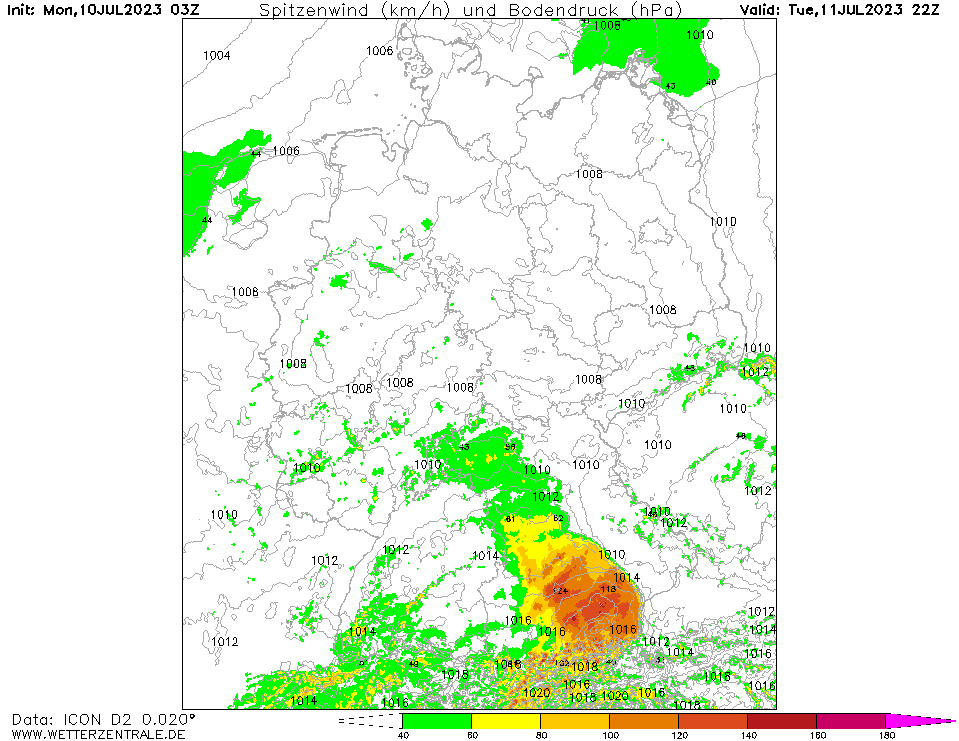
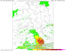
| Maximum wind gusts over Germany,
until 12.07 03 UTC
Source: DWD, Visulaization: B. Mühr
|
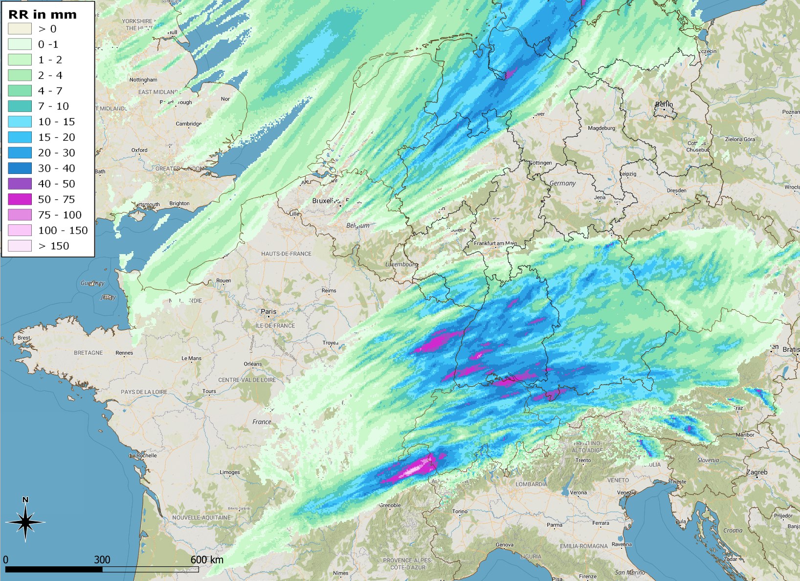
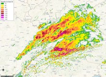
Accumulated precipitation over Central Europe,
until 12.07 06 UTC
Source: DWD, Visulaization: B. Mühr
|
Heat wave, severe thunderstorms
Central Europe
Issued: Tuesday, 11 July 2023, 07:00 UTC
Sweltering heat in the afternoon hours will be followed by severe thunderstorms in the evening and first half of the night to July 12, 2023. Day-time maximum temperatures are expected to reach up to 37 °C in the Upper Rhine Plain.
11.07.2023
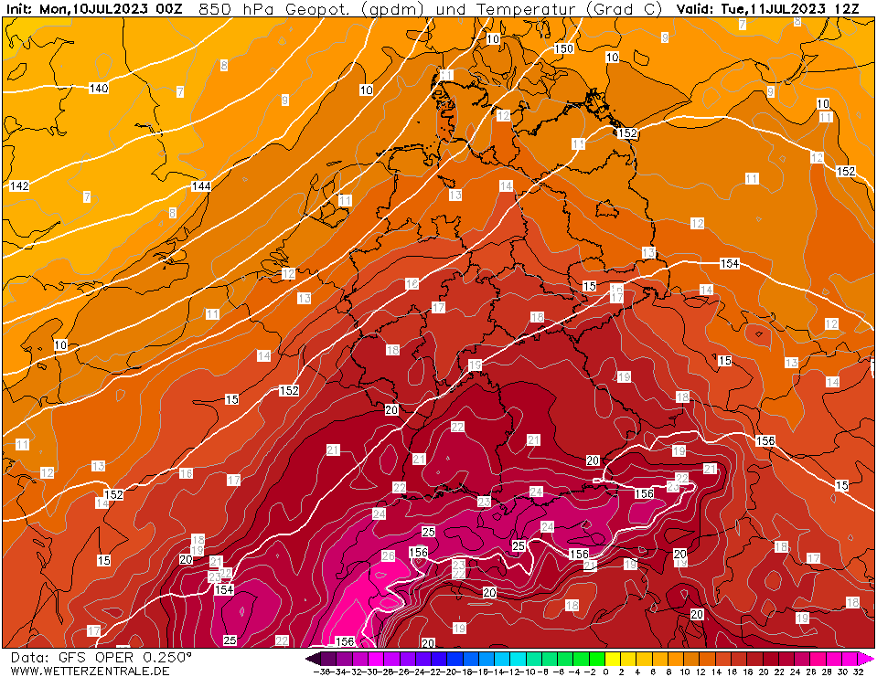
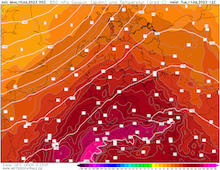
The nearing trough above the British Isles enhances the advection of moist and very warm air masses from the Mediterranean into Central Europe, with 850 hPa temperatures reaching more than 20 °C, leading to day-time maximum temperatures of up to 37 °C in the Upper Rhine Plain. Heat stress will be amplified by dewpoints reaching more than 17 °C.
The solar insolation today will provide abundant CAPE (> 2000 J/kg) in the Saône Plain and the Vosges mountains. Convection will likely be initialized in the early evening hours in the upper Saône Plain moving quickly northeastwards above the Vogese mountains. In the Upper Rhine Plain, temperatures will still be very high, likely close to the 35 °C-mark, while in regions where thunderstorm activity already sat in temperatures in the rain will quickly drop to 20 °C. With DCAPE values around 1000 J/kg, strong density currents running at the leading edge of the thunderstorms must be expected, convective downdrafts can produce gusts of 100 kph over larger areas. With the strongest thunderstorms, convective downdrafts of more than 120 kph must be expected, locally extreme gusts of more than 150 kph cannot be excluded. Due to the strong updrafts, large hail must be expected with diameters of more than 3 cm must be expected locally, additionally heavy downpours due to the high moisture content in the atmosphere must be expected.
In the first half of the night thunderstorms will quickly move northeastwards over Baden-Württemberg into Bavaria. After sunset, the temperature differences will diminish and reducing the available DCAPE convective downdrafts will weaken, nevertheless, convective downdrafts of more than 100 kph will still be possible in the eastern half of Southern Germany.
Monday, 10 July 2023, 07:00 UTC
|

|
|
|
850 hPa temperature Central Europe,
11.07 12 UTC
Source: wetterzentrale
| 6 h maximum temperatures over Central Europe,
11.07 18 UTC
Source: wetter3
| Mixed-layer CAPE over Germany,
11.07 12 UTC
Source: wetterzentrale
|
10 m wind gusts over Germany,
11.07 22 UTC
Source: wetterzentrale
|
Heat wave, severe thunderstorms
Central Europe
Issued: Monday, 10 July 2023, 07:00 UTC
The heat wave across Central Europe is expected to continue, as the trough above the Eastern Atlantic is slowly moving eastwards, leading to enhanced advection of subtropical air masses from the Mediterranean with 850 hPa temperatures of more than 20 °C. A second heat peak is expected on July 11, 2023 with temperatures reaching up to 38 °C in the southern part of the Rhine Valley.
10.07.2023
After locally severe thunderstorms attached to a weak cold front passing over the western part of Germany, day-time maximum temperatures today are expected to be 5 - 10 K cooler than yesterday. The highest measured temperature on July 10, 2023, was 38,0 °C in Waghäusel-Kirrlach. Subsequently at lower elevations in the southwestern part of Germany, temperatures are expected to rise once again above the 30 °C-mark today.
Tomorrow, July 11, 2023, the approaching trough above the British Isles will once again invigorate the advection of very warm air masses into Central Europe. 850 hPa temperatures above Southern Germany will be reaching once again more than 20 °C. Day-time maximum temperatures along the southern part of the Rhine Valley will rise up to 38 °C, locally temperatures of up to 39 °C cannot be excluded.
In the early evening hours, locally severe thunderstorms are expected to develop above the Black Forest and Swabian Jura, moving eastwards into the Danube Valley. Conditions for severe thunderstorms are favorable with locally MLCAPE > 2000 J/kg. Most probable, the classic embedded supercell formation in the Alpine foothills must be expected. Dangers are most likely, very high precipitation rates of more than 30 mm/h, locally more than 50 mm/h, large hail, and extreme convective downdrafts of more than 120 kph, as the models suggest very high DCAPE values of around 1000 J/kg to be prevalent across the southern part of Germany. Over the northern part of Germany, a cold front is expected to bring moderate precipitation with non-severe convective activity in the second half of the night from July 11, 2023, to July 12, 2023.
Saturday, 08 July 2023, 16:30 UTC
|
|

|
|
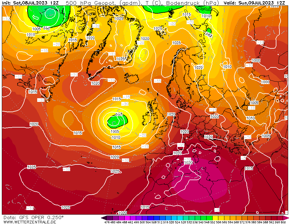
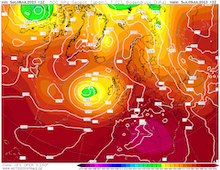
500 hPa Geopotential and sea surface
pressure Europe, 09.07 12 UTC
Source: wetterzentrale
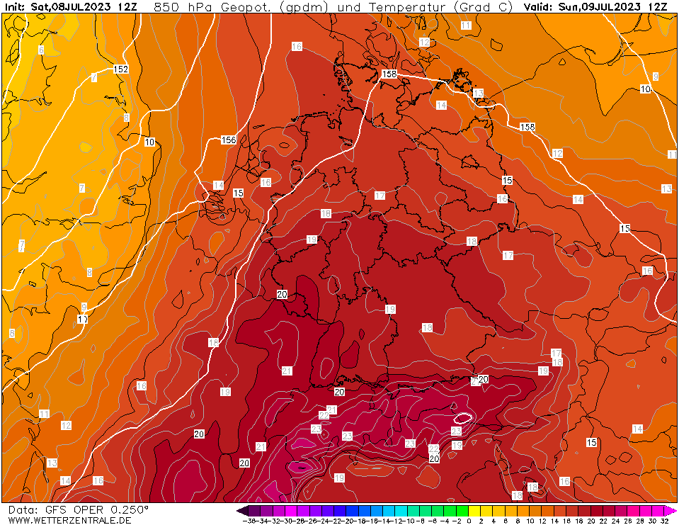
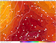
| 850 hPa temperature Central Europe,
09.07 12 UTC
Source: wetterzentrale
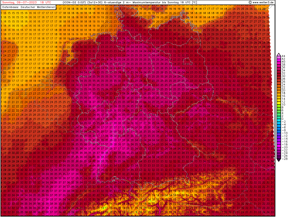
| 6 h maximum temperatures over
Central Europe, 09.07 18 UTC
Source: wetter3
|
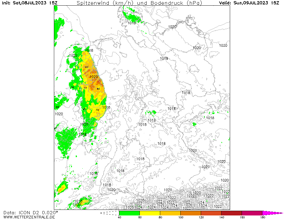
10 m wind gusts over Germany,
09.07 15 UTC
Source: wetterzentrale
|
Heat wave, severe thunderstorms
Central Europe
Issued: Saturday, 08 July 2023, 16:30 UTC
The combination of a trough over the Eastern Atlantic and ridge expanding from North Africa into the Mediterranean will induce severe heat in Central Europe with temperatures reaching up to 38 °C, with the approaching trough severe convective activity over Central Europe must be expected.
08.07.2023
The heat wave which started on July 07, 2023, will be the first major heat wave in the summer 2023, with 850 hPa temperatures over Central Europe reaching more than 20 °C. Tomorrow, July 09, 2023, the peak of the heat wave is expected with temperatures rising up to 38 °C in the Rhine Valley, locally temperatures of up to 39 °C cannot be excluded. In the evening hours, a small upper-level trough will provide mid-level lifting for severe convection to develop over the Benelux states and the northern part of Germany. These thunderstorms are expected to bring localized excessive precipitation as well as severe convective downdrafts, especially if the thunderstorms are organized in a squall line.
Behind the weak cold front, temperatures are expected to drop slightly, before a second trough will likely enhance the advection of very warm air masses once again on July 11, 2023, with day-time maximum temperatures in the southern part of Germany rising once again over the 35 °C-mark. In the medium-range ensemble forecast 850 hPa temperatures are expected to return to the climatological average by July 12, 2023.
Issued: July 08, 2023, 16:30 UTC
KG
Issued: July 10, 2023, 07:00 UTC
KG
Issued: July 11, 2023, 07:00 UTC
KG
|