Wednesday, 28 September 2022, 12:00 UTC
|
|
|
|
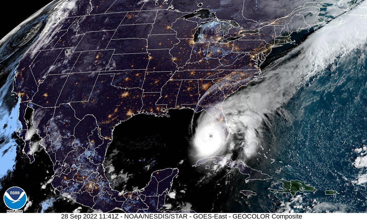
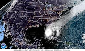
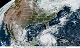
Visible Satellite Image Gulf of Mexico,
28.09., 11:41 UTC
Source: NOAA
|
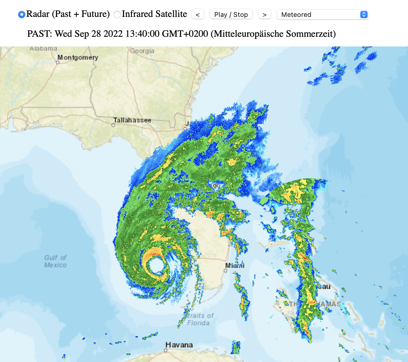
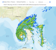
Radar Imagery Gulf of Mexico, 28.09., 11:40 UTC
Source: B. Mühr
|
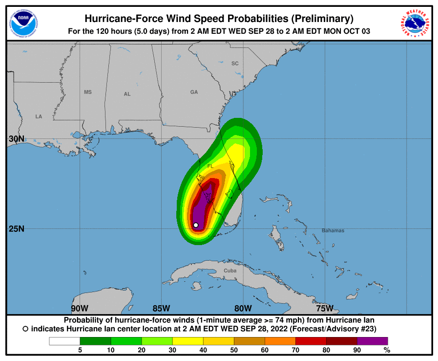
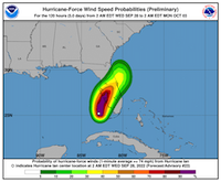
Possibility for sustained winds reaching
hurricane force
28.09., 06 UTC
Source: NHC
|
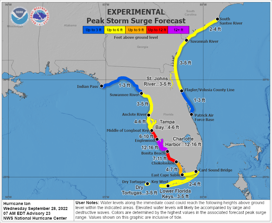
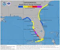
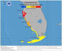
Expected storm surge along Floridian coast,
28.09., 11 UTC
Source: NHC
|
Tropical Cyclone
Florida
Issued: Wednesday, 28 September 2022, 12:00 UTC
Hurricane IAN made landfall in western Cuba on Tuesday as a powerful category 3 hurricane with sustained winds of 200 km/h. IAN is now again over open waters over the Gulf of Mexico and expected to strengthen before making landfall in Western Florida. At the moment the hurricane reached category 4 with sustained winds over 250 km/h.
28.09.2022
Yesterday, September 27, 2022, Hurricane IAN made landfall in the western part of Cuba, the powerful category 3 hurricane brought heavy precipitation und extreme winds to the island, with highest wind gust being 208 km/h in San Juan y Martinéz, causing power outages across the island.
At 11 UTC the hurricane was about 160 km off the coast of Florida with a minimum pressure of 937 hPa and sustained winds of 250 km/h moving north-northeast at 15 km/h. With the outer bands of the hurricane already causing heavy precipitation across many parts of Southern and Central Florida. Even though Key West, FL wasn´t directly hit by Hurricane IAN, wind gusts of over 120 km/h were reported at Key West Intl.
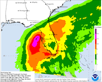
IAN is expected to make landfall in Western Florida on Wednesday evening local time, while further strengthening over the warm waters of the Gulf of Mexico during the coming hours. IAN has been upgraded to a category 4 hurricane. Currently landfall expected close to Cape Coral, FL with sustained winds of around 250 km/h. IAN is expected to induce a severe storm surge along the western coast of Central Florida with water levels rising more than 2 m. Locally an extreme storm surge of more than 3 m is possible. Furthermore, IAN will bring heavy precipitation to many parts of Florida reaching more than 250 mm and localized up to 400 mm, accompanied by an enhanced risk for tornados in Southern Florida.
IAN is expected to cross Florida and change course over the Atlantic Ocean. Moving northwestwards the system is expected to make landfall in Georgia by Friday, September 30, 2022, weakened to a tropical storm, nevertheless causing heavy precipitation.
Monday, 26 September 2022, 17:30 UTC
|
|
|
|
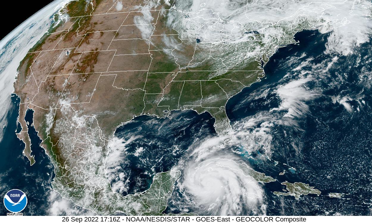
Visible Satellite Image Gulf of Mexico,
26.09., 17:16 UTC
Source: NOAA
|
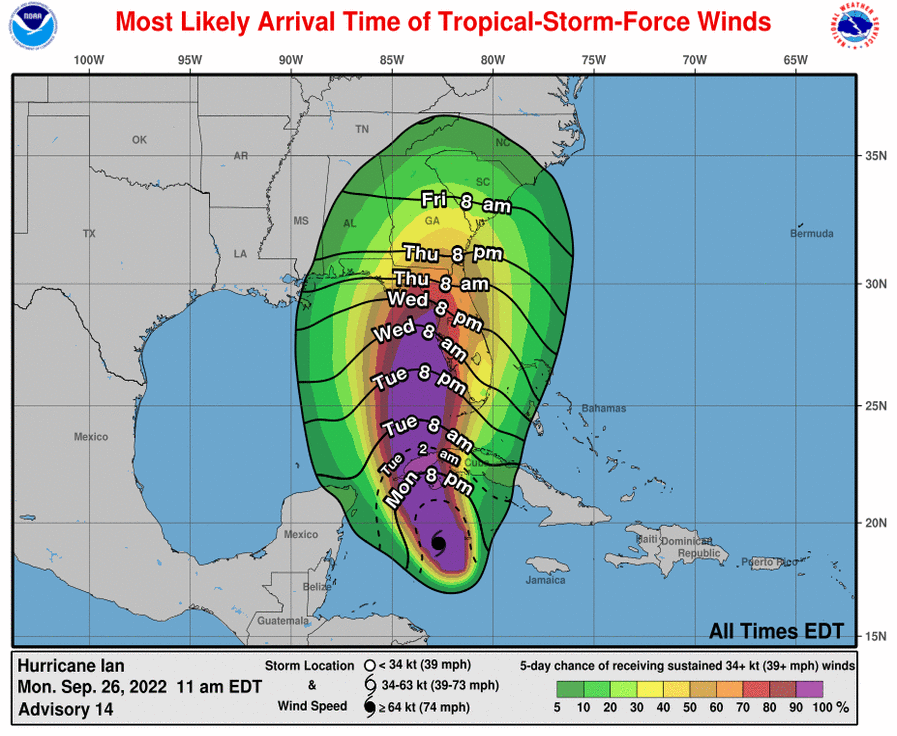
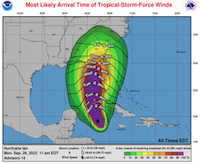
Most likely arrival of hurricane IAN
with proability for tropical storm force winds
until 01.10., 12 UTC
Source: NHC
|
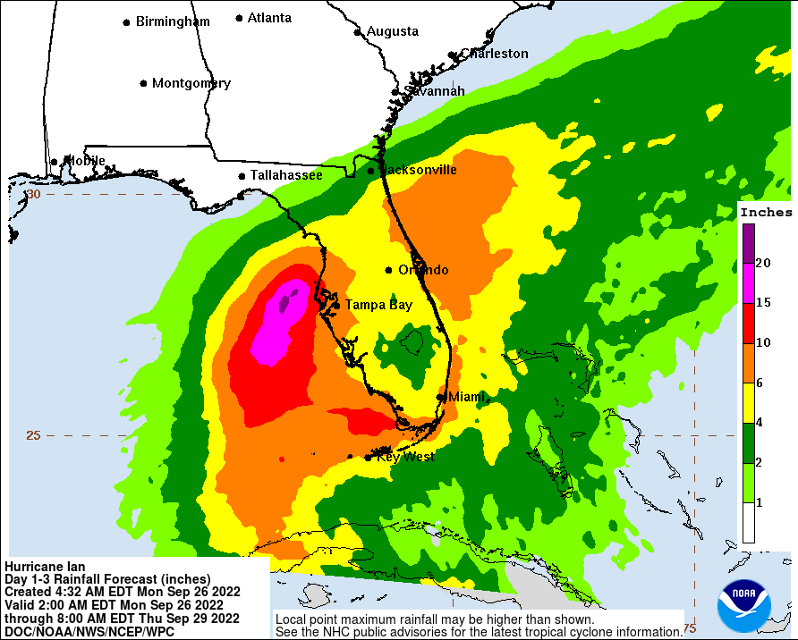
Accumulated precipitation over Florida until
29.09., 12 UTC
Source: NHC
|
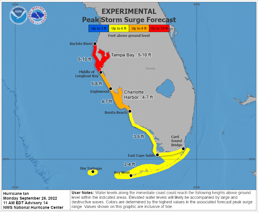
Expected storm surge along Floridian coast,
26.09., 12 UTC
Source: NHC
|
Tropical Cyclone
Cuba, Gulf States
Issued: Monday, 26 September 2022, 17:30 UTC
Southeast of the Cayman Islands tropical low IAN intensified into a category 1 hurricane. Under further intensification Hurricane IAN is expected to make landfall in western Cuba by early Tuesday morning local time as a major hurricane, further threatening the west coast of Florida in the following days.
26.09.2022
Under favorable conditions a tropical depression formed over the Caribbean Sea on Friday, September 23. Over the weekend the tropical depression intensified over the warm waters of the southern Caribbean Sea, with water temperatures exceeding the 28 °C-mark, maturing into tropical storm IAN by Saturday, September 24.
In the last hours the system intensified considerably into a category 1 hurricane by 12 UTC on September 26. Currently located southeast of the Cayman Islands with a central pressure of 980 hPa and sustained winds of 130 km/h. Further intensification is expected as the hurricane is moving northeastwards with 20 km/h.
By early Tuesday morning, September 27, local time the hurricane is expected to reach the western part of Cuba. Torrential rain, sustained winds of more than 180 km/h and an intense storm surge ought to be expected as the hurricane makes landfall, possibly reaching category 3 on the Saffir-Simpson-Scale before moving over land and therefore becoming a major hurricane.
After the passage of the island the hurricane is expected to further (re-)intensify over the Gulf of Mexico. In the night from Wednesday, September 28, to Thursday, September 29, local time IAN is expected to close in onto the west coast of Florida as a major hurricane. There is still a high uncertainty concerning the precise location of the landfall along the Floridian coast as the hurricane is expected to reduce its moving speed as well as divert onto a more easterly course. Nevertheless, extreme precipitation and winds as well as an intense storm surge ought to be expected along the west coast of Florida.
Issued: September 26, 2022, 17:30 UTC
KG
Issued: September 28, 2022, 12:00 UTC
KG
|