Banner
Der Internet Explorer bietet nur eine eingeschränkte Funktionalität. The browser you're using is only limited functionable.

Sunday, 22 Aug 2021, 12:00 UTC


Forecasted trajectory of Hurricane
HERNY, 22.08., 06 UTC
Source: NHC
Tropical storm force wind probability
and arrival time, 22.08., 06 UTC
Data Source: NHC
78h precipitation, 25.08., 12 UTC
Data Source: NHC
Satellite image (infrared) of HENRI, 22.08., 09 UTC
Data Source: NOAA


Tropical Storm
USA, Canada

Issued: Thursday, 22 Aug 2021, 11:00 UTC

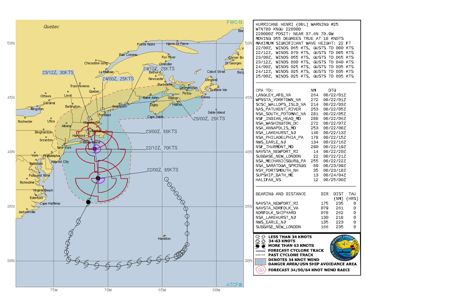
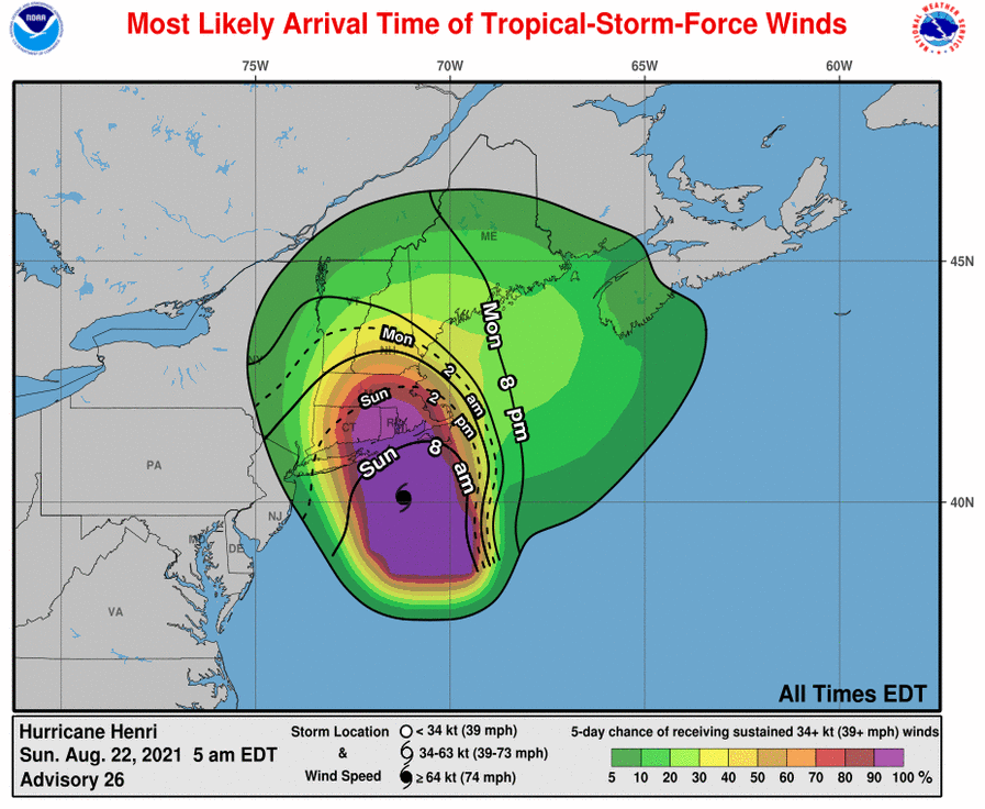
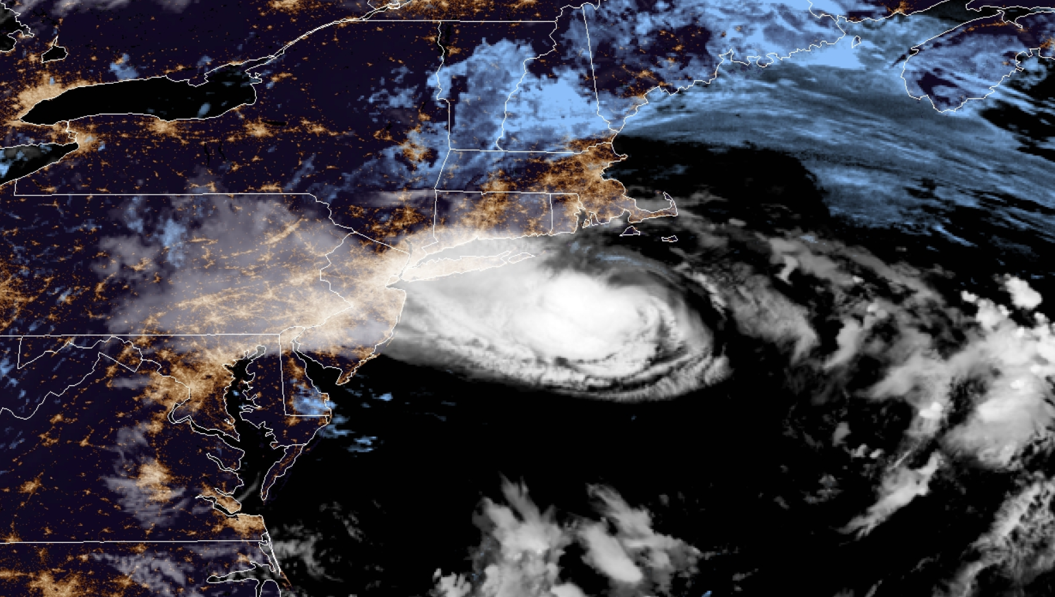
Hurricane HENRI is moving very close across Long Island and is set to make landfall in southern New England on Sunday 19 UTC between New London and New Bedford. Precipitation 
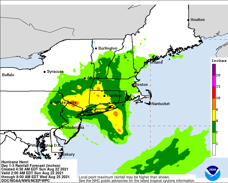
of up to 150mm possible as well as storm surge of up to 1.5m.

21.-23.08.2021


With an unusual trajectory starting roughly 500 km northwards of the Bermuda Islands, circulating around them clockwise and then turning northwards towards southern New England, HENRI has reached Hurricane-strength on August 21 at 15 UTC. The system has never been south of 29°N and reached its Hurricane-status above the 35°N latitude circle. HENRI is already showing signs of starting extratoprical transition (significant asymmetry), but the system will still strengthen to an upper Category Hurricane with mean wind speeds of up to 140 kph and gusts up to 165 kph before landfall.

Landfall is expected on August 22 around 19 UTC between New London and New Bedford. Due to the asymmetry of the system, heavy precipitation is also expected in the western area of the system. Up to 150 mm within 72h are possible across Long Island as well as New York. A strom surge warning is issued for the next 36 hours for Long Island eastward from Mastic Beach to Montauk and from Flushing, New York to Montauk, as well as from Flushing, New York east to Chatham, Massachusetts, including Nantucket, Martha's Vineyard and Block Island.


Issued: Aug 22, 2021, 11:00 UTC
FS

Visit us at
Facebook:

Information on warning levels and icons used
Information on meteoalarm.eu