|
Wednesday, 20 Aug 2021, 21:00 UTC
Issued: Friday, 20 Aug 2021, 21:00 UTC
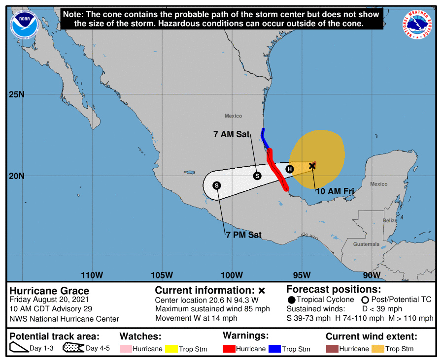
After Hurricane Grace passed the peninsula Yucaton in Mexico and the northern part of Belize, they will make a second landfall south of
Tampico at Friday night. Hurricane winds over 120 km/h and heavy precipitation are expected.
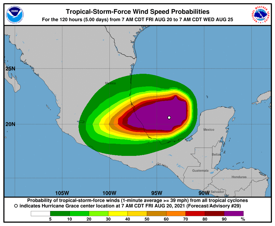
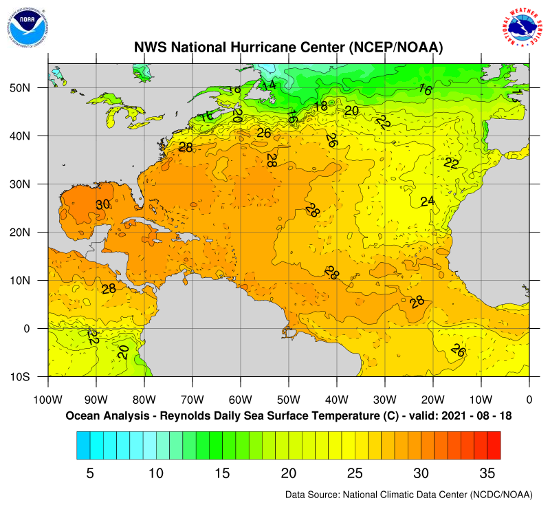
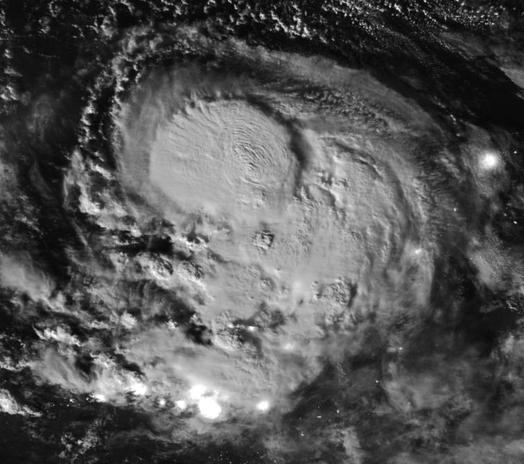
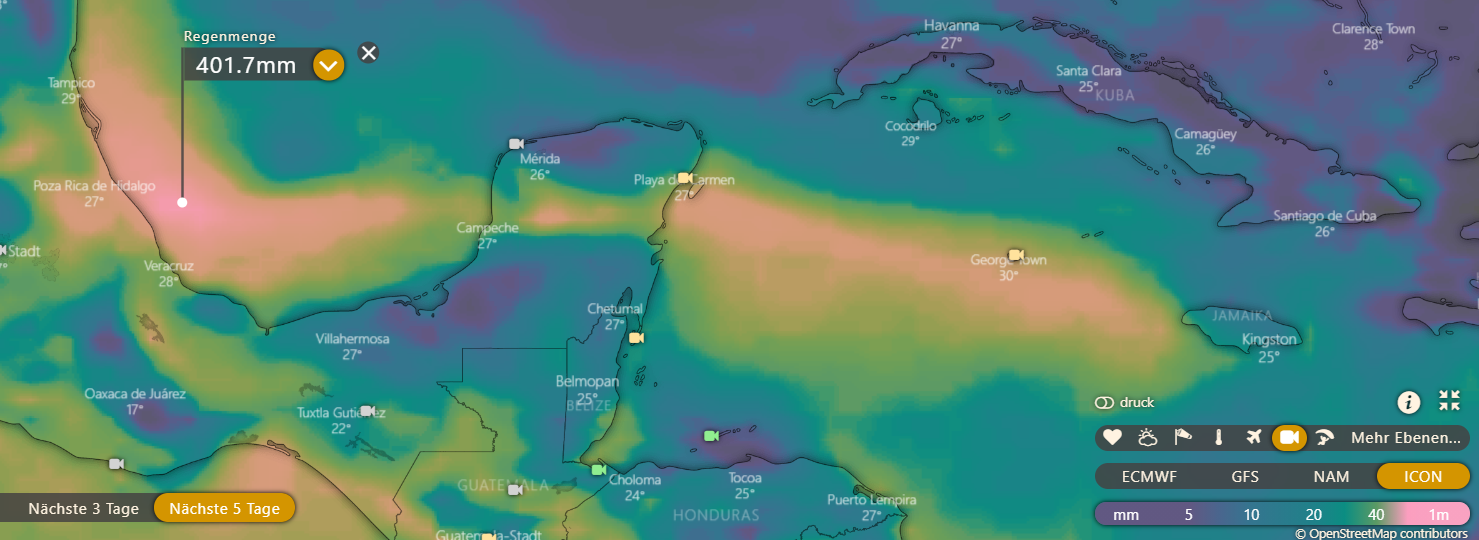
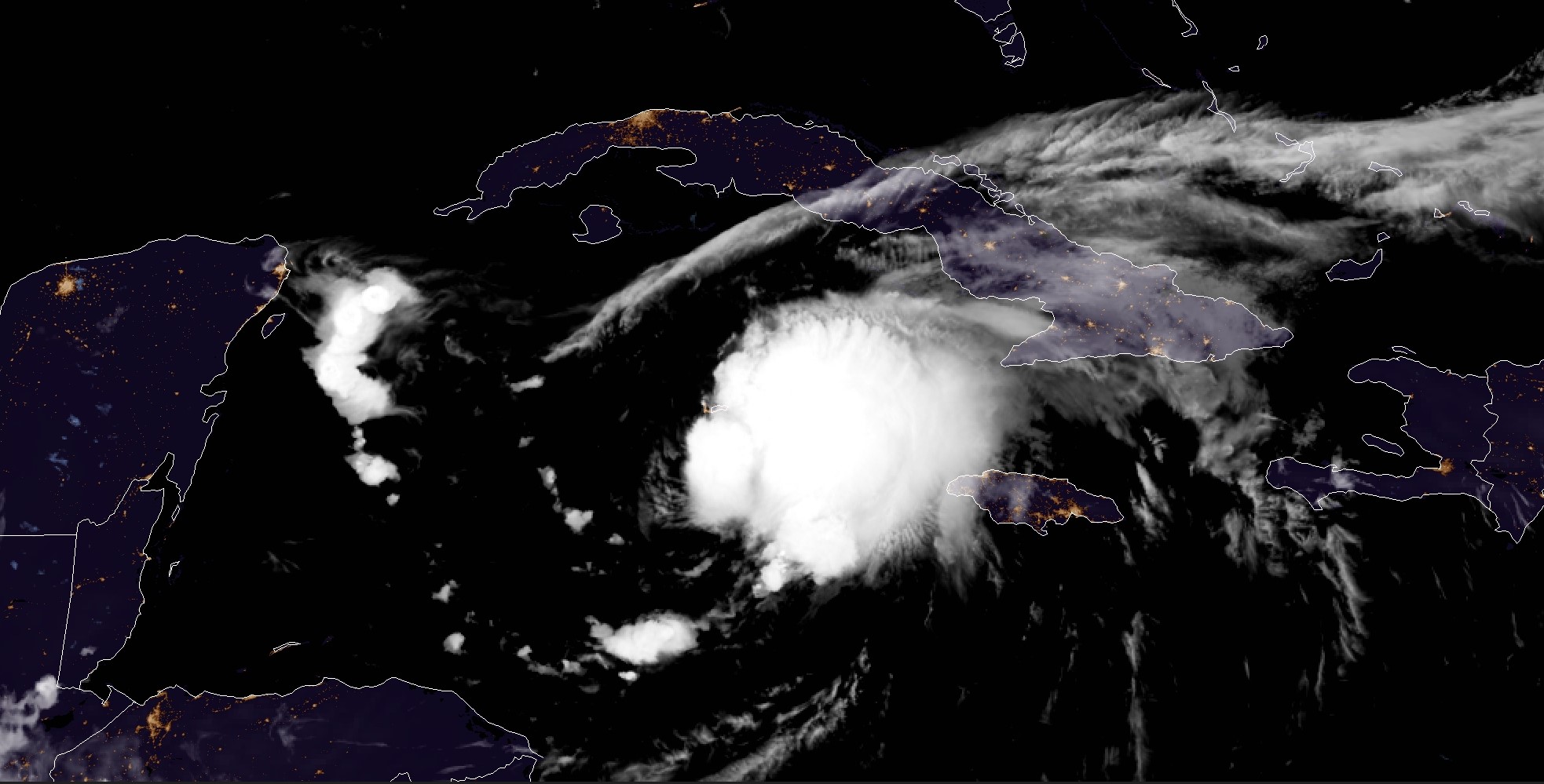
After Hurricane Grace brought intense rainfall to the Yucatan Peninsula and northern Belize, as well as wind gusts around 160 km/h and floodings, it weakened briefly as it made landfall, interrupting the energy supply. Thus, it was downgraded to a tropical cyclone yesterday (Thursday). However, a renewed intensification began over the southwestern Gulf of Mexico. This was due to very high water temperatures of 30°C and above and low to moderate wind shear values between 10 and 15 m/s. Furthermore, a very high moisture content exists. As a result, convection intensified and Grace again grew into a well-structured category 1 hurricane. The storm will likely continue to strengthen until landfall, making a second landfall Friday night as a Category 2 hurricane in Mexico. Then, a moderate storm surge, with winds up to 160 km/h, and heavy rains must be expected along the east coast. Accumulated precipitation amounts up to 300 mm are expected until Sunday. Therefore the greatest danger comes from intense rainfall, which will cause flooding and landslides, especially in mountainous and highly populated areas.
Wednesday, 18 Aug 2021, 11:00 UTC
Issued: Wednesday, 18 Aug 2021, 11:00 UTC
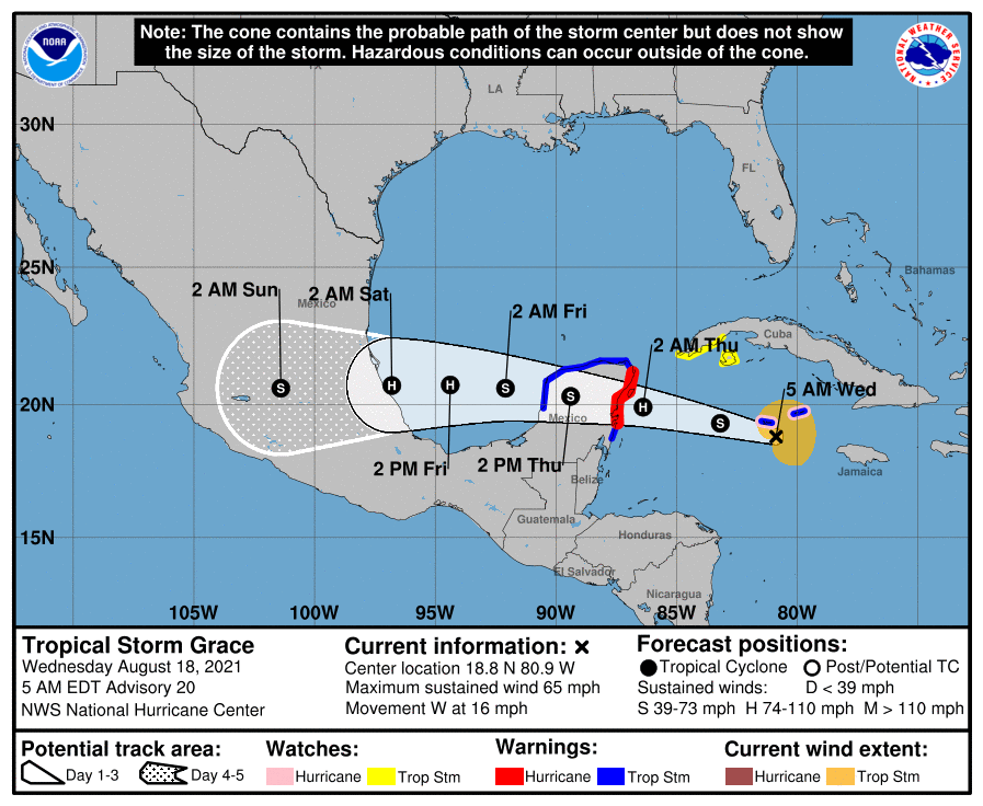
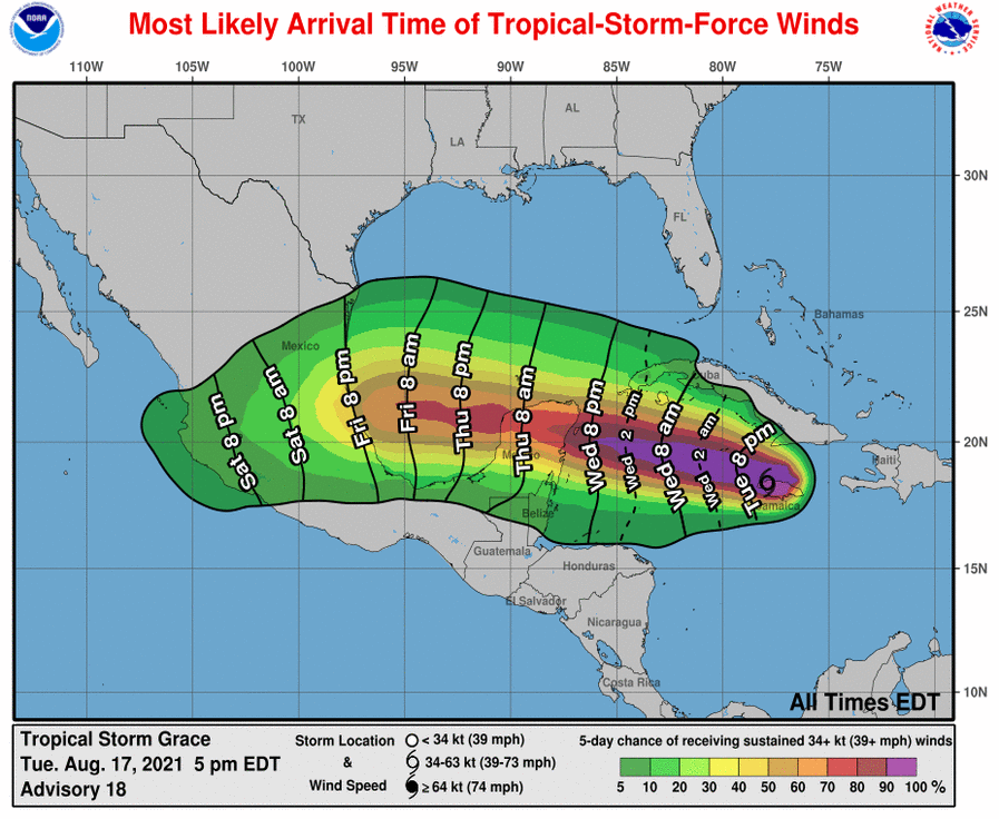
Three active tropical system in the Northern Atlantic. GRACE will make landfall in Quinatana Roo (MX) and re-enter the southern Gulf of Mexico.
Another Hurricance-strength landfall is possible. Total precipitation of up to 300mm.
While the 2021 Northern Atlantic Hurricane Season picks up the pace, there are currently three active tropical systems beeing monitored. Ex - Tropical Storm FRED
has already moved from the Gulf of Mexico to the north and is dissipating over the continental masses of Northern America. Roughly 2500 km eastwards Tropical Depression
Eight has increased to Tropical Storm HENRI on August 16 and is likely to reach Hurricane strength on Friday, August 20. However, there will be no landfall and the impacts
will be limited to coastal areas of Easern USA and Canada as well as the Bermuda Islands. Issued: Aug 20, 2021, 21:00 UTC NB Issued: Aug 18, 2021, 11:00 UTC FS |