Friday, 18 June 2021, 08:00 UTC
|
|

|
|
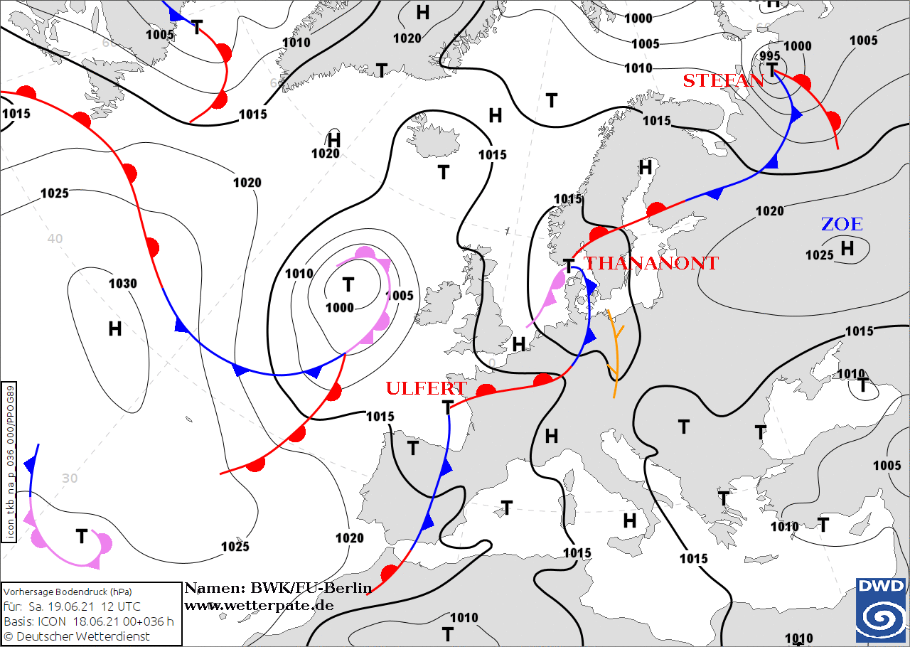
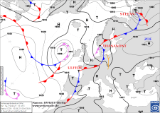
Sea level pressure and fronts, 19.06., 12 UTC
Source: DWD
|
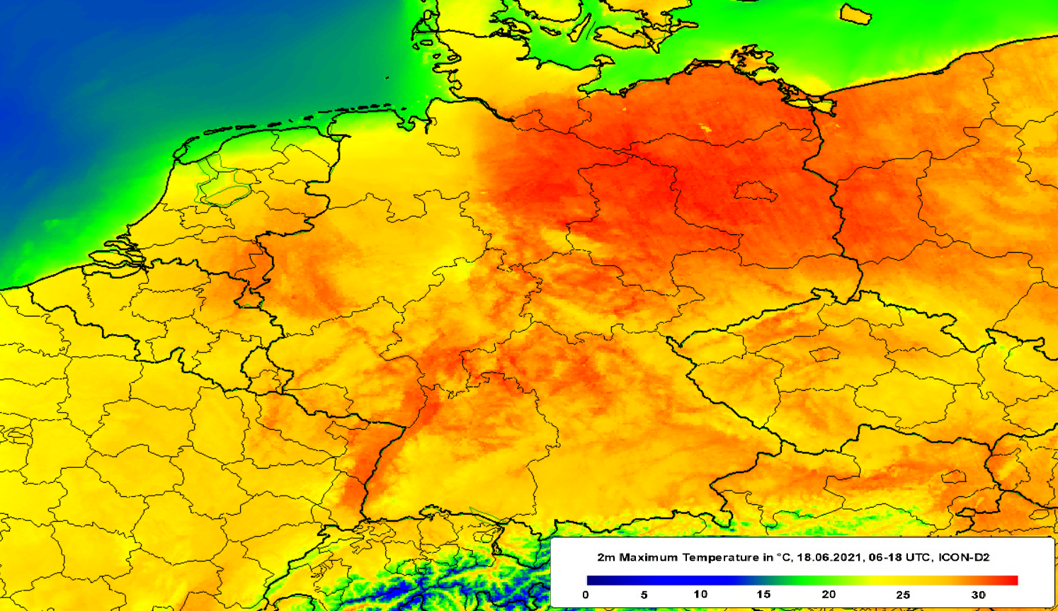
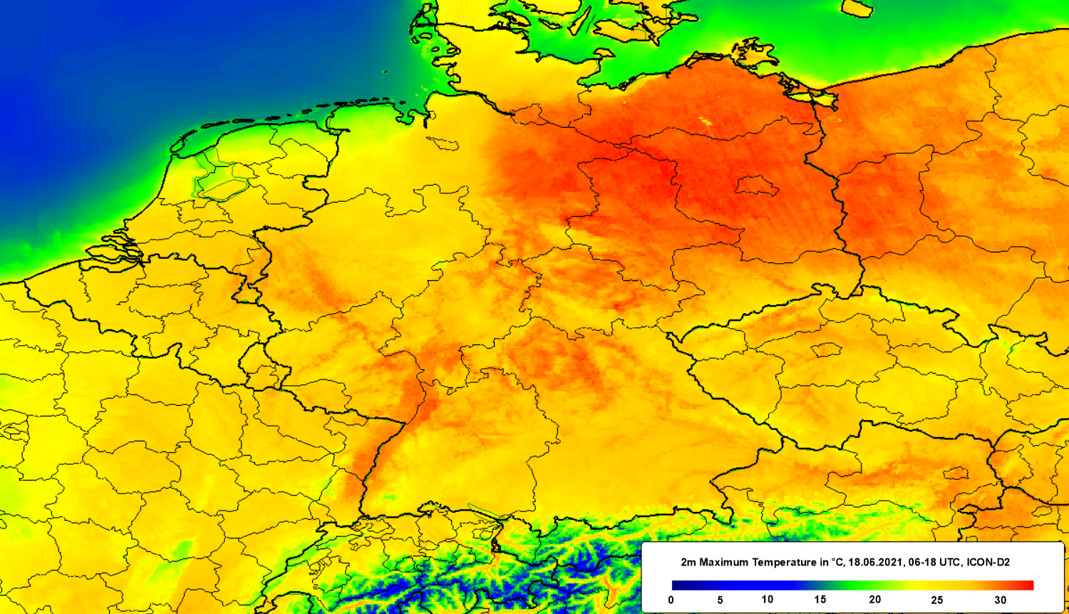
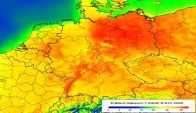
2m maximum temperature, 18.06., 06-18 UTC
Data Source: DWD, Figure: Fabian Siegmann
|
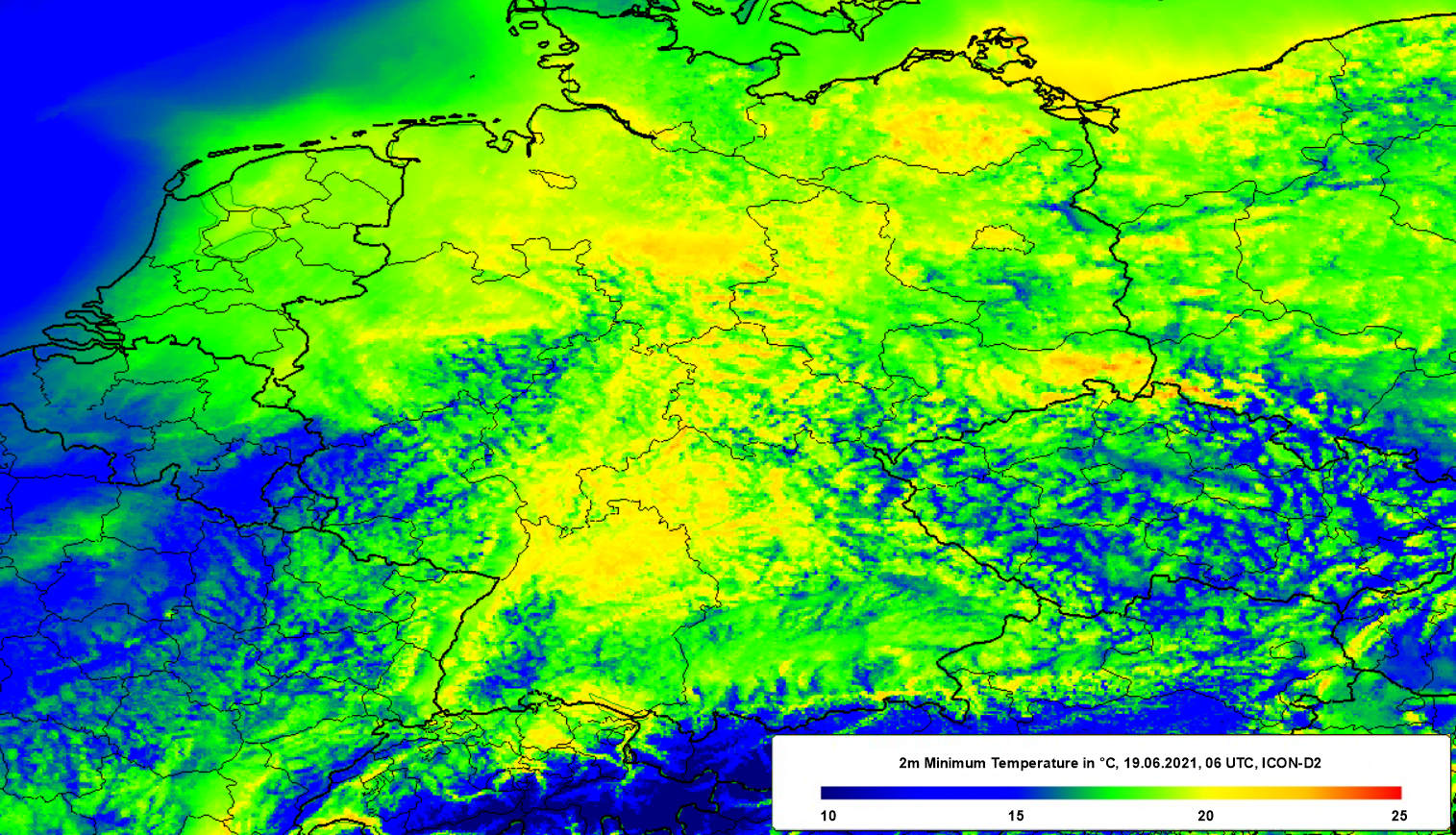
2m minimum temperature, 19.06., 06 UTC
Data Source: DWD, Figure: Fabian Siegmann
|
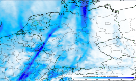
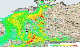
48h precipitation, 21.06., 12 UTC
Data Source: DWD, Figure: Fabian Siegmann
|
Heat Wave / Thunderstorms
Central Europe
Issued: Friday, 18 June 2021, 08:00 UTC
Heat wave has reached its climax in the western parts of Germany. Temperatures well above 35°C still possible in Eastern Germany. Increasing risk of
thunderstorms including gale-force gusts, heavy rain and hail. Tornadoes possible.
17.-20.06.2021
The Atlantic trough has further shifted to the east and is located over the western Iberian coastline on todays Friday. Very warm air with 850 hPa temperatures above
20°C continues to be directed towards Central Europe. While in western Germany the climax of the heat wave - in terms of actual temperature - has been reached yesterday,
the temperatures may still rise to well above 35° in the eastern parts of the country. Additionally, increasing moisture leads to even enhanced heat loads for humans. With the
presence of clouds, nighttime temperatures will increase. Tropical nights (Tmin > 20°C) are likely in large parts across the country.
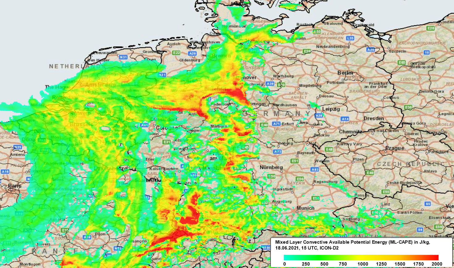
Starting today there is a risk of heavy thunderstorms including gale-force gusts and heavy precipitation for western parts of Germany. On Saturday and Sunday, thunderstorms
will reach further to the east and become more organized as vertical wind shear is increasing. ML-CAPE values of up to 2000 J/kg, locally even reaching 2500 J/kg, represent
the high amount of available energy. Hail has to be taken into account. Although these phenomena are rare in central Leuopra, it is still noteworthy and necessary to warn of
an increased risk of tornadoes in the vicinity of larger-scale thunderstorms and MCSs. Accumulated precipitation on Saturday and Sunday is expected to reach 20 mm in large
parts of western Germany. Locally up to 75 mm are possible. Only litte or even no precipitation in parts of eastern Germany.
Highest maximum temperatures from 17.06.2021 in Germany:
| Location |
Maximum Temperature |
Date |
Münster/Osnabrück Flugh. (53m)
Hamburg-Neuwiedenthal (3m)
Celle (40m)
Dörpen (8m)
Köln/Bonn Flughafen (100m)
Lippstadt-Bökenförde (92m)
Worpswede-Hüttenbusch (7m)
Wunstorf (57m)
Bad Mergentheim (250m
Boizenburg (46m)
|
35.5°C
35.3°C
35.1°C
35.1°C
35.0°C
35.0°C
35.0°C
34.9°C
34.9°C
34.8°C
|
17.06.2021
17.06.2021
17.06.2021
17.06.2021
17.06.2021
17.06.2021
17.06.2021
17.06.2021
17.06.2021
17.06.2021
|
|
Thursday, 17 June 2021, 16:30 UTC
|
|
|
|
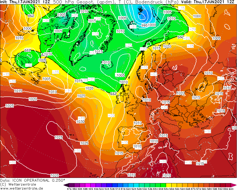
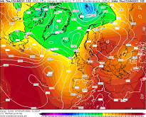
500 hPa Geopotential height, 17.06., 12 UTC
Source: Wetterzentrale
|
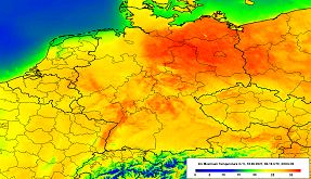
2m maximum temperature, 18.06., 06-18 UTC
Data Source: DWD, Figure: Fabian Siegmann
|
ML-CAPE, 18.06., 15 UTC
Data Source: DWD, Figure: Fabian Siegmann
|
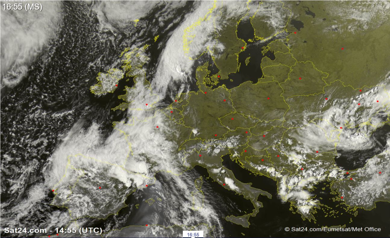
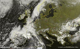
Satellite image (visible), 17.06., 15 UTC
Source: Sat24
|
Heat Wave / Thunderstorms
Central Europe
Issued: Thursday, 17 June 2021, 16:30 UTC
Temperatures up to 35°C from Thursday to Sunday. Increasing Thunderstorm activity with favorable setup on Sunday. Gale-force gusts, heavy rain and hail possible in Baden-Württemberg and Bavaria.
17.-20.06.2021
A light but extensive trough over the Bay of Biscay directs very hot air masses of subtropical origin to Central Europe in a south-southwesterly high-altitude current.
Already today, Thursday, the 850 hPa temperature will rise up to 20°C in the evening. On Sunday, even values of up to 25°C are possible in southeastern Germany. The heat
wave also appears to be remarkable close to the ground. Already today, the 30°C mark was reached in many locations across Germany. While today the highest temperatures
will be registered in the northwest and in the southwestern lowlands (Rhine valley), the maximum will shift to the northeast of the country tomorrow, Friday. The heat
will also last the longest there, with temperatures as high as 38°C possible in Brandenburg on Sunday.
Starting on Friday, thunderstorms will also be on the schedule, which, given a favorable set-up, may occur in a well-organized form. With high ML-CAPE values of up
to 2000 J/kg and wind shear increasing over the course of the weekend, gale-force gusts, heavy rain and hail may occur. The highest thunderstorm activity is expected
on Sunday, before a slight cooling sets in at the start of the new week.
Issued: June 17, 2021, 16:30 UTC
FS
Issued: June 18, 2021, 08:00 UTC
FS
|