Sunday, 15 November 2020, 08:00 UTC
|
|
|
|
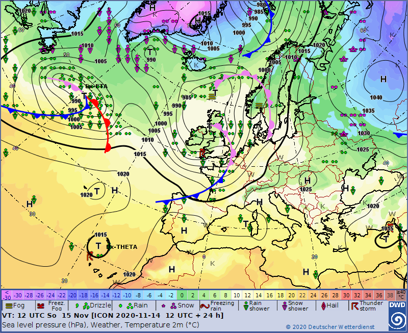
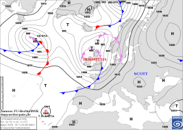
Sea level pressure and fronts, 15.11., 12 UTC
Data Source: DWD
|
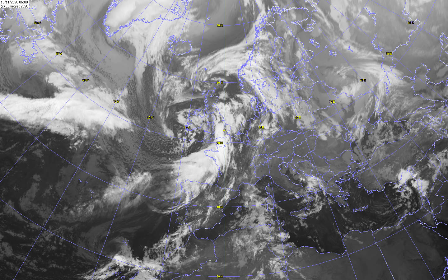
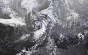
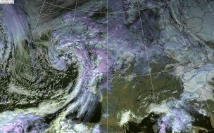
Satellite image (IR), 14.11. 06 UTC
Data Source: Wokingham
|
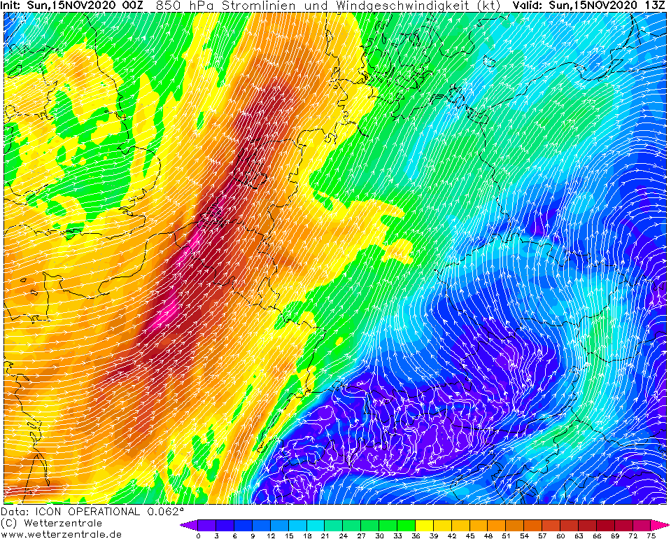
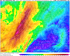
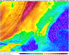
850 hPa Wind Central Europe, 15.11., 13 UTC
Data Source: Wetterzentrale
|
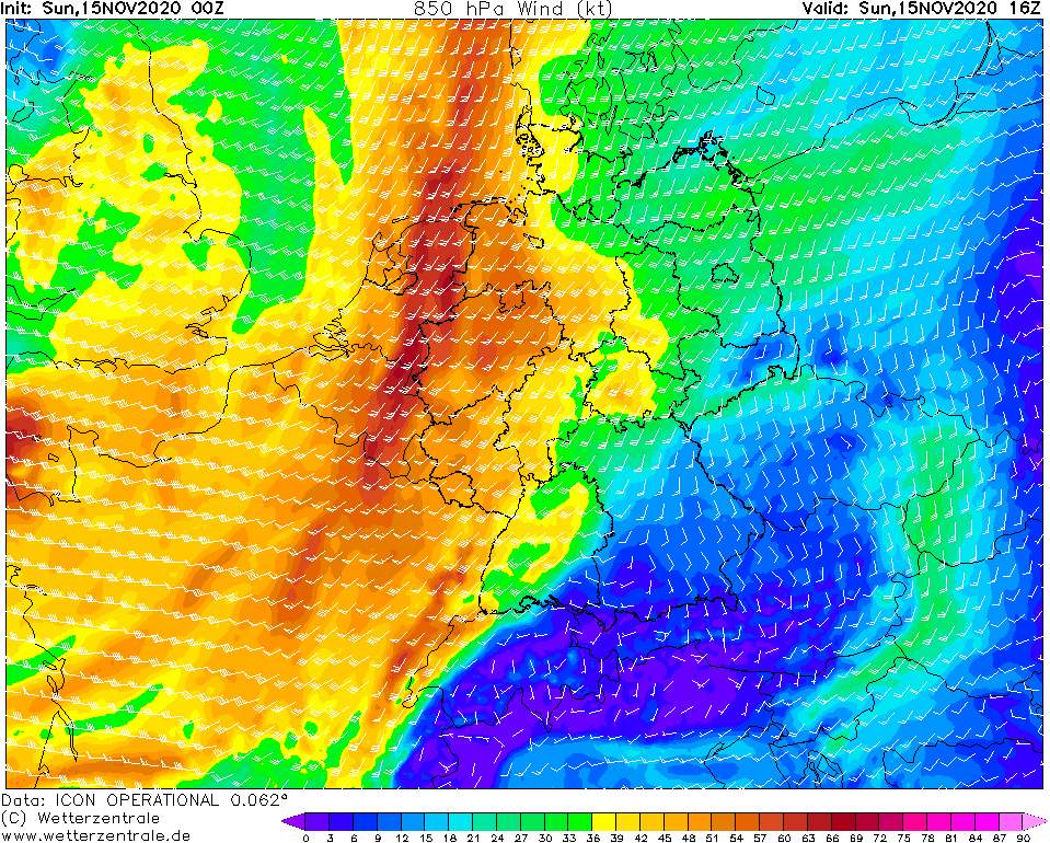
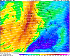
850 hPa Wind Central Europe, 15.11., 16 UTC
Data Source: Wetterzentrale
|
Windstorm
Europe, Great Britain
Issued: Sunday, 15 November 2020, 08:00 UTC
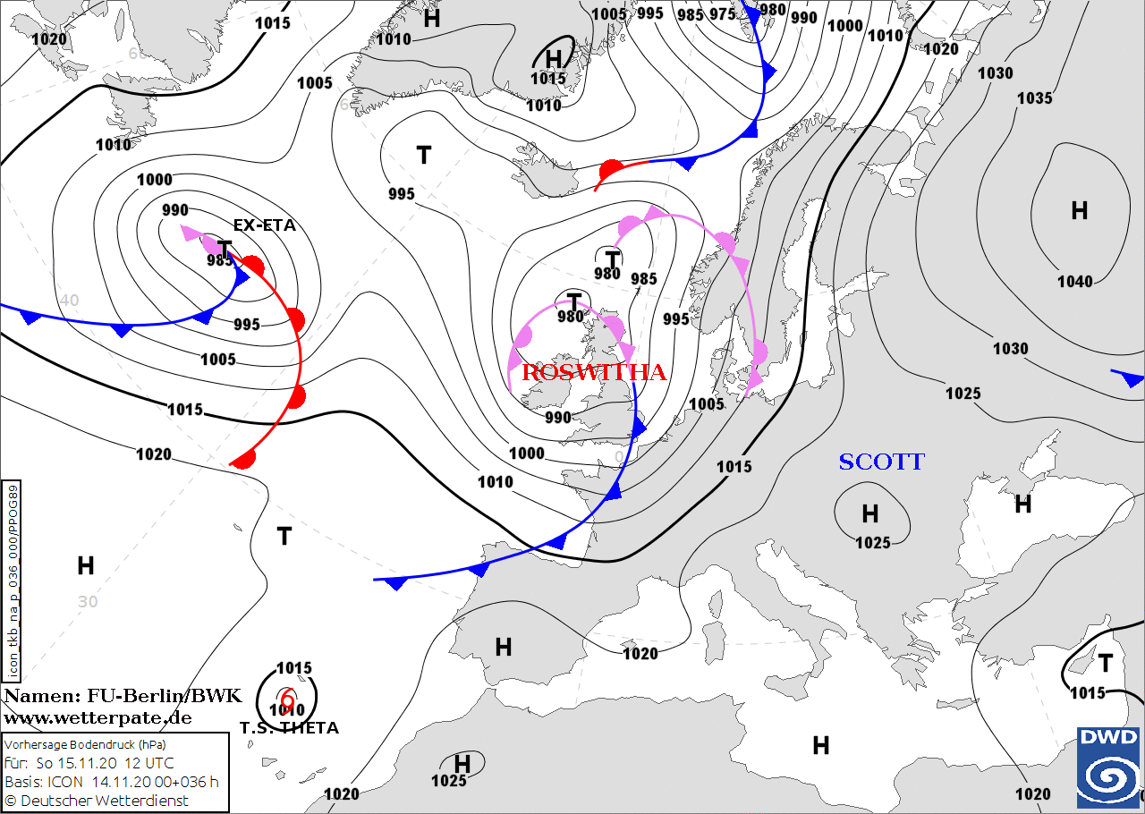
Storm low ROSWITHA provides gusts of up to 140 km/h in exposed locations during the night to Sunday. The north and north-east of France and the Benelux countries
are affected. Due to strong warm air advection the temperatures in the south of France and in the southwest of Germany reach temperatures just below 20 degrees.
14.-15.11.2020
While the high-pressure system Scott with its core over southeastern Europe is still providing calm weather on Saturday afternoon, storm low ROSWITHA has rapidly
intensified on the Atlantic west of Ireland. The core is located northwest of Ireland. The clouds of the frontal system are already reaching the northwest of France,
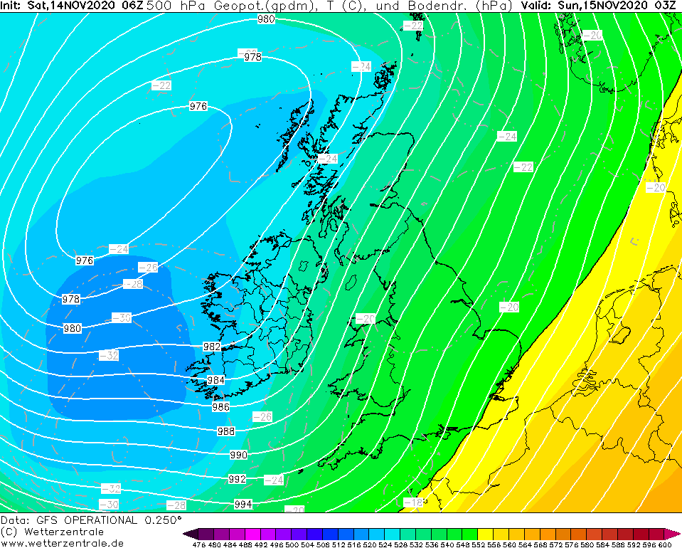
as well as Ireland and Great Britain. ROSWITHA is further intensified by the favorable location in front of a jet stream and by a dry intrusion. The core pressure
is currently around 980 hPa and will fall to around 975 hPa by night to Sunday. The strongest winds are expected along the cold front and southeast of the core.
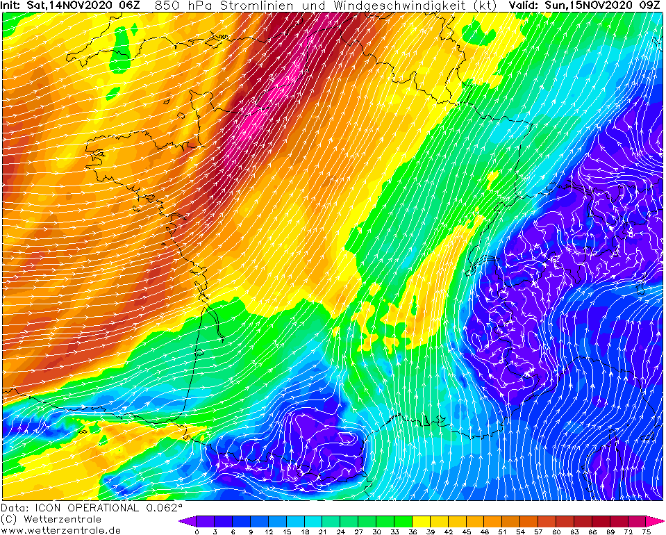
In the south of England the wind speed increases noticeably until the evening, especially at higher altitudes. At exposed locations, gusts of around 100 km/h are
occasionally expected, locally even 130 km/h. A second wind maximum is formed on Sunday night and tomorrow over the north of France by the cold front. There, gusts
of up to 140 km/h are expected in exposed locations. This storm field will then spread to the BeNeLux states and the southeast of England. At lower altitudes,
strong to stiff winds around 60 km/h are expected. Occasionally, gusts of around 120 km/h may also occur on Sundays in northwest and northern Germany in exposed
locations. Towards evening, the storm field weakens, but spreads to the entire west of Germany at about 100 km/h. In addition to stormy winds, the cold front also
brings showers and thunderstorms, some of which can be strong.
Not warning relevant but interesting is the remarkable warm air advection on the front of ROSWITHA. In the middle and south of France as well as in the southwest of
Germany (especially the Rhine plain) temperatures will reach just below 20 degrees on Saturday and Sunday.
Saturday, 14 November 2020, 15:00 UTC
|
|
|

|
Sea level pressure and fronts, 15.11., 12 UTC
Data Source: FU-Berlin
|
Satellite image (VIS), 14.11. 09 UTC
Data Source: Wokingham
|
850 hPa Wind Central Europe, 15.11., 09 UTC
Data Source: Wetterzentrale
|
500 hPa Geopotential, Central Europe, 15.11., 03 UTC
Data Source: Wetterzentrale
|
Windstorm
Europe, Great Britain
Issued: Saturday, 14 November 2020, 15:00 UTC
Storm low ROSWITHA provides gusts of up to 140 km/h in exposed locations during the night to Sunday. The north and north-east of France and the Benelux countries
are affected. Due to strong warm air advection the temperatures in the south of France and in the southwest of Germany reach temperatures just below 20 degrees.
14.-15.11.2020
While the high-pressure system Scott with its core over southeastern Europe is still providing calm weather on Saturday afternoon, storm low ROSWITHA has rapidly
intensified on the Atlantic west of Ireland. The core is located northwest of Ireland. The clouds of the frontal system are already reaching the northwest of France,
as well as Ireland and Great Britain. ROSWITHA is further intensified by the favorable location in front of a jet stream and by a dry intrusion. The core pressure
is currently around 980 hPa and will fall to around 975 hPa by night to Sunday. The strongest winds are expected along the cold front and southeast of the core.
In the south of England the wind speed increases noticeably until the evening, especially at higher altitudes. At exposed locations, gusts of around 100 km/h are
occasionally expected, locally even 130 km/h. A second wind maximum is formed on Sunday night and tomorrow over the north of France by the cold front. There, gusts
of up to 140 km/h are expected in exposed locations. This storm field will then spread to the BeNeLux states and the southeast of England. At lower altitudes,
strong to stiff winds around 60 km/h are expected. Occasionally, gusts of around 120 km/h may also occur on Sundays in northwest and northern Germany in exposed
locations. Towards evening, the storm field weakens, but spreads to the entire west of Germany at about 100 km/h. In addition to stormy winds, the cold front also
brings showers and thunderstorms, some of which can be strong.
Not warning relevant but interesting is the remarkable warm air advection on the front of ROSWITHA. In the middle and south of France as well as in the southwest of
Germany (especially the Rhine plain) temperatures will reach just below 20 degrees on Saturday and Sunday.
Issued: Saturday 14, November, 15:00 UTC
MG
Issued: Sunday 15, November, 08:00 UTC
MG
|