Saturday, 03 october 2020, 22:30 CEST
|

|
|
|
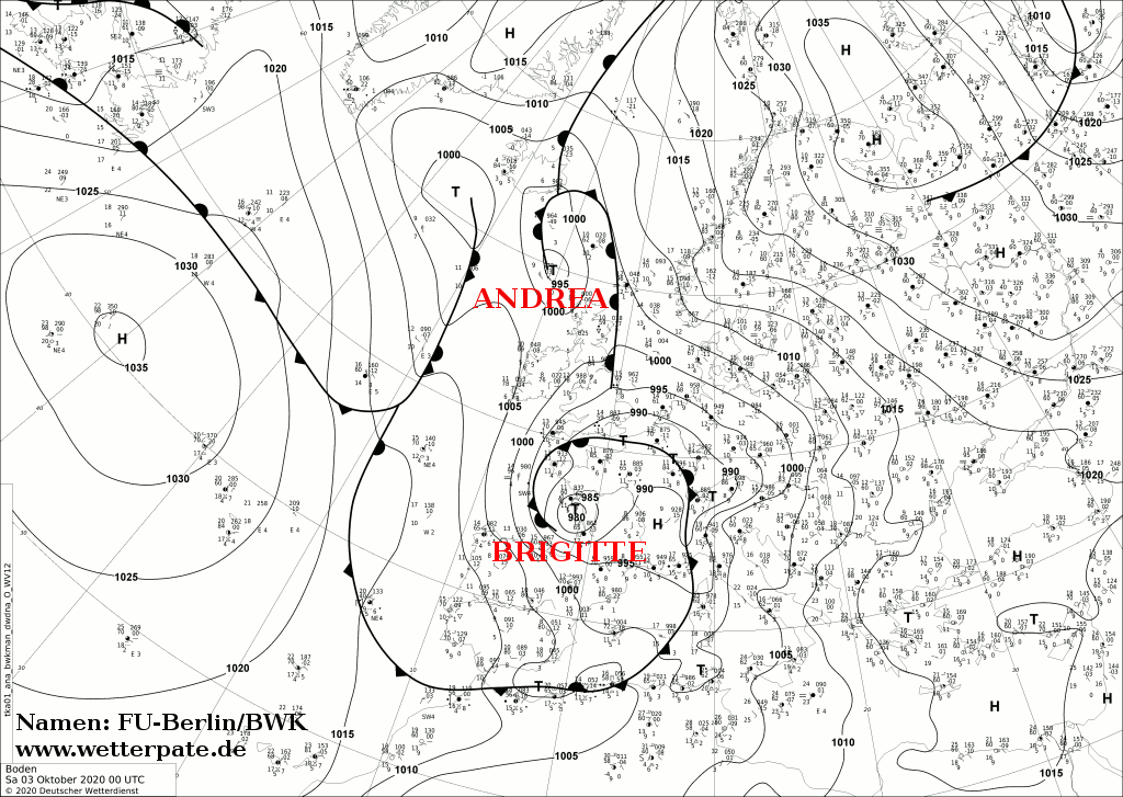
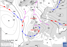
Sea level pressure and fronts, 03.10., 00 UTC
Data Source: FU-Berlin
|
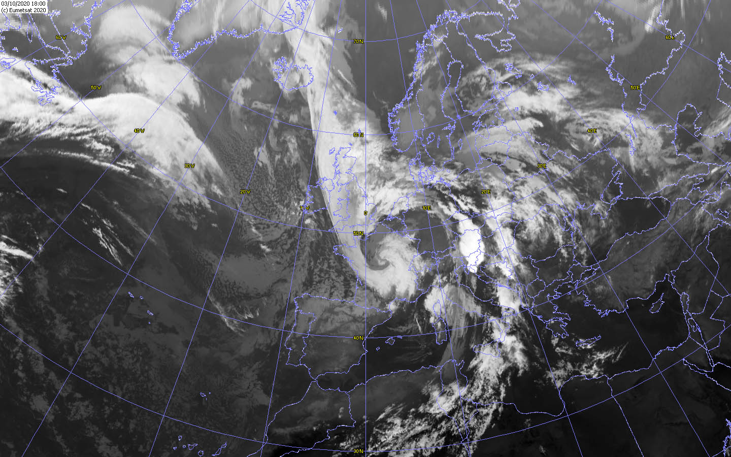
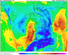
Satellite image (IR), 03.10. 18 UTC
Data Source: Wokingham
|
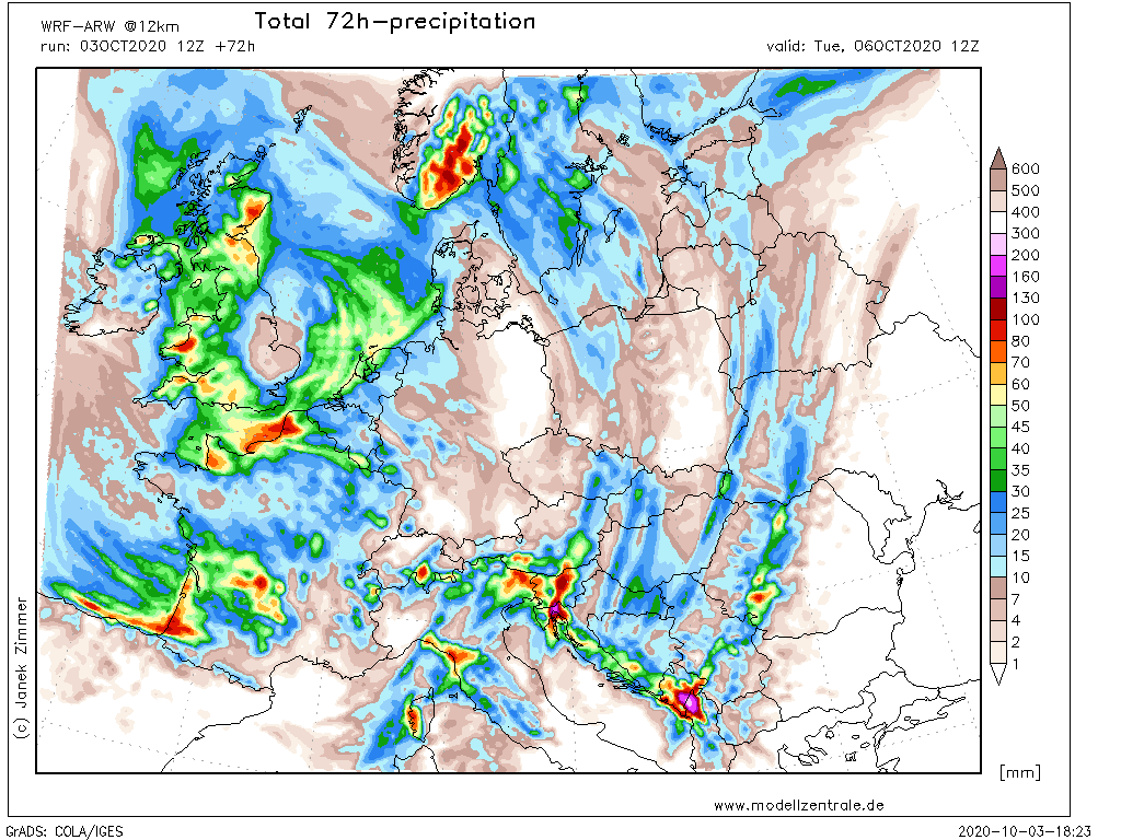
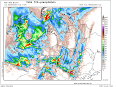
72h precipitation Europe
Data Source: Modellzentrale
|
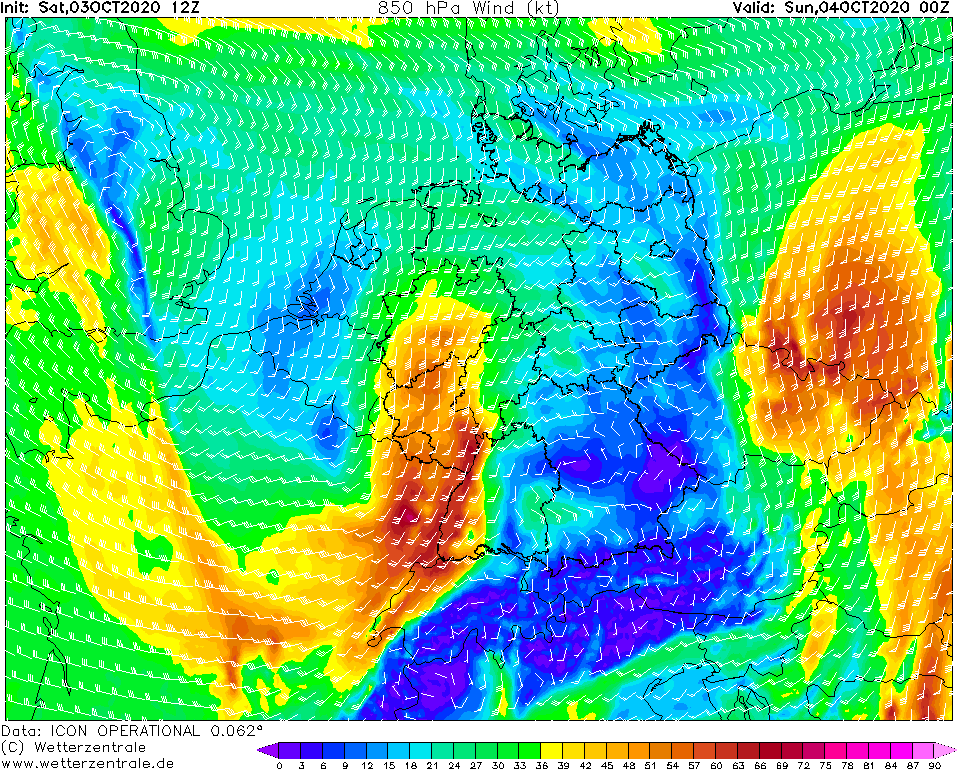
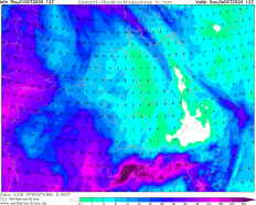
850 hPa Wind France, 04.10., 00 UTC
Data Source: Wetterzentrale
|
Storm Low
Central Europe
Issued: Saturday, 03 October 2020, 22:30 CEST
Stormy low BRIGITTE continues to cause gale-force gusts over Central Europe and torrential rainfall on the southern side of the Alps.
01.-05.10.2020
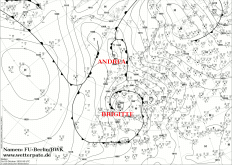
BRIGITTE's center is currently located above the center of France and will slowly shift to the northeast in the coming hours. A storm field of about 130 km/h is
forming southeast and south of the core. This storm field spreads over eastern France to Germany and also causes gusts of about 130 km/h in the night from Saturday
to Sunday. In the further course of the day the storm field weakens, but on Sunday in the southwest and south of Germany stormy gusts are still reached.
BRIGITTE also caused torrential rainfall in the area of the Southern Alps. In southern Switzerland, up to 350 mm were measured in the last 24 hours. In the
French Alps up to 100 mm were measured in the last 24 hours. Also in Italy the precipitation reached over 200 mm in the last 24 hours. From Sunday evening on,
there will be again heavy precipitation in this areas. Also in the northwest of Italy and on the coasts of the Balkan states, up to 250 mm can accumulate until
Monday.
Thursday, 01 october 2020, 21:30 CEST
|

|
|
|
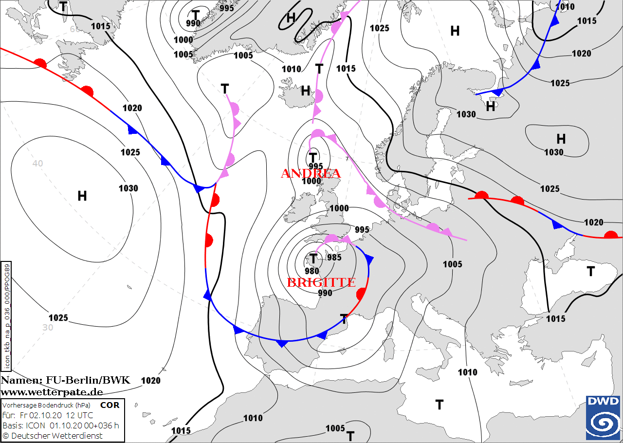
Sea level pressure and fronts, 01.10., 12 UTC
Data Source: FU-Berlin
|
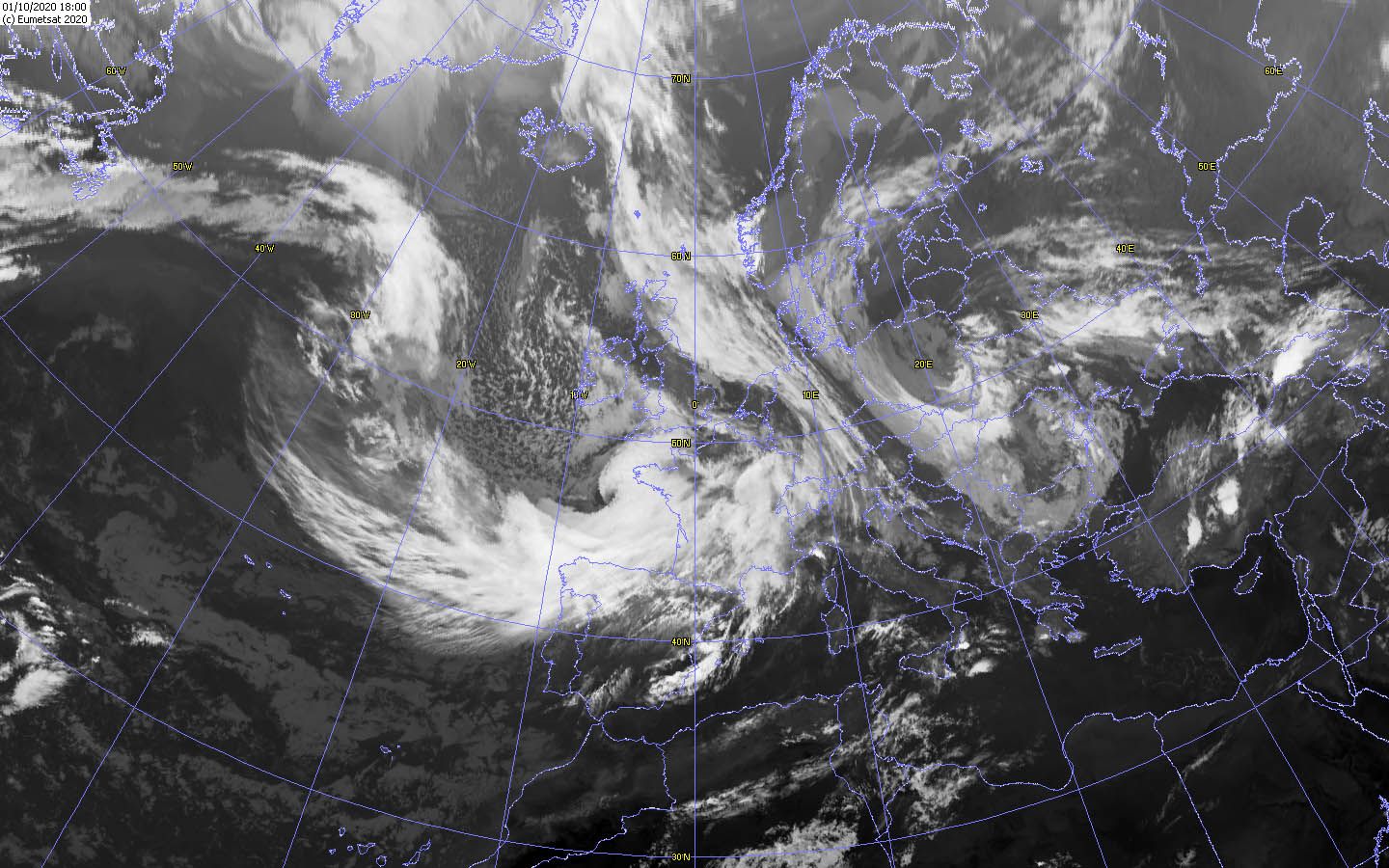
Satellite image (IR), 01.10. 18 UTC
Data Source: Wokingham
|
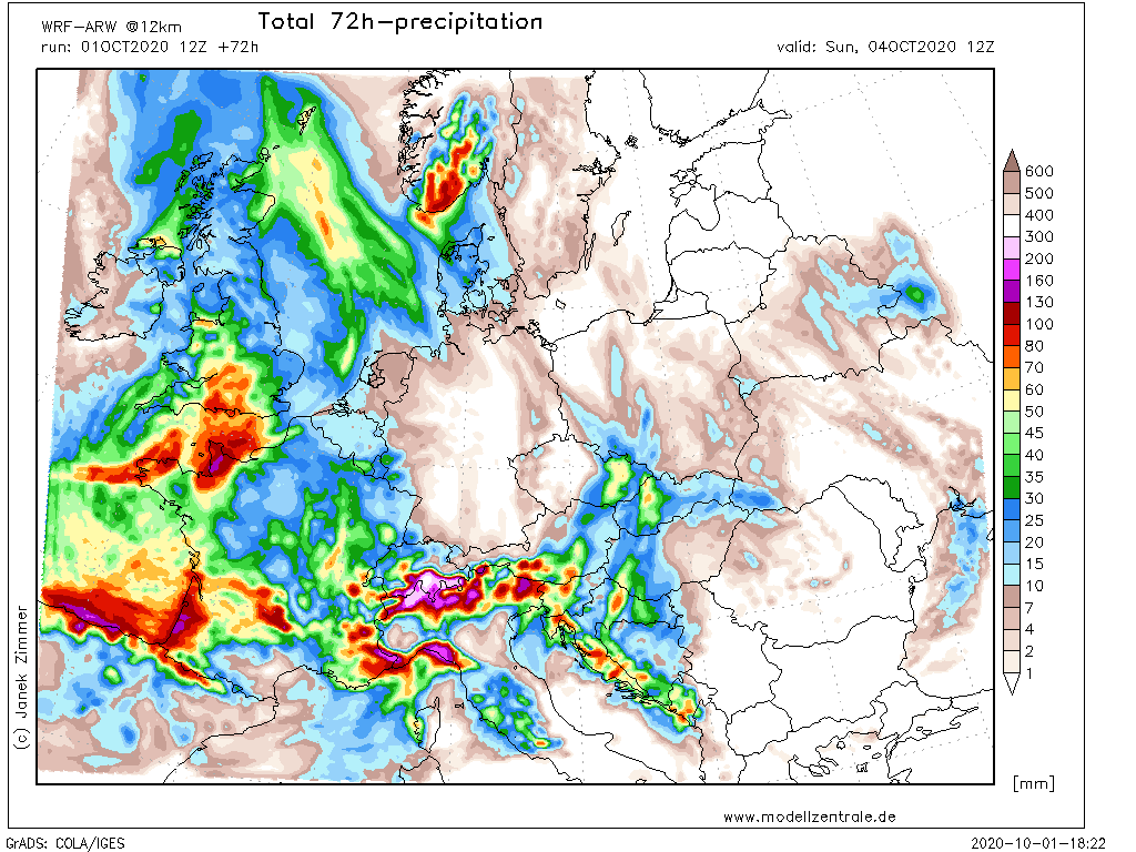
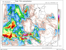
72h precipitation Europe
Data Source: Modellzentrale
|
850 hPa Wind France, 02.10., 00 UTC
Data Source: Wetterzentrale
|
Storm Low
Central Europe
Issued: Thursday, 01 October 2020, 21:30 CEST
Storm low BRIGITTE will cause gale-force gusts over large parts of France at speeds of up to 130 km/h over the next few hours. From Saturday, the low pressure system will also cause torrential rainfall over the southern Alps. By Sunday, up to 230 mm can accumulate.
01.-05.10.2020
The first autumn storm develops off the coast of France over the Atlantic. Low pressure system BRIGITTE intensifies over the Bay of Biscay and sets course
for Central Europe. BRIGITTE is currently at the head of a trough reaching far south and in front of a powerful jet stream. At 12 UTC this morning, its
core pressure was 1000 hPa and will fall to 970 hPa by 00 UTC tonight. This would put BRIGITTE in the category of rapid cyclogenesis. At this time its
core is located above Brittany. The strongest winds are expected with up to 140 km/h southwest of the core in the area of strongest pressure gradient. This
area extends from the deep core over the west coast of France and Friday morning over the center of the country. BRIGITTE itself will remain over Brittany and
will hardly shift until Friday afternoon. This is due to the strong ridge over eastern and northeastern Europe. From Friday evening on, the low pressure system
will shift rapidly southwards and its wind field will increase again. On the coasts of Spain and in the southwest of France gusts of up to 130 km/h are expected.
As soon as BRIGITTE reaches the mainland, its wind field weakens rapidly. In the night to Sunday another storm field with up to 80 to 100 km/h reaches the
southeast of France and the southwest of Germany and provides in the further course of the day also in the center and southeast for stormy gusts.
From this point on, the models simulate the further course of BRIGITTE differently. What is certain, however, is that a Föhnorkan can be expected over the
weekend. Due to the southerly wind, there will also be stagnant precipitation on the south side of the Alps. Especially the northwest of northern Italy
and southern Switzerland are affected. From Friday to Sunday, precipitation of up to 230 mm can occur there (in high altitudes up to 50 cm of fresh snow).
Especially in the night to Saturday there is a lot of precipitation. In three hours, up to 40 mm can accumulate locally.
BRIGITTE is a Shapior Keyser cyclone. Its distinguishing features are the massive cloud head and the only weakly pronounced cold front.
It remains to be seen whether a sting jet will occur.
Issued: October 01, 2020, 21:30 CEST
MG
Issued: October 03, 2020, 22:30 CEST
MG
|