Friday, 18 September 2020, 09:30 CEST

|
|
|
|
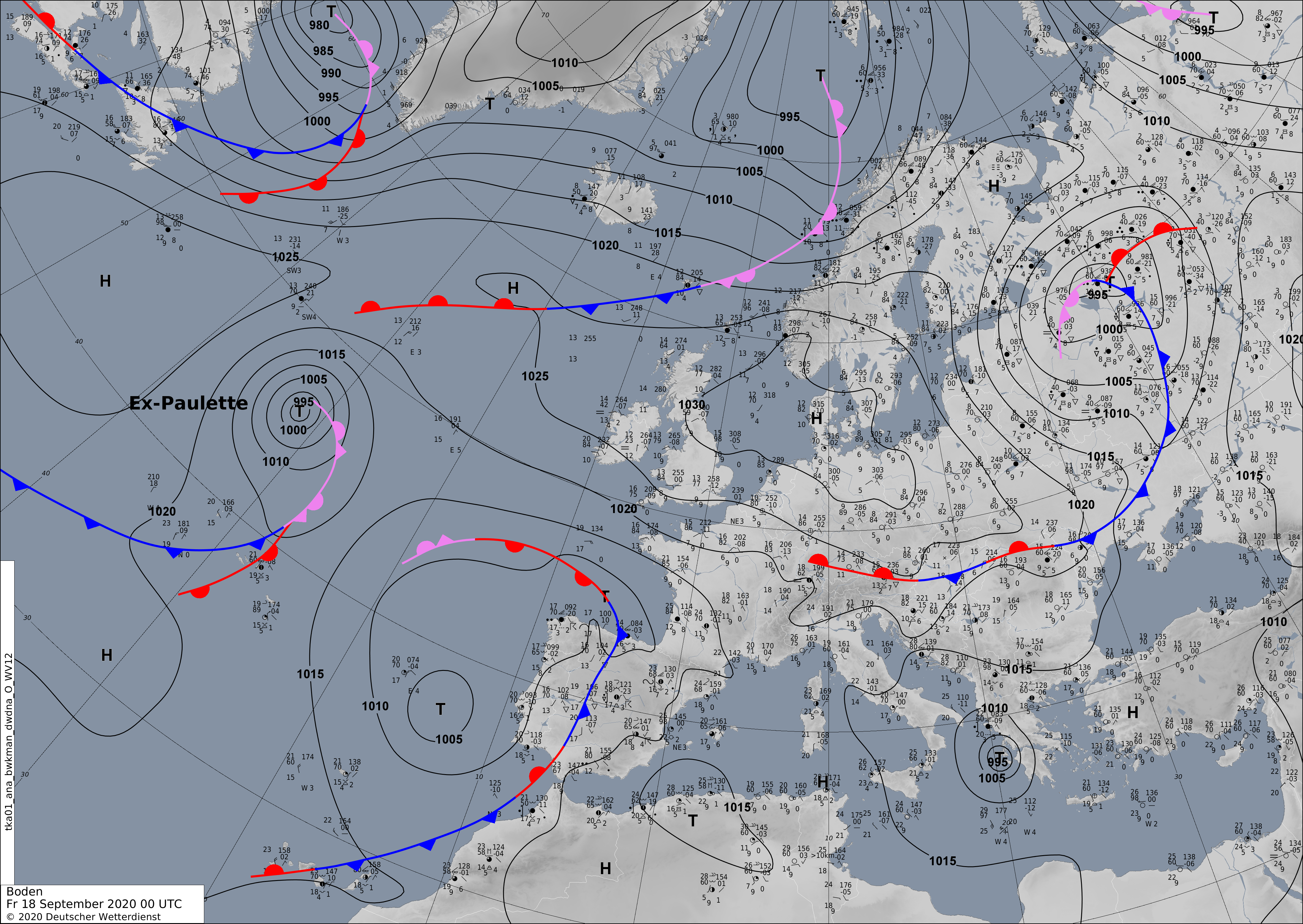
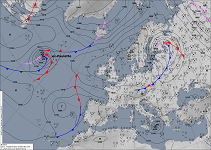
Sea level pressure and fronts, 18.09., 00 UTC
Data Source: DWD
|
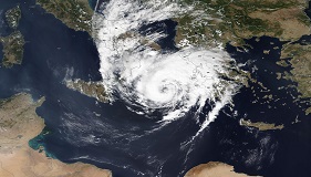
Satellite image (visible), 17.09. UTC
Data Source: NASA Worldview
|
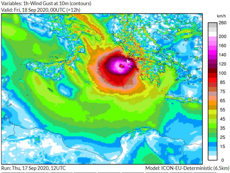
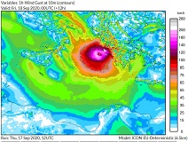
Wind gusts on surface, 18.09., 00 UTC
Data Source: DWD (ICON Model)
Image Credit: KIT
|
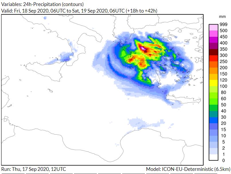
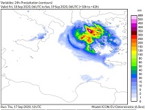
24 h precipitation, 19.09., 06 UTC
Data Source: DWD (ICON Model)
Image Credit: KIT
|
Typhoon
Mediterranean, Greece
Issued: Friday, 18 September 2020, 09:30 CEST
Tropical Storm UDINE is close to Medicane Category 1 on todays Friday. Precipitation up to 200 mm in large parts of Greece, locally up to 500 mm possible within 48 hours.
17.-19.09.2020
With wind speeds of up to 65kn in the southwestern quadrant, UDINE is currently on the edge between tropical storm and Medicane Category 1.
The center of the storm is moving across the island of Kefalonia this Friday and is not expected to move further inland, but will move south
again after a short stationary phase. However, due to the pronounced orography of Greece near the coast, the storm is weakening rapidly.
On the Ionian Islands as well as on the Greek mainland, precipitation amounts of 200 mm are common. Precipitation levels of up to 500 mm are
even possible in congested areas. Although the system could return to the open Mediterranean on Saturday, a re-intensification is unlikely.
Note: While the storm was christened UDINE by the German Weather Service, the name IANOS is also common internationally.
Thursday, 17 September 2020, 12:15 CEST

|
|

|
|
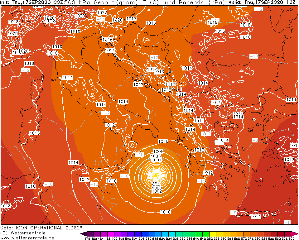
500hPa Geopotential and temperature, 17.09.,
12 UTC
Image Credit: Wetterzentrale
|
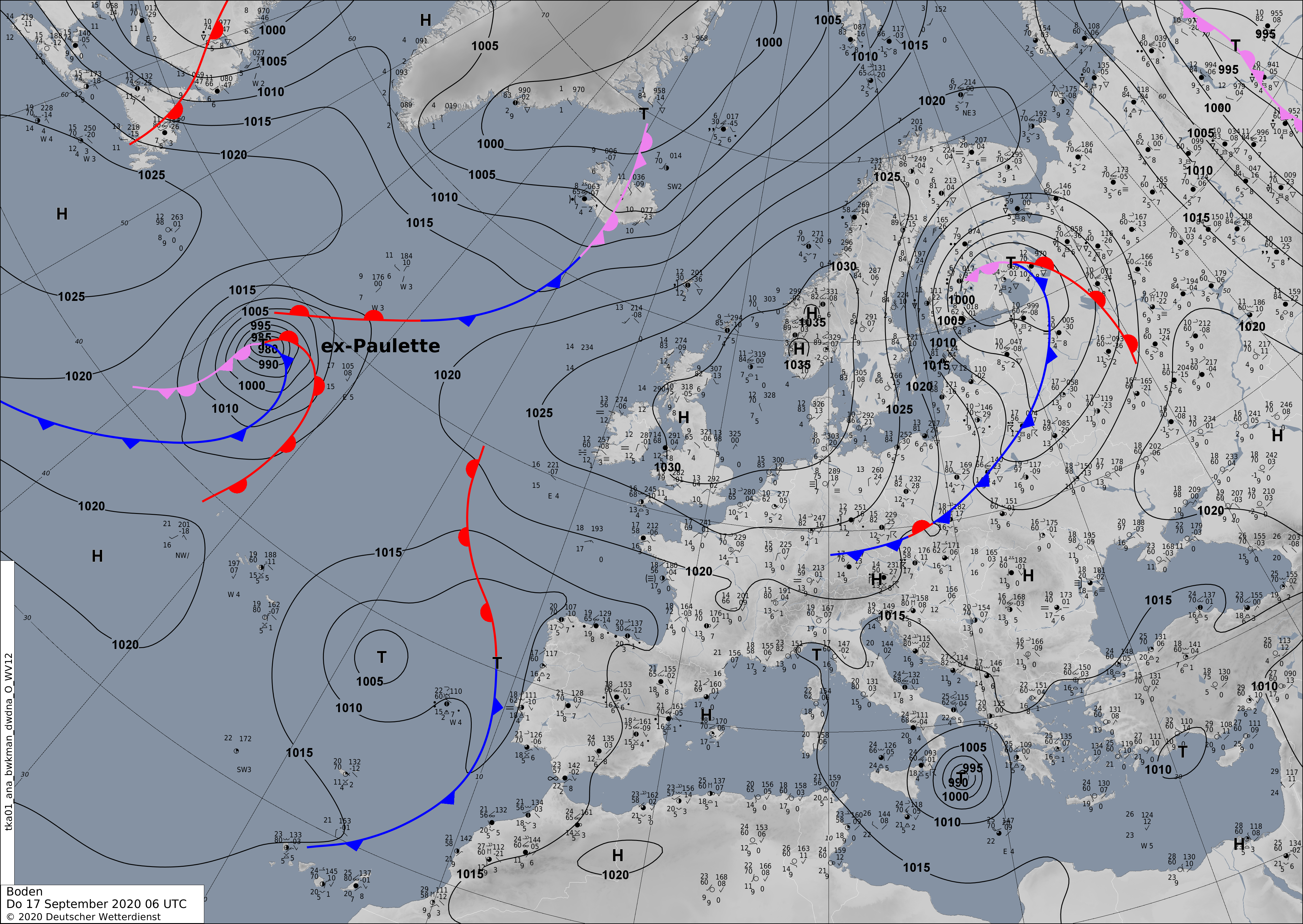
Sea level pressure and fronts, 17.09., 06 UTC
Data Source: DWD
|
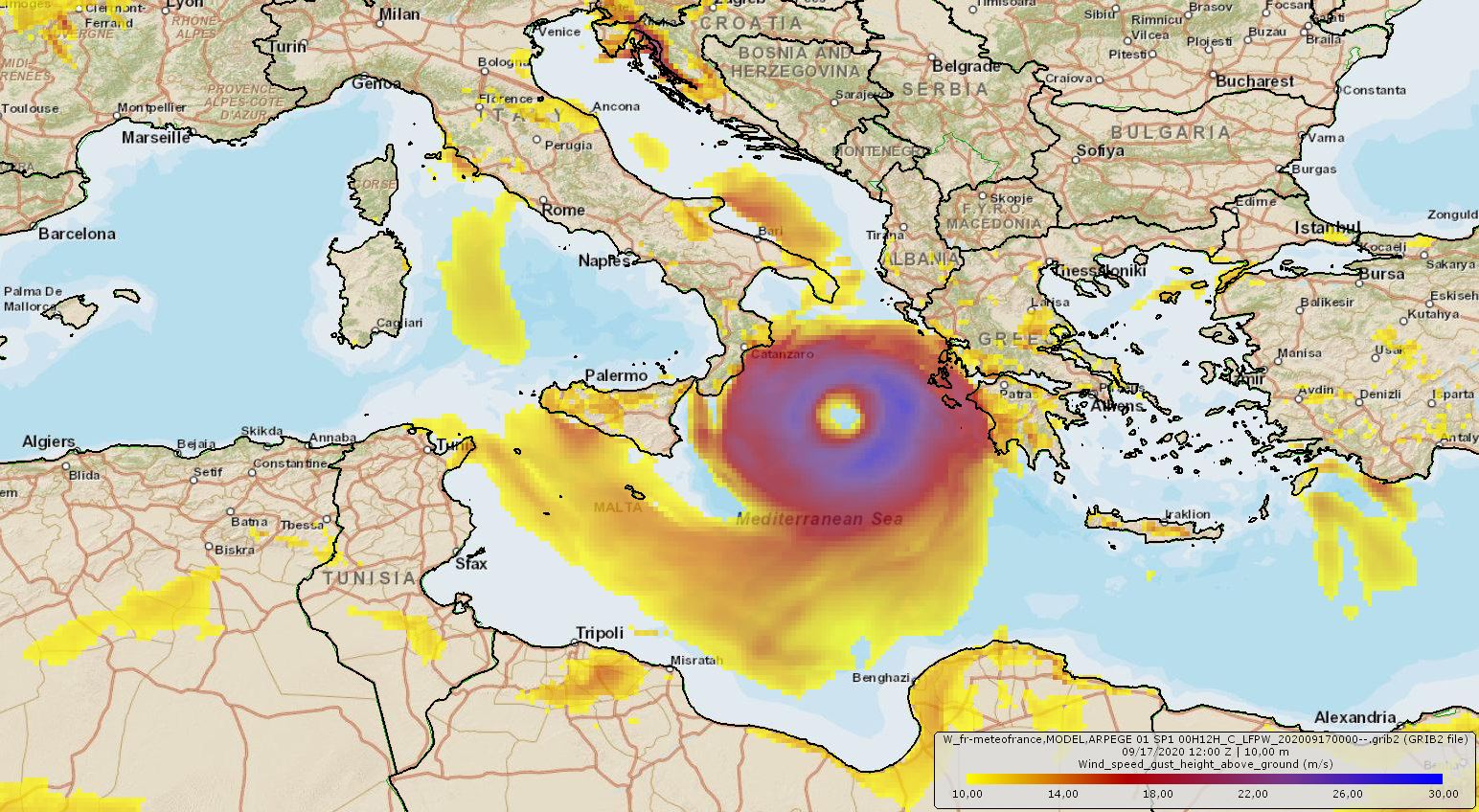
Wind gusts on surface, 17.09., 12 UTC
Data Source: Meteofrance (ARPEGE Model)
Image Credit: Fabian Siegmann
|
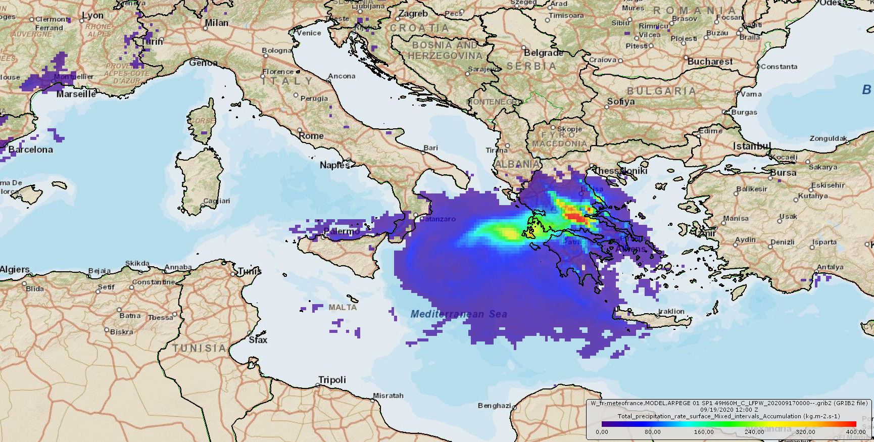
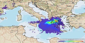
60 h acculumated precipitation, 19.09., 12 UTC
Data Source: Meteofrance (ARPEGE Model)
Image Credit: Fabian Siegmann
|
Typhoon
Mediterranean, Greece
Issued: Thursday, 17 September 2020, 12:15 CEST
Low pressure area UDINE is very likely to turn into a Medicane on todays Thursday. Gusts up to 200 kph possible on the Ionian Islands as well as total precipitation up to 400 mm on the Greek mainland.
17.-19.09.2020
Today, Thursday, a low pressure area development in the Mediterranean Sea, which has been visible since September 14, is developing into the Medicane UDINE.
While the wind speeds and also the visual appearance so far indicated an extratropical low pressure system, UDINE will reach wind speeds of up to 125 kph today
and form an enclosed eye. This corresponds to a Medicane of category 1.
On the Ionian Islands, gusts of up to 200 kph are expected during the night to Friday. On the Greek mainland precipitation amounts of 400 mm/60h are possible
locally. There is a danger of storm damage and flooding. In addition, there is danger of storm tides on the Greek west coast up to the south of Albania and
on the coasts of the Ionian Islands.
Issued: September 17, 2020, 12:15 CEST
FS
Issued: September 18, 2020, 09:30 CEST
FS
|