Friday, 18 June 2020, 11:00 CEST
|

|
|
|
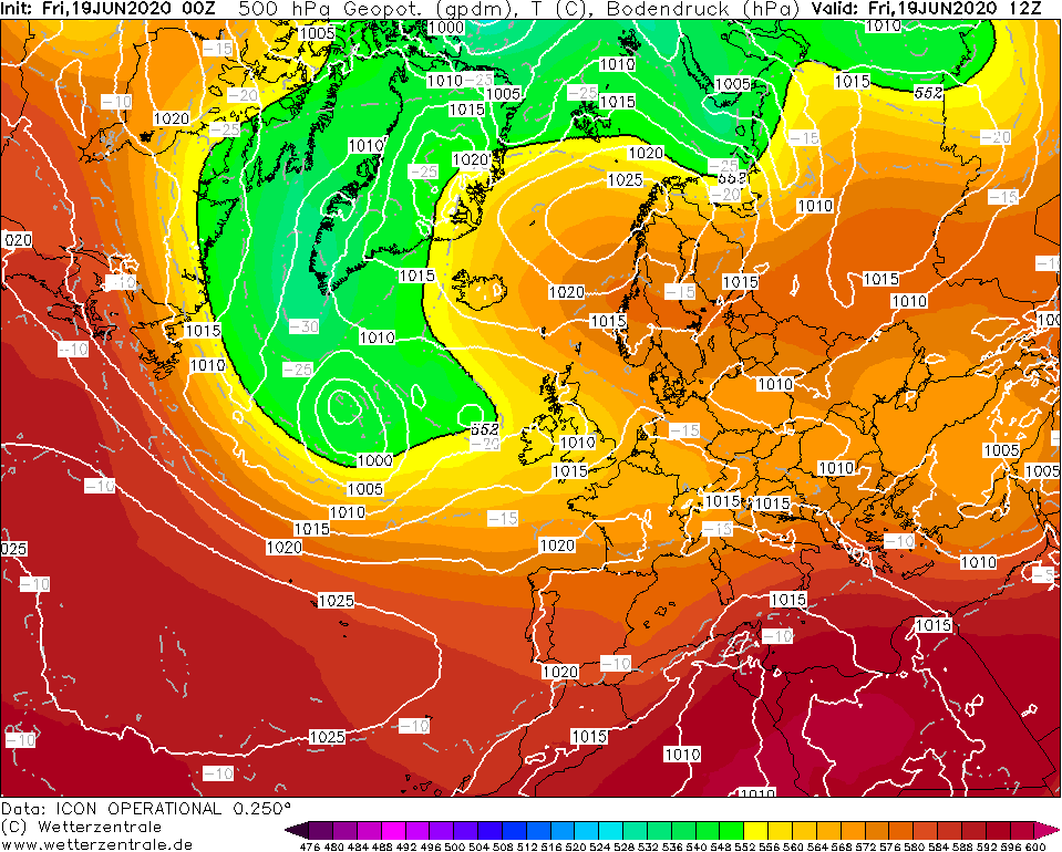
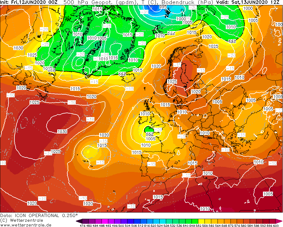
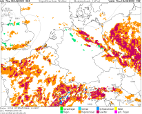
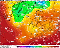
500 hPa Geopotential height, 19.06., 12 UTC
Image Credit: Wetterzentrale
|
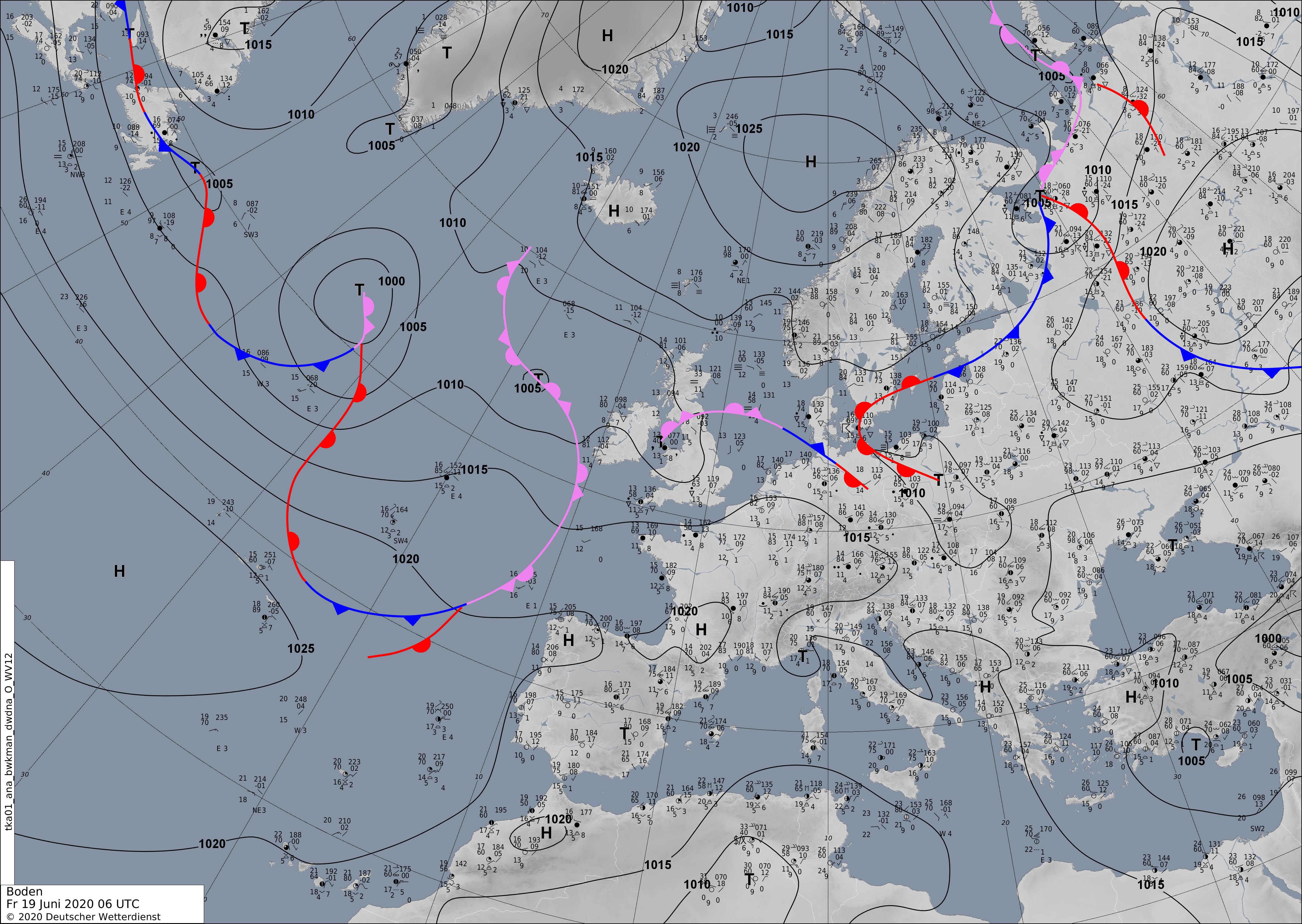
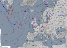
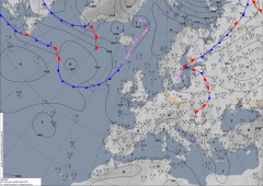
Sea level pressure, 19.06., 06 UTC
Image Credit: DWD
|
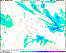
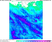
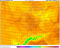
1h precipitation, 19.06., 06 UTC
Image Credit: Wetterzentrale
|
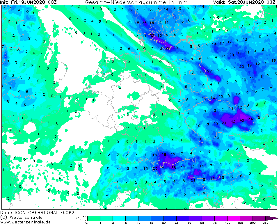
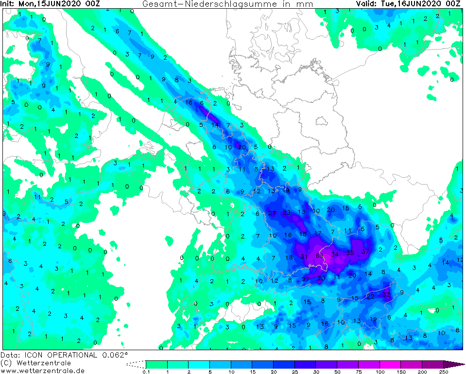
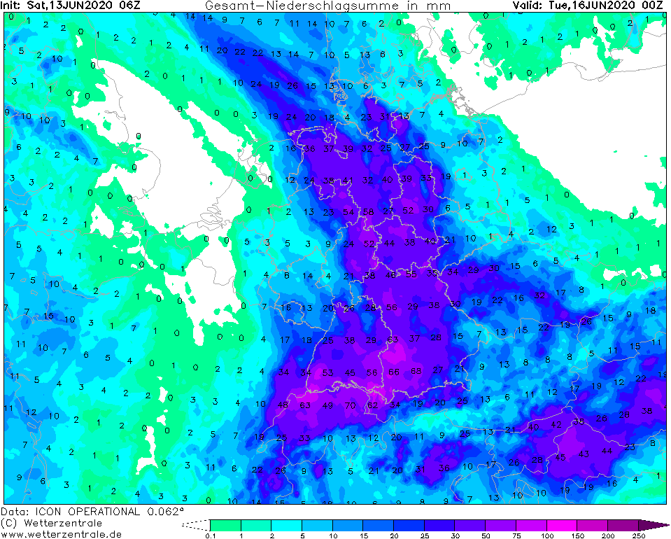
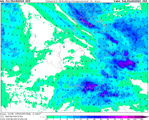
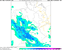
Accumulated precipitation, 20.06., 00 UTC
Image Credit: Wetterzentrale
|
Heavy precipitation
Central Europe, Germany
Issued: Friday, 19 June 2020, 11:00 CEST
With low pressure system NADINE still steering humid air towards Central Europe there is again possibility of showers and thunderstorms.
In the Bavarian Alps up to 50 mm precipitation are possible on today, Friday.
12.-19.06.2020
Along a convergence line in the north of Germany, which also represents an air mass boundary, showers and weak thunderstorms are forming today,
Friday. Due to moderate wind speeds in the troposphere, however, local precipitation will be limited.
In the south of Germany, especially in the Bavarian Alps, showers and thunderstorms will also form. Due to an only low wind troposphere,
the cells can form stationary here and occasionally cause heavy daily precipitation of up to 50 mm.
Selection of yesterday's daily precipitation amounts:
| Location |
24h precipitation in mm |
Date |
Kaufbeuren-Oberbeuren
Langenlipsdorf
Sohland/Spree
Leutkirch-Herlazhofen
Bertsdorf-Hörnitz
Soltau
Faßberg
Carlsfeld
Langenwetzendorf-Göttendorf
Treuen
|
50.0
44.4
44.4
44.0
43.3
42.0
37.9
35.0
33.0
32.0
|
18.06.2020
18.06.2020
18.06.2020
18.06.2020
18.06.2020
18.06.2020
18.06.2020
18.06.2020
18.06.2020
18.06.2020
|
|
Thursday, 18 June 2020, 12:00 CEST

|
|
|

|
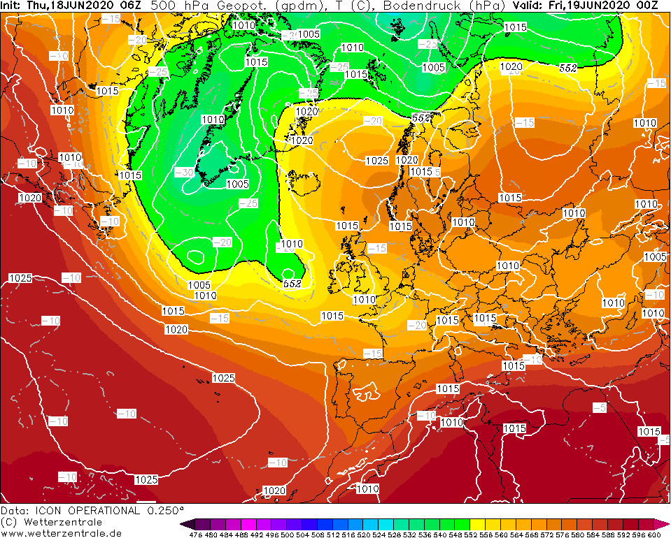
500 hPa Geopotential height, 18.06., 06 UTC
Image Credit: Wetterzentrale
|
Sea level pressure, 18.06., 06 UTC
Image Credit: DWD
|
Significant weather, 18.06., 15 UTC
Image Credit: Wetterzentrale
|
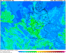
CAPE, 18.06., 12 UTC
Image Credit: Wetterzentrale
|
Heavy precipitation
Central Europe, Germany
Issued: Thursday, 18 June 2020, 12:00 CEST
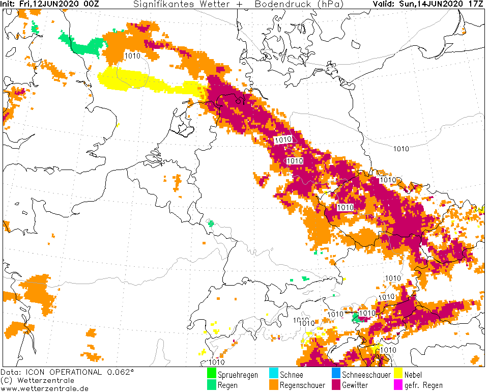
The cold front of Low NADINE continues to extend across Germany together with an upstream convergence line. Again, thunderstorms with heavy rainfall of up to
40 mm per hour are occurring today around daytime.
12.-19.06.2020
Deep NADINE continues to bring warm and humid and unstable air masses to Germany. The cold front stretches from northwest to southeast and is hardly
advancing due to the high over Scandinavia and the high over southwest Europe, as well as the upper low over the Bretagne. A convergence zone lies ahead of the cold front, which is also nearly stationary
and is advancing only slowly to the northeast. In the further course of the day there are showers and thunderstorms there, but the thunderstorms are also
accompanied by squalls and hail. The thunderstorms subside during the night, but revive again on Friday in the southwest of Baden-Württemberg and in the
south of Bavaria. Also on Saturday thunderstorms are expected there again with CAPE values around 700 J/Kg and PPW around 40 mm.
Selection of yesterday's daily precipitation amounts:
| Location |
24h precipitation in mm |
Date |
Leutkirch-Herlazhofen
Neckargemünd
Waibstadt
Mannheim
|
47.3
40.3
36.3
35.7
|
17.06.2020
17.06.2020
17.06.2020
17.06.2020
|
|
Wednesday, 16 June 2020, 10:00 CEST
|

|
|
|
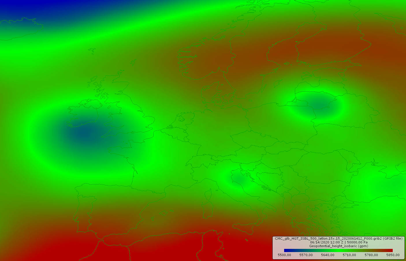
500 hPa Geopotential height, 17.06., 00 UTC
Image Credit: Wetterzentrale
|
Sea level pressure, 17.06., 00 UTC
Image Credit: DWD
|
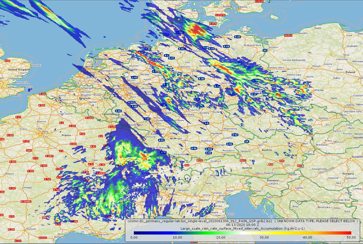
1h precipitation, 17.06., 18 UTC
Image Credit: Wetterzentrale
|
Accumulated precipitation, 19.06., 00 UTC
Image Credit: Wetterzentrale
|
Heavy precipitation
Central Europe
Issued: Wednesday, 17 June 2020, 10:00 CEST
The Coldfront of Low NADINE provides new shower and thunderstorm activity and also widespread rain. On Wednesday, up to 50 mm
possible in the Black Forest, up to 75 mm in northern Hesse on Thursday.
12.-18.06.2020
Low pressure system NADINE continues to direct humid Atlantic air to Central Europe. Today, Wednesday, the cold front
of the low-pressure system crosses the south of Germany. This results in widespread precipitation, but also embedded
showers and thunderstorms are possible. As usual, the heaviest rainfall is expected in the Black Forest. On Wednesday,
up to 50 mm can fall there.
On Thursday the cold front continues to spread over the northern part of the country. As in the days before, the
heaviest rainfall occurs along a convergence line that stretches from northern Bavaria across Hesse to North Rhine-Westphalia.
Daily precipitation of up to 75 mm is possible here.
Selection of yesterday's daily precipitation amounts:
| Location |
24h precipitation in mm |
Date |
Seegebiet Mansfelder Land-Roe.
Brocken
Pirmasens
Emsbueren-Ahlde
|
45.7
44.4
37.2
36.9
|
16.06.2020
16.06.2020
16.06.2020
16.06.2020
|
|
Tuesday, 15 June 2020, 12:00 CEST
|
|
|

|
Sea level pressure, 16.06., 06 UTC
Image Credit: DWD
|
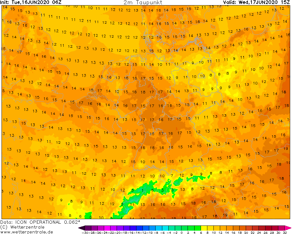
Dewpoint temperature, 17.06., 15 UTC
Image Credit: Wetterzentrale
|
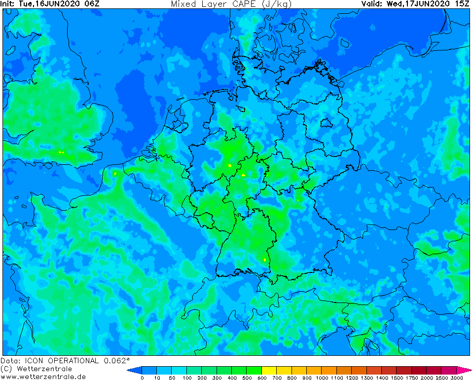
Mixed layer CAPE, 16.06., 15 UTC
Image Credit: Wetterzentrale
|
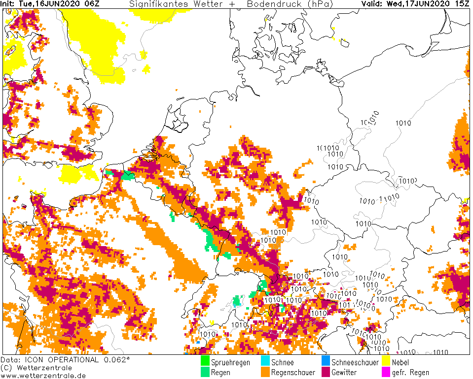
Significant weather, 16.06., 15 UTC
Image Credit: Wetterzentrale
|
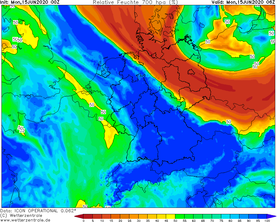
Heavy precipitation
Central Europe
Issued: Tuesday, 16 June 2020, 12:00 CEST
An air mass boundary still extends over Germany from southeast to northwest and continues to bring additional
rain. Locally in Bavaria, up to 20 mm are possible in 12 hours.
12.-18.06.2020
Due to a convergence line which lies diagonally over Germany, there is continuous rain in some regions, which is also
repeatedly interspersed with showers or thunderstorms. Due to the high ridge far to the north and the cut off low lying
to the south, the current is blocked and the rain belt only advances slowly to the southwest. Also due to the low-wind
situation, the rain belt and the rainfall associated with it, especially in the southeast of Bavaria, hardly makes any
progress. The northeast of Germany, on the other hand, remains dry, as relatively dry air masses are again stored here.
In the rest of the country it remains humid (PPW around 30 mm) and the tendency to thunderstorms increases again in
the southwest (CAPE around 500 J/Kg). Convective cells with heavy precipitation can form there, but also storm gusts
are not excluded.
This constellation will change very little in the coming days. The convergence line is making little progress and
continues to be blocked by the high in the north and the low over France. The air mass will remain very humid with
values around 30 PPW and where it loosens up and the sun's rays get through, the air mass will become unstable
(around 700 J/Kg) and the risk of showers and thunderstorms will increase. In the north-east, however, it remains dry.
Selection of yesterday's daily precipitation amounts:
| Location |
24h precipitation in mm |
Date |
Siegenburg
Aschau-Stein
Siegsdorf-Maria
Obere Firstalm/ Schliersee Ber
Marktschellenberg
Bad Endorf
Siegsdorf-Höll
Brannenburg-Degendorf
Rupholding-Seehaus
Bamberg
Obingen-Ilzham
|
66.5
66.1
66.1
54.8
51.3
48.9
47.9
47.4
47.3
44.7
|
15.06.2020
15.06.2020
15.06.2020
15.06.2020
15.06.2020
15.06.2020
15.06.2020
15.06.2020
15.06.2020
15.06.2020
15.06.2020
|
|
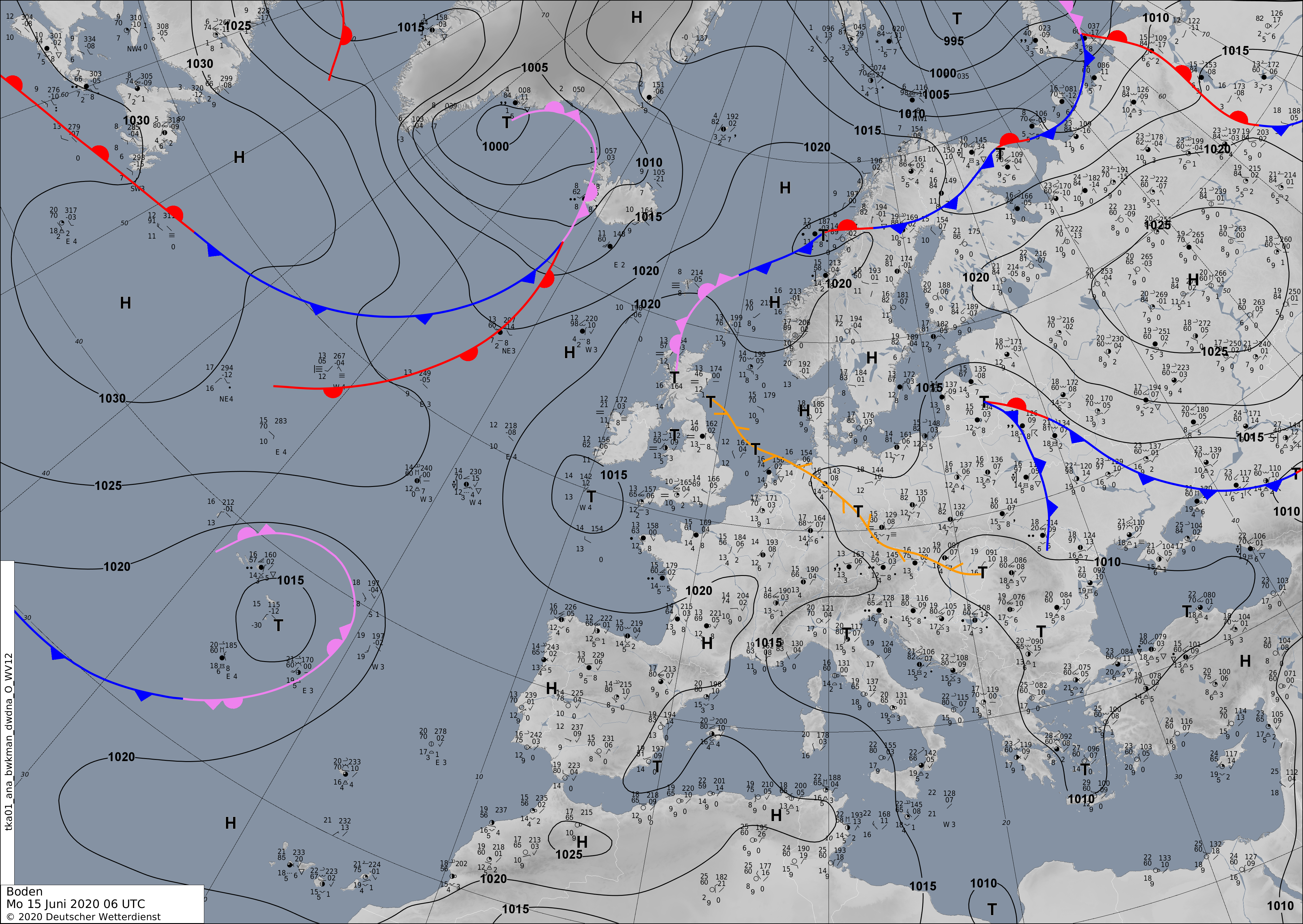
Monday, 15 June 2020, 11:00 CEST
Heavy precipitation
Central Europe
Issued: Monday, 15 June 2020, 11:00 CEST
Around an air mass boundary that stretches diagonally across Germany, there will again be significant precipitation today, Monday.
In the southwest of Bavaria, daily precipitation of up to 75 mm is possible.
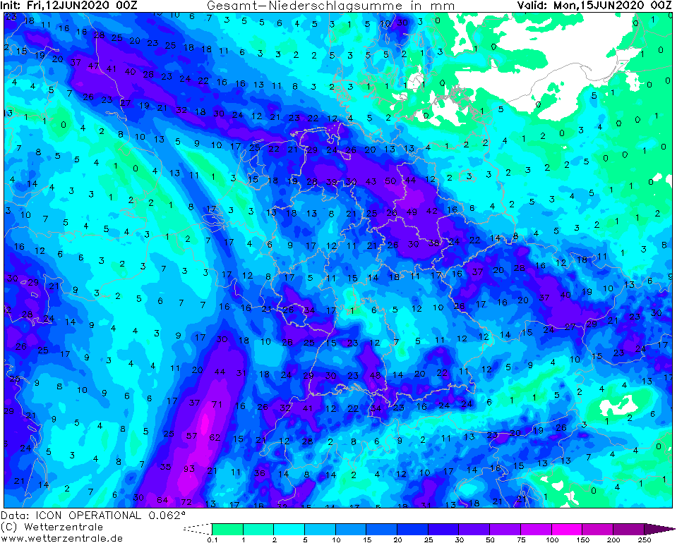
12.-18.06.2020
Low pressure system NADINE has shifted marginally to the northwest, but still directs humid Atlantic air to southwest Germany, while
dry air flows to northeast Europe at the backside of low pressure system PETRA located over the Baltic Sea. The air mass boundary in between
extends from the German-Dutch North Sea coast to Lower Bavaria. The convergence of air causes forced uplifting motion and thus precipitation.
This leads to stratiform precipitation, but also to showers and thunderstorms. The most abundant precipitation is expected at the edge of the
Bavarian Alps. Here up to 75 mm/24h may fall.
Selection of yesterday's daily precipitation amounts:
| Location |
24h precipitation in mm |
Date |
Ahaus
Göttingen
Borken in Westfalen
Gräfenberg-Kasberg
Ennigerloh-Ostenfelde
Herzberg
Brilon-Thülen
Fichtelberg/Oberfranken
Martinroda
Wsserkuppe
Alfeld
|
68.0
64.0
52.1
49.0
46.0
43.3
42.0
41.0
39.0
38.0
35.0
|
14.06.2020
14.06.2020
14.06.2020
14.06.2020
14.06.2020
14.06.2020
14.06.2020
14.06.2020
14.06.2020
14.06.2020
14.06.2020
|
|
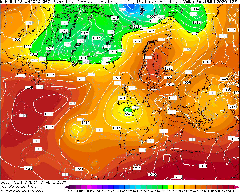
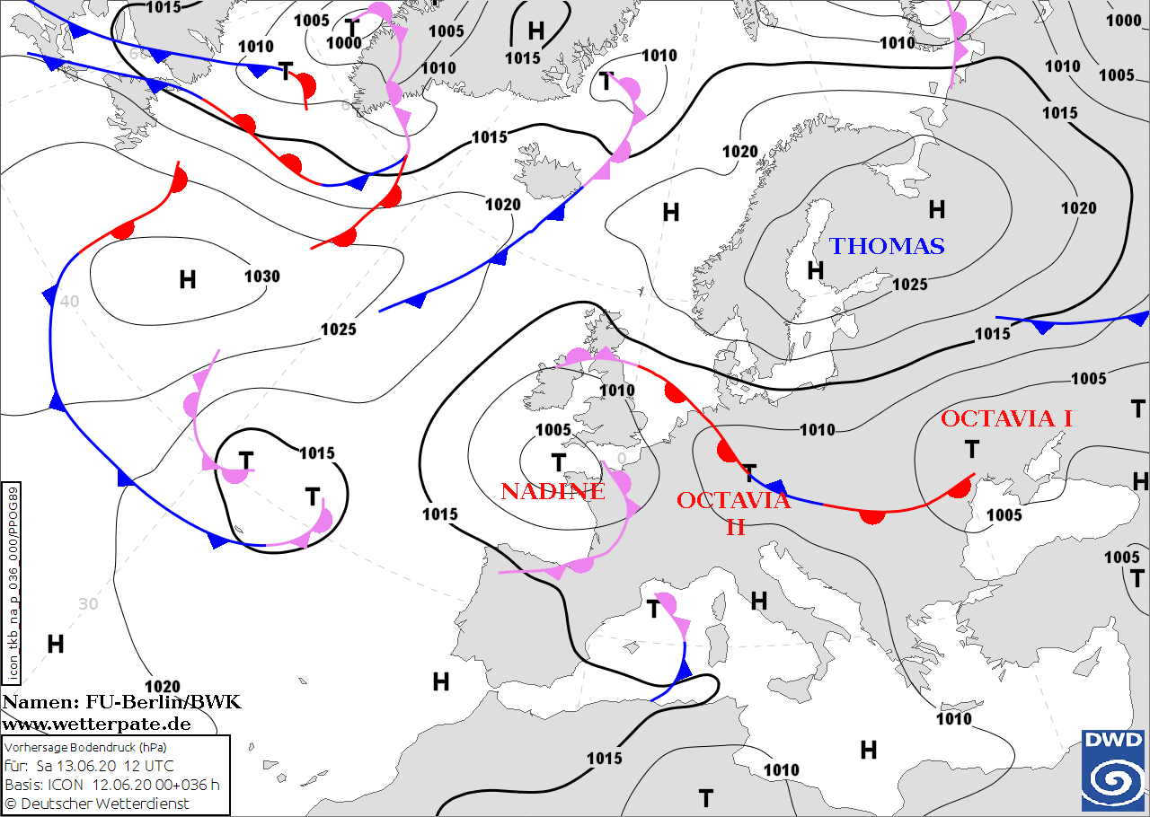
Saturday, 13 June 2020, 12:00 CEST
Heavy precipitation and thunderstorms
Europe
Issued: Saturday, 13 June 2020, 12:00 CEST
Cut-off low NADINE ist still stationary around the north western coast of France, which provides warm and humid air masses to Central Europe. On todays
Saturday, heavy showers and thunderstorms are likely to occur in the southern Black Forest and in northern Germany.
12.-18.06.2020
Due to the advection of humid Atlantic air around low pressure system NADINE, the last remaining dry air masses over Germany are being eliminated today. Along a
low pressure trough, which stretches from southern Saxony to the North Sea coast, strong showers and thunderstorms will occur today, Saturday. Precipitation intensities
of 50 mm/h and also coarse-grained hail cannot be excluded. In Northern Germany the formation of super cells is possible.
Thunderstorms are also likely to form in the south. Especially the border from Eastern Switzerland to Baden Württemberg offers good lifting potential due to the
orography of the Black Forest. Here, strong thunderstorms with small-grained hail and precipitation rates of up to 30 mm/h are possible.
Friday, 12 June 2020, 12:00 CEST
Heavy precipitation and thunderstorms
Europe
Issued: Friday, 12 June 2020, 12:00 CEST
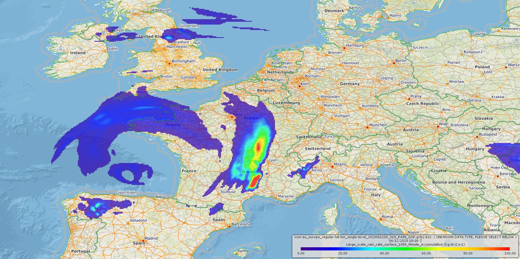
On the eastern edge of a cut-off low, heavy precipitation and locally strong thunderstorms are likely to occur in the coming days.
In eastern parts of France up to 100 mm of precipitation are possible today.
12.-18.06.2020
Cut-off low NADINE, which is almost stationary over Brittany, supplies Central Europe with warm and humid air today, Friday, and for
the next few days. This will result in heavy rainfall and thunderstorms. On Friday, positive layer-thickness advection (equals to warm
air advection) and significantly vertically increasing vorticity advection provide strong uplift in the east of France. Moderate CIN-values
lead to the formation of only few but therefore strong thunderstorms.
On Saturday, showers and thunderstorms will also occur in large parts of Germany. The strongest developments will occur along a convergence line
extending from the southeast to the northwest of the country. On Saturday and Sunday precipitation amounts of up to 80 mm/48h are possible.
Issued: June 12, 2020, 12:00 CEST
FS
Issued: June 13, 2020, 12:00 CEST
FS
Issued: June 15, 2020, 11:00 CEST
FS
Issued: June 16, 2020, 11:00 CEST
MG
Issued: June 17, 2020, 10:00 CEST
FS
Issued: June 18, 2020, 12:00 CEST
MG
Issued: June 19, 2020, 11:00 CEST
FS
|