Wednesday, 20 May 2020, 11:00 CEST
|
|
|
|
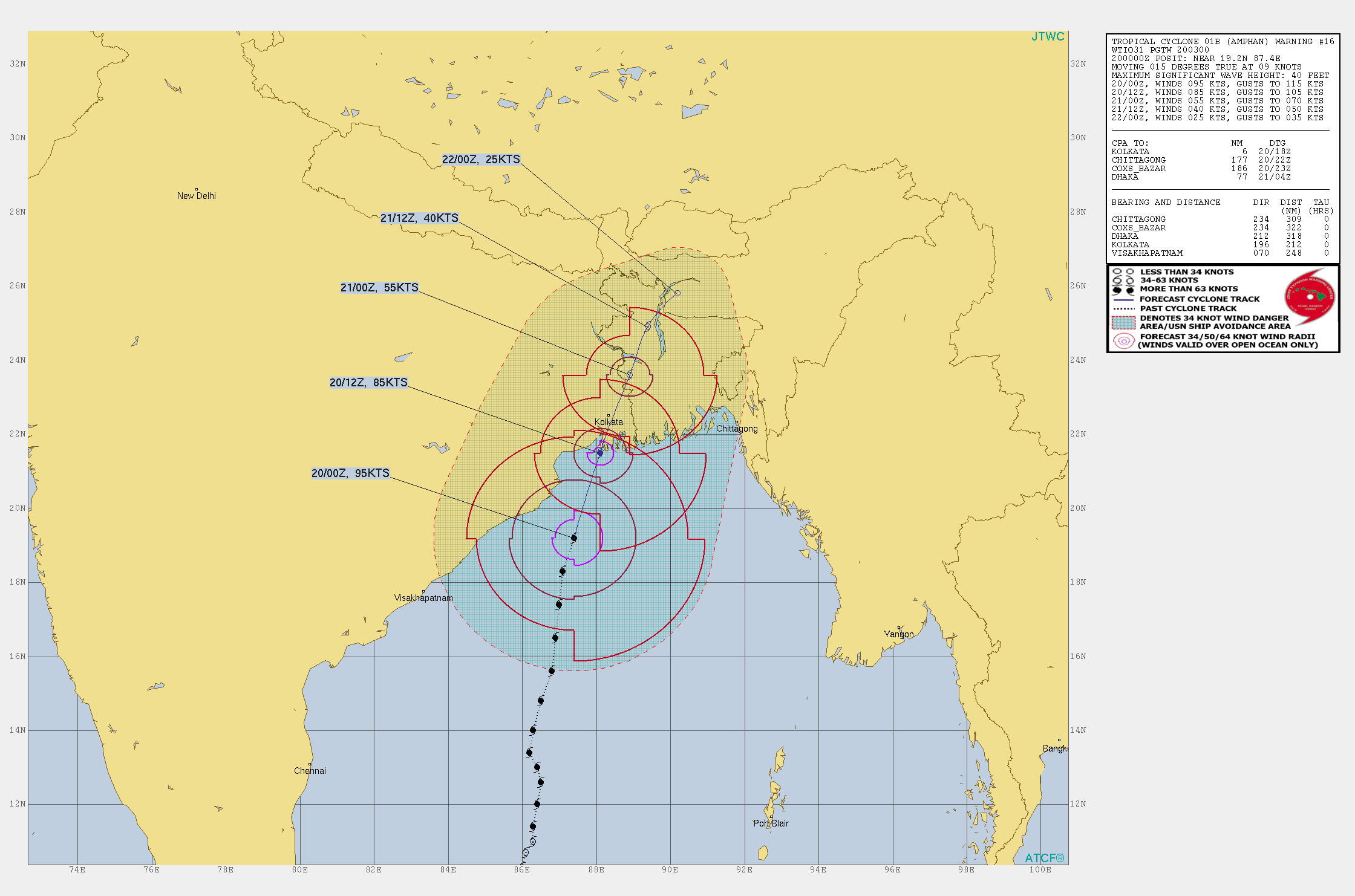
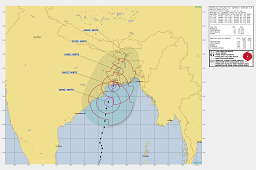
Storm Track of AMPHAN, 20.05.
Image Credit: JWTC
|
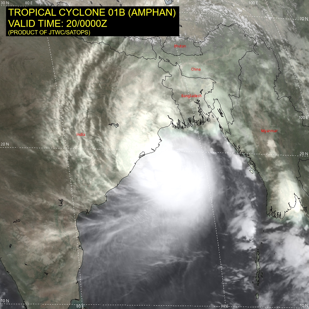
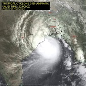
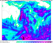
Satellite image (IR), 20.05., 00 UTC
Image Credit: JWTC
|
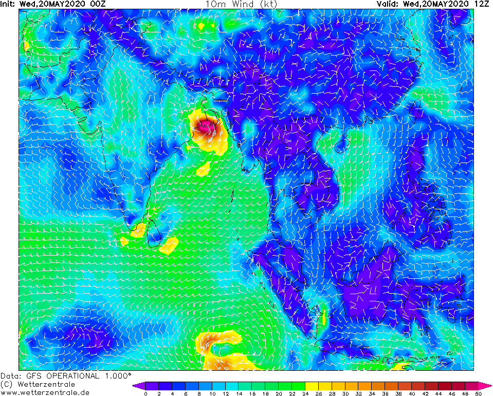
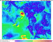
10m mean wind, 20.05., 12 UTC
Image Credit: Wetterzentrale
|
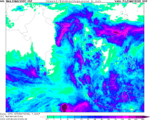
Accumulated precipitation, 22.05., 00 UTC
Image Credit: Wetterzentrale
|
Tropical Cyclone AMPHAN
India and Bangladesh
Issued: Wednesday, 20 May 2020, 11:00 CEST
With 1 minute sustained winds of 180 kph AMPHAN approaches the coast around Calcutta. Waves up to 10m in the whole northern Bay of Bengal.
Up to 300 mm total precipitation. Flooding caused by storm surge and heavy precipitation.
18.-21.05.2020
Very Cyclonic Storm AMPHAN is currently located 150 km south-southwestward of Calcutta and moves in northward direction with approximately 16 kph.
The 1 minute sustained wind speeds are 180 kph, in gusts up to 215 kph. Landfall is expected in the following hours, i.e. at 12 UTC.
The tropical cyclone, which strength is equivalent to category 2, causes storm damage as well as high waves of up to 10 m and a storm surge. The Ganges
delta in particular is exposed to this storm surge, as the water masses are driven into the adjacent rivers. Flooding is to be expected in many places.
These can be intensified by severe precipitation.
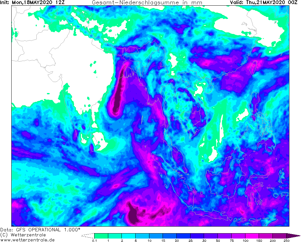
Maximum precipitation is expected in the western part of the Ganges delta, i.e. in the easternmost part of central India. The Himalayan mountains in the
north cause a second precipitation maximum in northern Bangladesh and the Seven Sister States of India due to orogrpahic precipitation. Besides the
danger of landslides, this precipitation contributes to the flooding of rivers, especially the Padma River.
Monday, 18 May 2020, 20:00 CEST

|
|
|
|
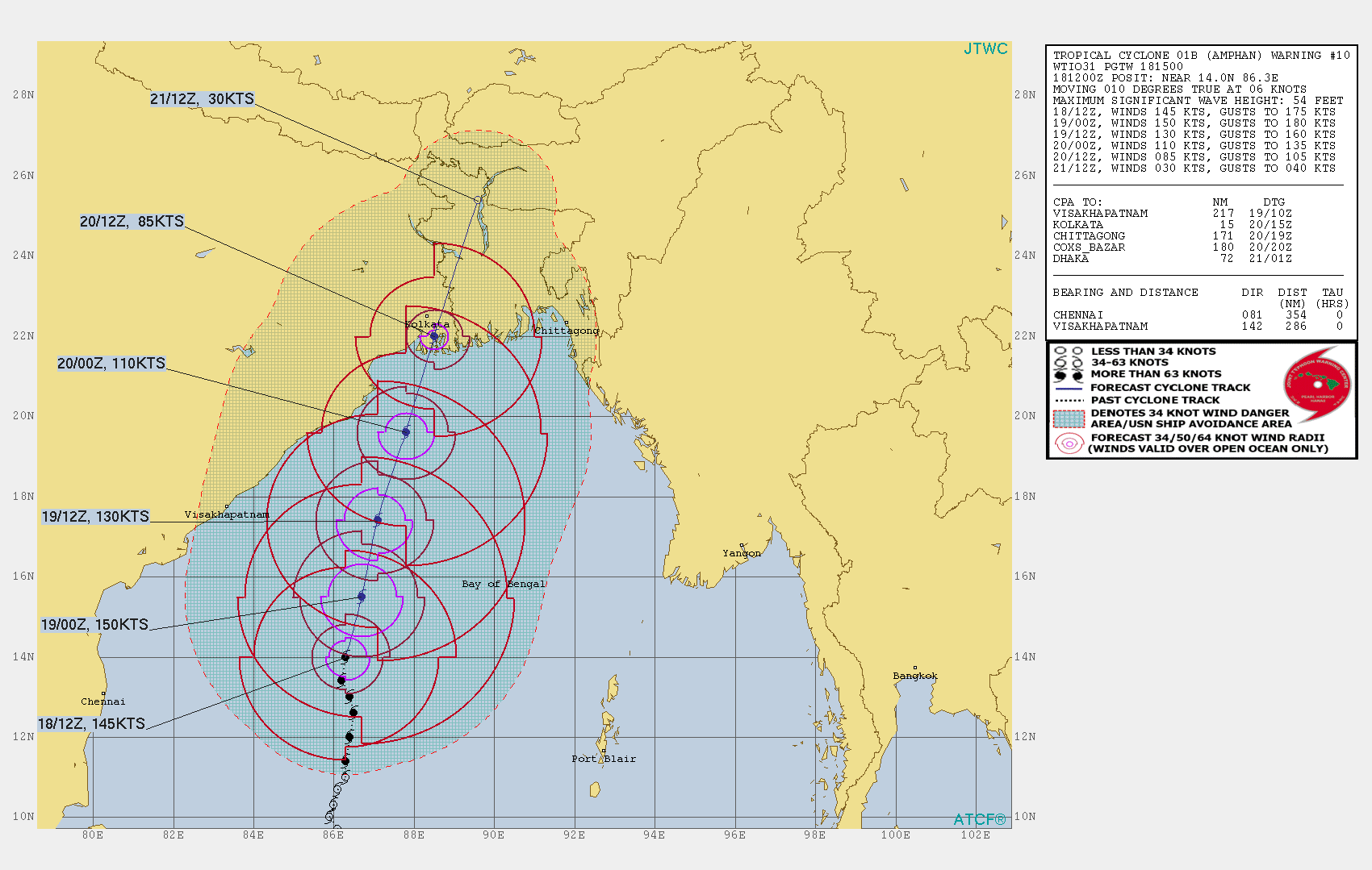
Storm Track of AMPHAN, 18.05.
Image Credit: JWTC
|
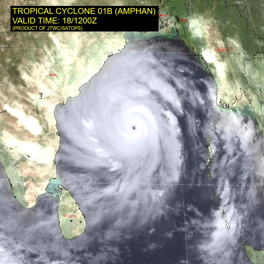
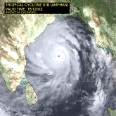
Satellite image (IR), 18.05., 12 UTC
Image Credit: JWTC
|
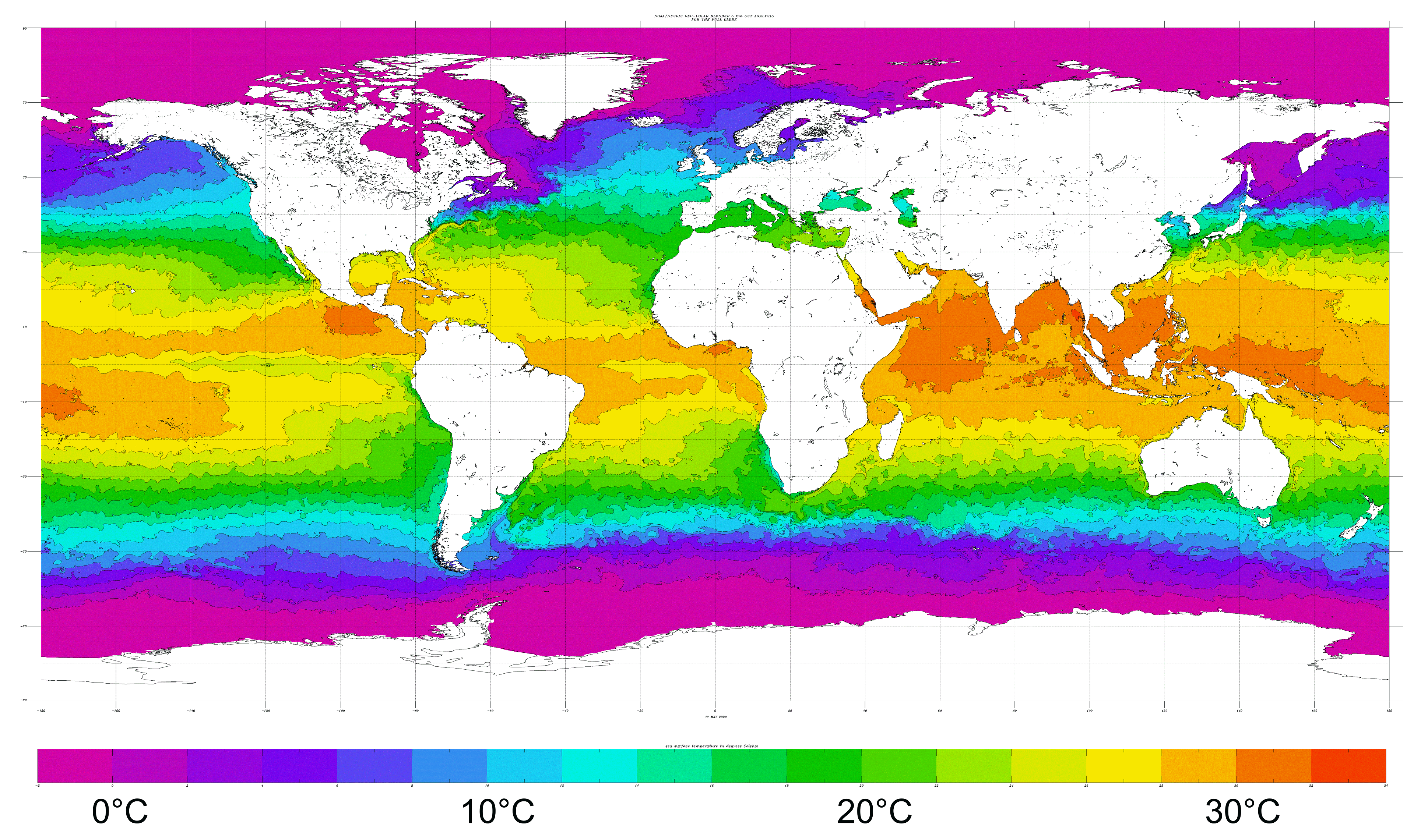
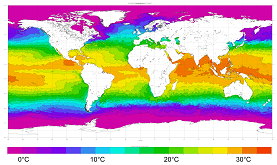
Global sea surface temperature, 18.05.
Image Credit: NOAA
|
Accumulated precipitation, 21.05., 00 UTC
Image Credit: Wetterzentrale
|
Tropical Cyclone AMPHAN
India and Bangladesh
Issued: Monday, 18 May 2020, 20:00 CEST
Super Cyclonic Storm AMPHAN apporaches the northeastern coast of India with wind speeds of up to 270 kph and waves up to 16 m height. Landfall
expected on 20 May around 12 UTC as Very Severe Cyclonic Storm.
18.-21.05.2020
AMPHAN is the first tropical cyclone of the 2020 North Indian Ocean cyclone season. The system showed first organized convection
on 16 May and slowly moved northwards. Due to favourable conditions AMPHAN underwent an explosive cyclogenesis on 17 May, strengthening from
a catgeroy 1 cyclone to a category 4 cyclone in less than 6 hours.
On 18 May 18 UTC the system is located about 400 km southeast of Visakhapatnam (IN) and shows wind speeds up to 270 kph, in gusts even 325 kph.
AMPHAN is moving in northwards direction with approximately 10 kph and is expected to make landfall on 20 May at 12 UTC in the area of Calcutta
(IN) as a Very Cyclonic Storm (equivalent to Category 2).
There is danger from objects swirling around and trees breaking down. Despite the weakened wind, waves up to 13 m high are still expected. The rivers
running into the Ganges delta will be flooded and will cause high water. There is also a danger of flooding due to heavy rainfall of up to 300 mm/48h.
Issued: May 18, 2020, 20:00 CEST
FS
Issued: May 20, 2020, 11:00 CEST
FS
|