Monday, 03 February 2020, 12:00 CET
|
|
|
|
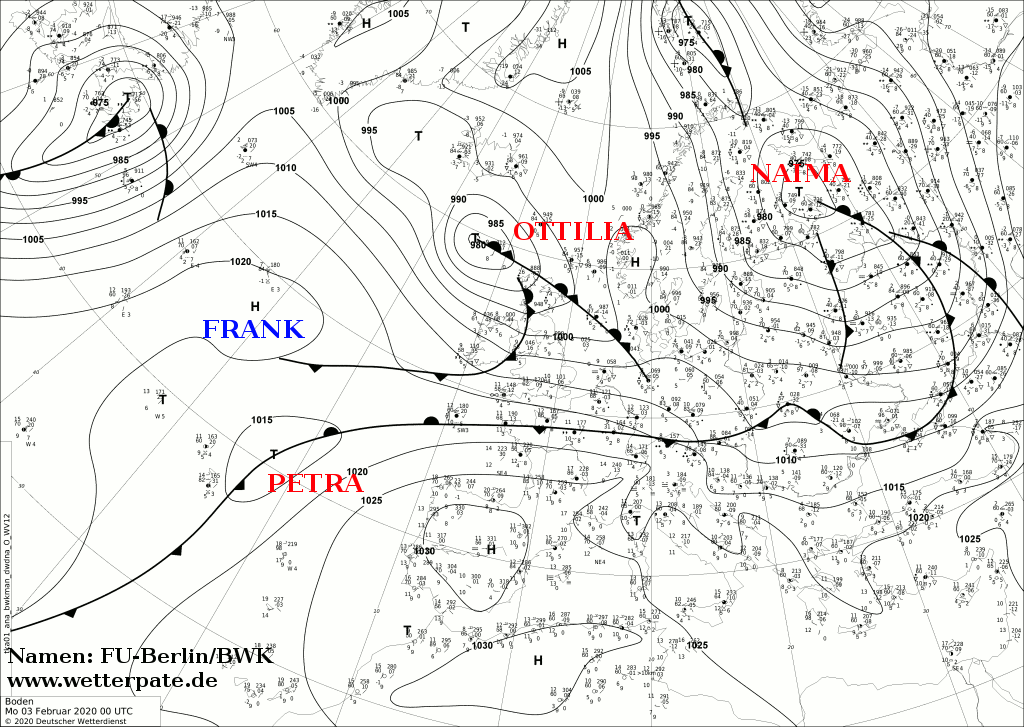
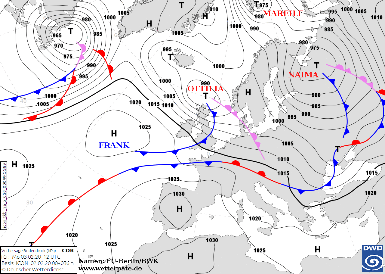
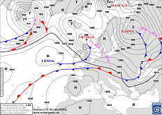
Sea level pressure and fronts, 03.02., 00 UTC
Image Credit: DWD
|
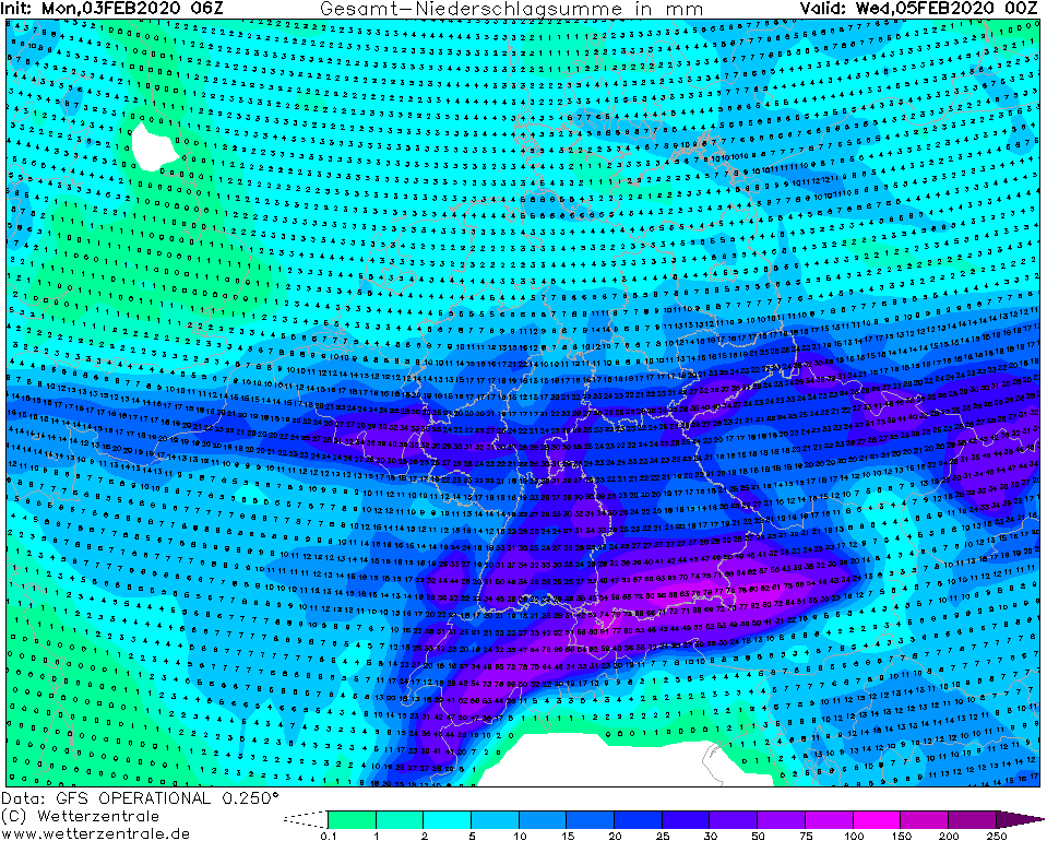
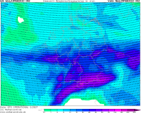
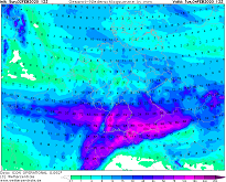
Accumulated precipitation until 05.02., 00 UTC
Image Credit: Wetterzentrale
|
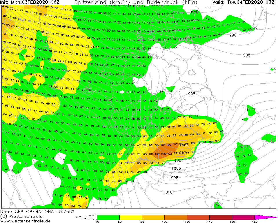
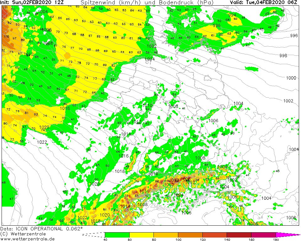
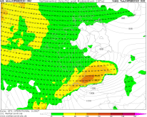
Gusts, 04.02., 03 UTC
Image Credit: Wetterzentrale
|
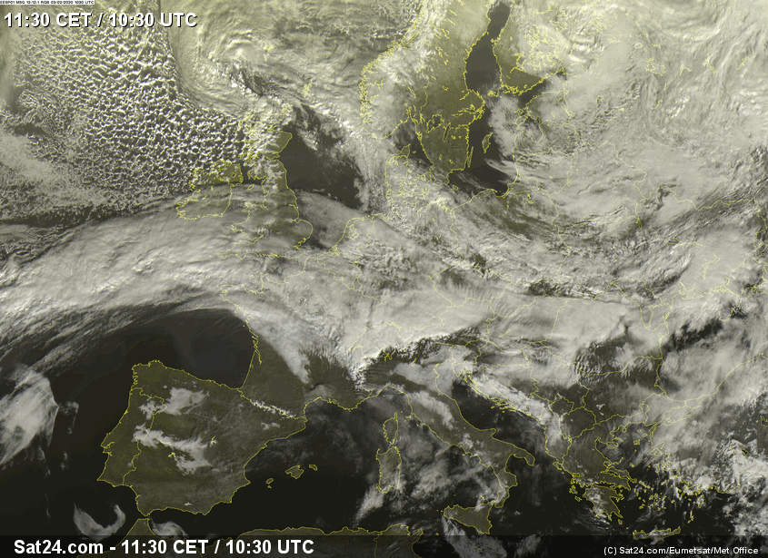
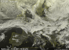
Satellite image (visible), 03.02., 10:30 UTC
Image Credit: Sat24
|
Heavy Precipitation, Winterstorm,
Western and Central Europe, Black Forest, Alps
Issued: Monday, 03 February 2020, 12:00 CET
Low pressure area OTTILIA effects stormy gusts in Germany on Tuesday morning. On Tuesday, gusts up
to 140 kph may occur on the mountain tops of the Alps. Precipitation of up to 150 mm/48h possible, locally even more.
Feb 02 - Feb 04, 2020
Central Europe is still in a westerly flow under the influence of low OTTILIA, which brings moist sea air.
In the area of the air mass boundary there is heavy precipitation in the south of Germany, which is intensified
in the Black Forest and the Alps. Precipitation can reach between 100 and 150 mm by Tuesday evening.
In congested areas, even higher amounts cannot be ruled out. Especially in the passage of the cold front
in the night to Tuesday, it can sometimes rain heavily. As the cold front moves through, the snowfall line
drops, so that snow falls up to middle altitudes. There are gusts of up to 140 km/h, especially at higher
altitudes in southern Germany.
The danger of flooding increases significantly due to the long period of precipitation, especially in
southern Germany. There is also a risk of storm damage.
Sunday, 02 February 2020, 17:15 CET
|
|
|
|
Sea level pressure and fronts, 03.02., 12 UTC
Image Credit: DWD
|
Accumulated precipitation 04.02., 12 UTC
Image Credit: Wetterzentrale
|
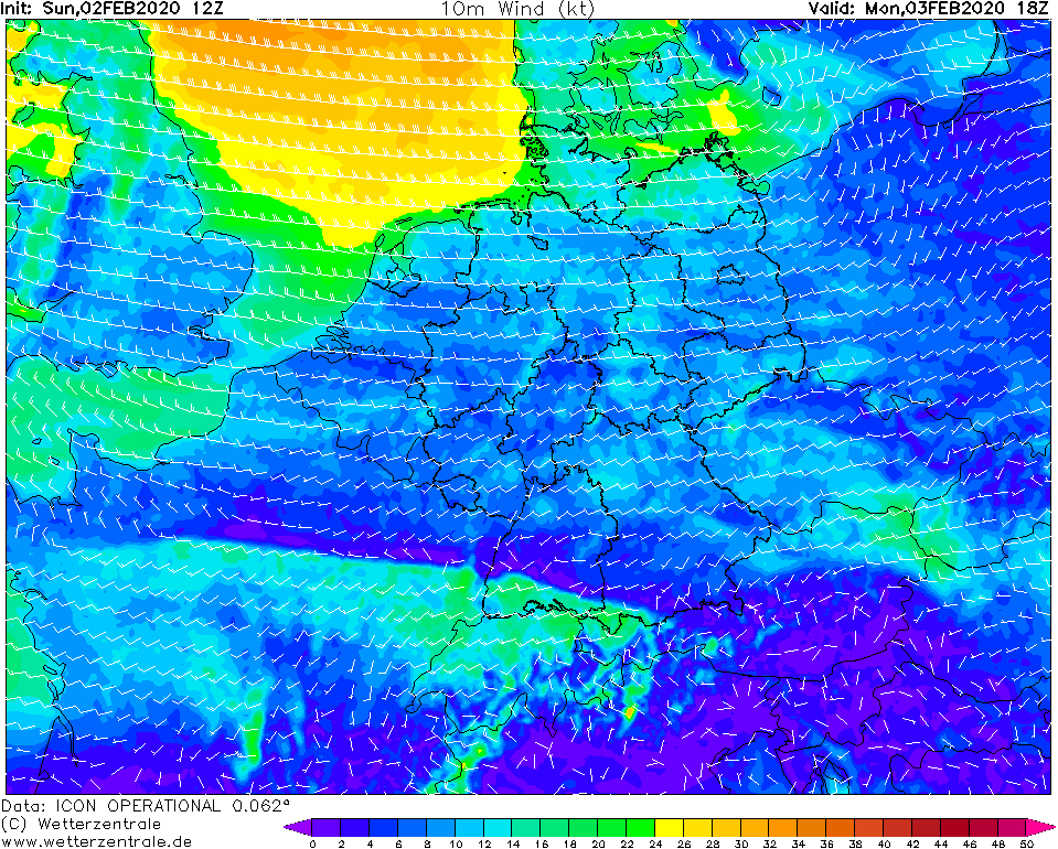
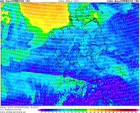
10m wind speed and direction, 03.02., 18 UTC
Image Credit: Wetterzentrale
|
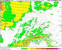
Gusts, 04.02., 06 UTC
Image Credit: Wetterzentrale
|
Heavy Precipitation, Winterstorm,
Western and Central Europe, Black Forest, Alps
Issued: Sunday, 02 February 2020, 17:15 CET
Low pressure area OTTILIA effects stormy gusts in GB and northern Germany on Monday. On Tuesday, gusts up
to 150 kph may occur on the mountain tops of the Alps. Precipitation of up to 150 mm/48h possible, locally even more.
Feb 02 - Feb 04, 2020
Low pressure system OTTILIA, currently located northwards of the British Isles, moves towards northern Germany. On Monday,
between the low air pressure around OTTILIA (approx. 985 hPa) and the high pressure from the Iberian Peninsula to the
Mediterranean Sea, stormy winds are expected in Great Britain and in the northwest of Germany. Wind speeds of up to 65 kph
and gusts of up to 90 kph can occur. On the North Sea coast, waves of up to 3m height may occur.
In the south of Germany the wind speeds are lower, but there is abundant precipitation, especially in the Black Forest
and on the northern edge of the Alps. Until Tuesday noon, up to 150 mm of precipitation can fall, locally even more. The
snow line remains very high (2000 - 2500 m) before it drops to about 800 m on Tuesday. It is likely that large parts of
the precipitation will fall as rain.
In the night of Tuesday, the peaks of the Alps are exposed to stormy winds and gale-force gusts of up to 150 kph.
Issued: February 02, 2019, 17:15 CET
FS
Issued: February 03, 2019, 12:00 CET
CL
|