Thursday, 16 January 2020, 09:00 CET
|
|
|

|
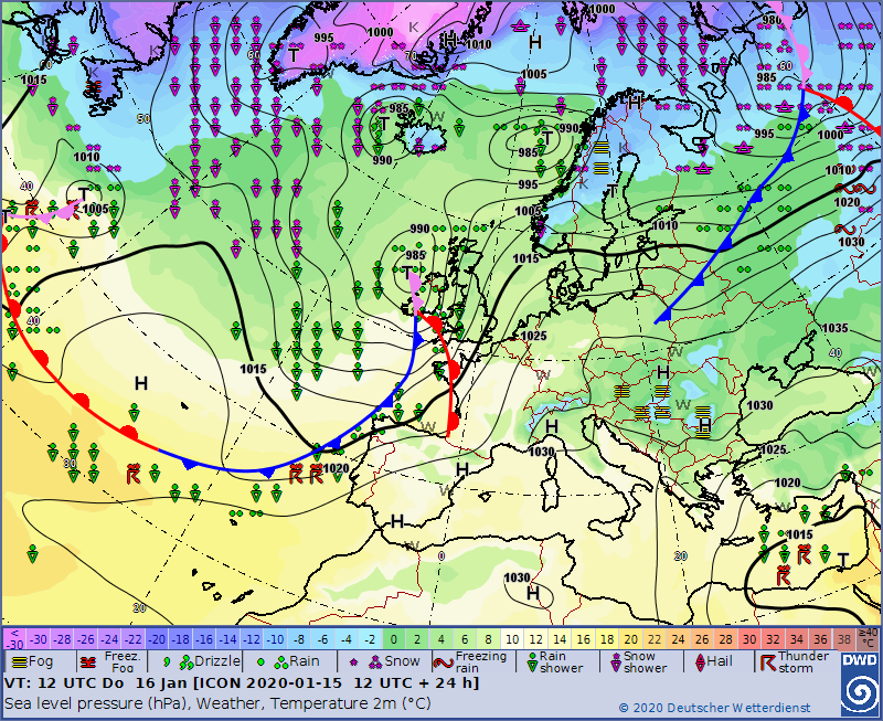
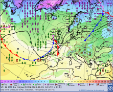
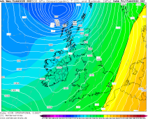
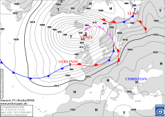
Sea level pressure and fronts, 16.01., 12 UTC
Image Credit: DWD
|
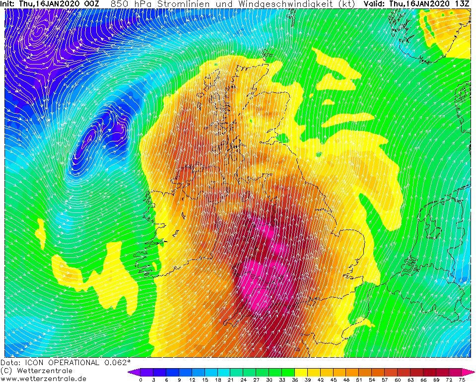
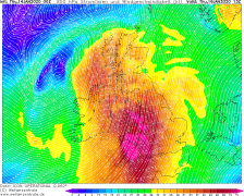
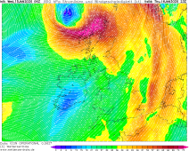
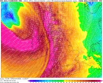
850 hPa Wind and Streamlines, 16.01., 13 UTC
Image Credit: Wetterzentrale
|
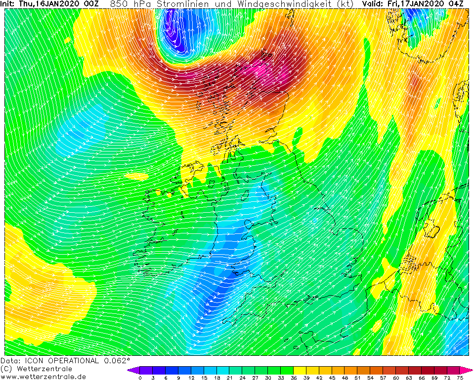
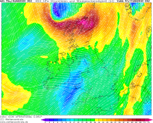
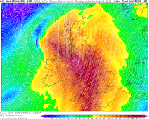
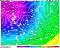
850 hPa Wind and Streamlines, 17.01., 04 UTC
Image Credit: Wetterzentrale
|
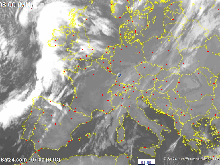
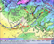
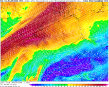
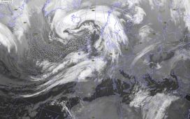
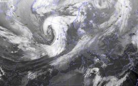
IR Satellite image, 16.01., 07 UTC
Image Credit: Sat24
|
Winterstorm FENJA, GERLINDE, HEIKE
Irland, Great Britain
Issued: Thursday, 16 January 2020, 09:00 CET
Windstorm HEIKE is currently located west of the coast of Ireland. The main storm field reaches Great Britain at noon and afternoon. Wind speeds of up to 160 km/h
are expected from Thursday till Friday morning.
13.-17.01 2020
The windstorm HEIKE is currently located with its core west of Ireland and will slowly shift to the northeast in the course of the day. HEIKE is in the area of a
left jet exit and a right jet entrance, which favours the intensification and causes the pressure within the centre to drop from 986 hPa to 976 hPa until the
evening and not to rise again until Friday morning. The track predicted today is similar to yesterday's
However, there are differences in the strength of the 1st wind maximum and its track. The forecast of the main storm field runs much further south than yesterday
and mainly affects Wales and England. Wind speeds of up to 160 km/h are expected there. Only towards evening the wind will weaken.
Also at the 2nd wind maximum there is a change regarding the forecasts yesterday. It is also calculated more southern and moves directly over the north of Scotland
with wind speeds around 160 km/h. In addition, it has shifted further into the night to Friday. This wind maximum lasts until Friday morning and wind speeds of up
to 160 km/h must be expected until then, especially near the coast (Scottish islands) and exposed locations.
There is a high risk of flooding due to the extremely strong winds in combination with high tides and storm surges on the coast within the affected regions.
Besides the strong winds can breack branches or uproot trees. Damages to infrastructer and traffic disruptions in road trafic and puplic transport must also be
expected. Delays and cancellations can occur.
Wednesday, 15 January 2020, 10:50 CET
|
|
|
|
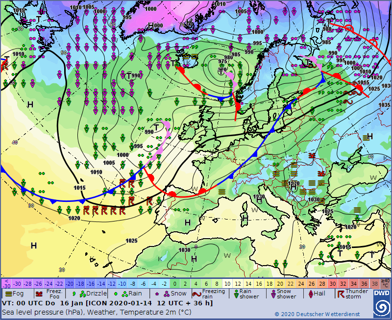
Sea level pressure and fronts, 16.01., 00 UTC
Image Credit: DWD
|
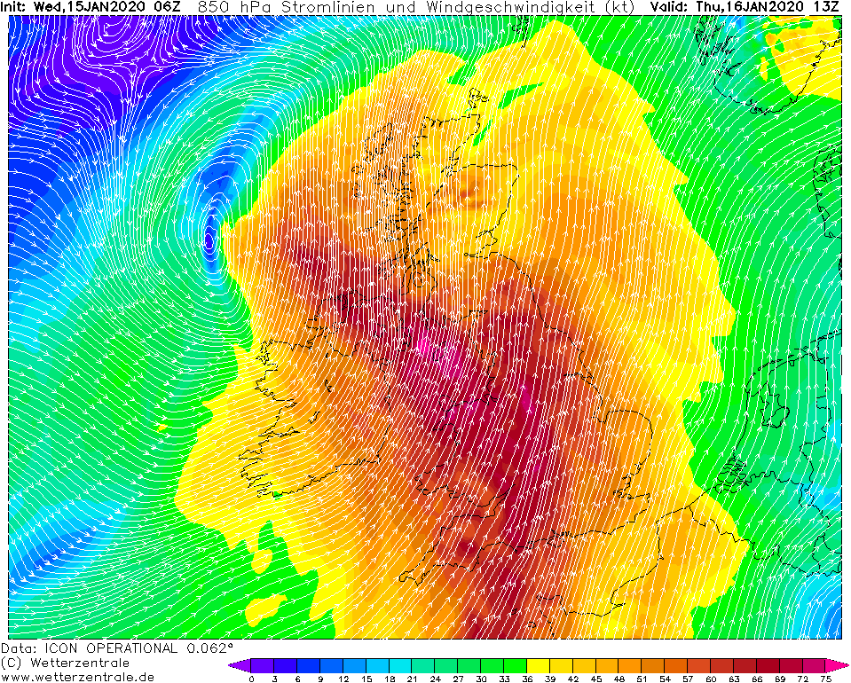
850 hPa Wind and Streamlines, 16.01., 13 UTC
Image Credit: Wetterzentrale
|
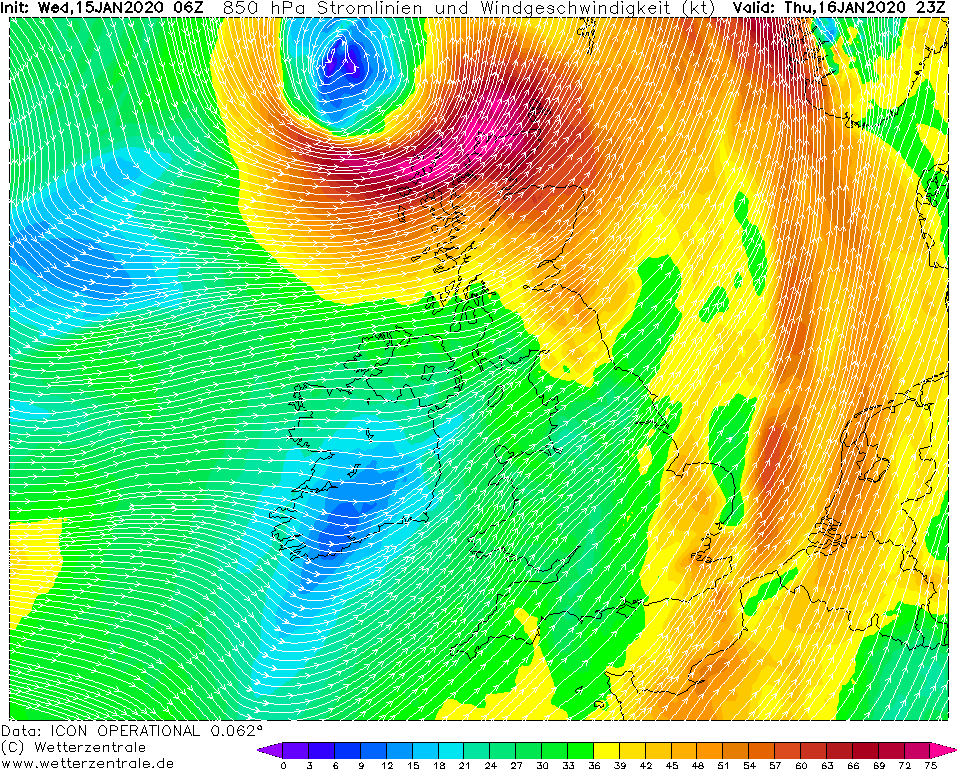
850 hPa Wind and Streamlines, 16.01., 23 UTC
Image Credit: Wetterzentrale
|
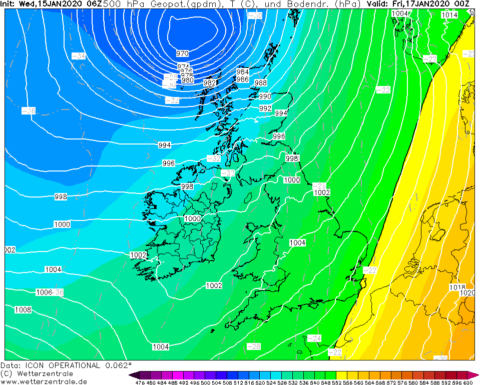
500 hPa Geopotential, 16.01., 00 UTC
Image Credit: Wetterzentrale
|
Winterstorm FENJA, GERLINDE, HEIKE
Central Europe, Irland, Great Britain
Issued: Wednesday, 15 January 2020, 10:50 CET
A new windstorm forms from Wednesday to Thursday and brings wind speeds of 160 km/h to Ireland and Great Britain. Windstorms FENJA and GERLINDE still provides gale gusts
in central and northeast Europe.
13.-17.01 2020
Windstorm FENJA and GERLINDE currently provide gale gusts in Scotland and Central and Northeast Europe. FENJA lingers on the European sea north of Great Britain
and brings gusts of 140 km/h, especially on the coasts and in exposed locations. Meanwhile in the north and on the coasts of Germany GERLINDE provides wind speeds
of up to 100 km/h. Also on the coasts of Sweden, Finland and Eastern Europe, gale gusts of up to 100 km/h can still be expected.
FENJA will stay a little longer on the European sea. Her storm field continues to weaken. GERLINDA moves to the northeast and also weakens.
During the course of the day, however, a new storm low develops on the Atlantic Ocean. HEIKE's storm field will first reach Ireland and then Great Britain in the
night to Thursday and will cause gusts of 100 km/h, on coasts and exposed locations 150 km/h. The pressure in the centre will drop to 970 hPa by Thursday night.
HEIKE shifts to the northeast towards the European sea and its storm field will reach a second wind maximum of 180 km/h on Thursday evening/Friday night.
This can still reach the very north of Scotland. The reason for further intensification is the favourable location of HEIKE at the left jet exit.
The exact path and strength of the main storm field are still uncertain.
There is a high risk of flooding due to the extremely strong winds in combination with high tides and storm surges on the coast within the affected regions.
Besides the strong winds can breack branches or uproot trees. Damages to infrastructer and traffic disruptions in road trafic and puplic transport must also be
expected. Delays and cancellations can occur.
Tuesday, 14 January 2020, 10:30 CET

|

|
|
|
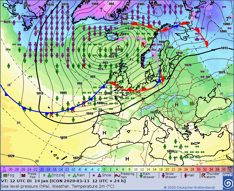
Sea level pressure and fronts, 14.01., 12 UTC
Image Credit: DWD
|
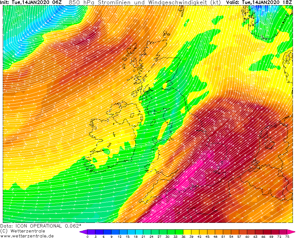
850 hPa Wind and Streamlines, 14.01., 18 UTC
Image Credit: Wetterzentrale
|
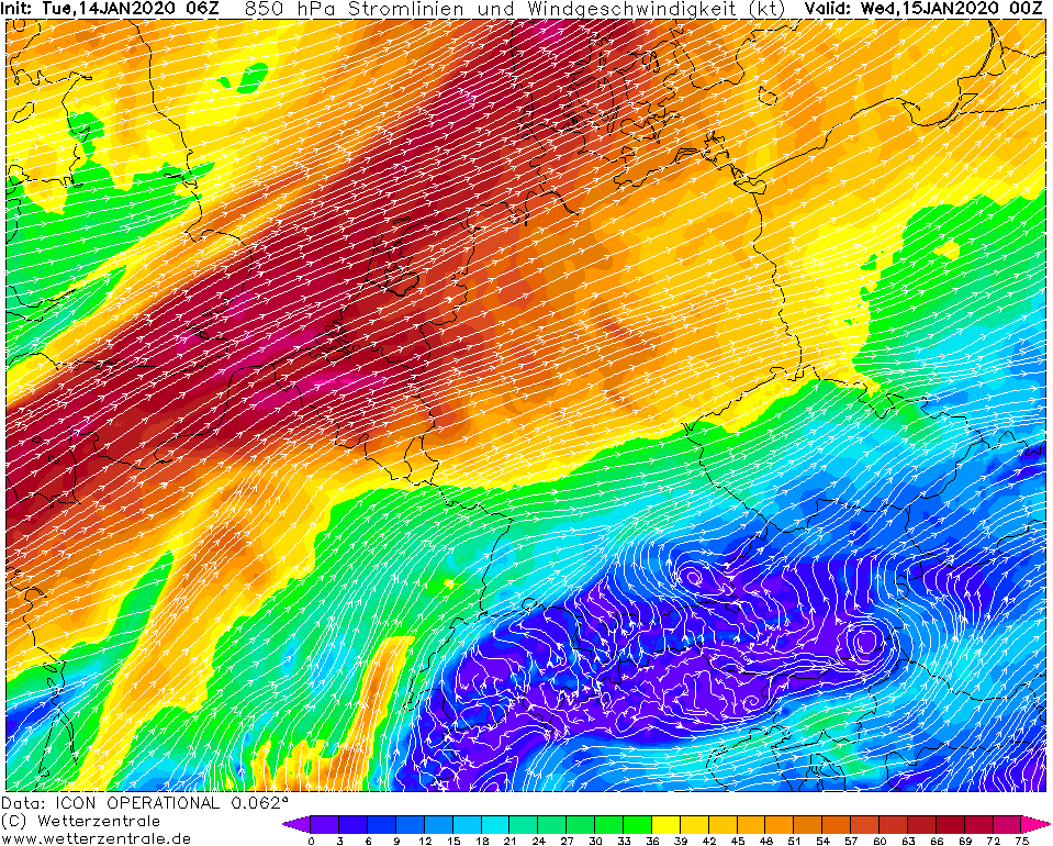
850 hPa Wind and Streamlines, 15.01., 00 UTC
Image Credit: Wetterzentrale
|
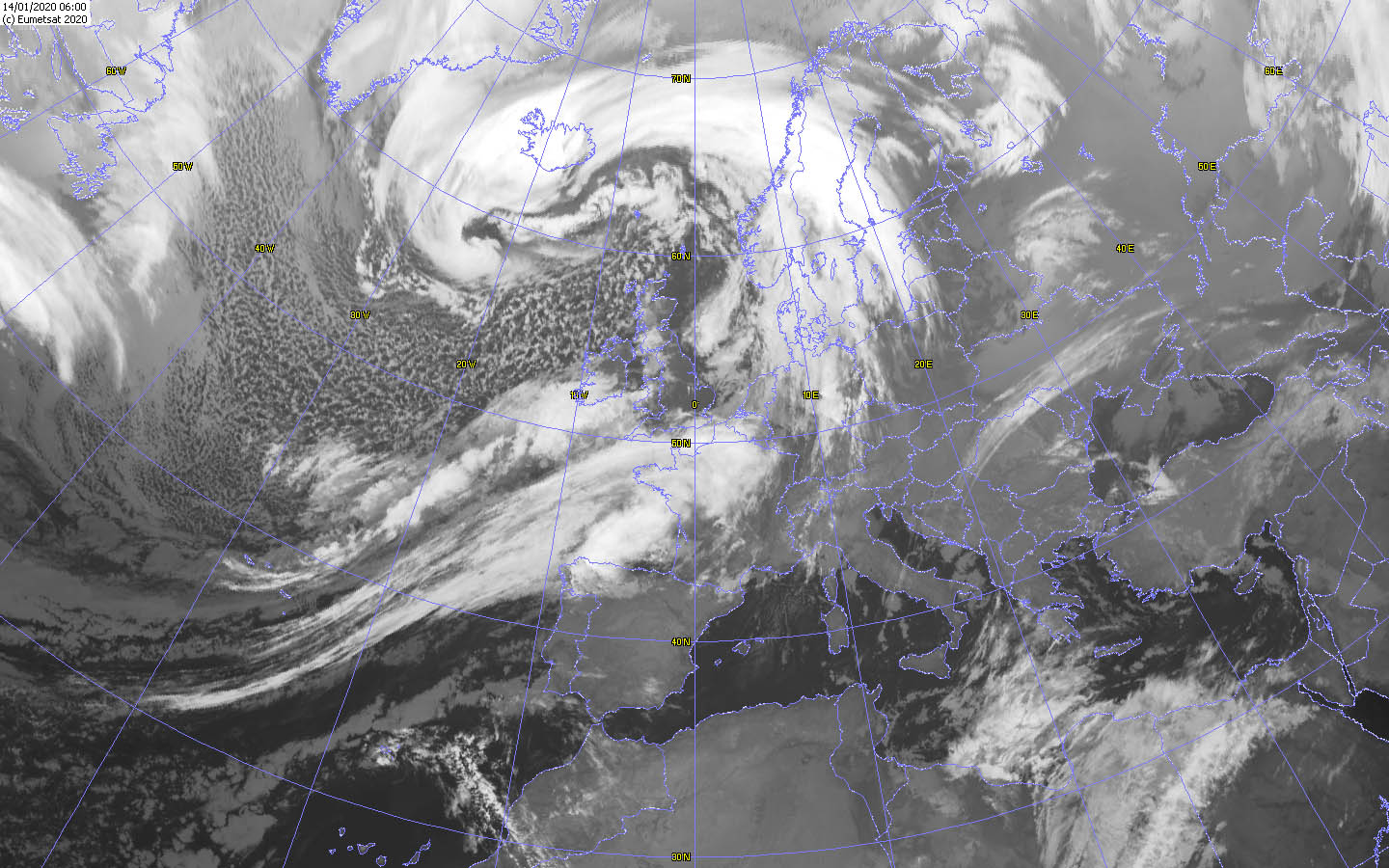
IR Satellite image, 14.01., 06 UTC
Image Credit: Wokingham
|
Winterstorm FENJA, GERLINDE
Central Europe, Irland, Great Britain
Issued: Tuesday, 14 January 2020, 10:30 CET
The winter storm FENJA retreats to the north to the Atlantic Ocean but still provides gale gusts of 140 km/h. Later in the day, winter storm GERLINDE causes
violent storm force winds of 160 km/h in Central and Northern Europe.
13.-17.01 2020
Winter storm FENJA is currently located on the Atlantic Ocean northwest of Great Britain. In the north of Scotland and in Ireland, wind speeds of around 120 km/h and
gusts of 140 km/h must be expected even today. However, these will decrease in the course of the day.
The frontal system of winter storm FENJA reached France, Benelux, Germany and Scandinavia last night. Gusts of around 100 km/h must be expected this morning.
Along the cold front of FENJA another winter storm has developed. GERLINDE is located over the Bay of Biscay with a core pressure of 985 hPa and will shift to the
east during the course of the day. The pressure will drop to 980 hPa as the storm moves northeast.
The storm field will affect the north-west and north of France and England at noon. Wind speeds of around 130 km/h are expected, on exposed sites and near the coast
around 160 km/h. In the evening the storm field will reach Benelux and northern Germany, and at night it will reach southwestern Sweden. Gusts of around 130 km/h
are also forecast here. The wind does not decrease until around noon on Wednesday. On Thursday a new winter storm will form, which will again hit Ireland and Great
Britain.
There is a high risk of flooding due to the extremely strong winds in combination with high tides and storm surges on the coast within the affected regions.
Besides the strong winds can breack branches or uproot trees. Damages to infrastructer and traffic disruptions in road trafic and puplic transport must also be
expected. Delays and cancellations can occur.
Monday, 13 January 2020, 10:00 CET
|
|
|
|
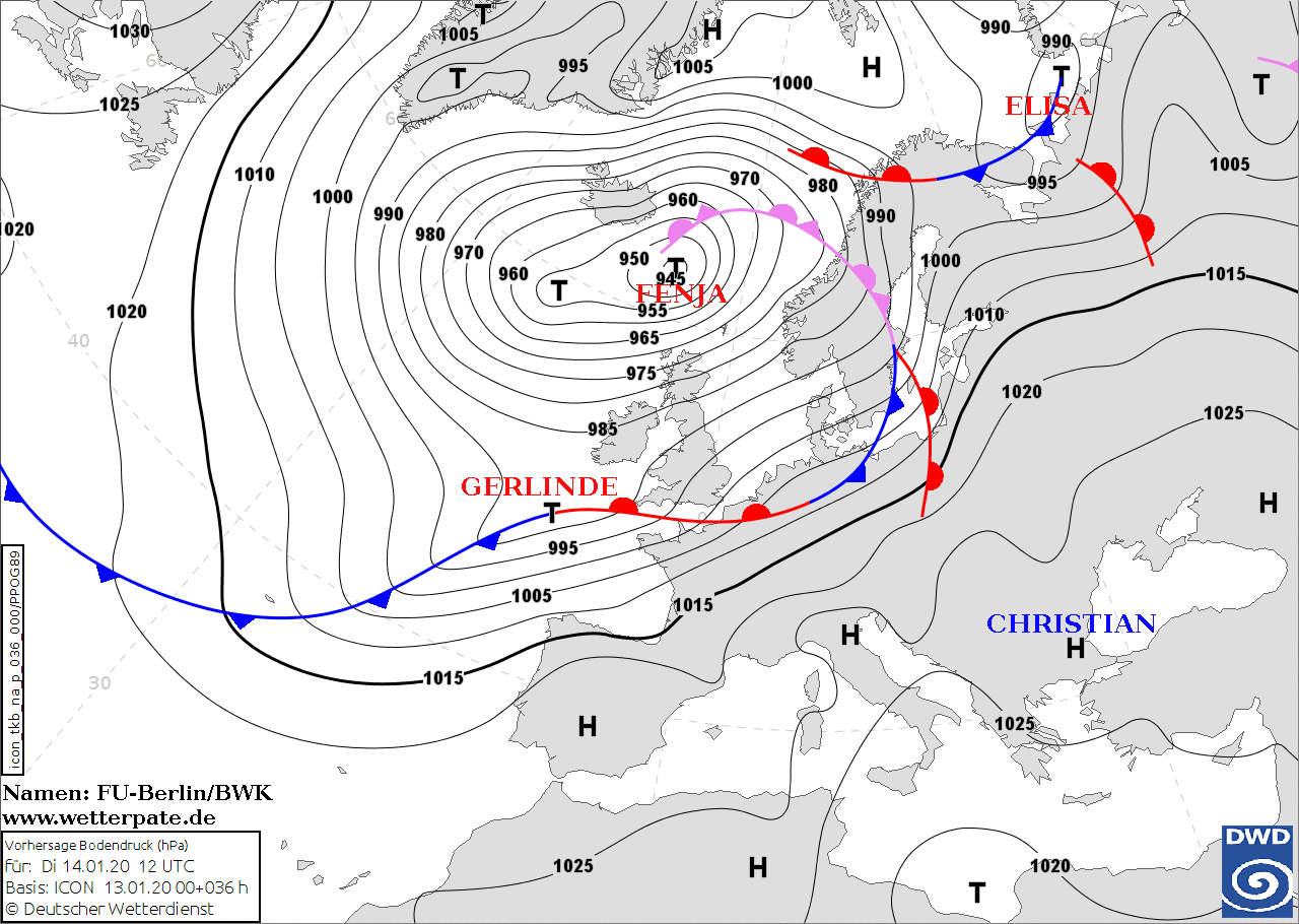
Sea level pressure and fronts, 14.01., 00 UTC
Image Credit: FU-Berlin
|
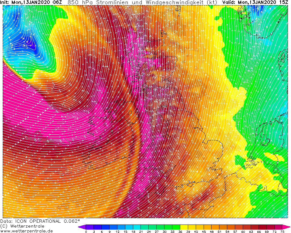
850 hPa Wind and Streamlines, 13.01., 15 UTC
Image Credit: Wetterzentrale
|
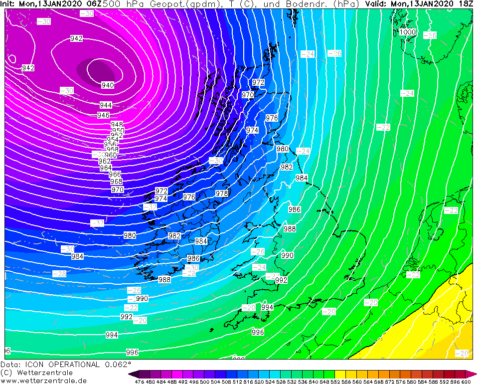
500 hPa Geopotential, 13.01., 18 UTC
Image Credit: Wetterzentrale
|
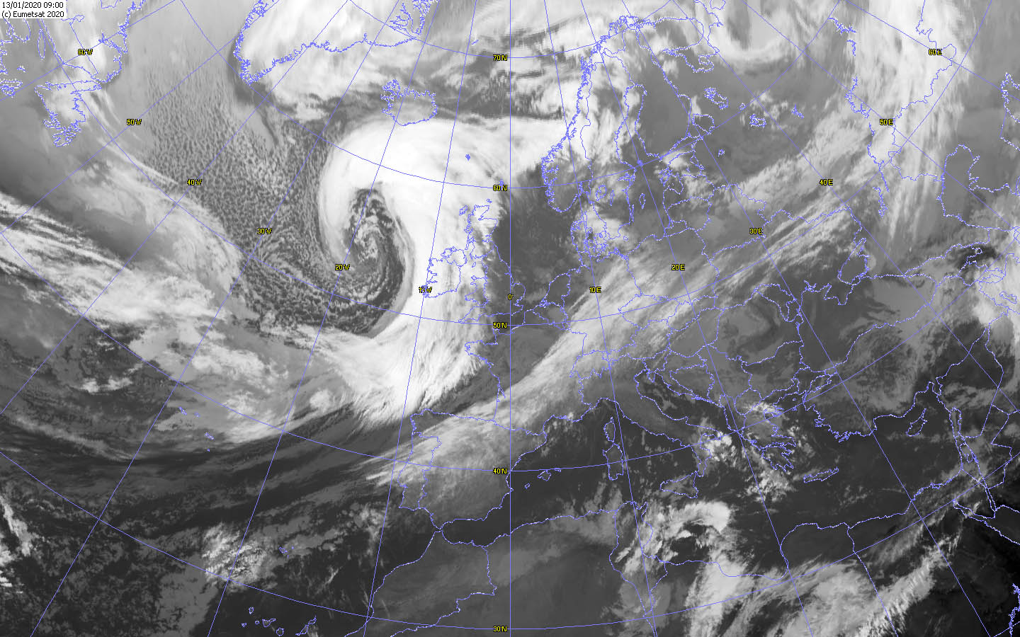
IR Satellite image, 13.01., 09 UTC
Image Credit: Wokingham
|
Winterstorm FENJA
Central Europe, Irland, Great Britain
Issued: Monday, 13 January 2020, 10:00 CET
Winter storm FENJA causes gusts of 180 km/h in Ireland and Great Britain. In France and Spain gusts of 140 km/h are expected.
On Tuesday, a marginal low reaches France, Benelux and Germany again.
13.-17.01 2020
A rapidly intensifying windstorm has developed over the Atlantic and is reaching Ireland and Great Britain. Due to the favourable location in the area of the
left jet exit and a dry intrusion, the core pressure will continue to fall (940 till Monday night) and it will also continue to intensify.
In the next few hours gusts of 180 km/h must be expected, especially near the coast and in exposed locations.
In the evening the storm reaches the north of France and the north of Spain. Gusts of 140 km/h are expected there. In the night to Tuesday, the wind will also
increase in the Benelux countries and north-west Germany. Gusts of up to 120 km/h can be reached.
On Tuesday, a marginal low develops at the front of FENJA, which again causes gusts around 140 km/h in the north of France and the south of England.
The storm field of low FENJA reaches Benelux and northern Germany again during the night. Gusts up to 140 km/h are calculated. In weakened form the storm
field reaches north-eastern Europe and northern Europe.
In the course of Thursday another storm develops, which will most likely hit Great Britain and Ireland again. For a more accurate forecast, however, further model
runs are required. The storm lows are moving very slowly eastwards. The reason for this is a pronounced ridge and its corresponding ground high CHRISTIAN over
southern and eastern Europe.
Due to the extremely strong winds, storm surges and floods must be espected on the coast within the affected regions.
Besides the strong winds can breack branches or uproot trees. Damages to infrastructer and traffic disruptions in road trafic and puplic
transport must also be expected. Delays and cancellations can occur.
Issued: January 13, 2020, 10:00 CET
MG
Issued: January 14, 2020, 10:30 CET
MG
Issued: January 15, 2020, 10:50 CET
MG
Issued: January 16, 2020, 09:00 CET
MG
|