Monday, 02 December 2019, 19:00 CET
|
|
|

|
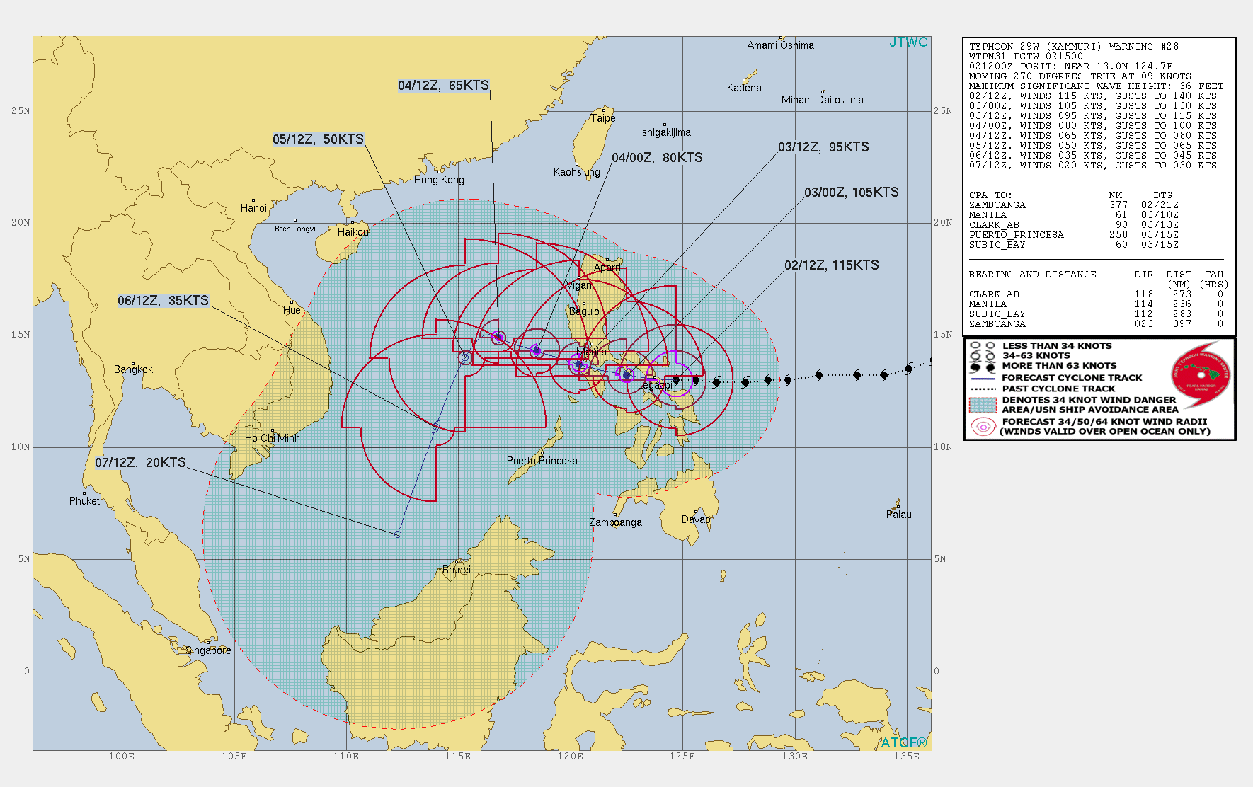
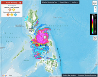
KAMMURIs trajectory, 02.12., 12 UTC
Image Credit: JWTC
|
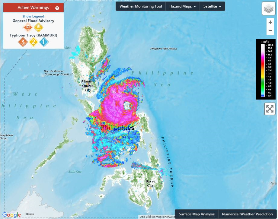
Precipitaion radar, 02.12., 16 UTC
Image Credit: PAGASA
|
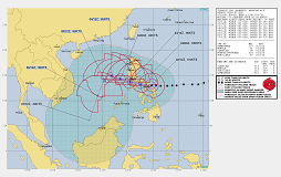
Specific warning information, 02.12.
Image Credit: GDACS
|
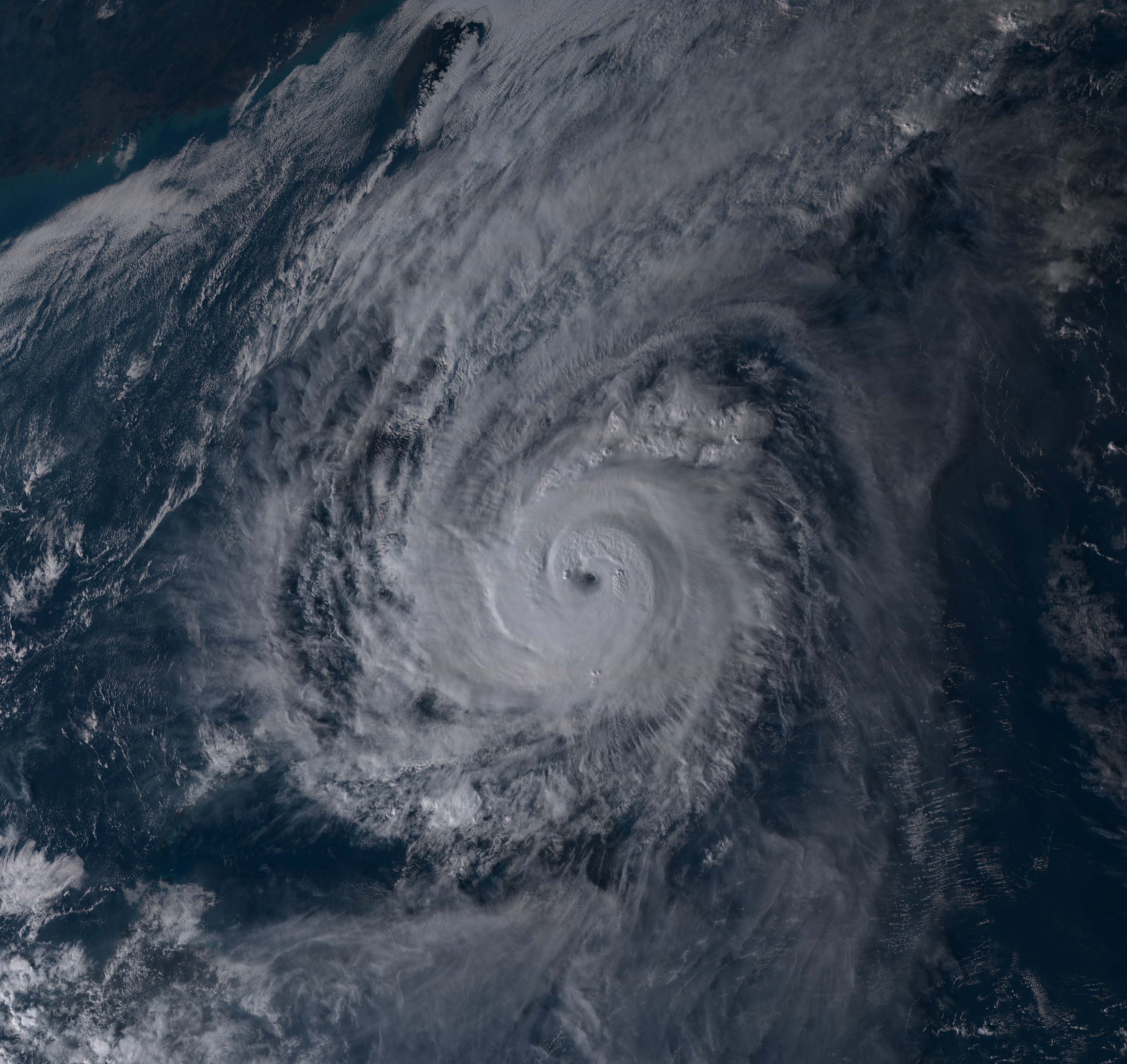
Satellite image, 02.12., 07 UTC
Image Credit: Himawiri
|
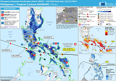
Tropical Cyclone
Philippines
Issued: Monday, 02 December 2019, 19:00 CET
Category 4 Typhoon KAMMURI is approaching the Philippine Islands with wind speeds of 205 kph. The landfall
is expected today, Monday, at about 18 UTC in the area of Sorsogon City.
02.-04.12 2019
Typhoon KAMMURI, which was still in category 1 yesterday at 12 UTC with sustained winds of 115 kph, has reached
category 4 after a rapid intensification. With a core pressure of less than 950 hPa and sustained winds of 205 kph,
the storm is approaching the Philippine Islands. In gusts up to 260 kph may be reached.
The landfall is expected this evening at 18 UTC in the area of Sorsogon City, a Philippine city with more than 150.000 inhabitans. Due to the moderate displacement
speed of approx. 16 kph, the Philippines will be in the storm's impact range for at least 48 hours. In addition to
stormy winds and waves of up to 11 m, total precipitation of up to 500 mm must be expected, especially on the eastern
sides of the islands. Severe damage to the infrastructure and in the industrial sector is to be expected. The manifold agricultural
sector (coconut trees, banana plants, rice and corn crops) will also suffer heavy damage.
Issued: December 02, 2019, 19:00 CET
FS
|