Sunday, 10 November 2019, 11:00 CET
Tropical Cyclone BULBUL / 23W MATMO
Bay of Bengal / West Bengal (India), Bangladesh
Issued: Sunday, 10 November 2019, 11:00 CET
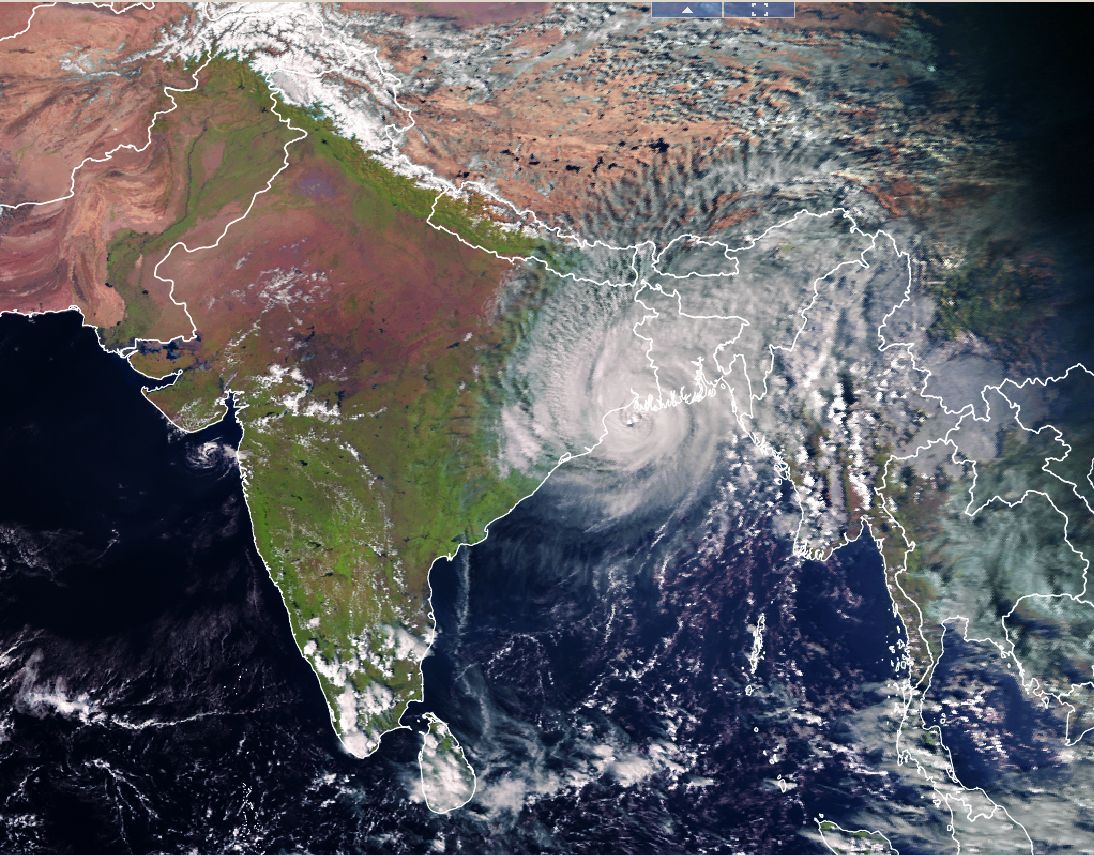
After making lanfall in the Indian province of West Bengal topical Cyclone BULBUL has approximately kept his strenth over the night
and moved to the Ganges Delta. Meanwhile, he has crossed the border from India to Bangladesh. There are warnings in effect due to wind,
heavy rain and storm surge.
09 Nov - 11 Nov 2019
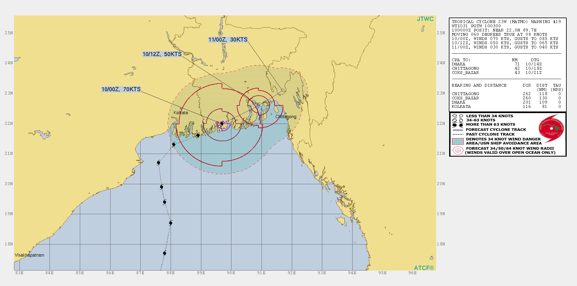
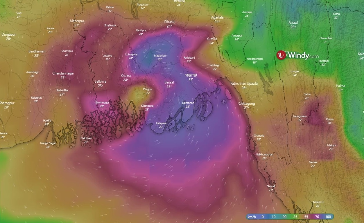
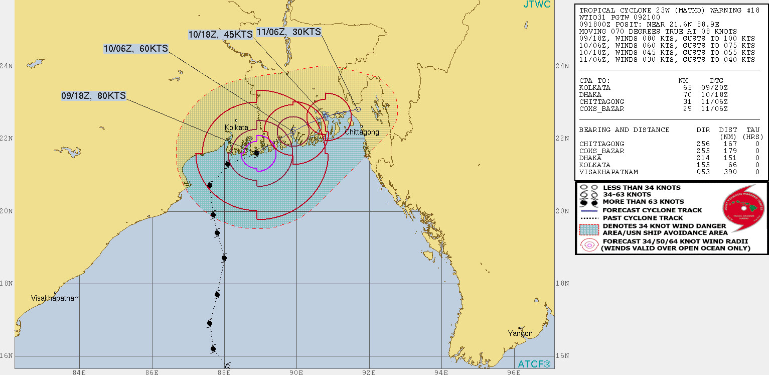
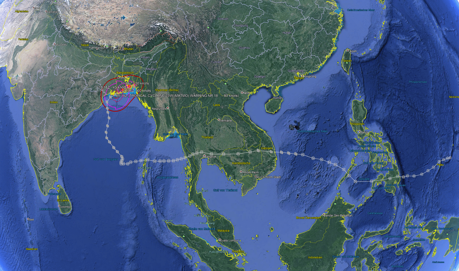
Tropical Cyclone BULBUL is currently located over the Ganges Delta about 200 km westwards of Chittagong (BD). With wind speeds of up to 120 kph
and gusts of up to 140 kph BULBUL belongs to cyclone category 1. The storm moves with a displacement speed of 15 kph in an east-northeast direction.
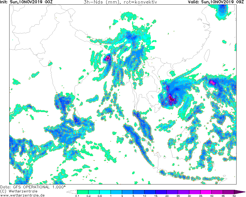
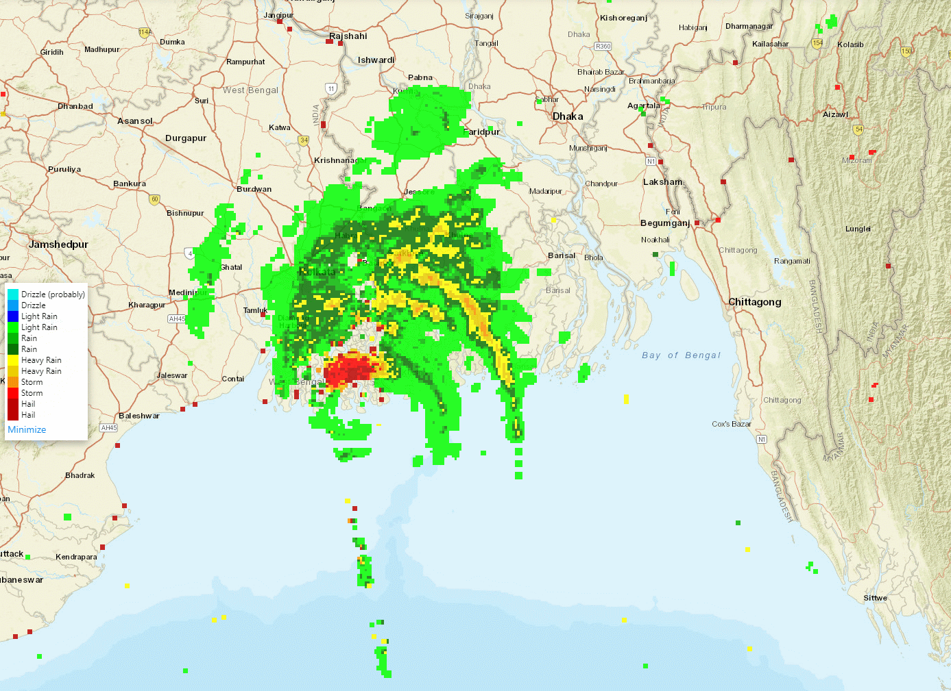
Both the strongest wind speeds and the most abundant precipitation occur in the two eastern quadrants of the cyclone. This leads to heavy rain up to
200 mm/24h in the eastern part of the Ganges Delta. The strong south winds east of the storm centre may additionally push water into the estuaries.
A storm surge of up to 2.5m must be expected, with many areas adjacent to the rivers being flooded.
Due to the increasing friction over land, especially over the eastern bordering foothills of the Patkai Mountains. Tomorrow, Monday, the storm will only
have wind speeds of up to 50 kph. Precipitation will also decrease rapidly, with thunderstorms and orographic rain of up to 50mm still to be expected
in the east of Bangladesh tomorrow.
Saturday, 09 November 2019, 14:00 CET
Tropical Cyclone BULBUL / 23W MATMO
Bay of Bengal / West Bengal (India), Bangladesh
Issued: Saturday, 09 November 2019, 23:00 CET
The Severe Cyclonic Storm BULBUL has made landfall around 16:30 UTC in the Indian province of West Bengal and will keep
sustained wind speeds of 110-120 and wind gusts of 135 kph for some more hours until crossing the border to Bangla Desh.
Warnings are in effect due to wind, heavy rain and storm surge.
09 Nov - 11 Nov 2019
The tropical cyclone which is called BULBUL in the Indian area of responsibility and formerly was
typhoon MATMO in the weastern Pacific Ocean will affect West Bengal (India) and parts of Bangla Desh until 11 November 2019.
Just before landfall, BULBUL was considered a very severe cyclonic storm
with sustained winds at 120-130 kph and gusts reaching 145 kph. BULBUL crossed the coastline of West Bengal
roughly 100 km south-southeast of Kolkata.
While making landfall and travelling towards the northeast across the Sundarba Delta the cyclone gradually will loose strength.
During the next 24 hours in parts of West Bengal heavy to very heavy rain may amount to 200 mm or above.
The sea conditions will be high to very rough along and off north Odisha coast and along and off West Bengal and
Bangladesh coasts.
Storm surge may be between 1 and 2.5 meters above atronimical tide and is very likely to inundate low lying areas
in West bengal and Bangladesh
Along the coastlines major damage to houses and huts may occur as well as damage to power
and communication lines. Coastal crops max suffer from torrential rain and wind,
and embankments and salt pans might be badly affected, too.
Issued: November 09, 2019, 23:00 CET
BM
Issued: November 10, 2019, 11:00 CET
FS
|