Friday 26 July 2019, 14:00 CET
Thunderstorms
France, Benelux, Germany
Issued: Friday, 26 July 2019, 14:00 CET
The influence of high pressure is replaced in the coming days by a drop of cold air, so that today
and especially tomorrow thunderstorms can occur in France, the Benelux countries and Germany.
26-27 July 2019
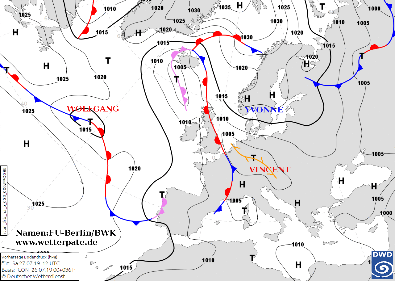
At the end of the heat wave, thunderstorms are expected at the weekend. At the moment Central Europe is
still under a high pressure influence, but a drop of cold air and a trough will displace the high pressure
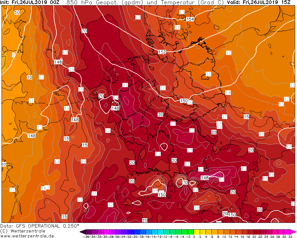
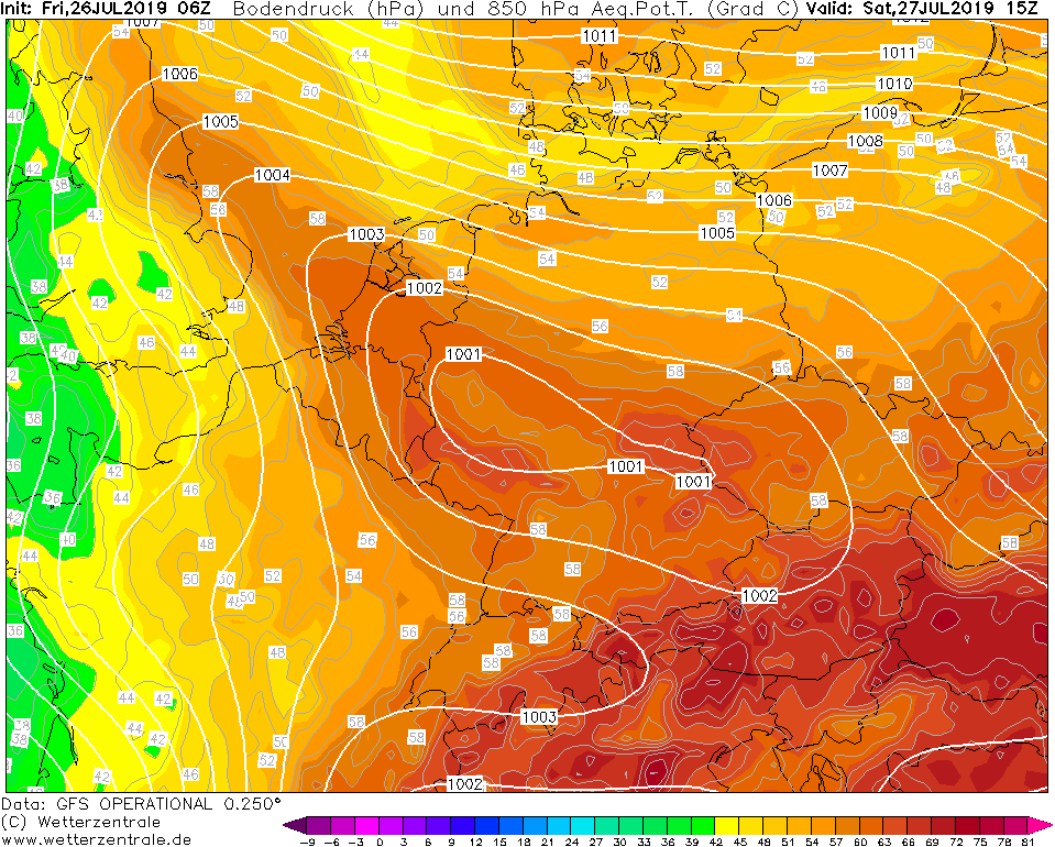
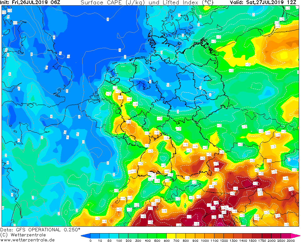
influence in the next few days. In addition, a heat low over the Alps is formed, which is leading to more
dynmaic in the atmosphere. The northeast and north of Germany are influenced by the cold air drop and an
easterly wind, while the west and southwest are influenced by the trough and experience a weak southwesterly
to northwesterly wind. This means that dry continental air reaches the north, while cooler and more humid air
reaches the south, which can lead to thunderstorms here. The dew point temperature also rises significantly
(18 °C - 20 °C). In the area of the cold front there are thunderstorms. Heavy thunderstorms with heavy rain
already occur today in France and the Benelux countries. Tomorrow the cold front shifts farther east and
reaches the west of Germany in the afternoon. Then strong thunderstorms can also occur here.
There is a danger of lightning, flooding and small-scale hail.
Issued: July 26, 2019, 14:00 CET
CL
|