Friday 07 June 2019, 13:00 CET
|
|
|
|
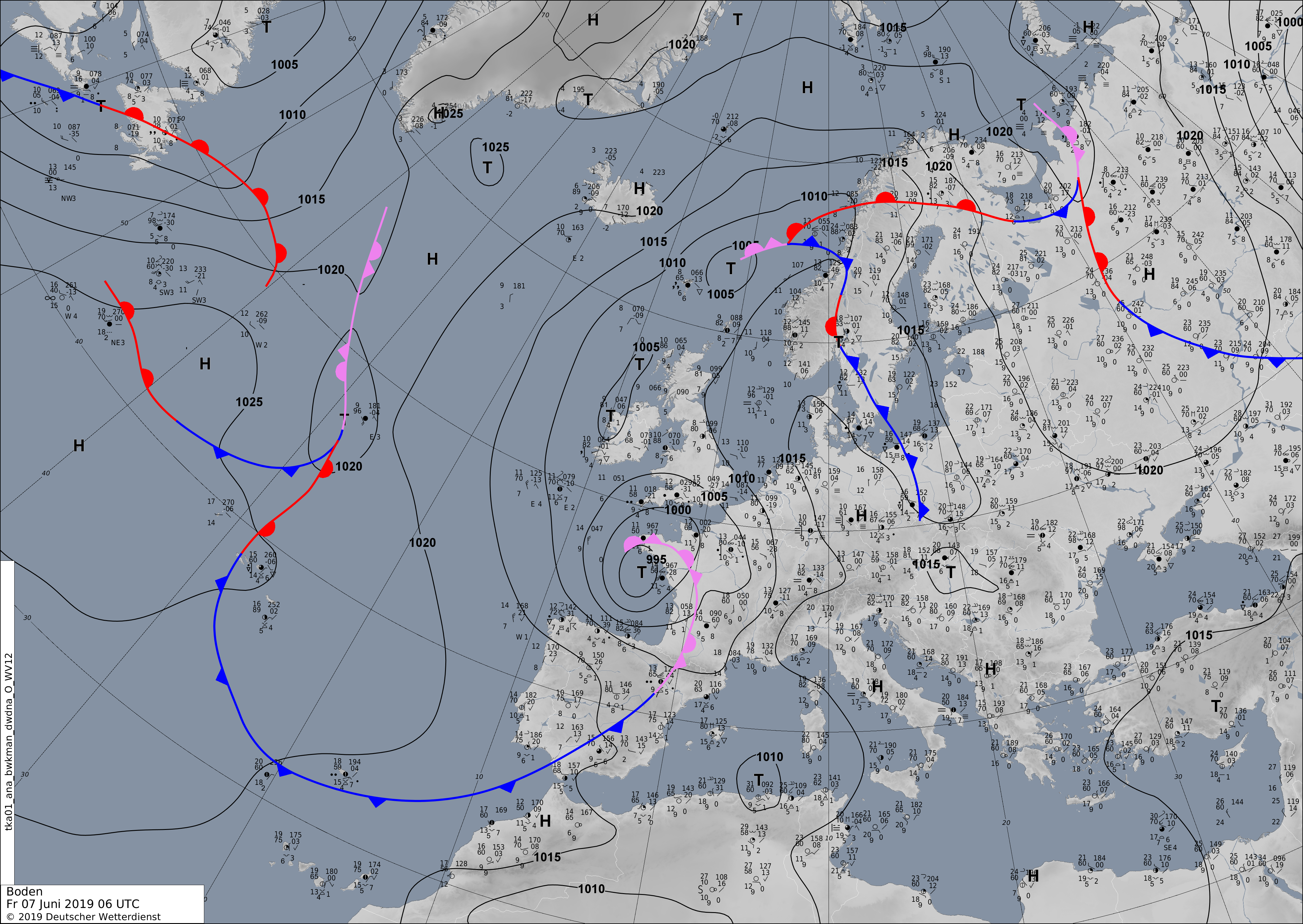
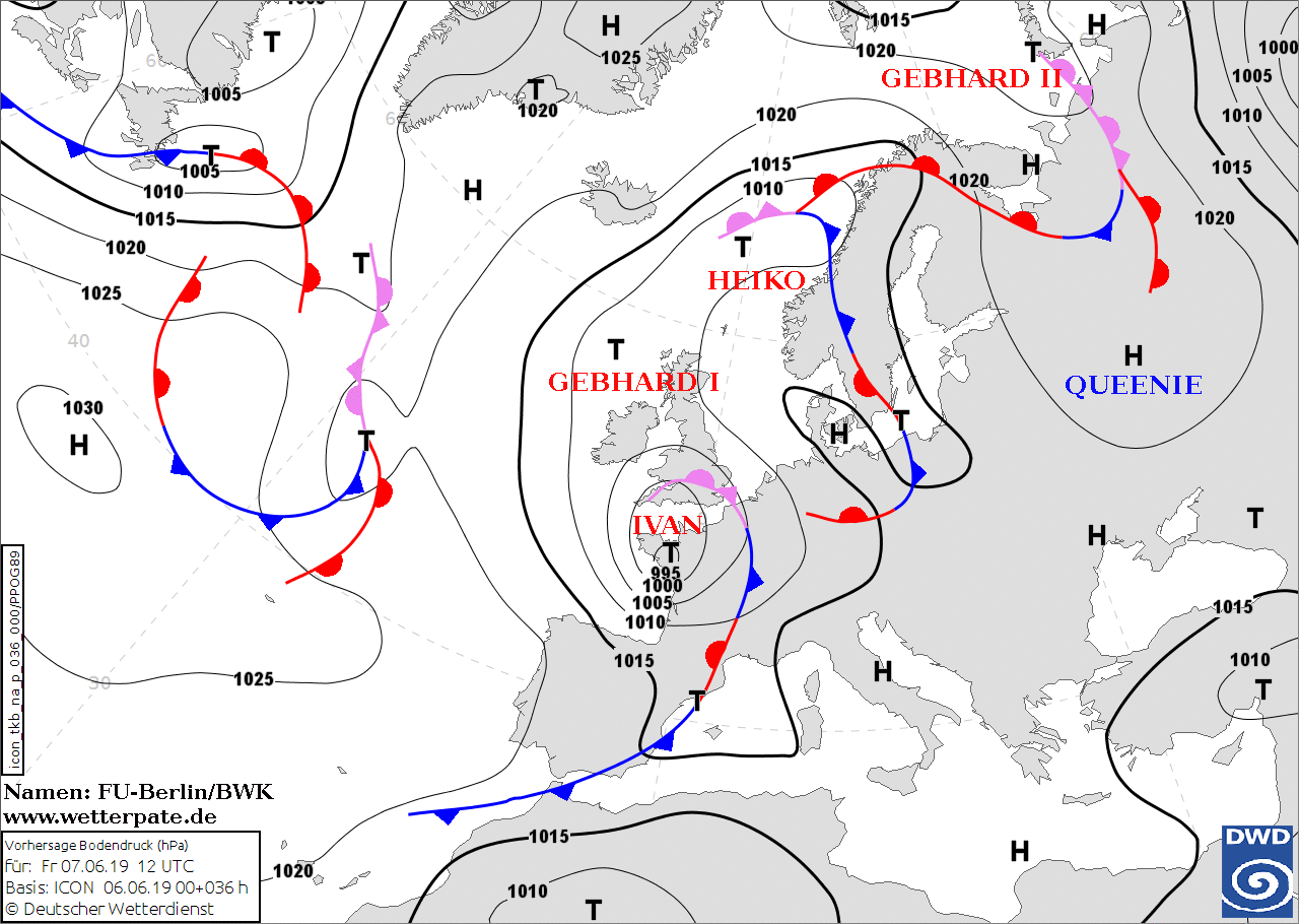
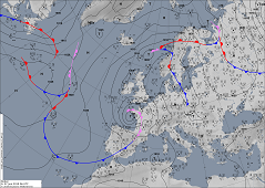
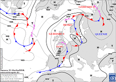
Soil pressure and fronts (Europe), 07.06., 06 UTC
Image Credit: Deutscher Wetterdienst
|
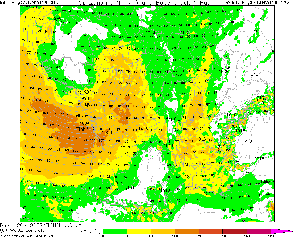
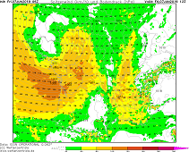
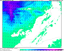
Wind gusts (France), 07.06., 12 UTC
Image Credit: Wetterzentrale
|
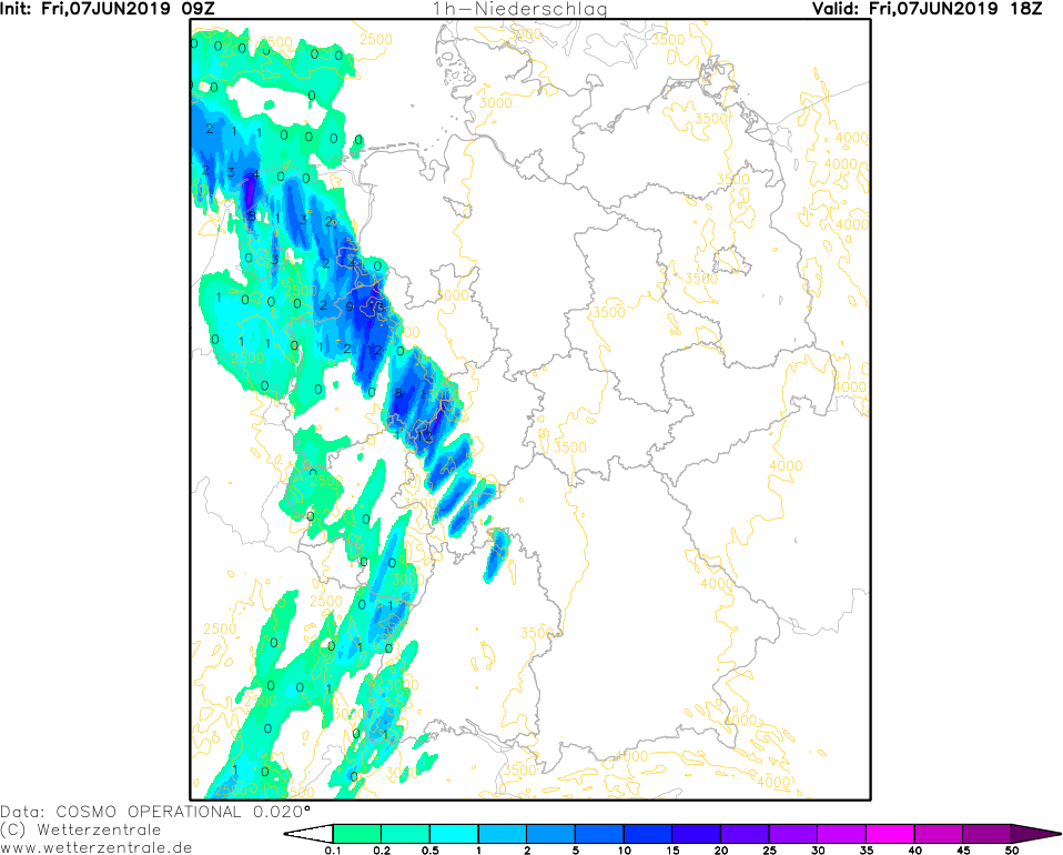
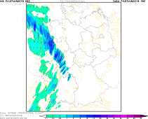
1 h precipitation (Germany), 07.06., 18 UTC
Image Credit: Wetterzentrale
|
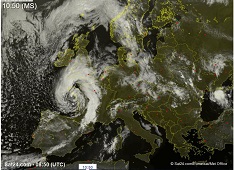
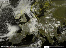
Satellite image (Europe, visible), 07.06. 08:50 UTC
Image Credit: Sat24
|
Storm, thunderstorms
France, Central Europe
Issued: Friday, 07 June 2019, 13:00 CET
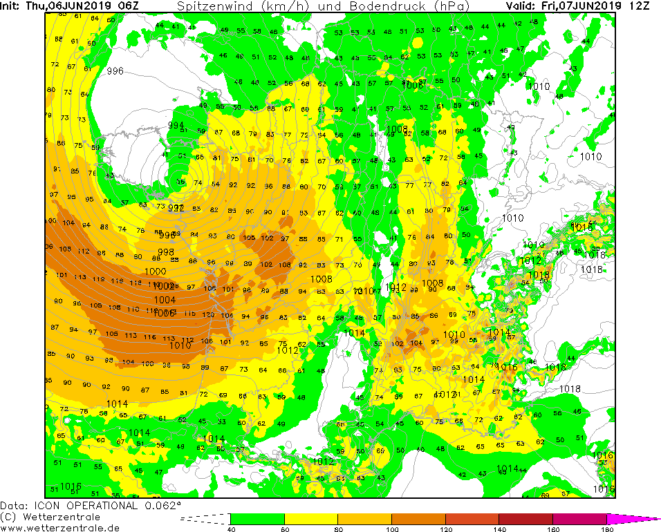
Low pressure Area IVAN provides hurricane-like gusts on the west coast of France on Friday. In the afternoon,
showers and thunderstorms are likely in France, Benelux and Germany.
06-08 June 2019
IVAN's core pressure did not decrease as much as expected. With a pressure of about 990 hPa, the center of the
storm is moving towards the northwest coast of France. In coastal areas, average wind speeds of up to 80 kph
and gusts of up to 120 kph are expected. Gusts of up to 105 kph are also possible in the French inland. There
is danger from blowing objects and falling trees or masts.
In the northwest of France, up to 40 mm of precipitation may fall today, Friday.
Rain showers and thunderstorms can form along the occluded front of low pressure are IVAN.
In the early evening they will also reach western Germany and the Benelux states.
Precipitation intensities of up to 20 mm/h are possible. The formation of squall lines is not excluded.
In the vicinity of thunderstorms gusts of up to 90 kph can occur.
Thursday 06 June 2019, 13:30 CET
|
|
|
|
Soil pressure and fronts (Europe), 07.06., 12 UTC
Image Credit: Deutscher Wetterdienst
|
Acc. precipitation (Spain), 07.06., 12 UTC
Image Credit: Wetterzentrale
|
Wind gusts (France), 07.06., 12 UTC
Image Credit: Wetterzentrale
|
Satellite image (Europe, visible), 06.06. 10:35 UTC
Image Credit: Sat24
|
Storm, heavy precipitation
Portugal, Spain, France
Issued: Thursday, 06 June 2019, 13:30 CET
Low pressure Area IVAN provides hurricane-like gusts in the northwest of the Iberian Peninsula on Thursday
and the southwest of France on Friday. Rain amounts up 100 mm are to be expected.
06-08 June 2019
At the frontside of a trough over the Atlantic Ocean extending as far as Spain, low pressure area IVAN is
formed today, Thursday. Due to the presence of the three most important lifting impulses - with height
increasing vorticity advection, positive layer thickness advection and latent heat input due to condensation
of cloud droplets - low pressure are IVAN is able to build and intensify very quickly.
After an intensification of almost 20 hPa in 24 hours, IVAN's centre will reach land in France on Friday at
about 10 UTC. The core pressure will be about 980 hPa.
On Thursday there may be heavy rainfall in the northwest of the Iberian Peninsula, especially along the
mountains. Up to 100 mm may fall within 24 hours. There is a threat of flooding and landslides.
In coastal areas, gale-force gusts of up to 115 kph must also be expected.
On Friday there is a risk of hurricane-like gusts of up to 130 kph on the west coast of France.
Issued: June 06, 2019, 13:30 CET
FS
Issued: June 07, 2019, 13:00 CET
FS
|