Thursday 06 June 2019, 13:20 CET
Thunderstorms, hail, downburst
Central Europe, Germany
Issued: Thursday, 06 June 2019, 13:20 CET
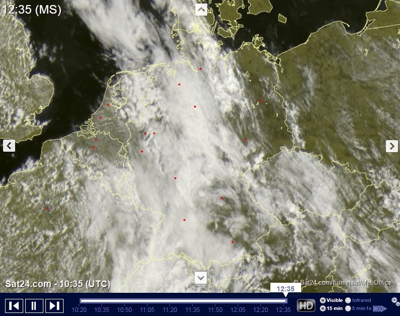
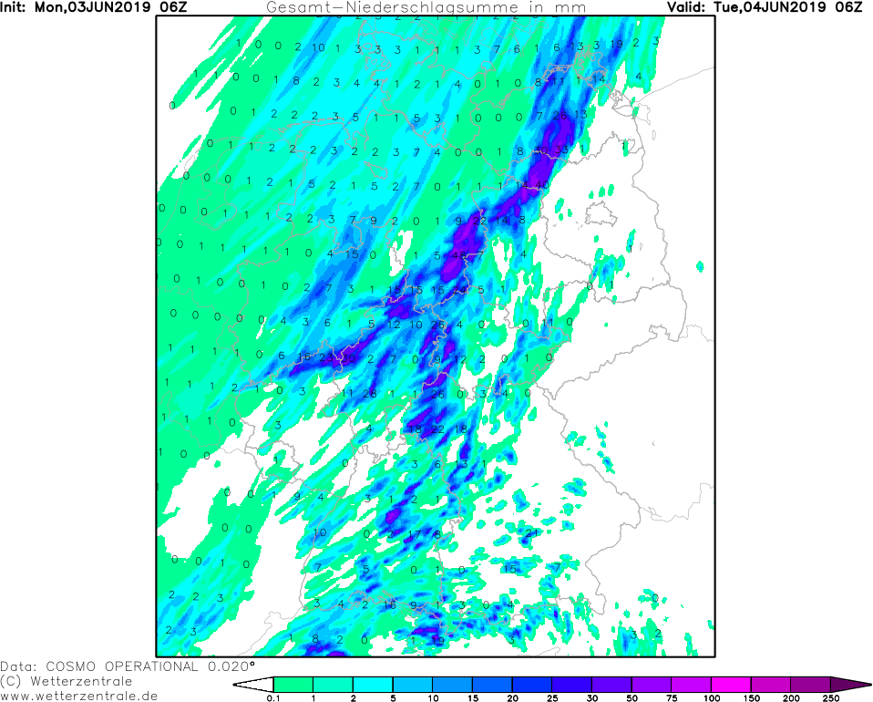
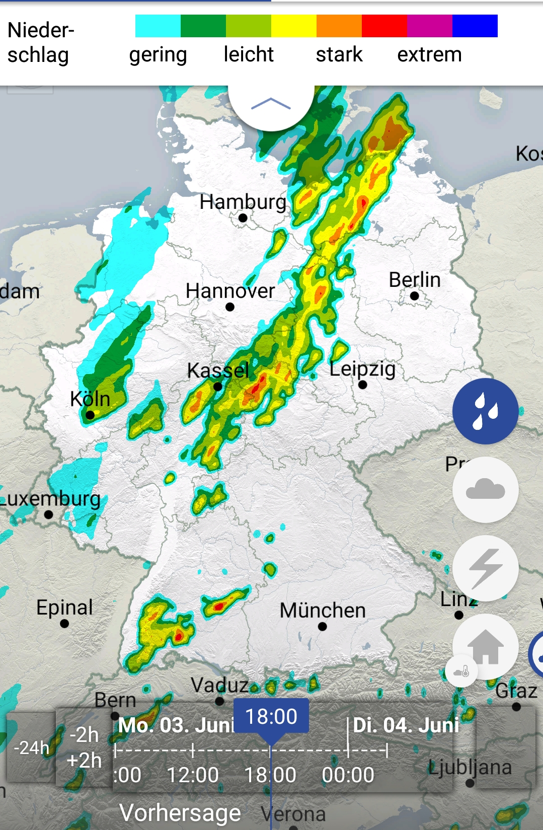
On Thursday there is a danger of heavy thunderstorms in northeastern Germany. There is a risk of hail, downbursts and severe precipitation.
03-06 June 2019
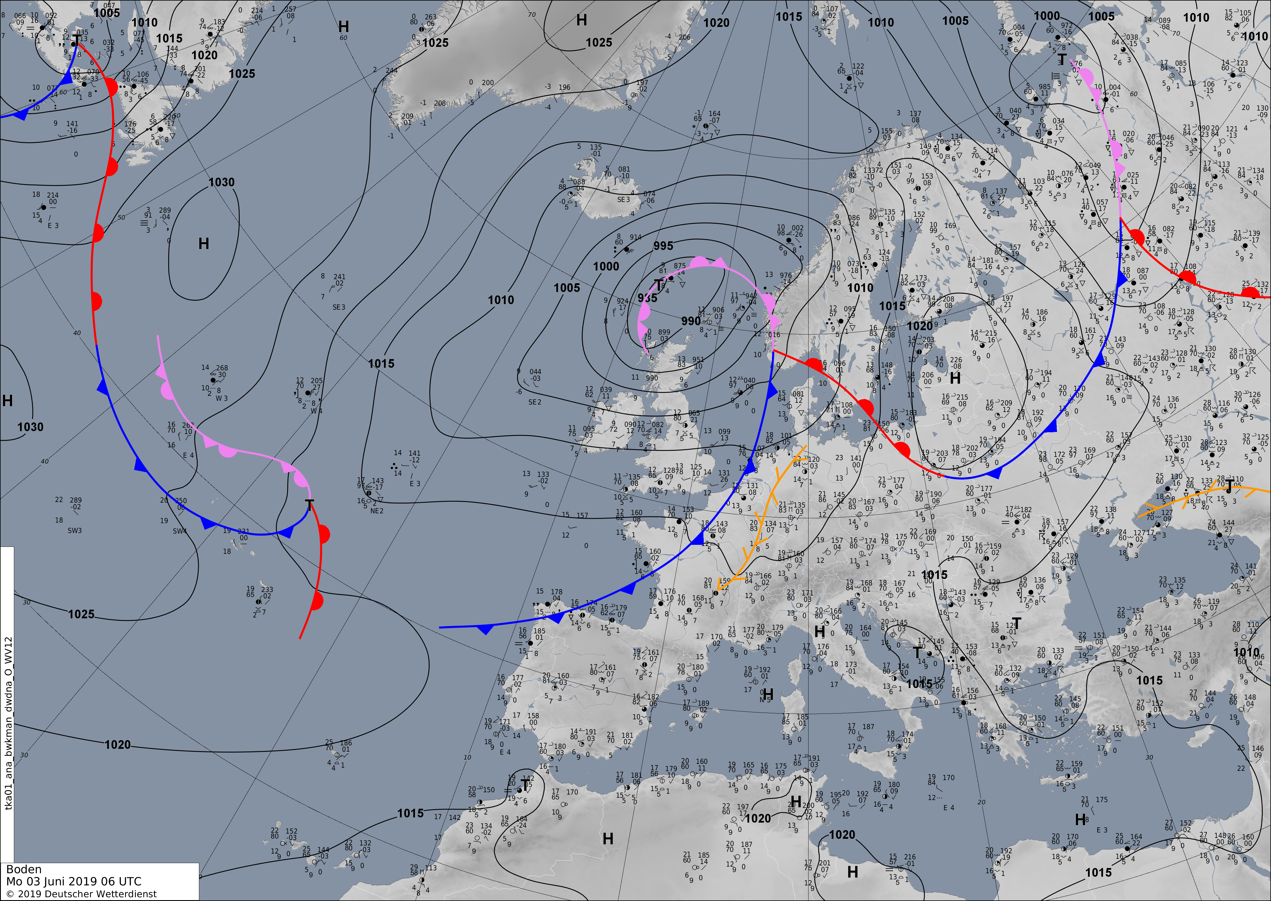
On Wednesday evening and at night, a frontal zone moved across France, the Benelux and Germany.
Severe thunderstorms formed along the frontal band and at night it developed to a Squall Line extending from the northern
Baden-Württemberg to the North Sea. This front or storm line reaches today's day the northeast of Germany and brings there heavy thunderstorms.
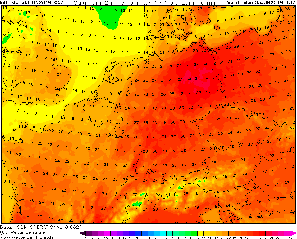
The temperatures can reach more than 30°C there today, while in the other parts of Germany it will not reach more than 20°C.
The East is still struggling with the drought and associated forest fires. The thunderstorms should bring at least a little rainfall, which, however, is
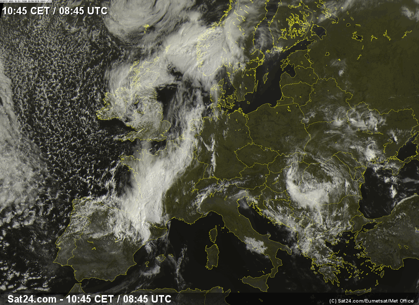
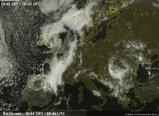
far from sufficient to compensate for the deficits. The first thunderstorms are expected from noon and can already be seen on the satellite image.
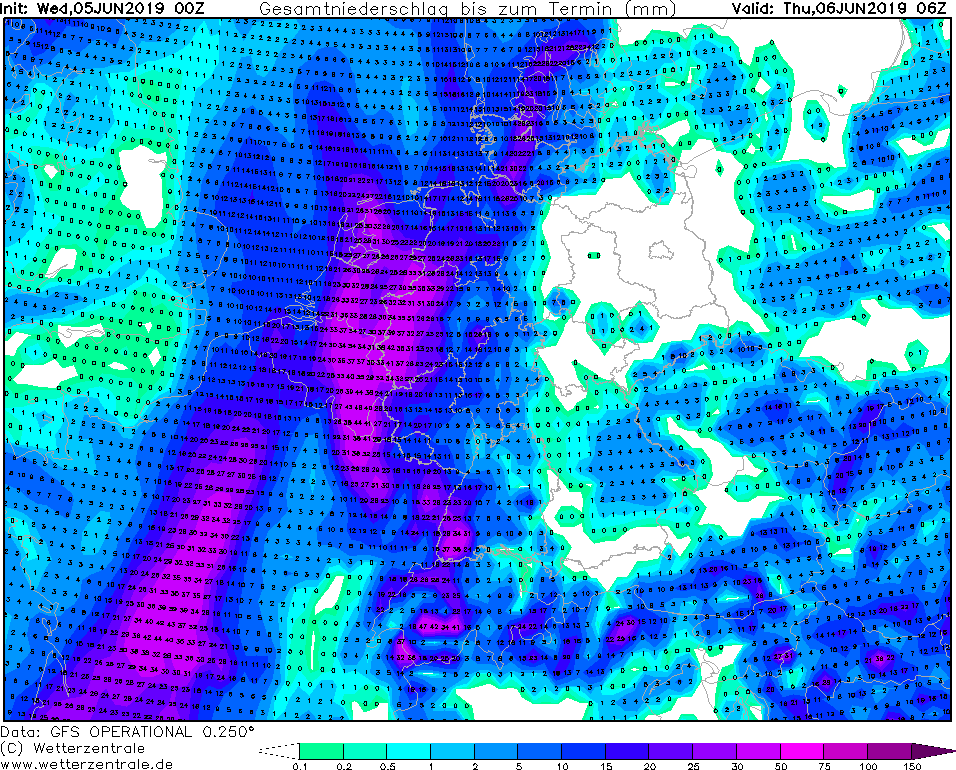
Above the extreme east, the frontal zone loses speed, which can lead to stationary thunderstorms, which can cause flooding by their heavy
precipitation. In the night of Friday, the storms will weaken again.
In addition to the risk of lightning, there also must be expected hail and severe precipitation and downbursts with gale gusts and gusts
with hurricane like force.
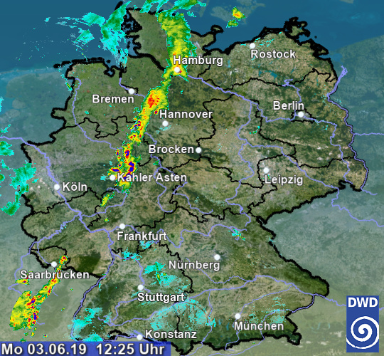
Wednesday 05 June 2019, 11:30 CET
|
|
|

|
Satellite image, 05.06.
Image Credit: Sat24
|
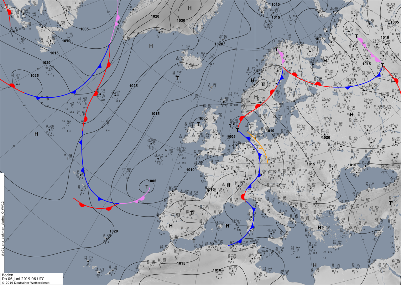
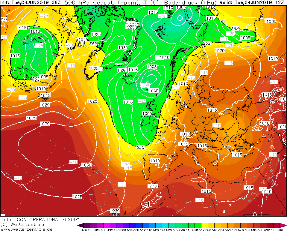
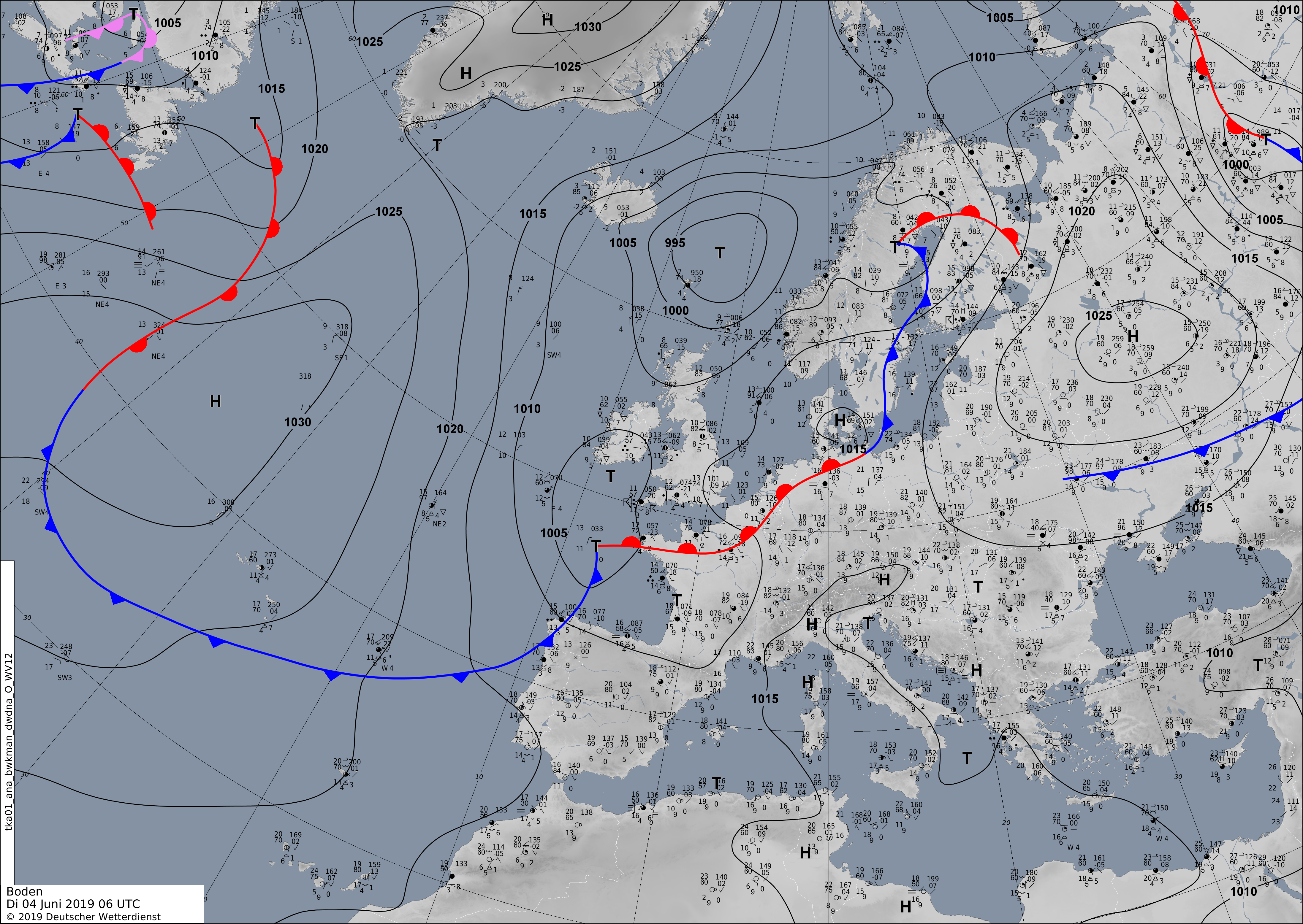
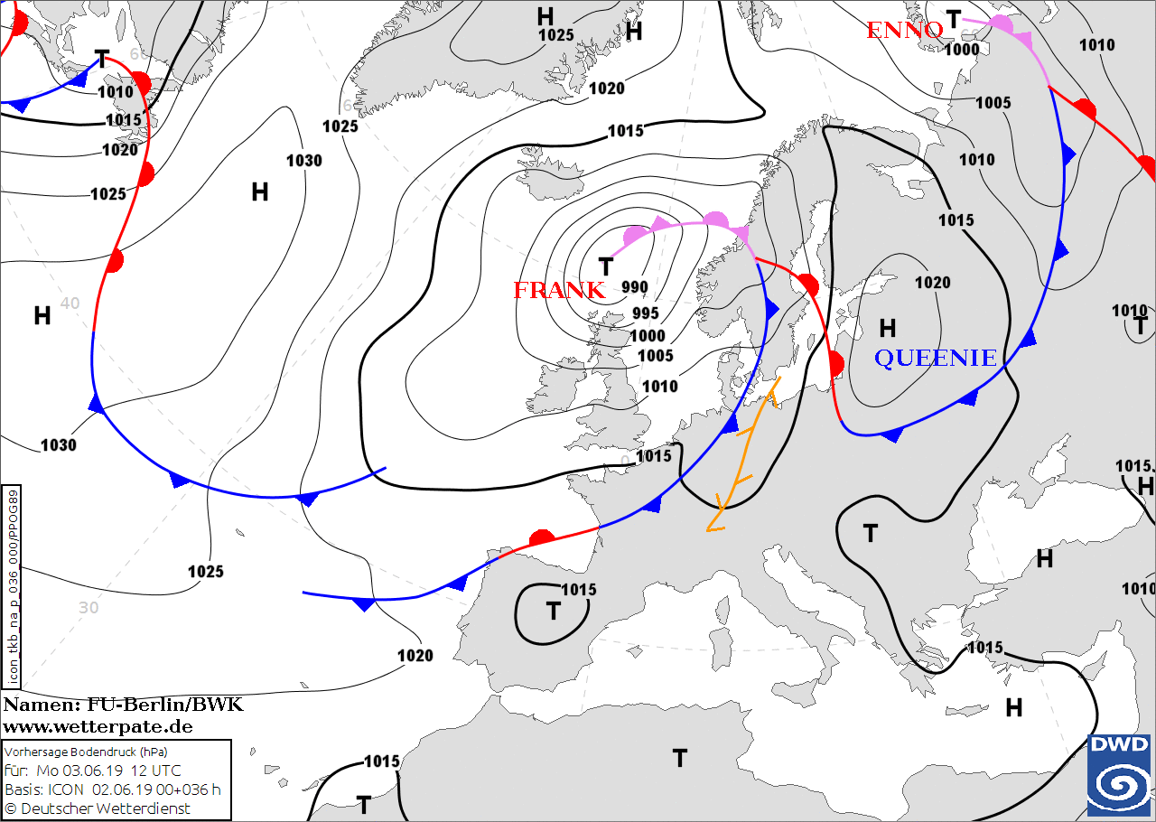
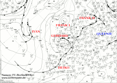
Soil pressure and fronts, 04.06., 06 UTC
Image Credit: FU Berlin
|
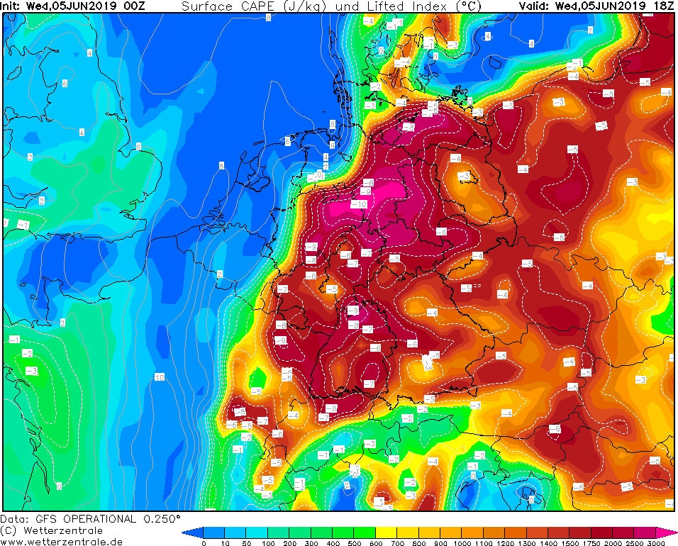
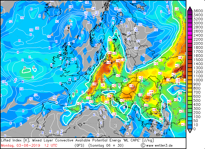
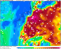
CAPE and lifted index, 05.06., 12 UTC
Image Credit: Wetterzentrale
|
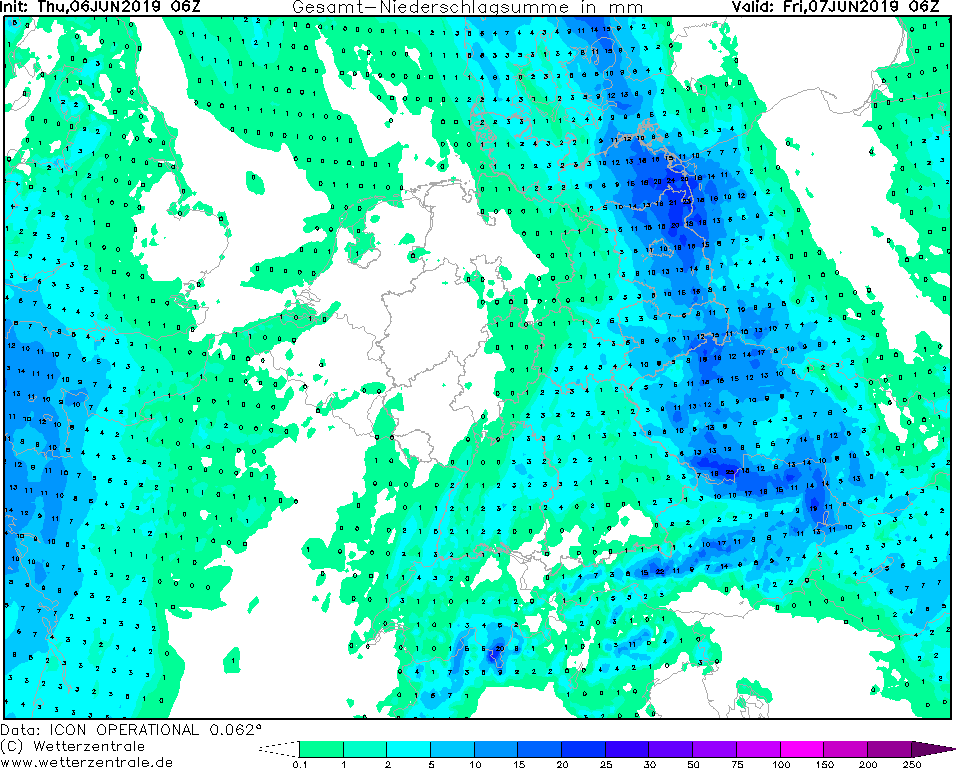
30 h precipitation
06.06. 06 UTC
Image Credit: Wetterzentrale
|
Thunderstorms, hail
Central Europe, Germany
Issued: Wednesday, 05 June 2019, 11:30 CET
On Wednesday evening there is danger from thunderstorms in the north of France, the Benelux countries and
Germany.
03-06 June 2019
In the evening and in the night to Thursday the trough moves in northeastern direction across France to the
British Isles. The new low is connected to it, which is formed during the day over France and moves from
Benelux to the North Sea. The associated front system separates the very warm subtropical air of clearly
cooler sea air (temperature 850hPa between 3 and 8°C), which is stored west of it. The new low is connected
to it, which is formed during the day over France and moves from Benelux to the North Sea. During the night,
this air mass limit spreads to the west of Germany. Strong uplift on the front side of the trough (mainly due
to positive vorticity advection) and the approach of the frontal system lead to increased showers and
thunderstorms in the west. The corresponding thunderstorm parameters suggest severe thunderstorms,
especially for the first half of the night.
Thunderstorms, which again caused heavy rainfall, hail and storm. It is unclear how
far the thunderstorms will continue after east.
In the second half of the night, the low and the trough are already moving into the North
Sea and subsequent cold air advection dampens convective events.
Tuesday 04 June 2019, 14:30 CET
Thunderstorms, hail
Central Europe, Germany
Issued: Tuesday, 04 June 2019, 14:30 CET
On Tuesday there is danger from thunderstorms in the north of France, the Benelux countries and the
German states of Lower Saxony and Schleswig Holstein.
03-06 June 2019
Due to a more stable stratification of the atmosphere, the threat of thunderstorms in southern Germany today
is rather low. However, the advection of humid warm air on the southern flank of low pressure area GEBHARD
can lead to strong thunderstorms in Northern France. The southwestern current also takes the thunderstorm cells
into the Benelux countries and the northwest of Germany.
The precipitation intensities can be violent up to 50 mm/h. Hail must also be expected. Since the thunderstorm
cells do not become stationary, the accumulated precipitation amount is rather low.
Storm- and hurricane-like gusts are to be expected near thunderstorms.
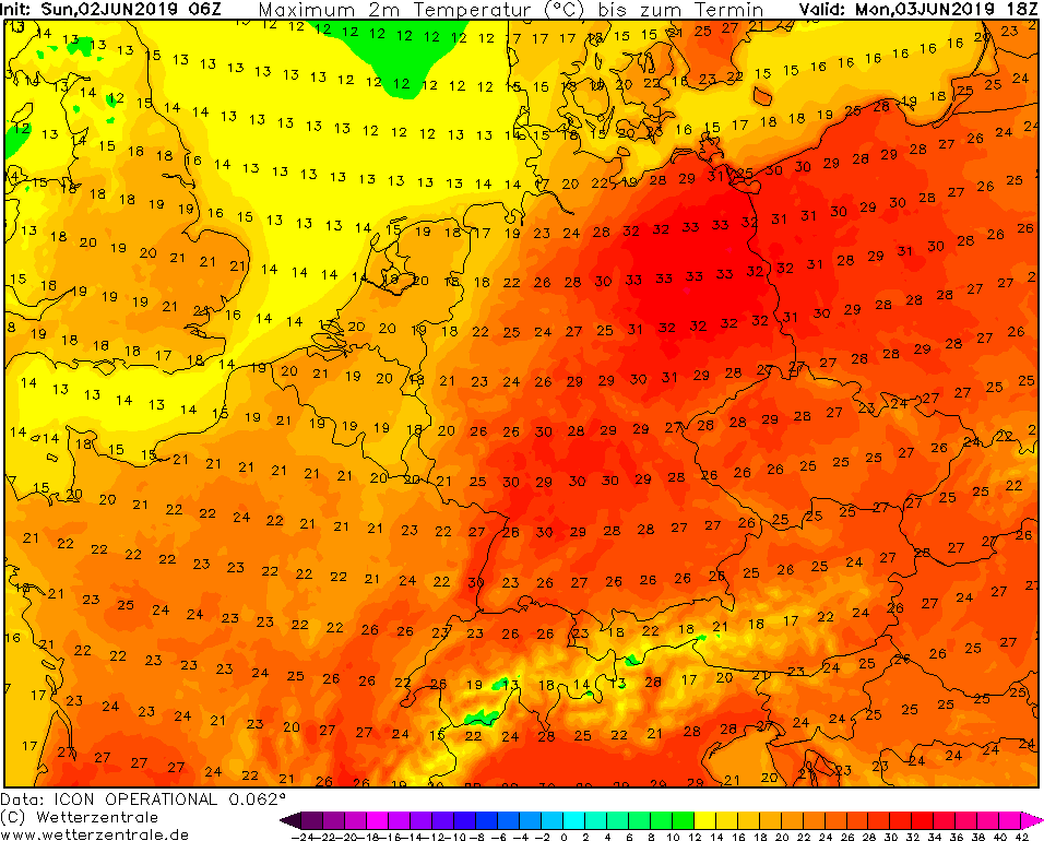
Monday 03 June 2019, 13:30 CET
Thunderstorms, hail
Central Europe, Germany
Issued: Monday, 03 June 2019, 13:30 CET
In a convergence zone between low pressure area FRANK and high pressure area QUEENIE, heavy showers and
thunderstorms will develop on Monday. Hail and gale-force gusts must be expected.
03-06 June 2019
On Monday there will be strong thunderstorms along a convergence line across Germany. Low FRANK directs
mild humid air from southwest to Central Europe. High temperatures and an unstable atmospheric
stratification provide a high severe weather potential.
Unlike yesterday's predictions, there is a danger of thunderstorms for all German federal states including
Bavaria, Saxony and Brandenburg. Clusters and squall lines may be formed. Local precipitation intensities
of up to 30 mm/h are possible. Due to the southwestern flow the thunderstorm cells will not be stationary,
so the total precipitation amounts may not exceed 50 mm.
Sunday 02 June 2019, 17:30 CET
Thunderstorms, hail
Central Europe, Germany
Issued: Sunday, 02 June 2019, 17:30 CET
After the first days of heat (T > 30°C) in Germany, low pressure area FRANK directs warm, humid air to
Central Europe on Monday. Showers and thunderstorms are expected. Hail cannot be excluded.
03-06 June 2019
Due to the influence of a southwestern current around low pressure area FRANK, the danger of
thunderstorms on Monday increases significantly. The anticyclonic rotation of high pressure
area QUEENIE, which lies over the Baltic States on Monday, leads to ground convergence over Germany.
Combined with high CAPE values, this enables the first strong heat thunderstorms of the Central
European summer season 2019.
The lowest risk of thunderstorms is in the federal states of Bavaria, Saxony and Brandenburg.
In the remaining states the passthrough of strong thunderstorms must be expected. Local intensities
of up to 25 mm/h and hailstones of up to 5 cm are possible. In the near of thunderstorms, storm
gusts are likely as well. Due to the southwest wind direction, no stationary thunderstorms are
to be expected, which is why accumulated rainfall amounts are estimated to be lower than 50 mm.
Issued: June 02, 2019, 17:30 CET
FS
Issued: June 03, 2019, 13:30 CET
FS
Issued: June 04, 2019, 14:30 CET
FS
Issued: June 05, 2019, 11:30 CET
CL
Issued: June 06, 2019, 13:20 CET
MG
|