Thursday, January 03rd, 2019, 19:30 CET
Tropical Storm PABUK - Warning
January 03rd - 05th, 2019
Issued on: Thursday, November 15th, 2018, 13:40 CET
Tropical Storm PABUK will hit Thailands southern east coast on January 04th, 2019.
Trajectory and intensity
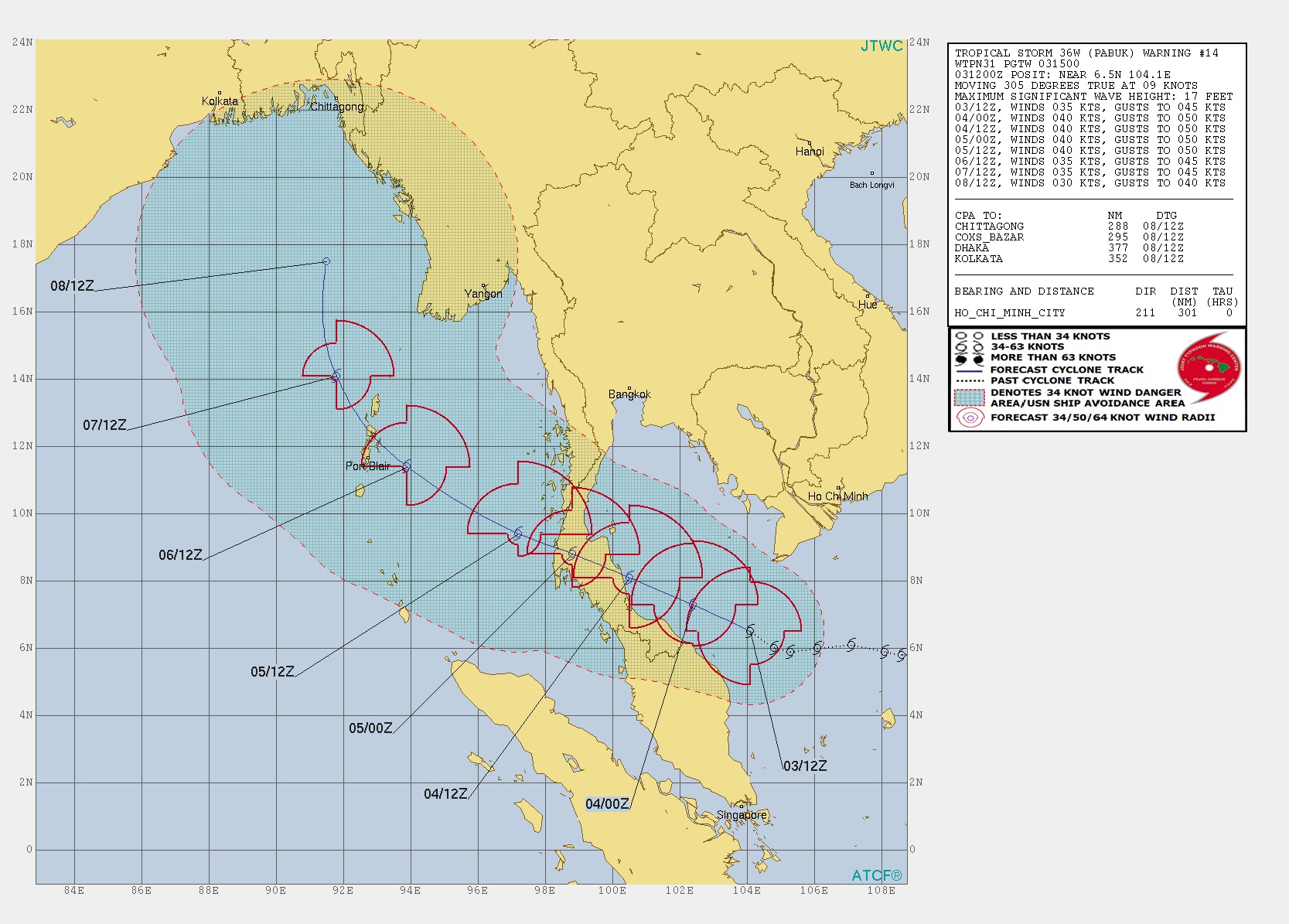
Tropical storm PABUK is currently located 550 km southwards of Ho Chi Minh City (Vietnam).
It is moving northwest at a speed of 9 kn. The wind speeds are up to 35 kn with gusts up to 45 kn.
As the water temperatures range between 27 and 28 °C, the storm continues to be supplied with energy
and provides high and persistent convection.
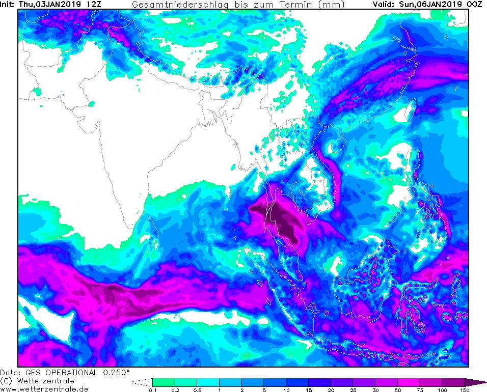
Threats and damages
For southern parts of Thailand between the cities Prachuap Khiri Khan and Hat Yai and the
northernmost regions of Malaysia there is danger by gusts up to 45 kn and accumulated precipitation
of up to 150 mm until January 06th 00 UTC. This can lead to landslides and flooding.
Further development
As long as PABUK is under the influence of a subtropical ridge located in the northeast, it continues
to move in a northwestern direction. After crossing the Thai mainland it will move to the Andaman Sea.
From 06 January, the tropical storm will weaken due to increasing vertical wind shear and decreasing sea surface
temperatures.
Installed on: January 03rd, 2019, 19:30 CET
FS
|