Thursday, November 15th, 2018, 13:40 CET
Cyclone GAYA - Warning
November 14th - 17th, 2018
Issued on: Thursday, November 15th, 2018, 13:40 CET
Cyclone GAYA hits southeast coast of Indian subcontinent
Trajectory and intensity
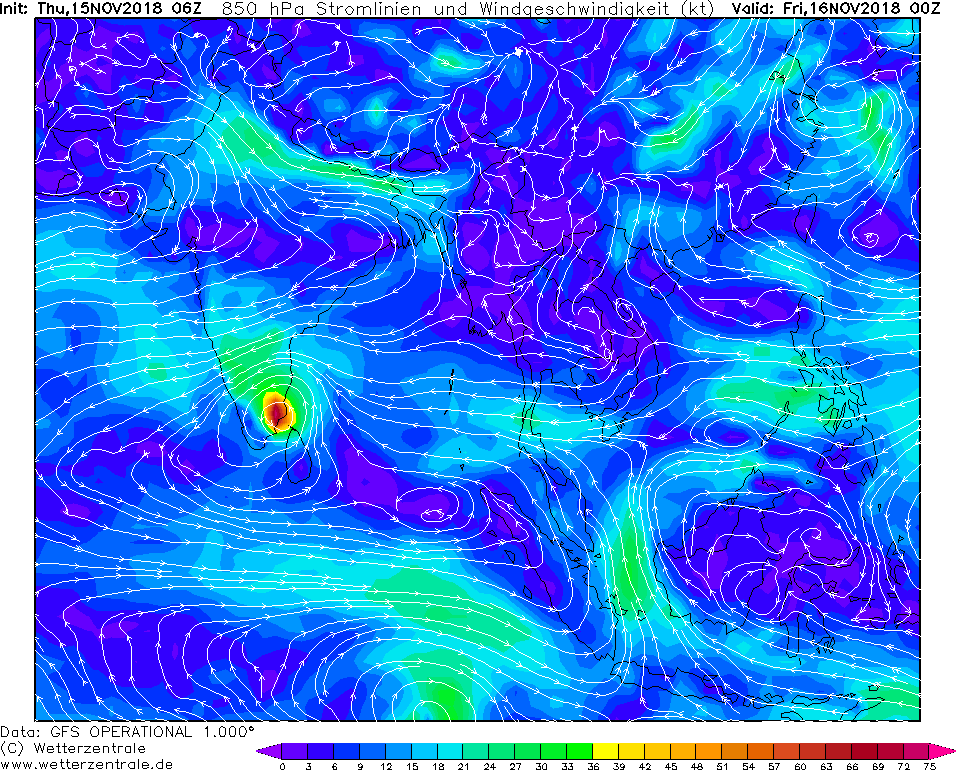
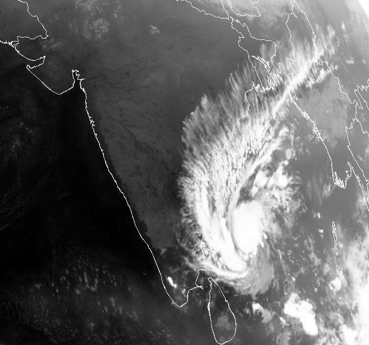
Cyclone GAJA is still located on the southwestern edge of the Gulf of Bengal off the east coast of India, approximately 260 km east of Chennai (Tamilnadu).
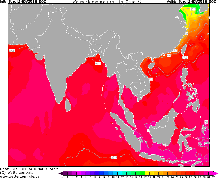
The storm moves westwards at a speed of approx. 18 km/h and intensifies due to still 28°C warm sea water. On recent satellite images the typical eye and more
organized convection / precipitation bands can now be seen. Due to the strong high pressure area in the north, GAJA will maintain its trajectory to the west.
GAYA will make landfall on November, 15th at approx. 21 UTC with wind speeds of up to 72 kt or approx. 130 km/h.
Threats and damages
In the states of Andhra Pradesh, Kerala, Karnataka and especially Tamil Nadu, wind speeds of 100 km/h and gusts of over 100 km/h must be expected.
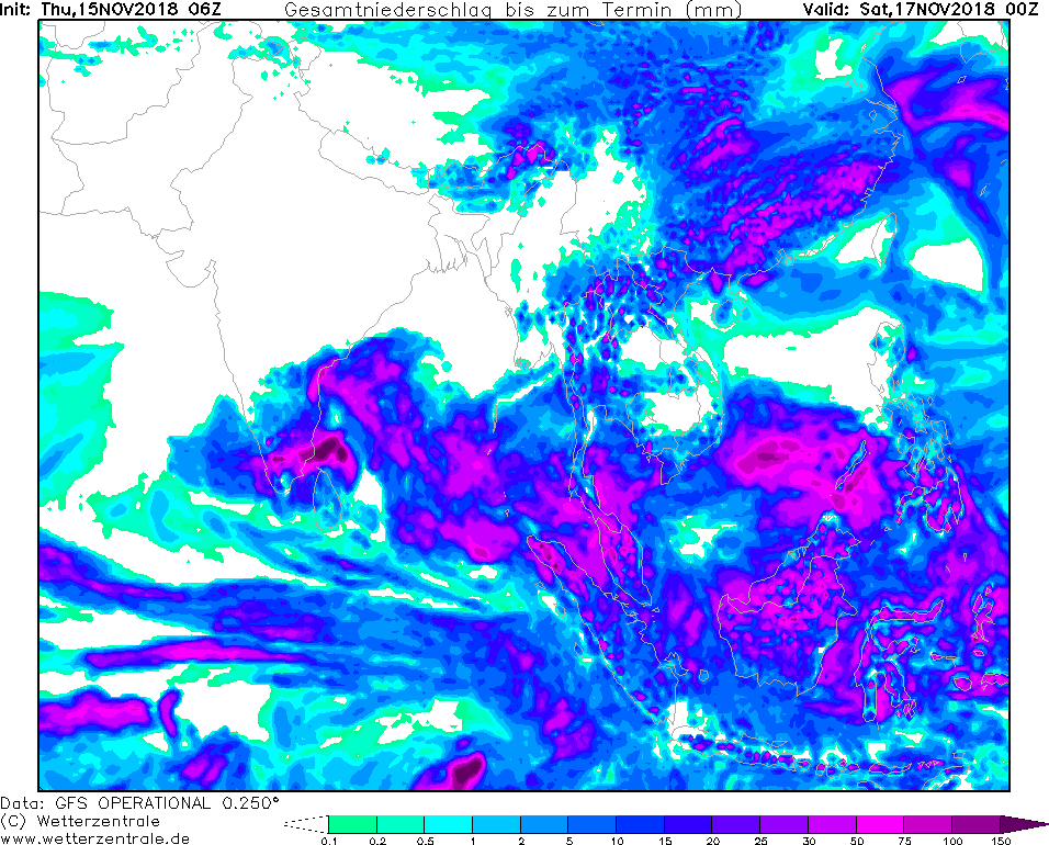
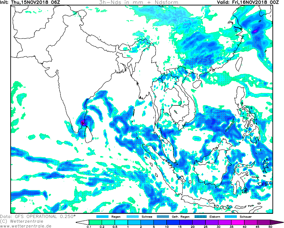
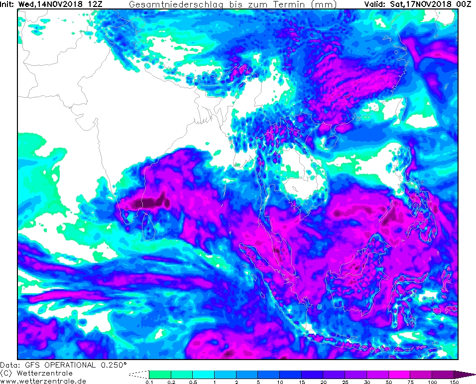
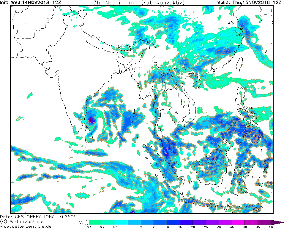
Along GAYAs trajectory rainfall of over 150 mm and intensities of up to 50 mm/3h must also be considered. This warning also applies in particular to the east
coast of the state of Tamil Nadu. Furthermore the high intensity of precipitation leads to a risk of flooding and landslides.
Further development
After landfall, the cyclone moves further in a westerly direction and heads out into the Arabian Sea on the west coast of Kerala. While the wind speeds over
land are decreasing rapidly, the strong precipitation is felt much further inland. Over the Arabian Sea, the cyclone could intensify again, while it continues
to move in a westerly direction. Once GAJA reaches the mainland, it will initially weaken due to friction. There is also the possibility that it may even
dissipate completely.
Wednesday, November 14th, 2018, 20:20 CET
Cyclone GAYA - Warning
November 14th - 17th, 2018
Issued on: Wednesday, November 14th, 2018, 20:20 CET
Cyclone GAYA hits southeast coast of Indian subcontinent
Trajectory and intensity
GAJA is currently located on the southwestern edge of the Bay of Bengal, approximately 430 km east of Chennai (Tamilnadu).
The storm moves westwards at a speed of approx. 13 km/h and intensifies over the still 28°C warm sea water. Landfall is
expected on November 15th at approx. 21 UTC with wind speeds of 80 to 100 km/h.
Threats and damage
In the states of Andhra Pradesh, Kerala, Karnataka and especially Tamil Nadu, wind speeds of 100 km/h and gusts of over
100 km/h must be expected. Along GAYAs trajectory, rainfall of over 150 mm and intensities of up to 50 mm/3h must also be considered.
This warning applies in particular to the east coast of the state of Tamil Nadu. Due to the high intensity of precipitation,
there is a risk of flooding and landslides.
Further development
After landfall, the cyclone moves further in a westerly direction and heads out into the Arabian Sea on the west coast of Kerala.
While the wind speeds over land are declining rapidly, the strong precipitation can be felt much further inland. Over the Arabian Sea,
the cyclone could intensify again, while it continues to move in a westerly direction.
German version
Installed on: November 14th, 2018, 20:20 CET
FS
|