|
Low pressure area NASIM I provided gale force gusts of more than 100 kph across Germany, up to 150 kph in exposed areas.
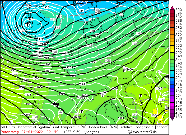
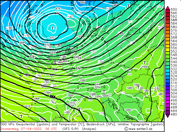
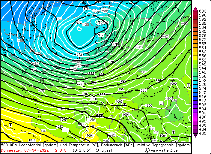
On Tuesday, April 5, the low-pressure system NASIM separated into its successors NASIM I and NASIM II west of the United Kingdom.
While NASIM II moved over Scandinavia with only a weak development and relatively unnoticed, NASIM I remained longer over the North
Atlantic Ocean and underwent a rapid cyclogenesis on April 6, which lowered the core pressure to about 965 hPa. In a zonally directed
upper-level flow over Western Europe, the low pressure area finally moved across the United Kingdom towards Denmark on 07 April.
|
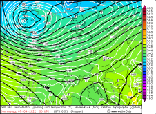
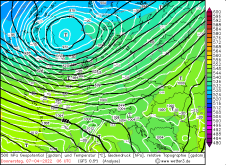
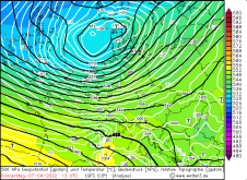
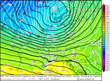
500hPa Geopotential temperature, and sea level pressure, 07.04.2022, source:
wetter3
| and
 |
 |
 |
 |
Worth mentioning here is the fact that the corresponding trough belonging to the low pressure area has only a low amplitude, because the
Azores High with high geopotential and also high surface pressure is advancing from the southwest towards the northeast. Therefore, strong
horizontal pressure gradients of up to 4 hPa / 100 km occurred in the area of transition. This pressure gradient was most pronounced not
over northern Germany, as is so often the case, but rather in the center and south of the country. As a result, gale force gusts occurred
throughout Germany, particularly also in the inland areas.
|
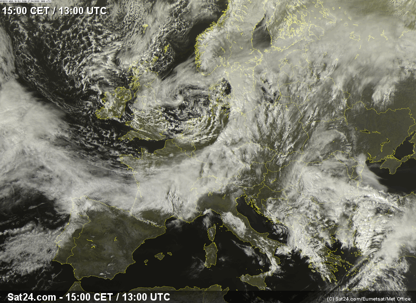
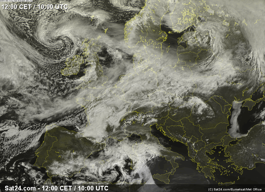
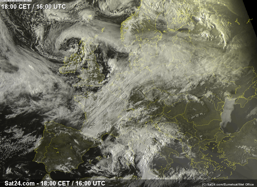
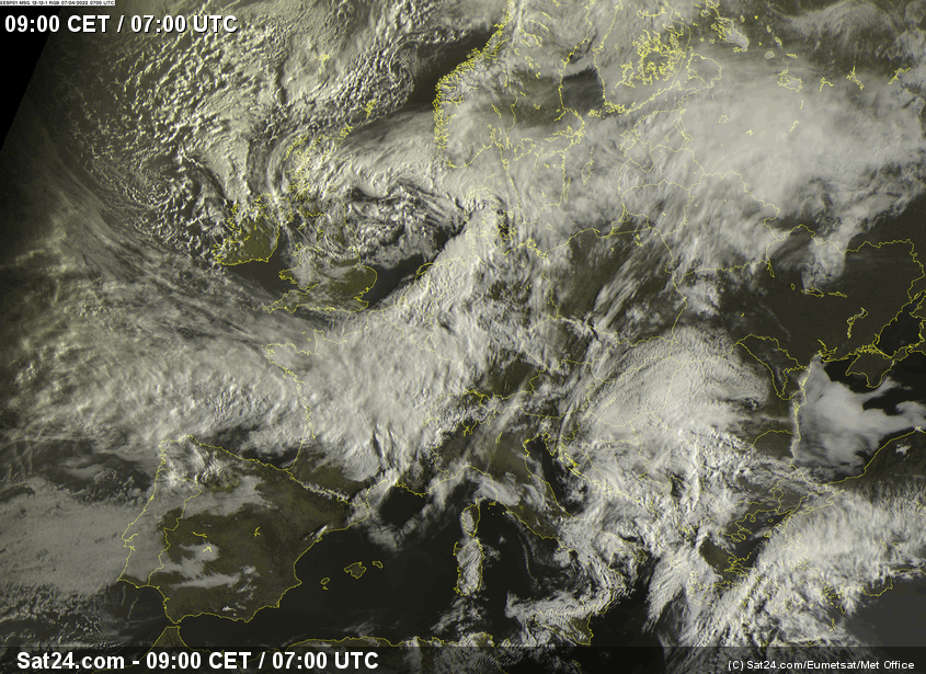
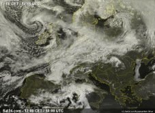
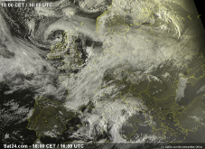
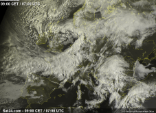
Satellite image (visible) from NASIM I, 06. and 07.04.2022 at 12, 18, 09 and 15 UTC, source:
Sat24
| and
 |
 |
 |
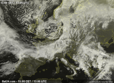 |
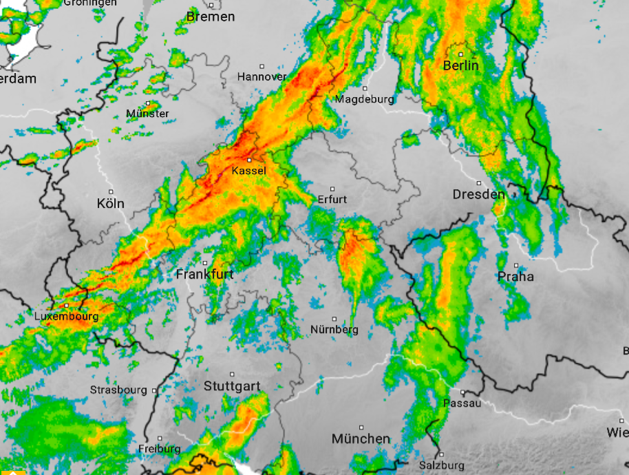
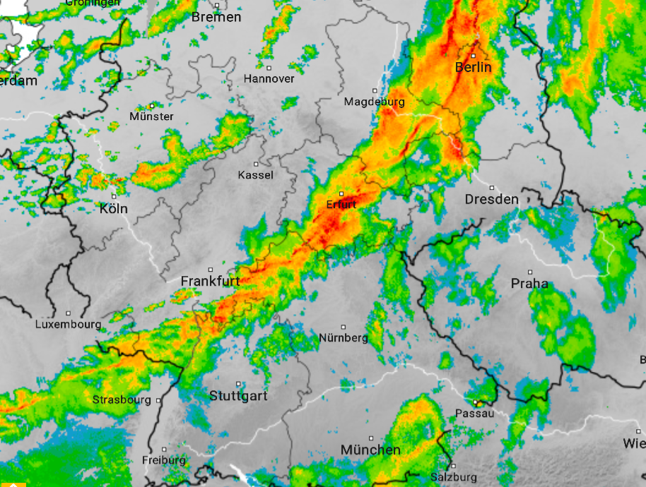
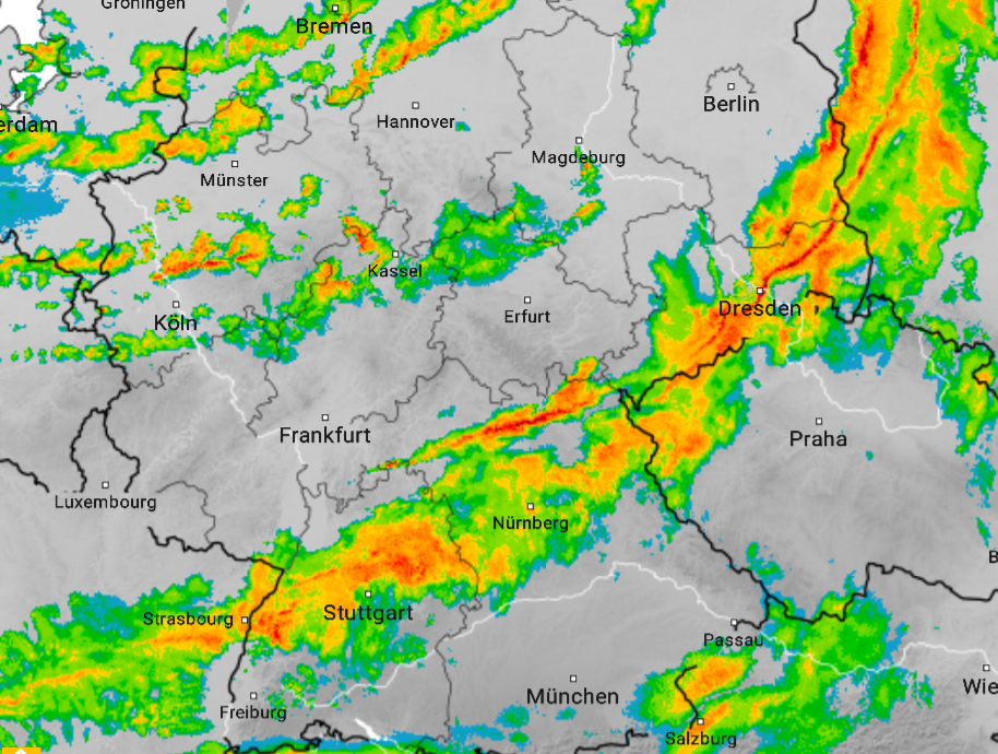
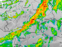
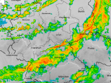
Special attention should also be paid to the frontal structure of NASIM I. Already in the early development phase of the low pressure area,
the cold front lost contact with the warm front and subsequently wrapped itself around the core of the low pressure area. This allowed an area
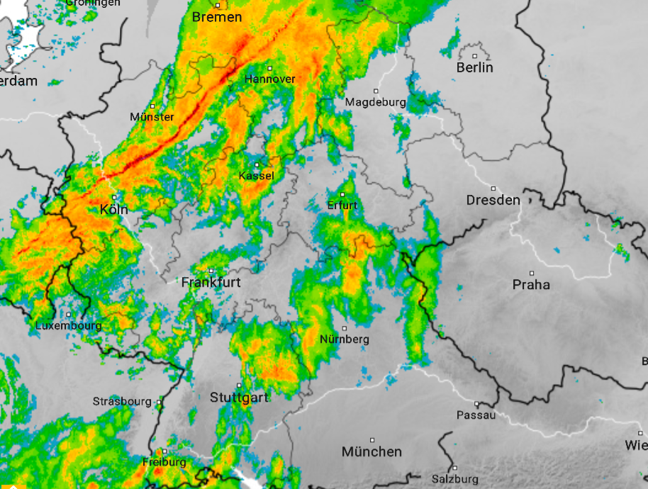
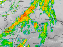
of dry cold air to form behind the cold front, which is clearly visible in the satellite image. On April 7, the cold front moved across Germany
from the northwest, well trackable by prominent associated precipitation features in the radar image. In many places, the strongest wind gusts
of the day occurred during the passage of the cold front.
|
Progression of NASIM Is coldfront as seen in radar data, source:
wetteronline
|
 |
 |
 |
 |
The gusts were strongest in exposed areas, with peak gusts of more than 130 kph on the summits of Großer Arber, Zugspitze, Feldberg and Brocken. However, gusts of more than 100 kph were also registered across the lowlands. Even far in the southwest of the country, at Munich Airport, a peak gust of 101 kph was recorded. The table below shows a selection of the peak gusts of 07 April at German stations.
| Location |
Gust in kph |
Brocken
Feldberg
Zugspitze
Großer Arber
Weinbiet
Wasserkuppe
Hohenpeißenberg
Münster/Osnabrück Airport
Fichtelberg
Alte Weser Leuchtturm
Schmücke
Wernigerode
Düsseldort Airport
Altenstadt
Seehausen
Kahler Asten
Werl
Munich Airport
Schleiz
|
150
143
133
130
122
119
115
112
109
108
108
106
104
104
102
102
101
101
100
|
|
Data source: DWD.
Text: FS
April 08, 2022
|