|
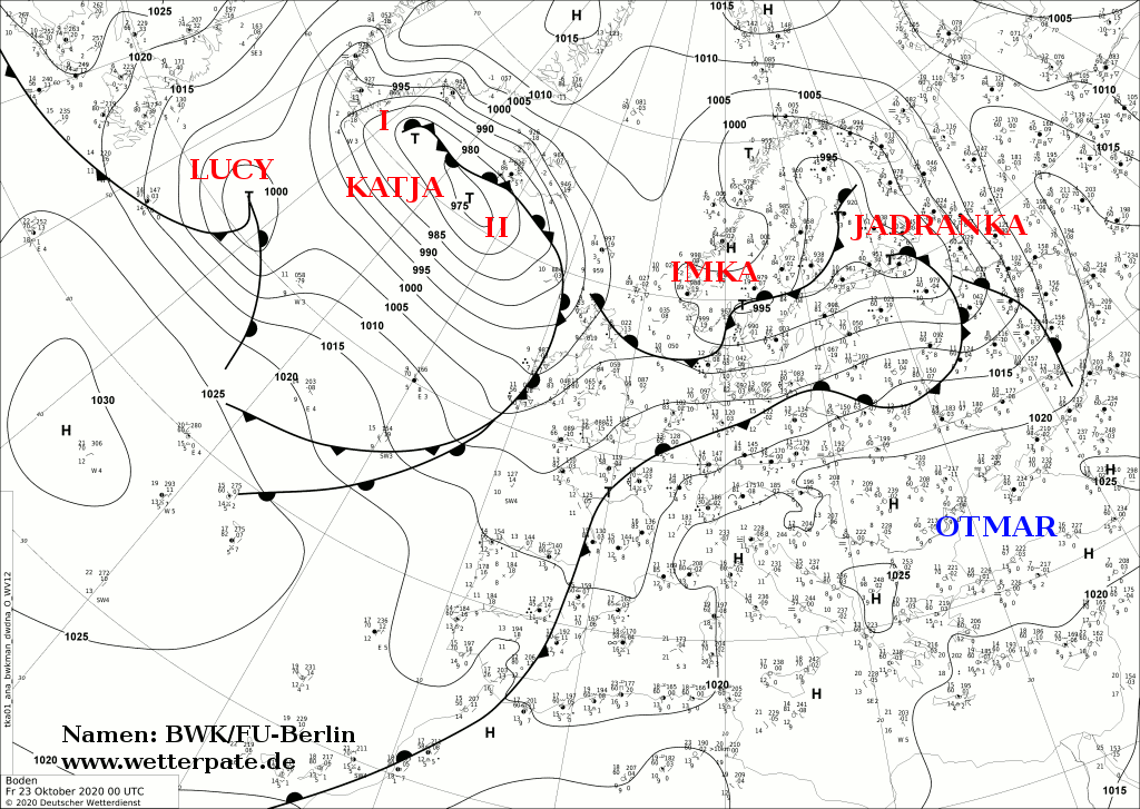
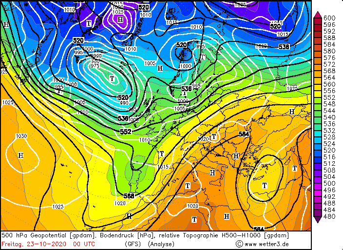
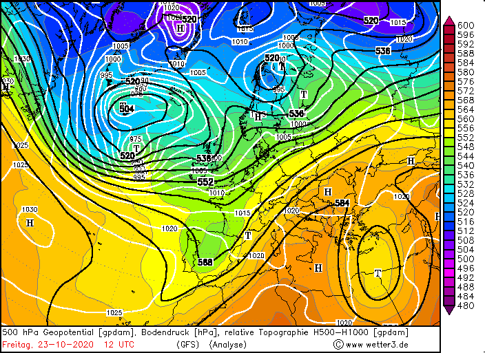
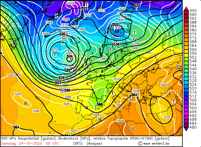
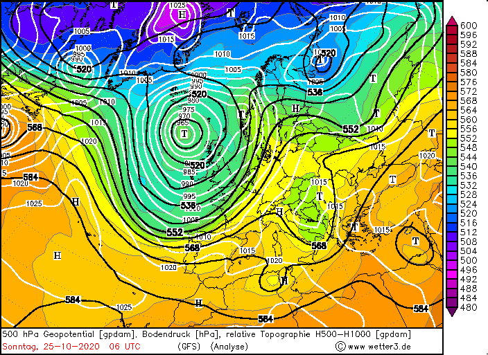
Shortly after the storm lows IMKA and JADRANKA, storm low LUCY reached Europe and Great Britain on October 23 and 24.
LUCY swept over Great Britain with wind speeds of 169 km/h (Cairngorn UK). In France 128 km/h (Barfleur Point and Pointe du Raz) were registered.
Weather Situation
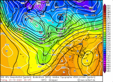
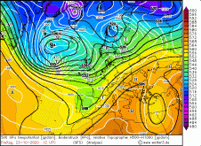
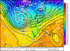
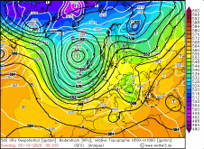
Stormy low LUCY developed at the front of an initially flat trough. However, the amplitude of the trough increased rapidly and reached as far as Spain
and Portugal on 25 October. LUCY remained at the front of the trough until October 24th and then gradually moved to the middle and finally to the back of the
trough, causing it to weaken rapidly. Its core did not reach Europe, Ireland or Great Britain.
|
500 hPa Geopotential, October 23-24, 2020:
Wetter3
|
 |
 |
 |
 |
Development
Stormy low LUCY developed on October 22nd near Newfoundland in the frontal zone in the middle of two jet streams. The jet streams intensified and LUCY
remained in the area of strongest divergence. As a result it began to intensify as well. In the temperature field it was also already visible as wave
disturbance and via the equivalent potential temperature. In the night of Friday 23 October, LUCY moved rapidly eastward across the Atlantic, always in the
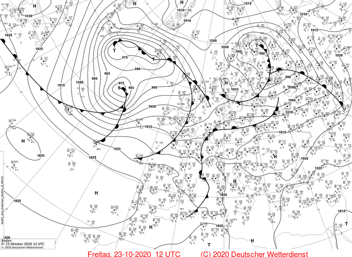
range of high positive divergence values. By Friday morning the core pressure dropped to below 985 hPa. The amplitude of the temperature wave increased and
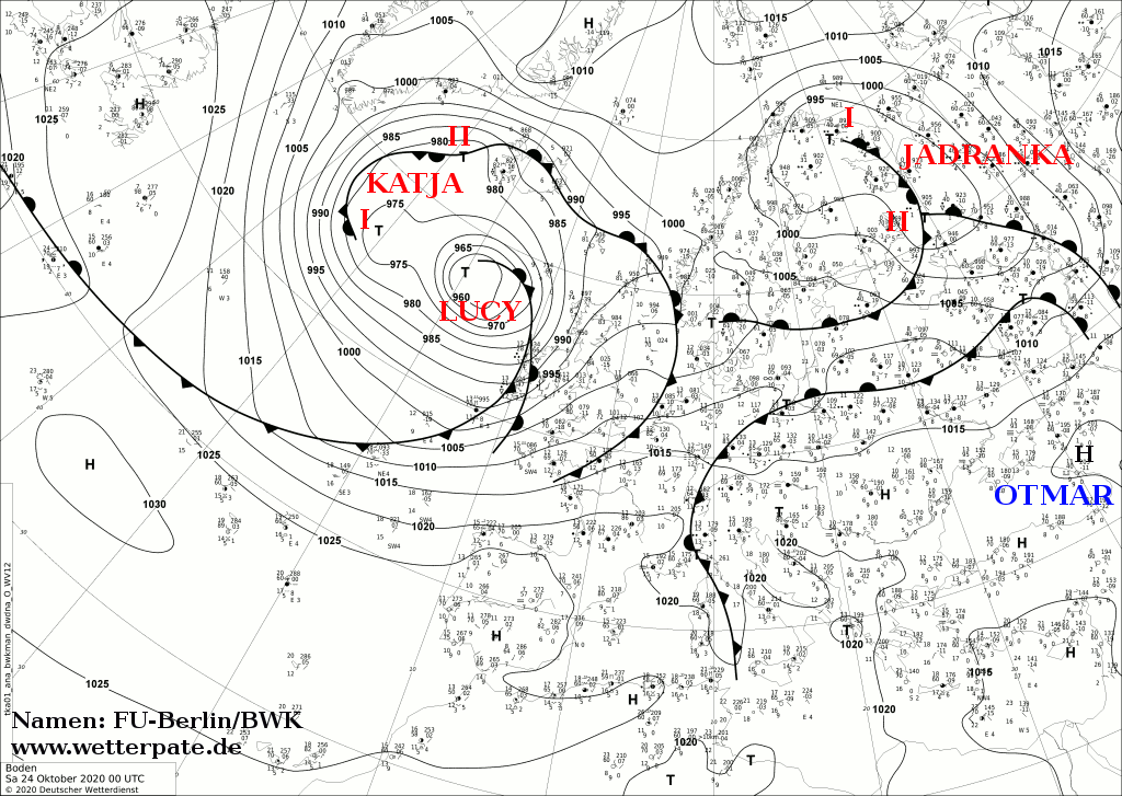
the fronts were more and more clearly visible via the equivalent potential temperature. During the night of Saturday 24 October, its wind field reached Ireland
and the UK, and in the afternoon it reached Spain and France. LUCY's core itself did not reach the mainland and moved northwest past Ireland, staying almost
stationary over the North Atlantic. It was not until the night of Sunday that LUCY began to weaken or its core pressure began to rise as the influence of the
jet stream weakened and it was no longer in front of the trough. Thus her wind field weakened, which was mainly caused by the strong isobaric pressure on her
southern flank.
|
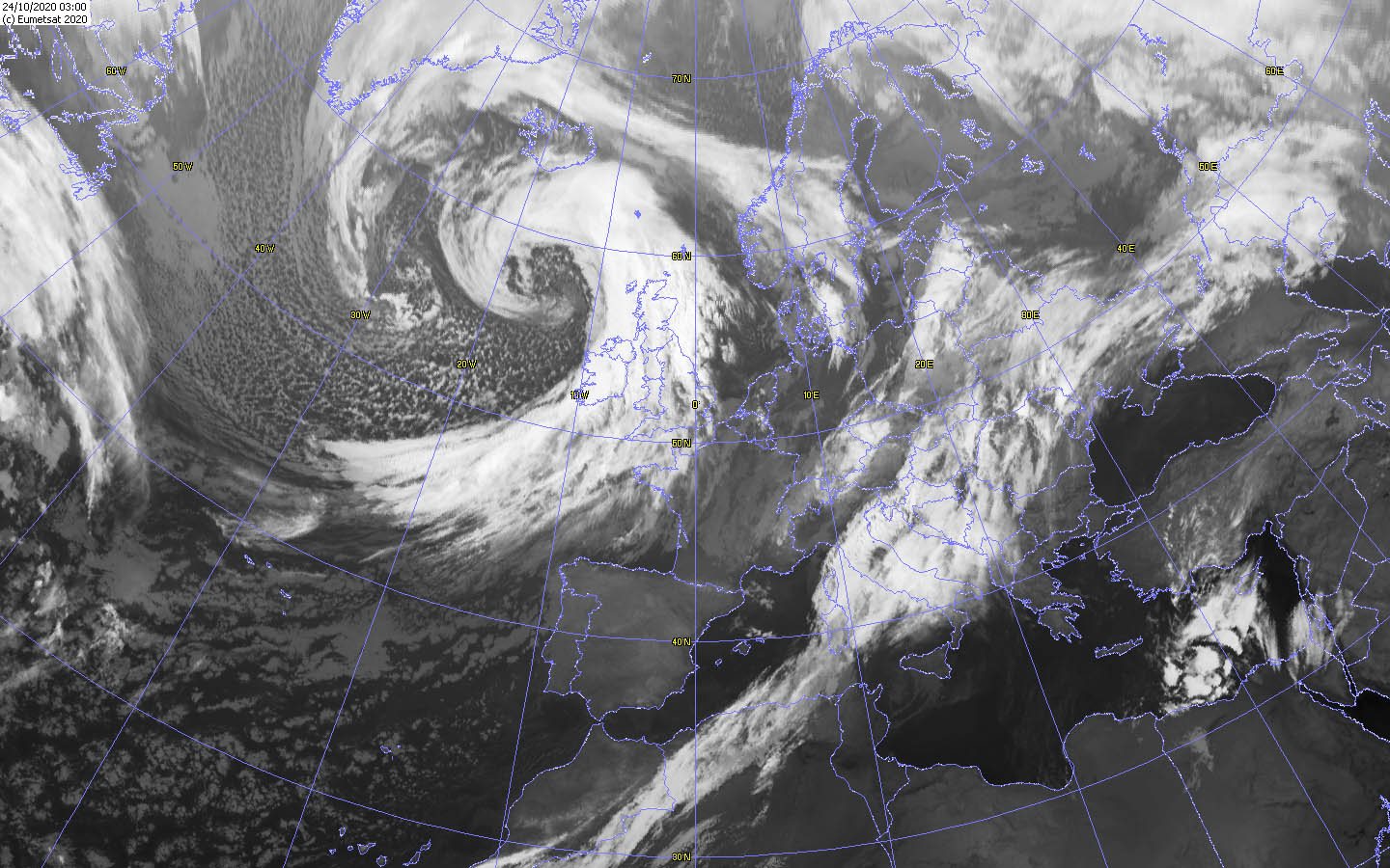
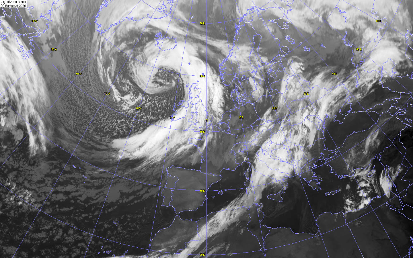
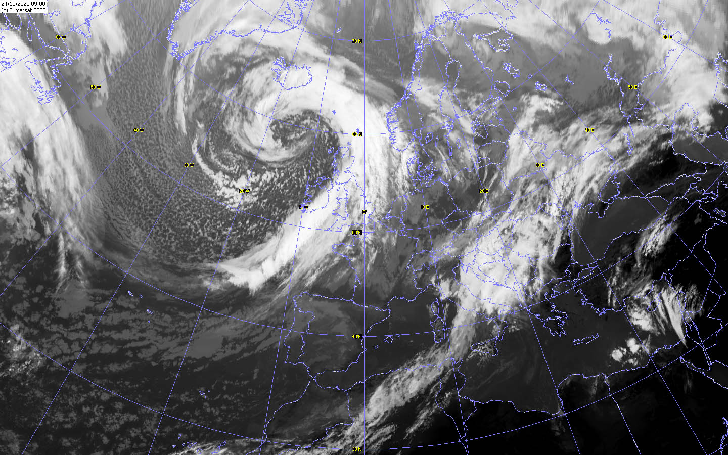
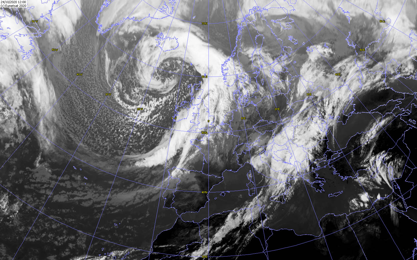
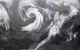
Satellite images (IR), October 24, Source:
Wokingham
|
 |
 |
 |
 |
|
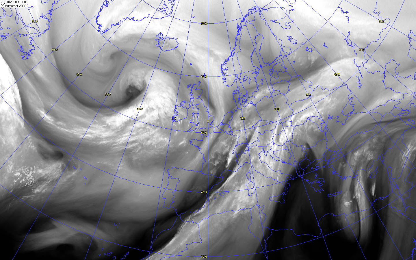
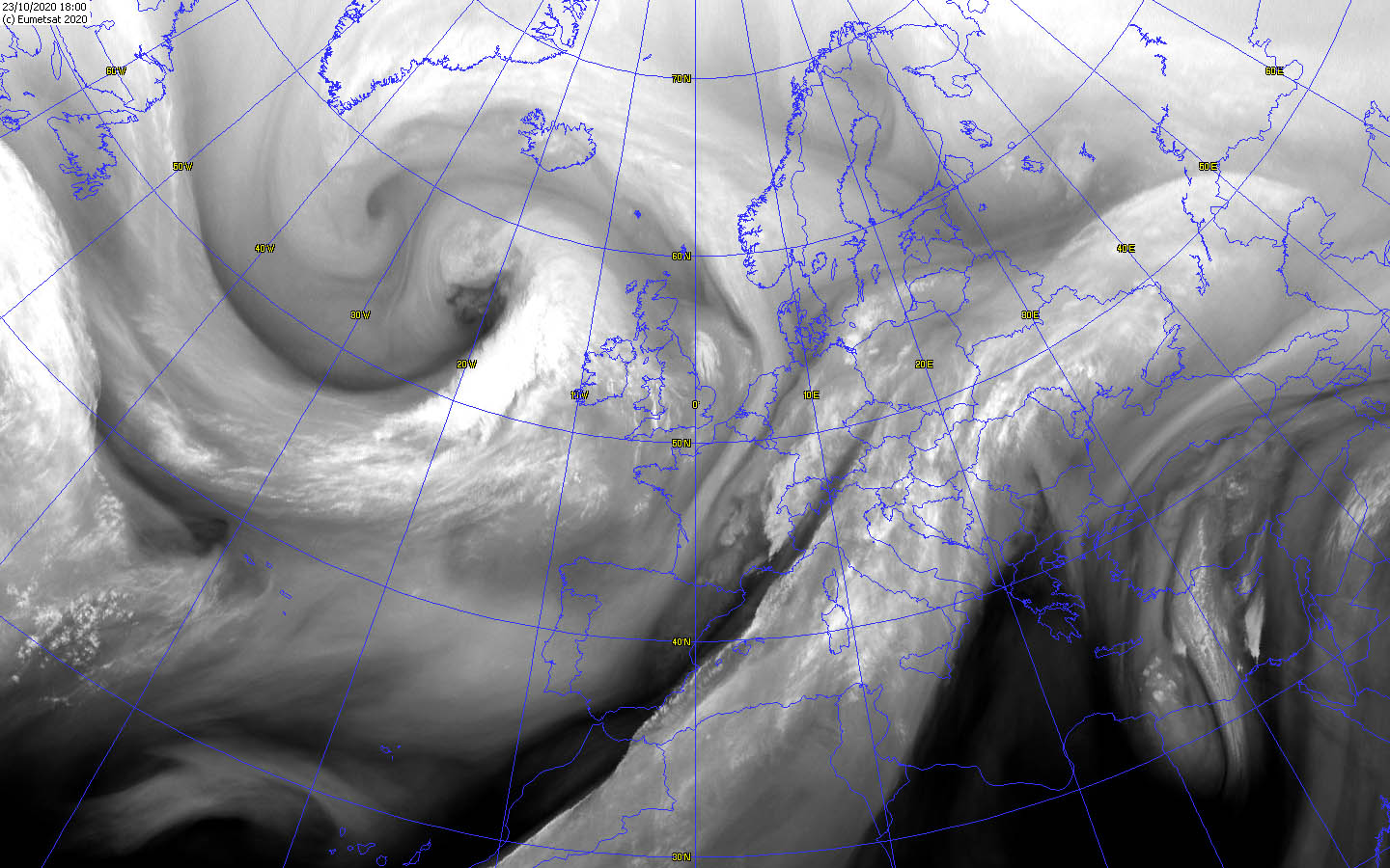
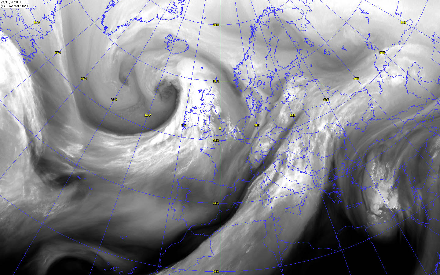
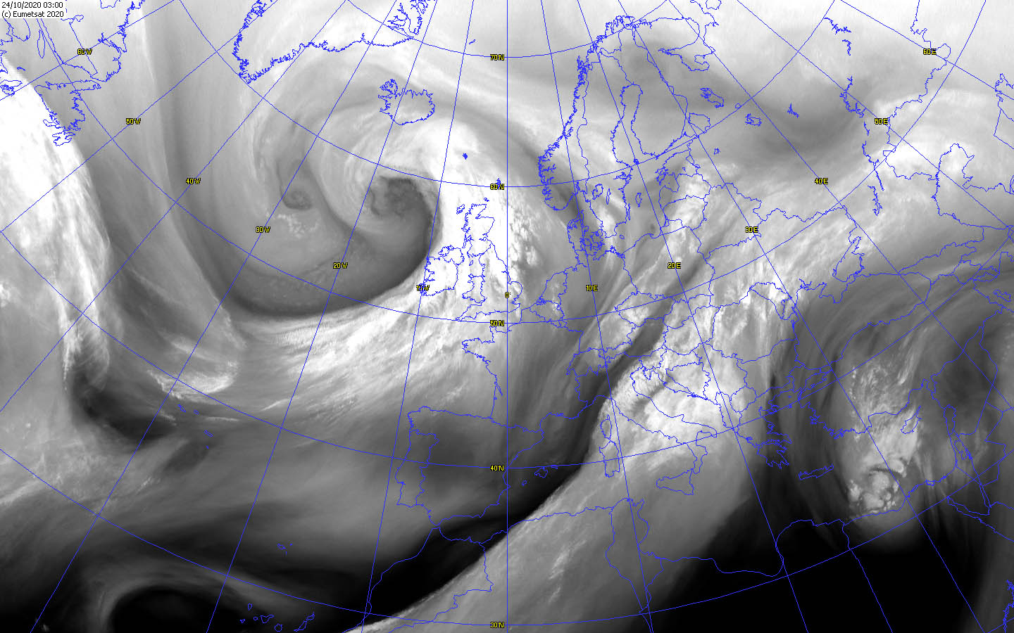
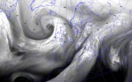
Satellite images (WV), October 23-24, Source:
Wokingham
|
 |
 |
 |
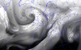 |
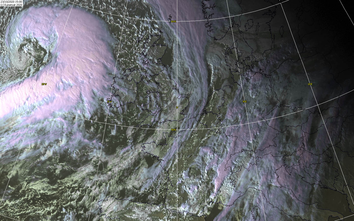
LUCY reached its lowest core pressure of 950 hPa on October 24 at 00 UTC. LUCY also underwent rapid cyclogenesis due to its favorable location in relation to the
jet streams. On 22 October at 18 UTC, its core pressure was 1002 hPa and fell to 960 hPa in 24 hours, a drop of more than 40 hPa. The rapid intensification was
probably also a consequence of dry indrusion. She is also a fast runner, as she covered more than 1000 km in 24 hours. On the satellite images, especially its
frontal system was impressive, as well as a Dry Indrusion and the Dry Slot near the low-pressure core.
Text: MG
October 31, 2020
|