|
The Medicane TRUDY developed from a cut off low and brought heavy rains to Italy and the Balkan coasts. In Italy 90mm came on November 12-13, on the Balkan
coasts up to 78mm. At the southern Alps it caused fresh snow quantities of more than 1m, as well as gusts of wind and snow drifts.
Development and trajectory
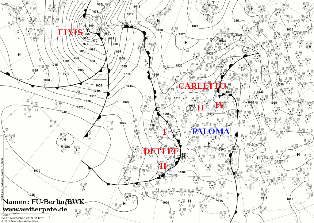
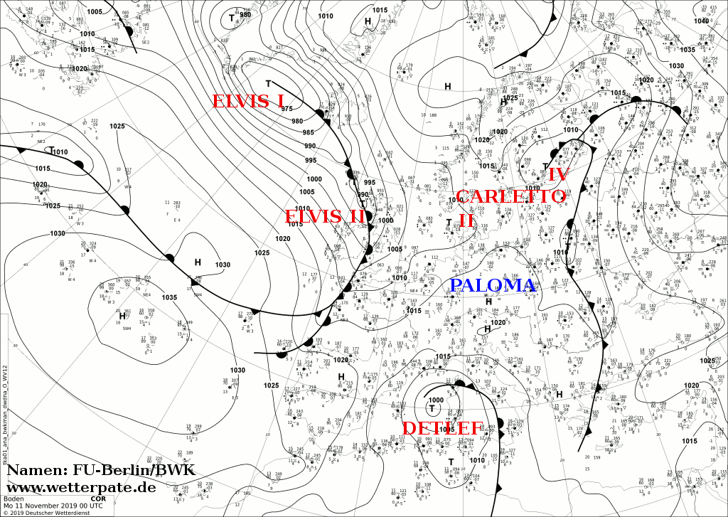
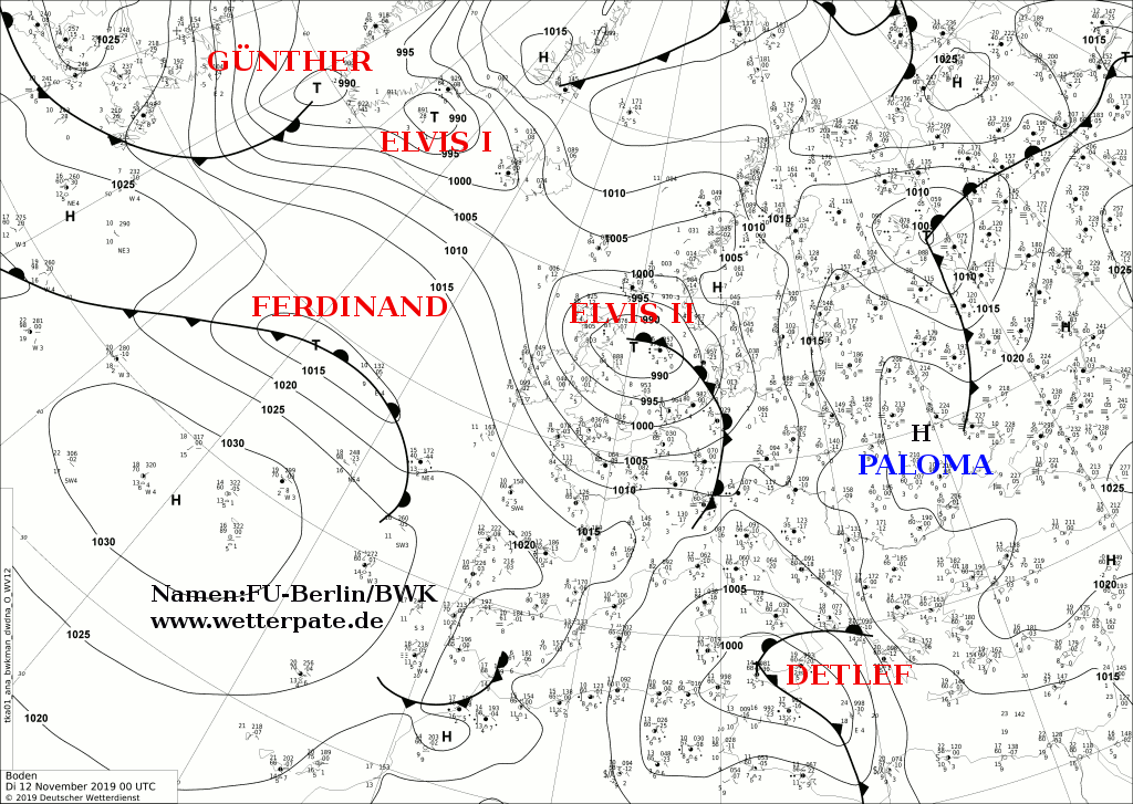
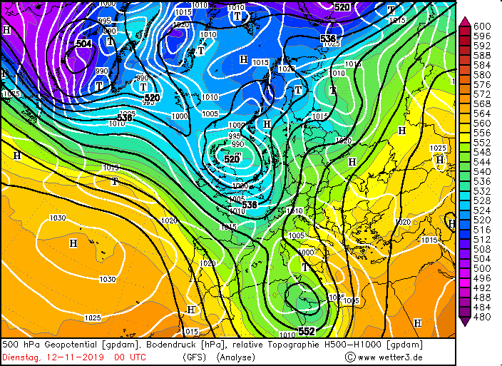
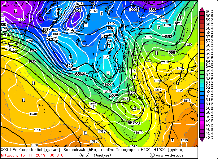
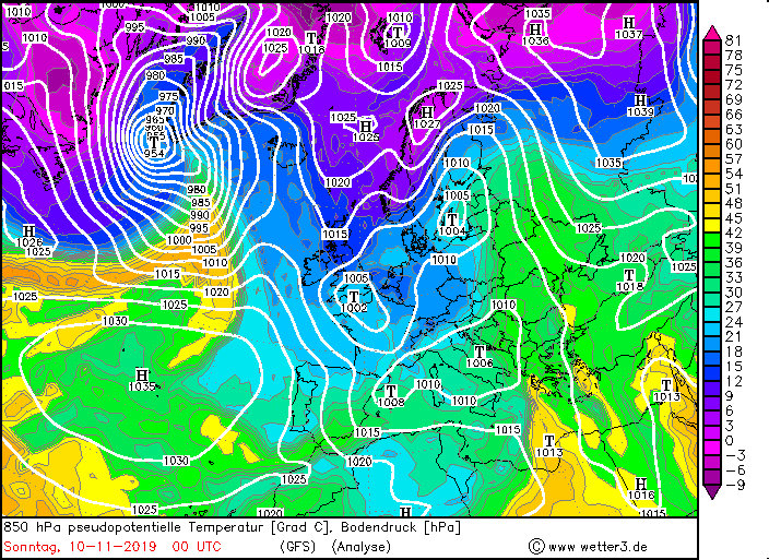
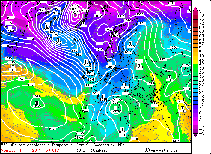
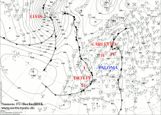
The Medicane TRUDY developed on Monday Nov 12 from the low pressure area DETLEF. The depression drifted from Nov 11-12 from the north via France to the
Mediterranean Sea and finally dripped off. It remained almost stationary off the coasts of Mallorca until it hit a southern course and moved towards North Africa.
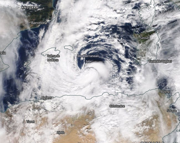
Due to high water temperatures of around 23 degrees, TRUDY was able to refuel enormous amounts of water vapor and finally developed into a Medicane with a very
pronounced eye. The pressure dropped to 990 hPa.
|
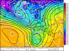
Sea level pressure and fronts, November 10-13, 2019:
FU-Berlin
|
 |
 |
 |
 |
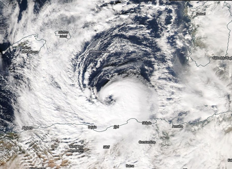
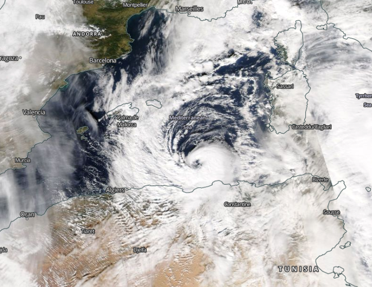
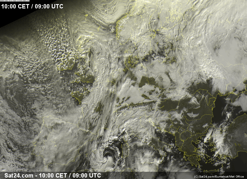
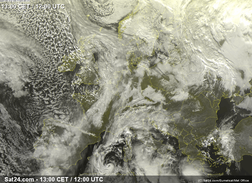
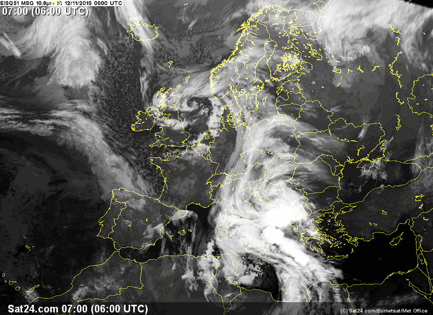
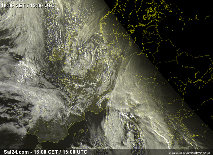
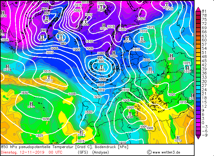
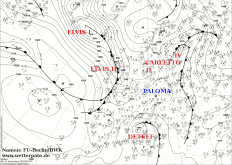
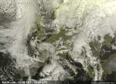
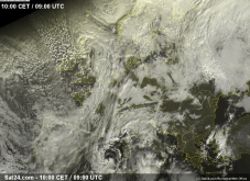
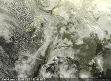
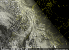
TRUDY moved relatively slowly eastwards along the Tunisian coast and already caused wind speeds of about 90 kph there. The preceded cold front was particularly
conspicuous, triggering heavy thunderstorms in the Balkan region. In the night to Tuesday TRUDY moved then in northeast direction over Sicily and central Italy.
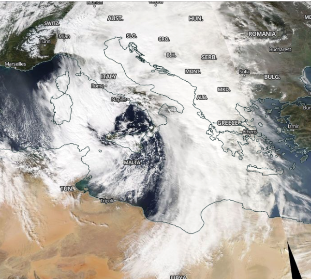
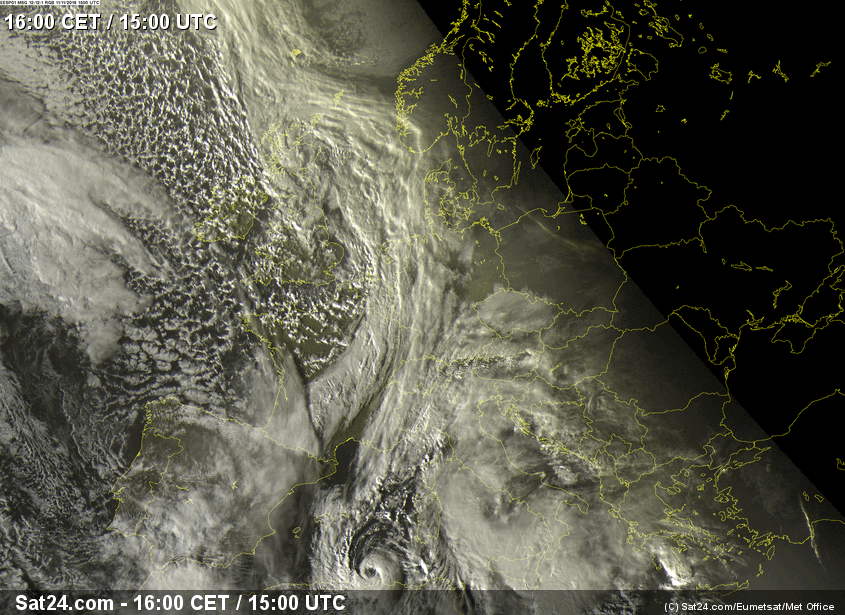
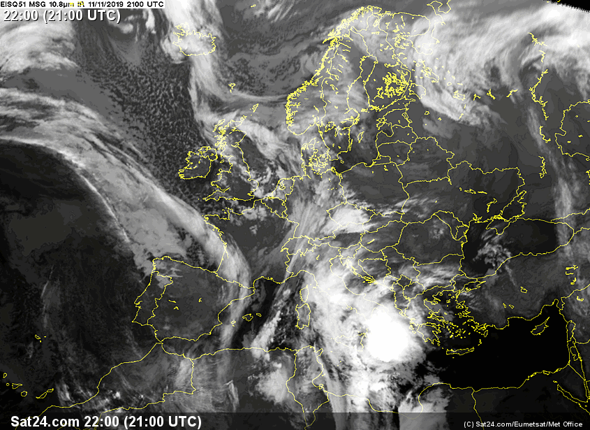
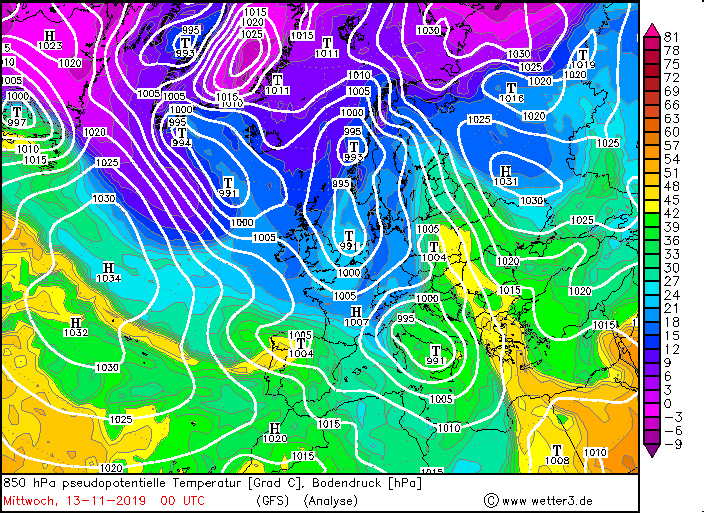
Due to high wind shear and velocity TRUDY lost his eye features on Wednesday night and quickly began to disolve. There were almost no frontal structures left and on
Thursday it was totally gone.
|
Satellite images (visible), November 10-13, 2019:
Sat24
|
 |
 |
 |
 |
In addition to the devastating amount of precipitation, gales and storm gusts of up to 130 kph also occurred.
The air pressure gradient increased strongly in the night to Tuesday which led to high wind speeds in the south of Italy and the Adriatic Sea.
This resulted in a high storm surge and high tide peaks, which led to heavy flooding especially on the Adriatic coast (all ahead of Venice) and the coasts
of Croatia.
|
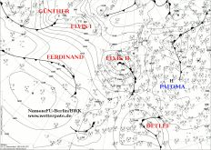
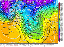
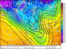
500 hPa Gopotential, November 10-13, Source:
Wetter3
|
 |
 |
 |
 |
|
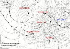
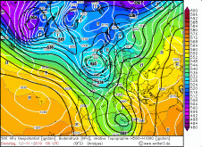
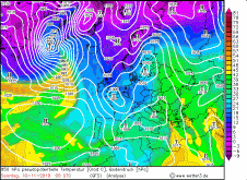
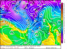
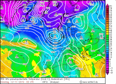
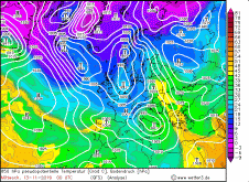
850 hPa pseudopot. Temperature, November 10-13, Source:
Wetter3
|
 |
 |
 |
 |
Observations and Damages
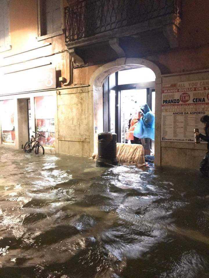
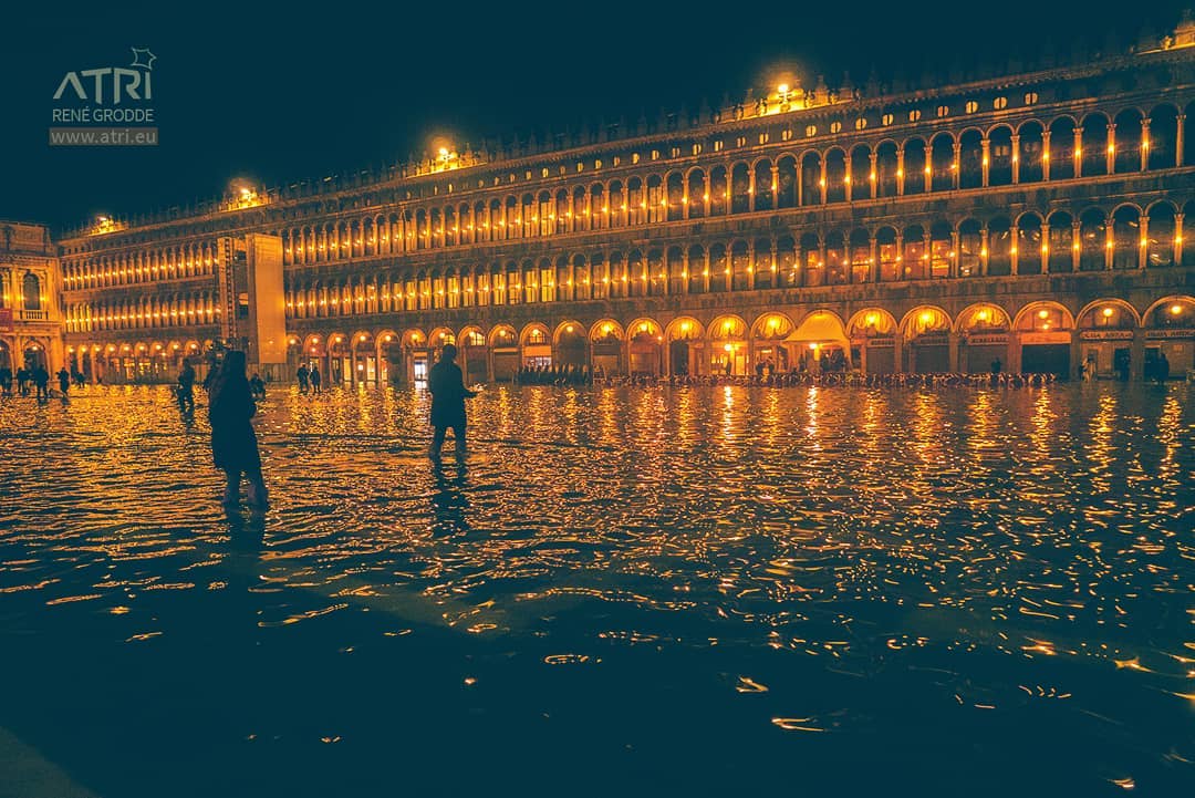
The Italian city of Venice was hit particularly hard by the enormous rainfall and storm tides caused by the strong wind (and a full moon). Aqua alta!
The flood and the high water reached water levels like the last time 50 years ago (194cm, 1966). The flood reached values of 187cm. Some buildings,
like the famous St. Mark's Cathedral, are still being examined for damage. Temporarily the storm disrupted the ships traffic and schools and other facilities had
to stay closed on Thursday. A state of emergency was declared, as strong winds and rainfall are expected to continue in the coming days, although not to the same
extent as last Tuesday and Wednesday. Two people have died as a result of the floods. There have also been severe floods and damage in other regions of Italy.
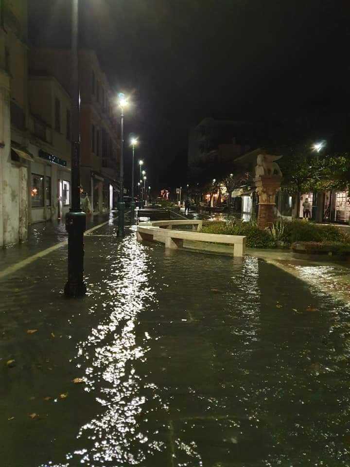
High waves and floods also occurred on the Balkan coasts due to the combination of high rainfall due to the squall line and the storm tides.
Croatia was hit particularly hard here.
Due to the high air pressure gradient wind speeds of 191 kph (Kasprowy Wierch) were registered in Poland on Nov. 12. There was damage to infrastructure and forest.
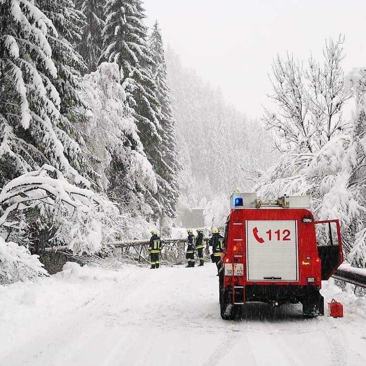
In the Southern Alps, the enormous amount of fresh snow caused traffic disruptions (especially in South Tyrol). Roads were temporarily impassable, as trees fell and branches broke which could no
longer bear the weight of the fresh snow.
In the table below you can see 24 hours precipitation in Italy, Austria and the Balkan regions (left) and Gusts (right):
| Location |
Precipitation amount in mm |
Date |
Serralta Di S. Vito(IT)
Catanzaro (IT)
Matera (IT)
Gela (IT)
Pula Aerodrome (CR)
Pazin (CR)
Mali Losinj (CR)
Lamezia Terme (IT)
Roma Flumilina (IT)
Villach (AU)
Dellach im Drautal (AU)
Spittal/Drau (AU)
|
90.0
86.4
82.0
82.0
78.0
74.0
71.0
65.0
60.0
58.3
58.1
57.1
|
12.11.2019
13.11.2019
12.11.2019
12.11.2019
13.11.2019
13.11.2019
13.11.2019
12.11.2019
12.11.2019
13.11.2019
13.11.2019
13.11.2019
|
|
| Location |
Gusts in kph |
Date |
Split/Marjan (CR)
Patscherkofel (AU)
Dubrovnik Cillipi(CR)
Dubrovnik Gorica (CR)
Brunnenkogel (AU)
Hvar (CR)
Alpinzentrum Rudolfshütte (AU)
Marina Di Ginosa (IT)
|
133
122
115
108
101
101
97
96
|
13.11.2019
14.11.2019
13.11.2019
13.11.2019
13.11.2019
13.11.2019
13.11.2019
13.11.2019
|
|
Data source: Ogimet.
Text: MG
November 14, 2019
|