|
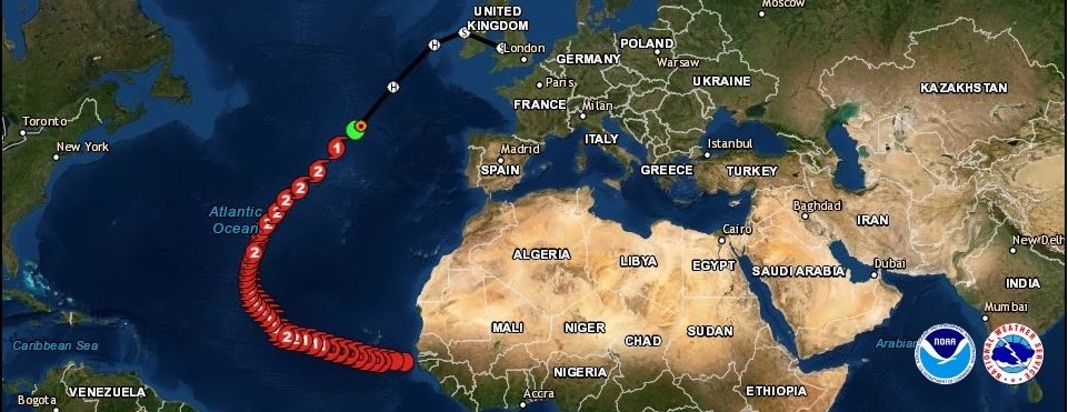
LORENZO was the easternmost Category 5 Atlantic hurricane on record. It crossed the Azores as a Category 2 hurricane and hit Ireland as a post-tropical cyclone.
Development and trajectory
LORENZO formed out of a tropical wave that emerged on 22 September near the west coast of Africa. Due to low wind shear and high water temperatures single
thunderstorms quickly organized into a tropical depression. Early on 25 September, the system reached hurricane force and underwent an unusually early eyewall
replacement cycle, which prevented further intensive intensification despite favourable conditions for about 24 hours. On the morning of 26 September the new
eyewall was established successfully and the storm reached category 4 in the course of a rapid intensification on the same day.
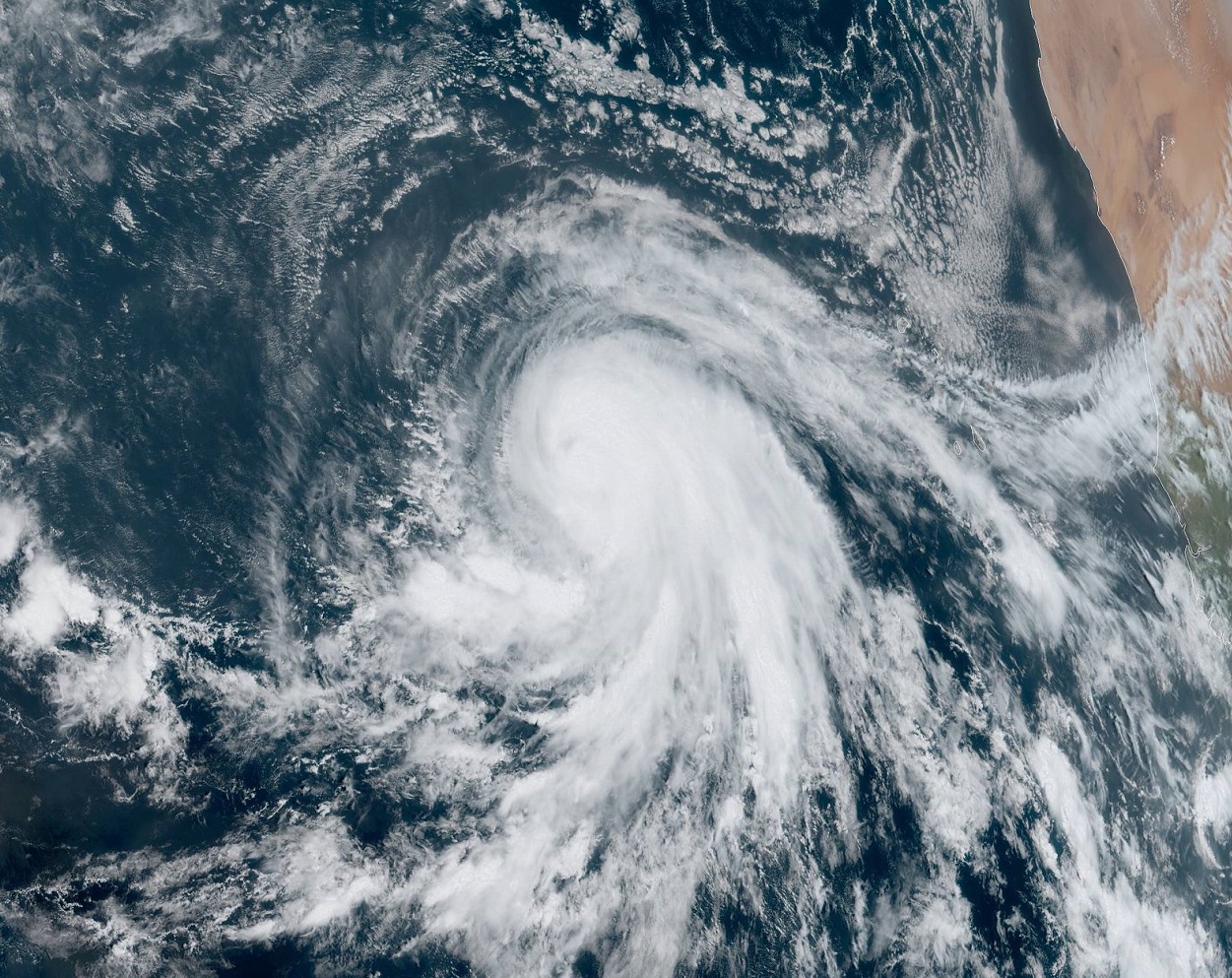
On 27 September LORENZO reached its temporary peak intensity with maximum sustained winds of 230 kph. A few hours later it also reached its minimum core pressure of
937 hPa. Both values set new all-time records for hurricanes in the eastern Atlantic (east of 45°W). Because of the lower water temperature than in the West
Atlantic, strong hurricanes are much rarer in East atlantic. At the time of LORENZO's intensification, the sea surface temperature in the Eastern Atlantic
was even lower than average. The main initiators for the rapid intensification were very low vertical wind shear and exceptionally high mid-level moisture.
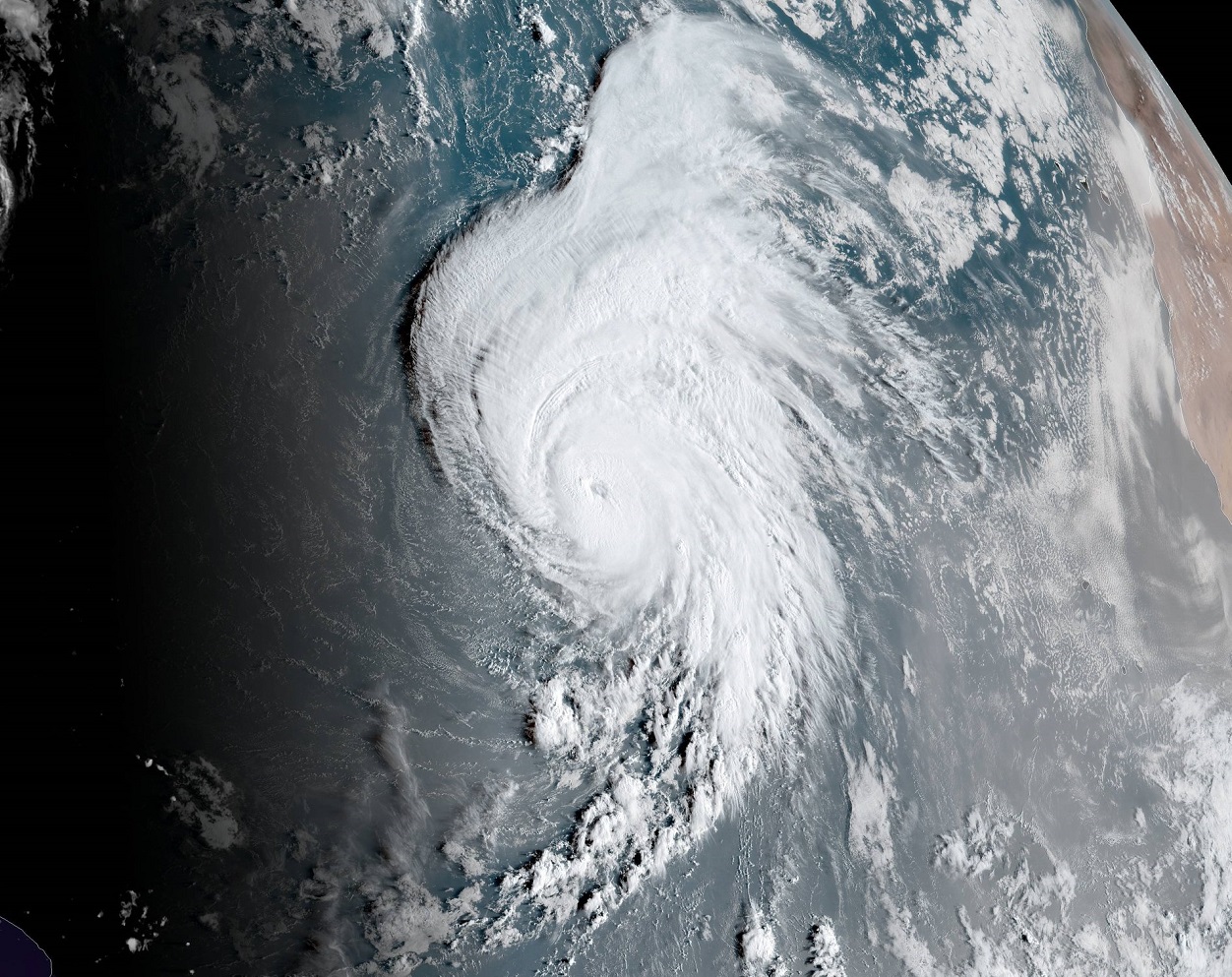
As LORENZO moved north, he began a new eyewall replacement cycle. Increasing vertical wind shear in the area of the jet stream caused a temporary weakening of
the hurricane. The completion of the second eyewall replacement cycle led to a re-intensification despite moderate wind shear and rather low ocean heat content.
LORENZO reached its final peak intensity on September 29 at 45° West with sustained winds of almost 260 kph making him the easternmost Category 5 hurricane on
record. Previous record was Hurricane Hugo in 1989 at 54.6°W. With a minimum core pressure of 925 hPa LORENZO beat his own record and became the hurricane with
lowest central pressure east of 50°W on record.
Sources: Luis Riscado and Renato Salgueirinha
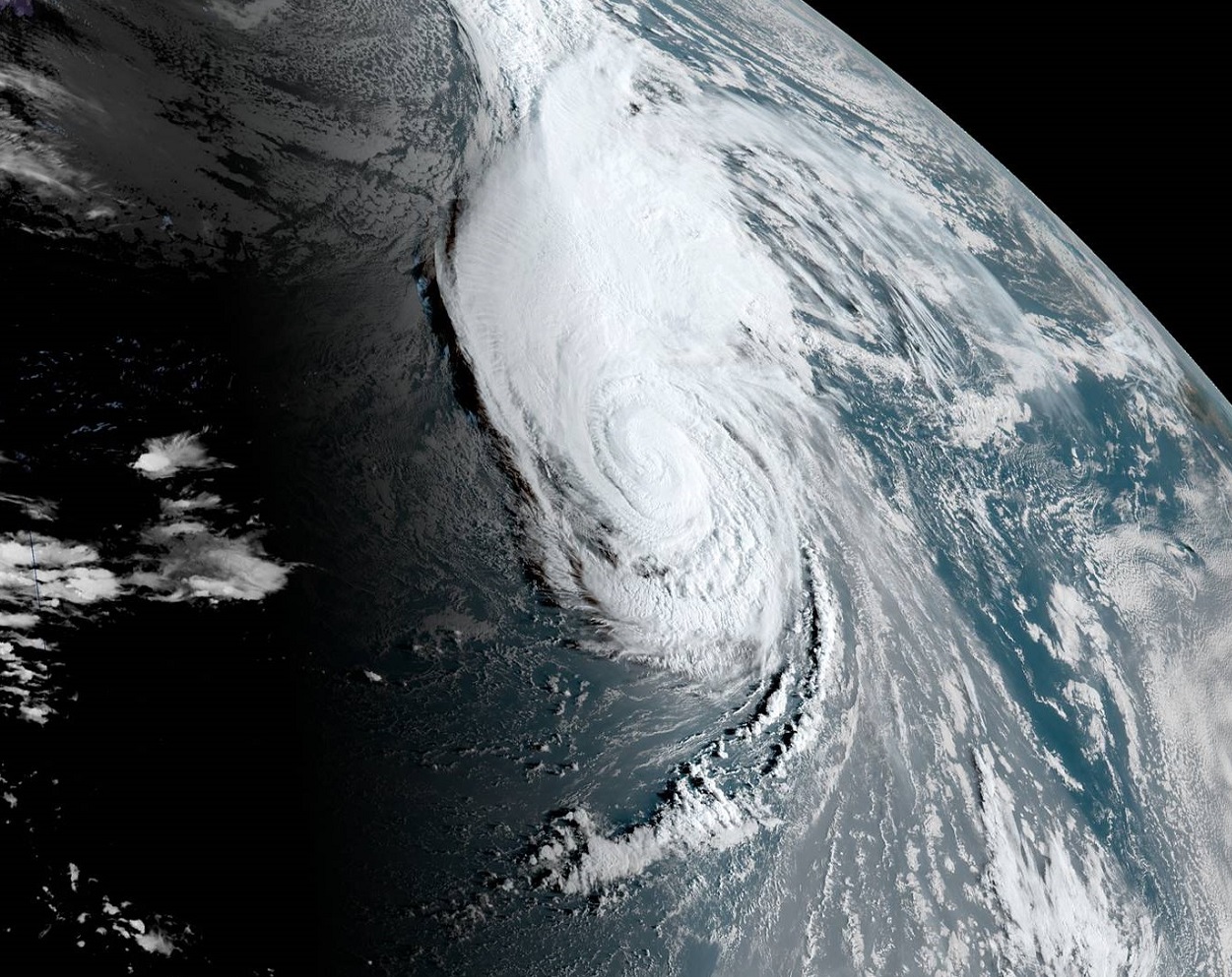
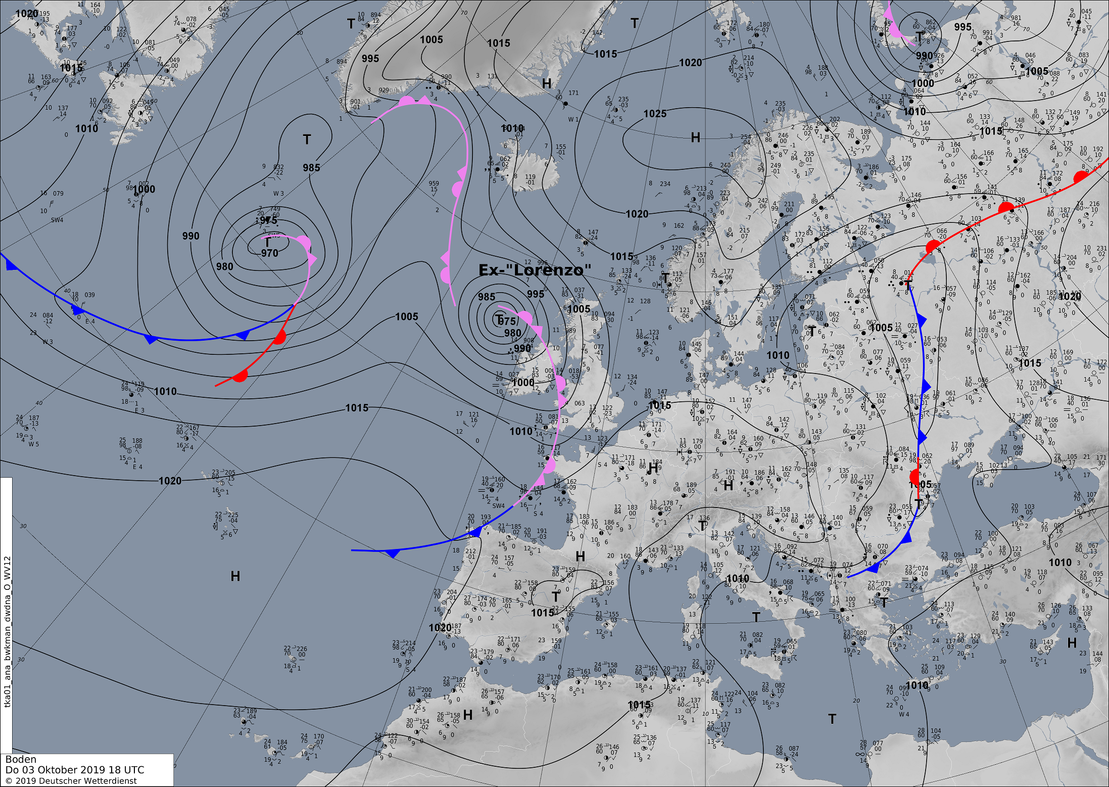
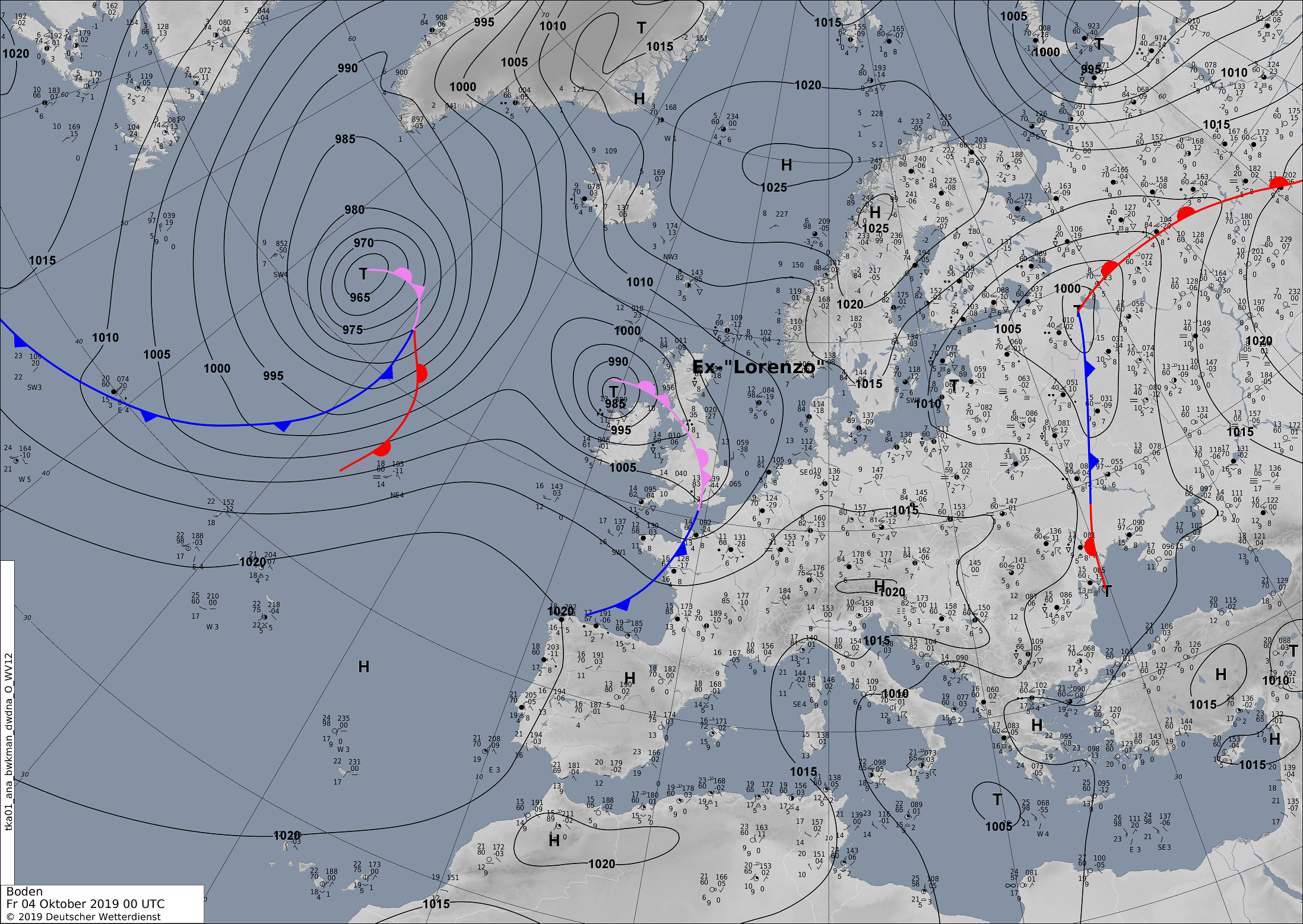
On late 29 September, Hurricane LORENZOs displacement velocity increased rapidly. Only 24 hours after reaching its peak intensity, it already belonged only to
category 2. In the course of the weakening, the cloud structure of LORENZO expanded in size especially in the two northern quadrants. In the early morning of
02 October the system passed about 100 km west of the Azores. Shortly thereafter, LORENZO began an extratropical transition, which was especially visible by
the asymmetric cloud pattern. The transition was completed on the evening of 02 October. As a post-tropical cyclone, LORENZO moved with high displacement
velocity to Ireland and over the main island of Great Britain, where the storm disappeared.
Observations
Wind speeds of up to 145 kph were recorded on the western islands of the Azores. In addition to storm damage and high waves of up to 20 m, storm surges caused
damage and flooding. The strongest precipitation occurred in the western quadrants of the hurricane, i.e. in an area that never touched land in LORENZOS' life
cycle. The rather weak precipitation in the eastern quadrants and the high displacement speed of the system resulted in barely any significant precipitation
being recorded in the Azores.
|
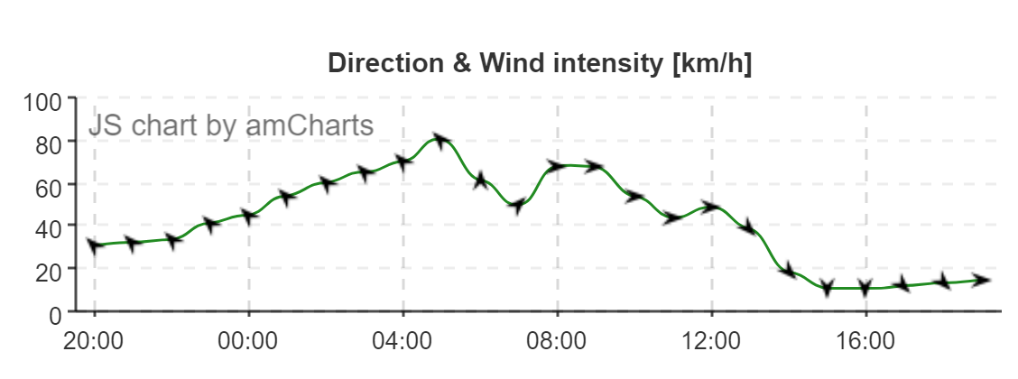
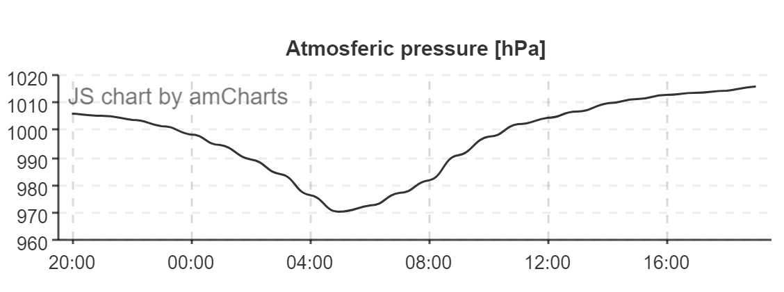
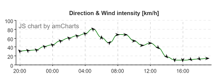
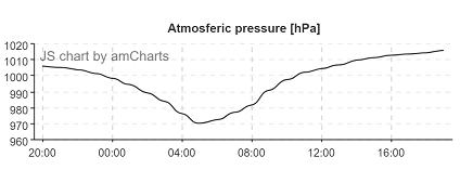
Wind direction and intensitiy (observation) and atmospheric pressure from 01 and 02 October in Flores (Airport)
Source: IPMA
|
 |
 |
When the system reached the Irish coast, the core pressure was only about 975 hPa. Nevertheless, wind speeds of more than 100 kph were recorded at weather
stations located on the west coast. Also still far inland storm gusts of more than 80 kph ocurred.
| Location |
Wind gusts in kph |
Date |
Horta (Obs. Principe Alberto)
Flores Airport
Sao Jorge
Pico Airport
P. Delgada Airport
Santa Maria Airport
Mace Head
Belmullet
Roches Point
Valentia Observatory
Malin Head
Mace Head
Newport Furnace
Belmullet
Claremorris
Knock Airport
Shannon Airport
Sherkin Island
Athenry
|
145.4
139.7
110.2
97.6
76.0
70.2
102
98
87
83
80
107
106
102
91
91
89
83
81
|
02.10.2019
02.10.2019
02.10.2019
02.10.2019
02.10.2019
02.10.2019
03.10.2019
03.10.2019
03.10.2019
03.10.2019
03.10.2019
04.10.2019
04.10.2019
04.10.2019
04.10.2019
04.10.2019
04.10.2019
04.10.2019
04.10.2019
|
|
Data source:
Source: IPMA,
Met eireann.
Text: FS
October 04, 2019
|