|
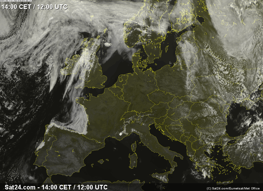
In Southern and Central Europe, June turned correctly in its last two weeks. Due to strong warm air advection, a heat wave was born, which produced
temperatures of around 40°C. The heat wave was very strong. The highest temperatures were reached in the last week of June in southern France and in Germany.
In Germany the highest measured temperature was 39.3°C, in France 45.9°C!
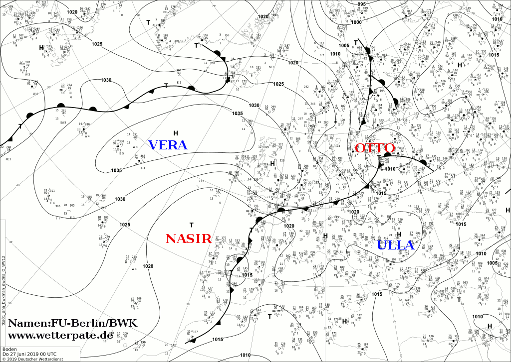
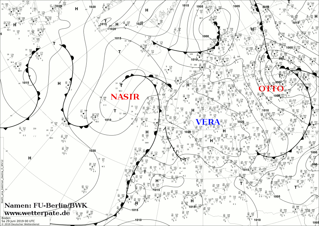
Weather Situation
At the end of June, the central and southwestern parts of Europe had to face a heat wave and extreme heat stress. The reason for this was the shift and spread
of the Azores high over Europe and strong warm air advection, which transported the hot air masses of Africa over the Mediterranean to Europe.
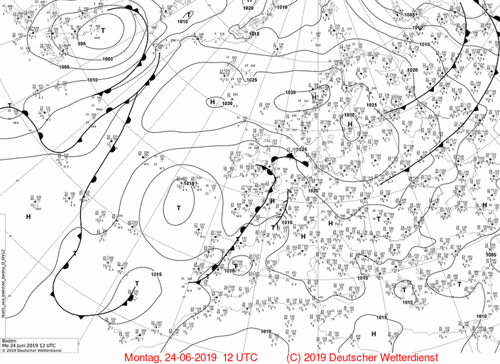
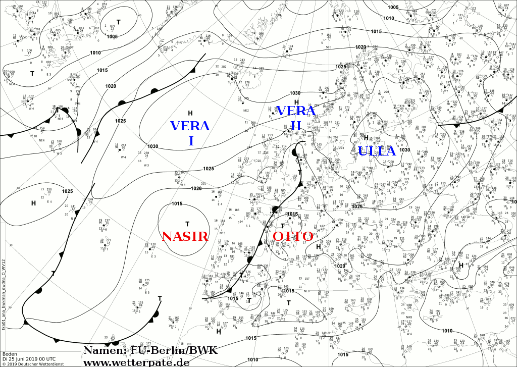
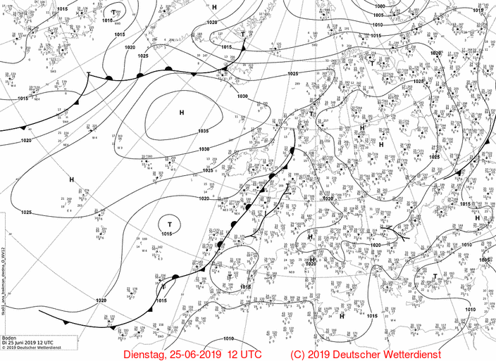
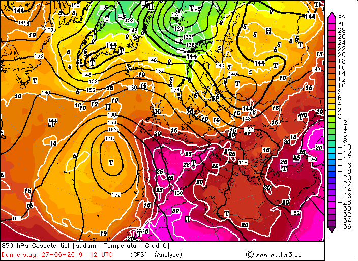
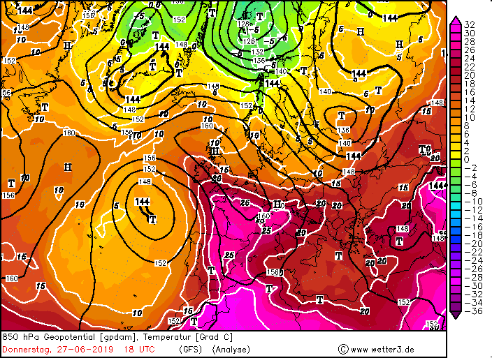
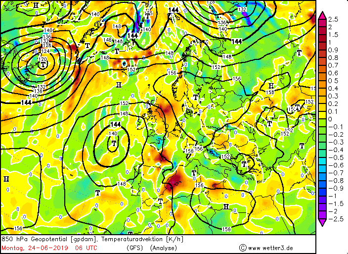
On the weekend of 23 June, the high ULLA began to expand further to the northeast. This resulted in a mighty ridge and a pronounced high pressure area over
Europe, with a core over France and Germany. On the Atlantic, however, there was a distinct drop of cold air, which intensified the southwesterly wind. The top of
the ridge reached as far as Russia and Scandinavia. Since the dust advection was lower this time, higher temperatures were also possible.
There were rows of temperature records broken (see tables below).
First peak of the heat wave
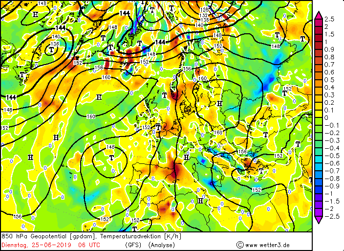
The first peak of the heat wave occurred on Wednesday 26 June. Particularly affected were the northeast of Germany and the Rhine plain, as well
as southern France. Already in the night the temperatures did not cool down below 20°C (tropical nights), as e.g. in Wernigerode with 28,1°C and already in
morning at 12:00 local time 30°C were registered already in Mannheim, or in Düsseldorf 33°C. The maximum temperature in summer is reached between 16:00 and
18:00 o'clock. There the values climbed to 38.6 °C in Germany. Thus there was a new June heat record since 1947 now. Even on the Feldberg 27°C were registered.
In France, on the other hand, higher temperatures were measured. There were temperatures of up to 45.9°C. The old June record was 44.1°C in France.
In France it remained with this heat peak, whereas in Germany a further peak was expected at the weekend.
|
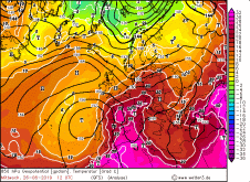
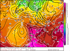
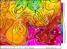
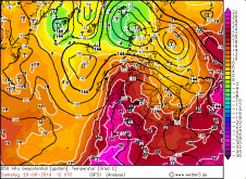
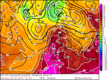
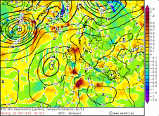
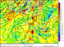
850 hPa temperature, several dates:
Wetter3
|
 |
 |
 |
 |
 |
 |
 |
 |
|
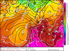
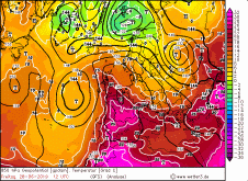
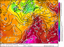
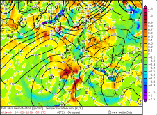
850hPa temperature, several dates:
Wetter3
|
 |
 |
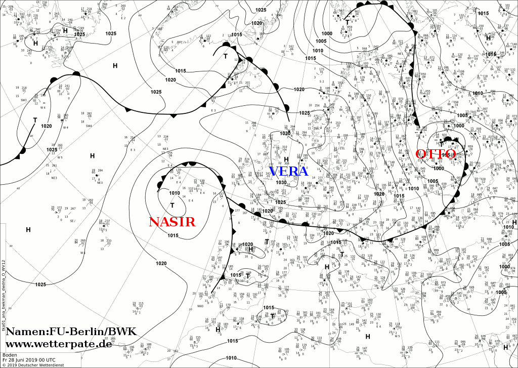
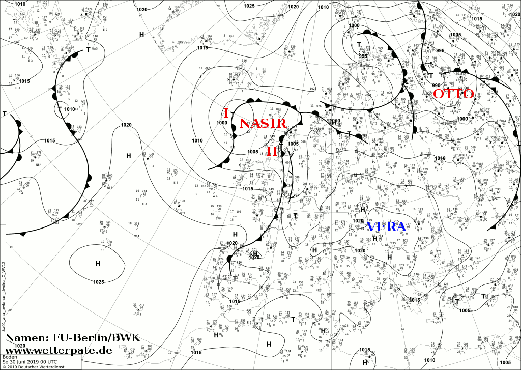
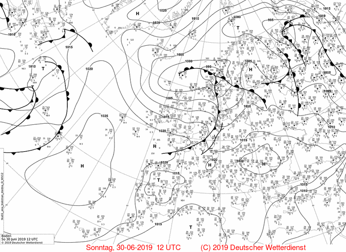
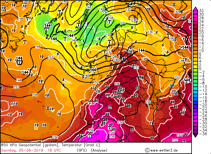
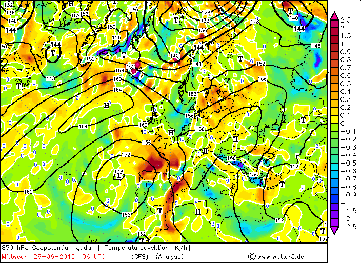
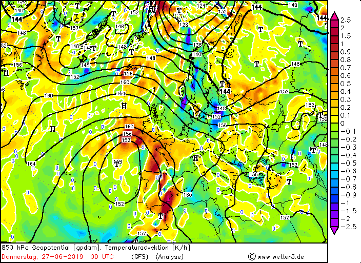
Second peak of the heat wave
The second peak of the heat wave came on Sunday 30 June and reached much higher temperatures than the first, at least in Germany. Here, too, the
northeast of Germany and the Rhine plain were particularly affected. The pronounced ridge had shifted further east, so did the trough over the Atlantic Ocean.
Thus, in combination with radiation-induced warming and strong warm air advection, the values were considerably higher than on Wednesday.
|
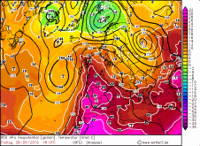
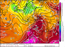
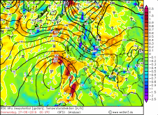
850 hPa temperature advection, several dates:
Wetter3
|
 |
 |
 |
 |
Records
During this year's June, every day in Germany was a summer day, so on each of the 30 days the temperature rose somewhere to 25°C or more. 7 of
them were during the heat wave. There were 22 hot days (7 during the heat wave). There were also 4 desert days during the heat wave.
(hot days = temperature rises above 30°C, desert day = temperature rises above 35°C).
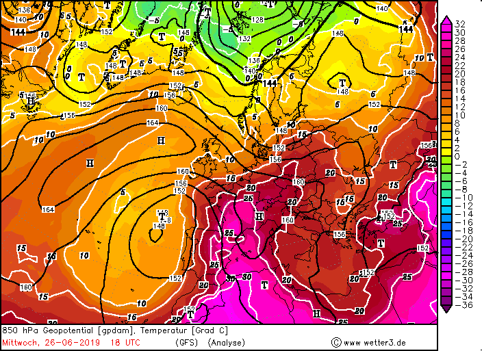
The first half of 2019 was significantly warmer than the record year of 2018. The massive outbreak of heat from the Sahara to Western
Europe was particularly noticeable at the 850 hPa level with temperatures of around 29°C. The aforementioned ridge also had record values of 598 gpdm.
May was 1.4 K too cold, June was 4.4 K too warm (number 1 of the warmest June months since 1881). Due to the heat wave at the end of June, the first half
of 2019 is already the warmest since recording began. It is also worth mentioning that especially in the last years all-time monthly records
(especially in spring) were repeatedly reached and surpassed. This also includes October 2018, September 2016, November and December 2015
and that in only 4 years, during a measurement series of 269 years.
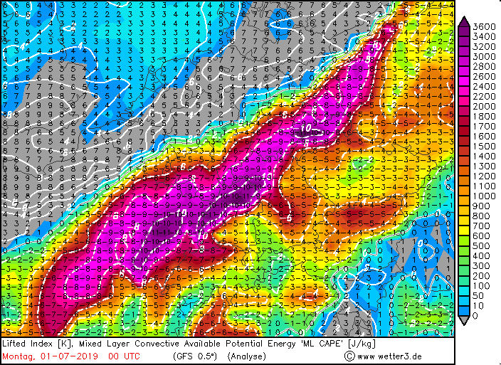
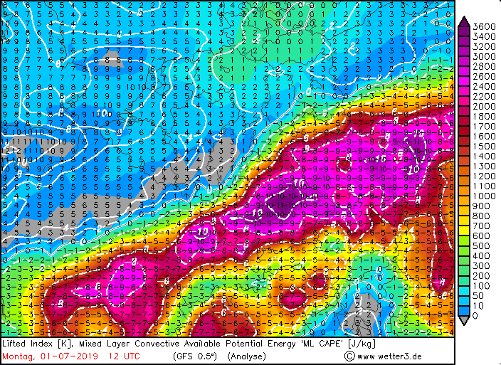
Because of the high temperatures and humidity the cape levels rose and severe thunderstorms developed on Monday July 1st
(see).
24 hours maximum temperatures in Germany (left) and in southern and central europe (right):
| Location |
Temperature in °C |
Date |
Frankfurt am Main
Mannheim
Geisenheim
Berlin-Tegel
Koblenz Falckenstein-Kaserne
Berlin-Tempelhof
Berlin-Schönefeld
Leipzig-Süd
Manschnow
Potsdam
Genthin
Leipzig-Schkeuditz
Hoyerswerda
Giessen-Wetterberg
Wittenberg
|
39.3
38.9
38.7
38.6
38.6
38.5
38.4
38.4
38.4
38.4
38.3
38.3
38.2
38.1
38.0
|
30.06.2019
30.06.2019
30.06.2019
30.06.2019
30.06.2019
30.06.2019
30.06.2019
30.06.2019
30.06.2019
30.06.2019
30.06.2019
30.06.2019
30.06.2019
30.06.2019
30.06.2019
|
|
| Location |
Temperature in °C |
Date |
Gallargues-le-Montueux (FR)
Villevieille (FR)
Marsillargues (FR)
Nimes/ Courbessac (FR)
Carpentras (FR)
Istres (FR)
Nimes/ Garons (FR)
Montpellier (FR)
Salon (FR)
Gerona/ Costa Brava (ES)
Talavera De La Reina (ES)
Casper (ES)
Zaragoza-Valdsparte (ES)
Avignon (FR)
Granada/ Aeropuerto (ES)
|
45.9
45.4
45.1
44.4
44.3
44.3
44.1
43.5
43.4
43.0
43.0
42.8
42.8
42.8
42.6
|
28.06.2019
28.06.2019
28.06.2019
28.06.2019
28.06.2019
28.06.2019
28.06.2019
28.06.2019
28.06.2019
28.06.2019
28.06.2019
28.06.2019
28.06.2019
28.06.2019
28.06.2019
|
|
Data source (for Spain and France): Ogimet.
Data source (for Germany): Deutscher Wetterdienst.
Text: MG
July 5th, 2019
|