Thursday, 9 April 2020, 10:30 CET
|
|
|
|
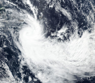
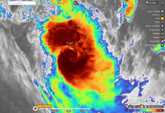
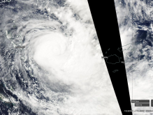
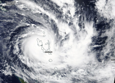
Satellite image (VIS), 09.04
Image Credit: NASA Worldview
|
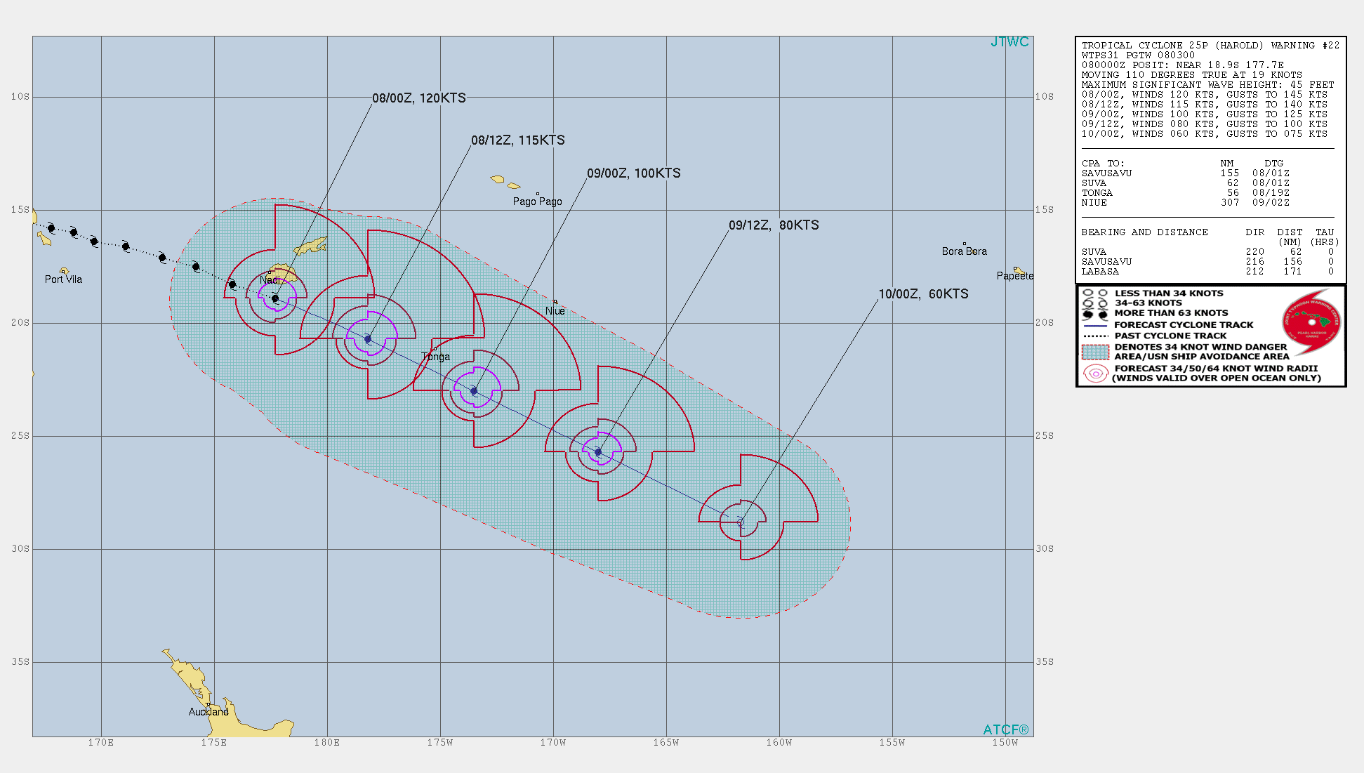
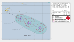
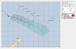
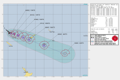
Storm Track of HAROLD, 09.04
Image Credit: JWTC
|
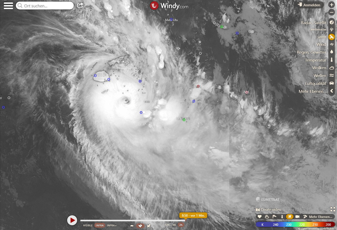
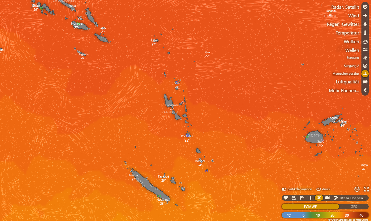
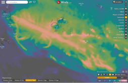
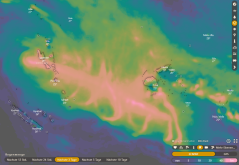
Satellite image (IR), 09.04.
Image Credit: Windy
|
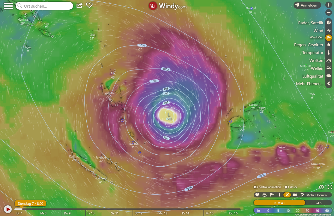
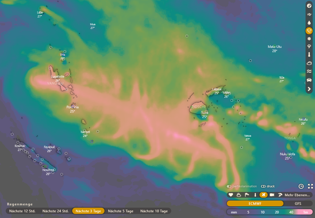
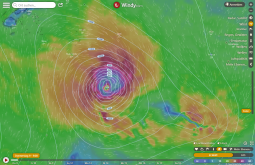
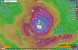
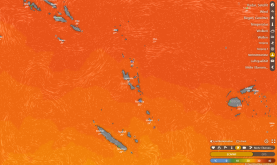
Wind and sea level pressure, 09.04.
Image Credit: Windy
|
Tropical Cyclone HAROLD
Vanuatu and Fiji Islands
Issued: Thursday, 09 April 2020, 10:30 CET
HAROLD crossed Tonga last night and is weakening. He hit Tonga as strong category 4/ weak category 5 cyclone like Fiji islands yesterday.
06.-10.04.2020
Yesterday HAROLD made landfall on the Fiji Islands with the strength of a strong category 4/ weak category 5 cyclone and as such also hit Tonga last night. Wind
speeds around 110 knots (approx. 200km/h) hit the islands. There was also the danger of destructive winds, torrential rainfall with floodings and landslides.
The coastal regions were affected by high tides and storm surges.
HAROLD moves tot he south east and will gradually enters the cooler SST range and weakens slowly. Today it weakens to a Category 3 storm and on the weekend it
will slowly weaken into a tropical storm.
Wednesday, 8 April 2020, 10:00 CET

|

|
|
|
Satellite image (VIS), 08.04
Image Credit: Windy
|
Storm Track of HAROLD, 08.04
Image Credit: JWTC
|
Satellite image (IR), 08.04.
Image Credit: Windy
|
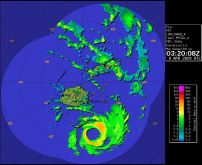
Precipitation Radar, 08.04.
Image Credit: Fiji Met. Office
|
Tropical Cyclone HAROLD
Vanuatu and Fiji Islands
Issued: Wednesday, 08 April 2020, 10:00 CET
HAROLD is still a strong category 4 cyclone and it is likely to increase. It is currently located south of the main island of Fiji and causes
wind speeds around 110 knots (200 km/h).
06.-10.04.2020
Tropical Cyclone HAROLD is located just about 270 km southeast of the Fiji Islands. It has a core pressure of 948 hPa and wind speeds of about 200 m/h is still a
category 4 storm.
As expected yesterday, it went through another eyewall replacment cycle during the night and intensified. It will continue to
intensify as the warm ocean provides it with energy. Tomorrow it will most likely reach Tonga as a strong category 4 storm. It has also increased in size, which
can be seen in the satellite images. There is still a risk of destructive winds, torrential rainfall with floodings and landslides.
Once HAROLD has crossed Tonga, it gradually enters the cooler SST range and weakens slowly. On Thursday it weakens to a Category 3 storm and on the weekend it
will most likely weaken to a tropical storm.
Tuesday, 7 April 2020, 09:00 CET
|
|
|
|
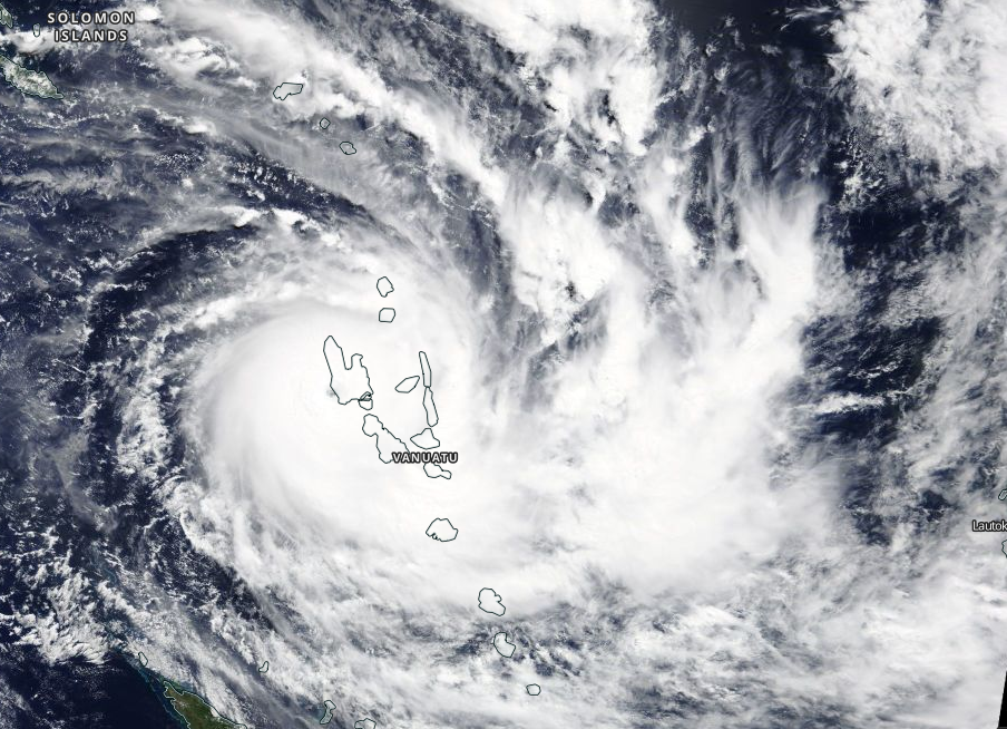
Satellite image, 07.04
Image Credit: NASA Worldview
|
Storm Track of HAROLD, 07.04
Image Credit: JWTC
|
3 days precipitation track, 07.04., 06 UTC
Image Credit: Windy
|
Wind and sea level pressure, 07.04., 06 UTC
Image Credit: Windy
|
Tropical Cyclone HAROLD
Vanuatu and Fiji Islands
Issued: Tuesday, 07 April 2020, 08:00 CET
Tropical Cyclone HAROLD is still a very powerful storm with winds speeds of 110 knots (ca. 200 km/h) and a core pressure of 940 hPa. At the moment hes located between the Vanuatu
Islands and the Fidji Islands and is slowly moveing to the east. Yesterday he hit the Espiritu Santo island and caused a lot of damages.
06.-10.04.2020
HAROLD is still a cyclone the category 4 according to the Australian Fiji scale. Yesterday morning local time it reached Espiritu Santo, the largest of the Vanuatu
Islands with 40,000 inhabitants. The storm passed directly over the island and later over Pentecost Island. HAROLD caused a lot of damage due to the
damaging winds, enormous amounts of rain and storm surges. Now it is slowly shifting eastwards towards the Fiji Islands and will make landfall there on Wednesday.
According to the latest model calculations he will hit Viti Levu or pass it to the south. At the end of the week he will reach Tonga.
Due to the landfall on Vanuatu, HAROLD has weakened somewhat, which could be seen in the satellite images through the asymmetrical eyewall. After it had shifted
back to the warm sea a new intensification begins and probably there will be another eyewall replacement cycle and a further intensification of the storm.
It is moving at about 27 km/h in the direction of east-south-east.
There are still warnings of extremely strong winds and enormous rainfall. The strong winds cause storm surges and high sea swells on the coasts. The precipitation
also causes flooding and lanslides could occur due to the softened soil.
Monday, 6 April 2020, 09:00 CET
|
|
|
|
Satellite image, 06.04
Image Credit: NASA Worldview
|
Storm Track of HAROLD, 06.04
Image Credit: JWTC
|
3 days precipitation track, 06.04., 07 UTC
Image Credit: Windy
|
SST, 06.04., 07 UTC
Image Credit: Windy
|
Tropical Cyclone HAROLD
Vanuatu and Fiji Islands
Issued: Monday, 06 April 2020, 09:00 CET
Tropcial Cyclone HAROLD underwent an extreme intensification in the last hours to become a Category 5 Cyclone, with core pressure dropping to 914 hPa (Vanuatu Met. Office) and
wind speeds of 120 knots (about 220 km/h).
06.-10.04.2020
HAROLD is a category 5 cyclone according to the Australian Fiji Scale, and on the Saffor-Simpson Scale it corresponds with 220 km/h and a core pressure of 914 hPa
to an upper category 4 hurricane. The Vanuatu Islands are a group of islands about 2400 km east of Australia, so they are located in the southern hemisphere,
where autumn is currently in full swing. Tropical cyclones peak in occurrence and intensity at this time of year, as water temperatures are at their warmest.
Nevertheless, HAROLD went through an unusually fast intensification to a Cat 5 cyclone. In the next 24-48 hours it poses a massive threat to the archipelago, also
because it moves very slowly. This can result in total local precipitation of 1000 mm, locally even more. The strong winds cause storm surges, which further
increase the risk of flooding. At the moment its eye is off the coast of the Espiritu Santo. However, due to the enormous extent of HAROLD, the entire archipelago
is affected by destructive winds and the enormous amount of precipitation. Due to the flooding, the danger for Lanslides is also increasing.
Besides the unusual track another special feature of HAROLD is that it has been strengthened for the second time by the Eyewall replacment cycle the day before
(this time quasi explosive). In the next hours/days it will slowly shift to the southeast. According to the models, it will not weaken until April 7th and 8th.
It will probably not have weakened to a tropical storm until 10 April, when it will move into much cooler waters.
Issued: April 06, 2020, 09:00 CET
MG
Issued: April 07, 2020, 08:00 CET
MG
Issued: April 08, 2020, 10:00 CET
MG
Issued: April 09, 2020, 10:30 CET
MG
|